LARCH MOUNTAIN
AUGUST 28, 2007
The Coon Family Hiking Club
Official 2007 Hike #4
6.8 miles - 5 hours 55 minutes
|
Here is the report I wrote back then: Larch Mountain Hike July 12, 2003 Just to show that history repeats itself, we did it again, and lived to tell about it. (They say a fool and his money are soon parted. Maybe that is why we weren't carrying any. ☺ ) 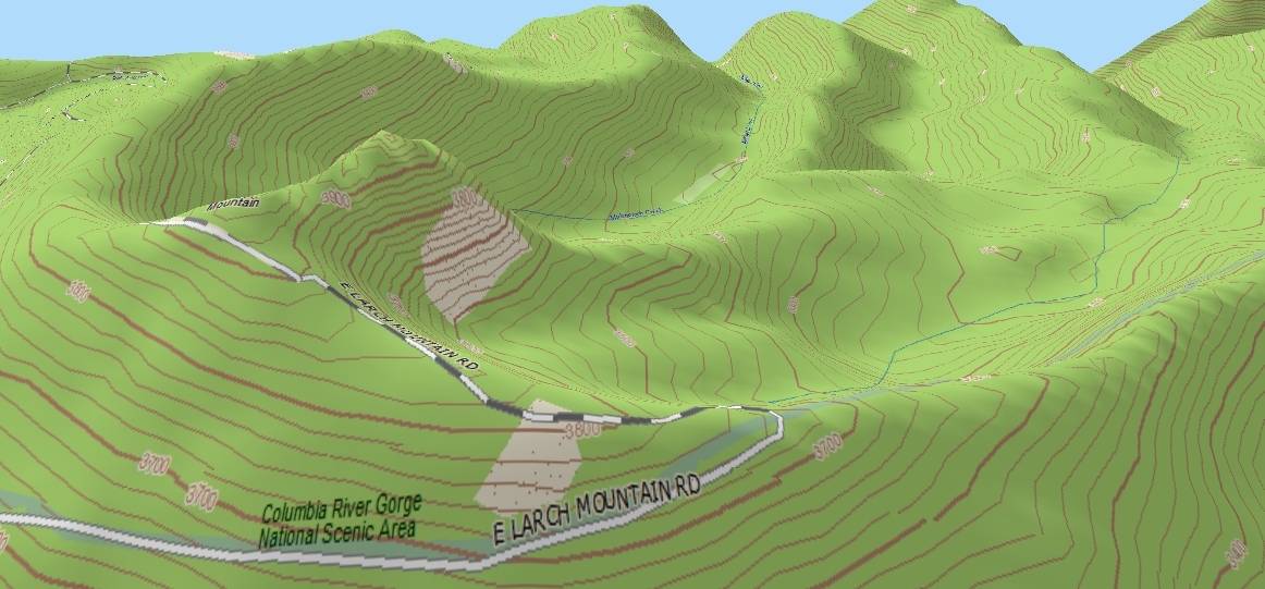 There is a reason why Larch Mountain looks a bit like Mount St. Helens kid sister. In the world of volcanoes, the older you are, the smaller you get, and Larch Mountain finished its erupting over 4 million years ago according to the geologists. Mount St. Helens is a baby throwing temper tantrums compared with this old lady of the hills. There is a reason why Larch Mountain looks a bit like Mount St. Helens kid sister. In the world of volcanoes, the older you are, the smaller you get, and Larch Mountain finished its erupting over 4 million years ago according to the geologists. Mount St. Helens is a baby throwing temper tantrums compared with this old lady of the hills.
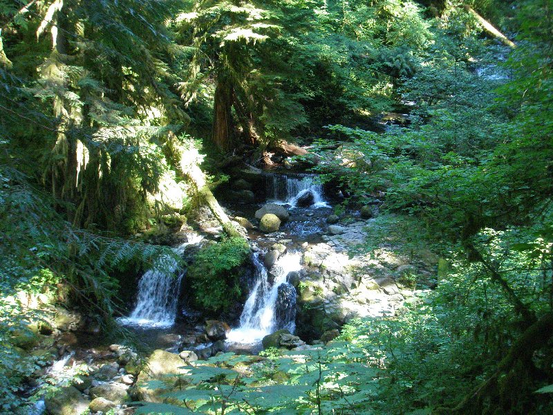
There is one of the most spectacular viewpoints in the Columbia River Gorge right here in the cone. It is called Sherrard Point, and stands upon the top of what is left of the volcanic plug that put an end to the final eruption of this old volcano. (Dotti and I went up there for a look around once more on August 9, 2007, but we took more pictures on the day of our last hike in 2003.) Now, Larch Mountain shows the ravages of time. The cone was more circular at one time, but there have been several glacial periods since it formed, and the most recent of these we commonly refer to as "the" ice age. From a geologists point of view, we are still in an ice age, and have been for a very long time. (Even today Washington State has around 1000 glaciers on its mountains, more glaciers than any other state than Alaska.)The ice advances (and the layman calls that an "ice age") and then it recedes, over and over again. Glaciers have covered Larch Mountain many times since she stopped erupting, and her cone has widened as a result, and a path has been formed downward towards the Columbia River, must like a slide for a giant child, but it is filled with just the small stream called Multnomah Creek, fed by an underground stream in the crater. The creek flows merrily along the glacially cut path, through meadow, and forest, through a small cupped region called Multnomah Basic, before running into sharp drops, creating beautiful waterfalls, including our favorite, Multnomah Falls. 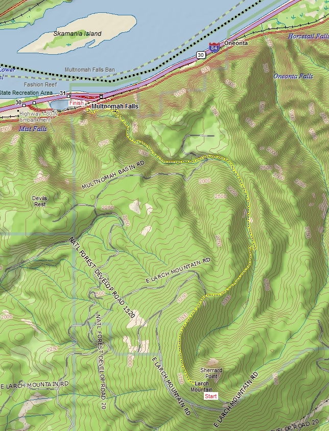 Our hiking journey was to begin right beside Sherrard Point, in the parking lot situated immediately beside the volcanic plug. We followed the western rim of the crater, until it falls away into the valley where Multnomah Creek runs, and then, dropping down beside the creek, we followed it all the way until it cut sharply over to the drop that has made this the site of the most popular natural attraction in the state of Oregon: Multnomah Falls. At that turn of the creek, we left it, and followed the switchback rich path to the bottom of the falls and the parking lot where our second vehicle was parked. (This time we made a one way trip on this challenging path.)
By the end if this hike, Dotti and I were both hobbling. Dotti was using two walking poles, similar to ski poles, but by the time we got near the bottom she was fearful of not being able to continue because of the pain she was in. We put one of her poles in my backpack and I took her arm on mine to help support her for the final descent. By the time we reached the bottom we were both finished. The perpetual downhill grade had torn at our knees and our feet, which blistered and ached. But we made it to the end, and were left with a determination to do this again one day when we are ready for it; one day we will walk from the bottom of the falls to Sherrard Point and back again, and be smiling at the end of the hike. Alas, this was not that day. |
||||||||||||
|
At 8:59 a.m. we had 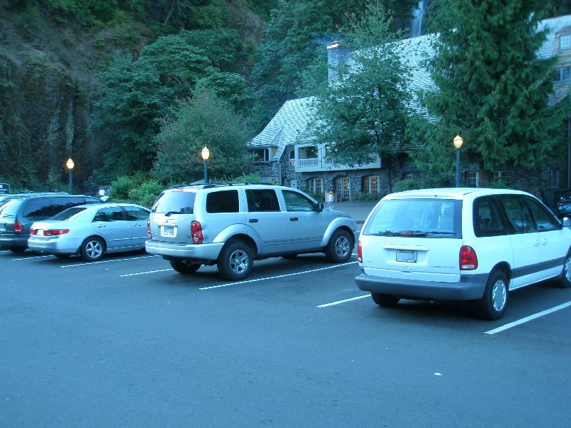 At 8:59 a.m. we had parked both of our vehicles in the parking lot at the Multnomah Falls Lodge, on the Columbia River Highway. We made a quick stop and then both jumped into the van and headed off on our way to the top of Larch Mountain. The last time we walked this trail, we only brought one car and parked it at the top. It left us with no alternative but to turn around after we walked down, and then walk all the way back up. We were cursing ourselves for doing that as we trudged up the mountain in the heat, with aching muscles. Not this time. We would merely be cursing ourselves as we trudged down with aching muscles, hips, knees, and feet. ☺
Every time we come to this lovely location  it leaves us in awe. The beauty, and the geological marvels that created it, are overwhelming.
The air was rich with the smell from the burning wood in the lodge's fireplace, and it was hard to pull myself away from its call. But we had a goal that was to begin thousands of feet above the top of this waterfall, and the cool morning was wasting away fast. 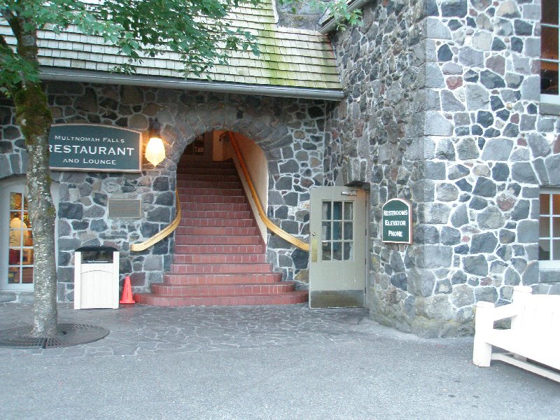 Up those stairs waited the fireplace that was creating the wonderful aroma on the air, but instead of going up and enjoying the fire and a cup of hot cocoa, we were going to take a very scenic route back to this location, where I would be taking another picture while standing in this very spot, with much sorer feet. Up those stairs waited the fireplace that was creating the wonderful aroma on the air, but instead of going up and enjoying the fire and a cup of hot cocoa, we were going to take a very scenic route back to this location, where I would be taking another picture while standing in this very spot, with much sorer feet.
Off we set in the van. 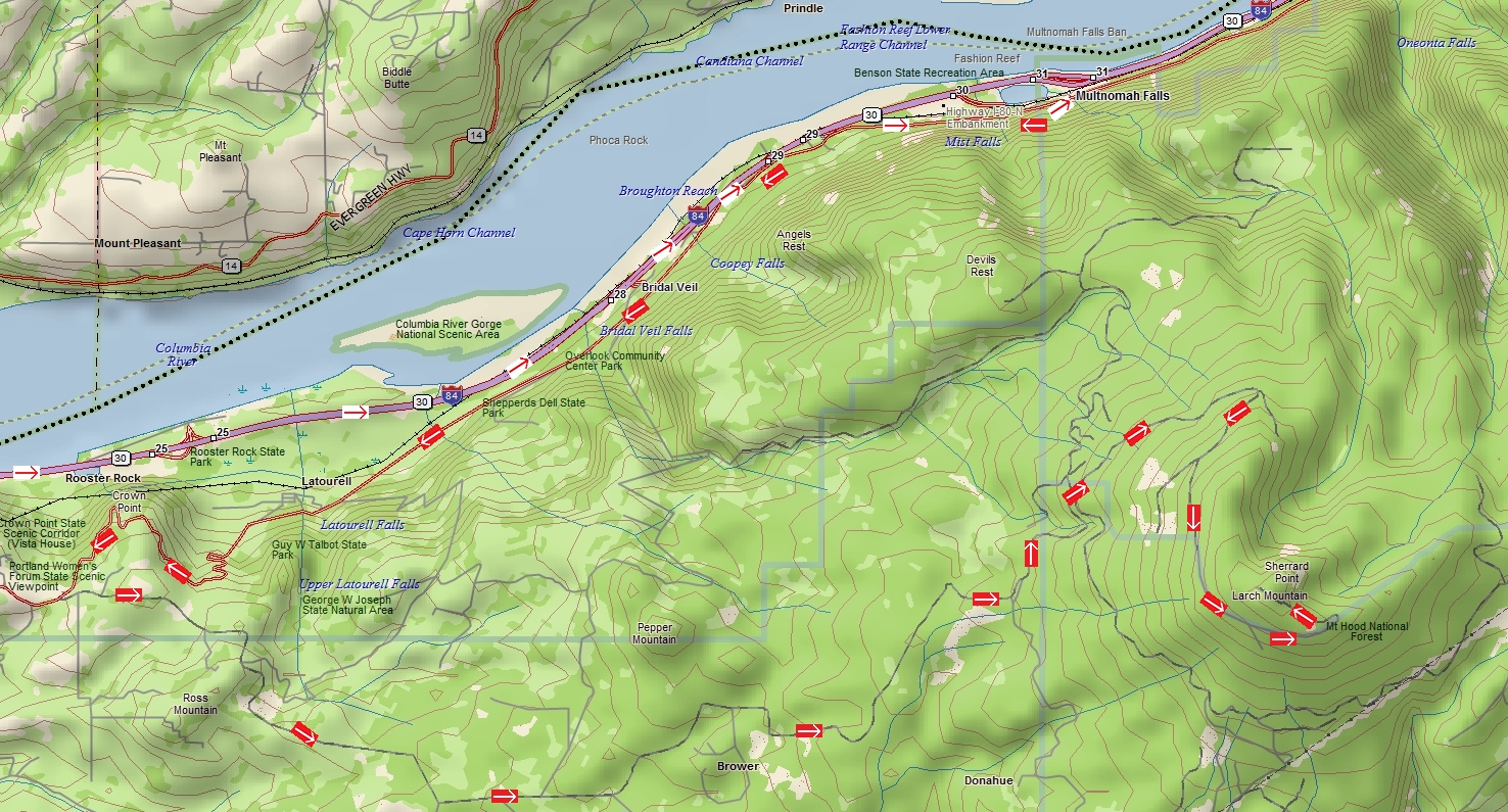 We had come in on Interstate 84, up to the Bridal Veil Falls off ramp, and then followed the Columbia Highway to Multnomah Falls. We had come in on Interstate 84, up to the Bridal Veil Falls off ramp, and then followed the Columbia Highway to Multnomah Falls.
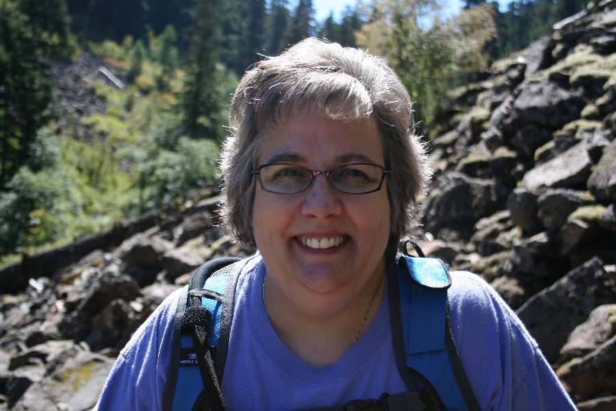
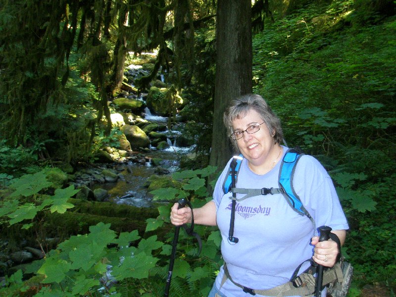
Now we backtracked and followed the Columbia River Highway west back past Wahkeena Falls, the Angel's Rest parking lot and Bridal Veil Falls. We continued on past Latourell Falls and finally up to, and past, the Vista House at Crown Point before reaching the cutoff for Larch Mountain. Then it was just over 14 more miles to the parking lot at the top of Larch Mountain. The last few miles we passed by a lot of high school kids, girls and boys, jogging up the highway towards the top. We had to work our way around them a bit, but mostly they were paying attention and gave us a clear path to get by. I am sure they were going to be tired when they reached the top! It was 9:56 a.m. and I was 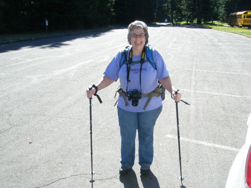 all set to take a hike with this lovely creature. Dotti was all smiles and ready to go, with her hiking poles in hand. Her camera was around her neck and her water backpack was over her shoulders, with her fanny pack strapped around her waist, and loaded up. She also had her new boots on&mdas;that are supposed to actually make walking more of a workout&mdas;and they were supposed to improve posture and provide good support for her feet. I am not sure how much they contributed to her painful finish to this hike, but at least she wasn't injured, and maybe they even helped in that area.
In the background you can see the bus that was waiting for the high school runners to arrive. Judging from the staggered position of the runners, with the youngest ones in front, and nearest the top, I am assuming that they dropped off the older kids nearer the bottom and then dropped off other groups along the way, in hopes of getting them to arrive at more or less the same time. Directly over Dotti shoulder you can see the coach standing at the entrance to the parking area. He had a stopwatch and a clipboard all ready to record the times for the arriving runners. My guess is that he has a pretty good track team if they are running up this mountain for practice. ☺ He was doing some stretching and other things to keep himself occupied while waiting. Other than that bus, our van was the only other vehicle in the parking lot. Dotti took this one of me  as I was folding up the information packet I had printed up for this hike. My backpack is mostly on, and my Dotti's Weight Loss ball cap is proudly in place on my head. Dotti bought some new pants for me which I had on for the hike. They had lots of pockets, and though they were a bit baggy, they were very comfortable for the entire hike. I really liked them, and they had lots of pockets. as I was folding up the information packet I had printed up for this hike. My backpack is mostly on, and my Dotti's Weight Loss ball cap is proudly in place on my head. Dotti bought some new pants for me which I had on for the hike. They had lots of pockets, and though they were a bit baggy, they were very comfortable for the entire hike. I really liked them, and they had lots of pockets.
This is it, we were ready to start our descent. On 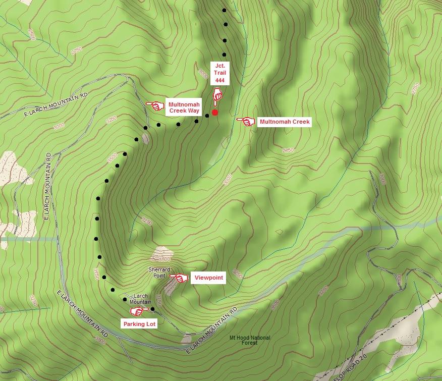 our Larch Mountain hike in 2003, before starting out, we first visited Sherrard Point to take some pictures from that great viewpoint. This time we didn't do that. First off we had just been there a few weeks earlier on August 9, 2007 and didn't have a burning desire to go take a look before starting our hike. Secondly, we knew we were going to need all of our energy for what lay before us. We have not been hiking as much this year as we did in 2003, and so we were not in great shape for this hike. It was going to be challenging at best. So, we didn't take the side trip for sightseeing this time around.
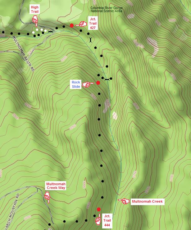
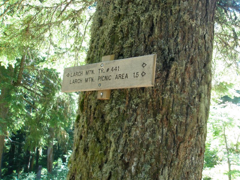
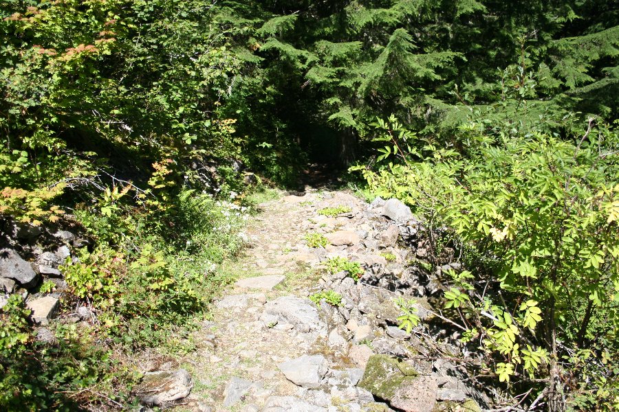
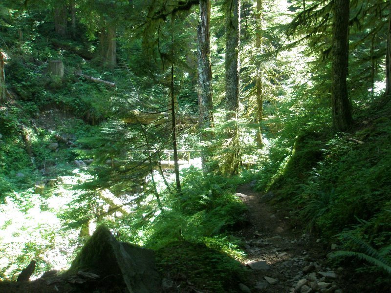
All the way down, we would be following Trail 441 (shown by the black dots on the maps). The first leg of the journey would be taking us along the western rim of the crater. Now, it is forested, and so we would not have known that we were walking along a crater's rim from what we saw. If the trees and shrubs had magically disappeared, it would looked like this map appears, and would have felt more like walking around the lip of Mount St. Helens. Once we reached the junction with Trail 444, we would be descending into the valley of Multnomah Creek. The trail became much more scenic and from then on the cheery sound of the creek running by was very welcome as we walked along. It is now 10:05 a.m. and 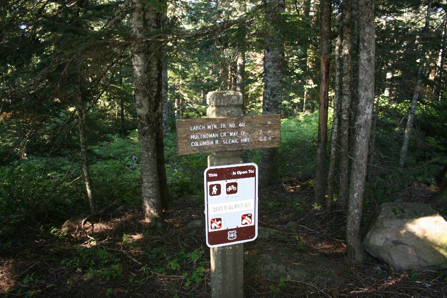 this is the trailhead for Trail 441, and this marks the official start of the hike. We have 6.8 miles to go to reach the highway where our car is parked, and 2 miles to go to get to Trail 444, called here the "Multnomah Creek Way Trail." this is the trailhead for Trail 441, and this marks the official start of the hike. We have 6.8 miles to go to reach the highway where our car is parked, and 2 miles to go to get to Trail 444, called here the "Multnomah Creek Way Trail."
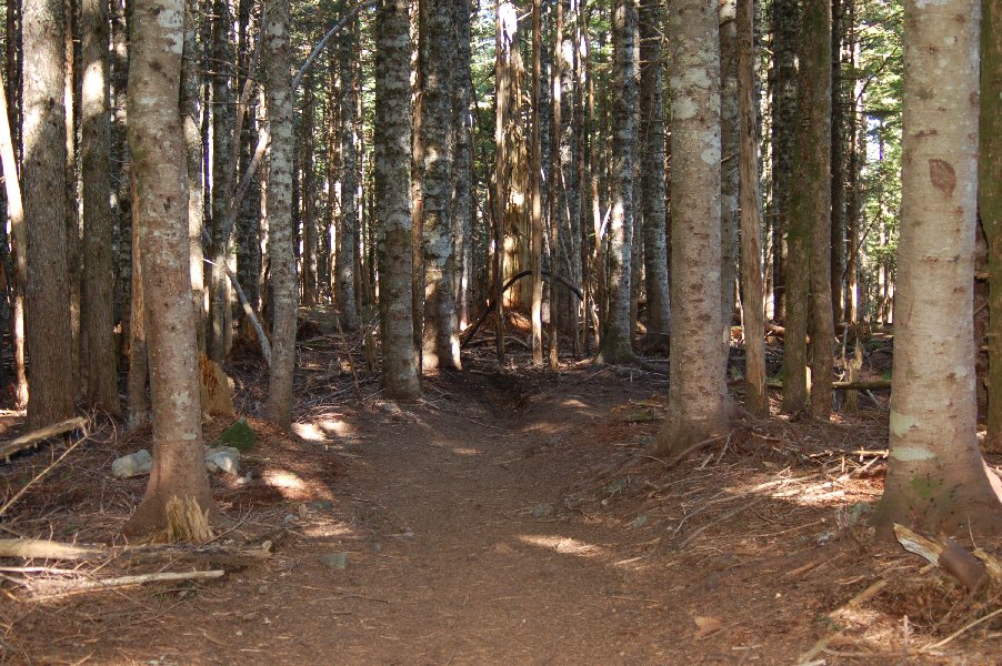
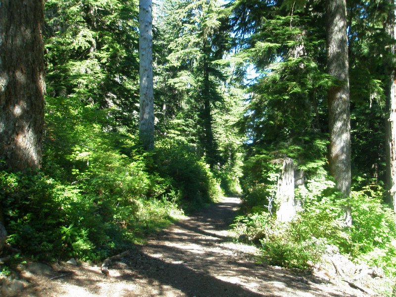
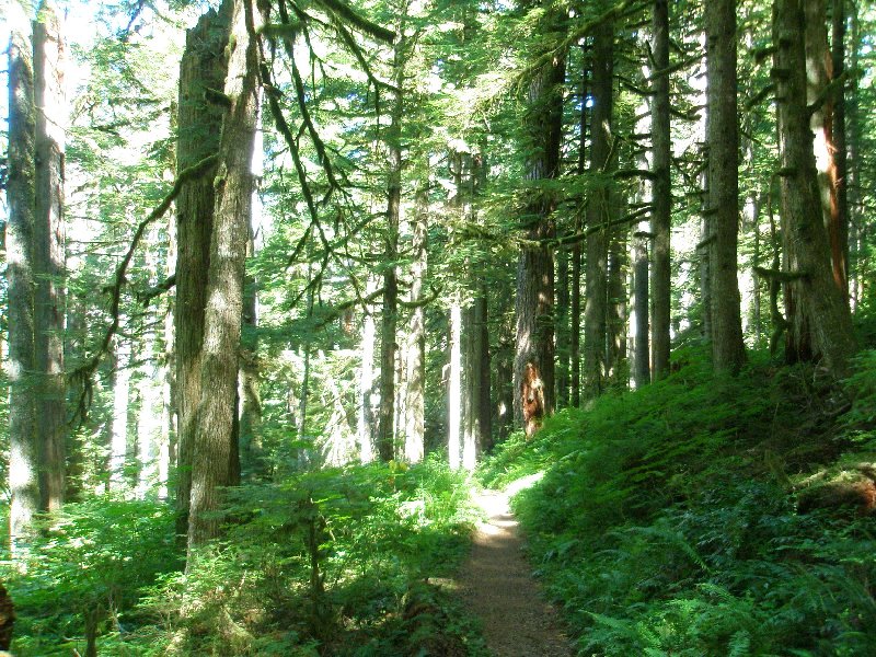
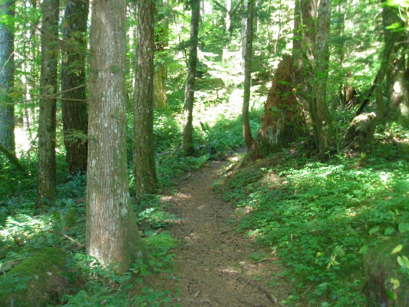
You will note that this trail is open to hikers and bicyclists. What is not so easy to see on the sign is that the bikes are limited just to the first 2 miles of trail. After that they have to turn off. It would be one crazy and unsafe ride to try and go all the way to the bottom on Trail 441. Also, if you ran out of control you could really hurt someone on foot. 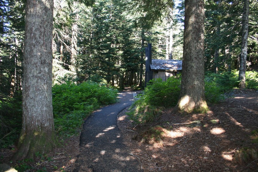 Just like in a storybook, the path runs off into the woods. What wonders lie ahead? Who might we meet in the forest and what will we see? Each time we take one of these hikes I feel the sort of mystery that has to rest at the heart of all fairy tales of old. The Little People and the Elves seem far more possible as we set off on a path like this. The trees feel almost sentient as they stand guard over the way. Here is the way, and our feet are on the path. Just like in a storybook, the path runs off into the woods. What wonders lie ahead? Who might we meet in the forest and what will we see? Each time we take one of these hikes I feel the sort of mystery that has to rest at the heart of all fairy tales of old. The Little People and the Elves seem far more possible as we set off on a path like this. The trees feel almost sentient as they stand guard over the way. Here is the way, and our feet are on the path.
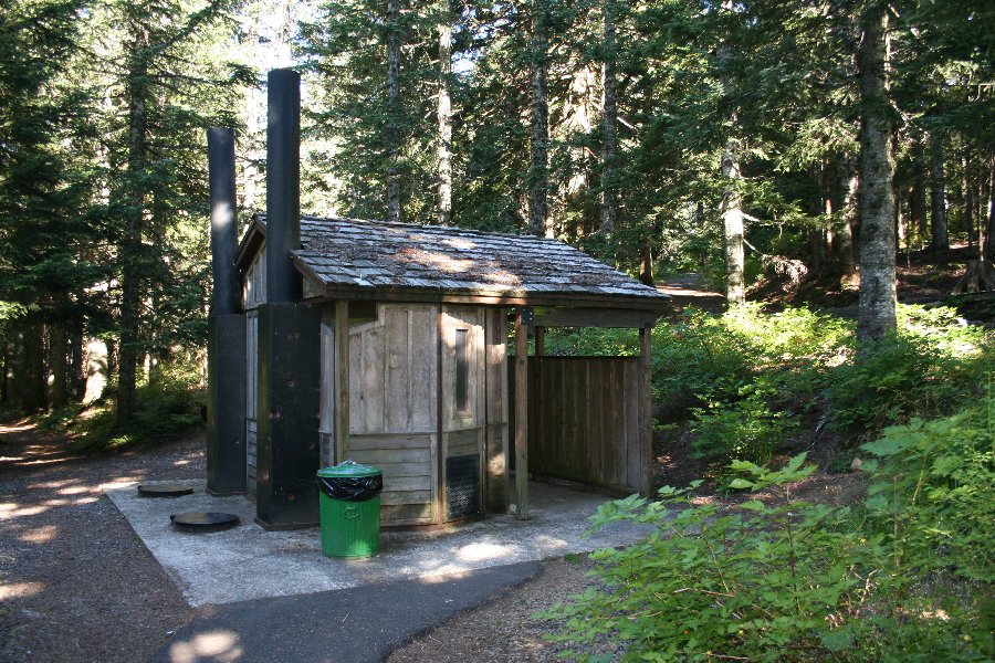 For us old folks, it is always a comforting sight to see that they have restroom facilities at the trailhead. The Eagle Creek and Silver Falls hikes have some very nice facilities. This restroom was an outhouse, but hey, it works. ☺ For us old folks, it is always a comforting sight to see that they have restroom facilities at the trailhead. The Eagle Creek and Silver Falls hikes have some very nice facilities. This restroom was an outhouse, but hey, it works. ☺
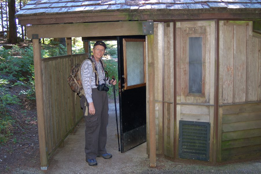 Who is that old guy looking like a tourist with his camera? I guess we can finally get started now. Who is that old guy looking like a tourist with his camera? I guess we can finally get started now.
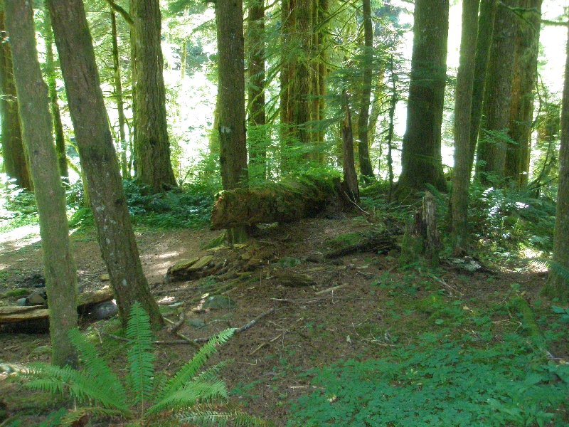
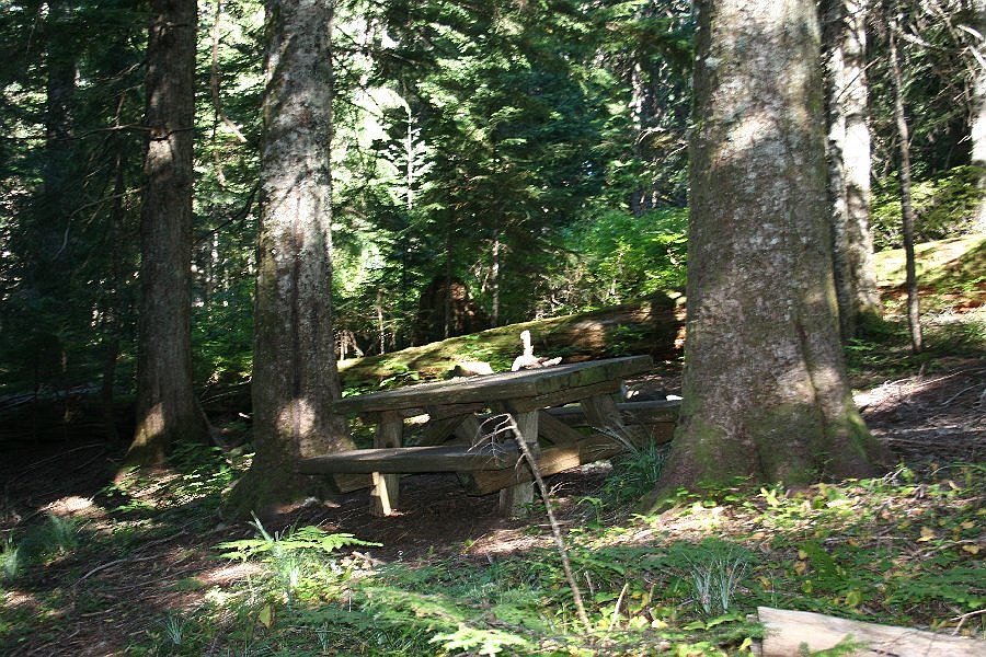 The picnic area seemed sad and lonely with no one to share the forest with. A tree lies on the ground behind the table, and that was a preview of what was to come along the trail. We saw a lot of trees in that position, but that is the story of the forest. Trees spring up, and if they are lucky, they will survive to grow tall. They grow and grow, and they look invincible, as though they will live forever. And then, the end comes. They lose their footing and fall. They rot and become the food for the next generation that they have spawned. It is life, and it goes on before us. The picnic area seemed sad and lonely with no one to share the forest with. A tree lies on the ground behind the table, and that was a preview of what was to come along the trail. We saw a lot of trees in that position, but that is the story of the forest. Trees spring up, and if they are lucky, they will survive to grow tall. They grow and grow, and they look invincible, as though they will live forever. And then, the end comes. They lose their footing and fall. They rot and become the food for the next generation that they have spawned. It is life, and it goes on before us.
 This path is unlike any other that we have walked. The ground is brown and the trees are unadorned at this level with even a touch of green. On our Fish Lake Hike we saw some forest that was uglier than this, but it had been burned recently. One point the two forests had in common was bugs. Fortunately, the bugs here were only large flies, and they left us by the time we dropped down by the creek. On the Fish Lake hike, there were mosquitoes and they didn't go away at all. This path is unlike any other that we have walked. The ground is brown and the trees are unadorned at this level with even a touch of green. On our Fish Lake Hike we saw some forest that was uglier than this, but it had been burned recently. One point the two forests had in common was bugs. Fortunately, the bugs here were only large flies, and they left us by the time we dropped down by the creek. On the Fish Lake hike, there were mosquitoes and they didn't go away at all.
It almost seems like a wrecking crew has been through here. Debris is on the ground and the trees look like they have been robbed of their dignity by a passing bandit.  As I walked along in front, Dotti took this picture, just as a large Gandalf-like creature put forth his staff high over my head. Or maybe it was just another fallen tree. What do you think? ☺ As I walked along in front, Dotti took this picture, just as a large Gandalf-like creature put forth his staff high over my head. Or maybe it was just another fallen tree. What do you think? ☺
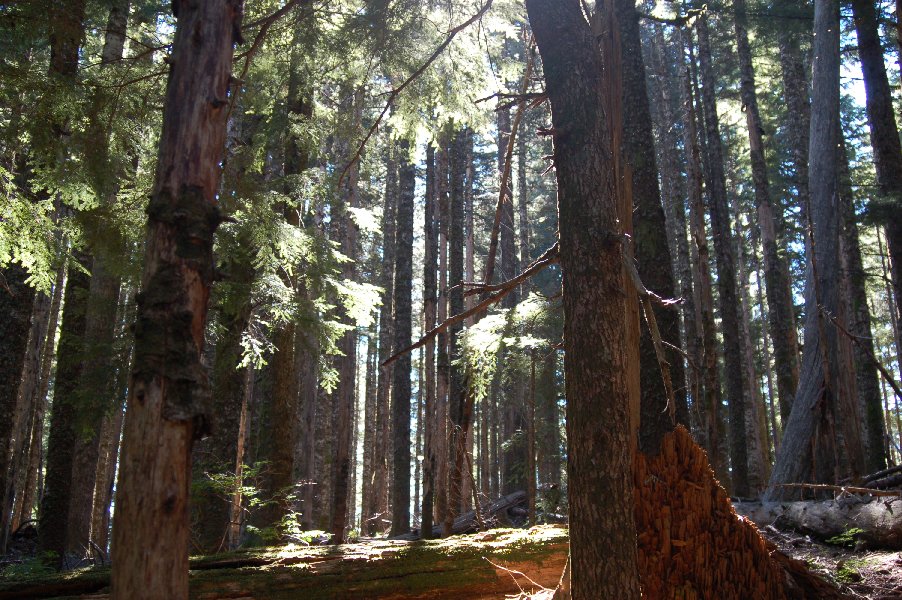
This stretch of trail had a very odd feel to it. But, it was a sunny day, and the rays cut through the trees, cheering up the desolation with feelings of hope. When the sun is shining, anything is possible. 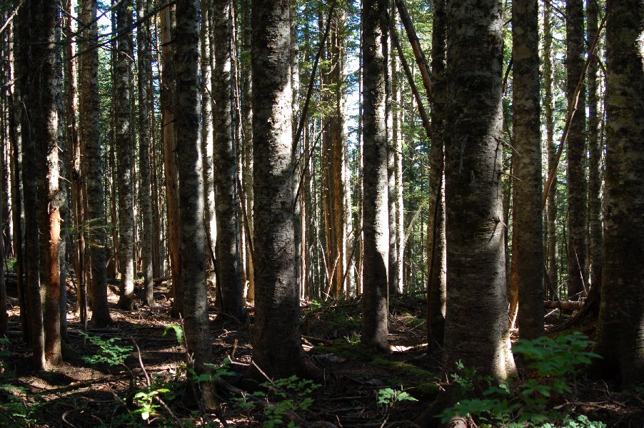 Dotti took this shot as well, catching the interesting play of light on the exposed trunks. The green of the branches, and that of the trees off in the distance, behind this stand of odd trees is a welcome change from the nearly unbroken shades of brown that have been surrounding us. Dotti took this shot as well, catching the interesting play of light on the exposed trunks. The green of the branches, and that of the trees off in the distance, behind this stand of odd trees is a welcome change from the nearly unbroken shades of brown that have been surrounding us.
 While there is still plenty of brown in the background, it is streaked with sunlight, and there is green in the foreground finally! While there is still plenty of brown in the background, it is streaked with sunlight, and there is green in the foreground finally!
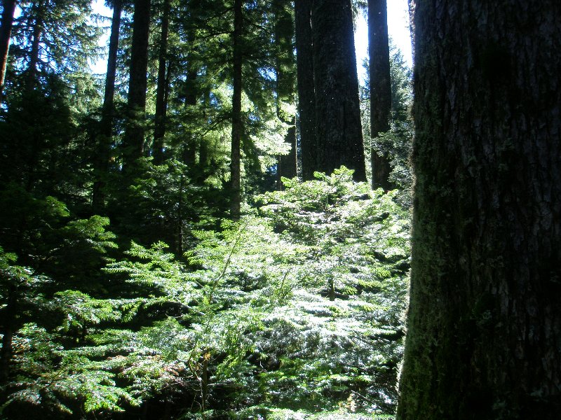 I was taken with the green that suddenly leaped out at me. The moss on the tree trunk, close enough to touch, and the Christmas tree-like richness of the small pine nearly as close, are set with backdrop of distant and tall green trees that call out to the traveler that the brown of the past steps will not rule for good, and living green awaits our future steps. I was taken with the green that suddenly leaped out at me. The moss on the tree trunk, close enough to touch, and the Christmas tree-like richness of the small pine nearly as close, are set with backdrop of distant and tall green trees that call out to the traveler that the brown of the past steps will not rule for good, and living green awaits our future steps.
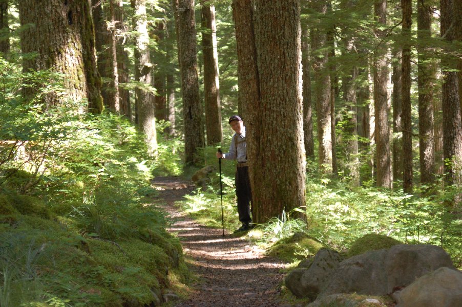
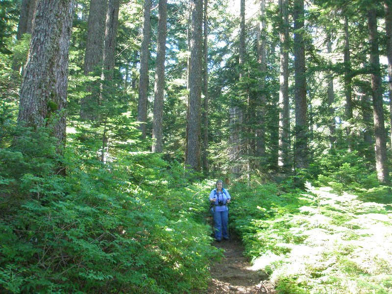 And behind their follows a beautiful forest goddess, surrounded by her subjects. The green was so welcome here, and whether it was the low lying green shrubbery or the green branches of the trees, things seemed happier here than they had at the start of the trail. And behind their follows a beautiful forest goddess, surrounded by her subjects. The green was so welcome here, and whether it was the low lying green shrubbery or the green branches of the trees, things seemed happier here than they had at the start of the trail.
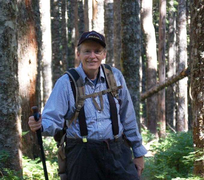
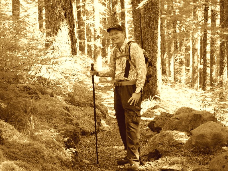
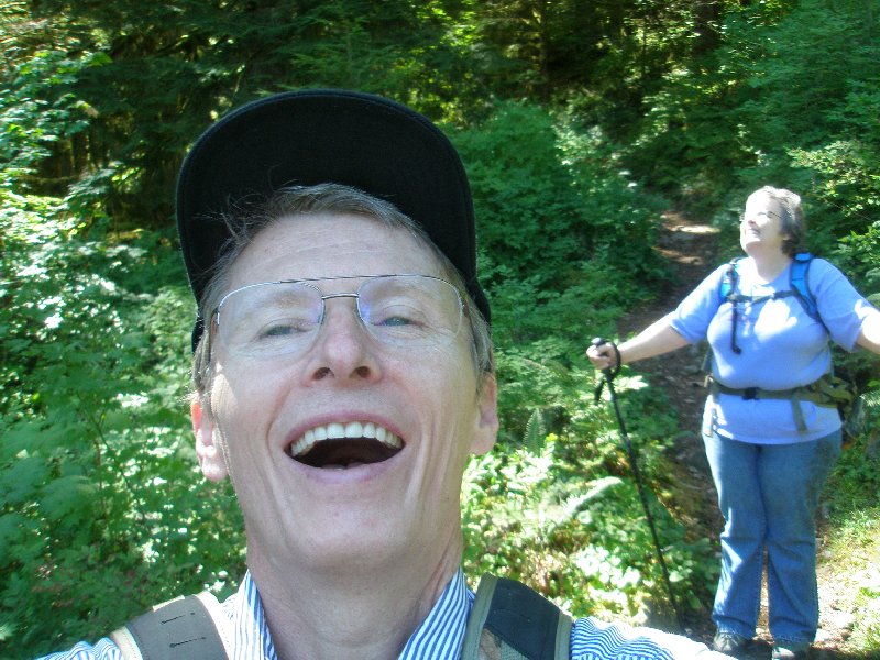
Here in the cool and 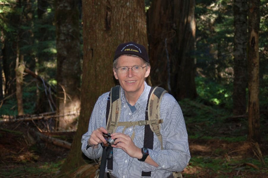 dark of the forest shade is where we find the peace and quiet that makes these hikes so special. The morning air was cool (which is why I still had on my long sleeved shirt) and we were still feeling fresh and ready to hike. I have my smaller camera in hand, because it was easier to manage and the trail steepened. As time went on, that choice was reinforced as the right one, because moving on became more and more challenging.
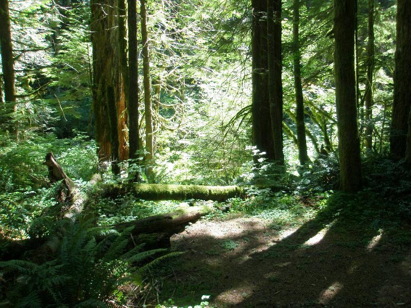
 Life and death, the future and past all play out before us in this picture that Dotti took. Young trees struggle for life as old trees lie broken and dead on the ground. The sun stands above looking down with distain and casts his light upon the living and the dead equally. And yet, the green of the branches wave in joy as they catch the light and take in the energy it gives to create more life. Hope is contained therein, and we can share in that. A lesson is held in this photograph: life is struggle, but the struggle is rewarded. The struggling tree will grow, even beside the trees that fall. Giving up is not a option. Catch the sunlight, it is there for you to use. Reach up and thrive. Life and death, the future and past all play out before us in this picture that Dotti took. Young trees struggle for life as old trees lie broken and dead on the ground. The sun stands above looking down with distain and casts his light upon the living and the dead equally. And yet, the green of the branches wave in joy as they catch the light and take in the energy it gives to create more life. Hope is contained therein, and we can share in that. A lesson is held in this photograph: life is struggle, but the struggle is rewarded. The struggling tree will grow, even beside the trees that fall. Giving up is not a option. Catch the sunlight, it is there for you to use. Reach up and thrive.
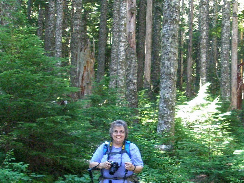 It is my beautiful Dotti standing in the forest of green, with sunlight kissing the bushes behind her. It is my beautiful Dotti standing in the forest of green, with sunlight kissing the bushes behind her.
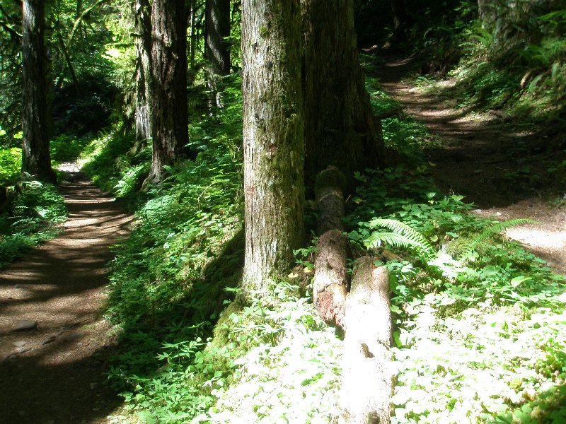
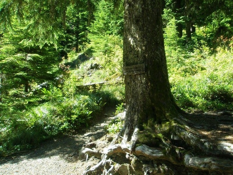 The path that runs up the hill behind this tree is the one that we have just come down. We have reached Multnomah Creek Way. This is a dirt road that runs out to E. Larch Mountain Road, the road we drove up to reach the parking lot at the top. We have come a mile and a half, and have just about finished our run along the crater's rim. It is almost time to head down into the valley. We have lost nearly 800 feet in elevation, and the ugly brown forest is being quickly left behind us, as we enter the lush forest before us. The path that runs up the hill behind this tree is the one that we have just come down. We have reached Multnomah Creek Way. This is a dirt road that runs out to E. Larch Mountain Road, the road we drove up to reach the parking lot at the top. We have come a mile and a half, and have just about finished our run along the crater's rim. It is almost time to head down into the valley. We have lost nearly 800 feet in elevation, and the ugly brown forest is being quickly left behind us, as we enter the lush forest before us.
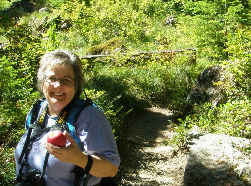 Walking in the forest with my lovely wife, is paradise to me. And Dotti is ready with the apple, something that no paradise would be complete without. ☺ Once again, there is the trail that we came down to get here. Walking in the forest with my lovely wife, is paradise to me. And Dotti is ready with the apple, something that no paradise would be complete without. ☺ Once again, there is the trail that we came down to get here.
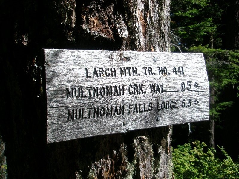 As the sign says, after hiking for 1.5 miles, we still had 5.3 miles to go. We were still in pretty good shape at this point. We hadn't started hurting much yet. But that was soon about to change.
 This Multnomah Creek Way leading back out to the highway. On our first hike, we were pretty well wiped out when we came to this point on our way back. I told Dotti that she could walk the level path to the road if she wanted, and I would hike back up to the parking lot, grab the car and drive back down and meet her, so she wouldn't have to do the rest of the climb. But she would have none of that; she said if I was going to finish the hike, she was too! That's my girl! This Multnomah Creek Way leading back out to the highway. On our first hike, we were pretty well wiped out when we came to this point on our way back. I told Dotti that she could walk the level path to the road if she wanted, and I would hike back up to the parking lot, grab the car and drive back down and meet her, so she wouldn't have to do the rest of the climb. But she would have none of that; she said if I was going to finish the hike, she was too! That's my girl!
 This was another sign at the same location, letting us know that we could go back the way we came and reach the picnic area in 1.5 miles. We took a rain check on that, and continued on down towards the Multnomah Falls Lodge.
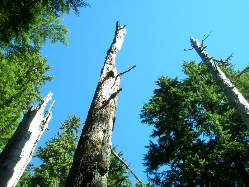
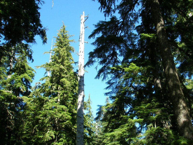 The white of the dead tree trunk stood in sharp contrast with the blue sky, and the sun hitting the green trees added a pleasing accent behind. We had a great day for our hike. It was still cool, but the sun was out and there was no threat of rain. The white of the dead tree trunk stood in sharp contrast with the blue sky, and the sun hitting the green trees added a pleasing accent behind. We had a great day for our hike. It was still cool, but the sun was out and there was no threat of rain.
 Dotti kept finding this guy standing around when she clicked her shutter. ☺ Notice the tree lying over in the background. Many times that day I had the melody of "Another One Bites the Dust" running though my head. Normally we see some downed trees on our hikes but the ratio to fallen and standing trees is well in favor of the standing ones. High up on the crater wall, it seemed like the fallen were too well represented. Dotti kept finding this guy standing around when she clicked her shutter. ☺ Notice the tree lying over in the background. Many times that day I had the melody of "Another One Bites the Dust" running though my head. Normally we see some downed trees on our hikes but the ratio to fallen and standing trees is well in favor of the standing ones. High up on the crater wall, it seemed like the fallen were too well represented.
 This stretch of trail held a variety of vegetation. There were short bushes and tall trees, and the dirt path to walk between them. This stretch of trail held a variety of vegetation. There were short bushes and tall trees, and the dirt path to walk between them.
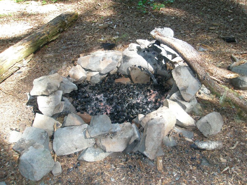 At one point later on, we talked with some Forestry employees and they said that they had discovered a smoldering fire in the woods. Fires are prohibited there at this time of year we were told. Fortunately they were there and killed the smoldering fire with no harm done. Obviously someone had been having a fire here as well. It looks like they were careful and didn't cause any harm either, but when things are really dry, it takes very little to set the forest on fire. At one point later on, we talked with some Forestry employees and they said that they had discovered a smoldering fire in the woods. Fires are prohibited there at this time of year we were told. Fortunately they were there and killed the smoldering fire with no harm done. Obviously someone had been having a fire here as well. It looks like they were careful and didn't cause any harm either, but when things are really dry, it takes very little to set the forest on fire.
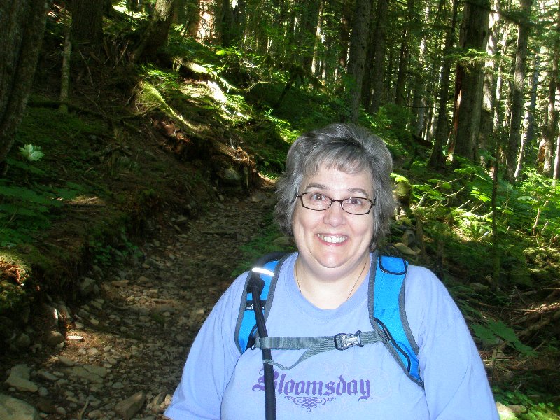
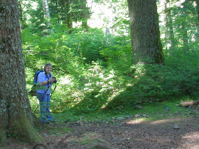 Dotti was taking pictures near the fire pit in the last photo. I took her picture in between her shutter work. Isn't she cute? Dotti was taking pictures near the fire pit in the last photo. I took her picture in between her shutter work. Isn't she cute?
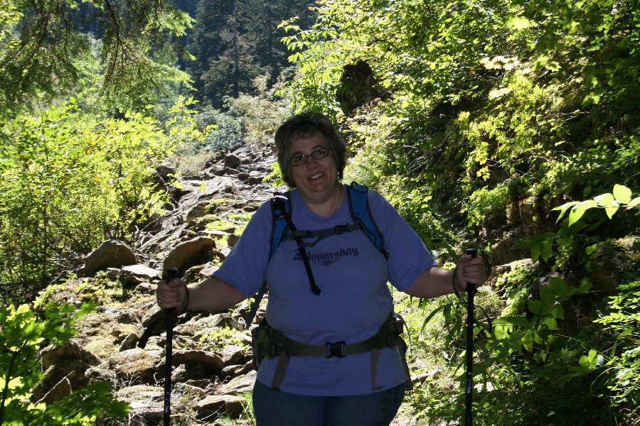
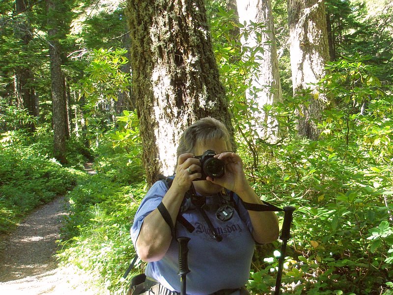 Dotti is poised to snap a picture. Her lens cap is dangling by a thread, and her tee shirt reminds us of our Bloomsday race in Spokane. Dotti is poised to snap a picture. Her lens cap is dangling by a thread, and her tee shirt reminds us of our Bloomsday race in Spokane.
Over her shoulder you can see the path that we have just come along, and it leads back to the top of the mountain.
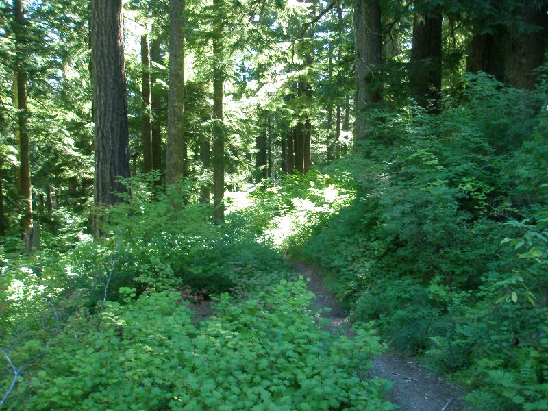
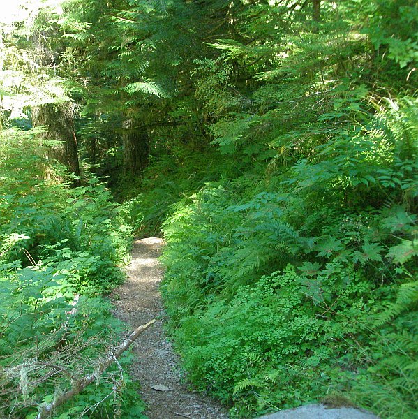
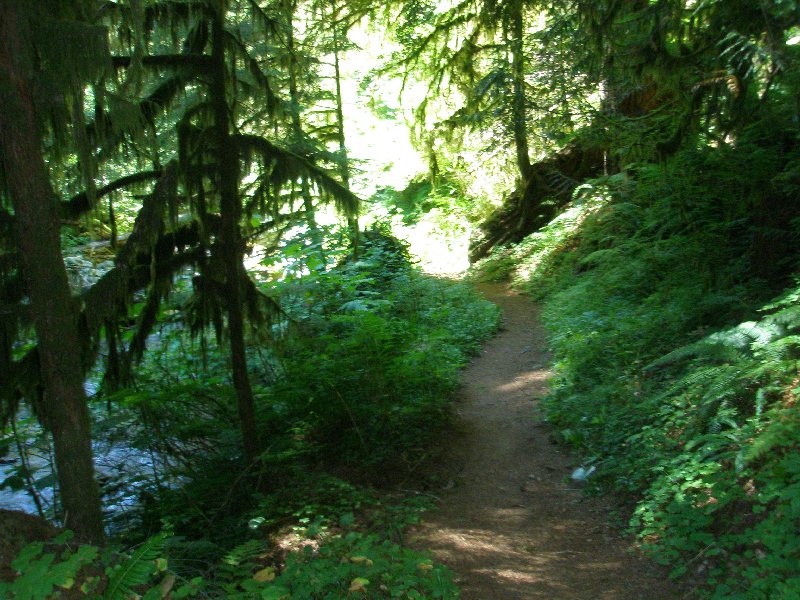
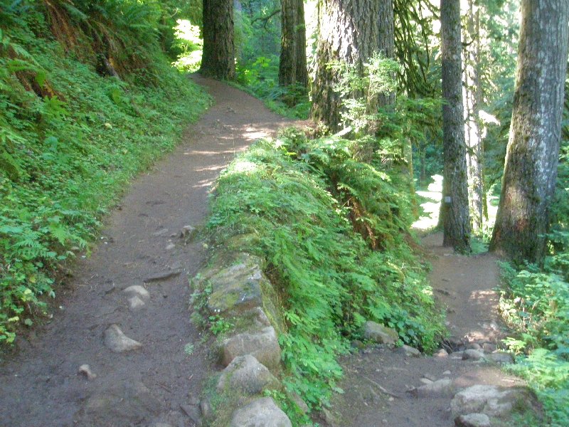
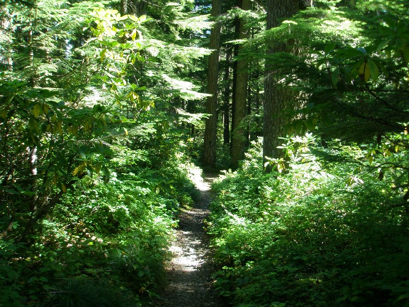 A path can look very different, depending upon the conditions at the time. The summer growth is lush and thick, with green painting every place the eye can visit. The sun is bright and drives some surfaces into a whiteout condition.
On a different day, during a different part of the year, the gray skies would block the sun and remove the harsh contrasts. Rain might muddy the trail and drip from the bare branches, or snow might cover the ground. On this day we only capture one of the many faces that this stretch of path might present. I am glad that we didn't miss it. 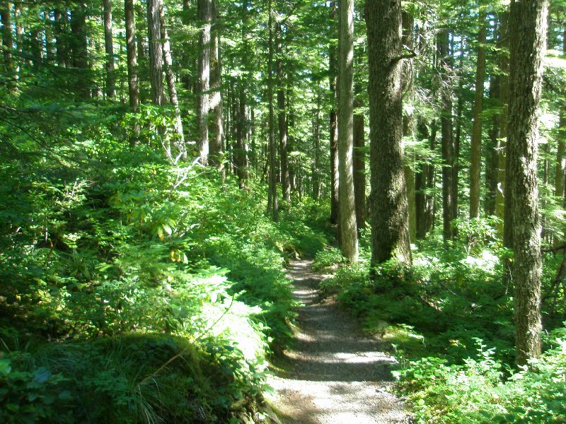 It was 11:26, and the overhead canopy of leaves was doing a hit and miss job of shading this part of the forest. Directly before us the sun was hitting the path squarely, but a few feet on, it was broken up, with patches of dark shadow, and partly lit ground. Looking up the trunks of the trees were a patchwork of light and shadow, green, brown and nearly white.
And of course the path was trending downward, ever downward as moved along. 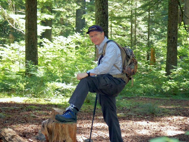 Here I am showing off my boot. I have two sets of laces on each boot. The lower lace, black in color, I keep snug, securing my foot inside, so it will not slide around and cause problems with blisters and other sores. The upper white lace I keep a bit looser, so my ankle area will not chafe under too much tension.
I still have my long-sleeve shirt on, but it is about to get warm enough to make me remove it. The backpack is very comfortable and balances the support for its weight between my hips and my shoulders. This really works well to avoid the upper back pain that I often get with a backpack. 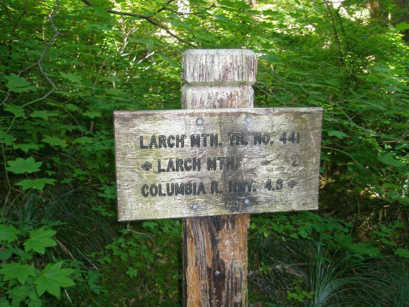 We have come 2 miles, with 4.8 miles left before us, and this is the junction with Trail 444. Herein lies a tale.
Back in 2003, on a warm day in July, I had planned out a hike around the Larch Mountain crater. It was to be a 6 mile hike, only slightly shorter than the one we were doing now. But the elevation was only going to go from 2750 feet up to 4050 feet, first going up 1300 feet and then coming back down. It was a moderate hike that we were ready for, because of the other hiking we had been doing. If we were going to do that hike, we would have to make the turn right here, and go on Trail 444, rather than continuing on down the mountain on Trail 441. This is the point where we "Crossed the Rubicon" and were committed to the long and difficult hike we took instead of the easier path. But I am glad that we made that choice, simply because we took on the challenge and did it. We may have been dragging and worn out at the end, but we did it! 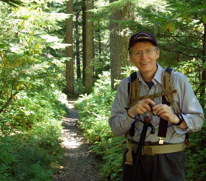 Well, I am still smiling. That is a good sign. ☺ Trail 441 runs off behind me here. Well, I am still smiling. That is a good sign. ☺ Trail 441 runs off behind me here.
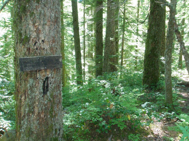 This sign shows an indication of the forces at work in the forest. The sign is made of the same material as the tree is. And yet the tree stands for many decades, while the wood of the sign ages quickly and the letters are nearly unreadable. A few more years and the wooden sign will rot to pieces. Trees, on the other hand rejuvenate themselves, repairing damage and continuing to appear as though there were no destructive forces at work upon them. This sign shows an indication of the forces at work in the forest. The sign is made of the same material as the tree is. And yet the tree stands for many decades, while the wood of the sign ages quickly and the letters are nearly unreadable. A few more years and the wooden sign will rot to pieces. Trees, on the other hand rejuvenate themselves, repairing damage and continuing to appear as though there were no destructive forces at work upon them.
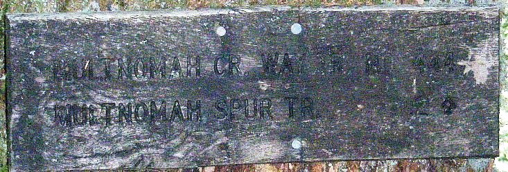 Even looking closely at the sign, it is difficult to see that it says "MULTNOMAH CR WAY TR # 444" and "MULTNOMAH SPUR TR. .2" Even looking closely at the sign, it is difficult to see that it says "MULTNOMAH CR WAY TR # 444" and "MULTNOMAH SPUR TR. .2"
There are several possible hiking options at this point. You can follow Trail 444 around to where it joins up with Trail 424, which leads back to the Parking lot where we started. This forms the 6 mile loop which Dotti and I were originally going to hike in 2003. You can take a 7.2 mile loop around the crater by connecting up with Trail 424 down a little farther, and walking the entire eastern rim of the crater wall. If you turn left on Trail 424 and head north instead, it will take you down to Horsetail Falls. You can also connect up with Trail 427, the Franklin Ridge Trail, which an alternate&mdahs;and 1.4 miles longer&mdahs;route down to Multnomah Falls. You could spend many days up in these forests, moving from trail to trail without ever returning to the road below. 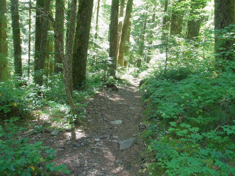 And this is the innocent looking Trail 444 which leads you into so many possible paths. Once you start walking on one of these trails, you never know where your feet might take you. Can you feel the pull of the trail? Don't your feet want to go and search out what lies just out of view down this trail? Mine do. And this is the innocent looking Trail 444 which leads you into so many possible paths. Once you start walking on one of these trails, you never know where your feet might take you. Can you feel the pull of the trail? Don't your feet want to go and search out what lies just out of view down this trail? Mine do.
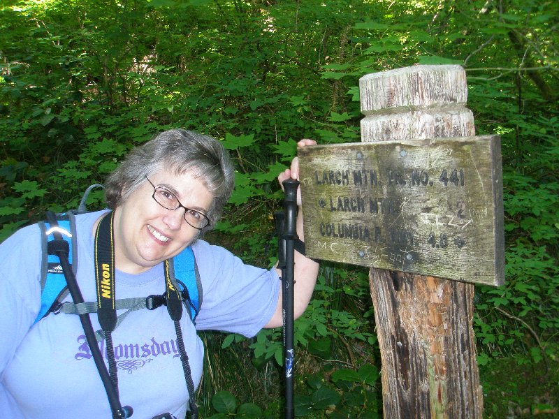 I am sure this sign looks familiar, but it just looks so much better with this lovely lady standing beside it!
 The green of the trees is spread like emeralds tossed across a richly blue velvet cloth. Shadow and sunlight shift the branches into a myriad of green tones, dazzling the eyes. The hulks in the foreground display parts of branches that once eagerly reached out to catch the sunlight for nourishment, but today it merely bleaches their dead surface into a lighter shade, leeching what little color remains in them. The green of the trees is spread like emeralds tossed across a richly blue velvet cloth. Shadow and sunlight shift the branches into a myriad of green tones, dazzling the eyes. The hulks in the foreground display parts of branches that once eagerly reached out to catch the sunlight for nourishment, but today it merely bleaches their dead surface into a lighter shade, leeching what little color remains in them.
 We came up with old photo of a hiker from long ago. There is something familiar about this guy, but I am not sure what it is.☺
 I thought I saw a hobbit back there and took a look. I couldn't be sure, but I thought I saw a bare furry foot being quickly pulled from view before I got there. From its size I guessed he must be part of the Proudfoot family line, but being so far from the Shire, perhaps he had a little Brandybuck in him. But then again, the forest can stir the imagination. It is alive, and most of the life you never see, hidden just beyond your field of view. I thought I saw a hobbit back there and took a look. I couldn't be sure, but I thought I saw a bare furry foot being quickly pulled from view before I got there. From its size I guessed he must be part of the Proudfoot family line, but being so far from the Shire, perhaps he had a little Brandybuck in him. But then again, the forest can stir the imagination. It is alive, and most of the life you never see, hidden just beyond your field of view.
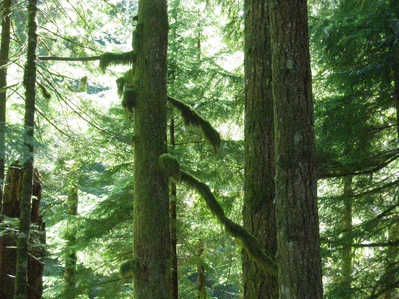
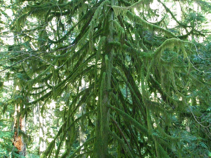
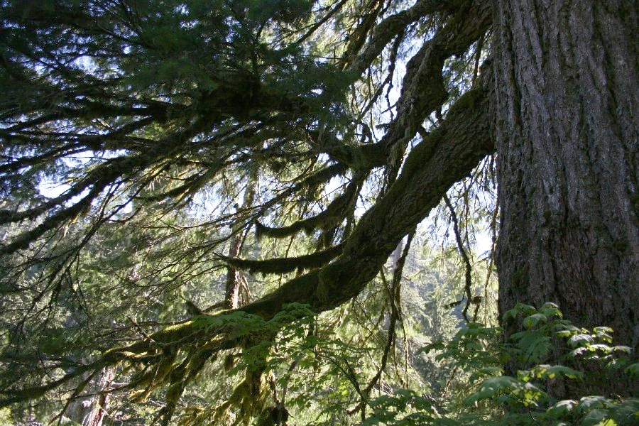 The mossy branches are reaching out like arms, grasping for something. Fortunately their owner was looking the other way as we passed by. The summer sunshine was drying the moss a bit, but soon the refreshing rain will start, and set things right. The mossy branches are reaching out like arms, grasping for something. Fortunately their owner was looking the other way as we passed by. The summer sunshine was drying the moss a bit, but soon the refreshing rain will start, and set things right.
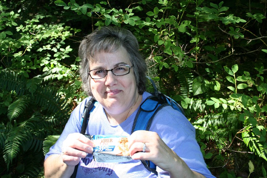 We were on the edge of the rockslide, and we paused for quick snack break. Dotti is showing off the wrapper of her Fiber One bar that she just finished eating.
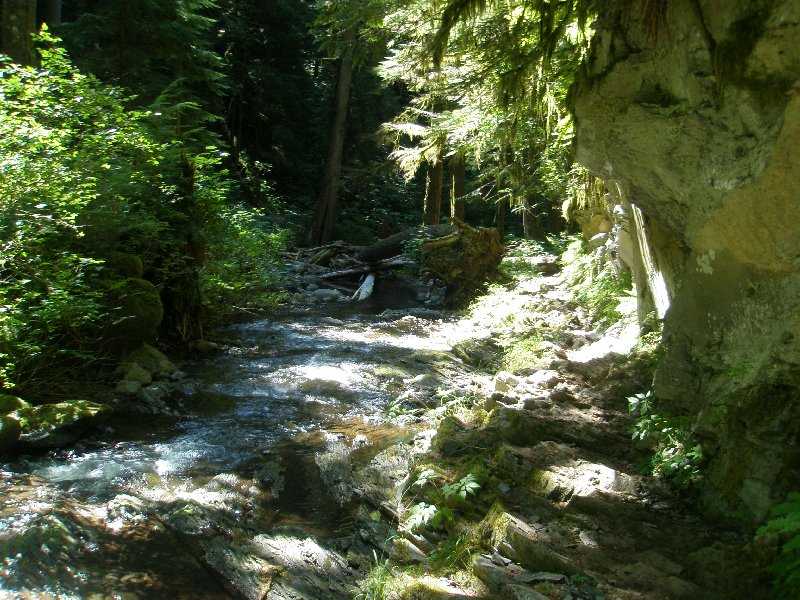
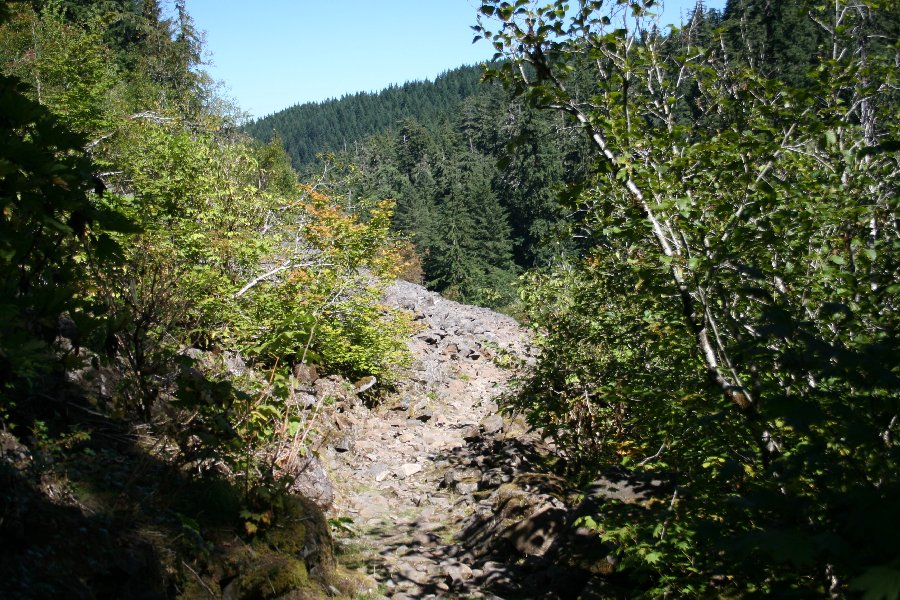 Dotti and I are still gun-shy about these rocks. In 2003, on the way back up the mountain, we were completely drained of energy by the radiant power of these stones. The sun beat down upon them, heating them up to a high temperature, just like the asphalt of a parking lot. As we crossed, the sun beat down on us as well, but the rocks also sent their stored heat up at us, baking us from both sides. We were parched and felt like quitting right there. That is what I was remembering when I looked out from our shady haven at our old nemesis. Dotti and I are still gun-shy about these rocks. In 2003, on the way back up the mountain, we were completely drained of energy by the radiant power of these stones. The sun beat down upon them, heating them up to a high temperature, just like the asphalt of a parking lot. As we crossed, the sun beat down on us as well, but the rocks also sent their stored heat up at us, baking us from both sides. We were parched and felt like quitting right there. That is what I was remembering when I looked out from our shady haven at our old nemesis.
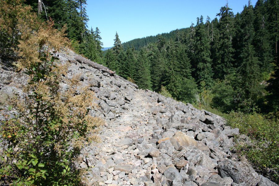
This entire area of the Cascade Mountains was created by volcanoes. Lava flowed everywhere, and then it was covered with ash from eruptions. Then more lave poured over the ash. Larch Mountain is an extinct volcano itself, so the primary type of rock above us, as well as under us, was volcanic basalt. Basalt is quite fragile, as rocks go, and it will fragment relatively easily. When a section of a hillside gives way, it breaks into little pieces and spreads out like salt thrown on a table. But it is rock, and as it spreads out, it knocks down trees, and covers bushes, leaving nothing but a rock parcel of barren ground. It was time for us once more to face the rocks. 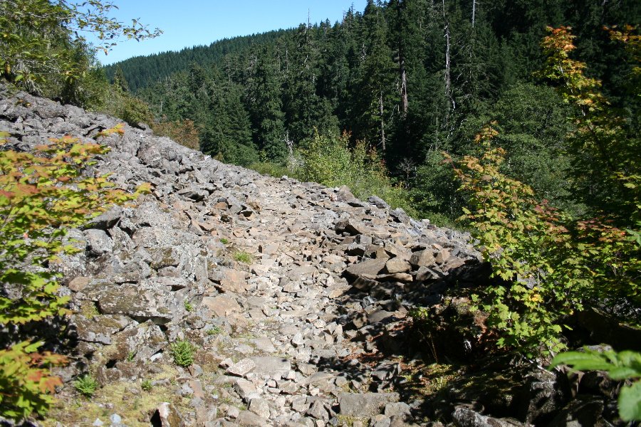 I took pictures along the route so you could get a feel for how large the rockslide really is. I have just stepped onto the rocks from out of the tree cover, and off in the distance, just to the left of the path there is a bush growing in the rocks. Notice how far away it looks.
 I have moved out onto the rocks a ways and looking back, here comes Dotti. Her walking sticks will come in handy here, as we have to pay attention of our footing. A fall on these rocks would be very painful, and dangerous. I have moved out onto the rocks a ways and looking back, here comes Dotti. Her walking sticks will come in handy here, as we have to pay attention of our footing. A fall on these rocks would be very painful, and dangerous.
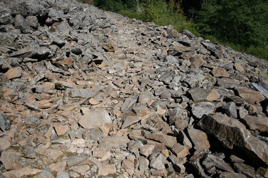 When basalt cools, it tends to form blocks or sections that are only loosely connected to each other. So, when a landslide occurs, the sections break apart and you have left what you see here.
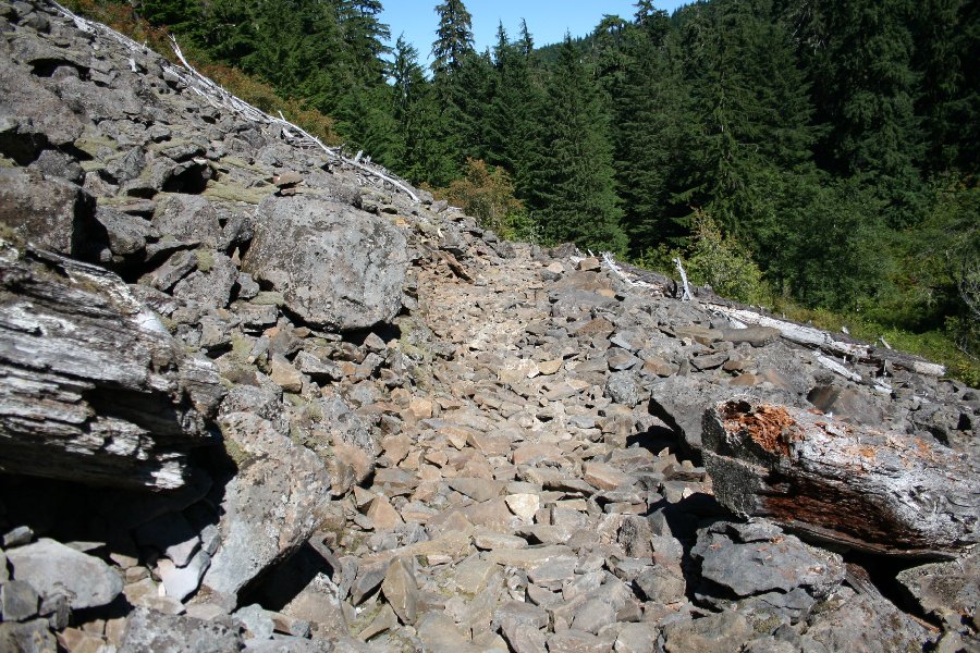
 We are getting closer to the bush we saw before, and there is still no end in sight for the rock field. The forest is heavy and green on the surrounding hillsides, and that gives an idea of the force that was released when this rockslide occurred; it had to have knocked down vegetation that was just as thick and hardy as the tree cover we see surrounding this area. I would not have wanted to be standing on this spot when the hillside cut loose.
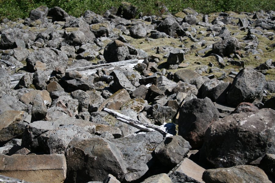 The pieces of wood that are strewn about amongst the rocks looks like driftwood. The heat bakes the broken tree parts and the sun steals the color from them. Just like bones in the desert, they just become whiter and whiter with time. The pieces of wood that are strewn about amongst the rocks looks like driftwood. The heat bakes the broken tree parts and the sun steals the color from them. Just like bones in the desert, they just become whiter and whiter with time.
 We have finally reached our first landmark, as we are standing right beside the bush we at the start of our rock adventure. Looking ahead, we see more rocks, and off in the distance, there is a fallen tree across our path. Fortunately there is a section cut out of it, clearing the way for us to pass. This will be our second landmark in the rocks. We have finally reached our first landmark, as we are standing right beside the bush we at the start of our rock adventure. Looking ahead, we see more rocks, and off in the distance, there is a fallen tree across our path. Fortunately there is a section cut out of it, clearing the way for us to pass. This will be our second landmark in the rocks.
 Scotty couldn't have done it any quicker with his transporter. ☺ We are now standing beside the fallen tree, with the ends of the upper and lower sections just visible at the edges of the photo. Off in the distance is another bush, and between here and there: more rocks! Scotty couldn't have done it any quicker with his transporter. ☺ We are now standing beside the fallen tree, with the ends of the upper and lower sections just visible at the edges of the photo. Off in the distance is another bush, and between here and there: more rocks!
Fortunately, the day was not yet too hot, and we were not suffering from thermal abuse the way we were the last time. We were mostly concerned with twisting an ankle, or stumbling into a nasty fall. We really didn't want to see any blood during our hike.  We are almost to the bush we saw from the fallen tree, and the trees are clearly getting closer. We have covered a lot of rocky ground, but the end is drawing near! We are almost to the bush we saw from the fallen tree, and the trees are clearly getting closer. We have covered a lot of rocky ground, but the end is drawing near!
The trail blazers did a good job in creating a walkable path through the rockslide. You can see on either side of the path what it would have been like to cross this rock field without a manmade trail. The rocks are uneven, standing in chaotic disarray, with various sizes intermixed, producing a most unsatisfactory walking surface. Sure, you could get across on those rocks, but it would have been a lot harder to do so, and the risk of injury would have been multiplied many times! I want to say THANK YOU to the men who did this work. We always support the trails financially through the annual purchase of the Pacific Northwest Pass. We also use the pay envelopes at the trailheads when we don't have our pass with us. These trails are a lot more valuable to us than any movie, and just look what they charge for a movie these days! This is the best entertainment bargain around, and far healthier than most other types you will find. 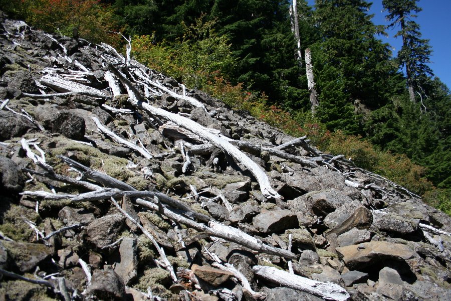 Here, surrounded by lush forest green, lie the bones of trees, as parched as if they were lying in Death Valley: a testament to the heat these rocks reflect from the relentless sun. And this is in an area that has a high percentage of cloudy days, and a fair amount of rain. Here, surrounded by lush forest green, lie the bones of trees, as parched as if they were lying in Death Valley: a testament to the heat these rocks reflect from the relentless sun. And this is in an area that has a high percentage of cloudy days, and a fair amount of rain.
 We are almost across and Dotti is smiling! That is a lot better than last time we were here. ☺ Hiking with Dotti is such a joy. She is a sparkle of life and source of joy, whose childlike curiosity and enthusiasm makes each new discovery a true adventure. We are almost across and Dotti is smiling! That is a lot better than last time we were here. ☺ Hiking with Dotti is such a joy. She is a sparkle of life and source of joy, whose childlike curiosity and enthusiasm makes each new discovery a true adventure.
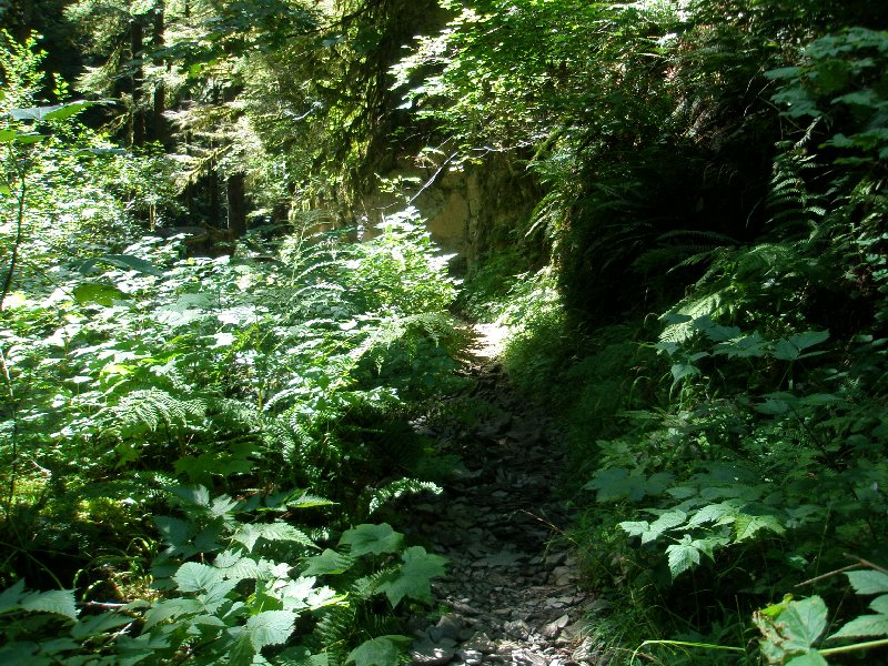
 We have passed the bush, and there, standing like a cool damp cave at the edge of a desert is the forest path waiting for us, hidden in shadow and calling to us. Here is where we needed to be most careful, because our minds wanted to hurry, but our feet were still covering rocky uneven ground. We have passed the bush, and there, standing like a cool damp cave at the edge of a desert is the forest path waiting for us, hidden in shadow and calling to us. Here is where we needed to be most careful, because our minds wanted to hurry, but our feet were still covering rocky uneven ground.
 We made it! You can tell from Dotti's face that the trip is already taking its toll. From this point on we were starting hurt. The constant downhill motion was straining our calf muscles, and Dotti's toes were hitting the front of her boots. She tried to keep a positive attitude but the fun was quickly leaving the adventure for her.
 With the rocks gone, even open areas could be covered in green, and that green held the heat away from us, and felt cool. Some stones remained at the surface of the trail but the area beside the trail was all overgrown with lovely vegetation. With the rocks gone, even open areas could be covered in green, and that green held the heat away from us, and felt cool. Some stones remained at the surface of the trail but the area beside the trail was all overgrown with lovely vegetation.
 I held the camera up and turned it back at the two of us as we celebrated being free of that barren rock desert. Dotti is smiling at the sky, and life is good, at least for the moment. ☺
 Even though we were tired and starting to hurt, this was a beautiful site. We were finally down in the valley of Multnomah Creek, and had left he rim of the crater behind us. From now on, we would be close to water almost all the way. (The farthest we would get from water would actually be on the final descent from Multnomah Falls as the switchback trail moved away in a search for a safe and rapid drop to the Columbia River's level.)
 It was almost like magic the way the shade of the forest and the rippling sound of the water blended to make us feel better. Dotti is smiling and if the hike had ended here, we would have considered it a job well done. It would have been about the right amount of walking at this point, in our efforts to work back up to doing some long hikes. It was almost like magic the way the shade of the forest and the rippling sound of the water blended to make us feel better. Dotti is smiling and if the hike had ended here, we would have considered it a job well done. It would have been about the right amount of walking at this point, in our efforts to work back up to doing some long hikes.
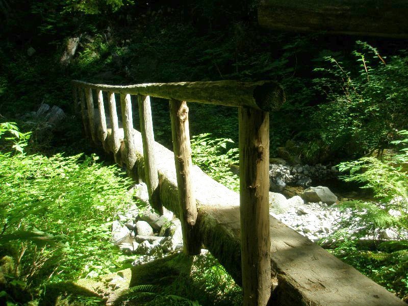
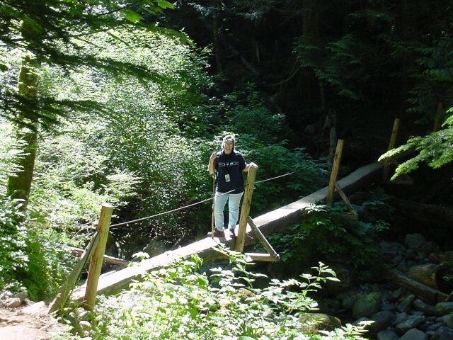
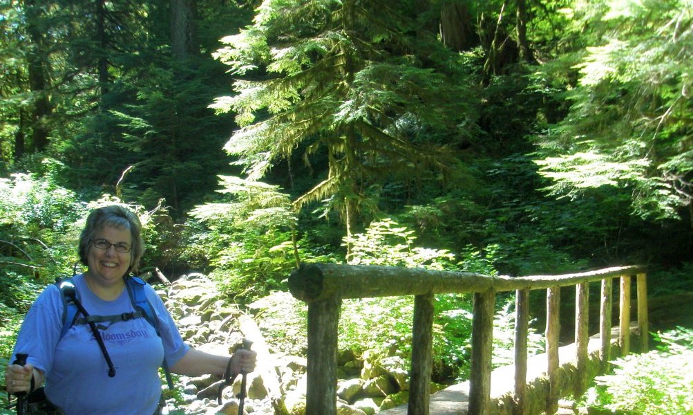
The black hose from the water reservoir on Dotti's back is hanging across the “B” on her Bloomsday tee shirt. On our last hike on this trail we ran out of water and were very parched by the end of the day. We were better prepared for our water needs this time around. We are crossing Multnomah Creek, and, as you can see in the photo on the left, taken during our 2007 hike, the footbridge was a narrow one, with just a single rail running along the left side.
Dotti paused on her crossing so I could  take this picture of her. She had transferred the left walking stick to her right hand, to free up a hand for the rail. We both were being very careful to avoid any falls this time on our hike. I took a tumble on a Multnomah Falls hike earlier this year, and then another one on a short walk on a visit to Mount St. Helens a few weeks ago, when I was trying to climb over a fallen tree in the path. Dotti had a cast on for 6 weeks this year from a fall she took as well. So, we are very careful these days to avoid any more of those events! take this picture of her. She had transferred the left walking stick to her right hand, to free up a hand for the rail. We both were being very careful to avoid any falls this time on our hike. I took a tumble on a Multnomah Falls hike earlier this year, and then another one on a short walk on a visit to Mount St. Helens a few weeks ago, when I was trying to climb over a fallen tree in the path. Dotti had a cast on for 6 weeks this year from a fall she took as well. So, we are very careful these days to avoid any more of those events!
 Safely across, my lovely Dotti is smiling brightly, with the sunlight forest behind her. Summer in the Pacific Northwest is a lot drier and sunnier than most people realize. During July and August it is usual to have bright sunny skies for our walks. Safely across, my lovely Dotti is smiling brightly, with the sunlight forest behind her. Summer in the Pacific Northwest is a lot drier and sunnier than most people realize. During July and August it is usual to have bright sunny skies for our walks.
 From the bridge, the path leads on through the forest. We are now down off the crater rim, and are following the less sharp angle of drop of the valley floor. Later on the angle would increase again, but for now, our hike became easier—physically with a more level terrain, and psychologically, with the water to soothe us on our way. From the bridge, the path leads on through the forest. We are now down off the crater rim, and are following the less sharp angle of drop of the valley floor. Later on the angle would increase again, but for now, our hike became easier—physically with a more level terrain, and psychologically, with the water to soothe us on our way.
 The sun continued to cut through the forest, keeping things bright, but not overheating things, as the shade predominated once more. The memory of the unprotected rock "desert" we had crossed earlier was beginning to fade. The sun continued to cut through the forest, keeping things bright, but not overheating things, as the shade predominated once more. The memory of the unprotected rock "desert" we had crossed earlier was beginning to fade.
The long-sleeved shirt is gone, and I am 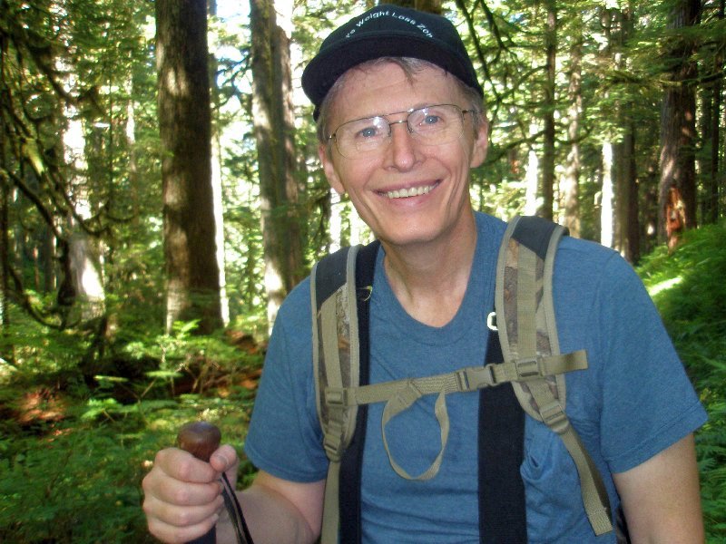 down to my tee shirt. This was the first hike while using this backpack and I really liked it. The shoulder straps were padded well, and they were held together by a connecting strap that easily hooked, and unhooked as required. Around my waist, there was another heavy strap that allowed the weight to be distributed to that part of my body, and that took a lot of the load off my shoulders and back. I sometimes have back pain when I carry a pack, but not this time. Maybe that was why I was smiling. ☺ down to my tee shirt. This was the first hike while using this backpack and I really liked it. The shoulder straps were padded well, and they were held together by a connecting strap that easily hooked, and unhooked as required. Around my waist, there was another heavy strap that allowed the weight to be distributed to that part of my body, and that took a lot of the load off my shoulders and back. I sometimes have back pain when I carry a pack, but not this time. Maybe that was why I was smiling. ☺
Moving farther down the trail, here is another crossing of Multnomah Creek. I took this picture as we walked down towards a switchback in the trail, because there were some men working on the bridge as was approached, and the noise caught my attention.
 We made it down to the Franklin Ridge Trail (#427). You can take this trail over to the Oneonta Trail and go down to Horsetail Falls, or up the eastern crater wall back to the parking lot at the top, where we had started our morning hike.
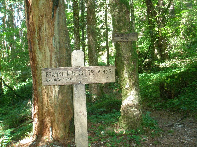
Just before we crossed the rocks earlier, we had met up with the only other hiker we had seen so far that day, and he said that he had come down the Franklin Ridge Trail. He was heading back up the trail we had used to descend when we met him. The last time that we hiked this trail we had run into another hiker who had done the reverse route on the trails that this guy had. We have yet to hike the Trail #427, but one day I hope we will get the chance. The Forestry people are always trying to make things better, and you can see how the new sign in front is much easier to read than the older one nailed to the tree in the background. 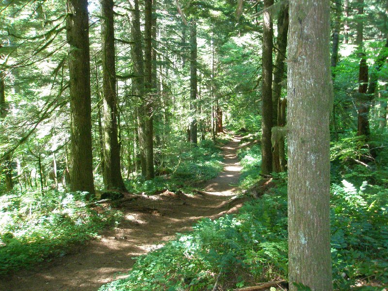 This our trail (#441) heading north down the mountain from the junction with the Franklin Ridge Trail. This our trail (#441) heading north down the mountain from the junction with the Franklin Ridge Trail.
 And this is the Franklin Ridge Trail heading off towards the east. And this is the Franklin Ridge Trail heading off towards the east.
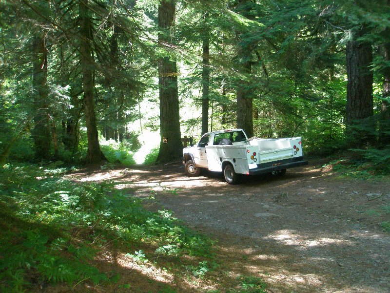 The valley empties out onto a natural basin at this point, and the road that the truck you see here took to get here is called "Multnomah Basin Road," after the basin we were about to cut across. The valley empties out onto a natural basin at this point, and the road that the truck you see here took to get here is called "Multnomah Basin Road," after the basin we were about to cut across.
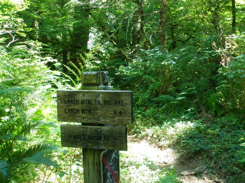 This sign not only identifies the dirt road we were about to cross, but also shows that we have already come 4 miles down Trail 441. Seeing the little arrow point up the trail made us happy that, unlike in 2003, we were not going to have to walk those 4 miles in the reverse direction this time. This sign not only identifies the dirt road we were about to cross, but also shows that we have already come 4 miles down Trail 441. Seeing the little arrow point up the trail made us happy that, unlike in 2003, we were not going to have to walk those 4 miles in the reverse direction this time.
 Multnomah Basin Road is a humble and little used route, mostly utilized by the Forestry people to maintain the trails. The guys we had seen earlier had driven the white truck to this spot, and unloaded a small motorized tractor-like vehicle to cart their tools up the trail to the bridge that they were working on as we passed by. Multnomah Basin Road is a humble and little used route, mostly utilized by the Forestry people to maintain the trails. The guys we had seen earlier had driven the white truck to this spot, and unloaded a small motorized tractor-like vehicle to cart their tools up the trail to the bridge that they were working on as we passed by.
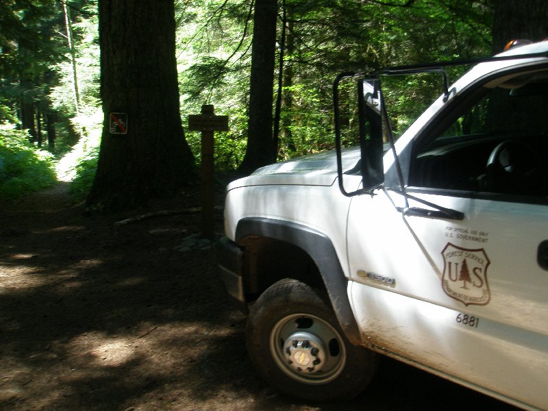 The Forest Service truck was parked off to the side, as our trail headed on past on the left. A sign marks they way down to the lodge, and the sunny meadow of Multnomah Basin awaited us. The Forest Service truck was parked off to the side, as our trail headed on past on the left. A sign marks they way down to the lodge, and the sunny meadow of Multnomah Basin awaited us.
With an assist from the flash, the sign that was in shadow in  the last photo comes to light and is easy to read. Notice that the sign pointing up the hill had said 4 miles and this one says 3 miles to the Lodge. Obviously, on one or both of these signs they were doing some rounding of the numbers. The entire trip was 6.8 miles and so the 7 mile total that these two signs indicated was a couple of tenths off. But what are 2 tenths of miles among friends? ☺ Actually, we were very happy to not have to actually walk those extra 2 tenths of a mile at the end. We had walked quite enough by that time, thank you very much. the last photo comes to light and is easy to read. Notice that the sign pointing up the hill had said 4 miles and this one says 3 miles to the Lodge. Obviously, on one or both of these signs they were doing some rounding of the numbers. The entire trip was 6.8 miles and so the 7 mile total that these two signs indicated was a couple of tenths off. But what are 2 tenths of miles among friends? ☺ Actually, we were very happy to not have to actually walk those extra 2 tenths of a mile at the end. We had walked quite enough by that time, thank you very much.
 In the meadow of Multnomah Basin, we took a little break from our walk and Dotti produced some cheese sticks and other snacks to help out with our waning energy level. The mossy and shaded meadow was inviting and a comfortable place to rest. In the meadow of Multnomah Basin, we took a little break from our walk and Dotti produced some cheese sticks and other snacks to help out with our waning energy level. The mossy and shaded meadow was inviting and a comfortable place to rest.
 A fallen tree, moss covered trunks, and green plants dominated this little resting place. Multnomah Creek was running just over the knoll. Beautiful! A fallen tree, moss covered trunks, and green plants dominated this little resting place. Multnomah Creek was running just over the knoll. Beautiful!
 Another fire pit in an area where no fires were allowed. At least it appears to have been a well monitored fire, and there is little evidence of migration of the burning material out of the pit. Another fire pit in an area where no fires were allowed. At least it appears to have been a well monitored fire, and there is little evidence of migration of the burning material out of the pit.
 Looking towards the creek, the camera was having trouble with the heavy contrast between sun lit greenery and the shadows that were keeping us cool. Looking towards the creek, the camera was having trouble with the heavy contrast between sun lit greenery and the shadows that were keeping us cool.
 The moss covered branches take on odd shapes in the shadows. The moss covered branches take on odd shapes in the shadows.
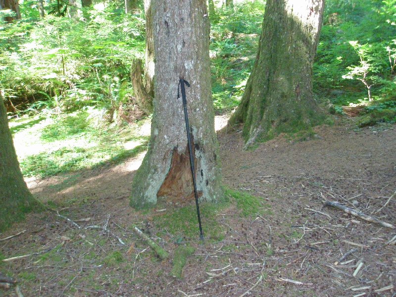 My walking stick was taking a break as well, as it rested against the tree. ☺ I had set it down as I walked around taking pictures. My walking stick was taking a break as well, as it rested against the tree. ☺ I had set it down as I walked around taking pictures.
I have found that when we stop, if I sit down, I don't want to get back up. So, I normally just relax standing up, and enjoy the scenery. 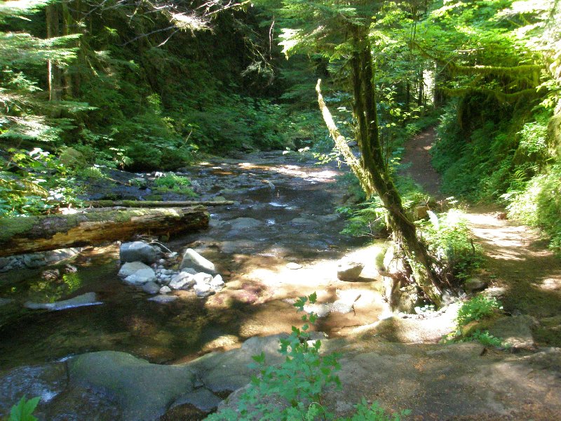 Back on the trail again, we found our path running right down against the water. This was very pleasant indeed! Water running along beside you, keeping you company on your walk, is a wonderful companion when you are tired. Back on the trail again, we found our path running right down against the water. This was very pleasant indeed! Water running along beside you, keeping you company on your walk, is a wonderful companion when you are tired.
 It almost as if the water were shy at times, as it works its way into hidden paths where it would be very difficult to follow if you chose to. The fallen trees provide a cover that the water runs beneath, and the undergrowth of the forest closes in on either side. It almost as if the water were shy at times, as it works its way into hidden paths where it would be very difficult to follow if you chose to. The fallen trees provide a cover that the water runs beneath, and the undergrowth of the forest closes in on either side.
But it always returns from its 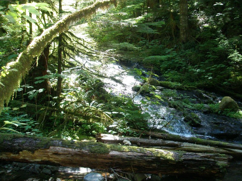 shy moments, and happily rejoins your journey. shy moments, and happily rejoins your journey.
The rich variation of light and shadow on a day like this is wonderful to see. On a cloudy day, the sharp contrasts are gone, and everything becomes almost a grayscale, rather than green, brown and blue. But we saw the whole range of color on this day.  The water changes all along the way. When it hits a deep spot in its bed, it appears still and green, but when it runs shallow like it was here, the water churns into white, and moves quickly. The water changes all along the way. When it hits a deep spot in its bed, it appears still and green, but when it runs shallow like it was here, the water churns into white, and moves quickly.
 Still running shallow, the white water dances out of the sunlight and into shadow, turning almost black in the darkness. A tree sends its moss covered branch reaching down towards the water, in search of what it only knew. Still running shallow, the white water dances out of the sunlight and into shadow, turning almost black in the darkness. A tree sends its moss covered branch reaching down towards the water, in search of what it only knew.
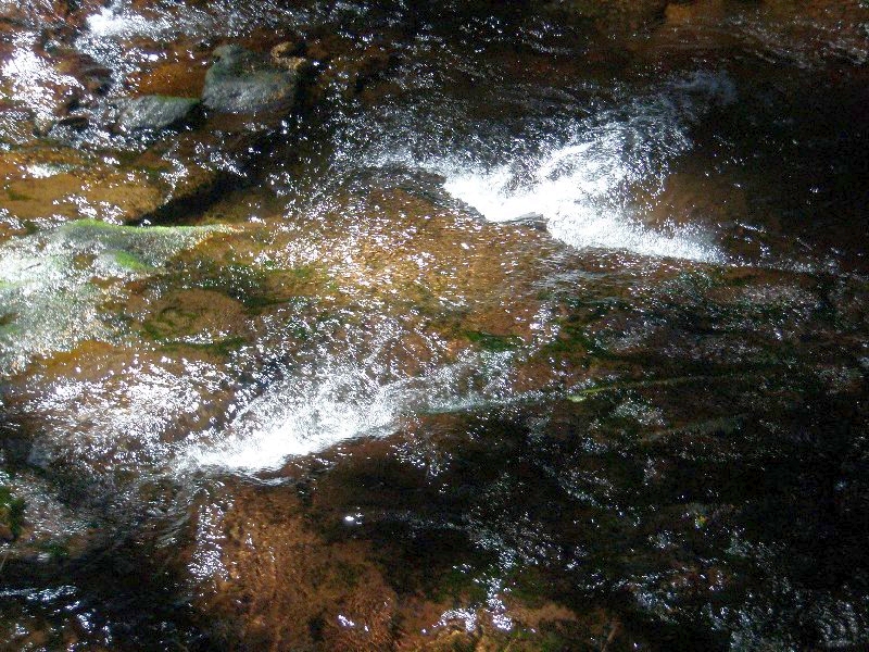 Sunlight hit the crystal clear water and cut straight through to the rock beneath, and then bounced back up into the camera. Streaks of green and brown mix with the sharp white of the water, as the stream rushes by. Sunlight hit the crystal clear water and cut straight through to the rock beneath, and then bounced back up into the camera. Streaks of green and brown mix with the sharp white of the water, as the stream rushes by.
We were entering on the last leg of the journey, but we still had a long ways to go. 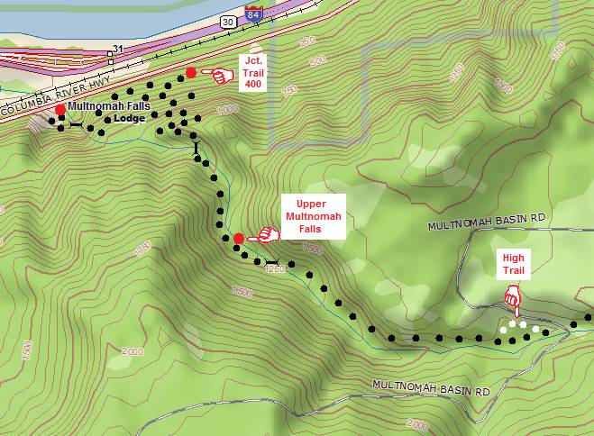 We had crossed the Multnomah Basin Road already and were approaching the High Water Trail. (As we have already seen, the water and the trail at times are nearly at the same level. At one point, the trail runs right up against some rock, and right down near the water. When the creek level rises the trail gets covered up by the water and is impassible. For those time, an alternate route is available, running high above the water line.) We had crossed the Multnomah Basin Road already and were approaching the High Water Trail. (As we have already seen, the water and the trail at times are nearly at the same level. At one point, the trail runs right up against some rock, and right down near the water. When the creek level rises the trail gets covered up by the water and is impassible. For those time, an alternate route is available, running high above the water line.)
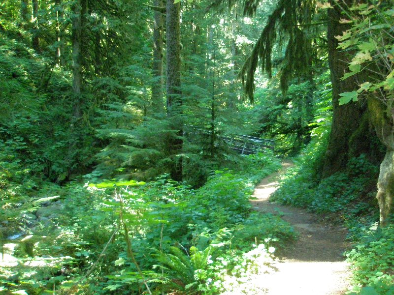
As we leave the Multnomah Basin we will follow the Multnomah Creek valley, and see some beautiful falls, especially the Upper Multnomah Falls. We'll then run into familiar territory, as we pass the junction with the Wahkeena trail and finally cross the creek one more time to get onto the main asphalted path that runs from the lodge to the top of Multnomah Falls that we have walked so many times over the last 33 years. Switchbacks dominate that trail, where we first ascend about 50 feet before we drop several hundred feet to cross the creek one last time on the famous bridge across the lower falls. 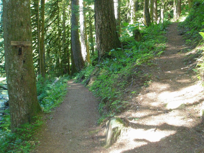 Here is the upper junction with the High Water Trail. You can see that it takes off at a sharp upwards angle, and at this time, we were so very glad that we didn't have to take that route with our tired feet and legs. Here is the upper junction with the High Water Trail. You can see that it takes off at a sharp upwards angle, and at this time, we were so very glad that we didn't have to take that route with our tired feet and legs.
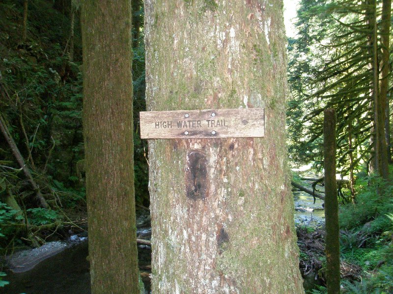 The trail was well marked. I remember the first time we encountered this trail, and I was a little confused as to what it was for. But after walking just a little ways past this point, it became perfectly clear, as the trail ran right down beside the water. The trail was well marked. I remember the first time we encountered this trail, and I was a little confused as to what it was for. But after walking just a little ways past this point, it became perfectly clear, as the trail ran right down beside the water.
Dotti was getting really tired by this time, 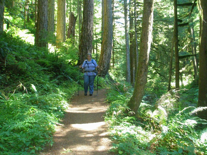 and she was really ready for the hike to be over. I tried to sound encouraging by sharing how far we had already come and how much shorter the remaining distance was compared with that. But she knew we still had the Multnomah Falls trail to get down, and that is a very sharp drop for tired and aching muscles and joints. and she was really ready for the hike to be over. I tried to sound encouraging by sharing how far we had already come and how much shorter the remaining distance was compared with that. But she knew we still had the Multnomah Falls trail to get down, and that is a very sharp drop for tired and aching muscles and joints.
 The difference between the shadows and the sunlit areas was profound. The dark of the shadows was very comforting as the day continued to warm up. The difference between the shadows and the sunlit areas was profound. The dark of the shadows was very comforting as the day continued to warm up.
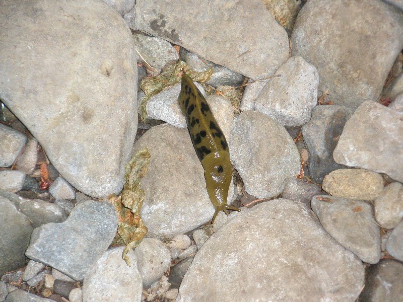 Dotti spotted this fellow traveler, and called me back to see it. I took his picture and told him to look for it on the Internet. ☺ Dotti spotted this fellow traveler, and called me back to see it. I took his picture and told him to look for it on the Internet. ☺
 This is the approach to the boxed in area that made the High Water Trail necessary. The rock wall on the right pushes out into the stream bed, and the rock walking path is not very high above the water. This is the approach to the boxed in area that made the High Water Trail necessary. The rock wall on the right pushes out into the stream bed, and the rock walking path is not very high above the water.
 As the channel narrows, it doesn't take too much of an increase in water level to cover the path. Sometimes Multnomah Creek carries a great deal of water. In August, the water level is quite low, so we have plenty of dry ground to walk on. As the channel narrows, it doesn't take too much of an increase in water level to cover the path. Sometimes Multnomah Creek carries a great deal of water. In August, the water level is quite low, so we have plenty of dry ground to walk on.
 This is the lower junction with the High Water Trail. We have passed the area that floods out normally, and the trails join up for the rest of the way down. This is the lower junction with the High Water Trail. We have passed the area that floods out normally, and the trails join up for the rest of the way down.
 Once again the difference in the angle the two trails take is quite significant, and our tired bodies were thankful we didn't have to use that trail. Once again the difference in the angle the two trails take is quite significant, and our tired bodies were thankful we didn't have to use that trail.
 We saw fallen trees all of the way down, but the ratio of fallen trees to standing trees was much lower in this part of the forest than it was near the top of the mountain. The entire forest just looks healthier at this elevation. We saw fallen trees all of the way down, but the ratio of fallen trees to standing trees was much lower in this part of the forest than it was near the top of the mountain. The entire forest just looks healthier at this elevation.
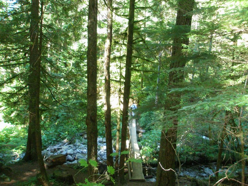
 We were approaching another creek crossing. We were approaching another creek crossing.
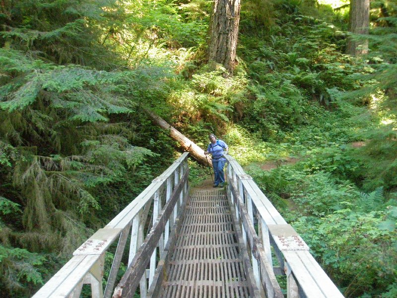
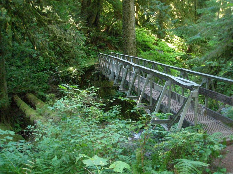 This time the crossing was wider, and the bridge was higher up off the water. So, they built a metal bridge to handle the tougher conditions, and to give a nice safe crossing for hikers. This time the crossing was wider, and the bridge was higher up off the water. So, they built a metal bridge to handle the tougher conditions, and to give a nice safe crossing for hikers.
 The bridge looks virtually unchanged since 2003 when last we walked across it. I don't know if a tree had fallen on this end, or how the railing was dented as it is, but it looked the same last time. Whatever happened, it was at least 4 years ago when it did. The bridge looks virtually unchanged since 2003 when last we walked across it. I don't know if a tree had fallen on this end, or how the railing was dented as it is, but it looked the same last time. Whatever happened, it was at least 4 years ago when it did.
Poor Dotti was so tired. She would 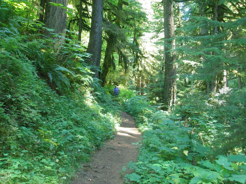 be right behind me and then I would turn around and she had fallen back quite a ways. I would stop and wait for her, and then we would do it again. We really were not ready for this hike and by this time, we were both sure of that fact. But there was no turning back at this point. We could only press on forward. be right behind me and then I would turn around and she had fallen back quite a ways. I would stop and wait for her, and then we would do it again. We really were not ready for this hike and by this time, we were both sure of that fact. But there was no turning back at this point. We could only press on forward.
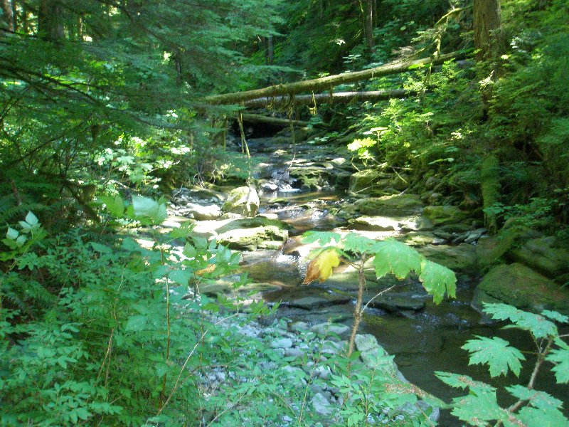
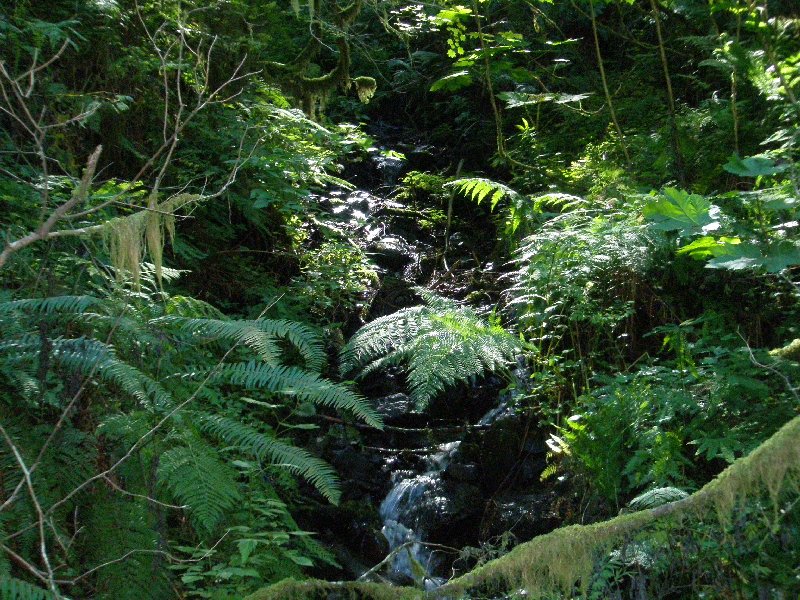
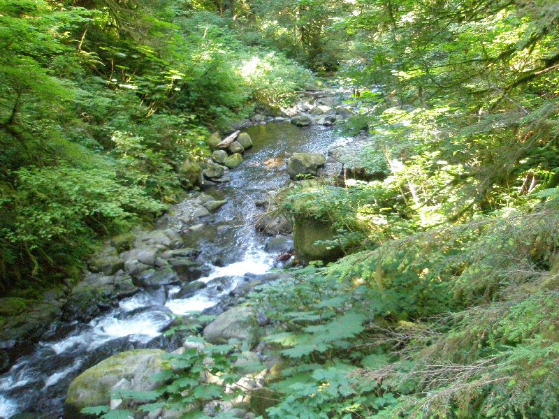 The creek was our one source of happy distraction at this point of the hike. It was beautiful and sounded happy to be there. We couldn't quite catch its enthusiasm at the time, but it did help. The creek was our one source of happy distraction at this point of the hike. It was beautiful and sounded happy to be there. We couldn't quite catch its enthusiasm at the time, but it did help.
 The water fell over the rocks in tiny waterfalls, and the lush growth soaking up the wet conditions, hugged the banks. Branches reached out, and were layered in moss so thick it looked like clothing. The water fell over the rocks in tiny waterfalls, and the lush growth soaking up the wet conditions, hugged the banks. Branches reached out, and were layered in moss so thick it looked like clothing.
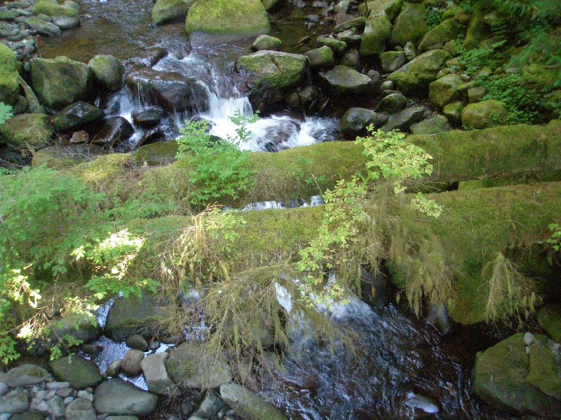 There is something about running water, and the forms it takes as it passes over varying surfaces. Here a little bridge was formed by two fallen trees, but it looks like the moss, and a few plants, were the only thing to use it. There is something about running water, and the forms it takes as it passes over varying surfaces. Here a little bridge was formed by two fallen trees, but it looks like the moss, and a few plants, were the only thing to use it.
 Dotti caught up again and was ready to cross the bridge, but she was starting to hobble now. I really wished I could just carry her the rest of the way. She was hurting. Dotti caught up again and was ready to cross the bridge, but she was starting to hobble now. I really wished I could just carry her the rest of the way. She was hurting.
 Still she tried to smile for me when I took her picture. The stream in the background was picturesque, and in spite of the pain shown in her face, so was Dotti! Still she tried to smile for me when I took her picture. The stream in the background was picturesque, and in spite of the pain shown in her face, so was Dotti!
 This was a little stream running into the main creek. It was playing in under the trees. This was a little stream running into the main creek. It was playing in under the trees.
This time we got a real smile! 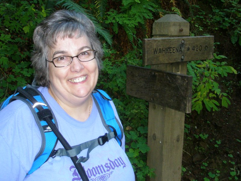 Yes, she still looks tired, but the end is getting nearer. The Wahkeena Trail (#420) junction is where in 2003 we stopped, ate a little snack, and then turned around to head back up to the top. It was refreshing, knowing that we would not have to do that again today.☺ Yes, she still looks tired, but the end is getting nearer. The Wahkeena Trail (#420) junction is where in 2003 we stopped, ate a little snack, and then turned around to head back up to the top. It was refreshing, knowing that we would not have to do that again today.☺
In 2003 we had two Coon Family Hiking Club hikes that included the Wahkeena Trail. The first one Dotti and I did the week before we did the Larch Mountain hike. The second one I did with Tom, LeRoy and Rip in October. Since Dotti and I did the Wahkeena hike the week before, at this point, we had walked from the top of Larch Mountain, all the way to the bottom of the falls, all within 7 days. But this year we did the whole thing in one day, from top to bottom.  The Wahkeena Trail heads up and off to the left, while our Trail 441 heads downward to the right. The sign once again shows some rounding, as the Lodge is listed as being 1.7 miles away, and the top of Larch Mountain is shown as being 5 miles up the trail. Somewhere a tenth of a mile got dropped off. The Wahkeena Trail heads up and off to the left, while our Trail 441 heads downward to the right. The sign once again shows some rounding, as the Lodge is listed as being 1.7 miles away, and the top of Larch Mountain is shown as being 5 miles up the trail. Somewhere a tenth of a mile got dropped off.
 Leaving the Wahkeena Trail behind, we set off on our trail to our destiny. Leaving the Wahkeena Trail behind, we set off on our trail to our destiny.
 From this point on, Multnomah Creek ran over several waterfalls, adding even more beauty to the already scenic setting. From this point on, Multnomah Creek ran over several waterfalls, adding even more beauty to the already scenic setting.
 The moss thickened on the trees. It not only covered the branches and truck but drooped off like the sleeve of frilly blouse from the arm of a lady at a formal ball. The moss thickened on the trees. It not only covered the branches and truck but drooped off like the sleeve of frilly blouse from the arm of a lady at a formal ball.
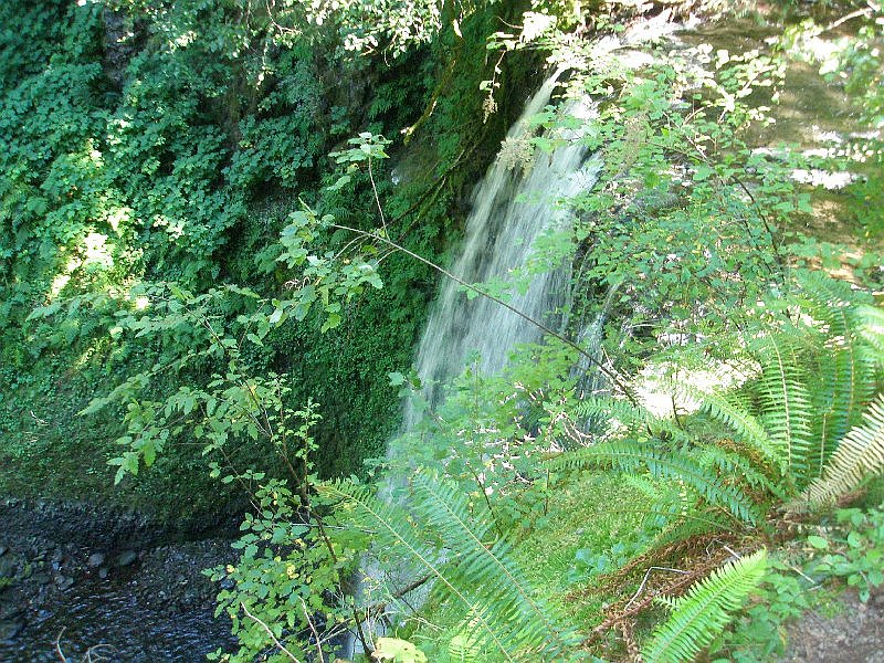 We couldn't get a good look at the full length of this falls but it was pretty, even from this angle. We couldn't get a good look at the full length of this falls but it was pretty, even from this angle.
Looking this trail, it is clear 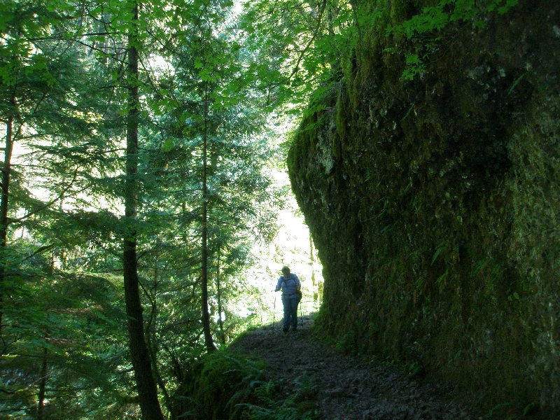 that the guys building it must have put a lot of work into this stretch. The solid rock wall has been cut back and a path left in the stone. Dotti is picking her way carefully across the stony surface with a nasty drop to the side. Neither of us liked being that close to a cliff when our muscles were so tired. The trees didn't seem to mind it though as they hung onto the side of the rock wall and reached for the sky. that the guys building it must have put a lot of work into this stretch. The solid rock wall has been cut back and a path left in the stone. Dotti is picking her way carefully across the stony surface with a nasty drop to the side. Neither of us liked being that close to a cliff when our muscles were so tired. The trees didn't seem to mind it though as they hung onto the side of the rock wall and reached for the sky.
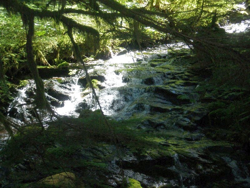
We came in high above Upper Multnomah Falls,  but the trail when through a set of switchbacks and brought us down for a great view of the falls. but the trail when through a set of switchbacks and brought us down for a great view of the falls.
Dotti stopped for a moment so I could take this picture. 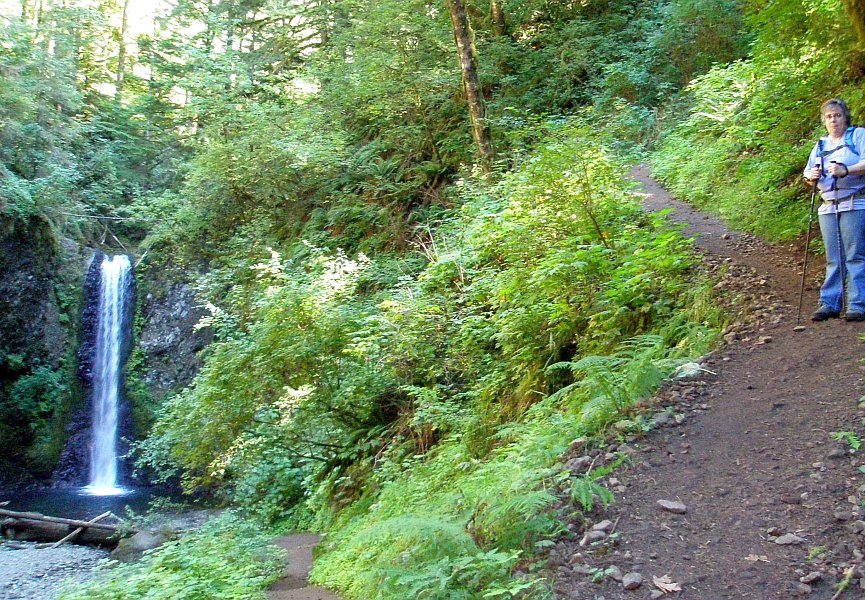 The falls is surrounded by green on every side and the trail descends sharply to this vantage point. Dotti's hips and knees were crying out at this time from the constant downhill strain. The falls is surrounded by green on every side and the trail descends sharply to this vantage point. Dotti's hips and knees were crying out at this time from the constant downhill strain.
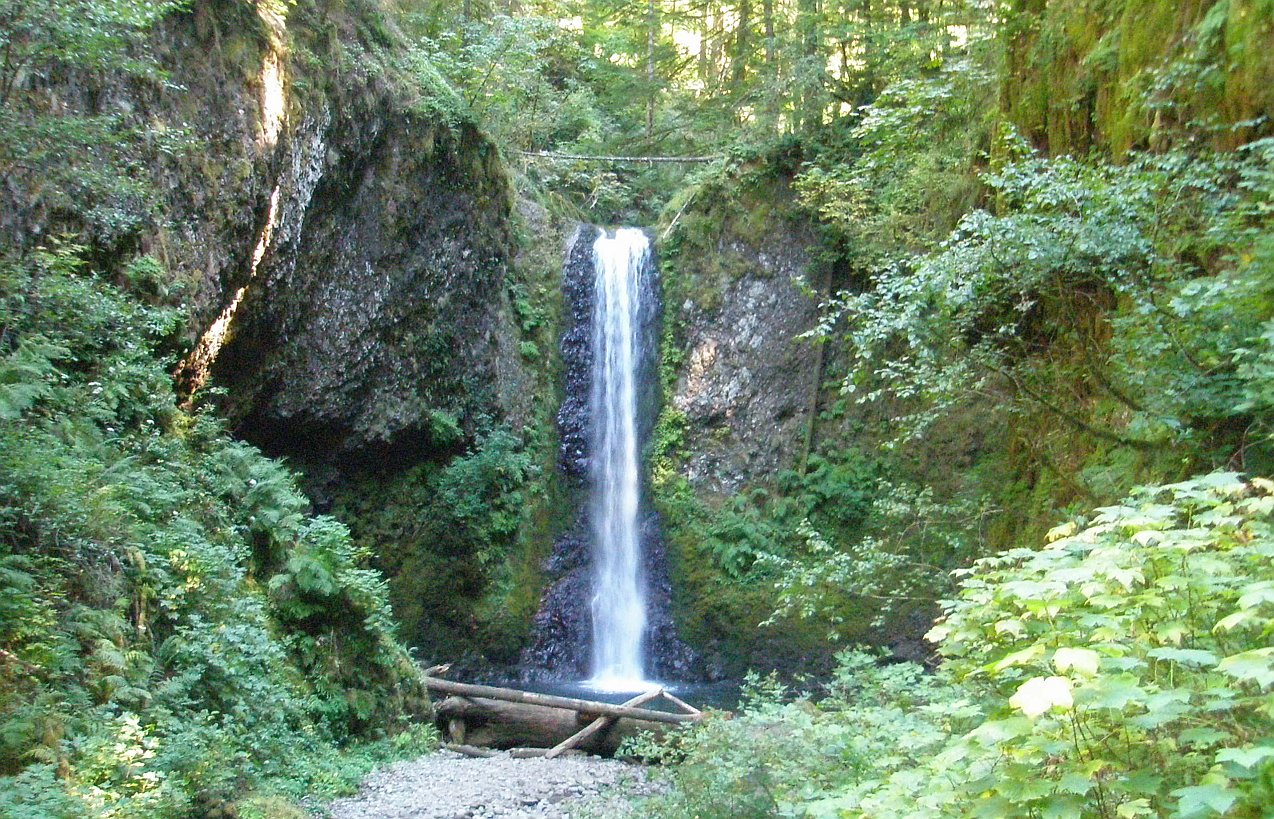 The Upper Multnomah Falls. The falls is just as lovely as its big brother that is so famous, but this one doesn't get seen by anywhere near as many people. If you take the effort to walk to the top of the falls, it really wouldn't take much more effort to get to this falls and, that effort would really be worth it! The Upper Multnomah Falls. The falls is just as lovely as its big brother that is so famous, but this one doesn't get seen by anywhere near as many people. If you take the effort to walk to the top of the falls, it really wouldn't take much more effort to get to this falls and, that effort would really be worth it!
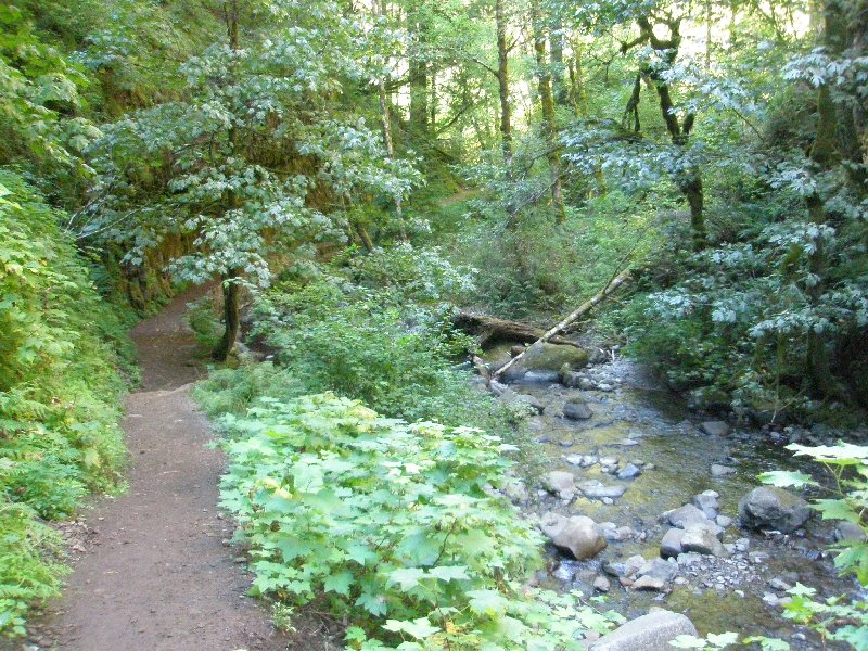 We still have more trail to cover, even though our bodies are saying, "No more!" We move on down the trail, running along beside the beautiful creek. We were very glad for the water moving by, because it was soothing, and we really needed soothing about then. We still have more trail to cover, even though our bodies are saying, "No more!" We move on down the trail, running along beside the beautiful creek. We were very glad for the water moving by, because it was soothing, and we really needed soothing about then.
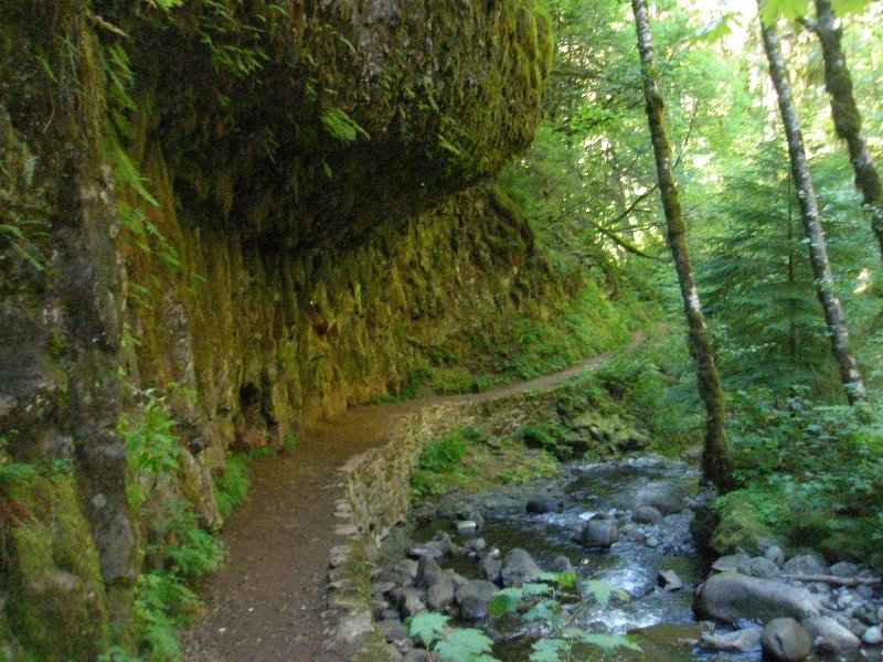 It always feels funny walking this stretch of path. The basalt rock hangs over our heads like a hammer, and you just hope that the stone, that is so prone to breaking off, won't choose this moment to cut loose. It always feels funny walking this stretch of path. The basalt rock hangs over our heads like a hammer, and you just hope that the stone, that is so prone to breaking off, won't choose this moment to cut loose.
 Dotti is the most persistent person I know, and you can see it in her face here. She is going to reach the bottom, whatever it takes. Pain will not stop her. She will not be defeated! Dotti is the most persistent person I know, and you can see it in her face here. She is going to reach the bottom, whatever it takes. Pain will not stop her. She will not be defeated!
The rock wall is not smooth, or uniform like granite would be. It is segmented and appears to be pieces joined together rather than one solid whole. This is why basalt wears so much faster than many other types of stone. 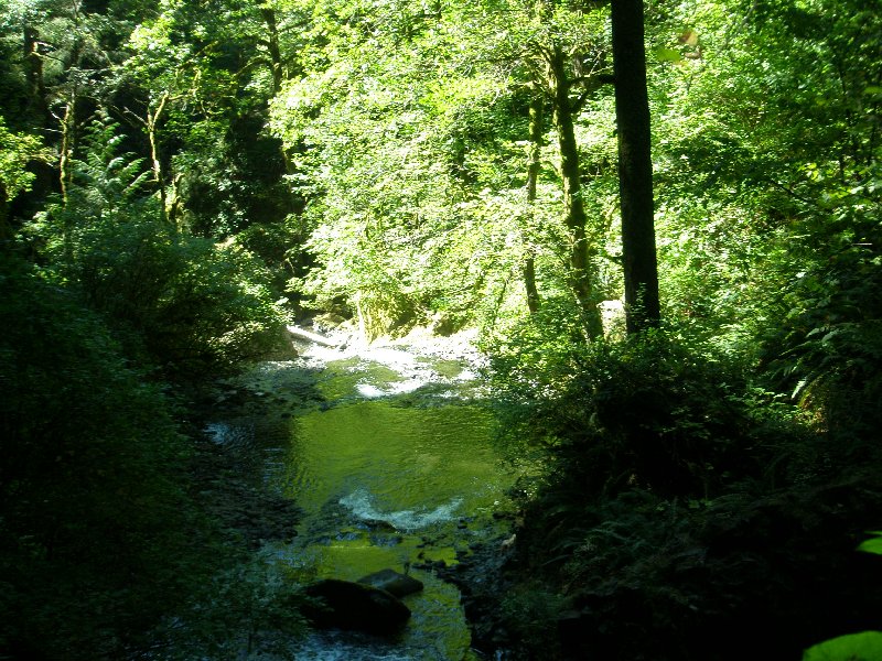 The water rushes on to meet its fate at the top of the giant falls ahead. Here it looks like a it is as peaceful as a summer night, but things will change before long. The water rushes on to meet its fate at the top of the giant falls ahead. Here it looks like a it is as peaceful as a summer night, but things will change before long.
 Poor Dotti is really in pain at this point. She is trying hard to smile, but the pain is not to be denied. Even the beautiful waterfall in the back can't override it. We were getting close but we still had the Multnomah Falls trail to go down. Poor Dotti is really in pain at this point. She is trying hard to smile, but the pain is not to be denied. Even the beautiful waterfall in the back can't override it. We were getting close but we still had the Multnomah Falls trail to go down.
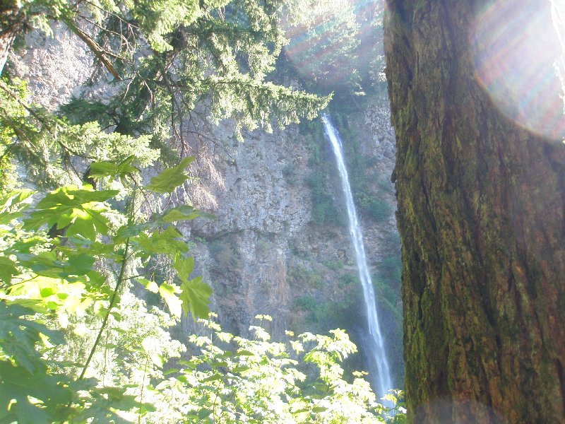 Here is Multnomah Falls finally. I took this shot from the photo friendly location just above the bench resting area about a quarter of the way up from the bottom. The sun was directly on us, and I had to use the tree standing there to block it so I could see the falls. Here is Multnomah Falls finally. I took this shot from the photo friendly location just above the bench resting area about a quarter of the way up from the bottom. The sun was directly on us, and I had to use the tree standing there to block it so I could see the falls.
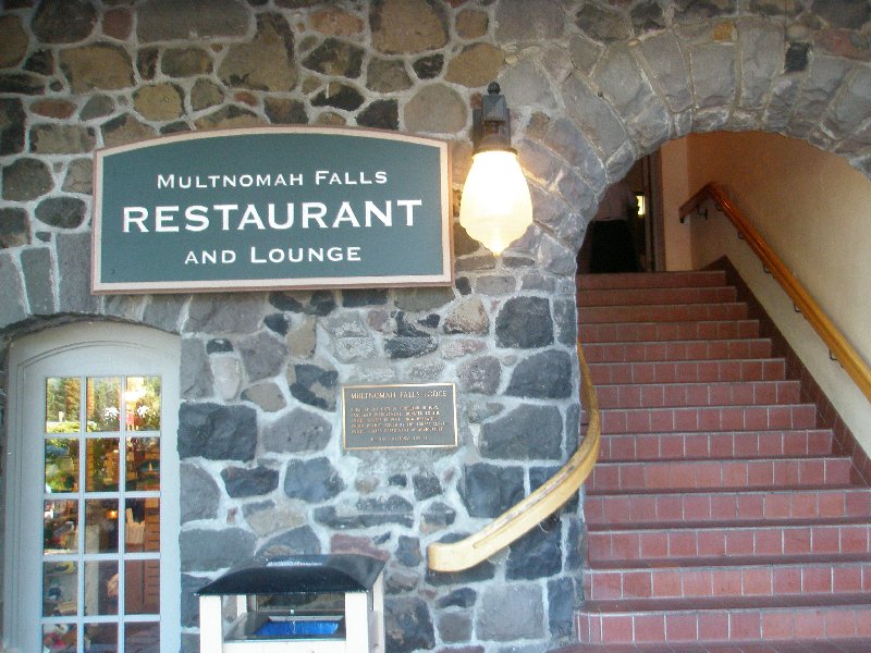 At the top of this page, there is a picture I took of these steps of the Multnomah Lodge at 9:02 a.m. Now, over 7 hours later, at 4:05 p.m., with the hike completed, we have returned so that I could take this picture. When I took this picture, it seemed like a lifetime ago when I had taken the first one. At the top of this page, there is a picture I took of these steps of the Multnomah Lodge at 9:02 a.m. Now, over 7 hours later, at 4:05 p.m., with the hike completed, we have returned so that I could take this picture. When I took this picture, it seemed like a lifetime ago when I had taken the first one.
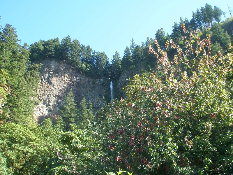 The top of Multnomah Falls seems so high up there on the wall of the Columbia Gorge, but we started our hike over three thousand feet above the highest point we can see in this picture. It was a long day. The top of Multnomah Falls seems so high up there on the wall of the Columbia Gorge, but we started our hike over three thousand feet above the highest point we can see in this picture. It was a long day.
And we still had some things to do. 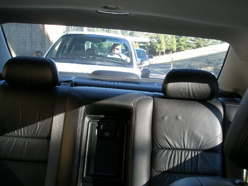 We first off had to drive up to the top of Larch Mountain to retrieve our van, and then we had to drive back home. All the way up to the top of Larch Mountain Dotti was saying that she really didn't feel like driving. (Normally she can rest all the way home after a hike because I am driving home. Since we had two cars this time, unfortunately, pain and all, she had to drive home too. We first off had to drive up to the top of Larch Mountain to retrieve our van, and then we had to drive back home. All the way up to the top of Larch Mountain Dotti was saying that she really didn't feel like driving. (Normally she can rest all the way home after a hike because I am driving home. Since we had two cars this time, unfortunately, pain and all, she had to drive home too.
And, as if that were not enough, it was late enough in the day to where we caught rush hour on the way home. I took this picture as Dotti was following me, and we were stopped for a bit waiting for traffic to start moving again as we merged from Interstate 84 West onto Interstate 205 North. You can see that Dotti is feeling a bit better as she is smiling back there. 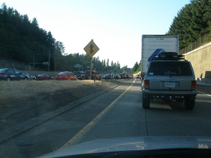 Ahead the traffic doesn't look good. But this side of town is actually much better than the other side. I-5 narrows down to two lanes, thanks to the HOV closing off the third lane to most of the traffic, and it is usually a nightmare during rush hour. This one slows for a bit here, but it has more lanes, and it moves along far better than I-5. Ahead the traffic doesn't look good. But this side of town is actually much better than the other side. I-5 narrows down to two lanes, thanks to the HOV closing off the third lane to most of the traffic, and it is usually a nightmare during rush hour. This one slows for a bit here, but it has more lanes, and it moves along far better than I-5.
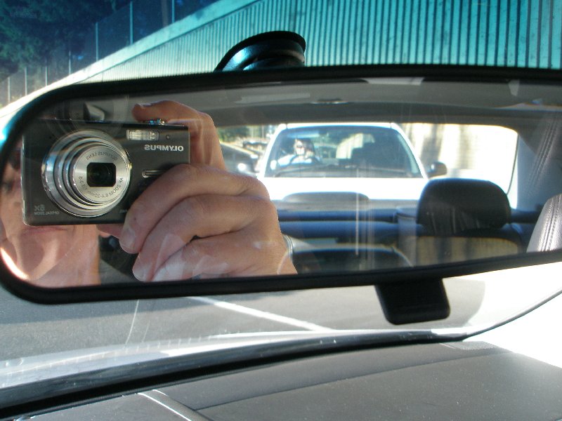 Just before we moved into traffic I took this final shot into the mirror, and it includes the both of us at the end of a challenging hiking experience! Just before we moved into traffic I took this final shot into the mirror, and it includes the both of us at the end of a challenging hiking experience!
| ||||||||||||