LARCH MOUNTAIN
7/12/2003
The Coon Family Hiking Club
Official Hike #11
11.0 miles - 6 hours 48 minutes
|
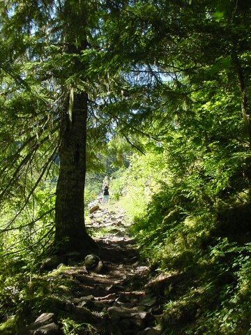
Wow! Talk about an all day affair. After driving for 45 minutes to reach the top of Larch Mountain, we set out at about 7:45 AM on our walk. Six hours and forty-eight minutes later we dragged ourselves back to our car, amazed that we were still standing. It wasn't just that we had, other than a few breaks along the way to take pictures (on the way down) or to catch our breath (on the way back up) been walking the entire time, but we had gone from 4056 feet in elevation down to around 1200 feet, dropping nearly 3000 feet, and then turned around and climbed back the same path.
It was a tale of two hikes. The first hike was the one headed down Larch Mountain, and I was saying to myself at a number of points along the way, "Oh, this is going to be tough coming back up!" (Unfortunately I was right.) The trail was very steep in spots, and it just kept going down and down. We had little trouble descending, but we were still tired after walking the 5 miles down, especially since we had previously added an additional mile walking around at the top, and up to Sherrard Point. We knew we had 5 long uphill miles ahead of us. We reached the turnaround point after we had been walking about 3.5 hours. (This had included the visit to Sherrard Point, with the associated picture taking that was mandatory from a place where we could see 5 major volcanic peaks, and a sky view of the city to the west. It also included many stops along the way to take pictures.) Here began the second hike. We invested the next 3 hours of hard climbing into getting back to our car, and wondering at several points how hard it would be to get a helicopter to drop in and pull us out. It was literally our putting one foot in front of the other, slowly trudging along, not worrying about what lay before us, but just moving that next step. For three hours that was how our hike went. I would not call that part of the hike fun, other than the fun you get from meeting a challenge and overcoming it. When we reached the top, you can be sure that we had a lot of that sort of fun. Hike #11 was not planned to be this way. I spent some time Friday night planning out a hike for us. It was scheduled to be a 6-mile hike around the Larch Mountain Crater, with a total elevation change of about 1300 feet. It would have been a nice challenging hike that I felt we were ready for. However, when we pulled into the parking lot at the top of Larch Mountain, Dotti asked, "How far is it to Multnomah Falls from here?" I told her that it was an about 13.8 mile round trip to the bottom of the falls. She said, "That doesn't sound too bad. I think we can do it." For some reason, I agreed with her. Now if we had actually done that hike, it would have been a change in elevation of over 4000 feet, and we would have had to include the Multnomah Falls hiking trail in the mix. We decided along the way that we would only go down to the Wahkeena Trail junction which we had reached on our hike the week before. That saved us 3.4 very difficult miles from our hike. Looking back now, I don't know if we would have made it if we had tried to go to the bottom of the falls. We both felt like we were lucky getting back to our car as it was. If we had planned this hike, we would have parked at the bottom, walked up to the top in the cool morning hours, then came back down on our tired legs, sort of coasting back to the car. We would still have been tired but it would not have been as bad. I was telling Dotti on our hike back up the mountain, that this was like eating our dessert first, and leaving the vegetables for last when our appetite is already gone. She replied that she didn't much like this vegetables either. It was a struggle getting up that mountain. However, we made it and lived to tell about it. What follows are the pictures we took at the top, and at Sherrard Point, and on the hike down the mountain. At the bottom turn around point, we both put our cameras away, and just focused on climbing, and climbing and climbing... |
||
|
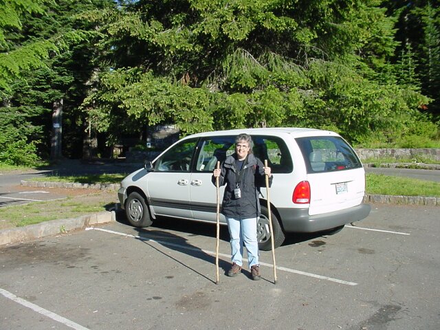
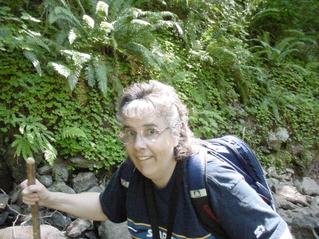
Here is Dotti in the Larch Mountain parking lot. That shadowy area on the left is the trailhead for our walk, which we would be beginning after we took a bit of a detour. | |
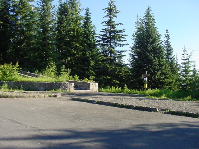
| The path to Sherrard Point. It appears to be clearly marked by a sign. |
|
|
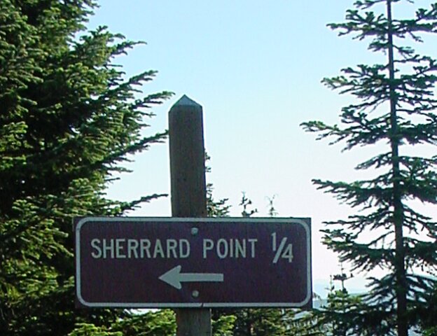
| Yes, there is the arrow, that way to Sherrard Point. Just follow the path that it is pointing to. | |
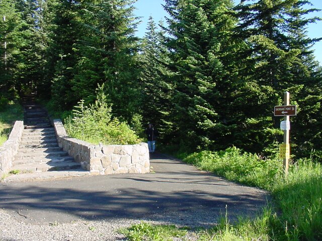
| But wait a minute. Which path is the one it is pointing to? As you can see standing back in the shadows Dotti is expressing her opinion as to which trail it means. However, I knew that Sherrard Point was a high view point and should be going up. I talked Dotti into going on the stone steps instead. |
|
|
| Dotti is listening to my reasoning and thinking about it. | |
| Well, after going up the stairs we found that we were in a picnic area and after passing through the picnic area, we hit a trail heading downward, and guess what? As Dotti is pointing out here, it joined up with the trail Dotti wanted to take in the first place. Well, on this day, we really did need to do a little extra hiking, didn't we? |
|
|
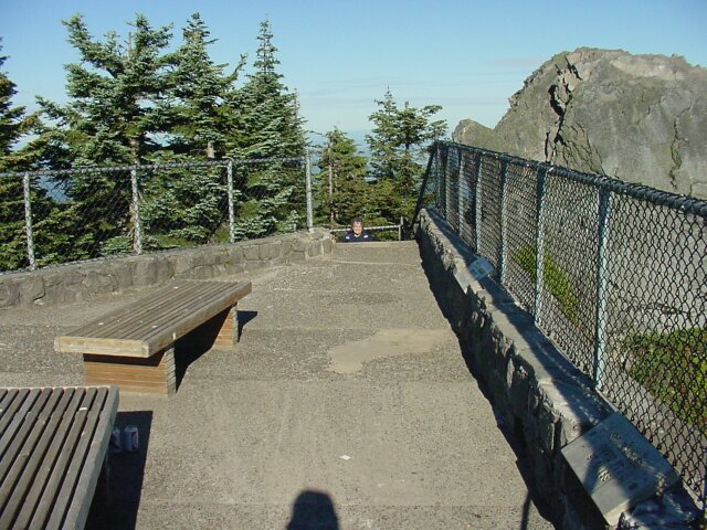
| Here are the steps leading up to Sherrard Point. We did need to go upwards after all. | |
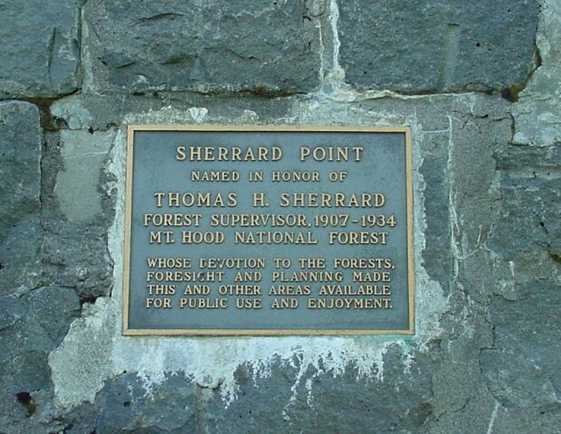
| The memorial plaque for the man that this Point was named for. And what is Sherrard Point? It is the plug for the throat of the Larch Mountain Volcano, which died long before Mt. Hood or Mt. St. Helens let off their first puff of ash. Sherrard Point stands at the edge of the crater, and provides a super view in some very interesting directions. |
|
|
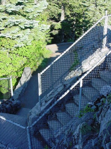
| The plaque was mounted in the wall that forms the hand rail base on the far side of these steps. The steps lead up to the viewing area. | |
| The final steps before reaching the top. |
|
|
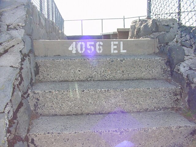
| On the top step you can see our elevation was 4056 feet. | |
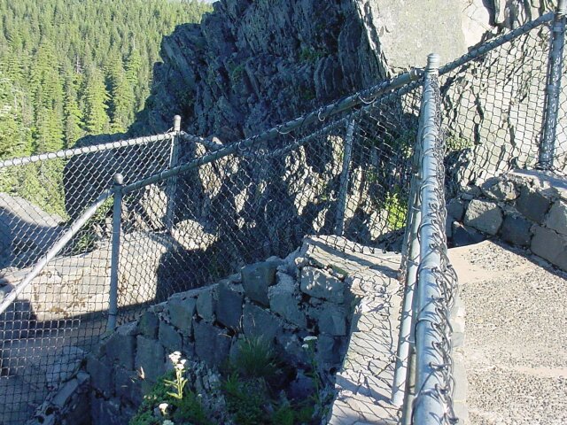
| Dotti taking a look from the area at the foot of the stairs. You can see why they put up a fence, because it would be tempting to get out farther on that rock, nearer to the precipice. |
|
|
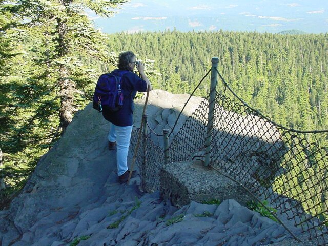
| On the top, and here comes Dotti up the stairs to join me. The little concrete plates you see on the right, mounted into the wall, have information about what Mountain you are looking at when you look directly over them. The one closest to Dotti is the one for Mount St. Helens. Unfortunately, this is the only shot I took of that one. The one in the lower right is for Mount Rainier, and that one I did take another picture of later. | |
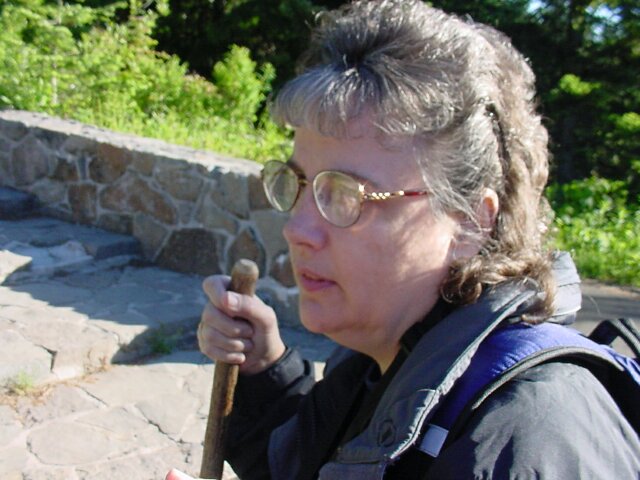
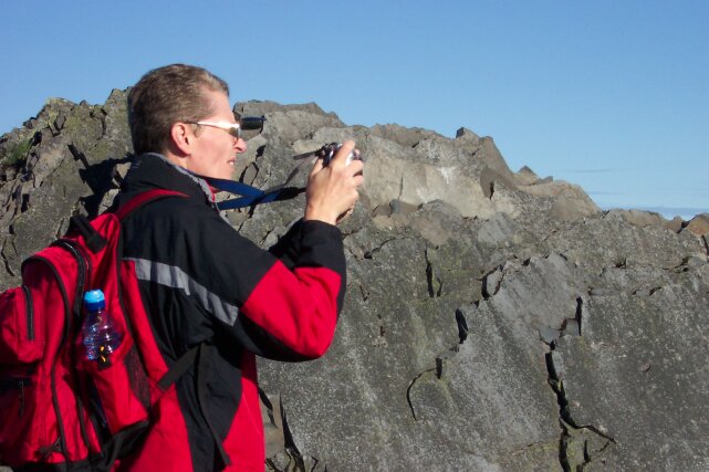
| Here I am squinting in the sun trying to line up a shot. The sun was bright, but it was still cool, so I continued to wear my jacket for a while. The clear skies were a nice surprise, because cloud cover was predicted for at least part of the day. |
|
|
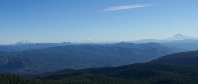
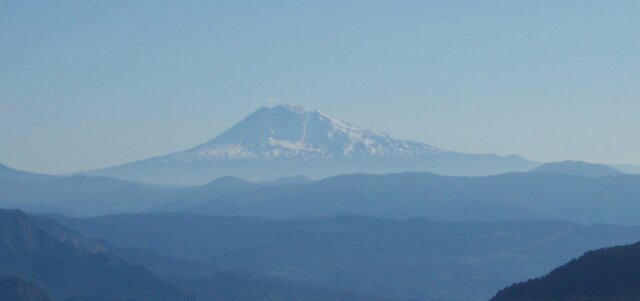
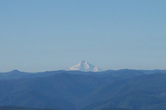
| However, with the clear skies, we were able to see quite a distance. On the left you can see Mt. St. Helens, in the center you will see Mt. Rainier, and to the left is Mt. Adams. | |
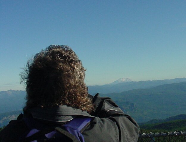
| Looking over Dotti's shoulder at Mt. St. Helens, which stand 8,366 feet tall, and is 48 miles from the point where this picture was taken. |
|
|
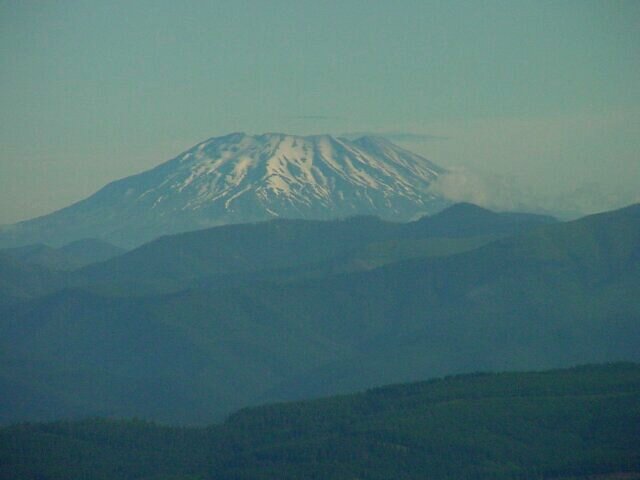
| Using the telephoto to capture a closer view of the flat topped Mt. St. Helens. | |
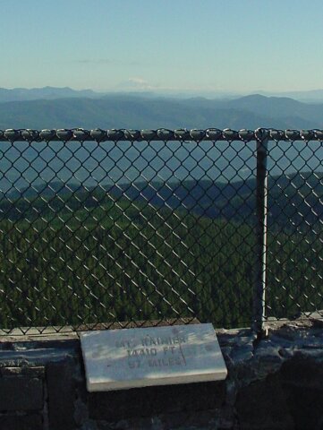
| This the plaque for Mt.Rainier, with the mountain visible in the distance. I had to tinker with this image to get the plaque to come up to where it was readable. Originally it was too dark, but I copied the plaque portion of the image to my graphic editor, lightened it up quite a bit, and then pasted it back in to the original picture. So, everything except the plaque looks unchanged, but the plaque is now easier to read. Mt. Rainier is the tallest of the Cascade peaks, even slightly taller than Mt. Shasta in California. It is 97 miles away from Sherrard Point but it is easily visible with a clear sky. |
|
|
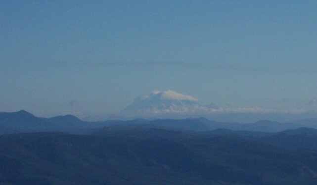
| Zooming in on Mt. Rainier with its summit cloud cover. | |
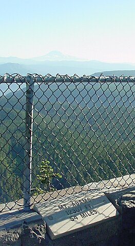
| Mt. Adams, is 54 miles away, and at 12,307 feet, is taller than Mt. Hood. We can also see Mt. Adams from Portland on a clear day. |
|
|
| Brining Mt. Adams a bit closer. | |
| I attempted to fix this plaque as well, but the detail was just missing from the original and this was the best I could come up with. It says, "MT HOOD; 11235 FT.; 22 MILES." |
|
|
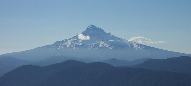
| Dotti took this lovely picture of the north side of Mt. Hood. | |
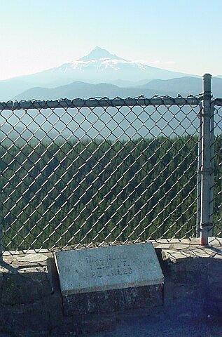
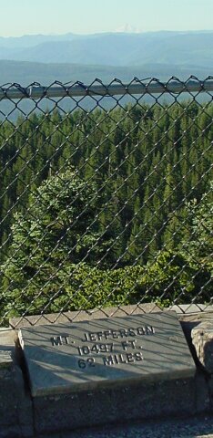
| Mt. Jefferson is 62 miles away, and it is shorter than Mt. Hood, so it looks pretty small off in the distance. |
|
|
| Zooming in on Mt. Jefferson. | |
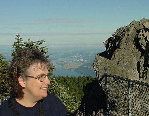
| My lovely Dotti looking off at Mt. Rainier as behind her the Columbia River flows through the Portland/Vancouver area. |
|
|
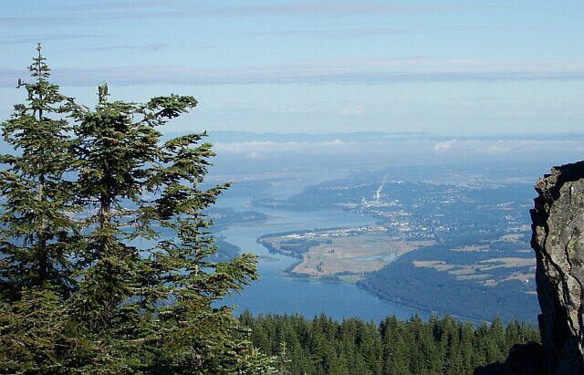
| On the right is Washington State, with Vancouver laying just beyond that towering wisp of smoke you can see about mid picture. (The smoke is coming from the town of Camas.) The city of Portland is on the left and mostly blocked from view by the trees standing there. | |
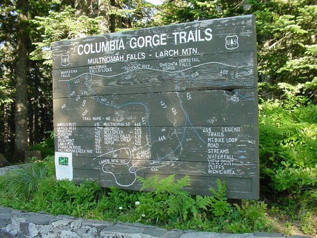
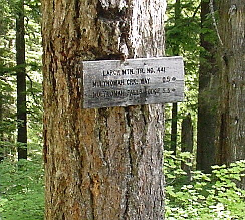
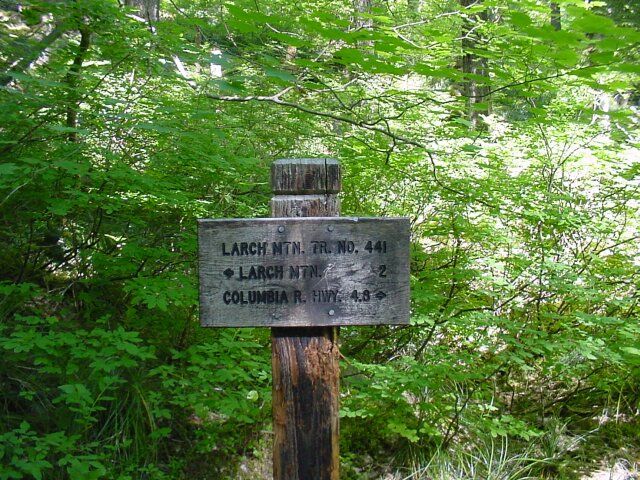
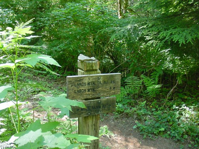
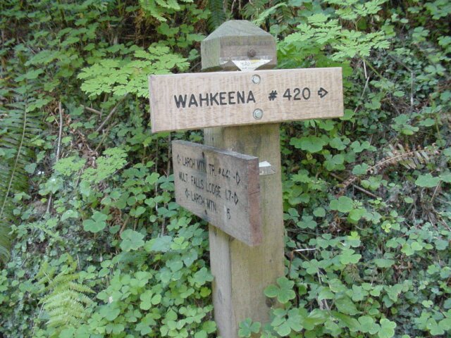
| This old sign is getting weathered a bit and probably not as easy to read as it once was, but it shows many of the trails in this area of the Gorge. We will be taking trail #441 from where it is labeled LARCH MTN (at the center, moving left to right, and near the bottom moving from the top down), all the way down to where trail 421 meets up with it. (That is near the bottom of the second board from the top over towards the left side of the sign.) You can see Multnomah Falls is labeled, as is the Wahkeena Falls. (Last week we walked the loop between them that included trail #421, and the portion of 441 that we did not walk on today's hike.) Today's walk is going to start in the shadowy area that lies to the left of this sign. |
|
|
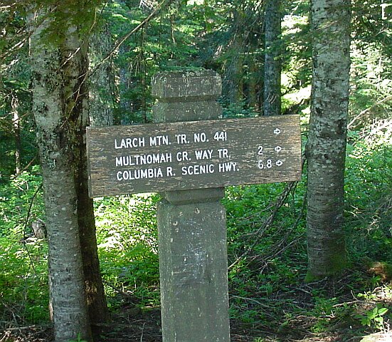
| The actual hike begins here. Notice that the "Columbia R. Scenic Hwy." is 6.8 miles away. That would be the bottom of Multnomah Falls, and would create a round trip distance of 13.6 miles. On the way back the "Multnomah CR. WAY TR" was a big landmark for us. We were just barely able to keep our feet moving at that point, and there had been an earlier sign that said we had 4 miles to go. I knew that this trail was halfway to the car from there, so we were happy to reach it! | |
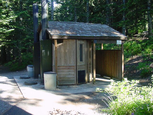
| The restroom facilities here were of the outhouse variety, with no running water, but when required, you don't get picky. |
|
|
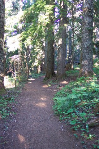
| The trail was calling to us. (I think it was a Siren's song.) | |
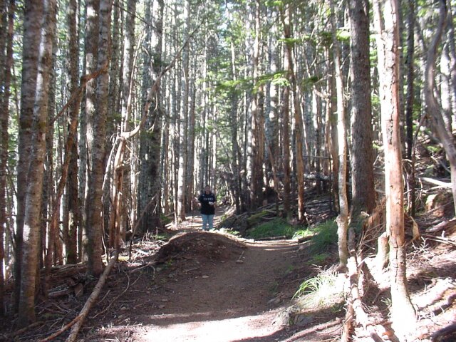
| We are off and heading into the forest. |
|
|
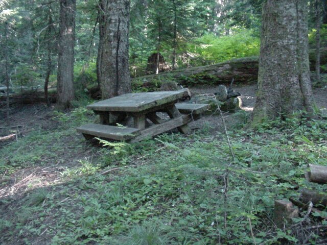
| We passed several picnic tables close to the parking lot, and Dotti was looking for them when we were on the way back, knowing that the ordeal would be over soon once we spotted them. | |
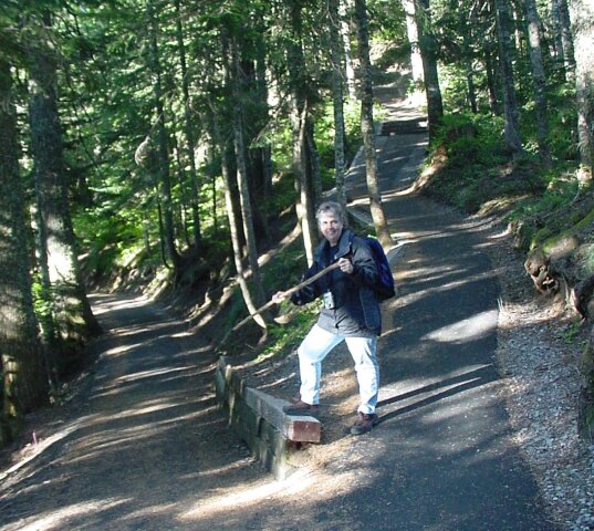
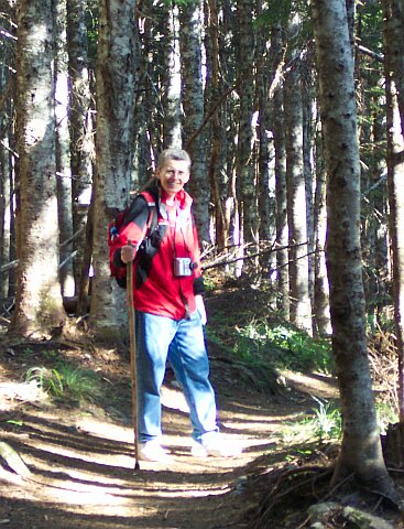
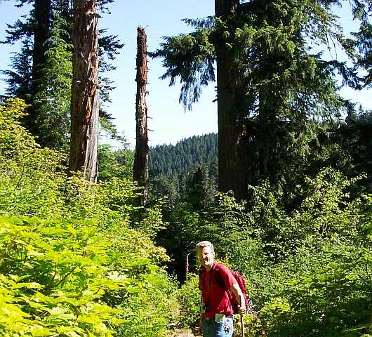
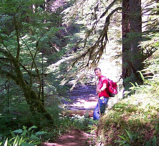
| Yes, I am smiling now. I am still cool enough to be wearing my coat, and all ready to do some walking. When I hit this point next, I was dragging one foot in front of the other, and my tee-shirt was soaked under my (13.5 pound) backpack, where my coat and camera were stowed away. |
|
|
|
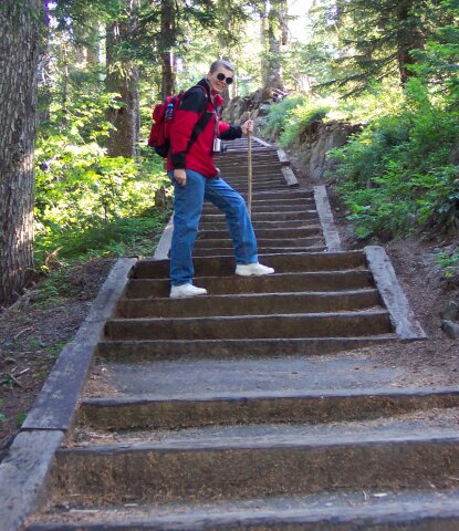
Dotti was ready early to take her coat off. This time out she also was wearing a backpack. (We weighed it when we got home and it was 9 pounds.) It is amazing how carrying weight in a backpack can add to the difficulty of the hike! And was this a tough hike to carry a backpack for the first time! I must say that I am very proud of the way she held up and finished the hike. (There was one point where she could have bailed out 2 miles early and let me go and get the car to pick her up, but she toughed it out to the end!)
The trees in this area look like they had suffered from a major storm. There are broken trees, and branches and wood that had been piled up in haphazard fashion from some chaotic force all around us for quite a while. |
|
| The type of tree we were seeing at this point was different than what we have seen before on our hikes. It wasn't quite as white as a white birch, but it was lighter in color than the other trees we have seen. The forest in this stretch was not terribly attractive, with all of the bent and broken vegetation. |
|
|
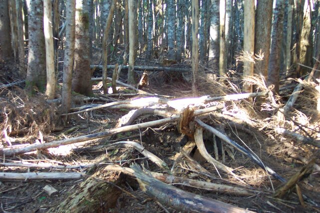
| I have no idea what caused this destruction to the trees, but it looked like something big had passed through. | |
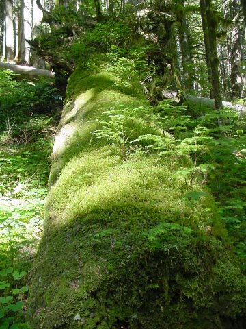
| This shows the coloration on the trees of this part of the forest. I have always found it interesting how the forest can change as you are walking through. It is almost like there are sections of forest where one person put this one together, someone else did this part, and someone altogether different did next part. Some of it has to do with elevation. (This was definitely the highest elevation that we have hiked at so far.) Some of it has to do with shading of the sun, by the overhanging rock walls, or perhaps how long it has been since a fire (or big storm) has passed through this part of the woods. In any case, no walk is homogeneous from start to finish. It always goes through changes as we go along. When we got back to these tree, on the return trip, we knew we were getting close! |
|
|
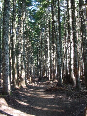
| Up until this point, the only time we saw this type of tree, was dead stumps of various sizes, or dead hulks lying on the ground. It was like the other part of the forest had at one time looked like this but a new breed of tree had moved in and taken over, killing off the original trees. I don't know if that is what happened, but it sure looked that way. Here, we started to move into the type of forest we were more familiar with. However, we still had yet to see or hear any streams or waterfalls. We started off above the source of Multnomah Creek, and even though we have already dropped a long ways, we have not yet gotten down to any of the streams in this area. | |
| We have come 1.5 miles so far, and dropped 800 feet. |
|
|
| Dotti caught me grimacing at the bright sunlight. I have put my coat away now, and things have warmed up a bit, but not to much. We were still comfortable at this point and of course still heading downhill. You can see that the trend of the trail is clearly downward. | |
| This was the potential bailing point for Dotti on the way back if she had wished to take it. We are not quiet 2 miles from the top here, but are around 900 feet lower than from where we started. This road leads out to Larch Mountain Road in about a quarter of a mile. But Dotti, as tired as she was, stayed the course and finished that last tough stretch! |
|
|
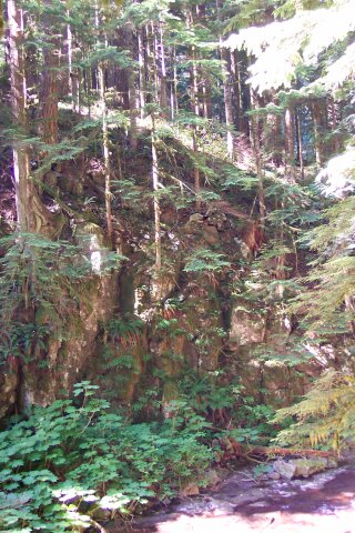
| This rock wall just appeared along the trail. It was a hint of something that was just down the trail that we were not too happy about on the trip back up. | |
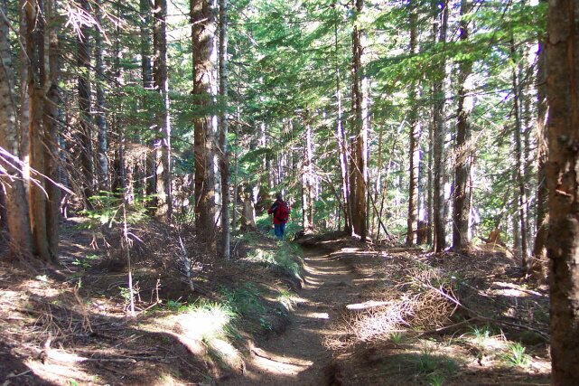
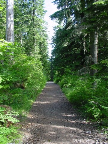
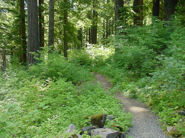
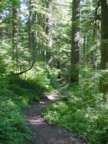
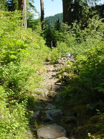
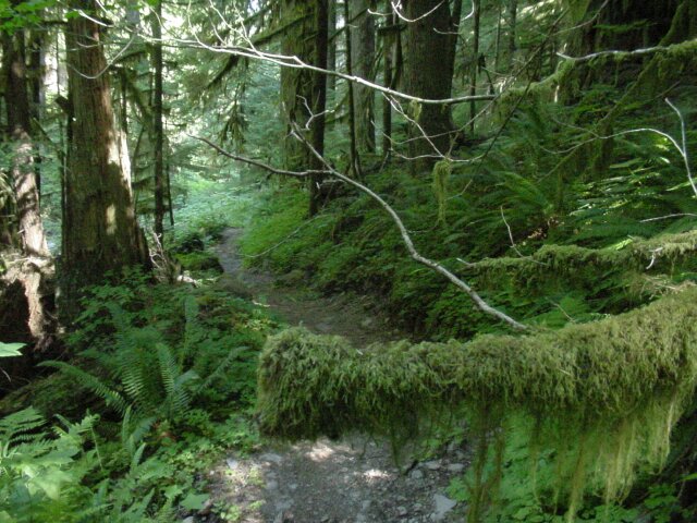
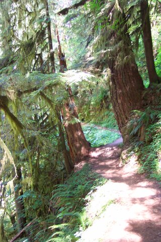
| Now this stretch of trail was very nice. It was not too steep and it was green and inviting. |
|
|
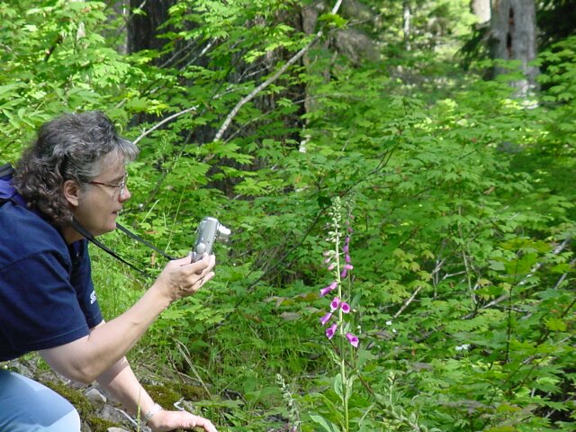
| Dotti has become our official botanical photographer on the CFHC hikes. At the bottom of the page you will see several samples of her work. Here I caught her in action capturing some beautiful flowers. | |
| Our originally planned hike would have had us turn here on the Multnomah Creek Way, to form the 6 mile loop. This was our last chance to change our minds and return to the original plan. No way! |
|
|
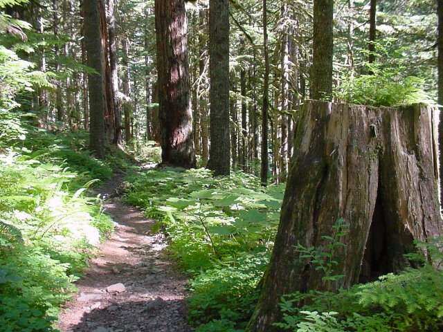
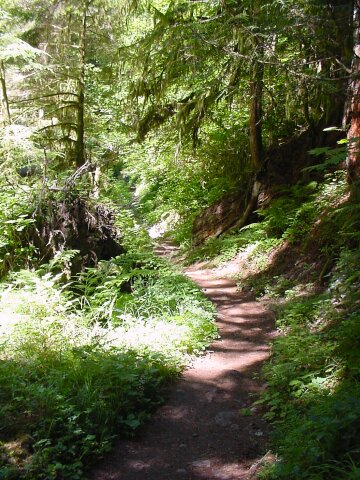
| The trail here is starting to look fairly close to what we consider normal for our hikes. | |
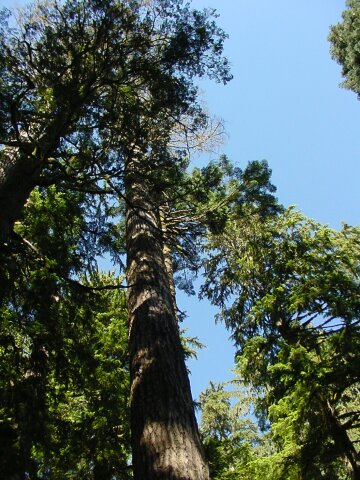
| Big trees. Really big trees! |
|
|
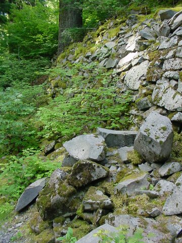
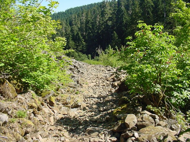
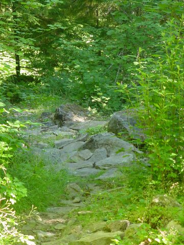
| All at once we start to see a large quantity of rocks appearing on the trail. They are large and pretty well coving the walking area. | |
| All at once the rocks have completely taken over. At some point in the past there was a huge rock slide through this area and it completely covered everything. It didn't leave tree or shrub standing in the heart of the slide. |
|
|
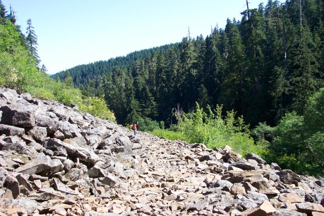
| Dot took this picture of me standing a ways into the slide. It just seemed to go on and on. We have seen rock slides before on our hikes, but this one was many times larger than anything we had seen before. | |
| Each time we rounded a bend, we expected to see the end, but it continued on. The rocks were loose, and hard to walk across. Going down they were inconvenient. Coming back up these stones just about stopped us. Although we arrived at the top of the mountain early, by the time we reached the turn around point at the bottom, it was pushing 12 noon. The day had really started to warm up, and by the time we made it back up to this point, these stones were hot, and really tired us out. They broke up our steady slow pace, and by the time we got across them, we felt like we were ready to quit. It was surprising how these things sapped our strength. |
|
|
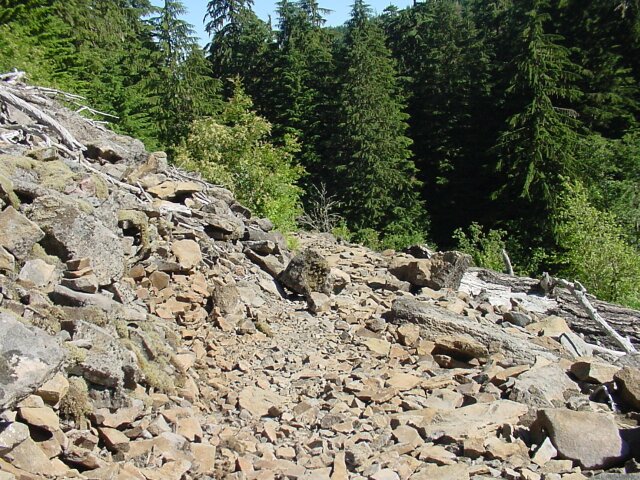
| Even after the main slide was over, the path was still covered with the stones. Here I am out of the open slide area, and back into the shade, looking back at Dotti. Even so, the path is still covered with the stones. | |
| Looking down the path and the stones continue. |
|
|
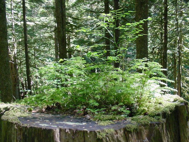
| Finally the stones started to lighten up a bit. On the right there is a sawed off old stump. On top of the stump there are little plants starting to grow. | |
| It is amazing where plants will set up a home. |
|
|
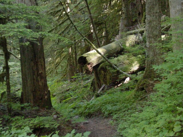
| Right across the path from that stump was this toppled old tree. All sorts of living things have started to grow on its carcass. | |
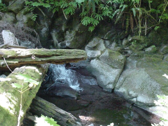
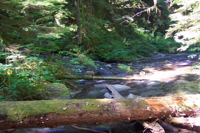
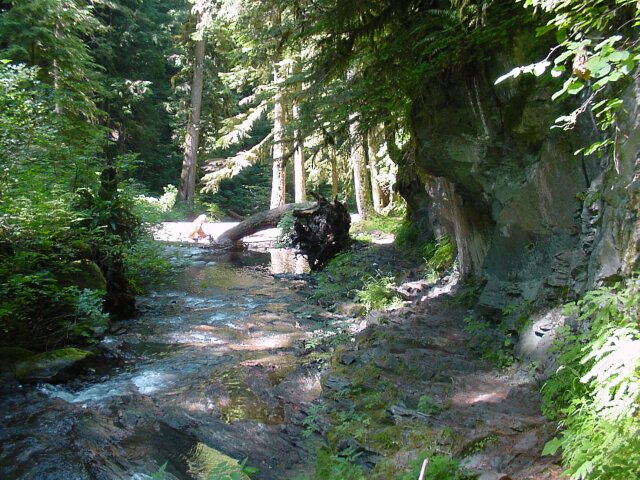
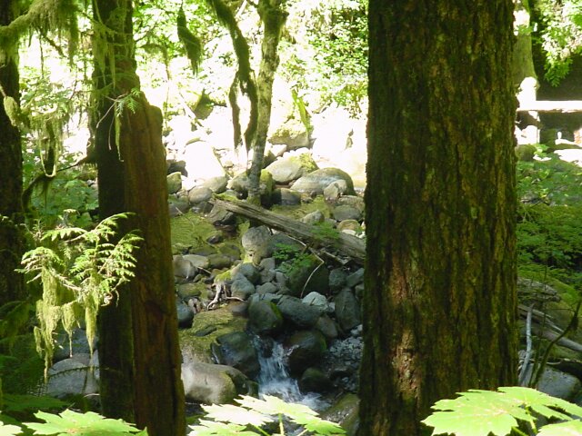
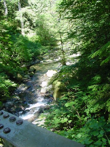
| After descending a long ways we started to hear water. Then after we descended a lot more, we finally reached Multnomah Creek. For the bridge they laid a single log across the creek, and then attached a number pieces from smaller logs to make the single handrail. The sound of water really cheered us up. |

|
|
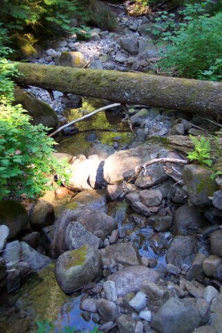
| The water flow running under this bridge was pretty light. From this point on, we saw little streams and one very large stream add its force to the creek. | |
| Looking upstream from the bridge. Notice the tiny Multnomah Creek falls. |
|
|
| We felt like we had made it back home at this point. Looking back over the bridge, and up the hill you can see how lushly green it all is. This is territory like what we have been doing most of our hiking through in the past. We love it! | |
| The branch in the foreground is totally covered with green moss, and the path is just surrounded with green in every direction you look. |
|
|
| We never get tired of seeing this type of beauty. | |
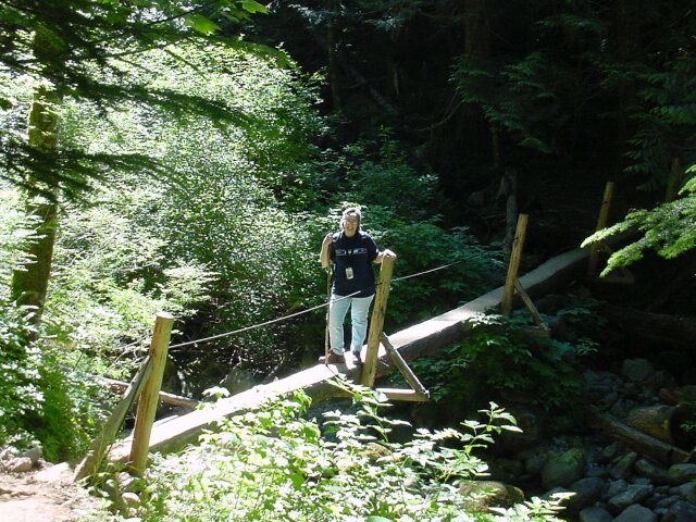
| Here is my lovely Dotti standing on a single log bridge that lies across the East Fork of Multnomah Creek. This bridge is at about 2200 feet in elevation, so we have dropped 1800 or 1900 feet already. We have come 4 miles from Sherrard Point, with still more than a mile to go to reach our turnaround point. |
|
|
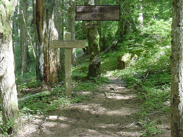
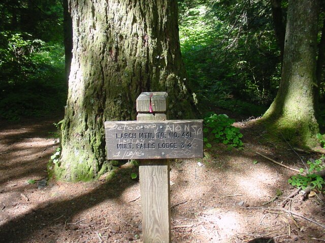
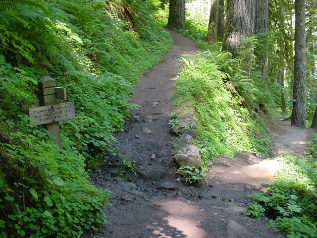
| The Franklin Ridge Trail is an alternate route up to Larch Mountain. It is about 2 miles longer than the path we took on this day. We met a guy on our return trip, who had taken the Franklin Trail earlier in the day, and was now heading back down to his car. We were wishing that we were heading back DOWN to our car at that time. This junction marks the point where we have one more mile to go downward before turning around. By this time we have finally given up the idea of going to the top of Multnomah Falls for our turn around, and have firmly committed ourselves to halting at the Wahkeena Trail, and then retracing our steps. I took the top sign and lightened it up a bit so it could be read, and pasted it into the picture at the top. | |
| Here is another road crossing. This one is called Multnomah Basin Road. However, the main thing that mattered to us was that the sign says, 4 miles to Larch Mountain. As we were heading back, as soon as we passed this sign, I started thinking about that sign up the mountain that says 2 miles to Larch Mountain. It became my short-term goal; the halfway point. Short term goals came down to just taking that next step at times along the uphill grade. When we passed this sign on the way down there was a group of boys surrounding a man with a map and a compass standing here. I had to work my way around them to snap this picture. They had back backs on and may have been on a camping trip. |
|
|
| This somewhat abused sign was just across the dirt road from the previous one. It lets us know that we are 3 miles from Multnomah Lodge straight ahead. Fortunately, we are not going that far. | |
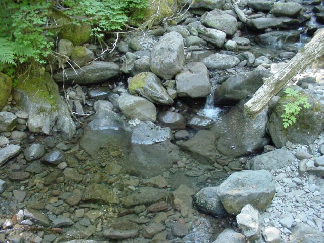
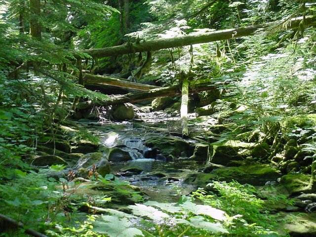
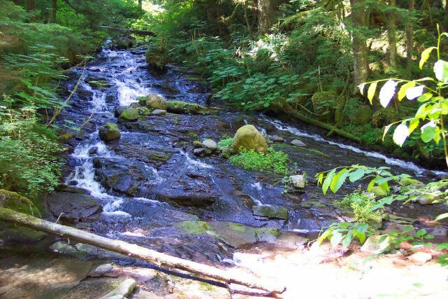
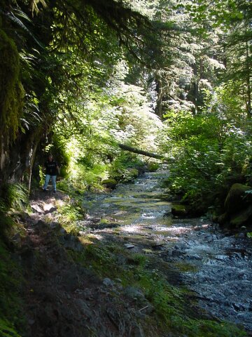
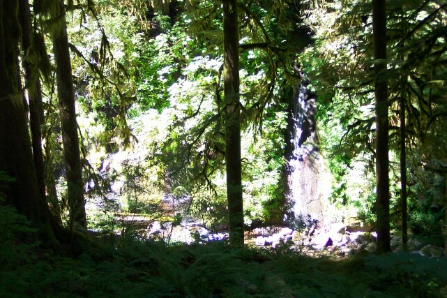
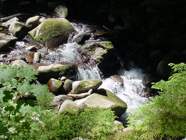
| The creek from here on down put on a continuous show for us. Little water falls, and rapids and so on. This was the best part of our walk. |
|
|
| I just thought this shot was too good to pass up. | |
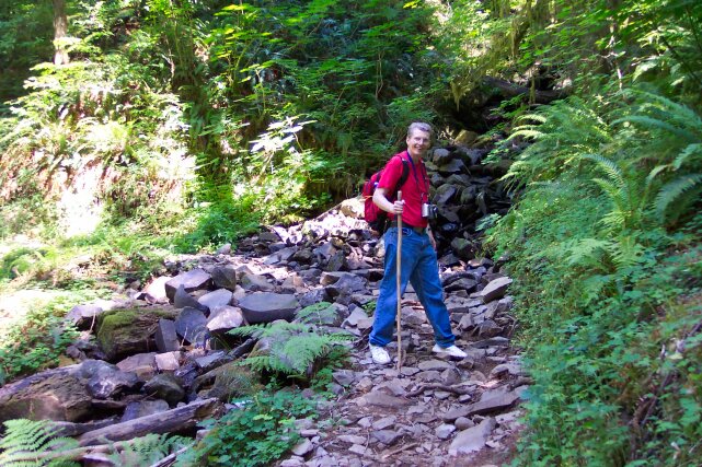
| Dotti took this one of me with the creek in the background. |
|
|
| The rock had turned to a form of slate along the bottom of the creek here. | |
| The creek we have been following up until now leads off to the left. Coming straight at you in this picture is a western fork, and the two of them join together and form a much larger Multnomah Creek for the rest of the way down. |
|
|
| Looking back toward the confluence of the two streams. | |
| Dotti was intrigued with the wall on the other side of the stream and took this picture of it. Note how there are trees growing straight up from rocks paralleling the surface of the rock wall. A couple of trees on the left are quite large. |
|
|
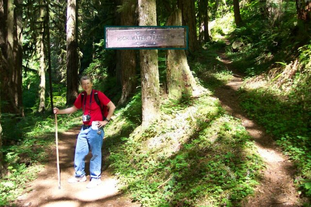
| The sign you see pasted in at the top of this picture was taken from another picture of a tree that stands to the left of the field of view you can see here. The trail off to the right is an alternate route that must be taken when the water level of Multnomah Creek is up. At this time of year the water level is significantly lower than it would be in the rainy season. So, we did not have to use the High Water Trail. As you can see, it does involve a bit of climbing. | |
| More rocks, but this time it is simply from water flow from a subsidiary stream that cascades down the rock wall behind me. |
|
|
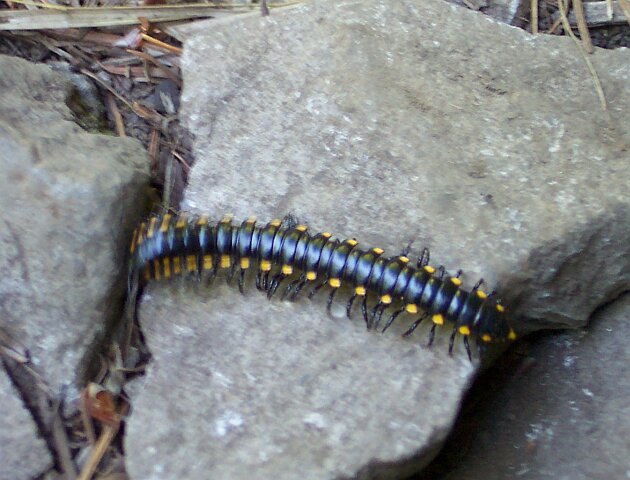
| Not only did Dotti get pictures of the flora along the path, she even captured some shots of fauna. This was not 12 inches long, as it might appear. It was only a couple of inches. | |
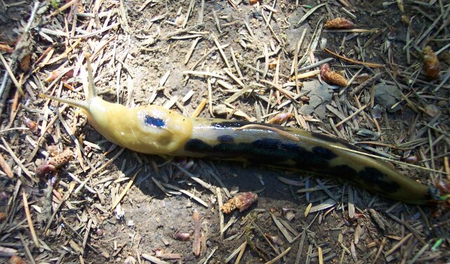
| You do have to share the trail with slugs sometimes. Here is a shot of one of our trail companions. We saw quite a number of these little critters towards the lower portion of our hike. This one was 3 or 4 inches long. |
|
|
| The trail making a jog between a couple of trees; one living, and the other just a stump. | |
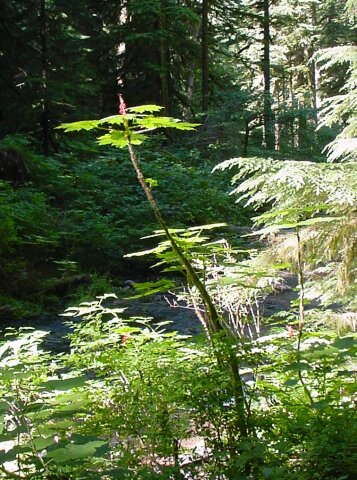
| I thought this curved plant was of interest, so snapped a picture. |
|
|
| The path winding its way to our turn around point. | |
| This is the stretch of trail that makes the High Water Trail you saw before necessary. Even with the water low as it is, there is not a lot of distance between the stream and the slate rock walk way. The rock wall blocks any retreat away from the water should it rise. So, the alternate path is required. |
|
|
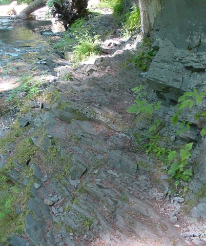
| This rock path is very uneven. It would be a great place to turn an ankle of you aren't paying attention. The sheets of rock come up at odd angles and seldom provide a flat and level surface to step on. | |
| Looking back at Dotti traversing the "Low Water Trail." |
|
|
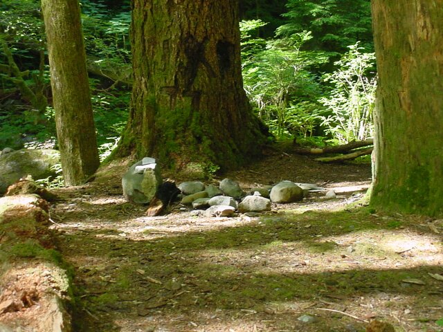
| It looks like somebody was camping here recently. | |
| Dotti is still looking like she is ready to do some walking. That is a determined look in her eye! |
|
|
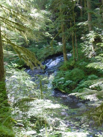
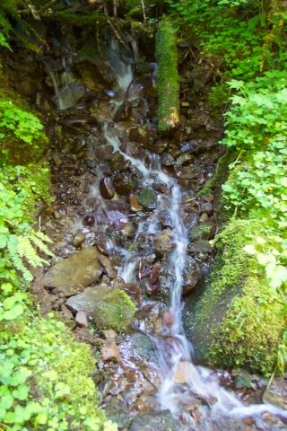
| Another little waterfall dropping in. | |
| This was a rather pretty waterfall, but unfortunately, it was in the bright sunlight, and the surrounding terrain was in shadow. It destroyed the contrast setting for this picture. |
|
|
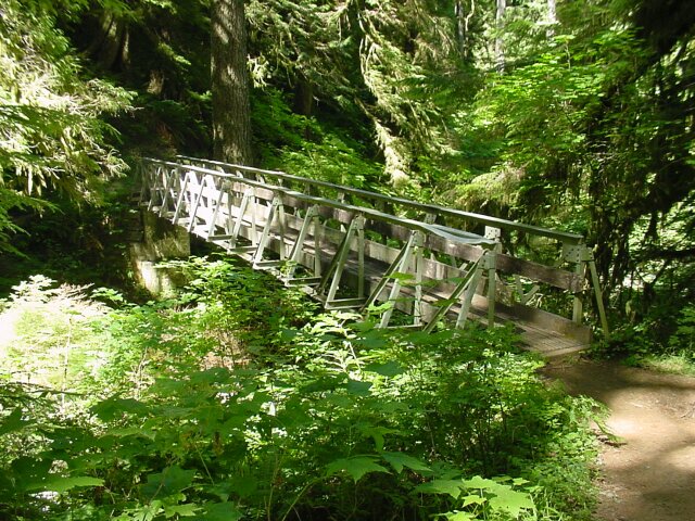
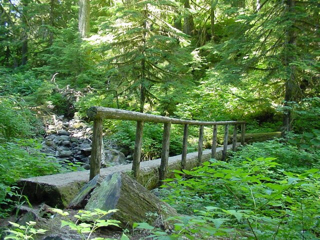
| Crossing our last bridge before turnaround. It also means that we have now crossed every bridge from the bottom of both Multnomah Falls, and Wahkeena Falls, on the path up to the top of Larch Mountain, for trail 441 anyway. This was a very long and hard hike, but it was a hike that we had been looking forward to for a very long time. Ever since we started coming up to the top of Multnomah Falls we could see that there was a trail leading off, with a sign that said Larch Mountain on it, and we have wanted to walk to the top. It was just as tough as we expected it to be. | |
| Looking downstream from the bridge. |
|
|
| Another little waterfall to brighten our hike. | |
| Just as we were approaching our turn around point, there were two little streams flowing down across our path. Dotti took this picture of one of them. I took a picture of the other one but it didnt turn out too well, so I didn't include it. |
|
|
| Here it is! The turn around point. The trail leading off to the left is the Wahkeena Trail that we came down last week. The trail to the right leads to Multnomah Falls. We also walked that one last week. The trail leading straight at you goes to the top of Larch Mountain. We now have walked that one too. Except now we had to turn around and walk that one again, uphill. | |
| The Lodge is 1.7 miles away, and our destination of the top of Larch Mountain is 5 miles away. At this point we knew we had a piece of work cut out for us, but we really didn't get the picture until we started back up again how tough it was going to be. |
|
|
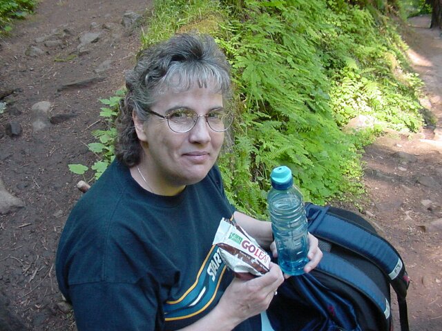
| Before we started back up, we stopped and had a snack for some energy. We each ate a Kashi Bar (5 points) and had some water. We had two water bottles like the one that Dotti is holding, and they both were dry by the time we hit the top. We could have used some more. Next time we bring bigger bottles, and probably more bottles. | |
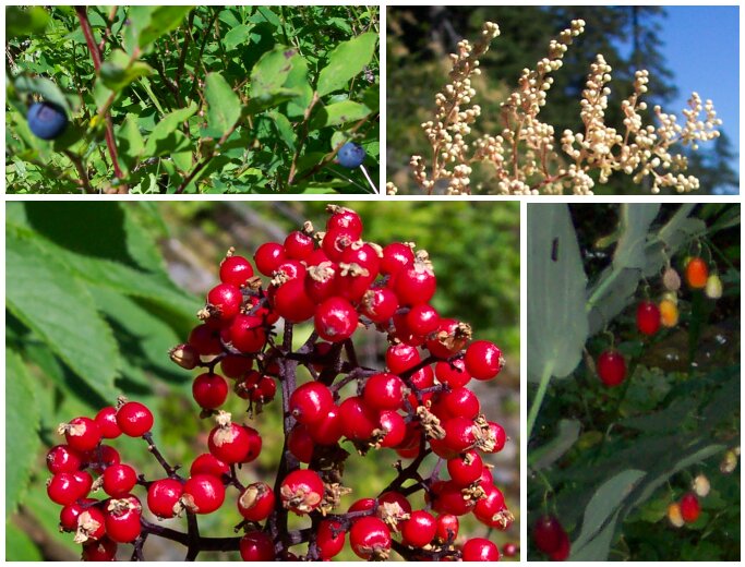
| We thought we would share with you some of the plants along the way. Dotti took all of these pictures, and I put them together into this collage of berries. The red ones just jump out at you. |
|
|
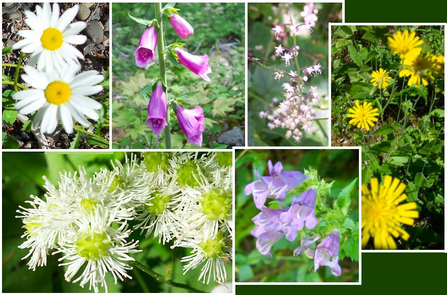
| Just look at all these flowers that Dotti took pictures of. | |
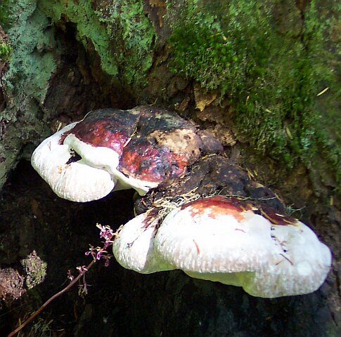
| Dotti spotted this fungus growth on one of the trees and snapped a picture of it. It is interesting, if not pretty. |
|
|
|
Well that brings hike # 11 to an end. At the turn around point the temperature had started to rise. On the way up the sun was out most of the way, and we felt overheated at times, especially crossing the rockslide. As we entered our last mile, some cloud cover finally started to help a bit, and a breeze came up. That helped a lot. The last half mile or so was not so steep of an incline, and we were able to recover our spirit a bit then. Though we saw only a few people for most of the day, the last mile or so we saw quite number of people heading down the hill from the parking lot. A couple of them saw our tired faces I suppose because they said, "You're nearly there!" After another half mile of walking we were thinking that we perhaps had different definitions for the words they were using, but since the ground was not as steeply graded, and the breeze was cooling us off, we didn't mind.
When we (finally) got back to the car, it hurt to take the backpacks off, to put the walking sticks away, and to just walk around the car to get in. Oh, but it was heaven sitting down in the car, and taking a drink of the warm water that was sitting in my drinking mug. It would have been better if it was cold, but it was delicious even warm. Next week we climb Everest on Saturday, and K2 on Sunday. Well, maybe not. |
||