SILVER FALLS
TRAIL OF TEN FALLS
Silver Falls State Park
June 21, 2003
The Coon Family Hiking Club
Official Hike #6
7.5 miles - 3 hours 46 minutes
|
After a week off, for back rehabilitation for Al, the Coon Family Hiking Club nearly had another week of rest. Dotti dropped a 3.5 pound tabletop, edge on, onto her foot on Thursday night, from about 5 feet in the air. Fortunatly nothing broke, but she was in quite a bit of pain. After a session of ice on the foot, the swelling decreased and by Saturday morning she decided she was up to trying a walk. I had originally planned a walk with some climbing in it, but with the foot injury, we decided a more level walk would be in order.
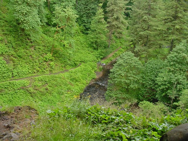
So, with some reservations, we set off our 6th official CFHC hike. This time the trail ran past 10 waterfalls, and we saw 9 of them. (We ended up walking past the Winter Falls without spotting them.) It was a fairly long hike (7.5 miles), but there were only a few hundred feet in elevation change over all. Geologists say that the lava, which makes up the canyon walls where the falls are located, was laid down 15 million years ago. At one point we saw where trees were engulfed by that lava flow, and their outline is still cast in the stone today! Not only that but carbon is still visible where the original tree burned. And you will never guess where we found these casts! Read on |
|||
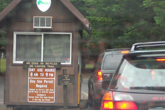
 At the entrance to the parking lot for the South Falls Trailhead this sign was to be found. On this picture towards the bottom you will see the "Lodge" pointed out. That is the place where we parked and started our hike. We continued clockwise all the way around the loop to the North Falls, and even the Upper North Falls, then around past the Winter Falls, and on back to the Lodge.
|
|||
 Waiting to pay our $3 entrance fee. We arrived fairly early, and the parking lot was nearly empty. We drove down close to the trailhead, and got set for a fun hike.
|
|||
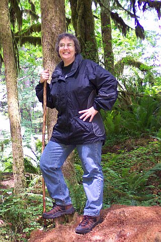
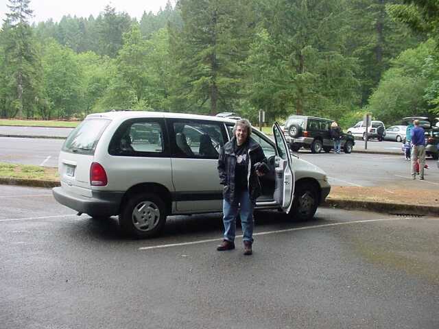 Here's Dotti with her camera case, with our car safely in its parking space. We are nearly set to start.
|
|||
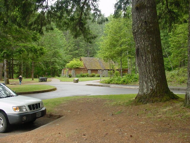 From our car looking towards the restroom facilities, which were the nicest of any we have seen at any trailhead so far.
|
|||
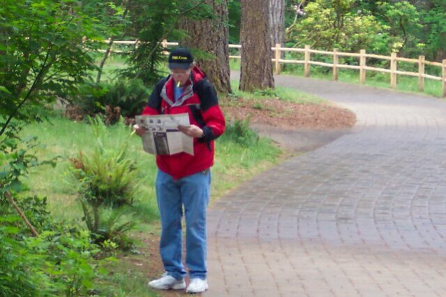 Here is Al studying the map, with his highlighter in his hand, and its cap in his mouth. (In the bad old days that would have been a cigarette, but no more!) There were several off trails and loop shortening trail cutoffs along the way. I found myself pulling out that map several times along the hike, including at the very end when it was not completely clear where the final 100 yards of the trail lay. In spite of it all, we made the entire loop with the only real problem being that we missed the Winter Falls.
|
|||
 This is the Lodge, but it was closed at the start of the hike. (That had changed by the end of our walk.)
|
|||
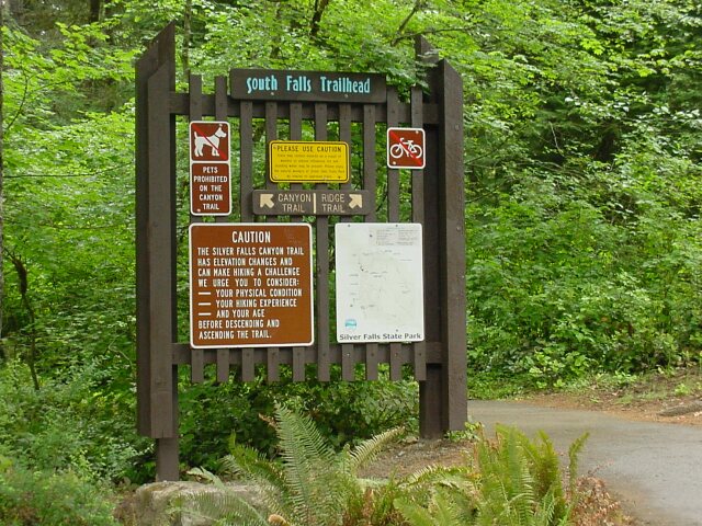
 South Falls Canyon was where we were heading. When we came back at the end it was on the Rim Trail. There were restrooms behind us, in front of us, and inside the Lodge once it opened. It would have been nice if a few locations around the trail were set up with some of them, but you make do.
|
|||
 Here's my Dotti in front of the "Log Cabin," which appears to be a single room that could be used for events.
|
|||
 This map was located on a sign near the "Log Cabin." It shows the entire route we were to walk. On the lower left side of the map is a note that says, "YOU ARE HERE," with a line that moves to the left and downward for a short distance, and the drops directly down for about twice the same distance to a dark circle marking the trailhead position where our hike was to begin.
|
|||
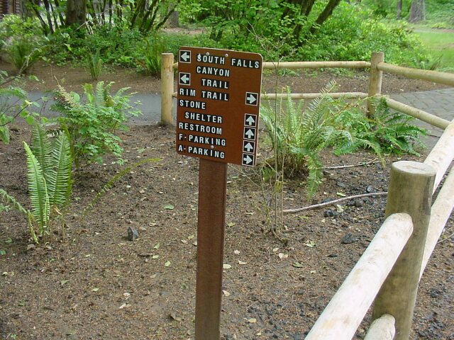
 A little above the center of this sign you will see a sign with an arrow that points up & to the left and one that points up & to the right. The first arrow point to the Canyon Trail, and the other points to the Ridge Trail. Which do we take? That sort of choice is what brought the map out of my pocket all day long. The map showed that the Canyon Trail ran over to the South falls, while the Ridge Trial headed north and linked up with the Canyon Trail later on. We wanted to go to the falls. So, it was to the left we ended going. But first
|
|||
 We took a quick detour to the top of the South Falls. The stream feeding the falls is behind Al in this picture. Once again the map is out, and the highlighter is in hand.
|
|||
 The bridge in the background leads to a path to the parking lot and some addition restrooms. The South Fork Silver Creek flowing by is about to have a sudden drop over the South Falls.
|
|||
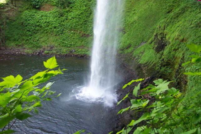
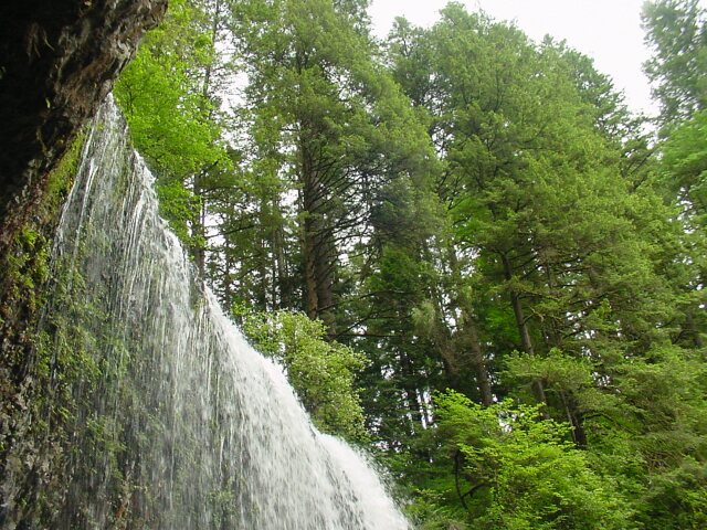
 This is the top of the South Falls, and the water is turning white as it speeds up and churns with excitement at the "E-ticket" ride, with a 177 foot drop, it is about to experience. ("Daddy can we do it again?" "No way!")
|
|||
 Down at the bottom, over this precipice, you can see all of the water droplets exiting the South Falls ride, continuing on along the South Fork Silver Creek water bed, no doubt they are discussing with each other how cool the last ride was. The bridge below we will be arriving at soon, though we will not actually cross it. Our Canyon Trail extends off the top of this picture to the north.
|
|||
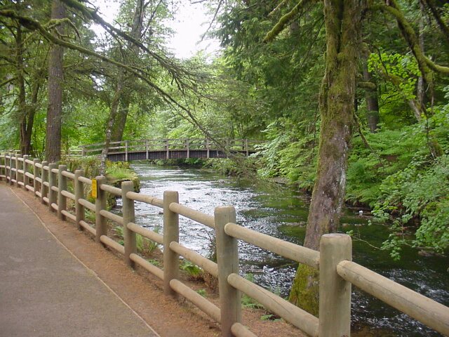
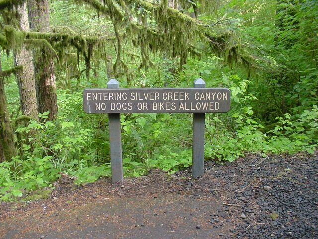
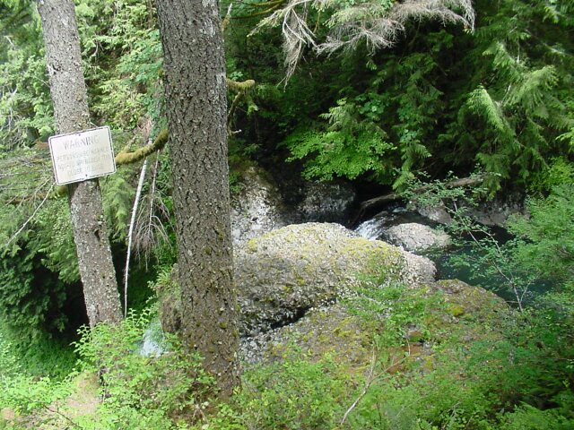
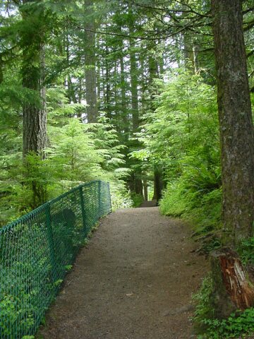
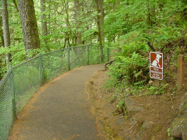 We are now descending to the bottom of the falls, and the path at this point is asphalted. Notice the lovely sign on the right. This day we were hardly bothered by dogs at all. Owners were not only were not allowed to bring dogs unless they had them on a leash, but they could not bring them at all. Not too many feet from this sign, we had just passed by a dog on a leash that had growled at us menacingly before the owner turned around and saw us, and yanked the dog back. That last thing you want to have to deal with is some dog taking a nip at you when you are trying to have a nice walk. I am always very glad to have my walking stick with me when dogs like that are encountered on the trail! But, at least for the Canyon Trail part of our hike there were no dogs!
|
|||
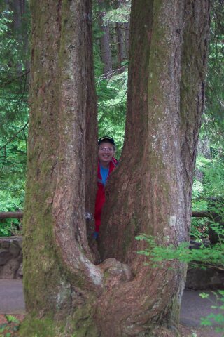 This tree set caught our attention. From a single base there had sprung six trees, all of which are visible in this picture! (There are two thin trees in front, with 4 larger trees behind but staggered, as if posing for the picture like Al is.)
|
|||
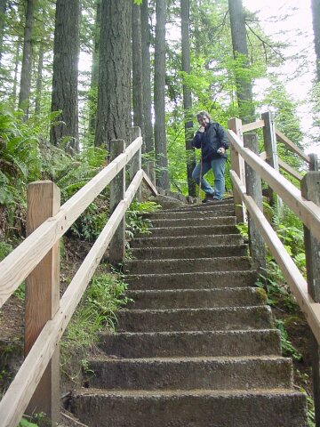 Dotti found a lookout, up these stairs, from which to take a picture of the South Falls, and me too.
|
|||
 As I was saying
I was wearing my DWLZ.com hat, which was put to a lot of use whenever the rain cut loose during out walk. I would hold my hat out over Dotti's camera when she was shooting a picture in the rain, keeping it dry.
As I was saying
I was wearing my DWLZ.com hat, which was put to a lot of use whenever the rain cut loose during out walk. I would hold my hat out over Dotti's camera when she was shooting a picture in the rain, keeping it dry.
|
|||
 Can there be music to your eyes?
|
|||
 This tree had requested of us to not be hasty and to stop and take his picture. We naturally obliged him. He couldn't smile, but we got him to wave to the camera with his lower limb.
|
|||
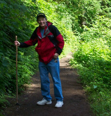
 Okay, it is early in the walk, so we don't get a big smile, but she is still looking great! In the next picture it is like magic how she is transported from where she is standing here, all the way over to the rock trail under the falls.
|
|||
 There she is! Way over on the rock trail standing about halfway between the falls and the tree on the left.
|
|||
 I used the zoom on the camera to pull in Dotti's image from the scene above.
|
|||
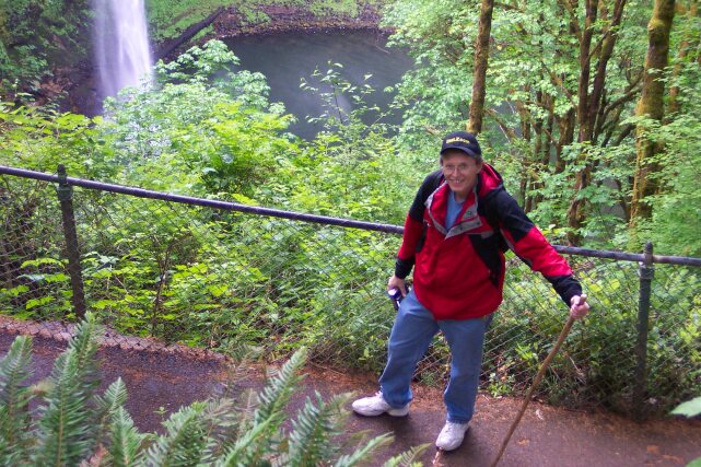
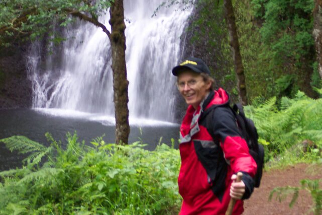
 I had caught up with her just under the falls and looking out over the valley where the South Fork Silver Creek flows away from the South Falls, the first of the nine falls that we were going to see this day.
|
|||
 Now I have passed her by and this shot is looking back under the falls from the other side.
|
|||
 Looking north down the creek.
|
|||
 The fall pool for the South Falls.
|
|||
 Al checking the map again.
|
|||
 A last look at the South Falls.
|
|||
 Here is the bridge we saw from the top of the falls, with Dotti looking back at me.
|
|||
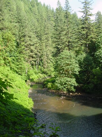
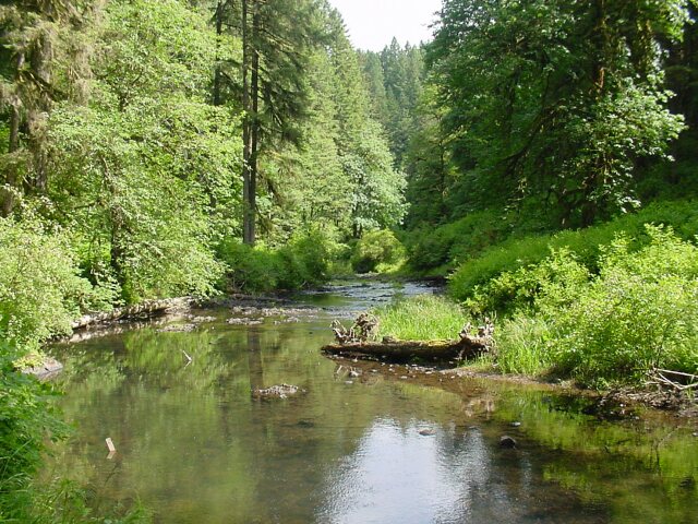 The South Fork Silver Creek is just lovely. We have sunshine, plenty of green, and beautiful flowing water. This is really great!
|
|||
 Down the creek things are still looking beautiful.
|
|||
 Early in the morning, this first day of summer (which officially began at 12:10 PM PDT) it was still quite cool and the jacket felt nice. As it turned out, I wore the jacket the entire trip, because after the sun was out for a short while, the clouds would come and drop some rain, cooling everything down. Once again the sun would come out and the cycle would begin again. The last couple of miles of the hike the rain became quite intense. However, when we finally walked to our car the sun was out again.
|
|||
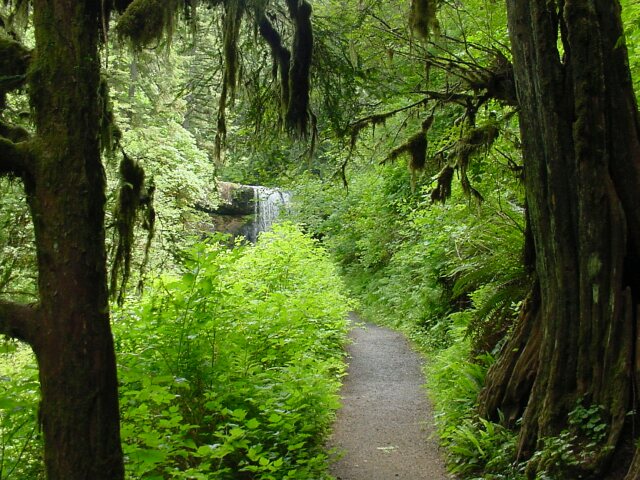
 The next falls we saw was the Lower South Falls, and it was less than a mile away from the South Falls.
|
|||
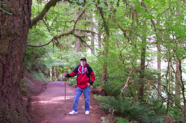
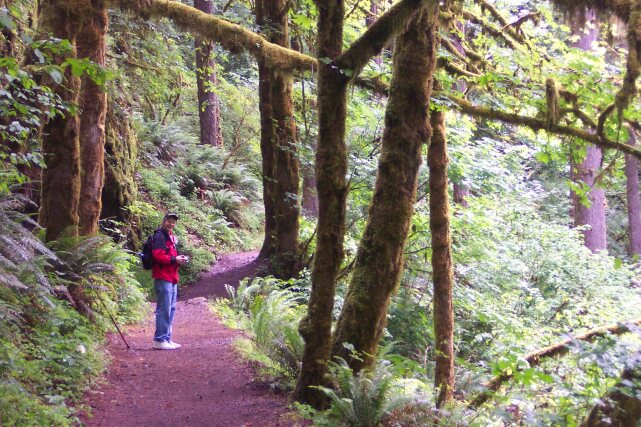
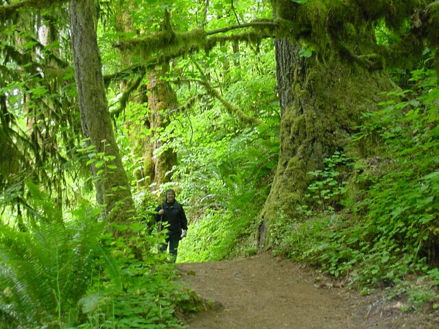
 Dotti has starting bringing her camera on the hikes too, and that means that there are now more pictures of Al being taken on our hikes. (My apologies.) Can you tell that I am having a good time on this hike? There is no doubt as to why this is the most popular hiking trail in all of Oregon. This collection of falls is simply wonderful.
|
|||
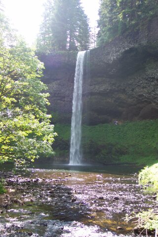
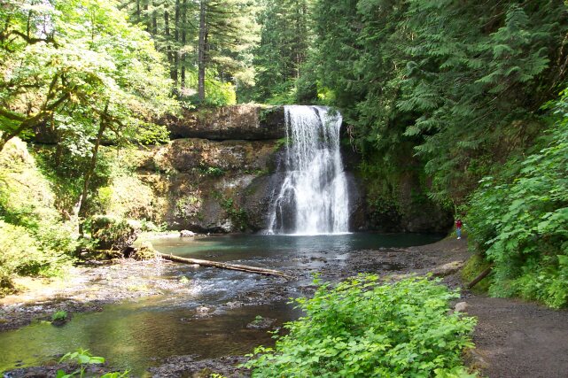
 All 93 feet of the South Falls. The water droplets hardly get settled down from the last drop before they hit the next one!
|
|||
 Dotti posing on the path working our way behind the Lower South Falls.
|
|||
 Al waving to Dotti from behind the Lower South Falls.
|
|||
 The Lower South Falls taken from behind with Dotti's camera's freeze frame "sport mode." The water looks like it is frozen in place and in time. (Can you see the happy little droplets with their arms raised up, their faces frozen in a scream of delight?)
|
|||
 Al took this picture from behind the Lower South Falls looking at Dotti, who was waiting to take the picture of Al above. Notice that even though we got a fairly early start that morning, and the weather was supposed to be iffy at best, there were quite a few people on the trail already.
|
|||
 This is the trail leading out from under the falls.
|
|||
 The rock protrusion where part of the falls strike first, before cascading on down into the drop pool.
|
|||
 The top of the Lower South Falls, with trees reaching for the sky above.
|
|||
 Dotti behind the falls.
|
|||
 The Light of my life looking lovely and surrounded by loveliness.
|
|||
 On the path to the Lower North Falls. We have changed streams at this point. Behind us, and off the path we were walking, the South Fork Silver Creek joined the North Fork Silver Creek and they continued to the northwest as the Silver Creek. We cut to the east, joined up with the North Fork Silver Creek, and headed upstream.
|
|||
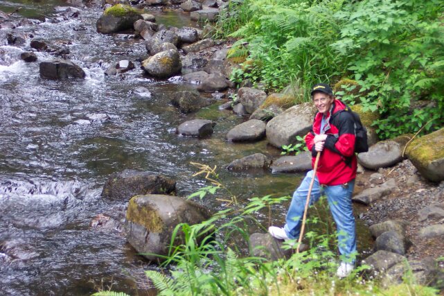 Al again next to the North Fork Silver Creek.
|
|||
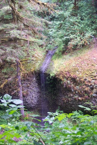 We have crossed the North Fork Silver Creek, and are now walking parallel to the south bank. Across the creek, as you can see, there was a little unnamed falls.
|
|||
 This tree wasn't speaking to me anymore. He turned his back and was sulking.
|
|||
 Here we are at that Lower North Falls, which drop 30 feet.
|
|||
 The Lower North Falls are wider than some of the falls, and the water flows in sheets down its slide surface. Can you hear it calling out, "Whee"? The tree tried to used the slide but he was too big.
|
|||
 Looking back down the Lower North Falls.
|
|||
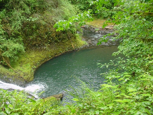 The fall pool and North Fork Silver Creek outlet. As before, everything surrounding this area is lushly green.
|
|||
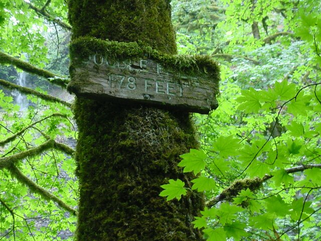 After a short walk, we came to path, leading off the main trail, heading to the 178 feet tall Double Falls. This sign is really something. It has been in place for along time, is weathered, and it is covered with moss. The name of the falls is barely legible.
|
|||
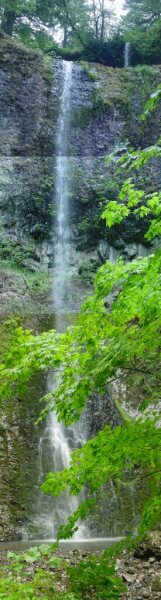 I put 3 pictures together to create this shot of the entire double falls. Note the short drop of the upper falls, and the significantly larger drop of the lower falls.
|
|||
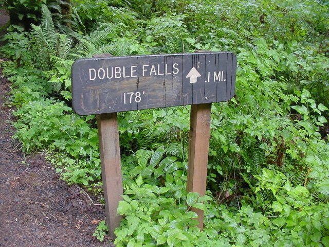 This is the sign on the main trail pointing out the Double Falls, 0.1 miles away.
|
|||
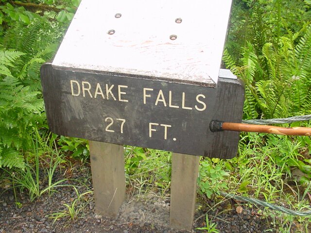 Another 0.2 mile up the trail we found the Drake Falls that drop 27 feet.
|
|||
 On the Drake Falls viewing platform, here is my love Dotti, hair and jacket wet from the rain, but smiling brightly!
|
|||
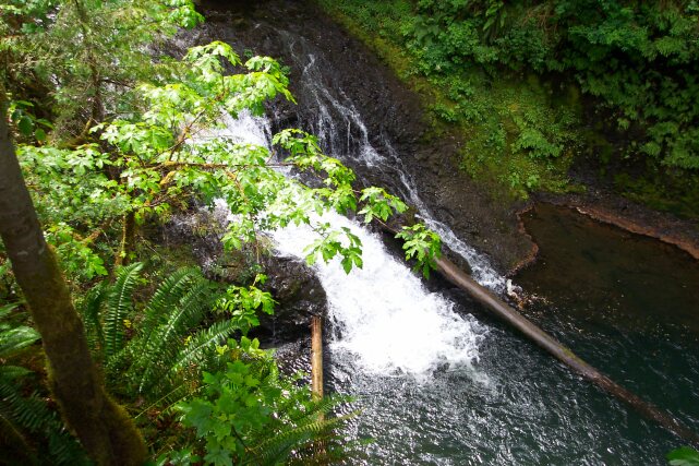 Here are the Drake Falls. We were not able to get as good of a view of these falls as some of the others.
|
|||
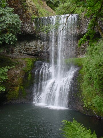
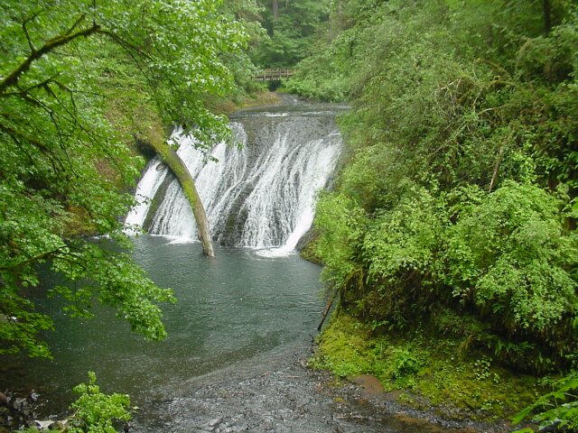
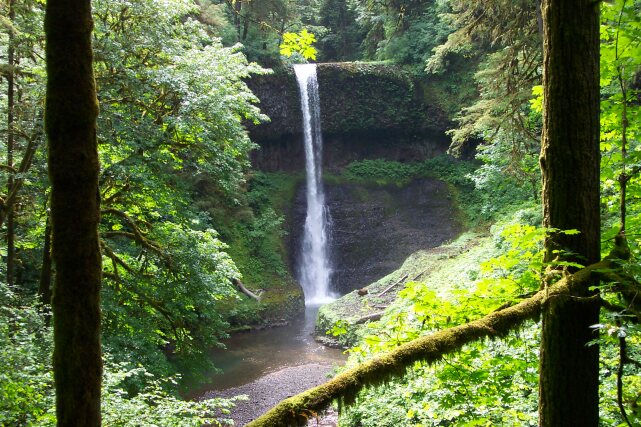
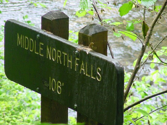 Only 0.2 of a mile farther and we were at the Middle North Falls, which drops 106 feet.
|
|||
 This falls has an interesting exit for its fall pool. Did there used to be a small lake created behind the lava damp that was worn down over time? What created the physical configuration of this interestingly hidden fall pool? Looking up at the top of the falls, it has the appearance of having at one time been much wider than it is now. The fall exit point could service a great deal more water than it is getting right now. It looks as if water has flowed across a strip nearly 5 times as wide as it is flowing across right now, and the fall zone along the bottom appears to have serviced a much wider stream in the past. The green is intense all around this area.
|
|||
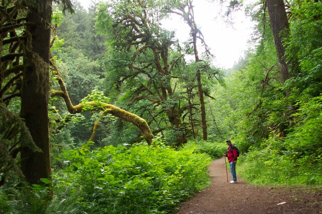
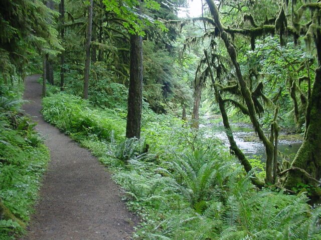 Continuing up the North Fork Silver Creek. The trees off to the right look as if they are about to start moving around. To the left the path beckons for us to continue.
|
|||
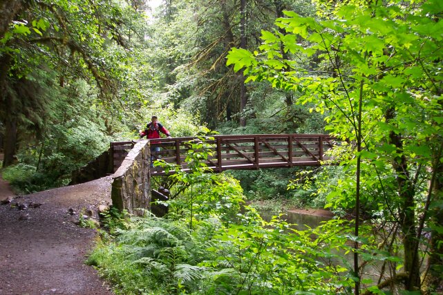 Here Al is standing the bridge, which is just about at the halfway point for our hike, and which leads to a shortcut which will close the loop back to the lodge in only 5.1 miles and that runs past the Winter Falls, which is the only one of the 10 major falls we did not get to see. Our path leads off to the left.
|
|||
 This sign stands at the foot of the bridge in the previous picture. As you can see we have come 3 miles from the South Falls, and have 1.5 miles to go to the North Falls.
|
|||
 Dotti on the path, surrounded by giants (whose attention was fortunately elsewhere).
|
|||
 The nearly hidden Twin Falls, where the North Fork Silver Creek splits into to distinct fall channels and then drops 31 feet.
|
|||
 While I was stopping to grab a picture of the Twin Falls, you can see the trees above me appeared to be active.
|
|||
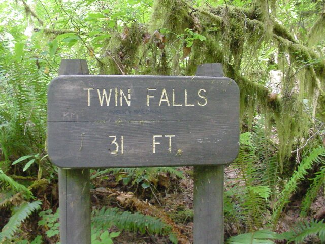 Twin Falls: The Sign.
|
|||
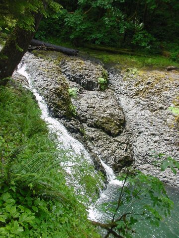 A side view of the Twin Falls.
|
|||
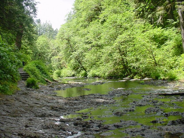
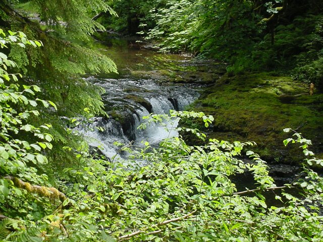 The North Fork Silver Creek dropping a few feet in a very attractive way.
|
|||
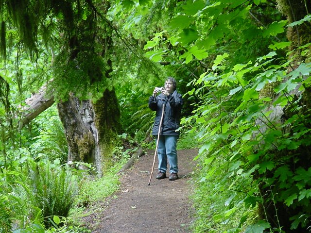 Dotti captured taking a picture.
|
|||
 Queen of the mountain, or at least the huge redwood stump!
|
|||
 For some reason the tree on the right didn't like what I had to say to it. He just leaned over and covered up his face.
|
|||
 Here was a tricky bit of the trail where a tree was reaching out to grab us with its two arms that you can see. Fortunately, we were too hasty for it though.
|
|||
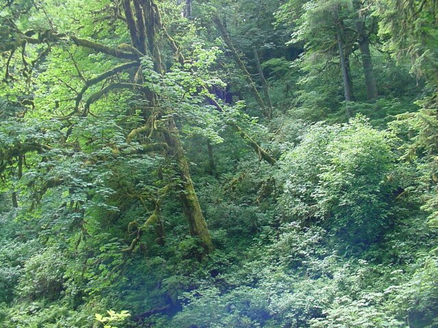
 The forest is filled with many sorts of beauty, some green, some not.
|
|||
 I don't know what it was but these two trees at that center of this picture reminded me of two sailors coming back from liberty, after having a few too many beers. The back one has lost his balance and fallen against his drinking buddy, who is staggering as well.
|
|||
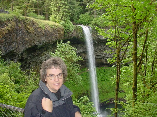
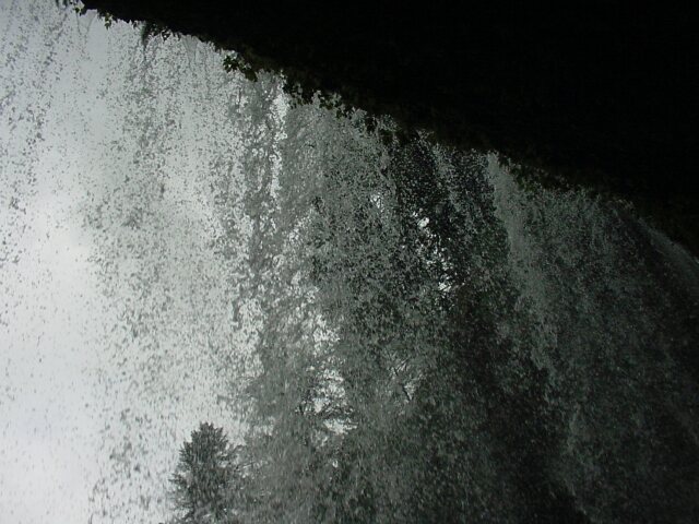
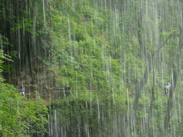
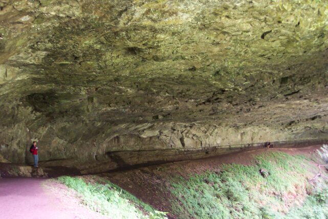
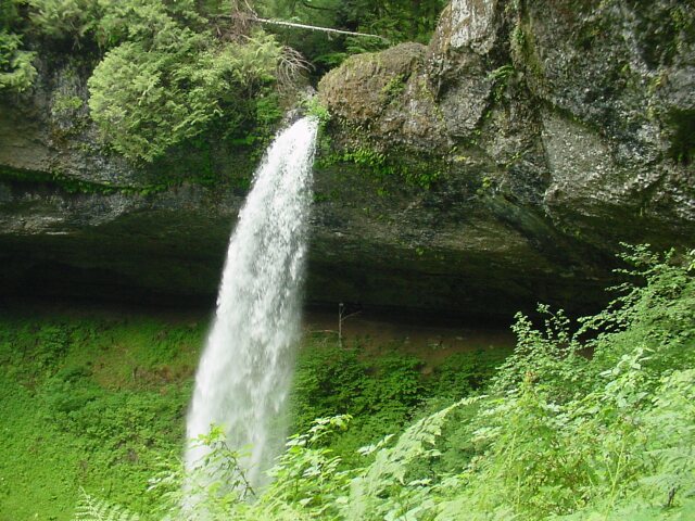
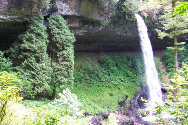 Welcome to the North Falls, which drops 136 feet. It is a beautiful falls, and it has created a cave behind it, as have all the falls. (This one is larger than most of the others however.) The process is one of water spray hitting the rock surface and intruding into any porous surface or crack, and then freezing in the wintertime. This causes the water to expand, thereby cracking the stone. When enough of the stone's support has been removed in this fashion, it falls; exposing new rock surface where the process can start again. Over time all the once flat rock wall behind the falls has been carved out, excavating a huge cave.It has also exposed something that I found extremely remarkable. I will come to that later. At the upper right-hand corner of the picture you can see a section of fence. That fence borders the path that we will be walking on later. Right now our path leads through the cave underneath the falls. At the bottom of the picture, you can see many of the rock boulders that have been dislodge by the process of described above.
|
|||
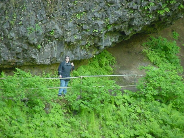
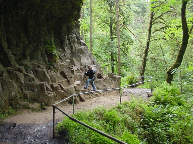
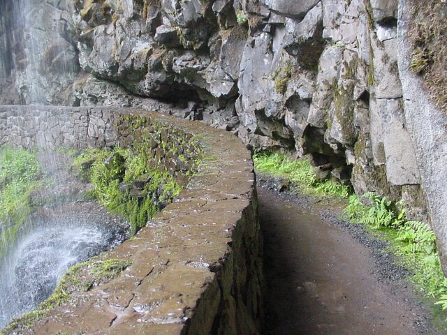
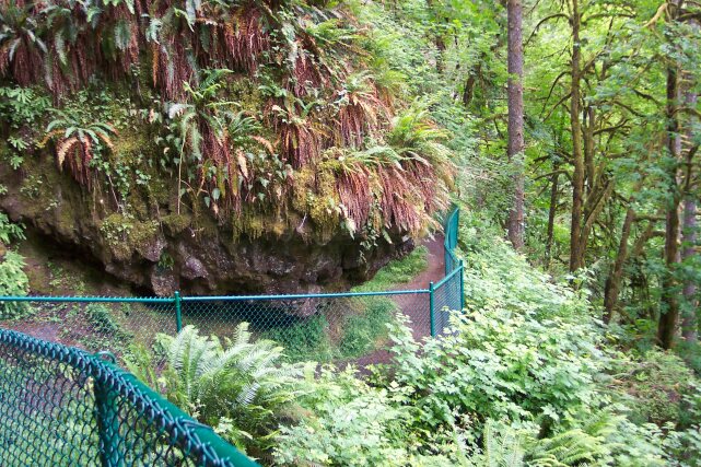
 Al standing near the entrance to the "cave" below North Falls. It is amazing how much rock has been excavated.
|
|||
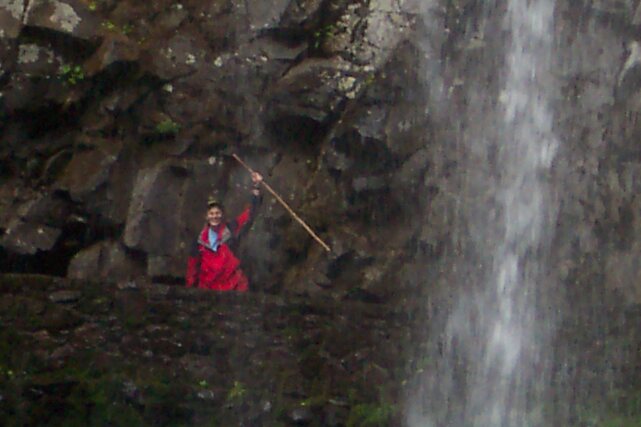
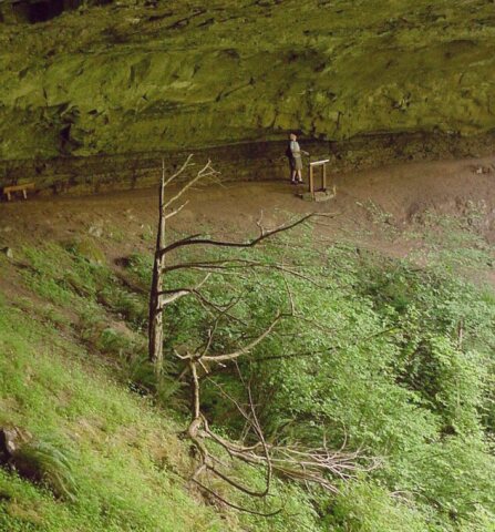 Notice this tree. It only has branches on one side, the side facing the falls and the sunlight. Also, notice the man in the background. What is he doing? It is connected with the item I mentioned above, and that I said I would discuss later. I will.
|
|||
 Al in the cave, with the North Falls in the background.
|
|||
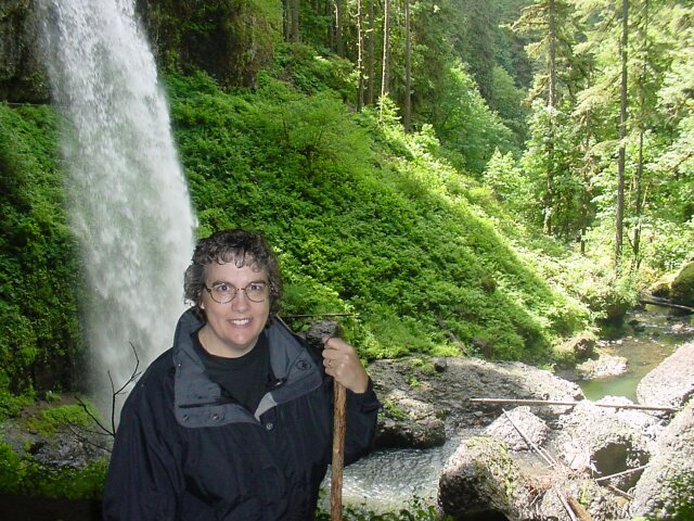 My lovely Dotti with the falls behind. We are still damp from the last rain, but the sun is shining again.
|
|||
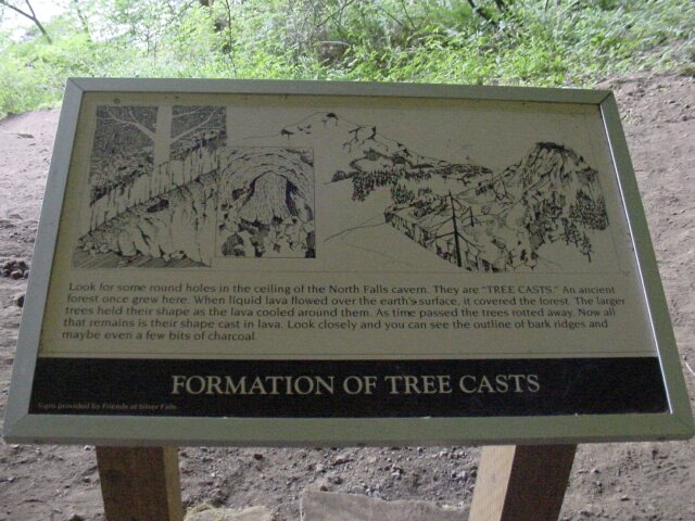 Here is the item that I was mentioning before. The cast of old trees was captured, 15 million years ago, according to the geologists. Lava flowed into a forest, and surrounded the trees. The trees naturally died, but they held their shape until the lava cooled enough to set. A cast was thereby made of the trees. Not only was the shape of the trees captured, but even some of the carbon from the burning process of the tree was trapped inside the lava. That is very interesting, but I have seen this before, at Mt. St. Helens. What is unique is that the casts of the trees, destroyed so long ago are now exposed by the excavation of the stone by the waterfalls, and the casts are visible IN THE CEILING of the cave. That is why the man in the earlier picture was looking up.
|
|||
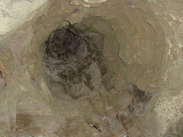 Looking up at a cast of a tree that was made long ago, and which is now located in the ceiling of the North Falls cave.
|
|||
 The North Falls from the other side.
|
|||
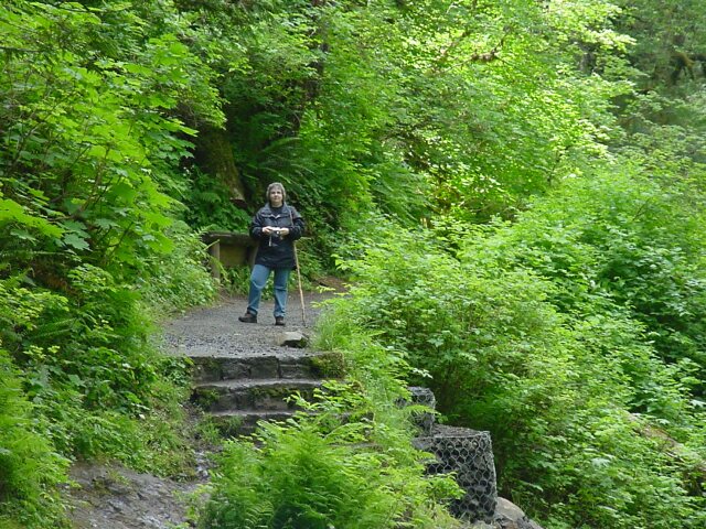
 Dotti looking unhappy about all the stairs we have to climb to get to the top of North Falls.
|
|||
 Looking down at the North Falls.
|
|||
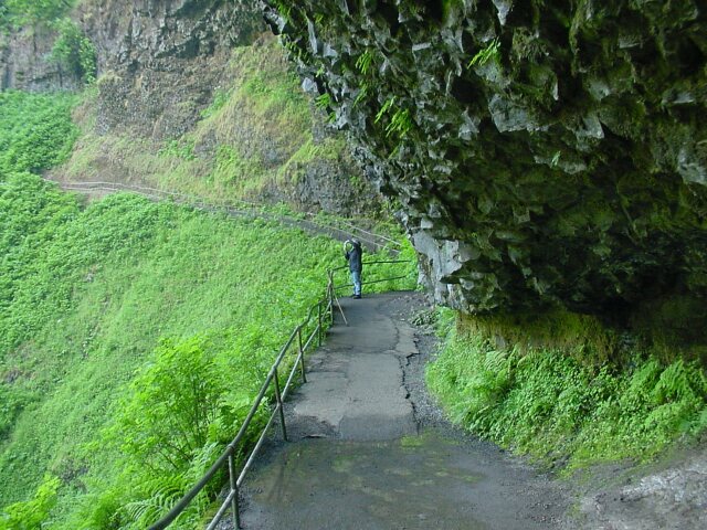
 The path we just traveled coming up from the stairs. The rock jutting out at the corner is low and intrusive to the hiker's space. If he did not pay attention he would painfully smack into that rock.
|
|||
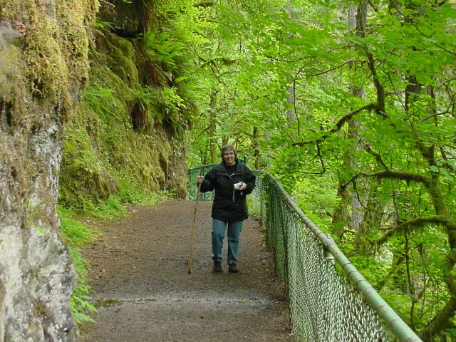 On the path to the top of North Falls. Dotti, camera in hand, is enjoying the walk, and the scenery.
|
|||
 The sign warns that it is extremely dangerous to venture closer. This is the top of the North Falls and there is a 136 foot drop right at that sign.
|
|||
 The path heading towards the Upper North Falls.
|
|||
 We have traveled 300 feet from the top of the falls.
|
|||
 The Upper North Falls can be just glimpsed off in the distance.
|
|||
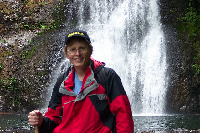
 The Upper North Falls dropping 65 feet, is the 9th falls that we have visited today. The path leading to this falls was 0.2 miles long, and was technically off the loop, but was definitely worth the visit. On the right you can just see Al's red coat and white shoes.
|
|||
 Al in front of the Upper North Falls.
|
|||
 A down stream view of the North Fork Silver Creek. On the left, above the stone steps you can see Dotti standing there.
|
|||
 Zooming in on Dotti's position.
|
|||
 Dotti in front of the Upper North Falls.
|
|||
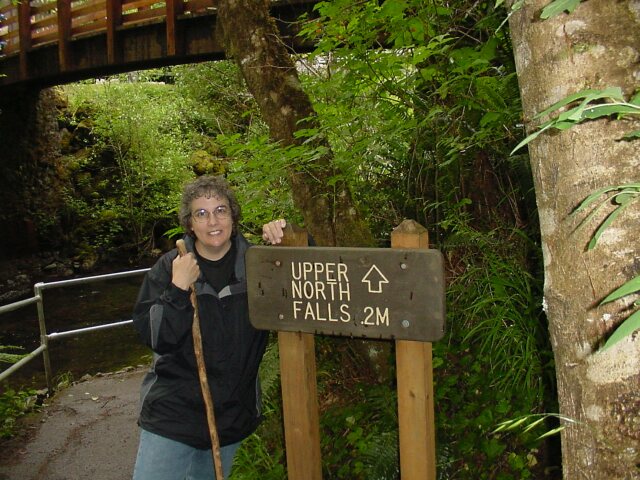 On the way back we grabbed a picture of the sign pointing the way to the falls.
|
|||
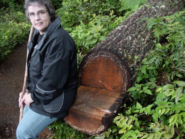 At various point along the path, they had cut a stump or fallen tree into a chair. Here is one of those chairs, with my Dotti modeling it. It was not easy finding a dry spot on the chair after all the rain we had that morning.
|
|||
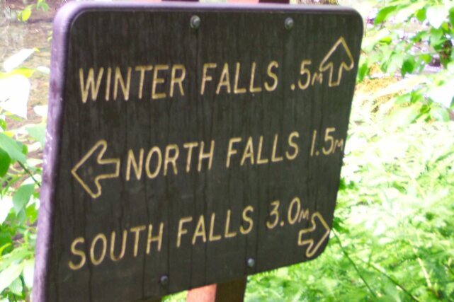
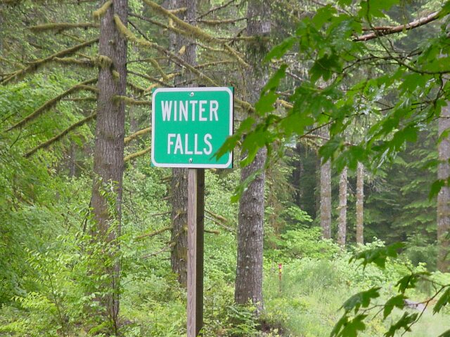 From the Upper North Falls to here was 0.9 miles, and we had started to get some rain. Using my hat as cover for the camera, I took it out to catch this picture. Unfortunately, we never did actually see the Winter Falls themselves.
|
|||
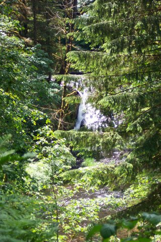
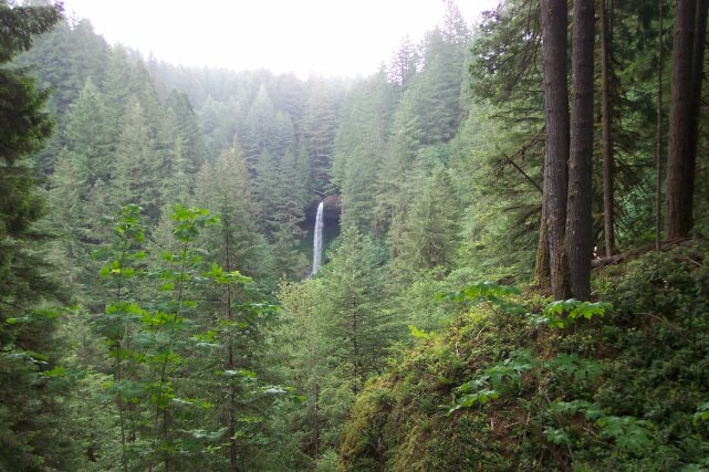 I used my ball cap again to cover Dotti's camera as she snapped this picture of the North Falls. Even from a distance it is an impressive site. The road ran above us at this point, and there was a parking lot where people were stopped to catch this view.
|
|||
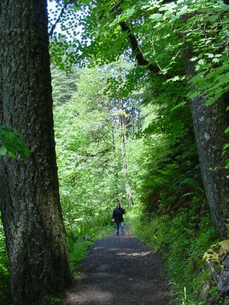
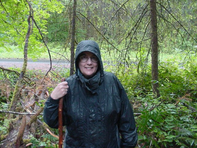 The rain got quite heavy for the last leg of our trip. Dotti had her hood up and it kept her pretty dry. We got damp but our Columbia Jackets kept all the heavy stuff off of us.
|
|||
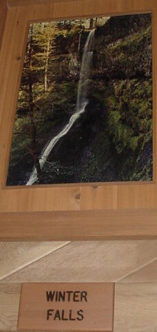 After walking 7.5 miles we were ready for a rest. We hit the Lodge at the South Falls parking lot. Hanging on the wall were pictures of all the falls. I had to catch a shot of the one we missed.
|
|||
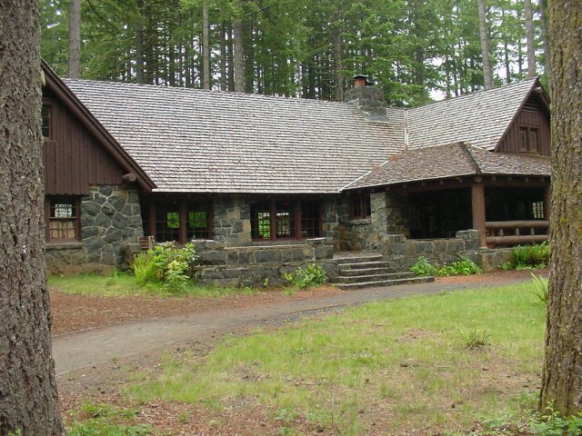
 Here is the lodge that was closed when we headed out early but which was open and operating when we go back.
|
|||
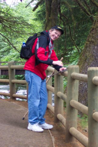
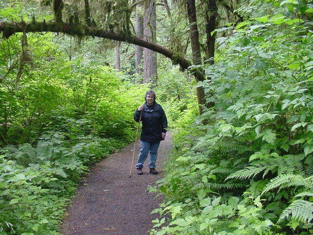
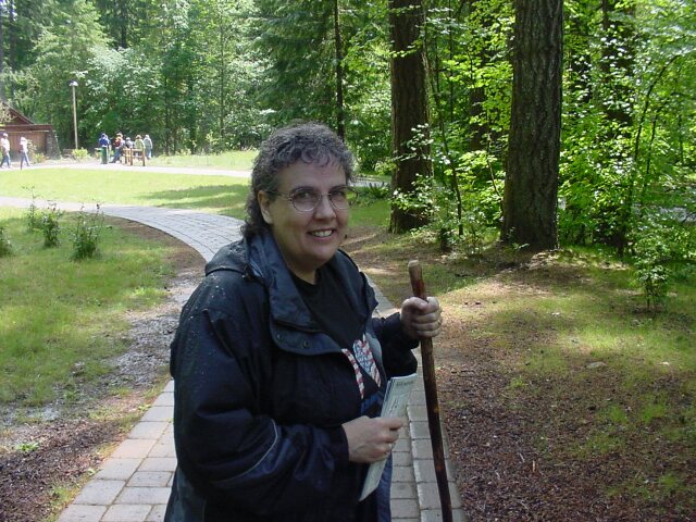 Dotti, with her walking stick in one hand, and a few brochures for our scrap book in the other. She seems happy to be finished and heading back to the car.
|
|||
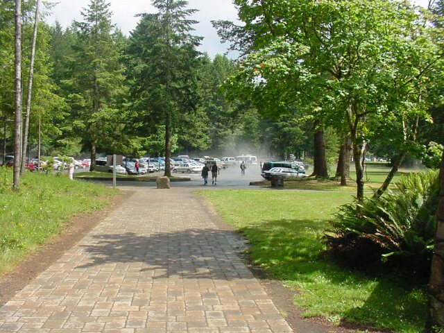 Out in the parking lot, where our car, and some well earned rest awaited us, it looked like a fog had set in. However it wasn't fog...
|
|||
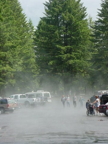 The sun had come out and was hitting all the rain water on the ground and vaporizing it. It was just that kind of day for the weather.
|
|||
|
|||
|
|