TUNNEL FALLS
AUGUST 23, 2003
The Coon Family Hiking Club
Official Hike #15
12.4 miles - 6 hours 20 minutes
|
This week we chose a hike that we had partially done twice before. However, this time we did a lot more hiking than the other two combined.
We got on the road around 07:00. I started my stop watch a few seconds before 08:00 as we set out on the trail. If you would like details of the early phase of our hike, it is fairly well covered in the two Punchbowl Falls hikes: Punchbowl Falls Hike 2 The weather forecast for the day was "Partly Cloudy" with a high of 74°. According to the prediction graph I printed out from Underground Weather, the temperature should have been around 58° when we started, and at noon when we got to the top the temperature should have been in the high 60s. When we got back to our car at 14:30 the temperature was to be 72°. We didn't see any of that cloud cover, and I think the temperature was up a little higher than 72° on our way down, but the graph was probably fairly accurate. Fortunately the humidity was down to about 40% by the time we reached our car, and so that wasn't much of a factor in our hike. This hike was the longest one we have tackled so far, although the elevation change was not the greatest. Along with having hiked 6 miles, we had climbed 1,200 feet from where the parking lot sat, when we reached the Tunnel Falls. We then continued on another 0.2 miles up to another falls that up to this point has not been named. It is a beautiful falls and I am amazed that no name has been assigned to it yet. When we got to the top we sat down for 10 minutes, ate a Kashi bar, while listening to the water rushing by. We then hit our feet and headed back down. At this point in our walk we actually felt cold, thanks to the spray we had gotten from Tunnel Falls as we passed it, and the nice breeze that was blowing by at that time. It didn't take long after passing Tunnel Falls on the way down before that cool feeling was replaced by a warm one. At the top we both felt like we could go on farther up the trail. Our feet were in good shape and we didnt feel all that tired. However, it was good that we headed back down, because on the way down we found the rocky path was doing a number on the bottoms of our feet, and by the time we were back at the parking lot, we were quite happy that the hike was completed. I think that the Eagle Creek Trail actually rivals the Silver Falls Trail for the number of waterfalls it has. Unfortunately, we could not get a really great view of all of the falls, because the trail wasn't close enough to some of them, and the trees blocked the view, but we could get glimpses and they were beautiful falls. The parking lot was nearly empty when we arrived, but when we got back to our car after our hike, the lot was filled, and cars were parallel parked out on the road, some them even appeared to be parked illegally. There were people even hiking into the trail head from the next parking lot over, out near the highway. It is good to arrive early. |
||
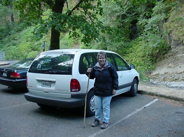
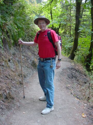
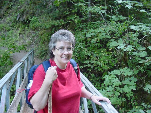
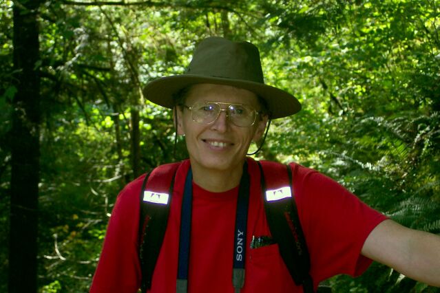
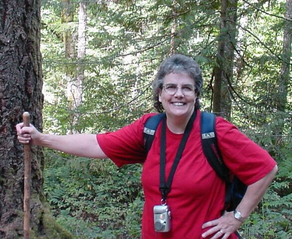
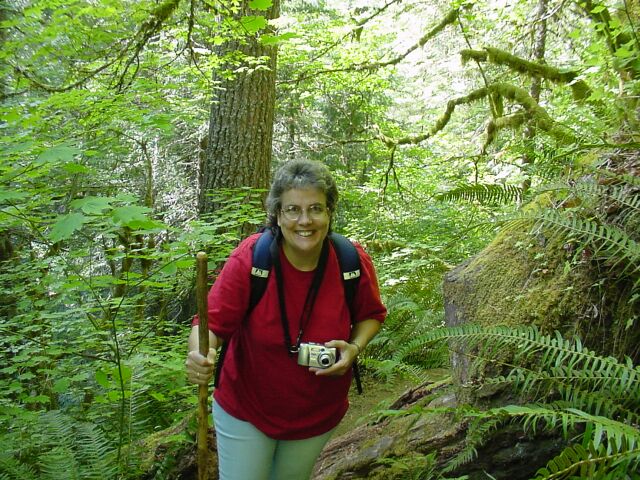
| When we first arrived it felt pretty cool. We decided to put on our coats, and we even had our liners on. Dotti was all ready to go as you see here. | |
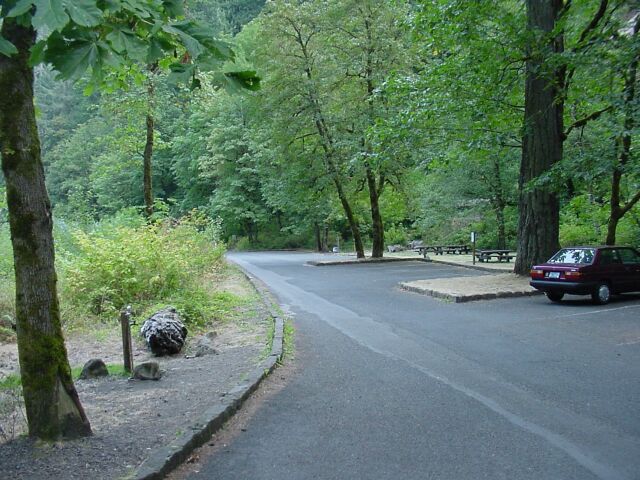
| Looking north across the parking lot towards the road where we came in at, you can see that the lot is nearly empty at just before 8 AM. When we got back at 14:30 all these spaces were filled, and the road out beyond had cars parked along it. Beyond that point about a half mile there is another parking lot that was also nearly full, and people were hiking in from over there to get to this trail. |
|
|
|
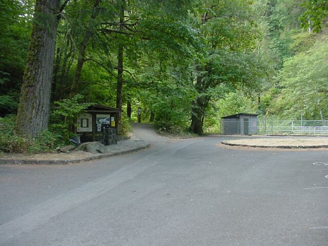
Looking south towards the trailhead. You can't see all of the empty spaces in this direction but there were a few more of them that were filled up when we returned. If you would like see the trail from this point up to Punchbowl Falls please click on these links: Punchbowl Falls Hike 1 Punchbowl Falls Hike 2 |
|
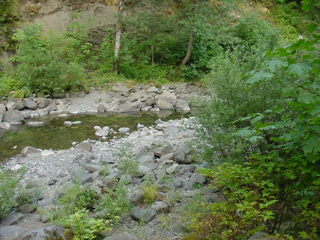
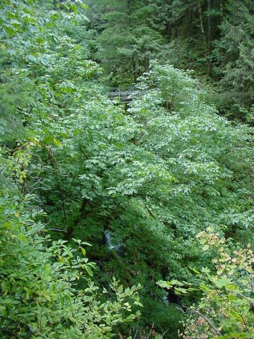
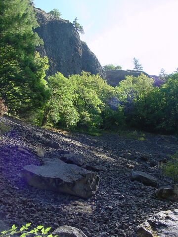
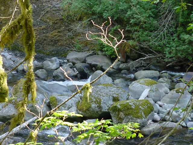
| Eagle Creek as viewed from the parking lot. It definitely was down from the last time we came. Of course it is in late August here, and we have not had much rain this summer. So, it is not surprising to find the water level to be so low. |
|
|
| We didnt get far up the trail before we found our coats to be no longer required. They have already been stowed in our backpacks. | |
| Here's my lovely Dotti after removing her coat. |

|
|

| I snapped this shot of this particular stretch of the trail, looking back down towards the direction of the parking lot, because the first time we hiked along here, it was raining and the trail was muddy here and there was some standing water. When we were heading back down from Punchbowl, we had to climb up on the ridge on the right-hand side of this picture in order to keep our shoes dry. LeRoy was with us and gave us both a hand up. | |
| Punchbowl Falls. The water level is definitely down for the stream coming over the falls. |
|
|
| Here is the lovely Dotti in front of the falls, just visible over her left arm. | |
| And here we have traded places. |
|
|
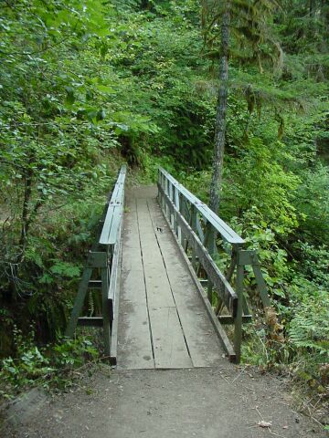
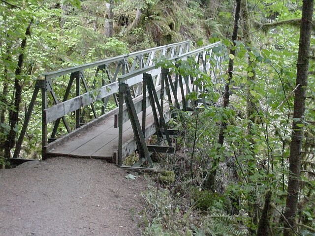
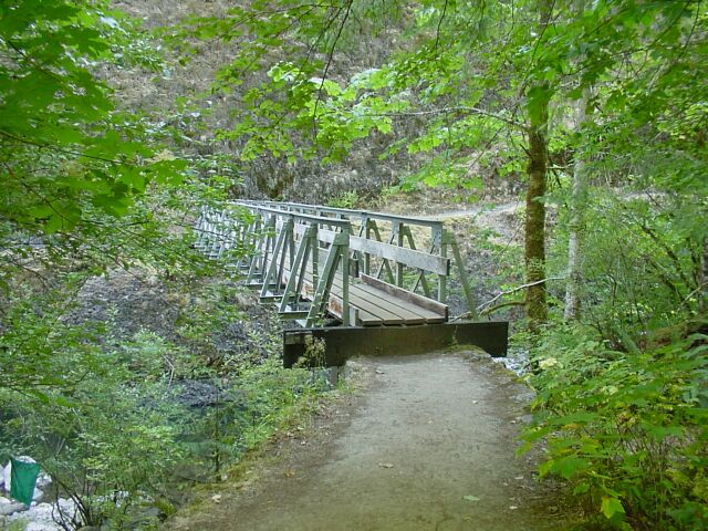
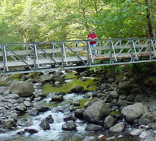
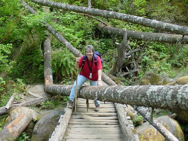
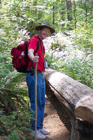
| This bridge was just a bit farther up the trail from Punchbowl falls. We are now heading into new territory for us. | |
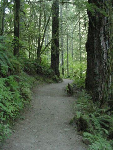
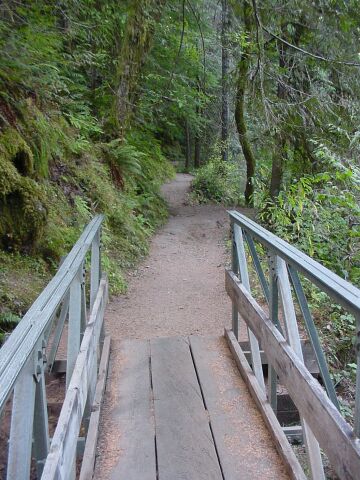
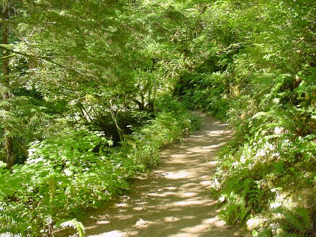
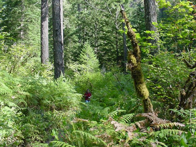
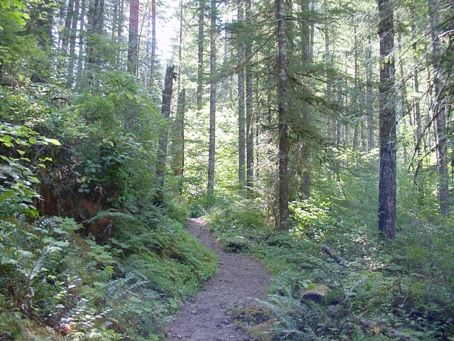
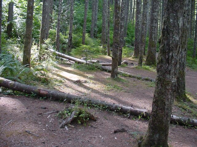
| The trail cutting through the forest. |
|
|
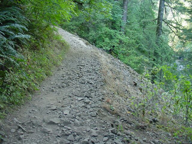
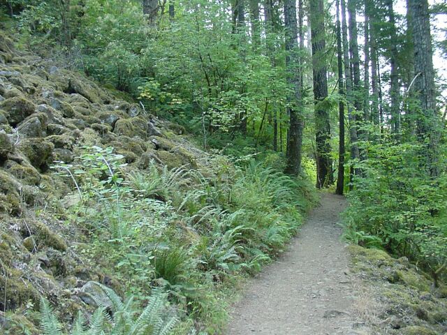
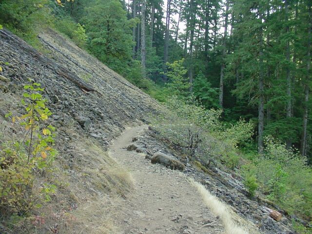
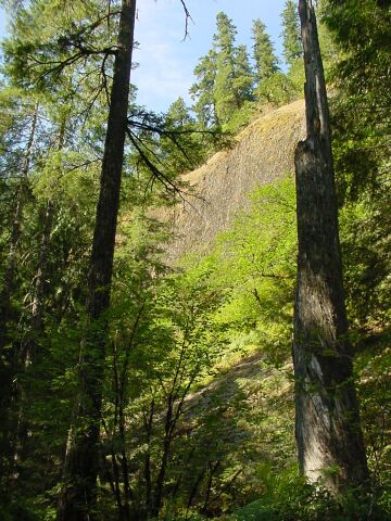
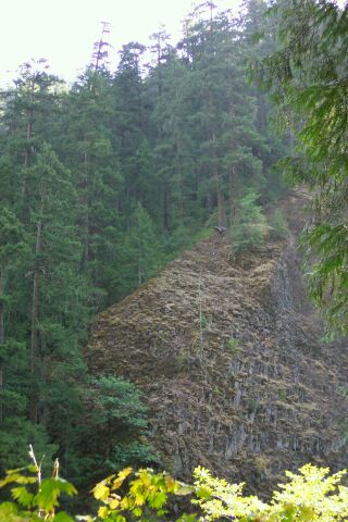
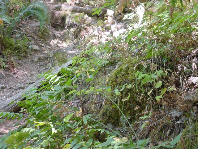
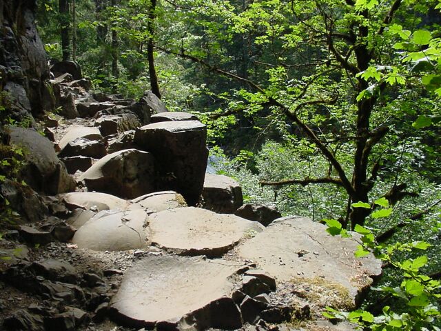
| Here is a lava rockslide that the trail has been cut through. We saw several such slides along the way. This trail was the roughest one we have been on so far for rocks on the trail itself. | |
|
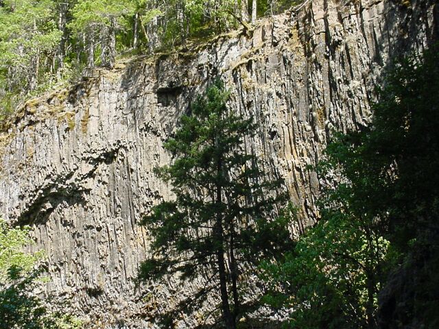
It was clear from the number of rock slides that we saw, that these rock slides have been a very common occurrence in the past. Some large segment of rock broke loose from high up the mountain and then crashed down the mountain side, shattering into a million pieces as it fell, knocking trees down and anything else in its path. Everything was either knocked aside, or covered completely.
The age of the landslides was clearly uneven. Some looked like they could have happened yesterday, with rocks completely bare of any sort of vegetation, while some were almost unrecognizable because they were completely coated with moss and other vegetation. I would expect that since we saw so many places where the walls had given way in the past, that there are probably several layers of these landslides in some places where one occurs and then much time passes, and then another lava avalanche comes through. A geologist could probably dig down and differentiate the layers by finding old vegetation creating a layer between them. |
|
|
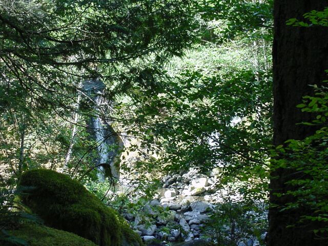
| You can see a small falls at the bottom of the picture through the trees. Near the top of the picture you can see a bridge that we were going to cross. | |
| And here it is. |
|
|
| Looking ahead to where we will be walking. | |
| Looking back at my beautiful wife. |
|
|
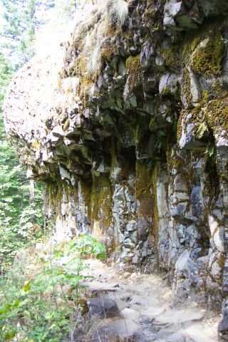
| Here is another lava landslide. | |
| This is one of the parts of the trail that makes me think of the Lord of the Rings story. The trail is cut into the sold rock. It is interesting to remember that this trail was actually constructed back before 1920, and that is when they made these cuts in the stone, as well as when they created the tunnel at Tunnel Falls, which we will see later. |
|
|
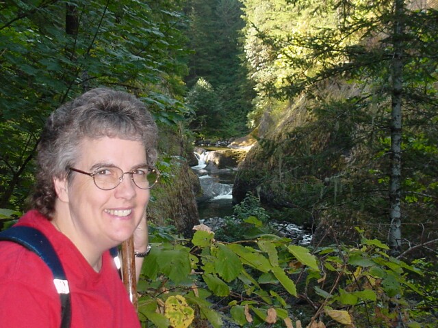
| This is my favorite picture of the entire hike. It has my lovely Dotti (I used a fill flash to bring her out), trees, lava basalt walls, covered in moss, Eagle Creek and a small waterfall in the distance. It has quite a lot of light contrast to make it interesting to the eye. It was more a case of serendipity than of preplanning a good shot, but I do especially like this one. | |
| Loowit Falls. It has a long drop at the top, flows into Eagle Creek, and then turns to the right, as you can just barely make out at the bottom of this shot, and can see much better in the next photo. |
|
|
| This is a zoom showing the portion of Loowit Falls that includes the entire Eagle Creek, at the base of the upper falls. | |
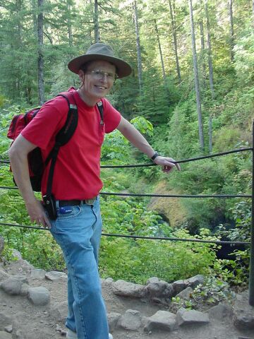
| Here I am studying my information packet that I printed up before we came on the hike, while standing across from Loowit Falls. |

|
|

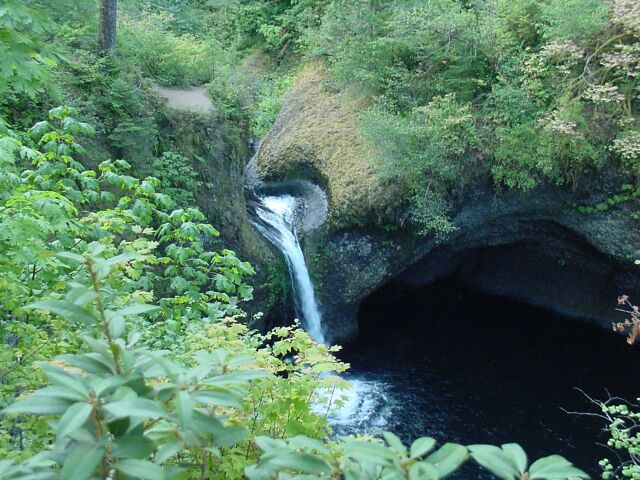
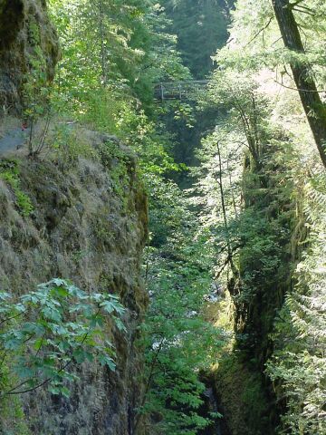
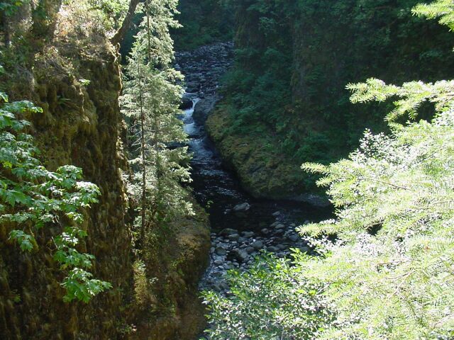
| This is a fault that runs through this area, and it created this valley that Eagle Creek flows through and High Bridge crosses over. | |
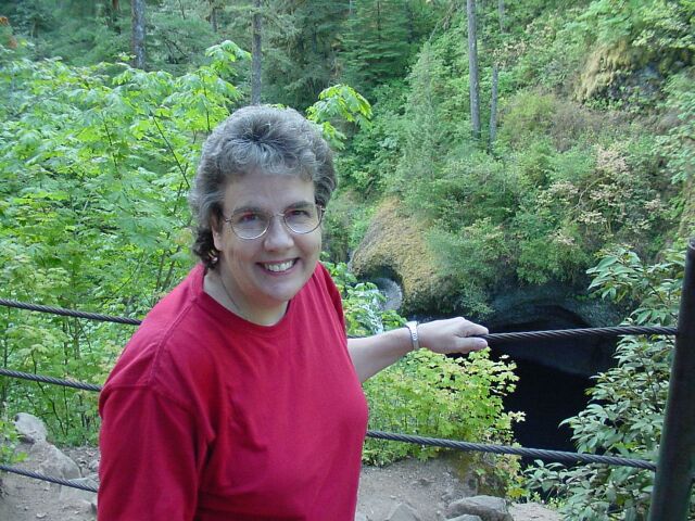
| Looking higher from about the same point as the last photo was taken from. You can see High Bridge at the top of the canyon, and through the vegetation below, you can just barely see the white of the creek flowing over some rocks. |
|
|
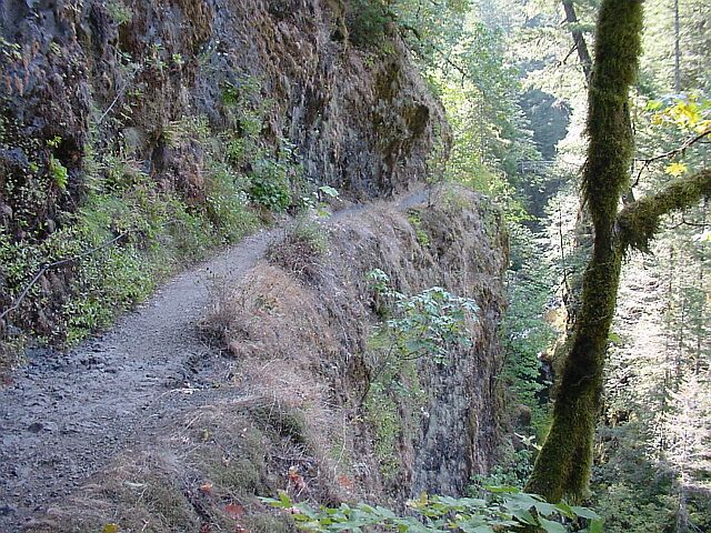
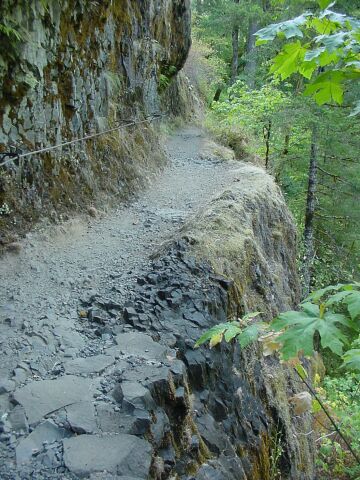
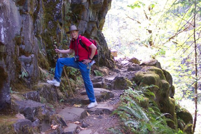
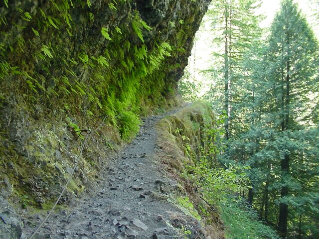
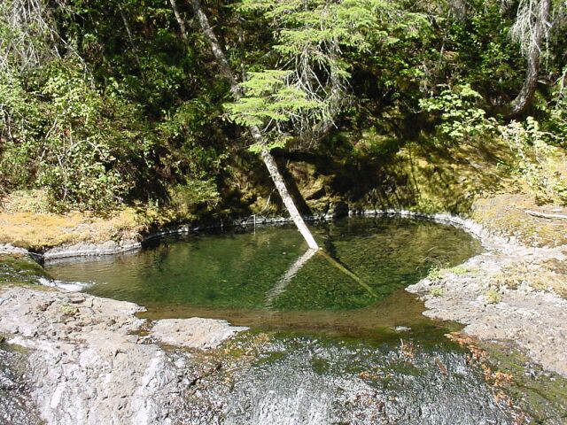
| The trail leading to High Bridge has been cut out of solid rock, and it has a metal safety hand cable installed all along the cliff. | |
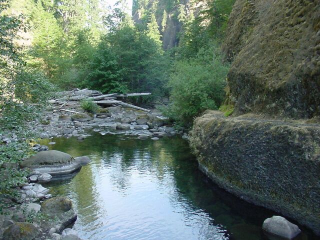
| Looking down from that rock path, into the pool fed by Eagle Creek. You can just see a small waterfall on the far edge of the pond, at its exit on the right. |
|
|
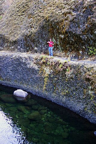
| Here we were standing at the High Bridge, just before getting on. I thought that it was interesting to look at the sheets of cooled lava, that stand normally hidden by the forest in the Columbia Gorge, but that are exposed at this point. The intact rock stands in the form of a hill while the disintegrated chucks lie strewn over the landscape below the hill. | |
| High Bridge, looking south, the direction we were heading. |

|
|

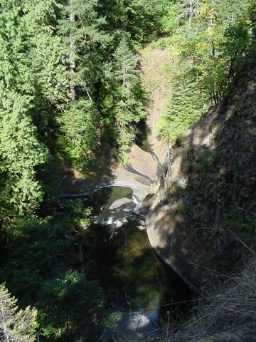
| Looking down from High Bridge, it is easy to see where it got its name from. Eagle Creek flows below us, well below us. Towards the top of the picture we are looking back (downstream) toward the direction from which we took the earlier pictures of this canyon. | |
| Looking upstream from High Bridge. |
|
|
| Moving off the bridge while continuing to look upstream. | |
| And the path continues on from the bridge. All this greenery is just beautiful. But notice there are no pine trees right here. When Autumn comes, much of this greenery would die back for the winter. |
|
|

| Moving up the trail shows that there are pine trees a plenty around. Dotti took this shot and it really captures the blue of the sky we had that day, with only the lightest of wisps of clouds. The contrast of the varying shades of green is also striking when placed against the brown of the exposed volcanic rock. | |
| My Dotti is making her way through all of the greenery. It looks like there is no trail at all from this angle. |
|
|
| Once again the volcanic basalt is exposed to view. The cliff face is just too sharp to sustain even this tenacious life that surrounds us on every hand. | |
| Another outcropping of volcanic rock. |
|
|
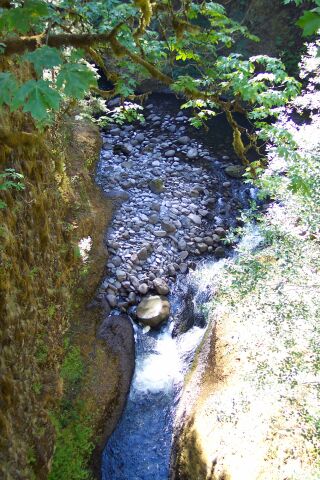
| It is really nice that this trail spends so much of its length right next to Eagle Creek. We nearly always could hear the sound of running water during this hike. | |
| Dotti used the flash on this one. You can tell because the reflective surfaces on the back pack straps are very bright. |
|
|
| After the last one, you might think this one would be called "low bridge" because it is quite close to the water. However, it is known as 4.5 Mile Bridge, not because that is how far it is to the parking lot from here, but because it is that far from the original trailhead for this trail, which was out on the Columbia Gorge Highway. Because a dam has been built, and a fish hatchery along side of it, they have moved the trailhead one half mile closer to this bridge today, and so it is only 4 miles from it to the parking lot. | |
| Looking downstream from the bridge you can see there is a section of trail that has been carved from the stone wall on the right. However, it only goes as far as the bushes you can see. I walked over there to see what was visible, but it didn't go far enough to provide any unique views. |
|
|
| Dotti caught me over there on the path segment, as I was preparing to take a picture of her. | |
| And here that picture is. My lovely Dotti standing on 4.5 Mile Bridge. |
|
|

| Looking upstream from the bridge. | |
| You can just see the Opal Creek Falls through the trees. |
|
|
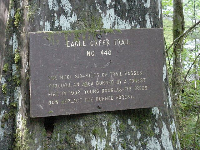
| When they first built this trail, it was before 1920, and so it had been less than 20 years since the fire, mentioned on this sign, burned this area. Now it has been 101 years, and while the trees are smaller in diameter, there is little else to let us know that a fire came through here. (Contrast that with what we saw on hike #5.) | |
| Here you can see the smaller diameter of the trees, but there is no lack of green vegetation. |
|
|
| The height of this bridge doesn't merit handrails. | |
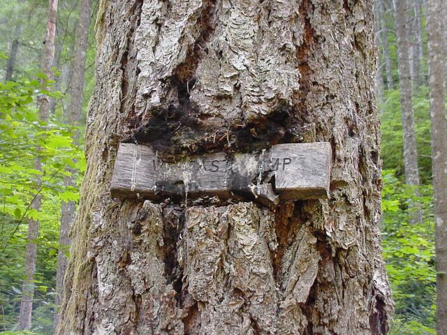
| It looks like this sign has been there awhile, and has seen better days. It is marking the Wy'east Camp, one of only 4 places where camping is allowed before the 7.5 mile point on the trail. |
|
|
| Here is the camp itself. You will see that the accommodations are strictly for the backpacker who is "roughing it." Most of the summer even campfires are not allowed. If you don't bring your own stove, its cold food for dinner. The only thing that is provided are the logs on the ground to separate the campsites from each other. | |
| Dotti smiling pretty! |
|
|
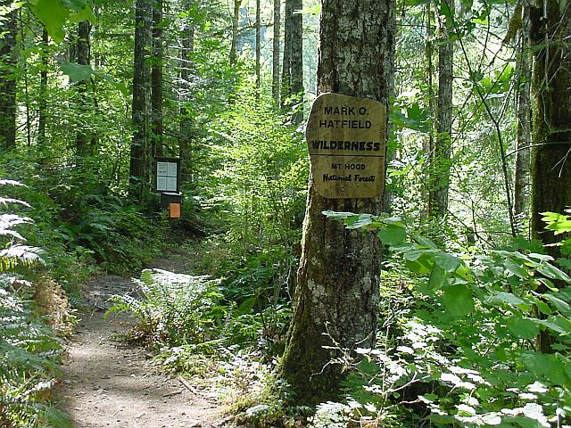
| We are leaving the McCoy Wilderness and entering the Hatfield Wilderness. Well, at least the latter. This is the Mark O. Hatfield Wilderness, portion of the Mt. Hood National Forest. The signboard up ahead has a place for hikers to register and the orange piece of paper says that the fire danger is "Extreme" at this time and no open fires will be permitted. | |
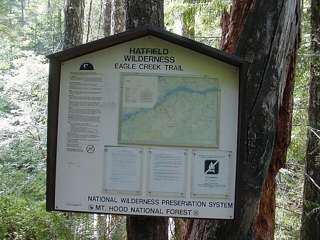
| The Hatfield Wilderness, with map. |
|
|
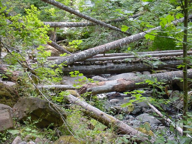
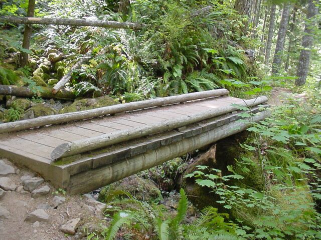
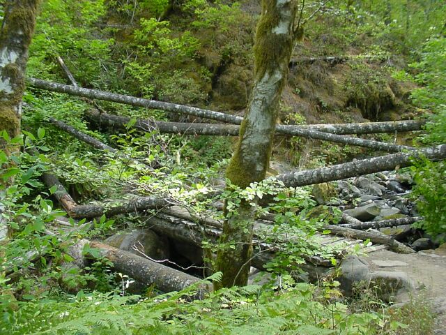
| At first look this appears to be a bunch of fallen logs strewn about. But it is not. There are fallen trees to be sure, but they have fallen around and across the log bridge. It is a full time job keeping these trails up and I think the forest service does a wonderful job on doing just that. This is the first time so far in our hikes that we have come across a bridge in this condition. | |
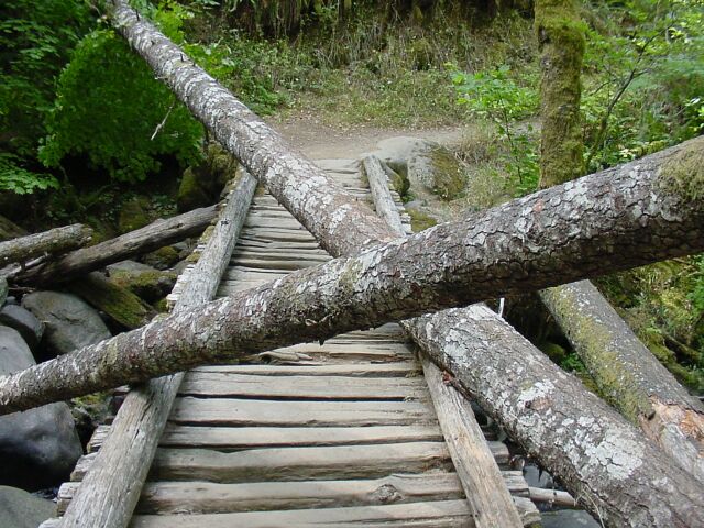
| There are only two logs that actually cross the bridge itself. The others are off to the side. |
|
|
| Here's Dotti crossing the bridge. | |
| Looking back at the bridge from the other side, it is nearly hidden by in the mess. |
|
|

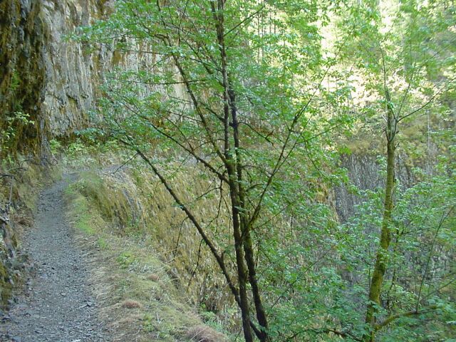
| The trail once again is cut in stone. | |
| Dotti zoomed in on this little waterfall. |
|
|
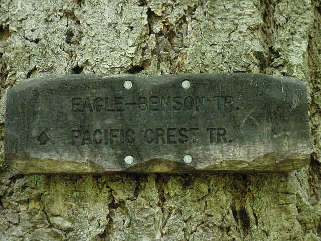
| Here we are at the Pacific Crest Trail once again. We ran into it on Mt. Hood and now we are on it again. | |
| This is the Pacific Crest Trail heading north, up onto the Benson Plateau, and over to the Cascade Locks where it will cross the Columbia River at the Bridge of the Gods. You can just barely tell there is a trail there at all. We will be joining the southern route of this trail for the rest of our hike up to Tunnel Falls. |
|
|
| This tree fell along side of the trail. | |
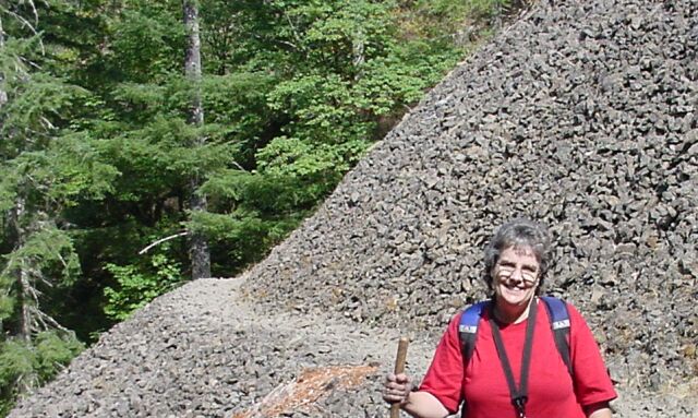
| Another volcanic rock landslide area. This one has a very rough path surface. It, along with several other points along this trail, really beat up the bottoms of our feet. They were quite sore at the end of the day. |

|
|
| Here's Dotti with the rocks behind. It is amazing the amount of rock laying here, as well as the relatively uniform size of the pieces of rock. | |
| This was a tricky bit of trail. The rocks were sticking up at all angles and you had to watch your step so you didn't turn an ankle. |
|
|
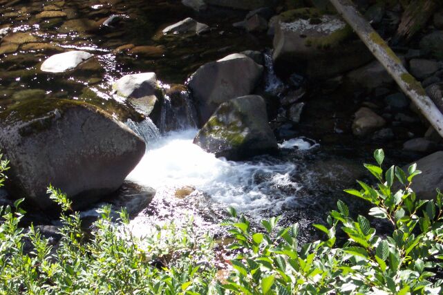
| It is not what you would call a smooth path at this point. In the middle of this picture you can just see a portion of the waterfall that lies behind these rocks. | |
| Looking back at the rock path and the wall that it was cut out of. |
|
|
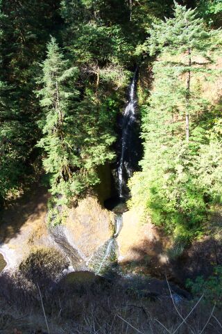
| Here is the waterfall mentioned above. | |
| Dotti with her beautiful smile. The green seems to take on an existence of its own here. |
|
|
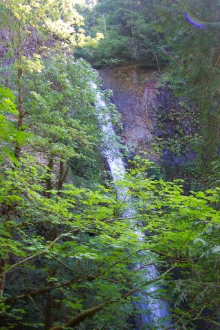
| Our first look at Tunnel Falls. | |
| Here is the base of the falls, with its surrounding walls. |

|
|
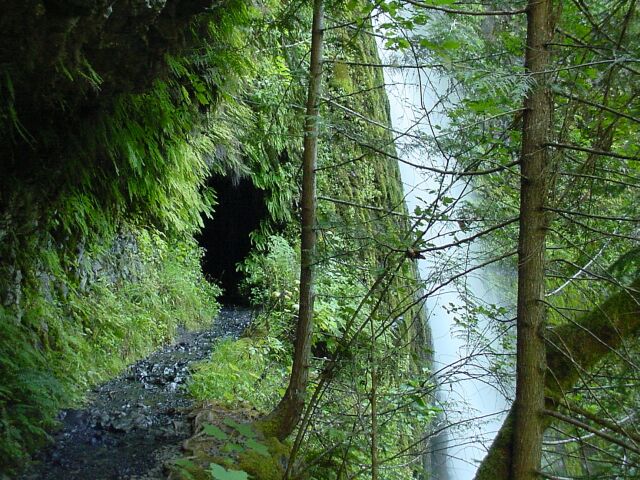
| Coming up to the tunnel which gives the falls its name. The mouth of the tunnel is nearly engulfed in green growth. | |
| Inside the tunnel the walls were dark, and the roof was dripping water, like it was raining inside. It appears that a few of the drops got between the camera and Dotti, and they refracted the light that bounced back from her reflective patches on her backpack, or they just bounced the flash back at me. |

|
|
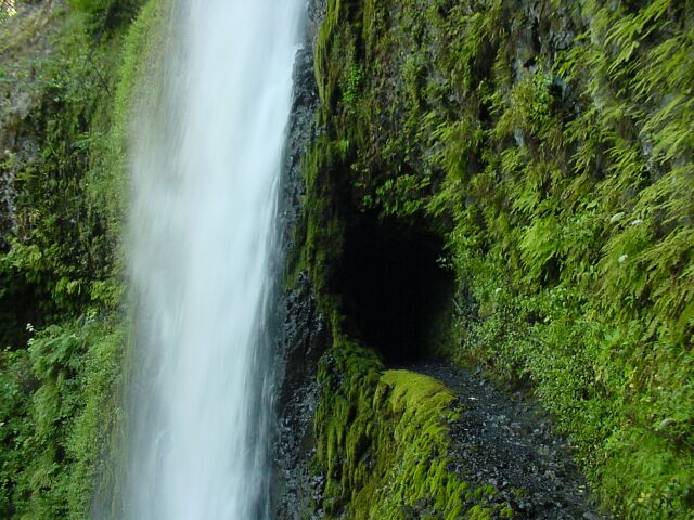
| Coming out the other side of the tunnel. The falls look really close. | |
| I put 3 pictures together to get this shot of the entire 130-feet length of Tunnel Falls. |

|
|
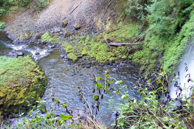
| This is the drop pool for the Tunnel Falls. | |
| This volcanic rock wall stands along side the falls. The surface is rough and has been weathered considerably. |
|
|
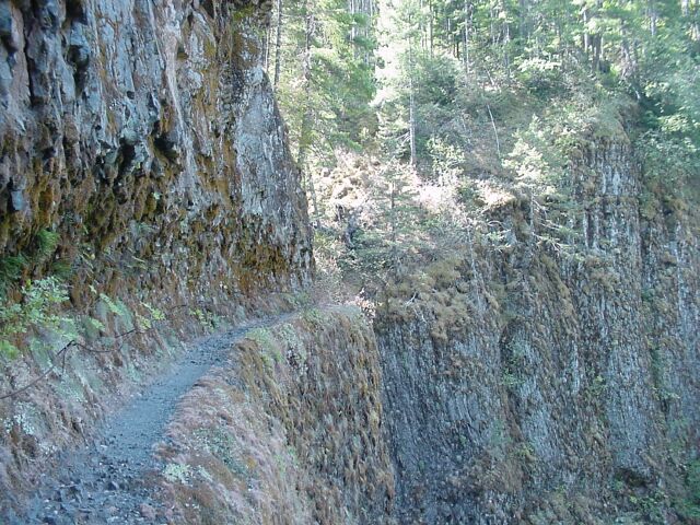
| The path here once again is cut into solid rock, but the rock has been covered with a great deal of growth, thanks to the large supply of water that is delivered to its surface by the falls. | |
| We have turned the corner, and the falls are no longer visible from this point. Stretching off into the distance the rock trail once again makes me think of the trails cut by the dwarves in the Lord of the Rings series of books. This is a tall sheer rock wall, and the trail is cut right into it. |
|
|
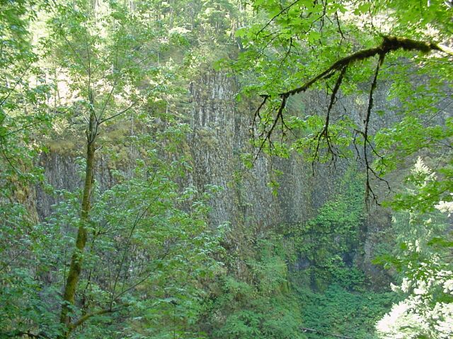
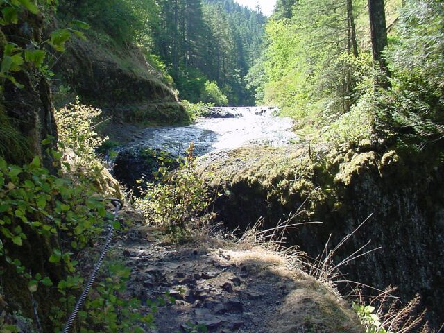
| This is the wall as it continues on the other side of the falls we are coming up to. | |
| Here I am about 6.1 miles into our hike. The trail will be making a left turn at the far right of this picture, and then we will be at the top of our hike. |

|
|
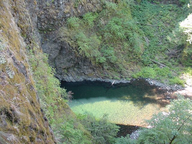
| It almost appears as though this is all one solid wall of stone and that the trail just stops up ahead. But there is a dividing point between the wall where we were and the other side stretching off to the right in this picture. Where the trail appears to end, it merely turns abruptly left, and passes by a beautiful waterfall, and continues on its way. | |
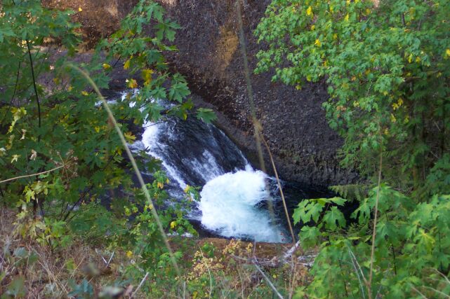
| Looking down from the rock cliff face we can see the drop pool for the unnamed falls. |
|
|
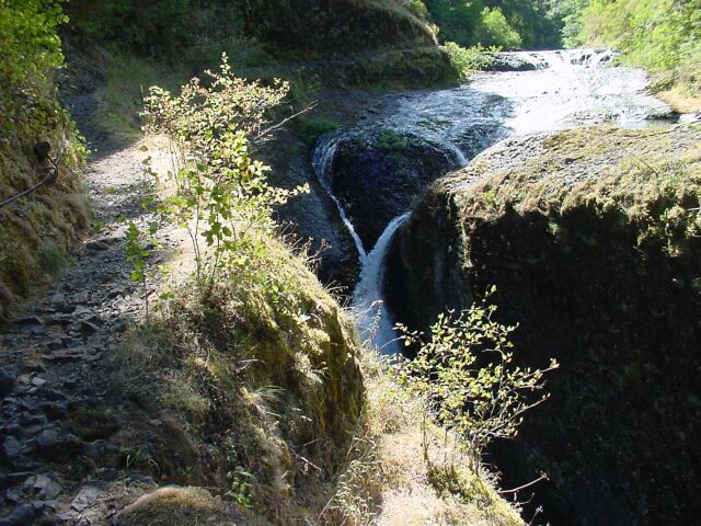
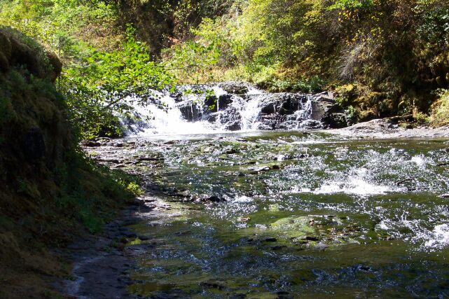
| Here we are making the left turn to see Eagle Creek flowing directly at us. | |
| The creek has been split in two, and the two streams are meeting in a crisscross pattern, before falling the rest of the way to the bottom. |
|
|

| Moving a little closer to the action. | |
| You can see that the streams really do cross each other. |

|
|

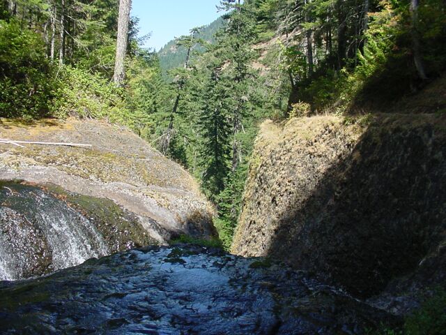
| The view to the bottom. | |
| Looking at the brink of the falls. |
|
|
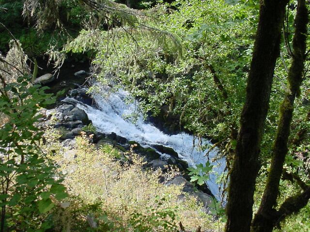
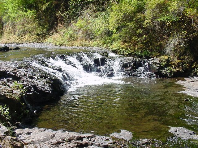
| Upstream there is yet another small falls. | |
| I walked up to get a closer look at the little falls. |
|
|

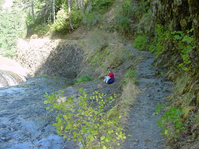
| Looking back you can see the downward trail on the right, Dotti partially hidden by the bush, and the top of the falls on the left. | |
| Dotti is set for our little snack, and I am heading back there myself. |
|
|
| As we were sitting beside the falls, we could see a pool straight across from us. We rested for nearly 10 minutes, and the we headed back down. | |
|
Our walk up had taken almost 4 hours. Our walk down would take just over 2.5 hours. It was a long hike, and we were pretty tired at the end, but it was definitely worth it. |
||