FISH LAKE CREEK TRAIL
Umpqua National Forrest
June 7, 2003
The Coon Family Hiking Club
Official Hike #5
4.0 miles - 1 hours 33 minutes
|
On our fifth CFHC hike we started from Als Moms house in Tiller, Oregon and drove 28 miles and ended up in the Umpqua National Forest. Als Mom had gone to the ranger station nearby and talked with the ranger there, and got some maps and info on hiking trails. The Fish Lake Creek trail was recommended. So, that was the one we chose.
It turned out to be quite different than we had expected. The area had suffered a forest fire during the last fire season, and it felt sort of like walking through a city that had been hit by a nuclear blast, or what the area around the perimeter of the blast zone of St. Helens when she blew must have looked like. There were trees that had suffered differing amounts of fire damage directly. Others had been weakened by the fire, and then had toppled because they succumbed to the erosion of flowing water under their root system because the vegetation that would normally hold it back was burnt away. It was a dismal scene. On top of that, there was a large population of mosquitoes that inhabited the area. Every time we paused for a moment to study the area, or to take a picture, the little bloodsuckers swarmed us. Although we were getting fairly warm by the end of the hike, we left our jackets on until we were back at our car. As we were getting back to the parking area, we came across another hiker who was planning on backpacking in to the lake, to spend the night. We mentioned the mosquitoes, and he said he was prepared for them. Apparently the pests are a regular problem in these parts. He showed us his mosquito repellent (Muskol brand) and he claimed the mosquitoes wouldnt touch him, even though his clothing protection was only shorts and a tee shirt. We are going to look that stuff up the next time we are in a sporting goods store! |
|||
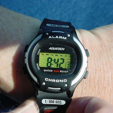
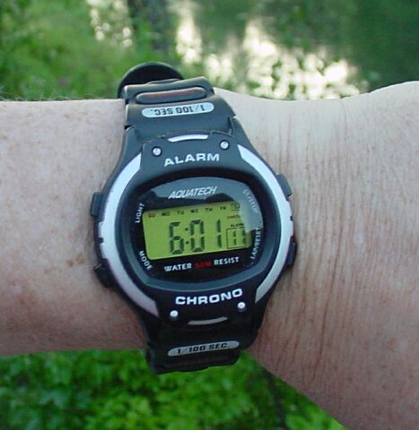 I snapped this picture of my watch, showing 06:01, as we were getting ready to load up the car. We wanted to get an early start because the high temps had been getting up into the 90s and we didnt want to do any heavy hiking in those kinds of temperatures.
|
|||
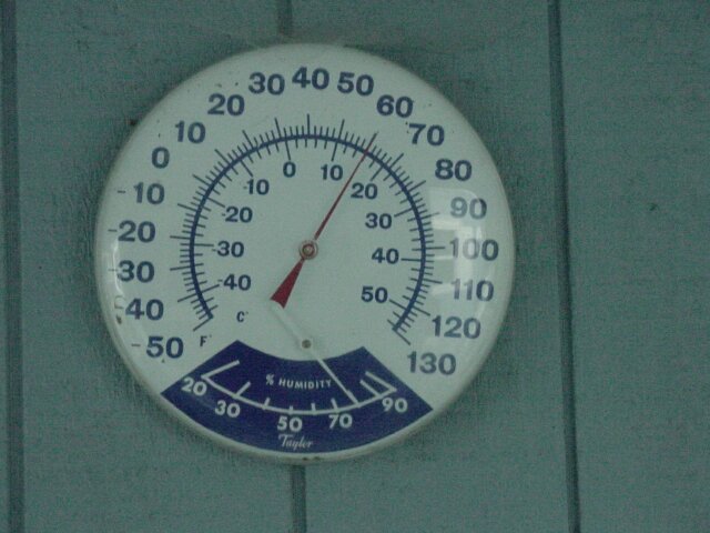 The thermometer said that it was a comfortable 60 degrees as we were heading out on the road.
|
|||
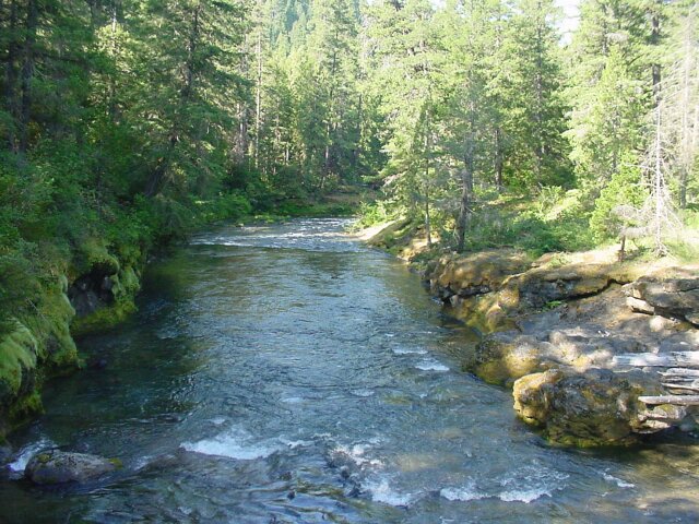
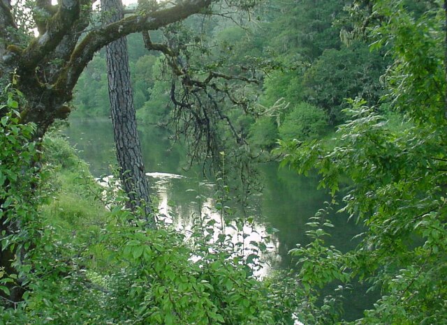 This is the South Umpqua River, and I took this picture before we started, because we would be following this river for most of our driving trip. Also, I think it is one of the prettiest rivers I have seen. It runs past my Moms house, and continues on down beside the road that runs through downtown Tiller, and 7 miles farther downstream it passes Milo Academy, my old high school. (LeRoy also attended that school for a couple of years.)
|
|||
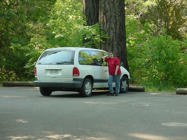
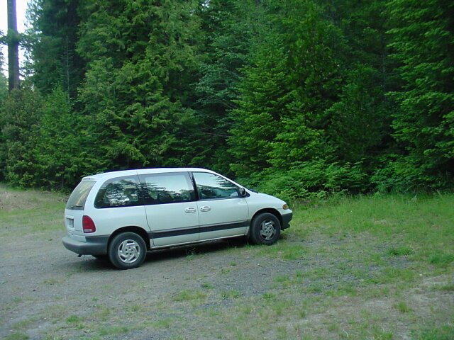 28.0 miles later here our van is parked at the Fish Lake Trailhead.
|
|||
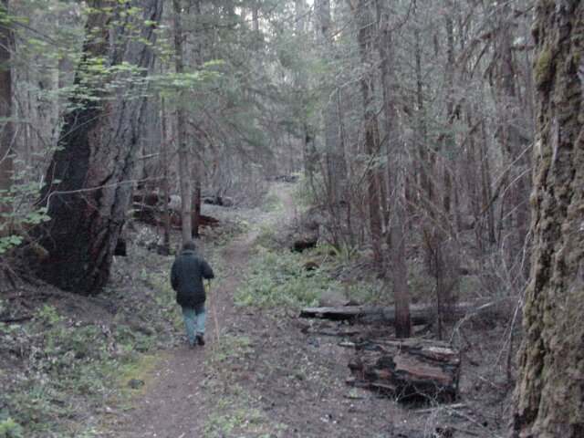
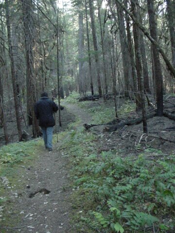
 Dotti is already ahead of me, heading for the start of the trail. In the background the fire damage is beginning to be visible.
|
|||
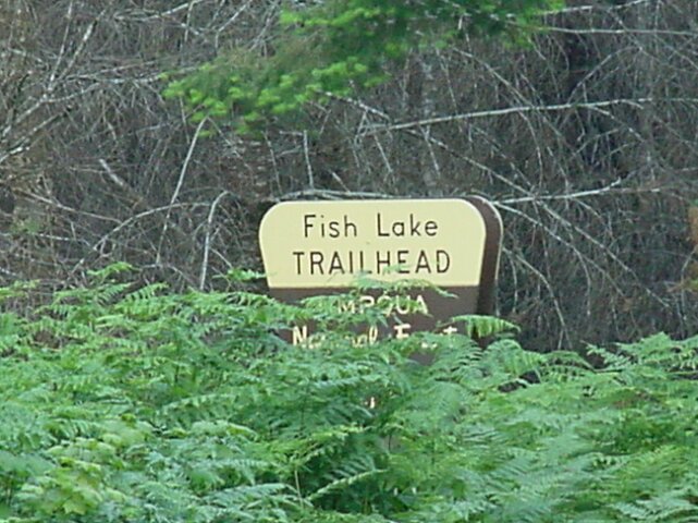 In the opposite direction the Umpqua National Forrest sign for this trailhead was visible, although cloaked by a bush.
|
|||
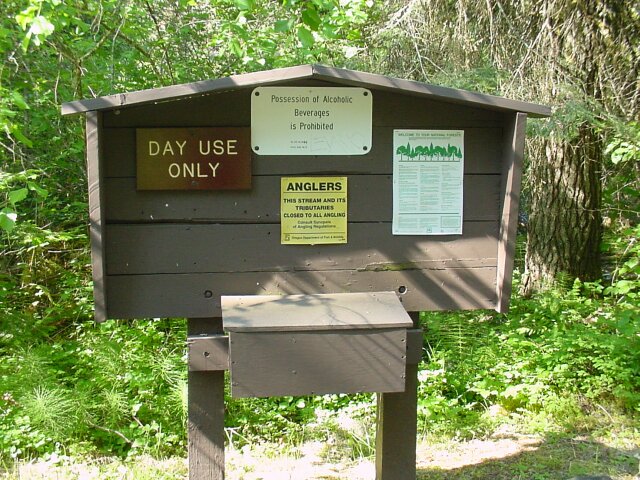
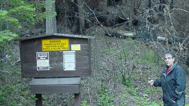 At the start of the trail there was this bulletin board. On it there were rules, recommendations and warnings. At the top was a warning about the burned watershed. We saw the results of that later on the trail. On the left was a request that all hikers register by lifting the lid of the box below, taking a form from a pad of them, filling out the form and dropping it into a collection box inside. The form wanted to know the starting date, and expected ending date of the hike, the number in the party, the destination location, and our zip code. I guess it was in case we didnt come out they would know to send in the dogs after us.
|
|||
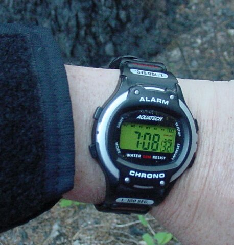 The watch said 07:08 when we started out on the trail.
|
|||
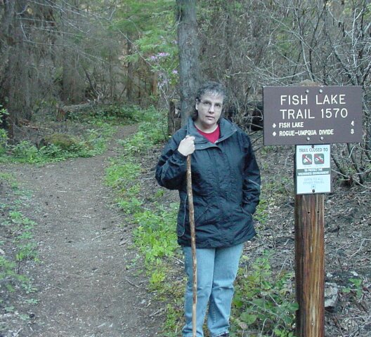 There were two trails we could have taken to go to Fish Lake. This one (1570) is the shorter one, and at this point in our hike, we actually planned to walk the 4 miles to Fish Lake and back. As it turned out, because of the mosquitoes mostly, we only walked half of the way there.
|
|||
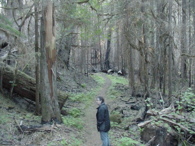
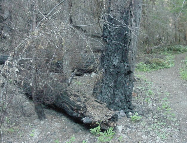 The carbon scaring on the base of this tree was a preview of what was to come all along this trail.
|
|||
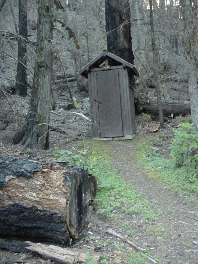 The accommodations were not plush, but they were appreciated.
|
|||
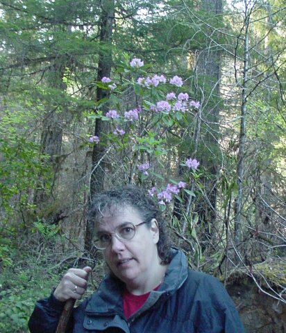 The flowers in the background were a welcome change to the damaged forest we were witnessing all around us.
|
|||
 Trees looking brown and dead, bark ripped from their surfaces, and many of them laying on their sides on the ground pushed into our view at every turn. Compared with the beautiful greenery that we had witnessed during our drive up this was a real shock.
|
|||
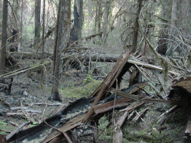 It almost looked like a flood had passed through here. Maybe it did, because of the burnt off water shed. You can see toppled trees, with their branches twisted and broken, all mixed up with burnt out remains scattered everywhere.
|
|||
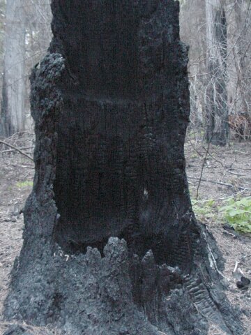
 From the base of this burnt stump, it looks like it may have once supported a very large tree, but no longer. In the background you can see the sun cutting through the trees. Most of this walk we were in shadow. It was still fairly early and we were surrounded by mountainous terrain that blocked the sun. Fortunately, it kept the temperature down for us, so we didnt have to take off our coats in the face of the unrelenting onslaught of the mosquito brigade. Unfortunately, it gave an eerie quality to the photographs.
|
|||
 Trees that were toppled across the trail had been chain sawed up into smaller pieces and moved off the path. The results were reminiscent of the ruins of the great columns of the ancient Greek civilization strewn about that land.
|
|||
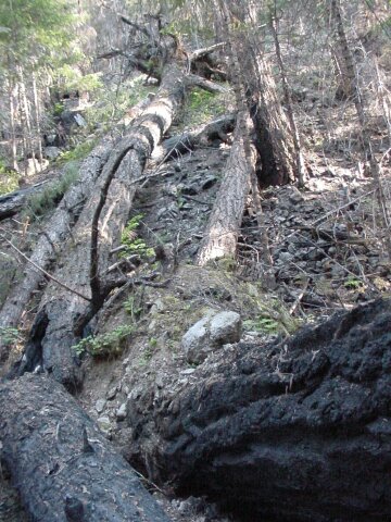
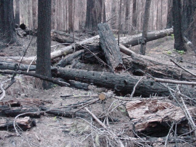 Trees are here lying on their sides, crisscrossing over each other in a jumbled pile. It is difficult to image the beauty that this area must have possessed before the fire ripped its way through.
|
|||
 This giant fell through its smaller brothers on its way to dying end, and then was cut by a saw in order to allow passage along the trail. It is sad to see its denuded branches stickup like legs of a dead insect.
|
|||
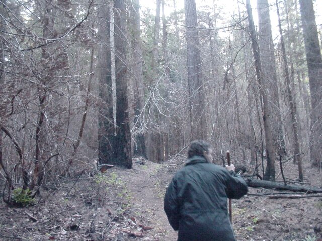
 The sun is cutting through this bleak landscape, as Dotti makes her way ahead.
|
|||
 This bridge reminds us of earlier hikes that we have taken through lush green forestland. Although it is not visible in the picture, the far right corner of the bridge has been burned, and small section is missing. The towering giants around it burned and died, but the bridge managed to survive.
|
|||
 A reminder of the water runoff that occurred as a result of the burnt out watershed.
|
|||
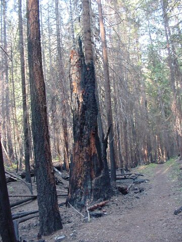
 The carbonized outer shell is all that remains of this tree.
|
|||
 It is difficult to believe, looking at this picture, that there was not a cloud in the sky. If a mountain trail could represent the entirety of life, this would depict a very sad time indeed.
|
|||
 Dotti is looking off to the right where the sound of water is calling to us. At this time, we very much would have loved to see some of the green river growth that we are used to.
|
|||
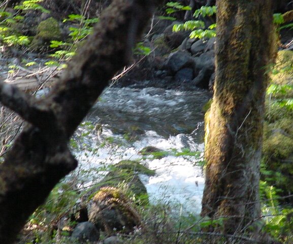
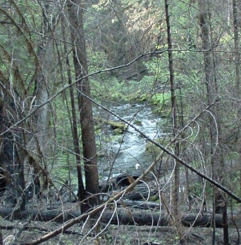 The water is flowing, but even the river has not overcome the fire damage visible in the foreground.
|
|||
 I cant help but be reminded of pictures of bombed out buildings from a war zone looking at these trees. What once was, is no more. What remains is just a sad reminder of what had been. Fortunately, like a city, the forest will be rebuilt in time.
|
|||
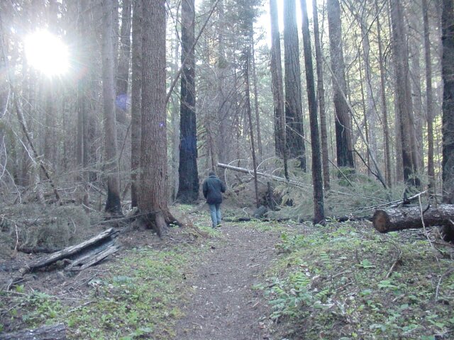
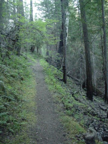
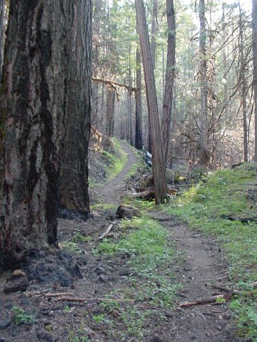
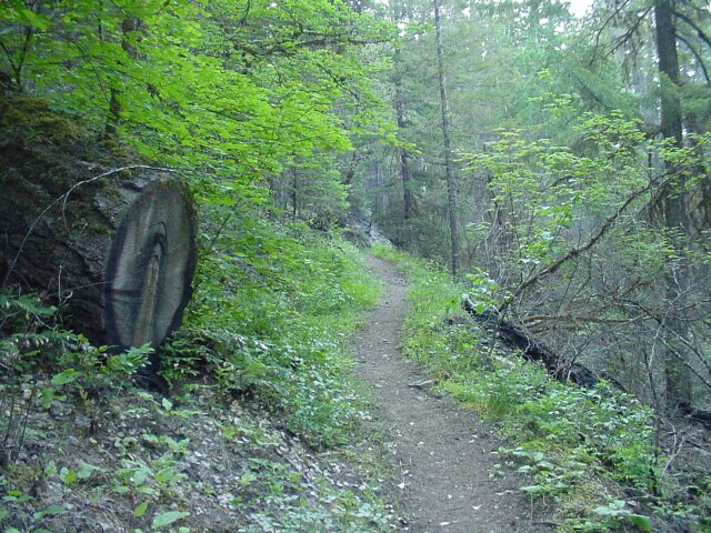 This section of path shows more green and looks less damaged by the fire. However the tree to the left is a reminder of what this forest has gone through.
|
|||
 There was one point along the way when Dotti stopped leading and decided she would rather follow. She came up to place where a huge spider web was blocking the path ahead. Right in the middle of the web, and hence in the middle of the trail, was a very large spider. I think Dotti was still thinking about that spider when I snapped this picture.
|
|||
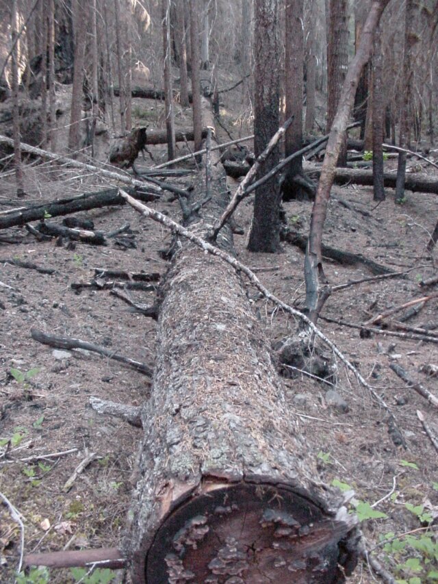
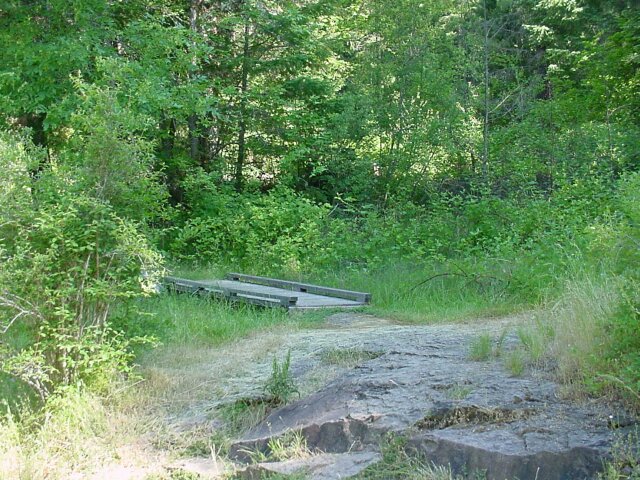
 This tree had fallen across the creek before the fire I believe. However, the fire did run along the top of the tree as it lay there. It still forms a bridge across the creek, but we didnt walk it.
|
|||
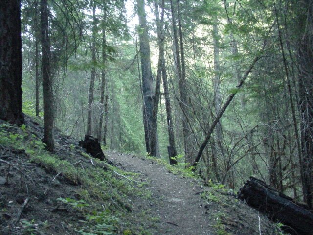
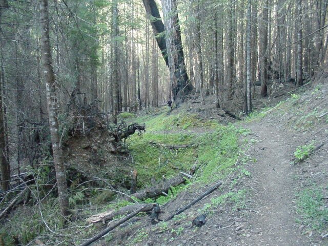
 We are seeing some greenery here. The fire seemed to go through areas and arbitrarily consume some things, lightly touch others, and completely miss others. To the right you see some fire damage, but to the left it looks relatively untouched.
|
|||
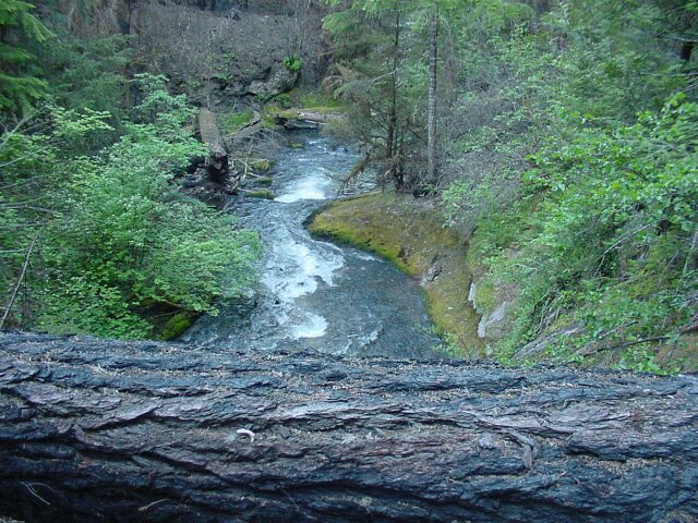
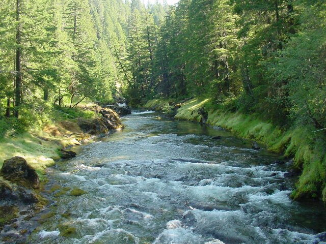
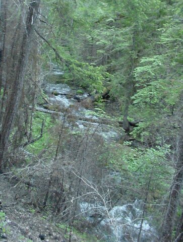 Another shot of Fish Lake Creek. The foreground looks damaged while the background looks like it is still in good shape.
|
|||
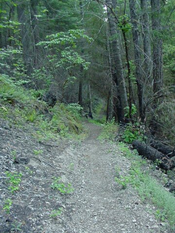
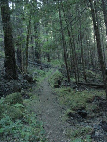
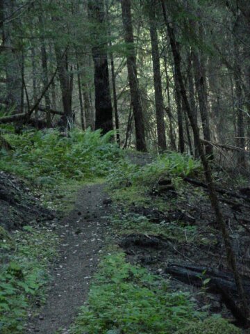
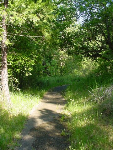
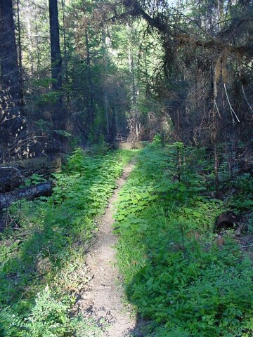 A green path through the damaged landscape.
|
|||
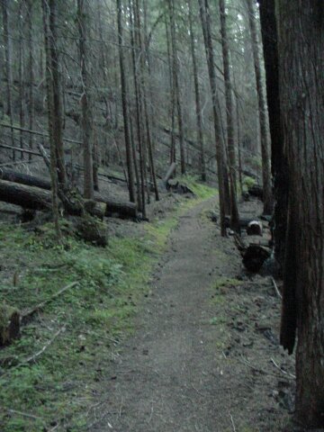 A dark and desolate path.
|
|||
 Dotti making her way though the gray terrain.
|
|||
 This shot includes a small creek, a burnt tree stump, and some greenery that survived the fire.
|
|||
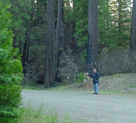
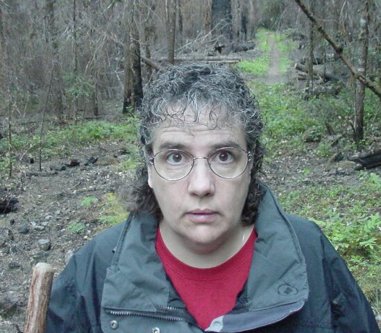
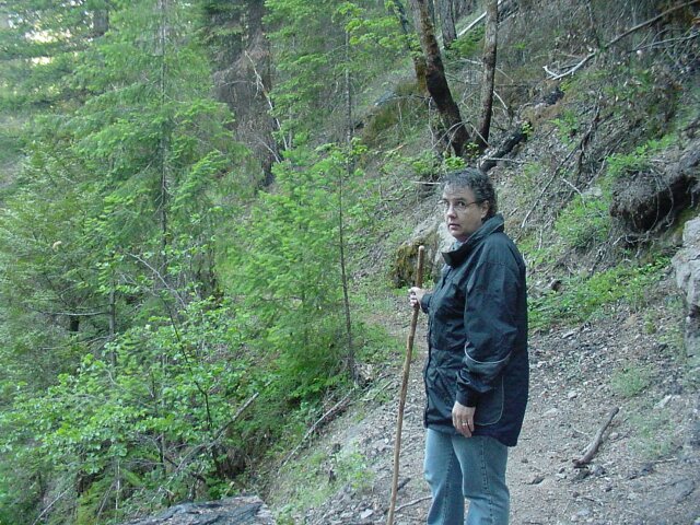
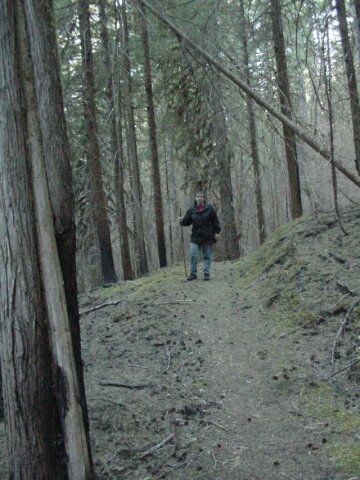
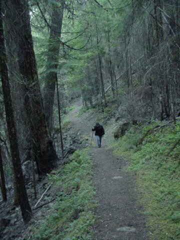
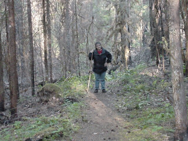
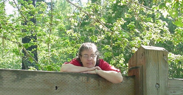
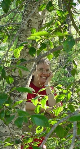
 Taking a moment to brave the mosquitoes and posing for a picture. (In case you were wondering, Al did make this trip. He was just behind the camera most of the time.)
|
|||
 The trail has a small amount of green on both sides of it at the grass level, and some greenery on the left even climbing into the air a bit.
|
|||
 Dotti is working her way through the mixed terrain of green and gray.
|
|||
 A green branch hangs in front of a couple of burnt hulks.
|
|||
 A curve in the trail that, before the fire, would have been quite beautiful I am sure.
|
|||
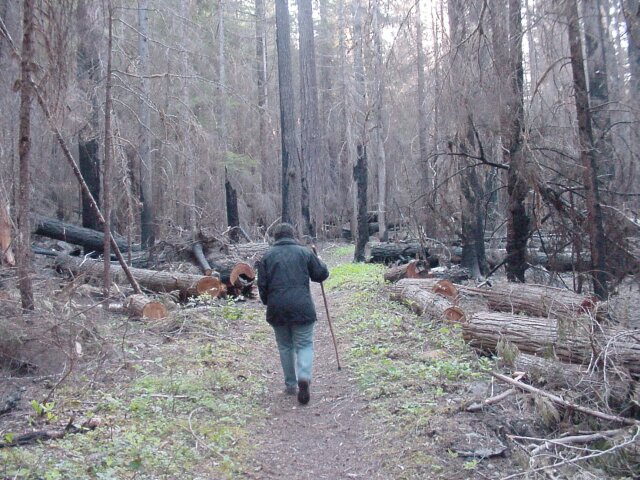
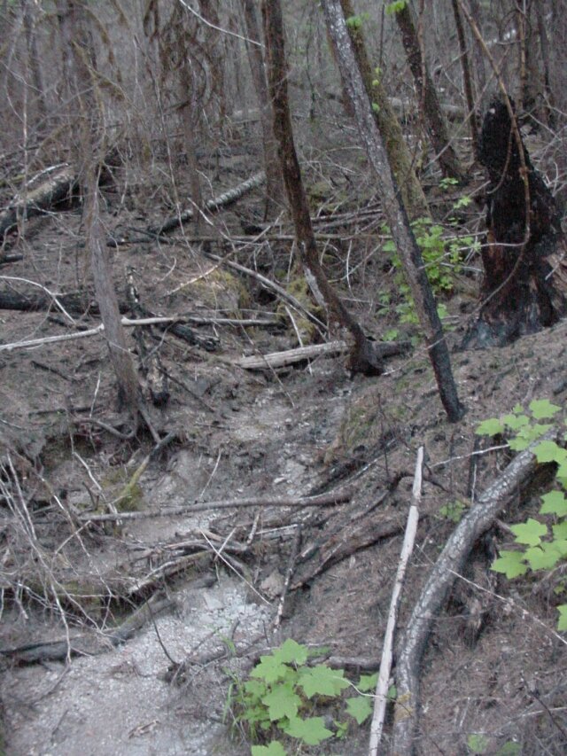
 Struggling back, the path is here passing through an area of forest that is showing some signs of recovery.
|
|||
 Abandon all hope ye who enter here...
|
|||
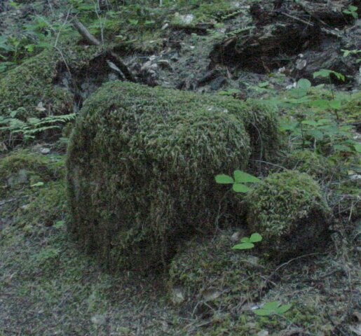 This rock is covered in moss, and gives a clue to how wet and green this area used to be.
|
|||
 The trail continues on, and the fire damage continues to show its black mark, though not as strongly at this point as in some of the earlier photos.
|
|||
 Dotti stopping for a moment with two large trees framing her.
|
|||
 Another shot of green and gray, with some black thrown in.
|
|||
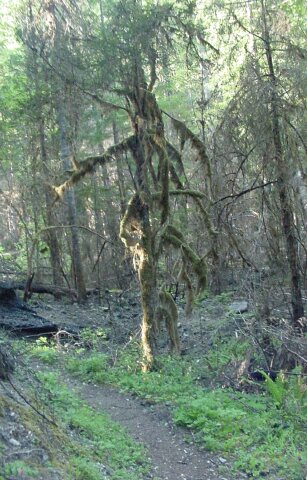 This tree is standing there covered in growth, that we have seen in other forests, where the lush growth is running wild. It is another indicator of what this forest looked like before the fire.
|
|||
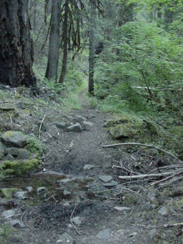
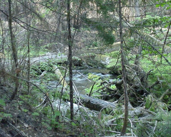 The creek is still running along our path.
|
|||
 The scenery around her has not improved much, but here Dotti is brightening the forest up with her beautiful smile.
|
|||
 A shot of Fish Lake Creek that could have been taken before the fire.
|
|||
 Once again we are faced with burnt and fallen giants.
|
|||
 As the trail continues, so does the damage done by the fire.
|
|||
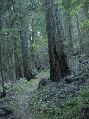
 Looking back at Dotti, way off in the distance. There are two large fire damaged trees between her and I at this time. The tree trunks in this area look like dead hulks with very little green to brighten their branches.
|
|||
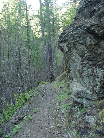 A rock wall juts out into the trail, which curves submissively around it.
|
|||
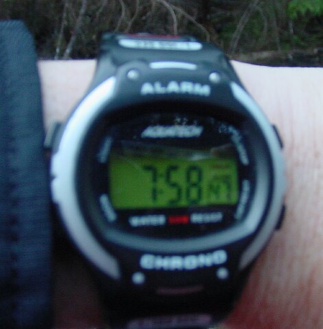 Its about time! It was 07:58 when the 2 mile mark, or halfway point, was reached.
|
|||
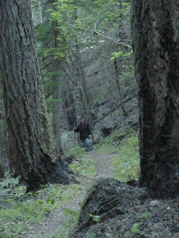
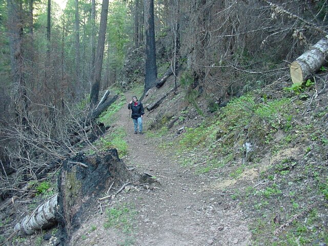 Here comes Dotti on the last leg of the first half of the hike. The stump in the foreground marks the 2-mile point. (As indicated by my trusty, and recently calibrated, pedometer.)
|
|||
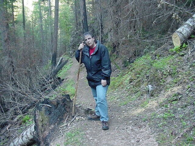 Success! Two miles completed. Doesnt Dotti look happy? Well, it has been nearly all uphill to this point.
|
|||
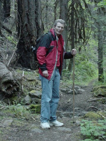
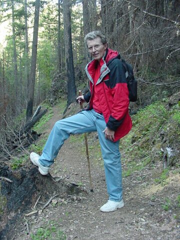 Al at the top, or at least as high as he was going to go on this day. It may have been all uphill to get here, but guess what? It is all down hill from here!
|
|||
 I had Dotti snap this picture when we were back in the car. Between the last watch shot and this one, we stopped to take pictures at the top, took, a restroom stop, and visited with another hiker who was heading up to go camping. So, of the 44 minutes that are registered here, probably only around 30 of them were actually done walking. At the 2-mile point, I put the camera into my backpack, and we were stepping out all the way. We were getting warm in our coats, but we were not going to let the mosquitoes feed on us all the way down. I set my stopwatch at the beginning of the walk and when we got back it had been 1:33:19 since we started. So, we left the coats on and made good time. This was the end of the hike, but not of the trip...
|
|||
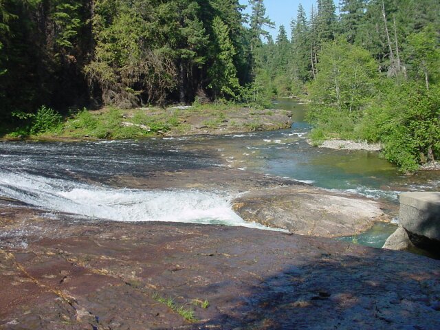
 Driving out from the Fish Lake Creek trailhead, we had to cross a bridge. Since hadnt seen a single car on the back road we were on (other than the one the other hiker was unloading his stuff from in the parking lot at the trailhead) we just stopped on the one lane bridge and shot some pictures. This one was taken by Al out the drivers side of the downstream view. Note the lack of burnt trees. How refreshing!
|
|||
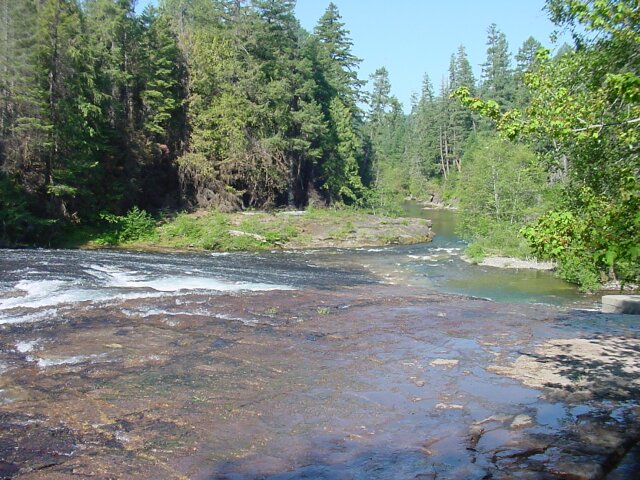
 Dotti took this photo of the upstream view from the bridge. Absolutely beautiful!
|
|||
South Umpqua Falls
On the road heading back was the turnout for one of the prime attractions of the area. Ever since my high school days people have made their way to the falls to go swimming on hot days. As kids they begged their parents to take them to the falls, and as parents they take their kids to the falls. By what they meant was the South Umpqua Falls.
|
|||
 All around the falls area are trails and picnic tables.
|
|||
 The woods are thick with growth, and the paths work their way into all sorts of beautiful situations.
|
|||
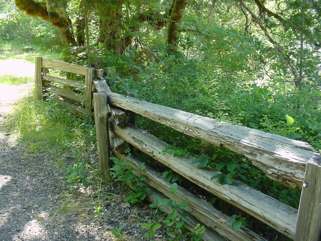
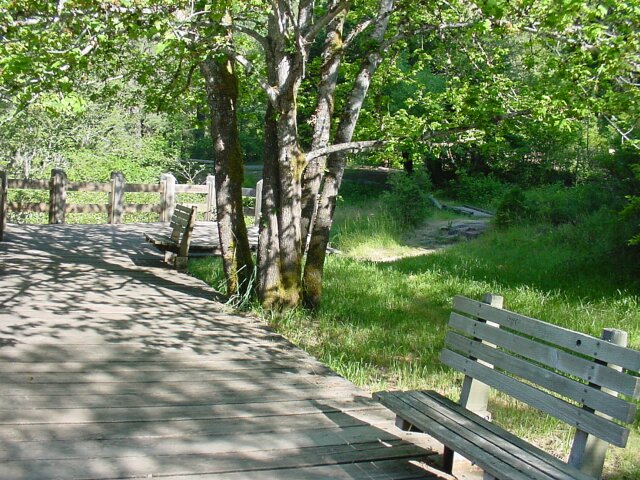 There are wooden fences, well kept paths and plenty of green.
|
|||
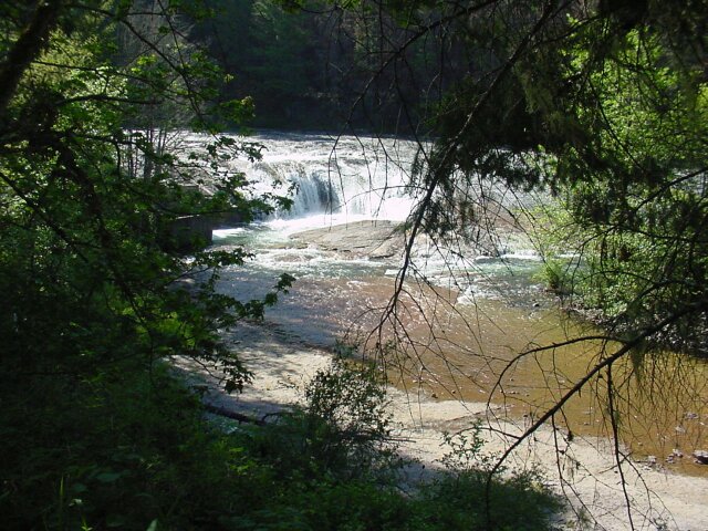
 This is the view of the falls from the platform. Notice that there are no other people than us at the falls. This is because it is not even 09:00 yet. The water is cold and the air temperature is still just comfortable for tee-shirts. In a couple of hours the place will be jumping with kids and parents having a ball and keeping cool in the 90 degree weather.
|
|||
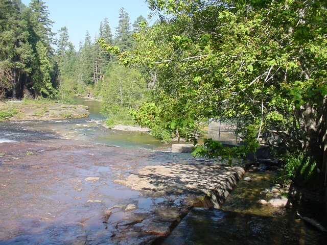
 These falls are interesting because the South Umpqua River flows over a rock formation at this point. On the far side of the river, the rock is almost completely smooth. There are some light rapids but nothing much. Just to the right of center on this picture are the actual falls. The water falls a few feet into a little pool and then continues on its way. At the center, and to the bottom of the picture, you see that the water is very shallow, just skimming across the rock in a thin sheet. When I jumped out onto that rock (which will be completely dry later in the summer when the river is lower) I had to be very careful to avoid hydroplaning on the water, but I didnt have to worry much about soaking my feet, because the water is so shallow at that point.
|
|||
 Here I am standing in the water, but my shoes are nearly dry anyway. Dotti is looking over the fence at her silly husband who is walking in the water.
|
|||
 The falls are right in front of me here. Notice at the far left, about a third of the way up. You can see the scooting thin sheet of water turning white as it hits a rough spot in the rock.
|
|||
 This is a little alternate falls on the close (north) side of the river. At the bottom of the picture the water is running in a sheet so thin that it looks as if the rock is just wet rather than carrying running water over it.
|
|||
 Here I caught a sneak peek of Dotti peeking at me through the trees.
|
|||
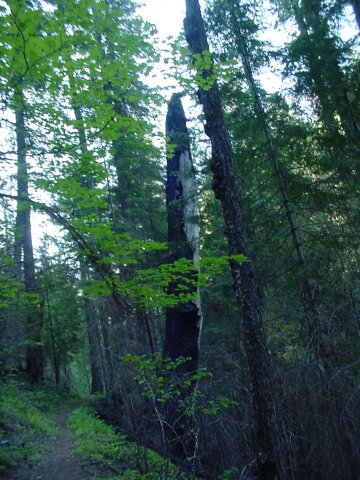
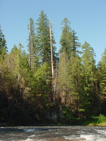 This is a shot looking directly across the river at the stand of trees on the other side. The middle white one, dead but standing in stark contrast to the green one right behind it, and to either side, was the reason that I snapped the picture. To the left there is another dead one, but it is black in color and harder to see against the dark background.
|
|||
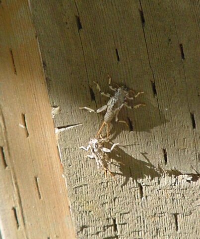 Dotti spotted these nasty looking insects, which were about an inch long. The way they moved, it was hard to tell if they were lizards or bugs. But when we got a good view, there was no doubt as to which they were. May they rest in peace.
|
|||
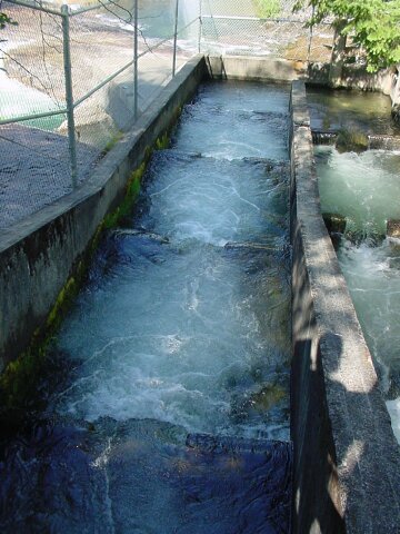 This is the upper level of the fish ladder that was put in place to help the migrating fish traverse the falls. The water from above the falls runs into this section from a channel that runs directly underneath the wooden viewing platform where we were standing. It then runs down the ladder to the U-turn at the bottom...
|
|||
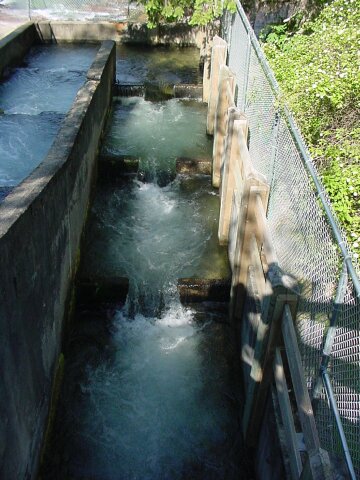 It then continues down this side of the ladder and into the lower channel through an opening at the bottom left of this photo. That lower channel is routed out underneath the upper portion of the ladder and out into the river past the falls.
|
|||
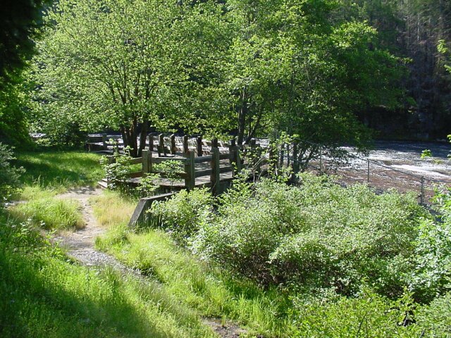
 Remember that bridge in the burnt out forest? One day it will look like this again!
|
|||
 I walked around on a picture taking mission. Our van is the only vehicle in the parking lot. (If you look closely you can see Dottis red tee-shirt through the rear windows. To the right are the restrooms.
|
|||
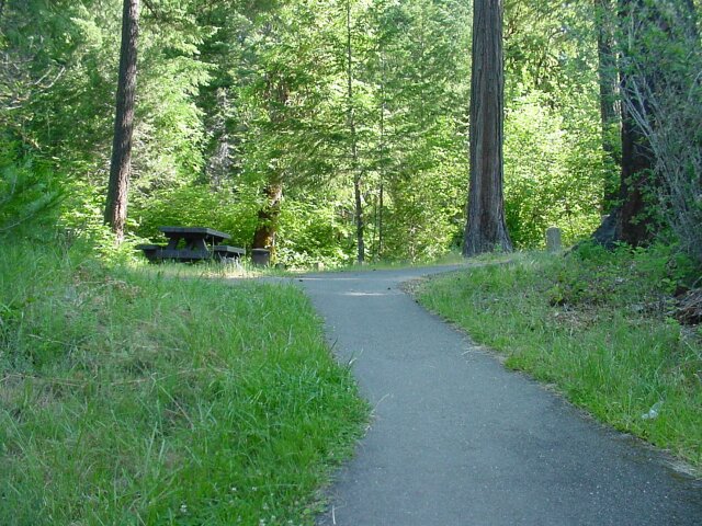
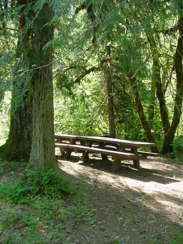 One of the many picnic tables in the area.
|
|||
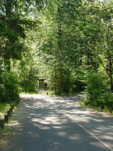
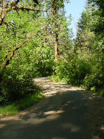 This is the exit road from the parking lot. The heavy growth around it is beautiful!
|
|||
 Here is Dotti patiently waiting, because I forgot to unlock the van. Oops. (Sorry Dotti!)
|
|||
 Another bulletin board with the rules and warnings.
|
|||
 The wooden fence really blends in well with the environment here.
|
|||
 Looking back upriver at the South Umpqua Falls.
|
|||
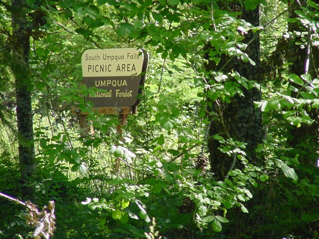 The official South Umpqua Falls Picnic Area sign.
|
|||
 Looking back at the viewing platform. The fish ladder is right behind the bush in the foreground, and its upper section is fed by a channel that runs right under this viewing platform.
|
|||
 On last look at the road leading into the parking area for the falls. (The van is just around the corner on the right.)
|
|||
|
|||
|
Although the hike ended up being shorter than planned, it still was a good walk, and we saw some things that were unusual. Dotti and I had fun, and we were happy that we had the chance to end by visiting the falls because the scenic beauty was saw there, was what we love the most about our hikes normally. We would have felt a bit deprived if we had not stopped there. Next week it is back to the Portland area for our CFHC hike. |