WAHKEENA FALLS LOOP
July 5, 2003
The Coon Family Hiking Club
Official Hike #10
6.0 miles - 3 hours 58 minutes
|
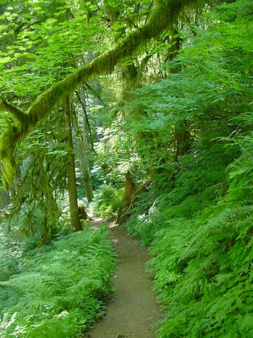
This past week we walked up to Angel's Rest, which gave us a good workout. Then we walked 9 miles in Lincoln City along the shoreline, and that one really wore us out. So, this week, we wanted to try to hold the length of our hike down to 6 miles or less, just so we could recuperate. Today's hike did meet the distance requirement, however the change in elevation added a difficulty factor to the mix. About halfway into the climb Dotti ask me with a laugh, what good it was going to do if we hold the distance down to 5 miles but then climbed enough to make it feel like 10? She definitely had a point, because there were a couple of places, especially early on, where that is exactly how it felt. The nice thing was that after we did our initial climb of about 400 feet, things eased off a bit, and from then on, it was a steady climb, with some fairly level spots. Once we hit the top, the climbing was pretty much at an end, and the rest of the walk felt pretty easy.
One author I read said that anytime he has hiking friends come to visit, who have never been to Oregon before, this hike is the one that he takes them on. We can tell you that he made a wise choice! This hike has it all, from steep trails, a wide ranged of beautiful vegetation, the tallest waterfall in Oregon, along with many more waterfalls along the way, running streams, and panoramic vistas. In my book this is the best hike so far. (Maybe that is why we took so many pictures.) |
||
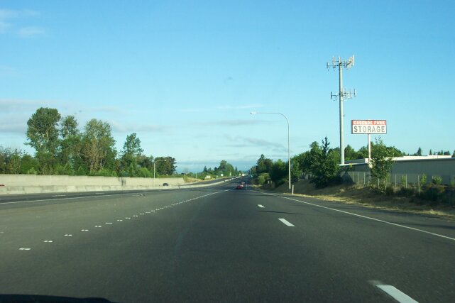
| When we got onto the highway, the sky was blue and the sun was shining brightly, even though it was only a little after 7:00 AM. It looked like we were going to have great weather for the walk, as long as we didn't run too late and let it get too hot for us. | |
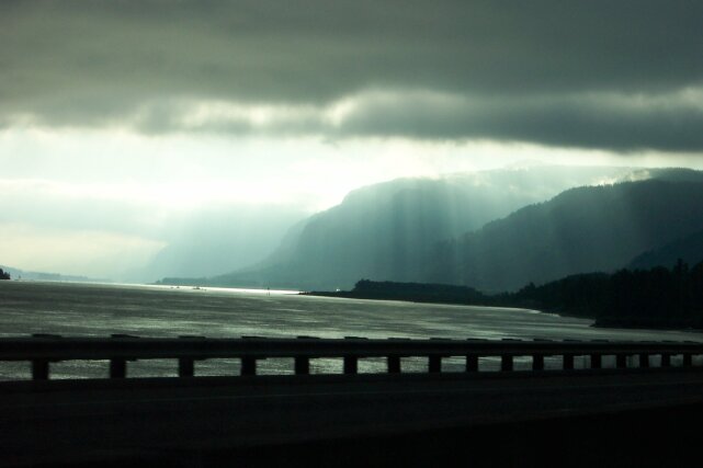
| Then, heading out Interstate 84, we suddenly were confronted with the possibility that we might be walking in the rain again. We were ready for it if it turned out that way. However, we didn't have a single drop of rain fall on us during our hike. The sun cutting through the clouds up the Columbia Gorge from us gives an eerie feel to the river. |
|
|

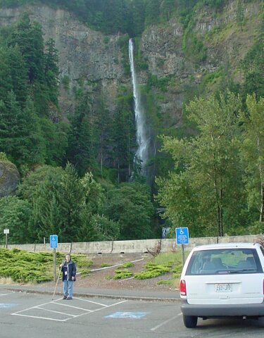
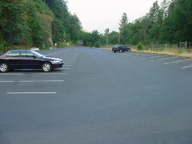
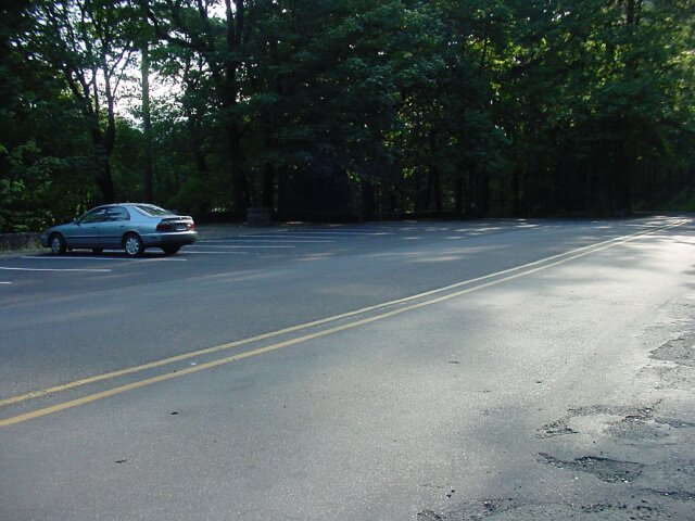
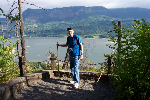
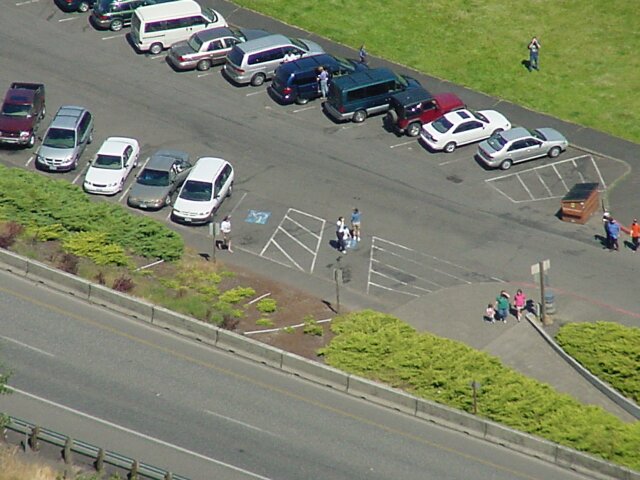
| Here we are in the Multnomah Falls parking lot off the freeway. To properly appreciate what is going here, you have to remember that this is the Forth of July weekend, on a Saturday. The weather forecast is for a high of 80, and we are at the primary outdoor tourist attraction in the State of Oregon. Later in the day there would be no empty parking spaces in this lot, and cars would be parked all along the curbs and even in places that they shouldn't even park. But right now, we just pulled right in to the very closest non-handicapped parking space to the falls in this lot and there are only two other cars in the entire lot, and you can see them behind me here. The reason for this situation is that it not quite 7:30 AM yet. It wasn't like this when we got back 4 hours later! | |
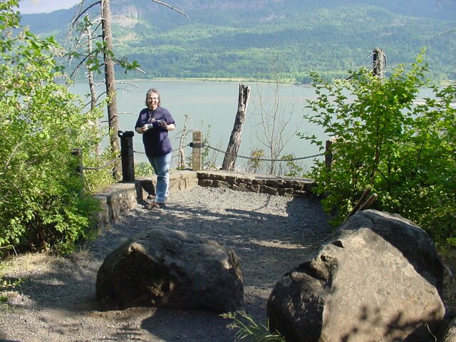
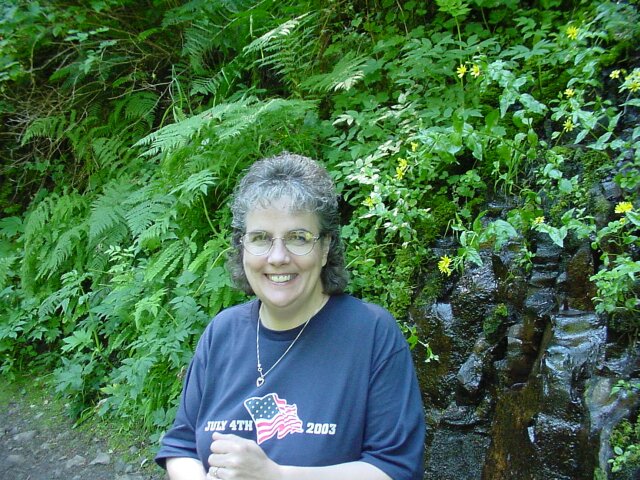
| Here's Dotti, with Multnomah Falls in the background. (We have some especially nice memories for these falls. We came here in 1974 for our very first date. We came to the falls with our dear friends Jim and Tammy last year, when unfortunately Dotti's knee was hurt, and in 2003 we had a large group of the DWLZ 3rd Conference attendees come here for our Saturday outing.) We both have our coats on for the start of the walk. The temperature is around 60 and there is a bit of a breeze. Later I will be taking a picture from the top of those falls of this spot, but that is getting ahead of my story. |
|
|
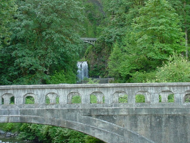
| We walked through the pedestrian underpass and the train bridge, coming out to this view of the lower falls and Benson Bridge across them. | |
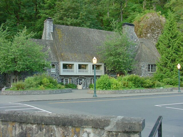
| A big CLOSED sign hands in the window of the Multnomah Falls Lodge, and the only other soul we saw outside of the lodge or around the grounds was a janitor moving a trashcan. We essentially had the place to ourselves. |
|
|
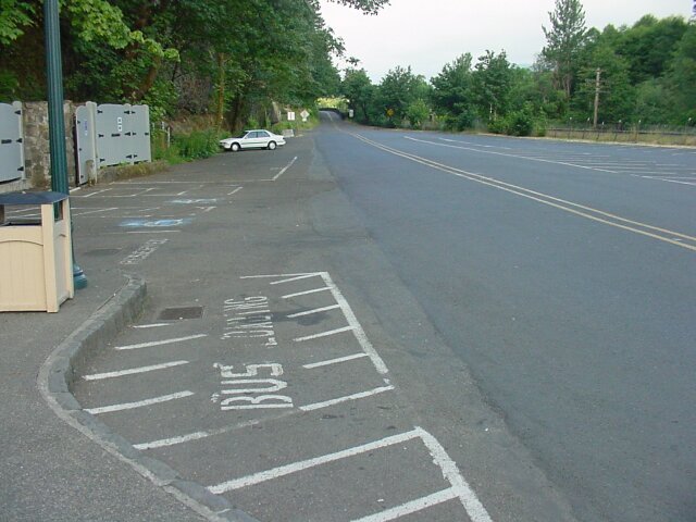
| This is the parking lot for the Columbia Highway access to the falls. Two cars on this side of the road and one on the other is all we could see. This lot will be packed later on. But for now, we were enjoying the solitude. | |
| Taking one last look at the falls for a few hours. You can see the wind catching the water as it drops. The flow is significantly less than it was in early May. |
|
|
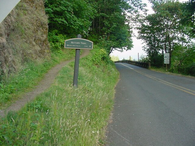
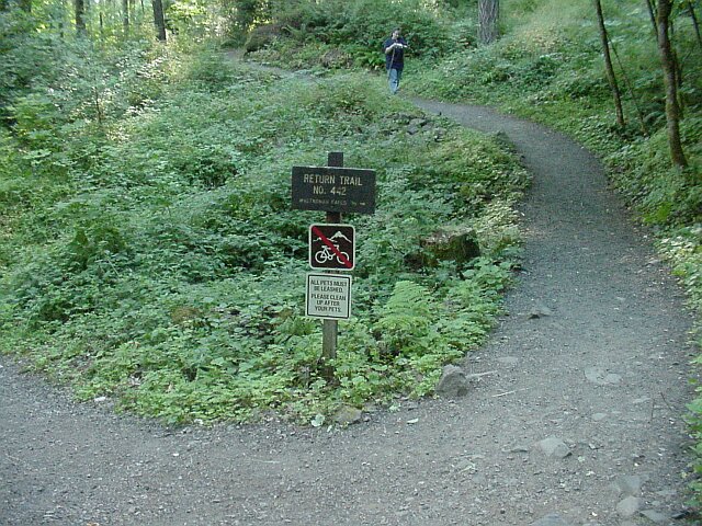
| This time out we did something that we had not tried before. Instead of heading up the path to Multnomah Falls, we turned right and passed in front of the lodge, and headed west for about 100 yards to pickup what is called the Return Trail. | |
| Here at the trailhead of the Return Trail stands a sign between the trail and the Columbia Highway which the trail parallels the entire half mile of its length. |
|
|
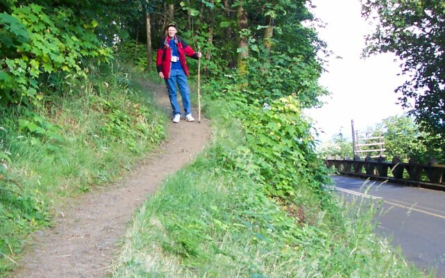
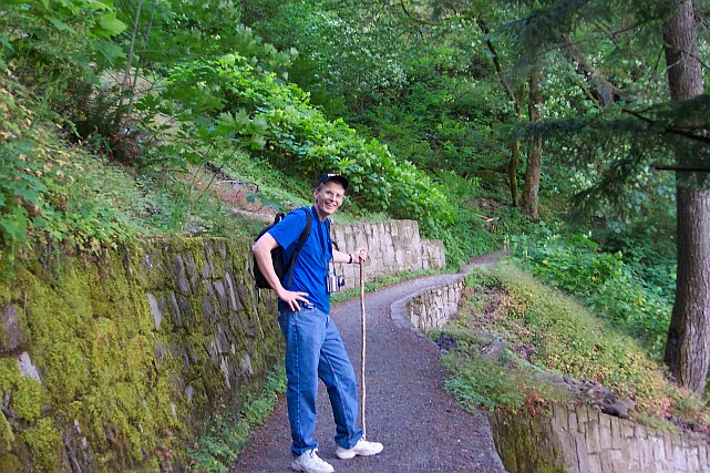
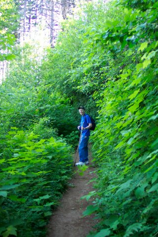
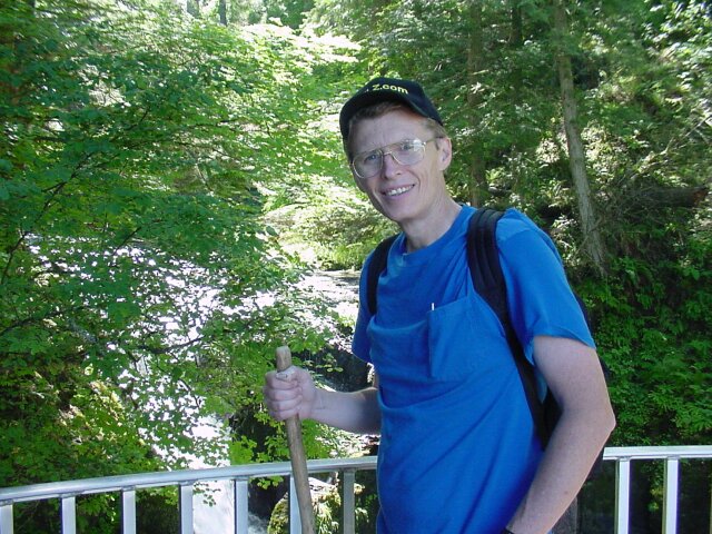
| Here I am just as we are getting our shoes dusty for the first time today. | |
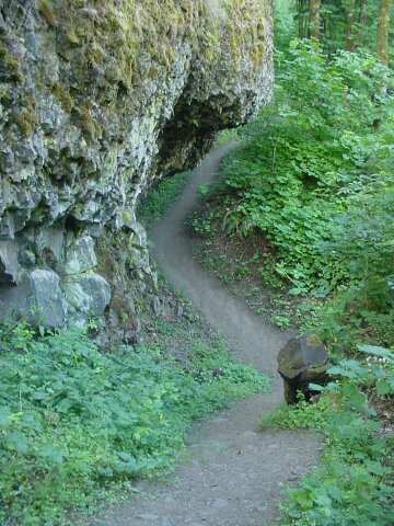
| Almost immediately we are treated to a geological treat. Here stands a volcanic basalt wall that has had its base excavated out, forming a cave. Judging from the cave itself, and the dry stream bed heading off to the north, from the trail, I have to guess that there is a seasonal waterfall that flows over this rock precipice during the winter months. This would supply the water needed to eat away at the rock and form the cave, as we have seen on other hikes we have gone on. |
|
|
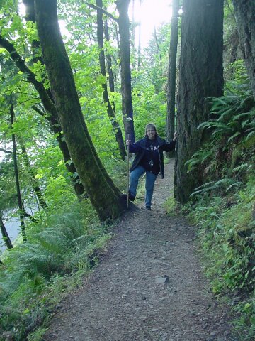
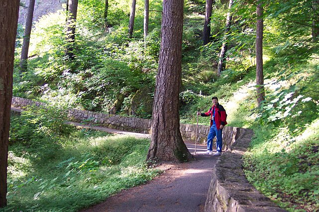
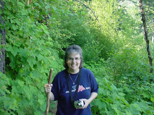
| Here is my lovely lady, still wearing her coat. The tree on the left seems to have had a little too much to drink, but the one on the right is standing sober, straight, and true. This trail is part of the Wahkeena Loop hike that we will be taking. The loop can be started from either Multnomah Falls, or Wahkeena Falls, and this trail makes the connection between the falls for either case. | |
| We are running right along with the road, and the railroad track. |
|
|
| On the other end of the Return Trail looking east back towards Multnomah Falls, now a half mile away. Dotti is adjusting a setting on her camera as she is walking towards us. | |
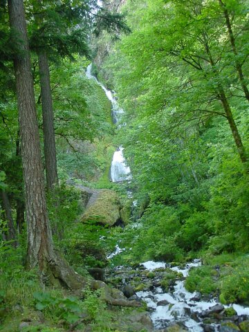
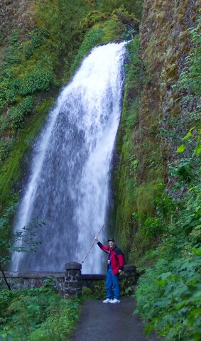
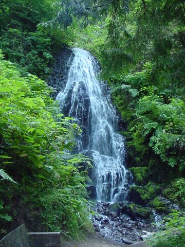
| Wahkeena Falls. We will be going up to the bridge you can see crossing Wahkeena Creek about a third of the way up this picture. |
|
|
| Once again, I had to point out the empty parking lot. Later in the day, this lot will be jammed, but now we have the place pretty much to ourselves. From the time we started our walk until we were nearly a third of the way through our hike we didn't see a single other hiker. By the halfway point we had seen 3 other people. Just before we reached the upper Multnomah Falls viewing trail, we had still only see 6 other people on the trail, and that was after 3 hours of hiking! Of course the last 45 minutes or so, we had to work our way through maybe a hundred or more, mostly from Benson Bridge on down. But by that time, we on the downward trail, and it was fairly easy sailing in spite of the crowd. | |
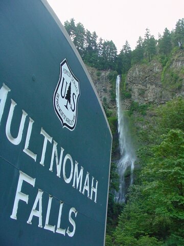
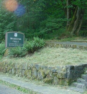
| The official sign of Wahkeena Falls. |
|
|
| Here is my lovely Dotti on the bridge over the Wahkeena Creek. | |
| Just west of the bridge stands this sign. We are going to walk past the falls, and Perdition Trail (which is a shorter path over to Multnomah Falls, but which is currently closed anyway), and all the way to the Larch Mt. Trail, three miles away, before turning north and heading down to Multnomah Falls and our car. (See map at the bottom of this page.) I say down, because we climbed up to well over 1600 feet above the parking lot, and the highest point on the Multnomah Falls trail is only half that. So, for elevation change, this hike is Multnomah Falls times two. For length, after our various side excursions and so forth, it was Multnomah Falls times five. |

|
|
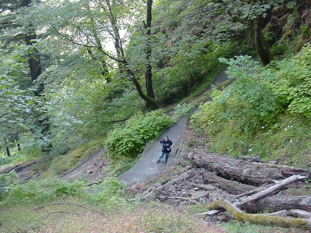
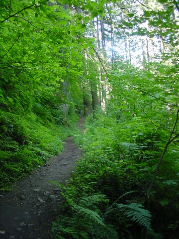
| Here we are on the Wahkeena Trail (Official Trail #420). At this point we are less than 100 feet above the parking lot. | |
| The trail to the bridge across the creek is asphalted, as well as surround by beautiful scenery. |
|
|
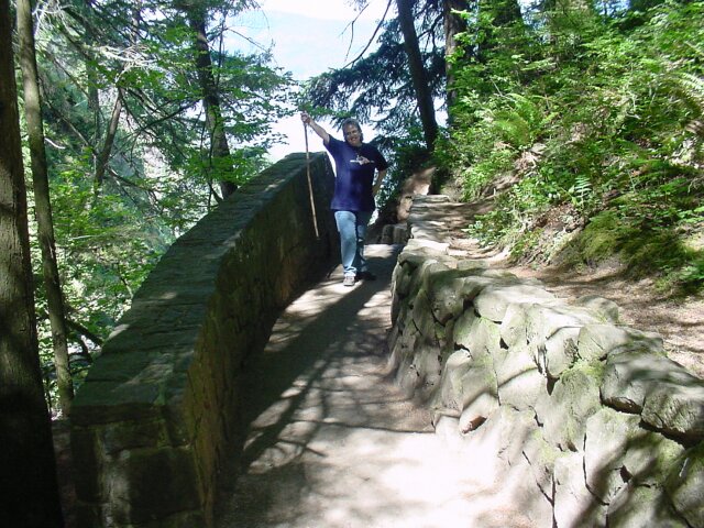
| The hike has not been too strenuous, and the breeze is still cool, but we were thinking that it would not be too much longer before the coats would be coming off. The rock wall along here is a nice touch, and it helps buttress up the surface of the area that was cut out of the hill. | |
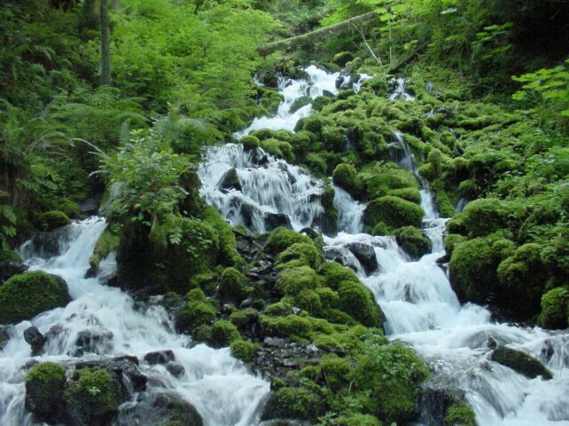
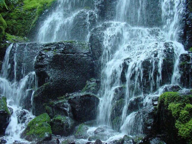
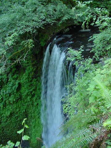
| Wahkeena Falls is actually several falls in one. This is a section with a nice drop. Other parts include waterslide like sections, and rapids. |
|
|
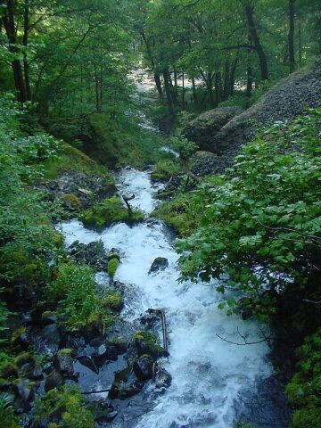
| This is looking down from the bridge along the route where the water cascades towards the parking lot, and the bridge we were standing on before. | |
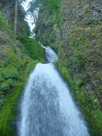
| Looking up the falls from the bridge, we can see part of the waterslide appearing section above the falls. |
|
|
| As you can see, we had had enough of the coats by this time. From the bridge, the next 0.4 miles rises 400 feet. We had our heart rates up, and we were taking plenty of deep breaths as we covered this part of our hike. | |
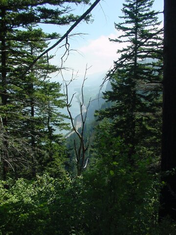
| We had gone up very far yet, but the Gorge is still beautiful! |
|
|
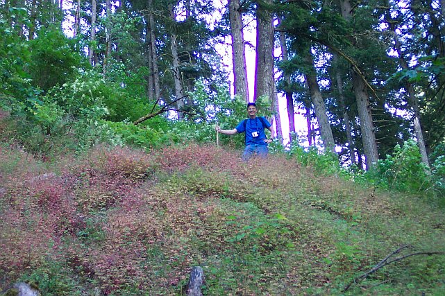
| Switchbacks! One guidebook said that from one point to another, go through 11 switchbacks, as if they were road signs. I have no way of knowing how may we actually went through total but there were a lot of them. I was up near the top of this batch of switchbacks and feeling pretty good about it. | |
| Even higher still, and no new switchbacks in sight. |
|
|
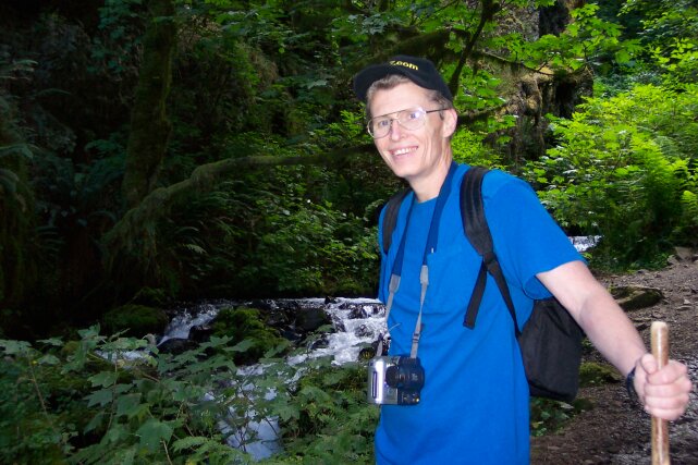
| Somebody had to wait below to take the pictures of the one at the top. Dotti was kind enough to volunteer. (You don't think she wanted a rest do you?) I am a really lucky guy to be married to a lady who likes to get out and hike like this. We have been having a lot of fun doing these hikes since we started the CFHC. | |
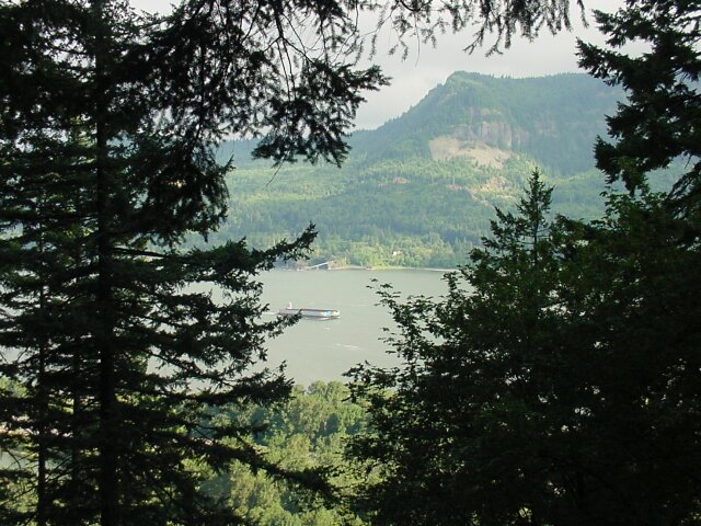
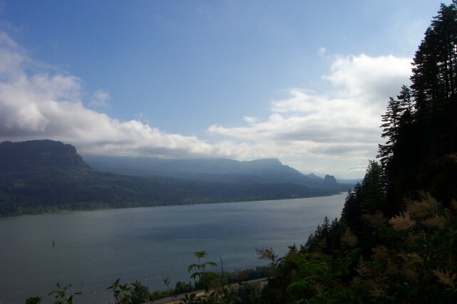
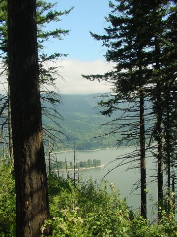
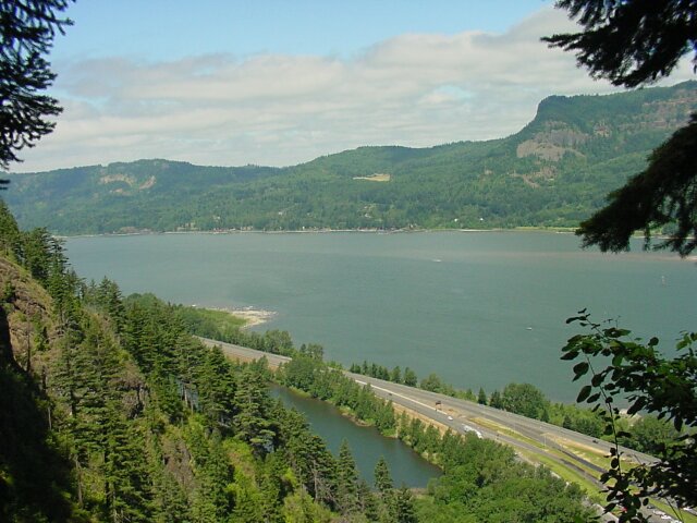
| While we are not way up in the air yet, Dotti was still able to grab this really beautiful shot of the Columbia Gorge looking east. Our home state of Washington stretches out before us along the northern bank of the Columbia River. |
|
|
| A little side trail took us to this viewpoint from which the last picture was taken. We are at about 800 feet at this point, which matches the highest point of the trail up to Multnomah Falls from the lodge. We still aren't quite halfway up as far as we are going to be, but the view is getting to be really good. | |
| In my opinion, no picture is complete without my lovely wife of 27 years. When she smiles, my day is always made brighter. |
|
|
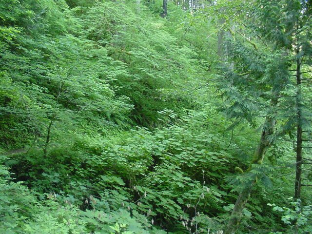
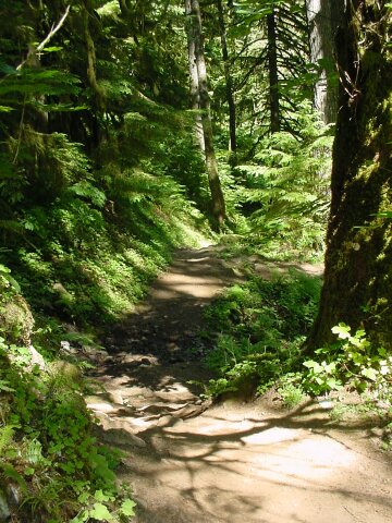
| For the next stretch of trail, the climb is less intense. However,it is still clearly uphill, but we hardly noticed the climb, because right beside us was flowing the beautiful Wahkeena Creek, and all around us was the green of an old growth forest. | |
| Dotti snapped this picture of me with the creek running happily behind. |
|
|
| We took many pictures of this creek as we went along. It was like a camera magnet, making it almost impossible to not take pictures. This hike was by far the hardest for me to weed though all the pictures in selecting the ones I was going to use on the web page. There were actually 525 pictures at the start; I took 334 of them, and Dotti took 191 before her battery failed. We were in beauty overload! | |
| This is Dotti approaching one of the several bridges that we crossed along the way. |
|
|
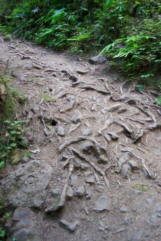
| We must have both found this an interesting part of the trail, because when I went through the pictures, I found that both Dotti and I had taken a picture of it. It appears that the roots are dug in and persistent, because after all the people who have walked this trail have stepped on them, they continue to cling to their position in the ground. | |
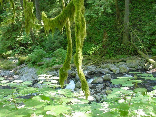
| That water sure looks cool doesn't? The moss seems to like it, and so do I! |
|
|

| Dotti and I took turns clicking and posing for this one. | |
| I am back up on another switchback with my lovely Dotti in my viewfinder. |
|
|
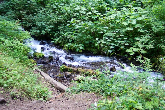
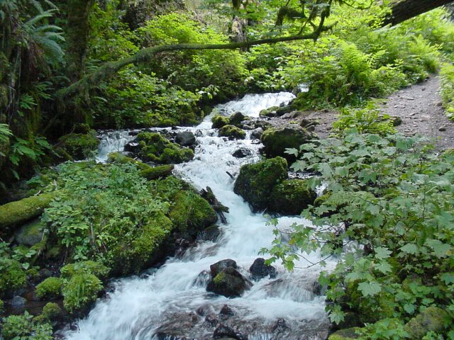
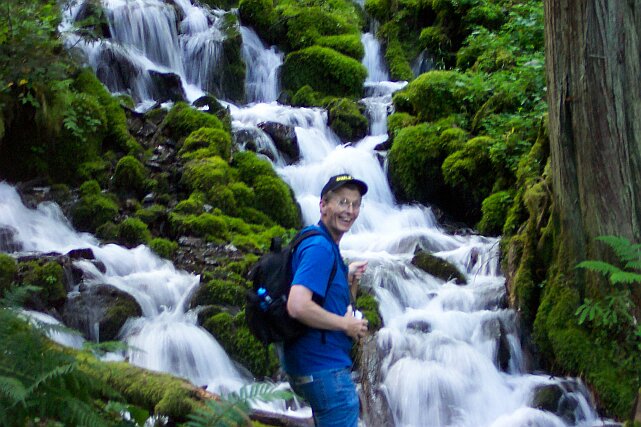
| Another view of Wahkeena Creek. | |
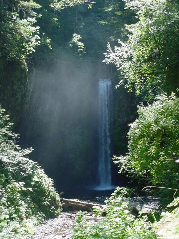
| This is the 20' drop of Fairy Falls, one of the most photographed falls in the Gorge. They even provided a bench for those who may be tired from the walk to get here. |
|
|
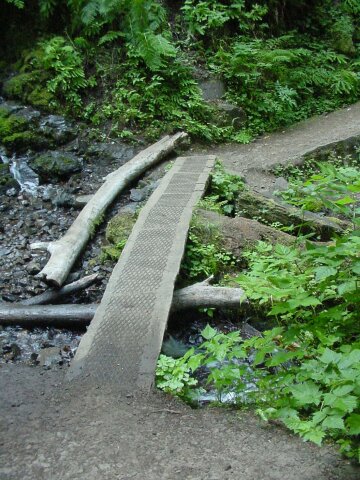
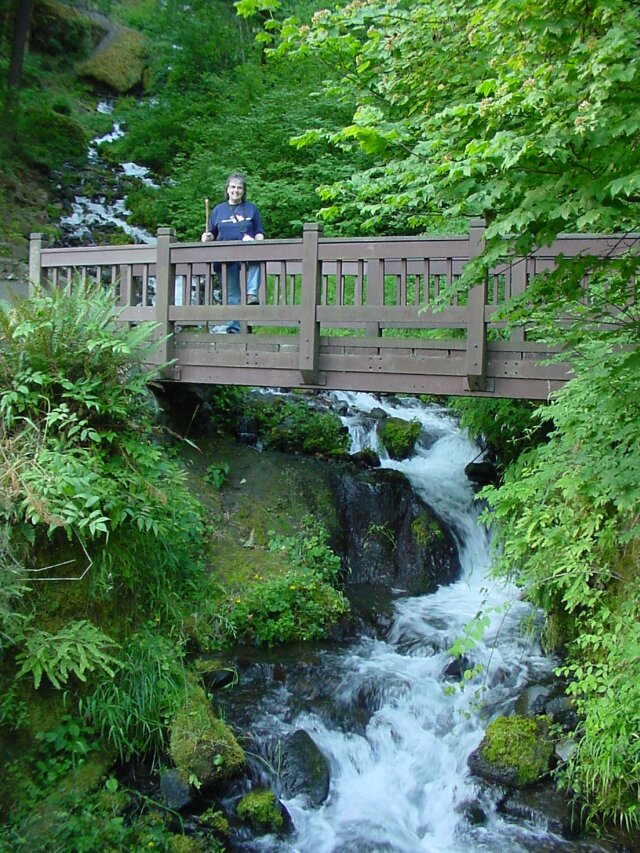
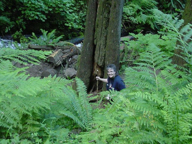
| The bridge crossing the Wahkeena Creek at the base of Fairy Falls. You can see it is a little different than most bridges along the trail. I felt a bit shaky standing in the middle and taking pictures. | |
| I thought the base of Fairy Falls made a good subject for a picture. |
|
|
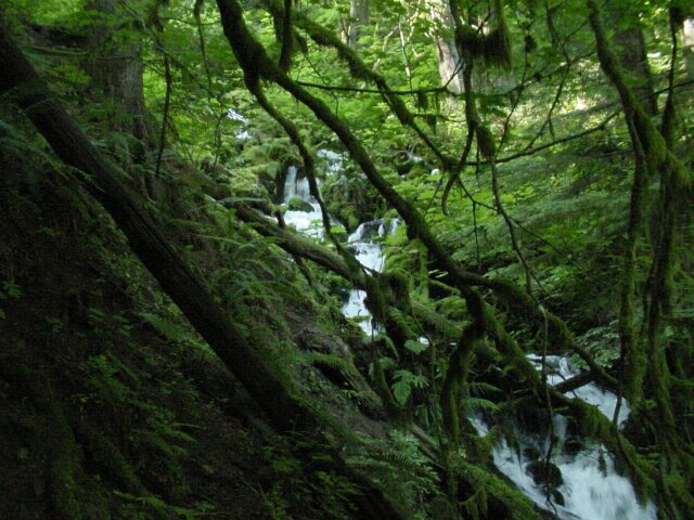
| Looking up the Wahkeena Creek as we said goodbye to it. The green was simply intense. | |
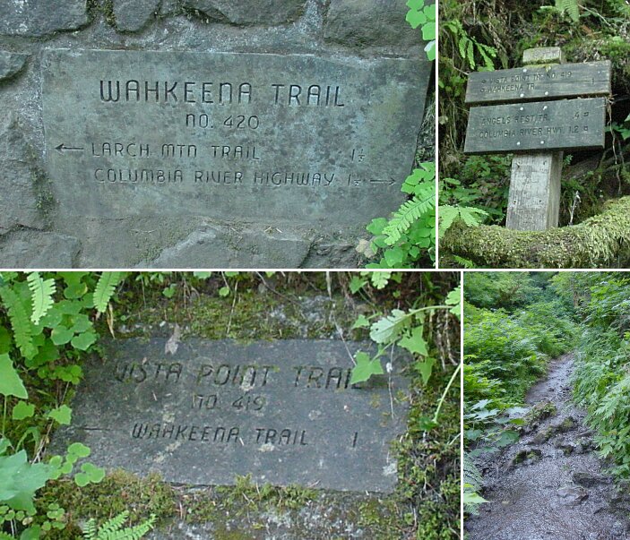
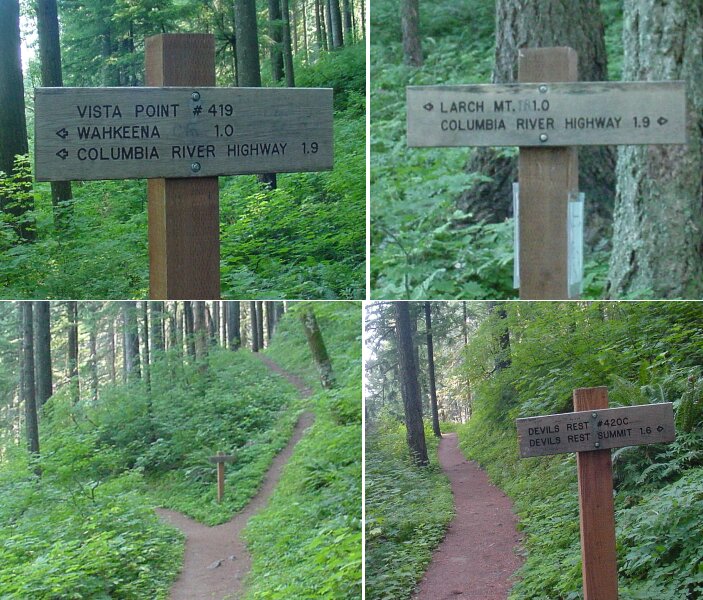
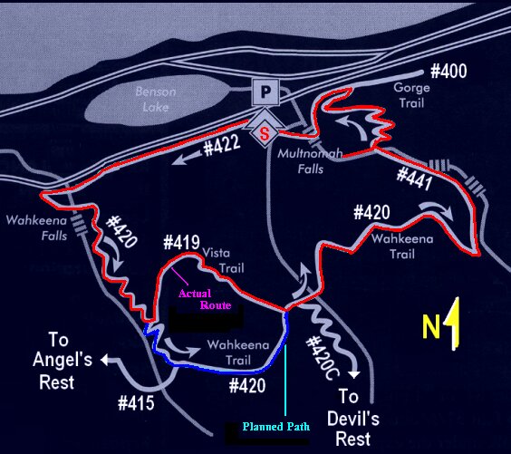
| The first image in this collage was a stone marker along the Wahkeena Trail, about a mile and a half from the Larch Mountain Trail. When we got to the junction between Trails #420 (the Wahkeena Trail, the one I planned to take) and #419 (the Vista Point Trail), I later figured out that I took a wrong turn. I ended up following the little arrow at the bottom of the stone marker (bottom left of image) that said the Wahkeena Trail was one mile away. Above that stone trail marker, there was also a wooden sign (upper right image). I knew we did not want to take the Angel's Rest trail (which leads to where we went last week on our hike) or to return to the Columbia River Highway. Once again the Wahkeena Trail was pointed to as being to the left. Anyway, the numbering system and the naming system all seemed to have gone out to lunch for these signs. To take the path that I had originally planned on taking, we should have gone right here. However, the length of the hike was actually longer this way, and there is reason for the name Vista Point! Dotti was saying later that she was happy that we took the wrong turn because otherwise we would have missed the view. So, all worked out for the good anyway. The real Wahkeena Trail was a nice dirt path like we had been following. The Vista Point Trail started off looking pretty scary. (Lower right image.) But it got better right after getting past the source of that water. (See next picture.) |
|
|
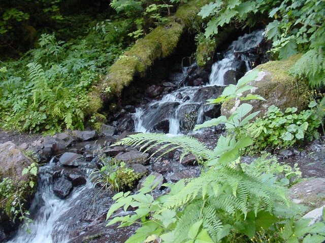
| With rocks placed across for easy fording, the trail cut this stream on the way to Vista Point. | |
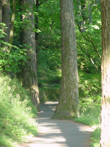
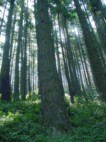
| We soon were walking on a nice trail once more, and right though a tall stand of trees whose branches don't start until the trunk is way up in the air. It makes for an interesting view, where you can actually see between the trees for quite a distance. You can see the sky on the other side of the trees here. Of course that means we are up over the 1200' point, and things are starting to clear out a bit, and sunshine is hitting the growth around us. |
|
|
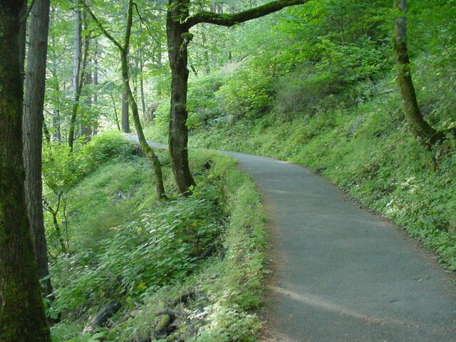
| Moving through the trees, and following a path that keeps bringing more fun things to look at. | |
| The growth is so thick here that it looks like the trail has ended in front of me. |
|
|
| We feel like we are walking through a garden, and I think Dotti is enjoying the view. Of course with Dotti smiling at me, I always enjoy the view. | |
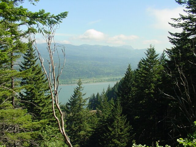
| This is what the Vista Point Trail was named for. This view of the Gorge with I-84 stretching off to the east is one I have not seen before. |
|
|
| Looking north we can see that we are almost even with the top of the Gorge on that side. | |
| We have done nearly 400 additional feet of climbing in order to get to this point, which stand over 1600 feet higher than the parking lot does. (It was along that ascending stretch of path where Dotti took the flower pictures that you will see at the bottom of this page.) This is where the Wahkeena Trail, the Vista Point Trail, and the Devil's Rest Trail all come together. We are going to head off on the trail to the left (lower right image), which is (finally) the Wahkeena Trail #420. An important aspect of reaching this point is that we are on the downhill side from here on. The only other significant climb we will have is on the Multnomah Falls trail after viewing the Gorge from the top of the falls, and that climb is a short one. |
|
|
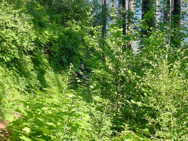
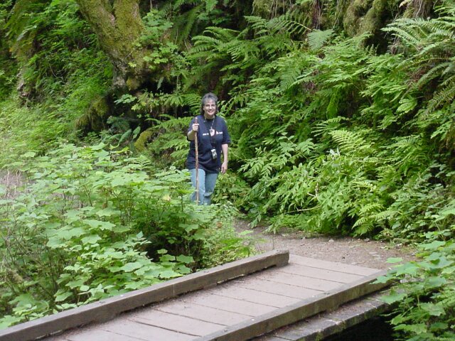
| There's Dotti walking only a short distance behind, but already partly hidden by the all the shrubbery. | |
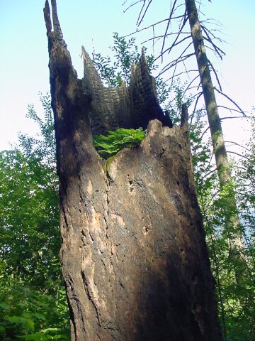
| I thought this was pretty cool. There was a dead tree that had been turned into a flower pot. There were several little shrub plants growing in the hollowed out part of the stump. |
|
|
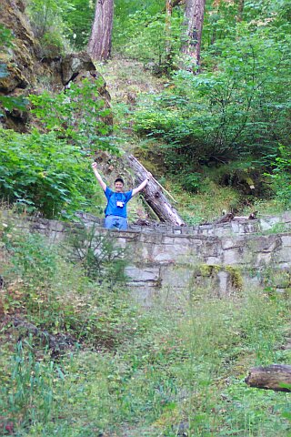
| We felt like we were on top of the world here. The sky was mostly blue, the trees were tall but not blocking our view. The plants along the side were thick and green. It was great! | |
| There is Dotti hidden among the green around the path. |
|
|
| One more shot of Dotti nearly invisible because of the plants surrounding our path. | |
| The sun was directly behind the tree dead center in this shot. The trees spread off in both directions, appearing to nearly be lined up in rows. |
|
|
| Looking down on the Gorge from about 1600 feet above. | |
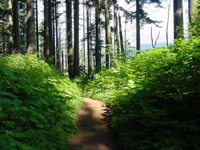
| There were spots on the trail that were so lush that they hardly looked real. This was one of those special locations. |
|
|
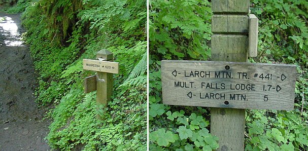
| We have crossed over on the Wahkeena Trail, and joined up with the Multnomah Creek valley, and the Larch Mountain Trail (#441). Larch Mountain, which is going to be a destination of one of our future hikes, lies 5 miles to the south on our trail to the left. Our current destination lies 1.7 miles in the other direction. At this point there was a couple resting, who were the 4th and 5th people that we had seen on the trail so far. This was the most solitary hike we have had so far, at least up to this point. | |
| Walking along beside the Multnomah Creek. The foliage is still think and green. |
|
|
| The green is so thick it just hangs down on you. | |
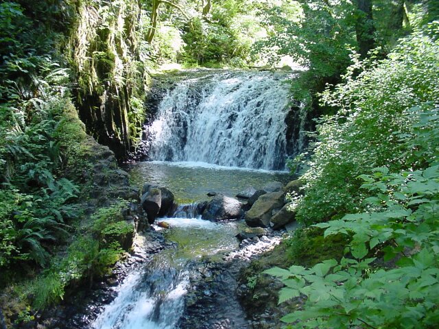
| There were several falls that we saw along the Multnomah Creek. This was a fairly long drop. |
|
|
| A little farther down the trail we saw this falls, which is fairly spectacular in its own right. The sun was right over the top of the falls, so the lighting was not the best for viewing this falls but it was still quite a sight. | |
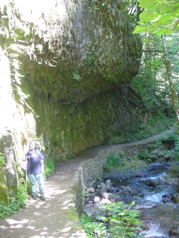
| Here the path worked under another basalt overhang, with the creek running right up to the edge. Unfortunately, the sunlight on Dotti washed her image out, but the trail is clearly visible behind her. (You can see from this picture that Dotti is not carrying her camera any longer. Her battery went dead up on the #420 trail, and so she didn't take any more pictures with her camera.) |
|
|
| Another Multnomah Creek falls. | |
| Here is my lovely Dotti again. By this time my mind was in beauty overload, completely saturated. Even so, Dotti's smile brightened things up even more. |
|
|
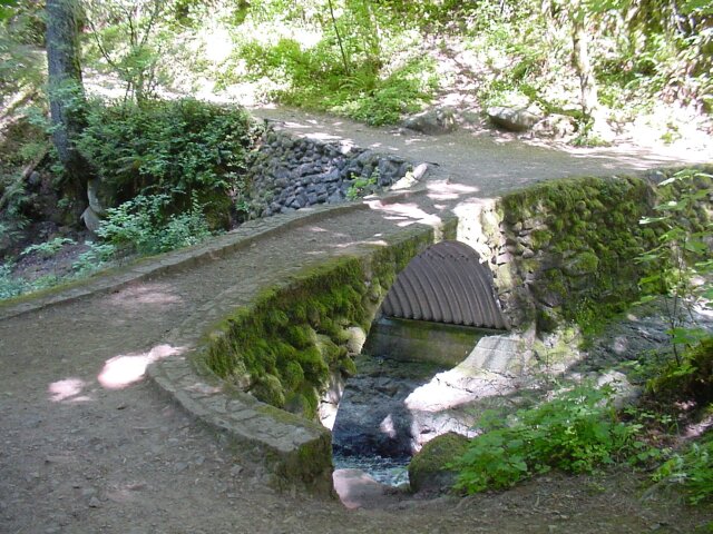
| This bridge crosses the Multnomah Creek, just before our trail joins up with the Multnomah Falls trail. We have come across this bridge before, from the opposite direction, on one of our trips up to the falls, but we never went up the trail more than a few feet beyond this point. The rest of today's hike will now be on familiar ground. | |
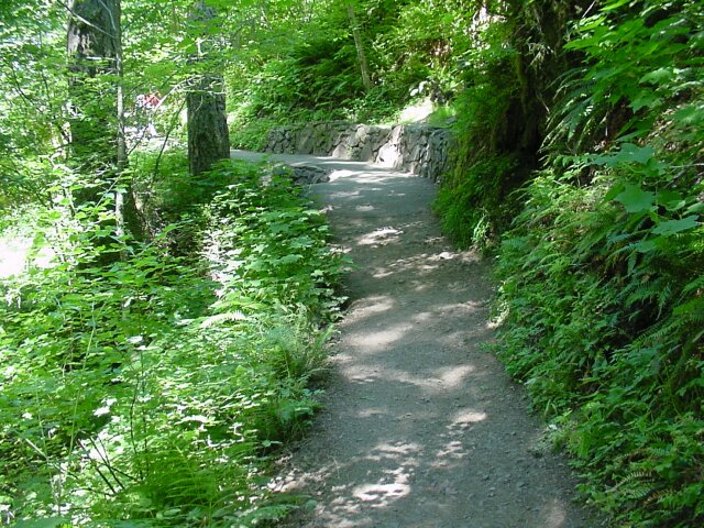
| Here is the place where the dirt of the Larch Mountain Trail meets the asphalt of the Multnomah Falls hiking trail. We feel like we are back home. |
|
|
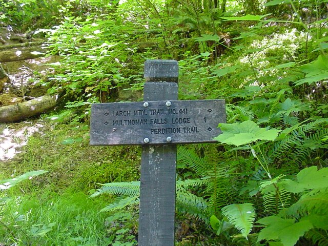
| This is a sign we have passed many times. To the right the Larch Mountain Trail heads back the way we just came. To the left and up is the path to the lodge. Perdition Trail is closed at this time, but the signs are still up. Off to the left and downward, is the viewing platform for the top of Multnomah Falls. You didn't think that we would come all this way and forget to stop by that view, did you? | |
| Here Dotti is standing on the path to the platform right above the stone stairs heading down. During the final phase of our trip we were asked many times where we got the hiking sticks. Dotti pointed out that they were available at the gift shop. We only once mentioned the fact that we got them there about 8 years ago, since they are still available there. |
|
|
| Dotti is standing in front of the point where Multnomah Creek drops a few feet into the pool that stands above the big drop. | |
|
As an aside, when we got to this viewing platform, I mentioned to Dotti that I hadn't ever felt so rested at that location before. Usually we had just finished a strenuous climb to get there. This time we had been coasting downhill for a long time when we got to the platform, and we were not winded at all. However, all was not as it seemed. When we did our final descent, first we had to walk up about 80 feet, and that felt hard, because our legs were tired. Then we had to go down the steep grade to the bottom, and that made my back ache, my knees complain, and overall it let me know that I was finishing up a long hike, and not just a walk up to the top of the falls. |
||
| Looking about 600 feet down. The water is taking a big dive, but the water flow is fairly low compared with other visits we have made. |
|
|
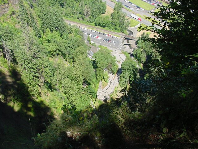
| This is about 11:00 AM and the full crunch has not arrived yet, but it is getting there fast. Remember that parking lot by the lodge with only 2 cars in it? There are a few empty slots visible still, but not too many. Later those will evaporate as well. If you look across the railroad track and the eastbound lanes of I-84 you will see the parking lot where we parked. The 3 cars that were there before have grown to a full house. The empty viewing platform and lodge area, are now starting to gather quite a crowd. It only gets worse from here. | |
| I had to take a telephoto shot of our van from the top of the falls. Things are pretty crowded already. Hey is that guy hitting my car? |
|
|
| For just a couple of moments we actually had the viewing platform to ourselves, but not for long. We had already passed 15 or 20 more people by the time we reached the platform. From there, we were in view of other people nearly continuously all the way to the bottom. When we hit Benson Bridge, there was no clear path across. We had to work our way though a mob. The path down from there was nearly as crowded, and one kid asked his parents, are we almost there yet? I only hope they weren't headed to the top. | |
| We couldn't miss having at least one view of the gorge from the top of Multnomah Falls. You can see that we are much lower here than we were from the Vista Point, but it still is a great view. The rest of the walk was along old trails. (To see the remainder of the trail that we walked, click here to visit our Multnomah Falls Hiking page.) |
|
|
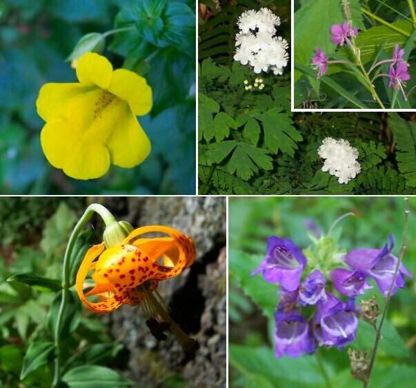
| These are some of the flowers that we saw along the trail. We found a way to follow the request that we "Please leave the flowers" and bring them with us too. | |
| Here is a map of our hike. We started at the red S and walked counterclockwise through the loop. As it turned out, we took #419 rather than #420, but it worked out well anyway. At the point where #419, #420, and #420C come together the elevation is 1600 feet higher than where we started, and 800 feet above the highest point on the Multnomah Falls trail from the Lodge. |
|
|
|
|
||