ANGEL'S REST
June 28, 2003
The Coon Family Hiking Club
Official Hike #8
5.0 miles - 2 hours 45 minutes
|
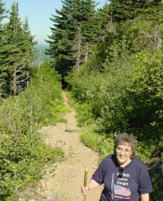
We had planned to do this hike a couple of weeks ago, but things came up and we had to postpone it. Considering the view we got at the top, it was a good thing that we waited until this day to actually do this walk.
The weather was clear, but the temperature was heading for the mid 90s, so we wanted to get up to the top before the real heat set in. We arrived about 8:30 AM, and set off on our hike. |
 The parking lot was already holding several cars when we arrived. However, it was completely filled with cars parked all along the road, and on up to the overflow parking lot by the time we got back. Because of the tremendous view of the Columbia Gorge this hike offers, it is a very popular hike.
|
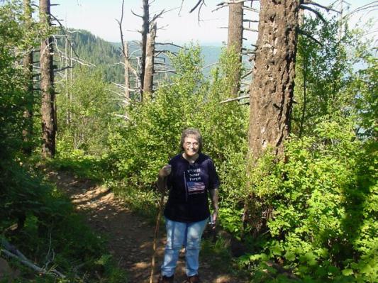
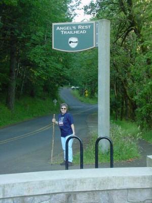 Dotti here is standing beneath the sign identifying the trail. The name of the trail is no doubt in reference to the fact that this rock outcropping at the top, looks like a great place for flying angels to stop off for a rest.
|
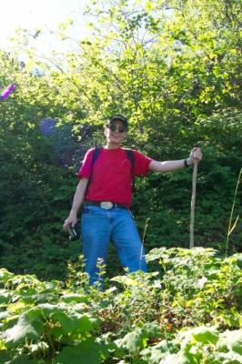
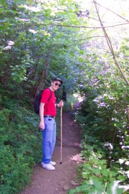
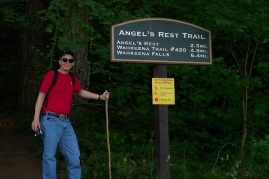 Here I am standing next to the trailhead sign. It was 2.3 miles up and back and we took a few side trips along the way. A lot of the hike was as steep as the Multnomah Falls trail is, but it was twice as long a hike. So, we got our workout!
|
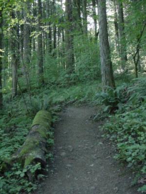
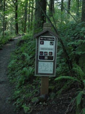 The sign is saying that bikes, horses and motorbikes are not allowed, but hikers and dogs on leashes are permitted. I am happy to report that every dog that we passed, and there were a few, were on leashes. The owners all kept their dogs away from us as we passed them as well. So, no complaints this week about the canines. The forest is green and healthy and the trail beckons us to follow.
|
 This hike has become so popular that they had to expand the parking. Now they have not only the regular parking lot, where we parked, but also an overflow lot up the road a bit. When we got to the top we saw why.
|
 The sun was already shining brightly. (In fact it was hitting the thermometer in our backyard at 7:30 AM, before we left, and sent its reading up well over 100, even though the temperature in the shade was only 58.) Fortunately, the vast majority of the trail lay in shade like this.
|
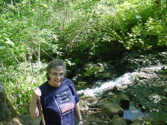
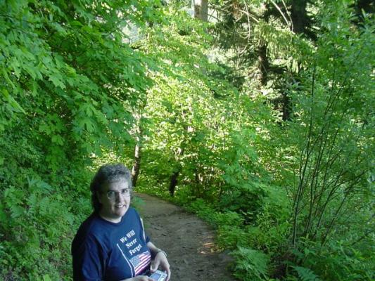
 My lovely Dotti holding her camera, which took a lot of the pictures that are included in this hike summary. Even though it is early in the walk, she is already smiling a bit. The green moss is clinging to the rocks and it is green every direction we look.
|
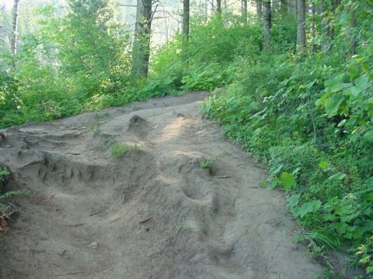
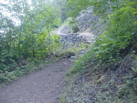 The trail cut through a landslide of volcanic rock, broken and strewn across the landscape. The rocks extended high above the trail, and well below it.
|
 Here I am with my oversized camouflage headdress, trying to blend in with the rocky surroundings.
|
 Dotti is making her way into the rocky stretch of trail.
|
 Looking down from the trail across the rock field.
|
 I am working my way out of the rocks and back onto the normal path.
|
 Here is my lovely Dotti, in the early morning surrounded with lush greenery. I can't think of a more beautiful sight!
|
 Here you get a feel for the intensity of the bright sun. The trail is curving around, still hiding in the shade, while the sky in the background is exploding with light.
|
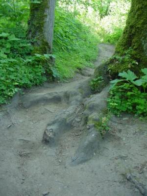
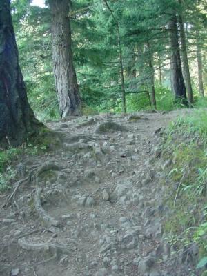 We saw many interesting trail compositions as we went along. Here the packed dirt surrounds rocks, and tree roots creeping along the surface. Along the way we commented to each other that this would be the worst trail we have seen so far for jogging on. In spite of that, we did meet one jogger on the trail.
|
 Dotti's ears picked up the sound first. We looked off to the left and there was the 100 foot Coopey Falls, nearly hidden behind the trees.
|
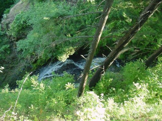 We took a little side excursion from the main path, and came to a spot where I could stick my camera out from behind a tree, point it down and click at the top of Coopey Falls. I tried a couple of shots before I was able to get this one that shows the falls starting off on its downward run.
|
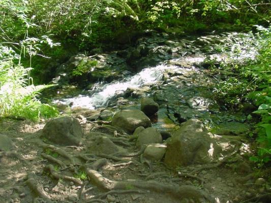 Back on the main trail again, Coopey Creek comes right up to it. As usual, the water is crystal clear, and the sound was delightful to listen to.
|
 Here is Dotti with Coopey Creek behind her.
|
 Here I am beside the creek, on the trail where it cuts through the trees, shrubbery and rocks. My shadow is still long, because it is early in the day yet. The temperature was still quite comfortable.
|
 The bridge across Coopey Creek is in great repair, and blends in very nicely with its forest surroundings.
|
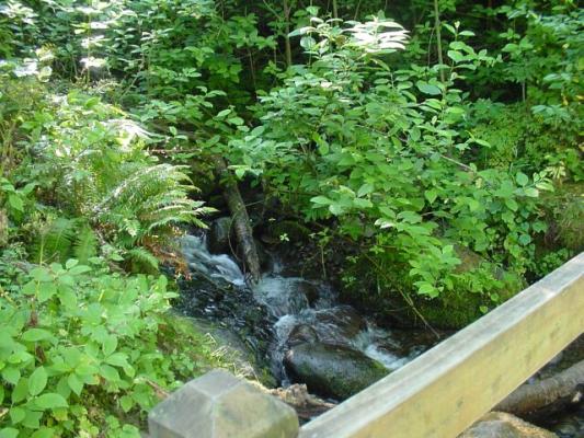 Looking down from the bridge upstream on Coopey Creek.
|
 Dotti is really starting to enjoy herself now, she is giving us a really nice smile!
|
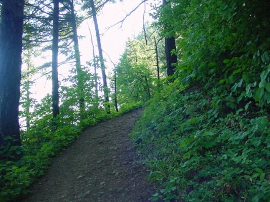
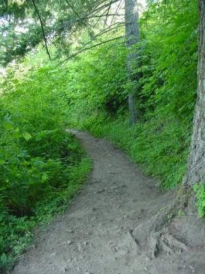
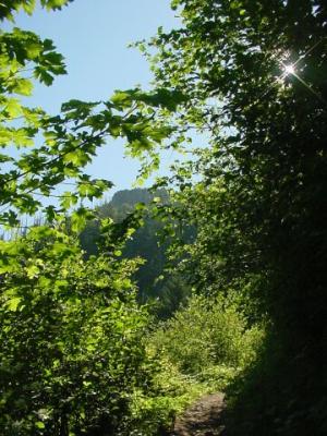
 The green is very intense along this stretch of the path, calling us on.
|
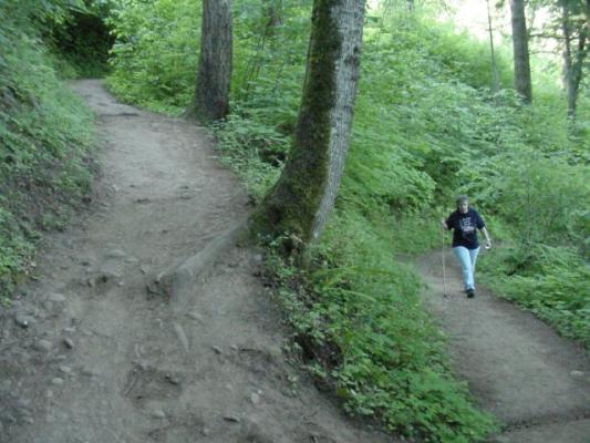 We were beginning to feel the grade by now. We had been going up for quite some time, and all we had to look forward to was more of the same. Here is a switch back leading up, and up.
|
 These roots were trying to make up their minds whether they were going to help us out by forming a stair, or merely be a trip hazard. The sun was breaking through the tree cover up ahead.
|
 Green, tree roots, and rocks continue to lead us on our way.
|
 Stopping to take some pictures of the Gorge.
|
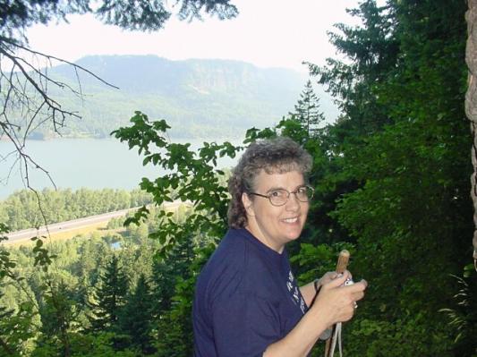
 Dotti standing in front of a glorious view looking west down the Columbia Gorge towards downtown Portland. Right over the top of her head in the background you can see Crown Point, which is a very popular tourist attraction in the gorge. It has a good view of the Gorge and normally has a historic building open, with a gift shop and displays. The building has been closed for quite some time for repairs, and it still is, as we noted when we past it on the drive home. The view we were about to experience at Angel's Rest is even better than that one you get at Crown Point!
|
 I was looking off up the trail when Dotti took this one. As you can see, it was a clear and sunny day, which is just what you want when your hike is taking you to the best viewpoint in the Gorge!
|
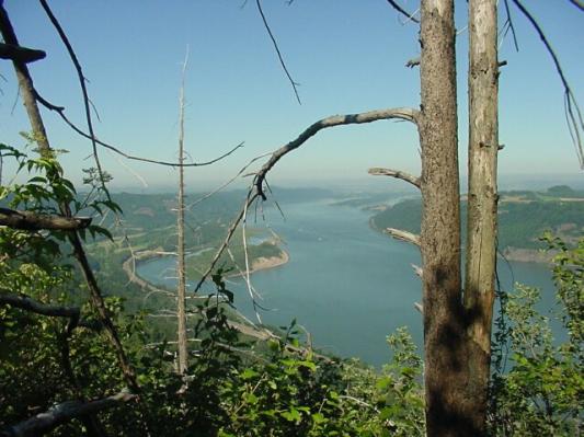
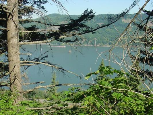 We are still fairly low yet, but we still could see some great views when the trees opened up enough to let us peak through. Here you can see a barge going up the Columbia River. Just this side of the barge is a volcanic island sticking up in the middle of the river.
|
 At last, still looking a long ways away, we catch a glimpse of our goal: Angel's Rest. The rocky plateau stands up above the forest and awaits our arrival. The sun is breaking through the trees, and around the corner we are about to enter the sunlight.
|
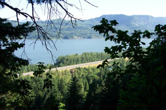 But first we took a shot of the Columbia River looking north towards the Washington side of the gorge. The cars are looking pretty small on the freeway.
|
 Here is an animated gif. I took several pictures of Dotti as she came up the path towards me, and I put them together.
|
 Here the trail was rock hard mud, with roots running underneath it.
|
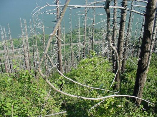
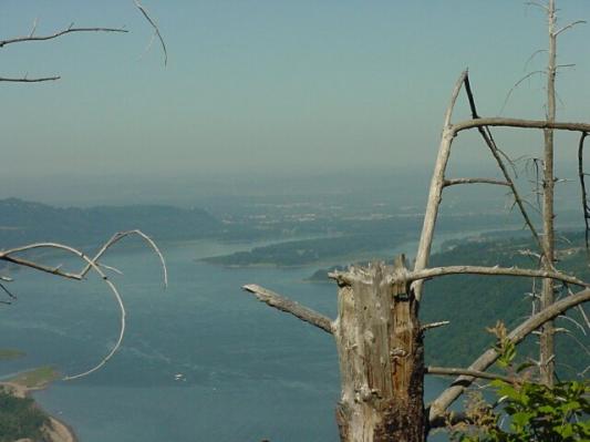
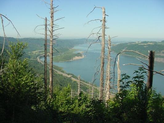 Once again we saw the after effects of forest fire. There were many dead trees standing in this part of the trail. Looking through them you can see the western end of the Columbia Gorges as the river runs into the end of Willamette Valley. The island you see near the left back of the river is called Sand Island, which is the same name as the one where Dotti and I had our first home together. (The Midway Islands are actually several island, and the large one we lived on was named Sand Island.)
|
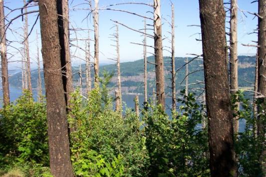 The dead burned trees stand between us and the Gorge. The green of the forground, and the healthy trunks of the trees, let us know that the fire didn't quite make it this far in 1991 when it passed through. Fortunately, the damage was localized to a stand of trees, and the underbrush. For the early part of the trip the dead trees were not visible and at the end of the trail they were not visible. It was sort of like the rock field we passed through, that was there and then was gone from view.
|
 Dotti shot this picture from a lower section of a switchback looking up at me, with the stand of burned trees being behind her.
|
 I returned the favor looking back down from the upper section of the switchback.
|
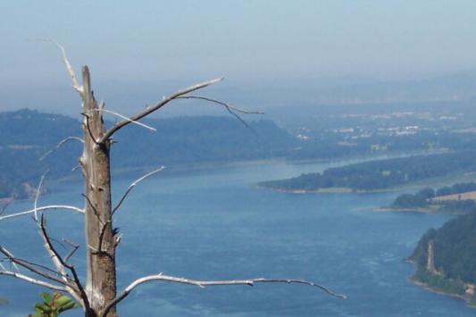 Dotti used her zoom to capture this shot of a fire dead treetop reaching out towards Troutdale, an eastern suburb of Portland.
|
 Here the dead trees stand thick and foreboding. The branch before us looks like a sickle of the Grim Reaper.
|
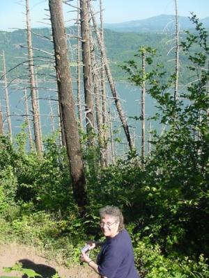
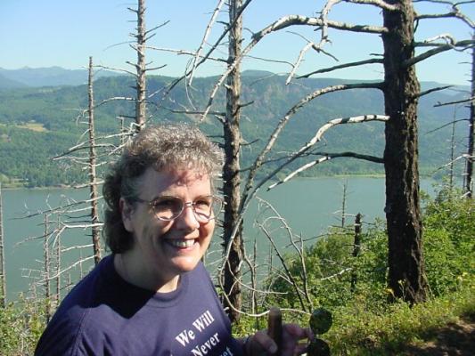 Dotti standing before the dead trees, with the Gorge in the distant background.
|
 Another view looking west down the Gorge.
|
 Here is one that I took looking out towards Portland over the top of a dead tree.
|
 We are starting to work our way out of the dead trees, and back into the green foliage. Dotti knows we are getting closer to the top.
|
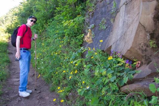 This huge chunk of basalt rock reminds us that this area is all volcanic. Sheets of lava were laid down hundreds and hundreds of feet running from Idaho to the ocean. After they were laid down, the Cascade Mountains rose up and lifted the sheets of lava high into the air where they now are often easy to see in the Columbia Gorge. Along with the green running by the path, we here are treated to yellow and purple flowers as well.
|
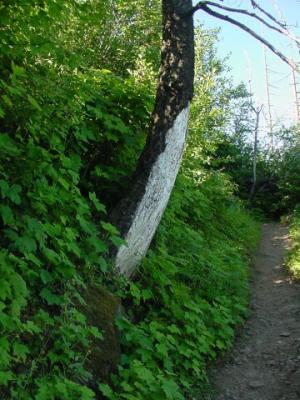 This tree was hit by the fire and the left side, as well as the top of the tree, is still covered with normal bark, but the bottom right of the tree has been stripped of its covering.
|
 Dotti with the Gorge in the background.
|
 There it is! Angel's Rest is clearly visible now. Dotti's pedometer was reading 2.0 miles as we reached this point. It won't be long now.
|
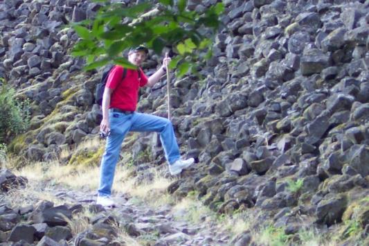
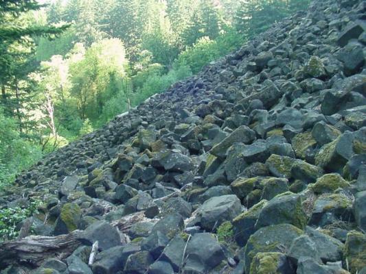
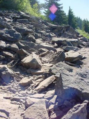 We turned a corner on the path and found ourselves looking at a rock field where the path actually disappears. If you look off to the right there is someone heading back down the trail, which let us know that the trail continued at that point. Otherwise it would have been just taking our best guess as to where the trail continued. Some of the rocks were loose and it was an interesting walk across these stone, making sure that we didn't twist and ankle or knee.
|
 The view from here was pretty good, and so I stopped to take some pictures, and Dotti took this one of me. Notice that the tops of the mountains behind me are not much higher than we are at this point.
|
 Here's my lovely Dotti, standing on the rock field, with the Columbia River stretching off in the distance behind her.
|
 We are across the rocks and back onto the trail, making the final push to Angel's Rest.
|
 Dotti's smiling because we are almost there!
|
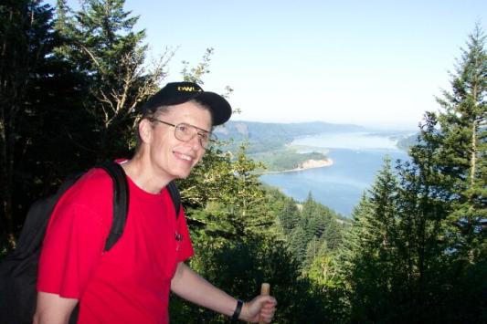
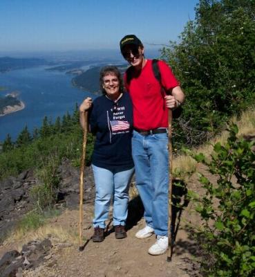 There was a nice couple that we met on the trail who were kind enough to take this picture of us, with Portland right above Dotti's head.
|
 Climbing up onto Angel's Rest and looking west through the trees. The stones of Angel's Rest are visible off to the right in the distance.
|
 The upwards push. Looking east up the Gorge.
|
 Going for the gold! Nearly at the top.
|
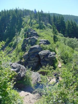 Looking back down the trail from the top, and along a backbone ridge of volcanic rock. If you look closely near the bottom you will see Dotti hiding behind a tree.
|
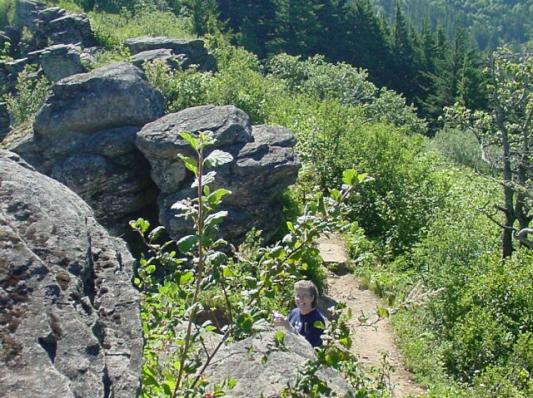 There is Dotti flashing me one of her golden smiles.
|
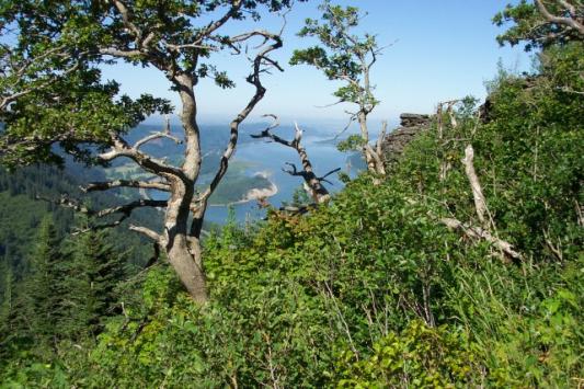
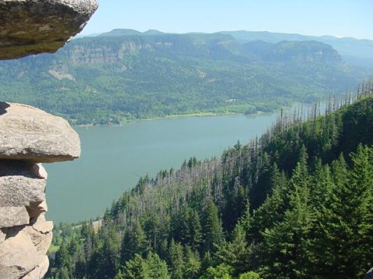
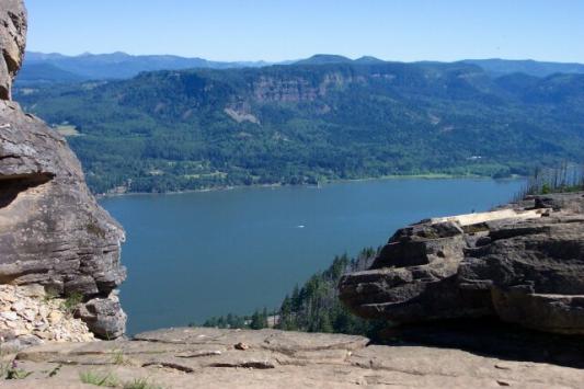 Framed in rock you can see the Columbia Gorge. Across the river the walls of the Gorge clearly show the layers of volcanic basalt laid down before the mountains lifted.
|
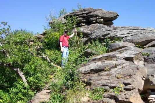
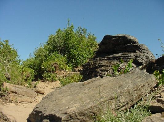 The top terrain. There were a number of little trails through the shrubs and trees on the plateau, as well as several interesting rock formations.
|
 Dotti at the top, taking a breather from picture taking for a moment so I could catch one of her.
|
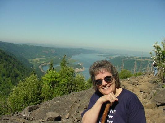
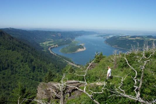
 Dotti stand on the top of Angel's Rest, looking at the scenic view of a lifetime.
|
 Looking west once more. Although it is hazy over the city, you can actually see up the Willamette Valley a ways from this viewpoint. Crown Point on the left of the river looks like it is far below us from here.
|
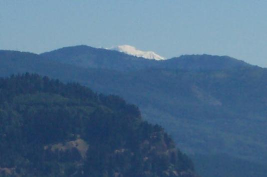 Dotti caught this view of the snowcapped peak of Mt. Adams looking over the top of the Gorge.
|
 I put together 7 pictures to make this one panoramic view of the entire Columbia Gorge view that we had from Angel's Rest. I had to work around some shrubbery, and so the view is definitely not seamless but it helps you get the idea of what we were looking out. It was beautiful!
|
|
We put our cameras away for the walk back down the trail, and headed out. About 50 minutes later we were walking back into the parking lot and putting our stuff back into the van. The temperature was still not too bad, being nearly an hour before noon, but it was defiantly hotter. If for no other reason than parking, we were glad we showed up fairly early. For the rest of the summer, we are probably going to shoot for earlier start times to beat the heat and the crowds. Our next planned hikes will be at the coast, so the terrain should be quite different. |