|
THE COON FAMILY HIKING CLUB
POWERED BY DWLZ.com |

|
| [ Home ] [ DWLZ ] [ Message Board ] [ Restaurants ] [ Order Cookbooks ] [ Dotti's Newsletter ] [ Support Dotti ] [ FAQs ] [ Email Dotti ] [ Email Al ] |
THINGS YOU
MIGHT ENJOY
MULTNOMAH FALLS
& ECOLA FALLS
August 16, 2013
The Coon Family Hiking Club
Official Hike
3.6 miles - 2 hours 17 minutes
Highest point: 1040 feet
Lowest point: 20 feet
Hikers:
Grandpa: Glenn Alvin ["Al"] Coon I
Grandson: Kai Anthony Coon
|
Multnomah Falls Facts Height of Falls, Total: 620 feet. Height of Falls, Upper Falls: 542 feet. Elevation Decrease Across Drop pool: 9 feet. Height of Falls, Lower Falls: 69 feet. |
|
Please visit our: Multnomah Falls History For lots of information on previous visits to this trail, and the geology of this scenic wonder! |
|||||
|
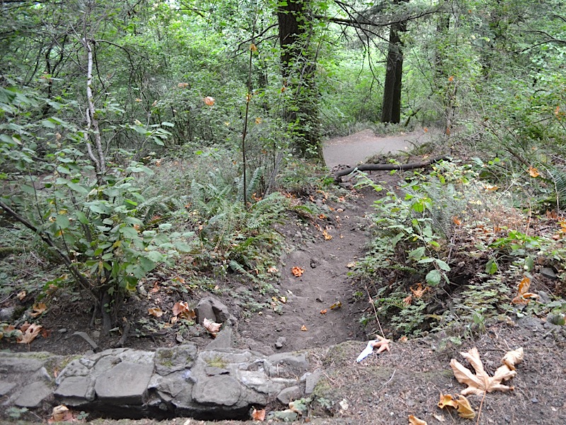
This time I did this hike, there was a new Coon along on our Coon Family Hiking Club, our wonderful grandson 15 years old, Kai Anthony Coon, son of our son Glenn Alvin ["Sonny"] Coon II. What a treat it was for Grandpa! It was just my grandson and me on this one. In 1996, a couple of years before Kai was born, we brought Kai's mom and dad, to the base of these falls to let them see its splendor, but we didn't hike to the top that day. (In fact both Dotti and I were in pretty bad shape at the time. We tried walking the trail when we got back to Vancouver in 1995, but didn't get halfway up before we had to give it up. I think we finally did make it up in 1996, but it was hard going, with the weight we were carrying.) Just the fact that going to the top of Multnomah Falls is the first thing that Dotti and I did together alone, on our very first date, makes every visit to this marvel of nature a special treat for me. But we have added more and more personal history to it as the years go by. And I can tell you that having my grandson wolk to the top of the falls with me is right at the top of the historical additions for me. Not only did I live long enough to know my grandson, but I lived long enough to hike to the top of Multnomah Falls, just the two of us together. I will take this wonderful memory with me all the way to my dying day! The only thing I wish I had done differently for this hike is I wish I had of worn my boots instead of my tennis shoes, because the shoes didn't have enough traction for the slippery bit of trail heading down to Benson Bridge, near the end of the hike, and my feet went right out from under me. As well as being steep, the asphalt was very wet, from the mist from the bottom of the falls, and my shoes just started sliding and there was nothing to do but try and land safely. Poor Kai was right behind me so he got to see Grandpa take a tumble. I landed flat on my back and was not hurt badly at all. I kept my head and elbows clear. (My upper back was a little sore for a couple of days, but that area is a problem for me anyway, with daily arthritis pain. The extra pain was hardly noticeable and went away quickly.) My dignity was hurt far worse, as people ran up to me like I was a doddering old fool, which may be true, but I don't like thinking of myself in those terms. *sigh* |
|||||
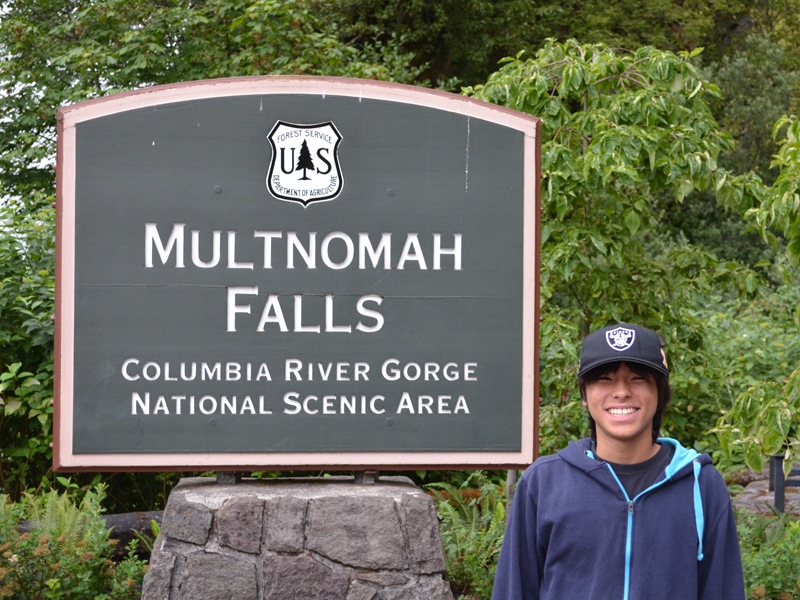 |
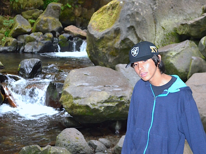
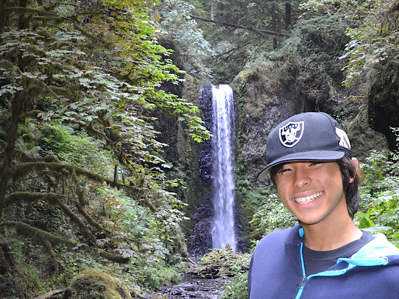
It was 8:10am when I snapped this picture of Kai by the Multnomah Falls sign, right beside the Multnomah Falls Lodge. We arrived early, coming in on the "Historic Columbia River Highway Scenic Byway," and got a great parking spot very close to where this sign is located.
| ||||
|
I like to get an early start on hikes in the summer because it is so much easier walking in the cool of the morning, than to struggle through the heat in the afternoon. The high for the day got up to 84°F (29°C), but we never saw that on our hike. We were back down to the bottom before 10:30am. It was about 67°F (19°C) when we started and just over 70°F (21°C) when we got back to the car. I started off wearing my tee shirt and no coat. (If you have gone through some of our other hikes you will see I often start off wearing a coat, because our evenings usually drop into the 50's even in the summer, so mornings can be cool, even when the high for the day will be much warmer.)
In Japan it is warmer than it is here, and Kai wore his sweatshirt for the entire hike, because it was a bit cool for him. | |||||
|
Turning around and looking west, there is the Multnomah Falls Lodge. While it has no rooms to rent, it does have a very nice restaurant that, among other things, serves and incredibly good cup of hot cocoa. Sitting next to the fireplace on a cold day that goes down really well. They have a nice gift shop, and information center, along with restrooms and phones. | 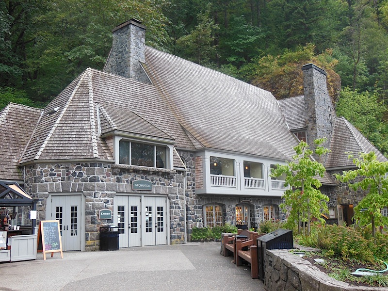 | ||||
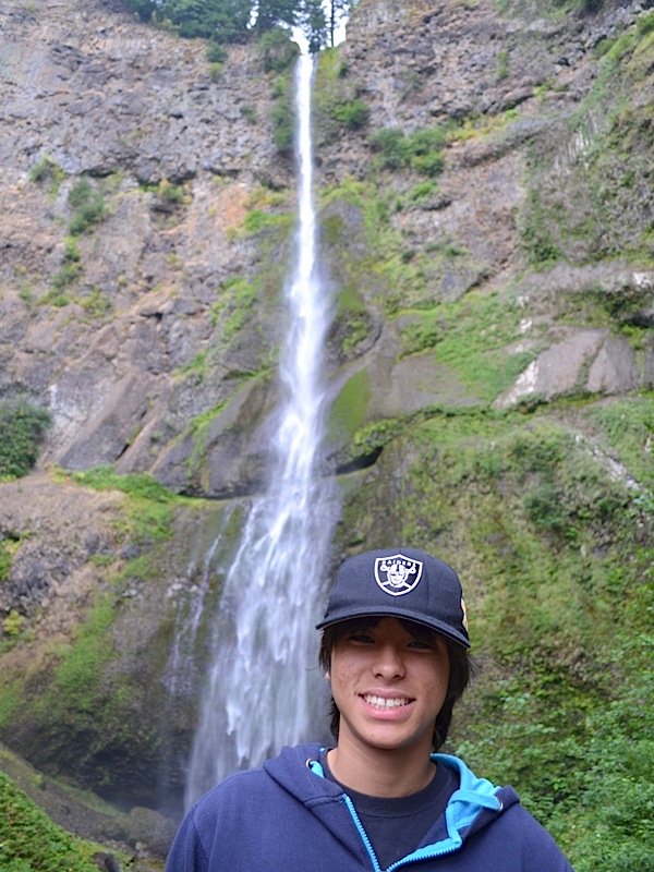
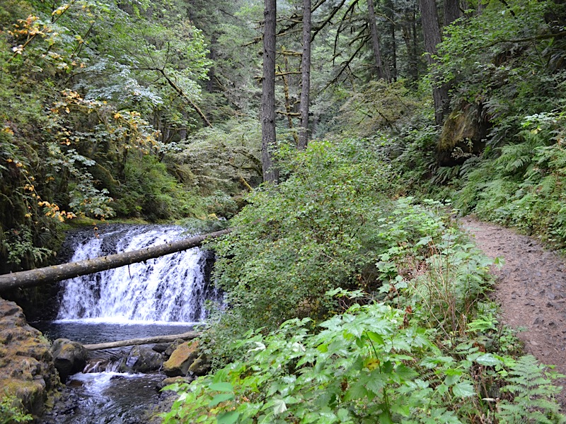
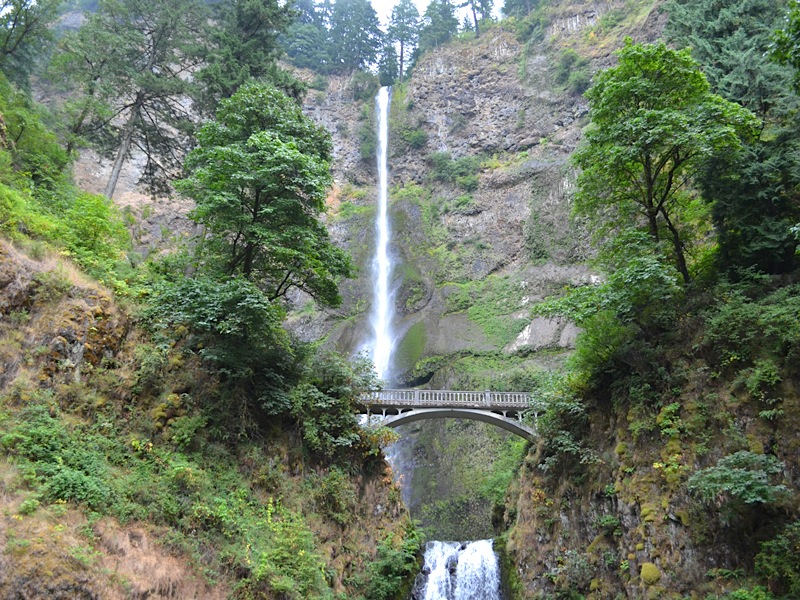 | And finally, turning and looking to the south and up, there stands the wonderful scenic wonder itself: Multnomah Falls, with the upper falls dropping 542 feet into its drop pool. Our goal was to stand at the top of those falls, on the viewing platform, and look back down to this very spot. I was already excited, knowing what was ahead. Kai said he was ready to hike, so off we set. | ||||
| The first stop after the Lodge area is always the lower viewing platform. From here you can see the lower portion of the falls, and how the water had eaten awake the rock it flows over as it falls 69 feet. | 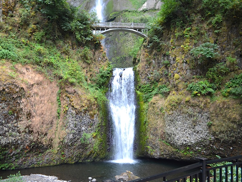 | ||||
 | I took a picture of Kai in front of the lower falls, and then we headed up the trail to Benson Bridge, which crosses Multnomah Creek over the lower falls. | ||||
| Here is Kai, standing on Benson Bridge, while behind is the drop pool for the upper falls. This point is at elevation 120 feet, or up 100 feet from where we started. If you look closely, you can tell that the quantity of water actually flowing over the falls, and draining away below the bridge is quite small at this time of year. | 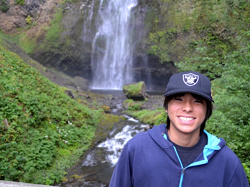 | ||||
 | The 542-foot drop of the upper falls behind Kai, continues to wear away at the rock it passes over. During the rainy season, you will see several small secondary falls come over the lip at the top, due to the expanded flow of water in the creek. | ||||
| Looking north from Benson Bridge, we can see the lower viewing platform where we stopped earlier, and on the right, Multnomah Creek almost sneaks away unnoticed, as it heads out to the Columbia River. Beyond the lower viewing platform, the highway parking lot can just be seen, with a train trestle beyond it. The creek flows under that bridge, and the walkway out to the freeway parking lot does as well. However they part company after that, as the walkway moves through a pedestrian underpass beneath the eastbound lanes of Interstate 84, and on over to the freeway parking lot that rests between the east and west bound lanes of the freeway. Beyond the freeway and the line of trees on the other side of it, is the Columbia River, and the hills of Washington State fading into the mist. |  | ||||
 |
We have moved up the trail a bit and Kai stopped by this boulder of basalt that came to rest right by the trail, after breaking off from some higher location and rolling here. You can see the irregular way the rock interior is held together. It is made up of many smaller pieces that are "glued" together, and the bonds are not nearly as strong as the ones holding granite together. Basalt wears away far faster than granite, and pieces of it often break away from larger segments in the walls of the Columbia River Gorge.
| ||||
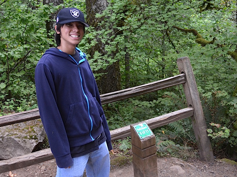
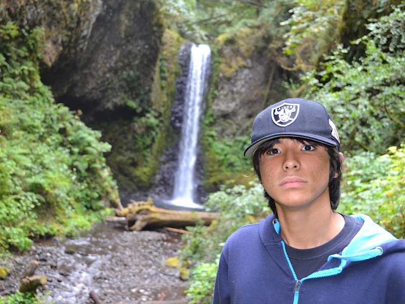
|
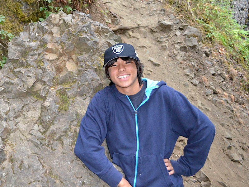
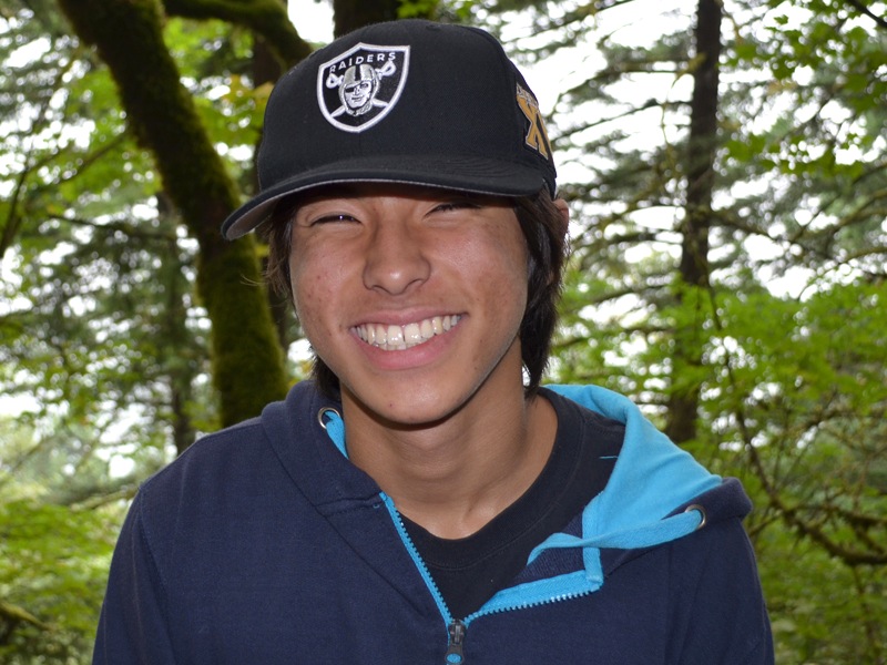
It had been about 20 minutes since I took the picture of Kai in front of the sign by the parking lot. We were at the first major landmark after Benson Bridge over the lower falls. There is a bench here for resting and a great view which stretches out behind Kai's radiant smile. He is a handsome lad, who, as you can tell from his hat, loves the Oakland Raiders, just like his dad. | 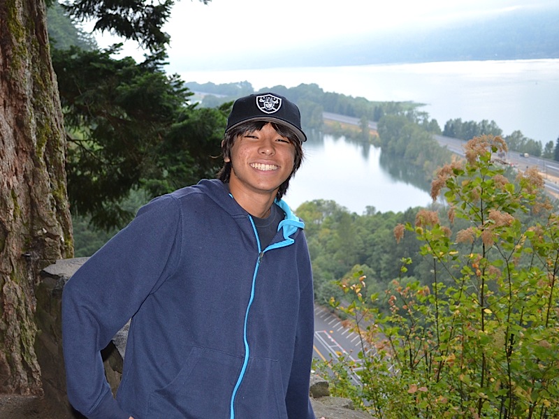 | ||||
 | Looking down from where Kai was standing in the last photo you can see the roof of the Multnomah Falls Lodge, with a glass section, where you can view the falls while eating your meal in the restaurant. The "Historic Columbia River Highway Scenic Byway" runs right in front of the lodge, and beside the parking lot for this natural wonder. Next comes the train track, a towering stand of trees, which surround Multnomah Creek on its way into Benson Lake at the top of the picture. | ||||
|
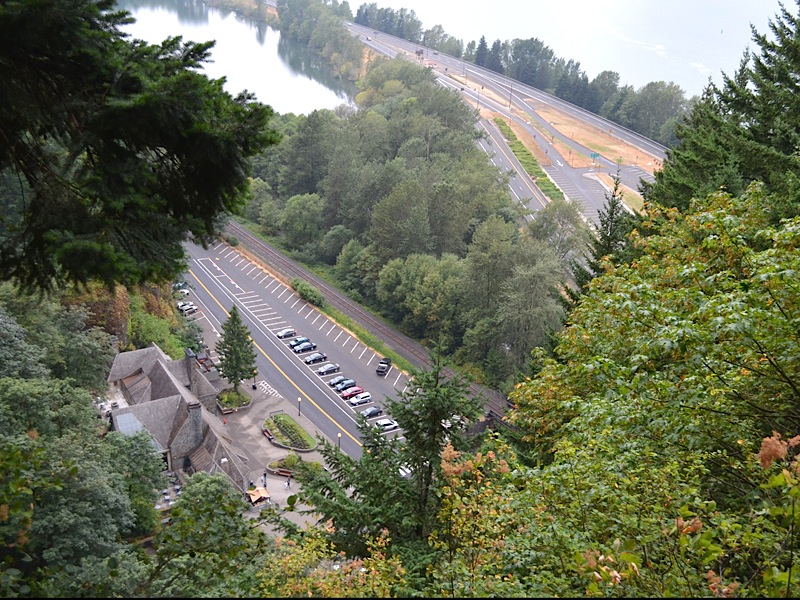
(From there, the water travels through an outlet into Wahkeena Creek, which came over the Wahkeena Falls, and flows through Wahkeena Rearing Lake, just west of Benson Lake, before it joins with Multnomah Creek and both of them then flowing into the mighty Columbia River beyond.
Just north of both Lake Benson and the flow of Multnomah Creek, is Interstate 84, which splits its east bound lanes, which are closest to us, and west bound lanes, running along beside the edge of the Columbia River, to make room for a large parking lot that lies mostly behind the trees on the far right of this photo. In September of 1974, a shipmate of mine, loaned me his truck, which I parked in that very parking lot, after driving Dotti and I to the location of our first date. The events of those days shaped my entire life that was to follow. For me, this is sacred ground. And having Kai with me here just adds to that feeling! | |||||
| Just up the trail a few steps is a view of the upper falls. We still have a ways to go, but, as you can see behind Kai, we are about even with the point where the rock fell out of the face of the wall behind the falls, and it fell 225 feet. Since the upper falls is 544 feet we are well above the level of Benson Bridge now. | 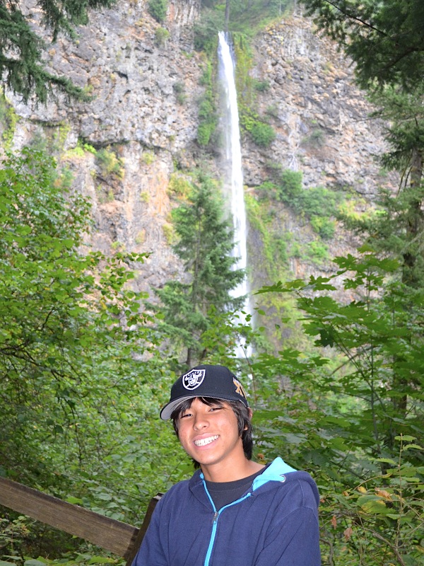 | ||||
 | Kai borrowed my camera and took a picture of his proud Grandpa. So far so good, we are not pushing too hard getting up the trail. Of course we still had a lot of steep switchbacks up ahead of us. | ||||
| And 10 minutes further up the trail we stopped to get a picture of Kai with the Columbia River behind him, and the misty mountains in Washington state beyond that. You can see that we are looking down on the tops of some pretty good sized pine trees. The trail was moving up sharply. | 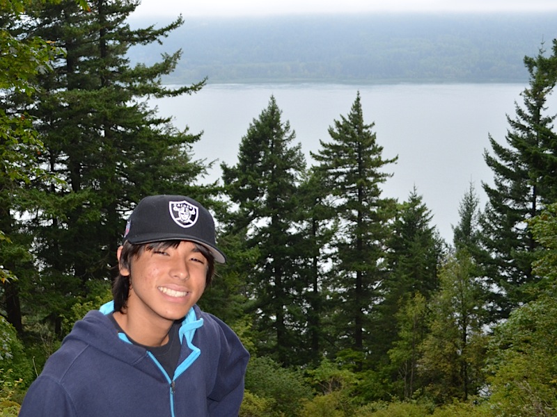 | ||||
 |
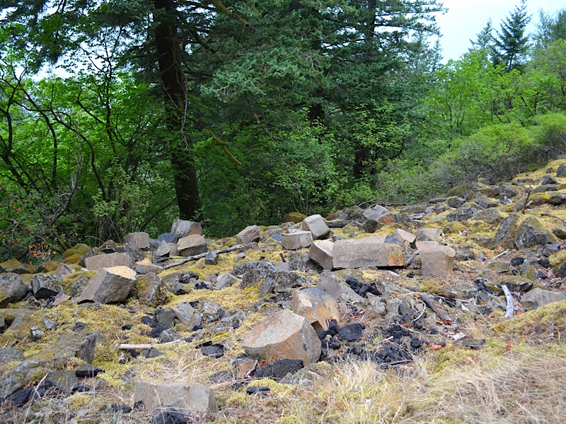
Looking down from the trail, you can get a feel for the steepness of the grade, as the gorge wall falls off towards the river. There are no trees here because at some point in the past, a section of the rock above the trail gave way, and sent a cascade of rock, from bolders to chips, sliding down the mountainside.
| ||||
|
It knocked over trees, and covered the ground with a layer of rock that has resisted the resurgence of forest growth. At some point in the future the trees will grow back and hide this debris, as it has all along the trail where more ancient landslides have disappeared under the growth.
These slides are common along all the of the trails in this area. If we continued up this very trail we were on, all the way to the top, we would reach the peak of Larch Mountain. Much higher up, there is an incredibly large rock slide that goes on for a quarter of a mile or more. On a hot summer day, that rock heats up, and you feel like you are in an oven while walking across them.
The Bridge of the Gods, right were they built the Bonneville Dam, marks a place where a much larger rock slide occurred a very long time ago. The side of Hamilton Mountain gave way and dropped so much rock across the path of the huge Columbia River that it actually blocked its entire flow for a time. When the river finally broke through, its course was a full mile south of where it had been before! Occasionally, even the Interstate Freeway is occasionally partially blocked by rockslides. There are thousands of feet of basalt rock making up the lower layers of the walls of the Columbia River Gorge, and basalt is prone to give way, and so it does. Sometimes it creates small slides that block hiking trails, and sometimes it creates huge slides that block rivers. Fortunately, geological events like huge rockslides, occur very rarely, relative to a normal human lifetime. But even so, I think about these things when we are out hiking, and listen for any hints that the rock is feeling frisky. | |||||
|
I have seen a lot of people on this trail who are struggling with the grade. The camera is pointing straight ahead here, and you can sort of judge how much the trail is moving up as we move forward.
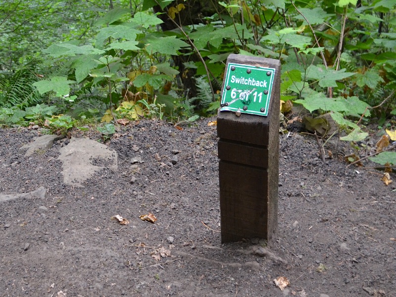
Also, off in the distance, you can just make out a marker on a 4x4 post, with a shiny top. Those markers are fairly new additions to the trail. It helps people to get a feeling of progress and also helps them to judge how far they have come and still have to go. Most people get to wondering just how many more switchbacks are ahead. You turn a corner and there is more trail ahead of you. And again. And again. | 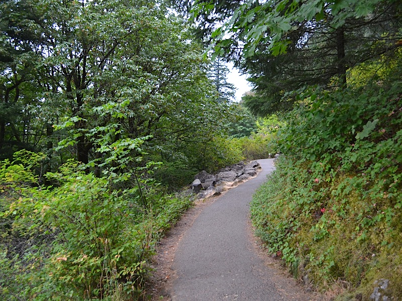 | ||||
 | We are 34 minutes away from the sign by the parking lot, and we are at switchback number 4 of 11. Does seeing that give your heart hope or dispair? I guess that would depend on how hard you are breathing at this point in your walk.
Fortunately, both Kai and I were doing okay still. | ||||
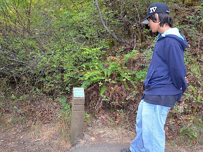
| And this was just one minute more up the trail, saying that we had come 3/4 of a mile. That put us almost 58% of the way to the top of the falls viewing platform, but only 44% of the way to Ecola Falls, which was our first destination. This might be a good place to stop and think about distances. | 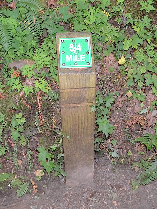 | ||||
|
The start of the hike was the sign at the bottom. That sign is 20 feet above sea level. (When you consider that the Columbia River still needs to flow around 140 miles, in order to reach the Pacific Ocean, that number is amazing.) It is 0.3 miles from the sign to Benson Bridge.
From Benson Bridge to the junction of the trail to the top of the falls viewing platform is 0.9 miles. The trail to the top of the falls is 0.1 mile long, each way. From the junction to the upper bridge across Multnomah Creek, is also 0.1 miles. From the upper bridge across the creek, to Ecola Falls, our most distant point traveled, is 0.4 miles, and Ecola Falls is at an elevation of 1040 feet, or 1020 feet above where we started from. So, our total hike turned out to be 1.7 miles to Ecolo falls, then we returned to the trail to the top of the falls, bringing our total to 2.2 miles, then we walked to the top of the falls and back (2.4 miles) and then back to the bottom, for a total of 3.6 miles for the day. | |||||
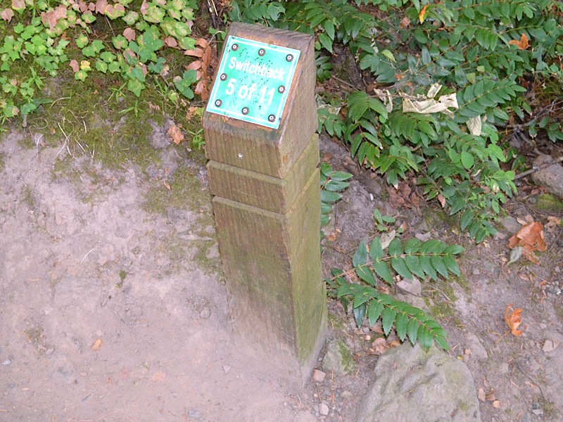 | 37 minutes into our hike we came to switchback number 5 of 11. At least we were making progress. | ||||
|
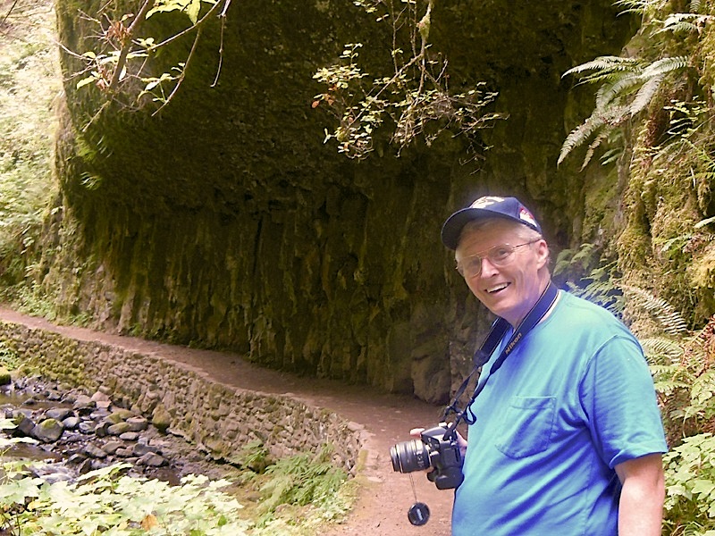
This is a very heavily used trail normally. We had it pretty much to ourselves for the hike up however, because we got a nice and early start. We saw some other hikers but not many. They actually ran asphalt all the way up the hill and built nice stone walls and made other improvements to this trail over the years. It was a little more rustic in 1974 when Dotti and I first walked up to the top, but it was well cared for even then, and quite a busy attraction.
The gnarled roots on the far right are very common sights along many trails and often even run right across the dirt trails. | 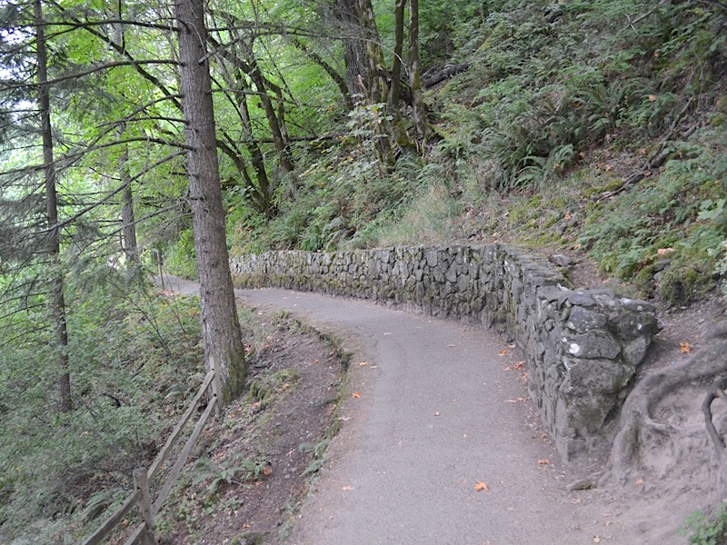 | ||||
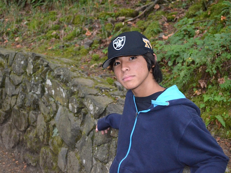 | Just around the bend from the 5th switchback marker Kai leaned against the stone wall for a picture. | ||||
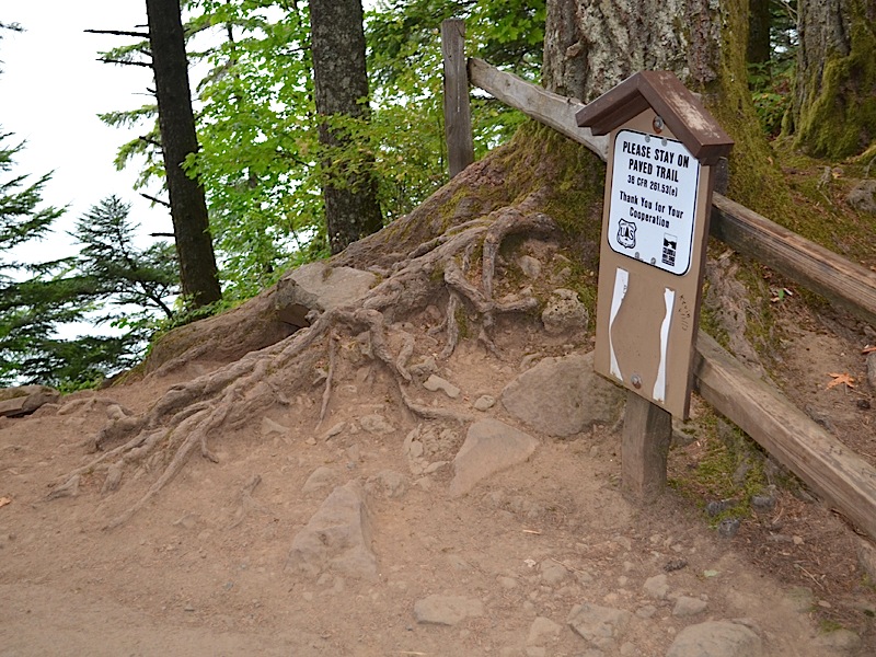
| The camera is aimed back along the trail towards switchback number 5, and Kai is looking at a sign that is meant for me, or at least the me who came here in 1984 with Dotti, in the 10th anniversary year of our first hike to the top, and we went up again. But this was before they put up all these signs. At one time they listed a huge fine on the signs, but now they simply reference 36 CFR 261.53(e). I guess they figure we all have that memorized. But alas, I didn't, so... | 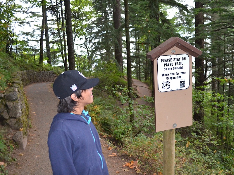 | ||||
|
I just looked this up online and I found that the reference Code of Federal Regulations Title 36 is connected with "Parks, Forests, and Public Property" and part 261, is the category of "Prohibitions." Then I found that in Section 53 there are listed "Special Closures," and Item (e) is "Public Health and Safety." All that is well and good but it doesn't make you much wiser. It merely states that the people in Washington DC have taken an interest in this particular trail and that they say you can't leave the paved trail because it would endanger public health or safety. But what if you ignore this prohibition? I searched further, and I found under §261.1b "Penalty" the following:
I guess this is stealth enforcement, compared with what they did before, when they posted the $500 fine, along with the warning. Now you get to guess what they will do if you violate their wishes. Anyway, I am glad the statute of limitations has run out on trail cutting.  They can toss you in the clink for 6 months, OR hit you for a $500 fine, or if that is not enough of an attention getter, they can give you BOTH. They clearly take this trail very seriously. They can toss you in the clink for 6 months, OR hit you for a $500 fine, or if that is not enough of an attention getter, they can give you BOTH. They clearly take this trail very seriously.
On the other hand, I almost topped their penalty, even though it was not actually in place in 1984. I was a heavy smoker, and though I was only 32 at the time, I was not in good enough shape to be cutting these switch backs. Dotti took the correct route, and after the last one I cut, I got to the top to wait for Dotti to catch up, and I had quite some trouble catching my breath. If I tried to do that today, I would probably keel over dead, and I think that would indeed trump their penalty. Of course today, for me, they don't need these signs up, because I am a domesticated old man, who no longer has either the energy, nor the inclination to do something so crazy. I guess I finally grew up, dog gone it. | |||||
 | And here is what all the fuss is about, a dirt trail cutting from the paved trail below up to the paved trail where we were standing. If you took that particular $500 shortcut, you would miss the opportunity to see Switchback #5 of 11. Quite a few someones obviously have not read 36 CFR 261.53(e), because there has been a lot of foot traffic along that forbidden route. | ||||
| No Kai was not practicing assuming the position for the trail patrol from Washington DC. Since there were no posted restrictions on moving boulders, he was trying his hand and his muscles on that boulder. | 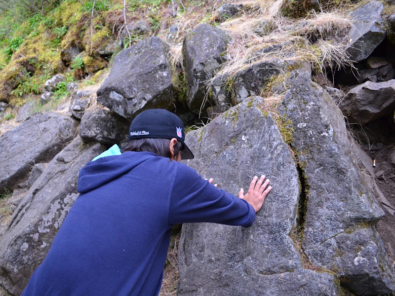 | ||||
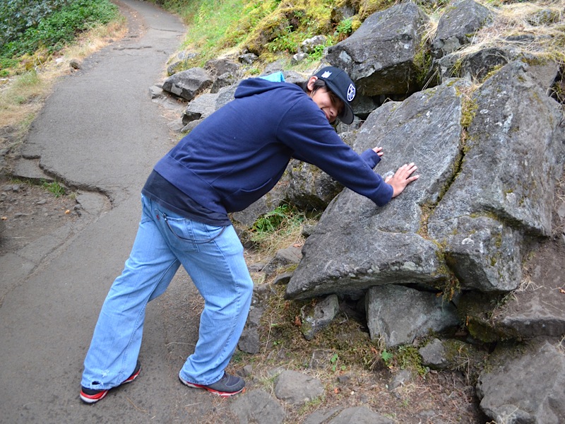 | As you can see, Kai caught that rock just in time, before it rolled out into our path. It was close, but...
Seriously there was a major rock slide at this spot in the past. This one decided to stop just before getting in the way. Probably several of his brothers were carted out of the way by the Forest Service guys who keep the trails clear of falling things like trees or rocks. And if you look at the asphalt here, even though they don't have any 18-wheeler traffic, the surface does wear out and get torn up, requiring resurfacing. Dotti and I have been up here when they had the machine on the trail that lays the asphalt down. | ||||
| This is a study in basalt. Remember that our ocean floors are made up of basalt. The oceanic ridges that are pushing the floor of the ocean apart, and sliding the continents around the globe, are dumping new ocean floor out all the time, and it is made up of heavy basalt. Now this basalt, in its current form was not at the bottom of the ocean. However, the elements making up this rock, may well have been on the ocean floor a long time ago, | 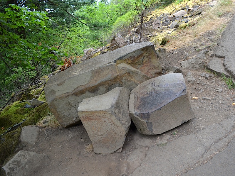
| ||||
|
moved under the Pacific plate, subducted as part of the constantly being consumed mass beneath the ocean, shoved deep beneath the continental plate, melted and then risen in an eruption of the Larch Mountain volcano rising above us on this trail. In fact that is very likely. But the shape it currently has was created by the cooling process after the eruption of liquid rock from the crater above. (Remember the viewpoint at Sherrard Point is a plug of the Larch Mountain volcanic vent, sitting thousands of feet above where these rocks lie today.)
What is extremely important to note here is the shape of these rocks. Notice the straight sides and sharp corners. These almost look like they were intentionally shaped to be laid into a wall by a mason. (In fact you will see such rocks used for that very purpose at Timberline Lodge and the Multnomah Lodge below us, at the start of this very trail.) Basalt cools into chunks, which are easily broken apart. If you shatter a piece of concrete or granite, it doesn't come out looking like this. These materials are good for building things because they are bonded strongly together. But Basalt is made up of isolated chunks, like these are, held together loosely. And this is why rock slides are going on all the time in the Columbia River Gorge, with its thousands of feet of basalt stacked all through the walls of this majestic natural wonder. | |||||
 | Once again, look at this collection of rocks in the rock slide so common to the Columbia River Gorge; these rocks look more like a child's blocks tossed down the hill than broken stones. | ||||
| It was a cool overcast day, but the clouds were not so low that we could not look across the Columbia River and see the forests of Washington on the other side. | 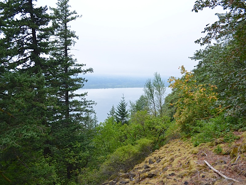 | ||||
 | Six switchbacks done, 5 more to go. We were making some good progress now! | ||||
| Kai is an active lad, but he is not used to hiking up these steep trails. We paused for a rest every so often, and frankly I didn't mind either. Overweight and not in too great a shape, I was breathing plenty hard myself on the way up. | 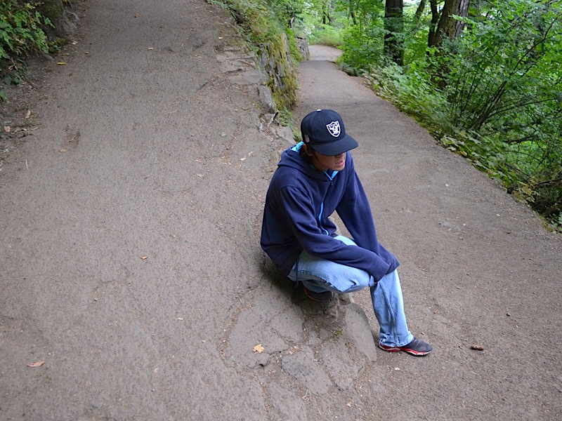 | ||||
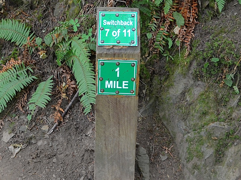
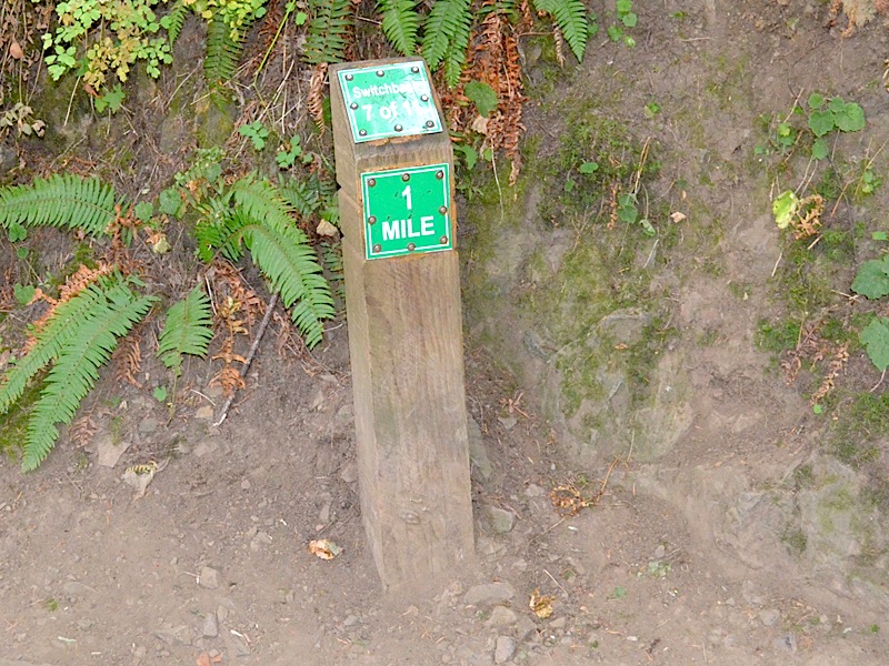 | They used to say it was a mile to the top, but here we were, at the 1 mile marker and it was only switchback number 7 of 11. But not all switchbacks are created equal and we were most of the way to the top by now. | ||||
| Kai was showing his determination here, he was going to go to the top of the trail! You can look behind him and see the sharp angle of the trail. We just came up the stretch on the right and were about to go up the path on the left. That path on the left climbs out of the view of the camera pretty quickly too! | 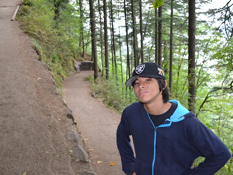 | ||||
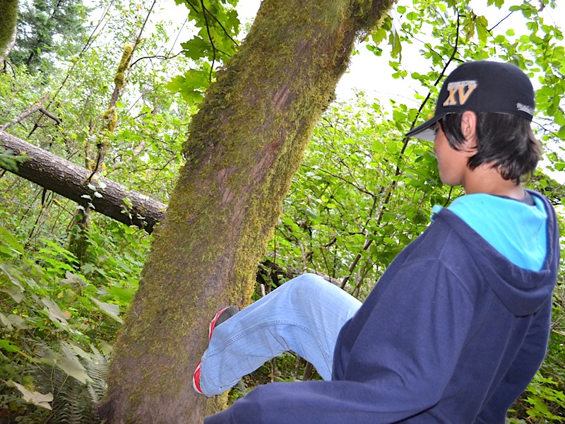 | The tree may be leaning, but its roots run deep into the mountain, and pushing on it will not budge it a bit, but Kai had to try. | ||||
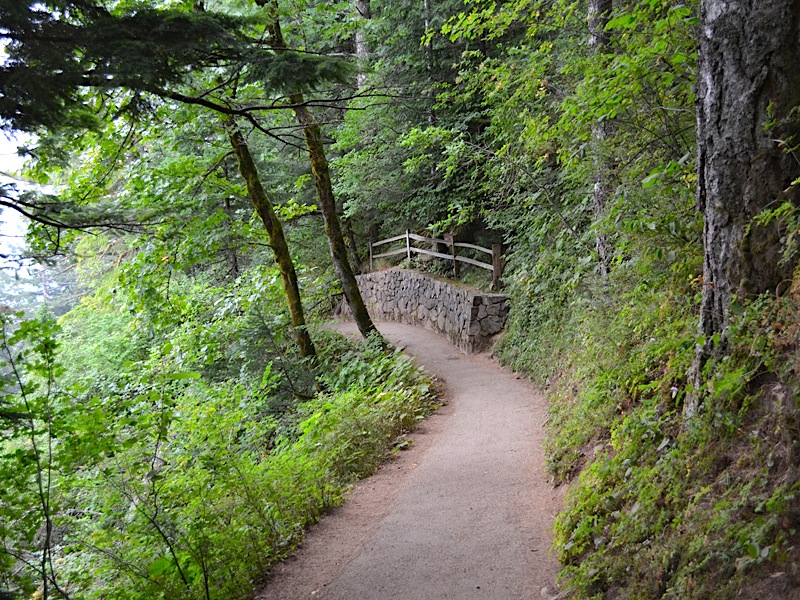
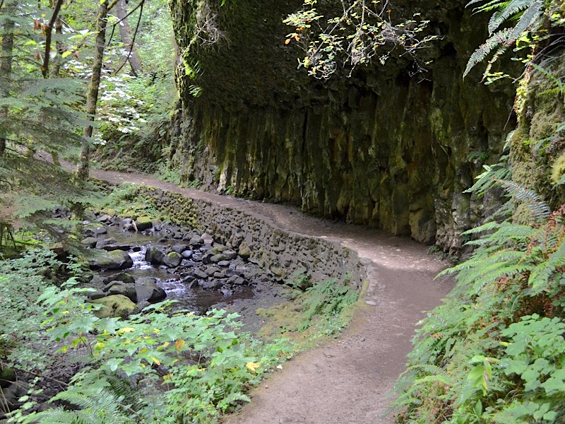
| This reminds me of the Cheshire Cat; what secrets are behind that smile? The trail has been worked and reworked over the years. Look at the wall—putting that good squared off basalt to use—and the wooden fence above. Those were not there in 1974 when Dotti and I went to the top. It is like painting the Golden Gate Bridge, the job is never finished. There is always more to do. | 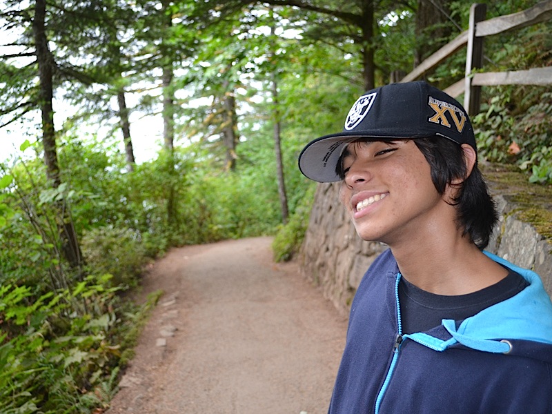 | ||||
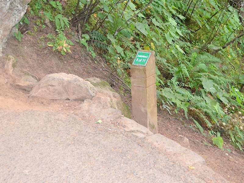 | Switchback 8 of 11. Almost there! | ||||
|
I can't help but think that John Ronald Reuel Tolkien must have spent time in a setting like this. Surely visions of the Shire, and Hobbit holes had to come to mind as he trod along forest paths. Is that a pair of small eyes looking out from around that fence post up ahead? |
 | ||||
|
My father pictured a small people who lived in lands like this and he thrilled me as a child with stories of these small people. It was only the last few years that I learned he had entertained his siblings when they were growing up together with similar stories. My Cousin Fay talked of these people to me in an email one time, and I about fell out of my chair. I had no idea he had ever told anyone else his stories.
These old forests are wild with life, and who knows? Maybe Hobbits or other "little people" are not as impossible as we think. They seem to come along in my mind's eye with me on many of these hikes. | |||||
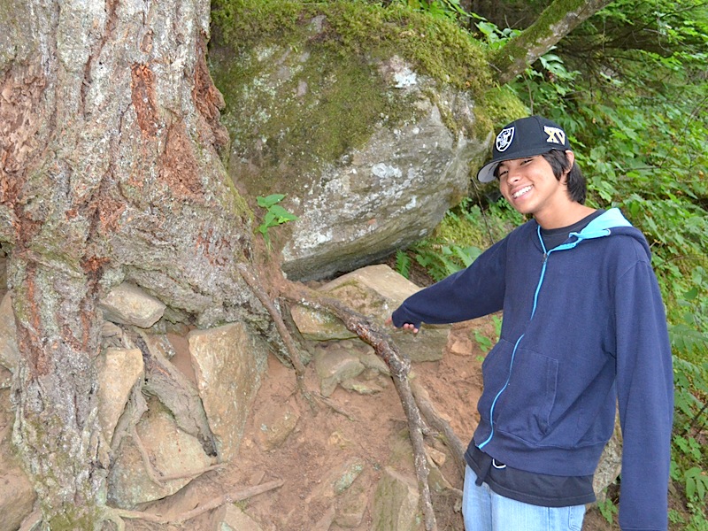 | Life is incredibly adaptive. Kai is pointing to the root system of this massive tree, working is way into the basalt and soil of the rocky roots of Larch Mountain, pushing back against a fallen boulder, while grabbing its own footing by reaching around, and over broken rocks beneath it. | ||||
|
Rock and tree seem to merge into a heterogeneous form of existence, hardly optimum, but showing the determination that life that survives always demonstrates. The struggle is forced upon this tree, and it grapples with the challenges of life and continues to reach for the sky. What a moral the life story of this monarch presents to us. Life is difficult, and filled with challenges, but that is no excuse to quit. Roll up your sleeves and grab onto life and find your own bit of sky to reach for. It is there, waiting.
| |||||
| Do you know what that little sign at the end of this hill marks? That is the highest point of the trail, on the way up to the top of Multnomah Falls. Although that is not the last switchback, it is the highest one! Later, you will see a picture or two of Kai sitting on that boulder on the left of the sign. It is a place that always brings joy to the heart of anyone who has struggled up this trail, breathing hard and wishing it would be over, so the top of the falls can be reached. This is a big landmark on the trail, and we were almost there! | 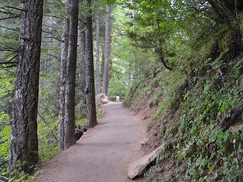 | ||||
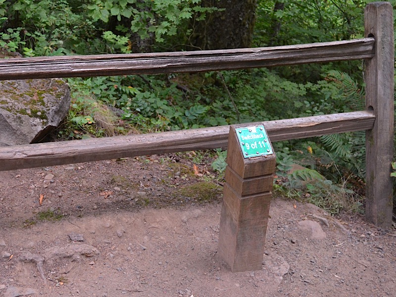 | And here we are! It is switchback 9 of 11, but the other two are on the downhill side heading to the top of the falls. The hard part is over. Even though we were going to add in an extra mile of hiking, by doing an out and back trip to Ecola Falls, the rest of the hike was going to be far less steep in grade. It was time to do a little celebrating. | ||||
| Looking back down the trail the way we had just come. It was from down there that I took the picture of the sign up ahead of us. |  | ||||
 |
Kai, as was Grandpa, happy to be at the top of the long hard climb. We still had some climbing to do, but the really tough stuff was over. And the rest of the hike, at least until we reached this same point on the way down, would be near water, and it is amazing how much more cheerful it is hiking along beside a babbling stream, as it bounces along over the rocks happily heading along its way. It is as if an enchantment of peace and joy were cast over the entire trail by the fairies of the forest. And that is what Kai and I had to look forward to. Let's go! | ||||
| After a short downhill walk, we came to switchback 10 of 11. And even though that meant the top of the falls was not far away, it would be a while before we reached it, because we had a little side trip in mind. | 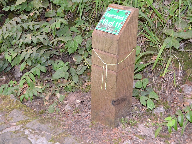 | ||||
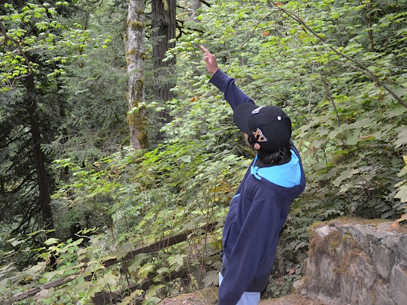 | Is it a bird? Is it a plane? Is it Superman? The forest is filled with moss covered trees, with birds serenading the hikers, boulders strewn over the landscape, and furry creatures scampering about searching for food. Kai's interest was caught by one of these things and his curiosity was piqued. | ||||
| One of the things I love about Kai is his curiosity. He is not loud and boisterous generally, but he is observant and bright. I find a resonance with my grandson. I enjoyed every moment I spent with him, and I am so glad we had our times alone together. | |||||
|
This is looking back at the trail standing at the "Switchback 10 of 11" marker. Once again the trail is steep, but it is, at least in the direction we were heading, downhill. It would be uphill on the way back and there have been times on past hikes on this trail when I cursed that. When it takes about all you have inside you just to get to the top of the falls, you are ready for a nice downhill walk back to the car. But first you have to get up to the top of the trail, and it is a bit of a climb, as you can see. | 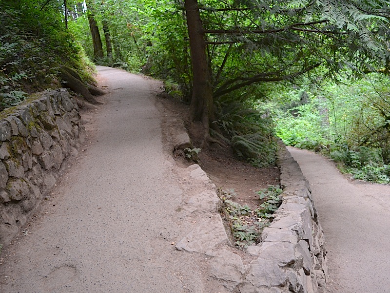 | ||||
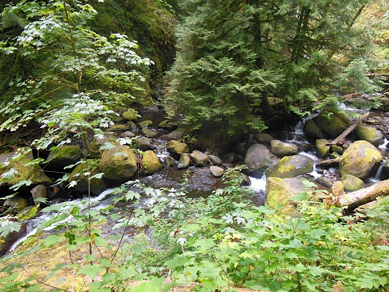
 |
Looking upstream on Multnomah Creek. It is August, and one of the things that makes summers so great in the Pacific Northwest, is they are dry! When temperatures rise, the relative humidity drops like a stone. | ||||
|
When you sweat, it evaporates and cools you right off. However, this aspect of our climate always makes this creek run a lot smaller in August than it does in January or February, when rain is falling almost every day.
Looking at the rocks lining this entire creek bed you can learn a number of things about this stream. As I mentioned, this is the off season for heavy flow. Also, the width of the bed shows that much more water flows on occasion, to have carved out this channel. And the size of the rocks in the bed, shows us that the stream at times runs heavy enough to move these fairly large rocks along. Note also that these are the same basalt rocks that we saw earlier in the rock slide. What is different about these? They have lost a lot of those flat sides and square corners. The water has rounded them off a lot, as it rolled them down the bed, bouncing them off of one another. Finally, just look at the green! Even the ground is covered in green, and vegetation is filling up the setting surrounding this beautiful creek. | |||||
| Turning around 180° and looking downstream, even more evidence of the difference between high water flow and the current summertime flow of Multnomah Creek. | 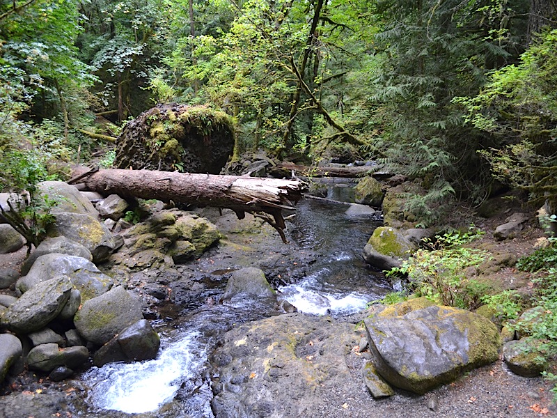 | ||||
|
Also, the large boulder on the left, most likely rolled down the mountain and stopped right there; I doubt that it was moved much by the water of this creek. However, the moss has attached itself to the surface of this rock and made it part of this scene as if it were always part of it.
While trees often live long lives, sooner or later they come to the end of it, as with this supine example, with its broken end hanging out over the water, like a wee diving board for the little people. (What little people? The ones we big folk almost never see.) More rounded basalt rocks, and lots of green fill up the eye in this view. Lovely! | |||||
 |
Kai has crossed the upper Multnomah Falls bridge while I stopped to take the previous two pictures. He is still smiling so he is doing well after the climb to the top, and ready to push on! | ||||
|
Off to the right, there is more evidence of falling rocks from above, and behind Kai is the slope upward that leads all the way to the top of Larch Mountain, and it is covered in green foliage and moss.
| |||||
| Upstream a bit, Kai pauses to study the peaceful stream and rocking creek bottom. It is hard to imagine that this crystal clear water would be soon churned into a white foam, cascading down the long drop of the majestic Multnomah Falls. | 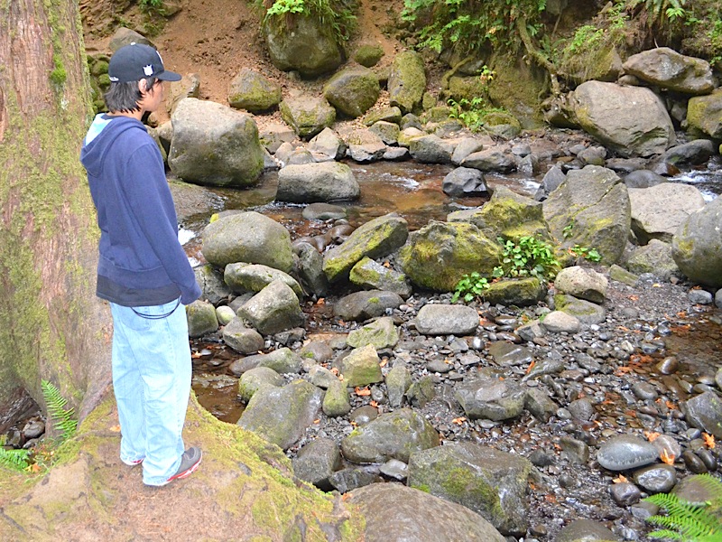 | ||||
 |
Turning to look back, there is the spot Kai had been standing only moments before at the uphill side of the bridge, with the downstream path of Multnomah Creek beyond.
In this area, which side of the tree does the moss grow on? The outside! | ||||
| When people think of the top of Multnomah Falls, they usually think of the stupendous view from the upper viewing platform at the very top of the falls, and rightly so. But sadly, most of them never see this somewhat more subtle, but equally beautiful point of the Multnomah Creek, and these smaller falls. Can you imagine looking out of your living room window and seeing a view like this? I don't believe that stress can survive in such a setting. It is a wonderful place to be. | 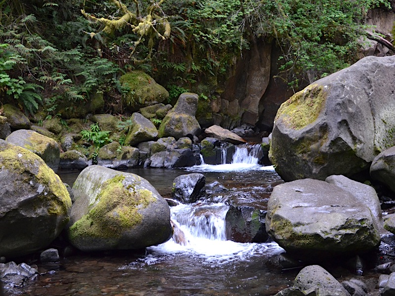 | ||||
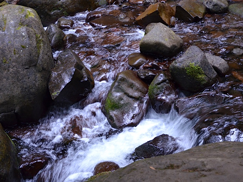 |
There are numerous points along the creek where you simply have to stand in awe of how truly beautiful it is.
| ||||
|
Something of interest here, is the difference between what I believe to be new rock arrivals and older residents of the creek; see how some of the rocks are still sporting sharp corners and flat sides, while many others are rounded on both sides and corners? Can you almost hear the stream flowing as you look at the wet scene here?
| |||||
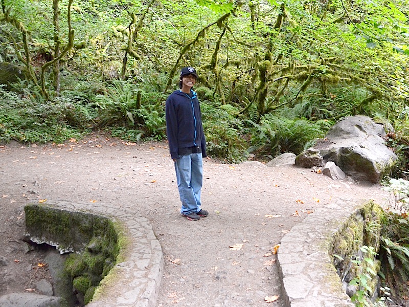
| Kai was cheerful and interested throughout the hike and a great hiking companion. He took time to use little scenic "viewpoints" just off the trail to enjoy the various sights we came across. I hope he enjoyed this hike as much as I did. It is stored away as one of those priceless memories for me, never to be forgotten. | 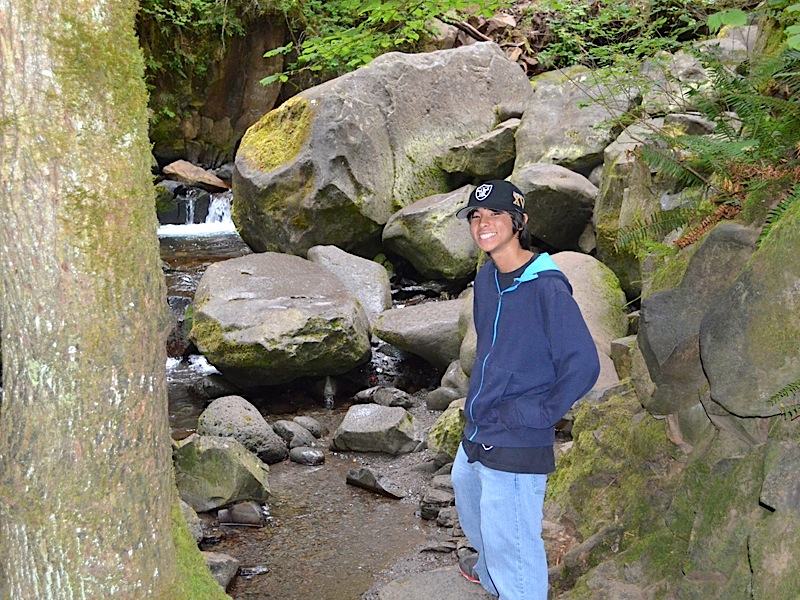 | ||||
 |
This is the same location. I just stepped a bit closer to show more of the background behind Kai. | ||||
|
As we moved upstream the trail lifted above the stream bottom.
|  | ||||
|
If you follow this trail all the way to the top of Larch Mountain there is one point along the trail where things narrow down so much that they created two separate paths, one for low water, like now, and one for high water, where the secondary path goes up and over past a channel narrows that gives no room for the lower trail to avoid being flooded.
| |||||
 |
Here is a picture that Kai took of Grandpa. If you checked that link above, of the picture of the high water trail, you will see that | ||||
|
Grandpa is much heavier here (I weight 224.5 that morning) than he was back in 2003 (I weighed 40 pounds less at 184.5 that morning). I hope to fix that problem soon, but at least I am still moving, and though red of face, I felt pretty good still at this point in the walk.
The wrist brace on my left hand is mostly preventive at this point. If you read my Journal you know that I got two cortisone shots in that arm for De Quervain's Tenosynovitisone and did a lot of ice dipping as well to get the pain under control before the kids arrived from Japan. It really worked! My left wrist allowed me to swing a bat, and play my guitar, and yes, hike the trail with Kai. | |||||
| One of the things you lose as soon as you leave the trail to the top of the falls is the asphalted surface. Most of this part of the trail was dirt, or occasionally mud, when tiny streams crossed the trail, but there was one short stretch that was made up of sharp pointy rocks and you would not want to take a tumble there; it would be painful at the very least. | 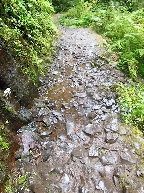 | ||||
 |
Rounded boulders, and basalt bedrock, covered by moss, and surrounded by green vegetation and the babbling of Multnomah Creek unfortunately can't know what an idyllic setting they are sharing at this moment in time. Fortunately, Kai and I could appreciate the entire scene together. | ||||
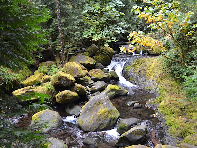
| The gently flowing stream tells one story, while the debris lying in its path tells another. Today the creek is quietly running along, with just enough water to create clear pools, small delightful waterfalls, and a happy little bit of pleasant babbling to cheer the happy hikers along their way. The large rounded boulders, the fallen trees, aligned with the flow of the stream, and the creek bed that is much wider than the stream is on this day, all speak of a far more violent mood that Multnomah Creek is capable of. | 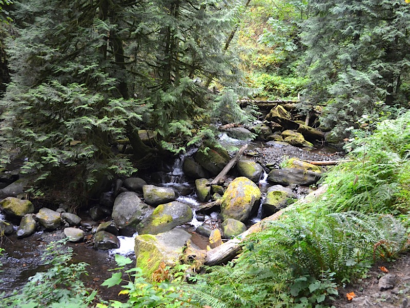 | ||||
|
Of course you need not climb to the top of the falls and continue even higher up the side of Larch Mountain as Kai and I were doing, in order to witness the change in temperament I am speaking of. All you need to do is to park in the parking lot in the median of the freeway, and look up and you can tell it even from there! The falls will then not only have a much wider stream filling up the main dropping flow, filling the entire depression you can see carved out of the rock at the top, but there will be auxiliary small streams of water falling separately from the main flow. It is as if the falls were filled to overflowing and bursting its seams. But this is the way of streams, and it is the way of rivers. In 1996, during our first year back in Vancouver we had a demonstration of what two mighty rivers could do when swollen and raging. The Columbia River is contained a bit by the numerous dams along its course, but it still rose up and ripped boats out of a marina near the airport. The Willamette River threatened downtown Portland as its waters rose 29 feet, lapping at the edge of the retaining wall. Salmon Street, which runs from right next to the river up past the old Pacific Power and Light building was in danger of going underwater. Why do I mention Salmon street? When I first met my lovely Dotti, she was working for P.P. & L. in an office of engineers, and I stole her away. I have clear memories of parking my car in the garage and walking up to her office at the close of her work day and we would go wandering around the downtown area. There was a candle shop just around the corner, and a really fantastic water fountain not far away. I don't know where the time goes, but I am thankful for the memories it leaves behind! | |||||
 |
There is a very cute little waterfall in the foreground, but the water in this picture takes a back seat to the boulders and trees that have been collected by this stream in is more angry moments. It is the way my room used to look when I was a kid before my mom told me to clean it up. Nature tends to be that way. If you inspect the space around planet earth you will find a great deal of untidy debris running around. Order is the exception, chaos the rule.
| ||||
| A bit farther along the trail, the water dominates the scene, with fallen rocks and trees, while present, they are merely elements of a greater picture. One of the truly fascinating qualities of water is the way it transforms into radically difference appearances, moving easily back and forth between crystal clear, | 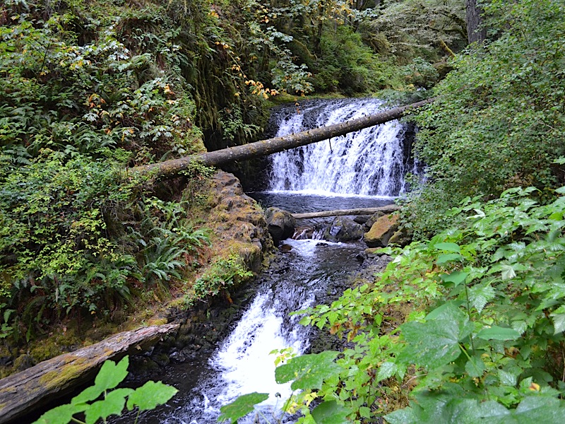 | ||||
|
to churning brilliant white, and back and again in only moments. And remember the same quantity of water is pouring over this wide and white fall of water in the background, as the tiny stream we saw in earlier views. It is a thin stream flowing over a wide area, and drops into a deeper channel, converting the white water to dark rippling water, and then exiting the ponded area, once again it changes to white as it runs quickly down another falls. And the green is ever present surrounding this lovely sight. | |||||
 |
Kai's path, and mine, led up and to the right of the waterfall. The ground is embedded with many small rocks, sticking up, pressing against the bottoms of our shoes as we walked by. I bought hiking boots specifically because of these types of rocks that Dotti and I encountered on the Eagle Creek Trail, approaching Tunnel Falls. | ||||
| We had walked 6 miles to get up to the falls that day, and then we hit a stretch of trail that was covered with these sharp pointy rocks. The bottoms of my feet were bruised from the attack these stones made upon them. This path was not quite as bad as the Tunnel Falls trail had been, but I still wish I had worn my boots, mainly near the bottom of the trail where their added traction would have come in very handy! (More on that later.) | |||||
| Turning around and looking back along the rocky trail behind us. The rock wall rises sharply beside the trail. |  | ||||
 |
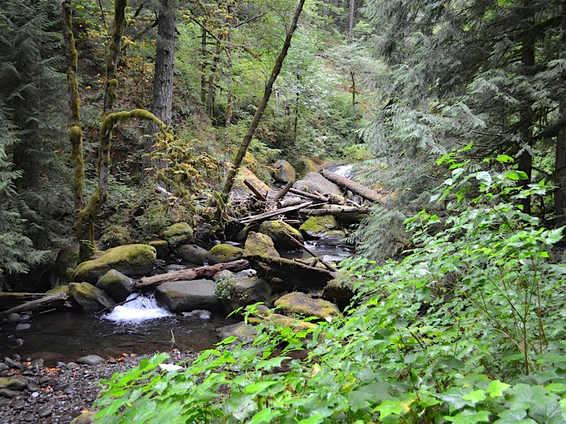
Once again looking backward, downstream. The log you see on the right is the same one you saw earlier when we were looking that waterfall; this is the one cutting across the view of the falls. | ||||
| The same log once again, this time looking straight across it. It would be a very tricky bridge to cross, even without the little branch nubs sticking up all along the trunk. Small animals would have no trouble using this, but I sure would. The log has been here quite a while because it is embedded into the soil on this end anyway. | 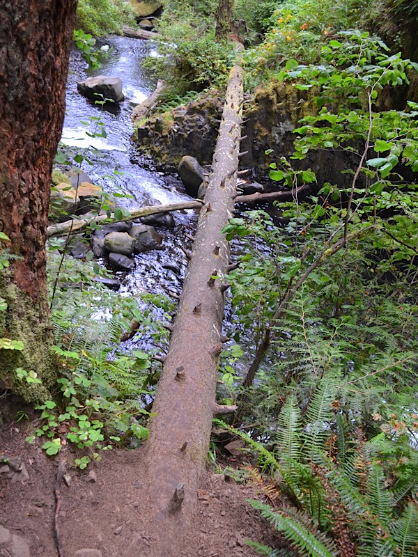 | ||||
 |
This is the top of that little falls, and you can see how thinly the water is spread out as it approaches the drop. | ||||
| Upstream just a bit, and the water is clear on the left, and on the right it is going back and forth into white and clear. The branch out over the water is covered in moss, as are some of the stones in the water. (Note they are well rounded, and that means they have been here a while.) | 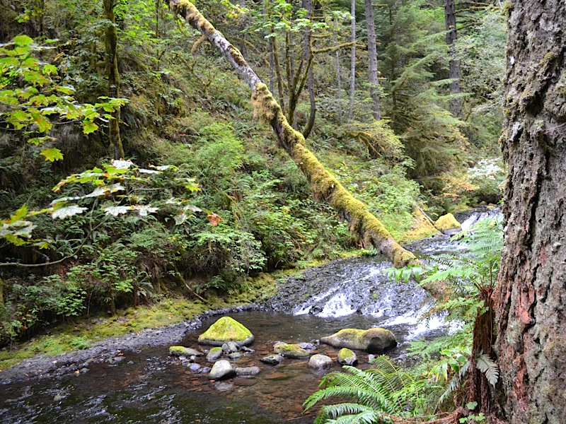 | ||||
 |
This corner in the trail was a good sign, I knew. We were almost at the end of the "out portion" of our out-and-back excursion to Ecola Falls! Right past this unique point in the trail, the falls were waiting for us. As I pointed out for an earlier photo, we were walking along the steep rock wall. At this point the rock wall jutted out far enough to block any chance of making a trail past it. So, they had to clear out a section of the rock wall, and then they created a path that runs under the rock wall a bit. I always feel a bit spooky walking under that overhang. | ||||
| Kai standing under the overhang a bit, and in the shadows, so I used my flash. The flash helped light up the rock wall, but it overexposed my grandson's face a little. | 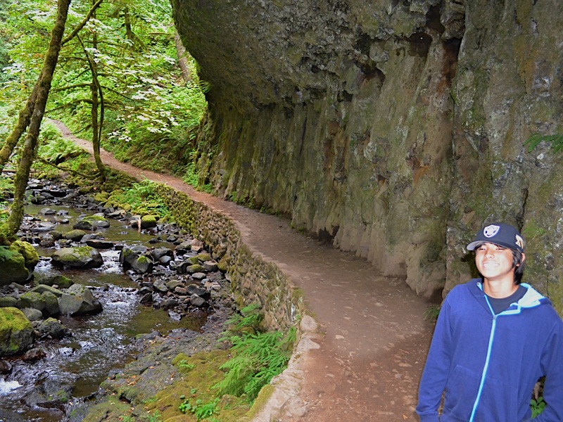 | ||||
 |
Swapping places, Kai took a picture of Grandpa. I can tell I need to work on my weight every time I look at one of these pictures of me. But I was having a great time on the hike, in spite of that. Kai is great company! | ||||
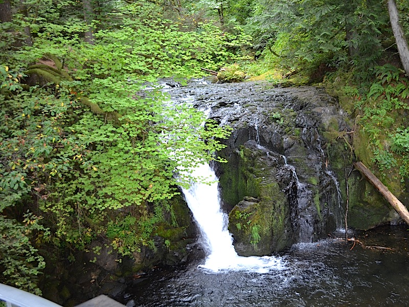
| Hurray! There is Ecola Falls, and we are nearly to the end of this part of the hike, as we came out from under the rock wall overhang. | 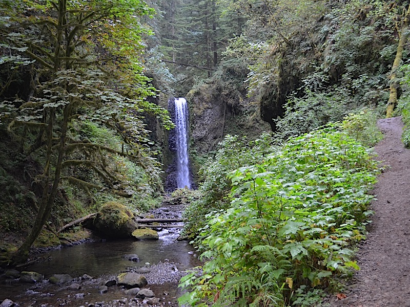 | ||||
 |
Kai looks happy to be at the falls. I know I was. And it was great, because we caught it at a time of day, and under conditions such that we could see the falls very clearly. Every other time I have come by this falls the sun has been hanging right over the top of the falls, and it washes out the view of the water. Therefore, Kai and I had a great view of the falls this day, which I was happy about. | ||||
|
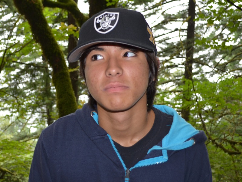
I was joking around with Kai and asked him to give me a serious look, and this was it.
|  | ||||
 |
And Kai took a picture of Grandpa at the falls as well. I felt quite happy that I made it up to the top of the hike without any difficulty. That work on the treadmill paid off! We are over one thousand feet above the spot where we began our hike. Now it was about time to start back down, with a stop off at the top of Multnomah Falls of course, along the way! | ||||
| Here is Kai showing his, "Yes I am ready to head downhill for a bit," look on his face. We are on the return trek now. |  | ||||
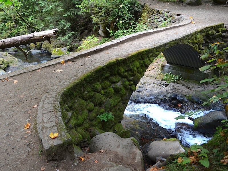 |
We are now back to the upper bridge across Multnomah Creek. As you might surmise, from the fact we are upstream from it, we are still above the top of the falls right here. If you look at our photo of the bridge from 2003, you will see the bridge has not changed much over the intervening decade. | ||||
| Kai and I are excited now. We have come 1.25 miles from the Multnomah Falls Lodge (not including our run up to Ecola Falls) and that put us nearly at the top of the big falls! | 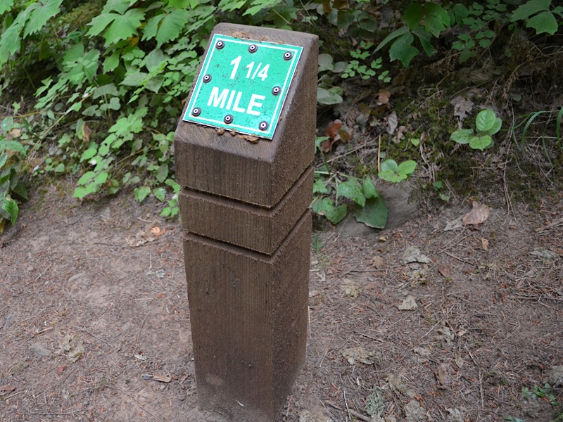 | ||||
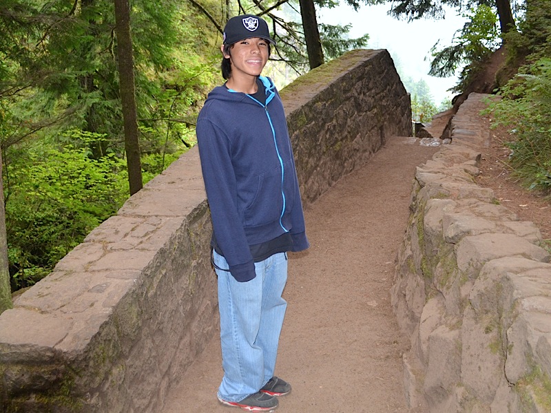 |
And sure enough, here is Kai, happy to be at the stairs leading down to the upper viewing platform of the majestic Multnomah Falls. These stairs have changed a lot over the years since 1974, but the view from the platform has not. It is still striking and panoramic, despite the fact that the falls over the years has attacked the rock walls and created a cathedral that sets back away from the River. | ||||
| Curious to see the view, Kai headed down the stairs, and we had the platform to ourselves! This is the reward we got for heading out early in the morning. Later in the day, on just about any clear day, the platform is a busy place. | 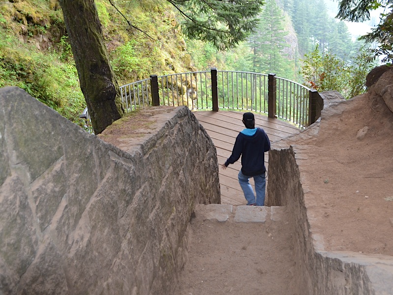 | ||||
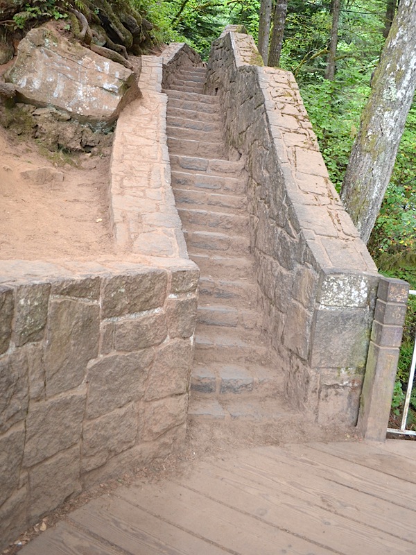 |
These stairs have not changed since 2003, but they have changed a lot since 1974. But the feeling you get coming down the steps and hitting the viewing platform hasn't changed a bit. You feel like you have reached your goal and the reward is worth every step. | ||||
| Kai took a picture of Grandpa, and you can see I was happy to be here. It is great sharing this adventure with my grandson, and it is nice being at the top of the falls finally. So, I had a lot to be smiling about by this time. |  | ||||
 |
Kai was at the rail right off, taking in the view from the top. He has is camera out and ready to shoot some pictures. | ||||
| This picture of Kai is on the other side of the platform, away from the big drop. The little minifalls which leads to the big drop is right behind him. No matter how many times I come to this spot, I am always thrilled to do it. | 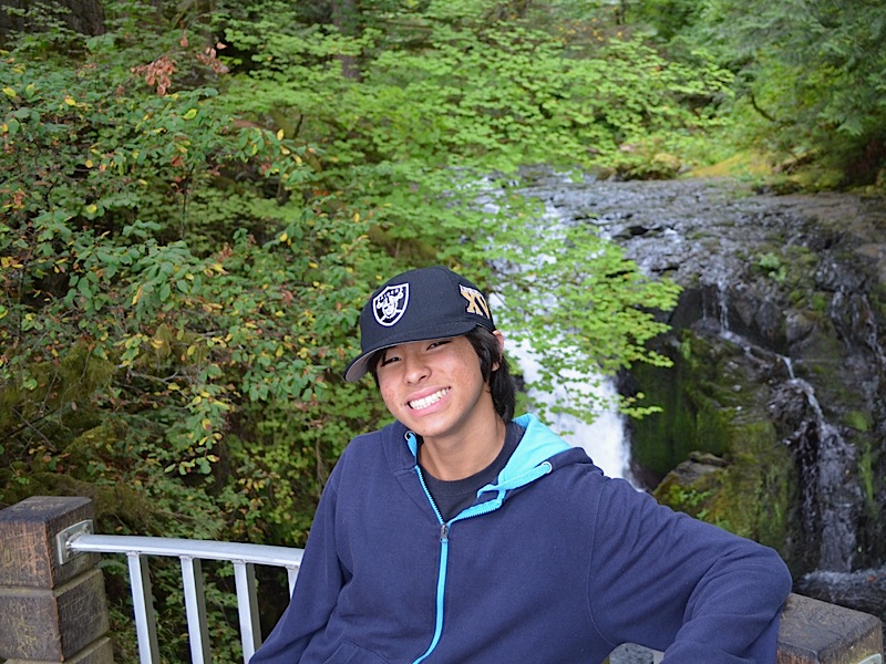 | ||||
|
If memory serves, I have only been to the top of the falls without Dotti three times. I came up with our friends Jim and Tammy in 2002, when Dotti had just had knee surgery, and she couldn't make the hike. (However, she did make the hike not too much after that!) On May 7, 2005, I wanted to find out how fast I could do the hike by myself, and Dotti, whose knee was hurting (the conference hike had injured it that year and she even missed Bloomsday which I also did without her, for the only time) waited in the gift shop while I speed walked the trail as quickly as I could. (It took me 40 minutes and 22 seconds round trip—22 minutes and 44 seconds to touch the rail on the viewing platform from the bottom.)
Now Dotti may have come up to the top of the falls without me on one or more occasions before we met. She knew about the falls and the trail to the top, and that is why she suggested it for our first date. But overall, we consider Multnomah Falls our special place in the world, because it was our first date. And it was a very special thing to share this place with our grandson Kai! | |||||
 |
This is another view of the mini-waterfall by the viewing platform. The same water we were seeing going over Ecola falls and all the little falls along the way this day, were heading for this very beautiful spot. | ||||
| Kai took one of Grandpa as well, with the mini-falls behind me. It was great having the platform to ourselves for so long. That is rare for this location. | 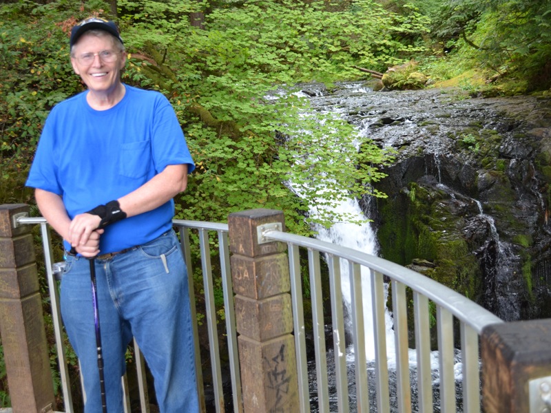 | ||||
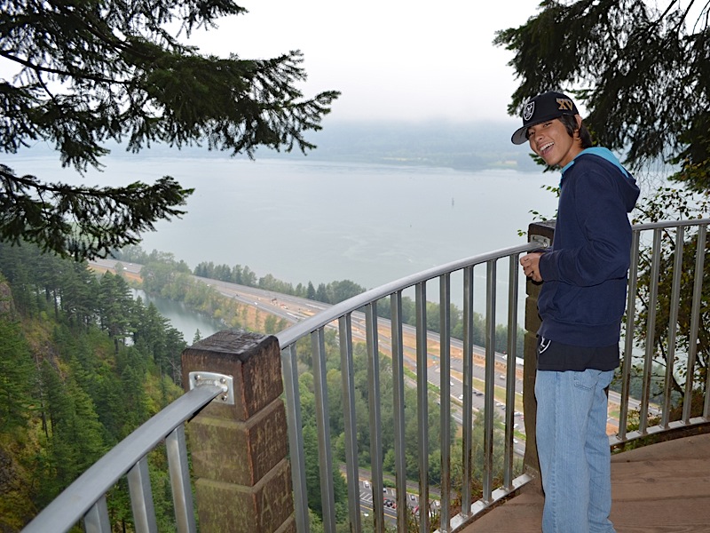 |
Here is Kai standing over the big drop, and you can see all the way to Washington state on the other side of the mighty Columbia River, as well as Interstate 84 (which was named Interstate 80N when Dotti and I came here in 1974) and through the bars at the bottom, you can even see the little parking lot in front of the lodge where our van was parked. | ||||
|
You can see the green water bottle I had hanging behind me, and of course my grey strap from my phone sticking out of my left front pocket. My shirt says I have been sweating, but it was worth ever drop of it! I really, really, enjoyed this time with my grandson. Kai is a great kid, and I was so happy he was willing to do this hike with me.
In the background you see that the clouds were low. It was hard on the view of course, but it kept the August temperature way down for us, and that made it a comfortable temperature to hike in. | 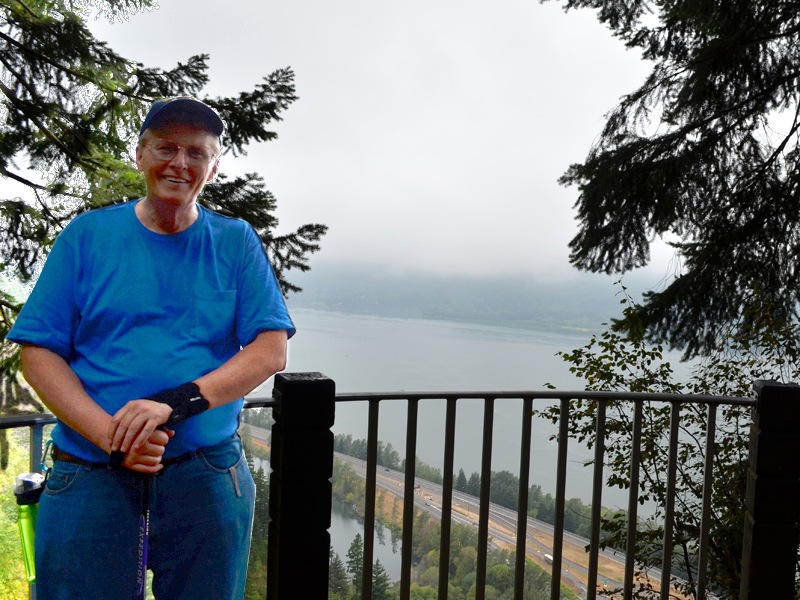 | ||||
 |
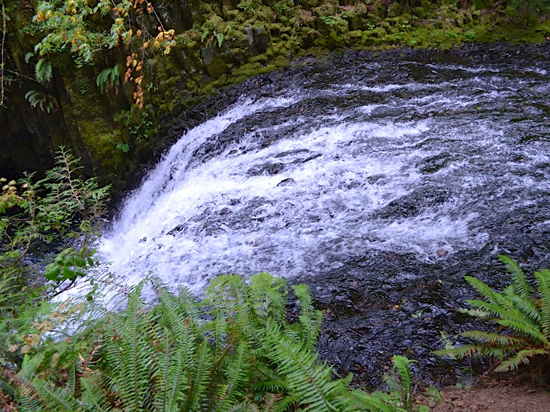
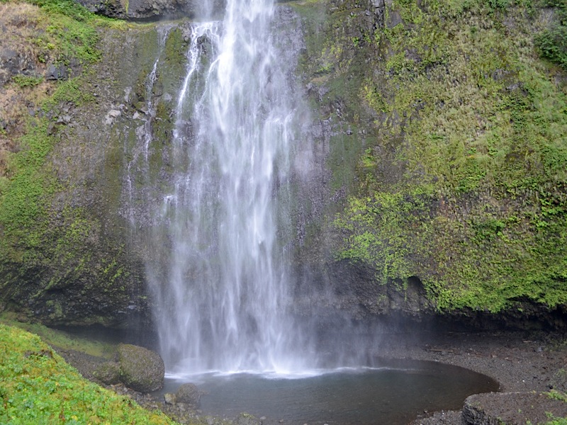
Well this is it. This is where the water begins the 542-foot drop, banging into the rocks all the way down, into the drop pool at the bottom, where it collects its wits after that "E-Ticket Ride," only to move quickly across the pool and under the Benson Bridge, and then make the smaller 69-foot drop into the final drop pool beside the lower viewing platform at the bottom.
It is hard to believe this little bit of water, already churning white, will create that stupendous sight of Multnomah Falls that is so famous. | ||||
|
Looking down from the top, you can see the lower viewing platform at the bottom, the glass in the roof of the lodge through which restaurant patrons can view the falls, the Columbia Scenic Highway and its parking lot—if you look closely, you will see a white hashed crosswalk cutting the Scenic Highway, and on this end of that crosswalk, just to the right of it, there stands the Multnomah Falls sign where I took Kai's picture, and where we began this hike—Interstate 84 and its parking lot, a bit of Benson Lake, and the Columbia River. The water that began 4000 feet above the Columbia River, flowing down Multnomah Creek, will pass through the lake and then into the Columbia, before making its way to the ocean, and remember the sea level‐NOT the river level, but SEA LEVEL— is only about 20 feet below those parking lots!
|  | ||||
 |
This time you can see the roof of the lodge much better. There is a little alcove area on the right, with tables where you can eat food and snacks you might have picked up at the snack bar or coffee stand. A hot cup of coffee can go well with this setting on a cool morning as you look up at the magnificent falls! | ||||
|
And although the aforementioned crosswalk is very easy to see here, the sign, where we started from, is still set sideways to our view and difficult to make out.
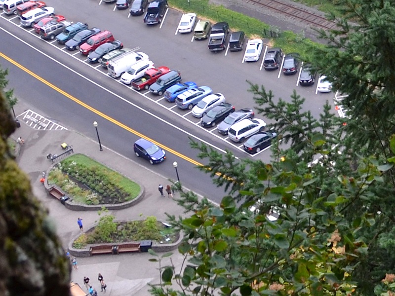
One thing you can see is the great parking spot we got, just the second one in on the right. There are a number of empty spots still, because we arrived early for our hike. Later in the day, people will be fighting to get a spot to park. You can see clearly the bridge that leads from the crosswalk, over Multnomah Creek, leading to the path that runs under the train trestle, and on over to the underpass that runs beneath the eastbound lanes of I-84, and gives access to the freeway parking lot. There is nothing at this location that is not beautiful. Every time I come here, I feel like I am part of it. If I were to be cremated, I would want my ashes to be dropped at the top of the falls and allowed to mingle into this site forever. | |||||
| Vegetation grows right up to the edge of the brink. It is content to stand and suffer the winds and weather, and not worry about whether or not the bit of basalt beneath it, will be the next part of the wall to fall. Past the vegetation is the lower viewing platform with the path leading off to the left, that takes you all the way up to the top of the falls, after crossing over Benson Bridge. |  | ||||
|
Many people walk from their cars to the lower viewing platform, take a few pictures and turn around and leave. They have been to Multnomah Falls, but they have not experienced this falls the way those who have walked to the top and taken in the wonder of the view, nor of those even smaller few, who have walked to and from the top of this Larch Mountain, from whence springs Multnomah Creek. There is so much here and no matter how many times I come back, there is more to learn and see. Do not misunderstand me, those who have come and only made it to the lower platform or Benson bridge, and then gone away, have been here and have felt the awe of this, what is to me at least, sacred ground. Even such a brief visit is amazing! | |||||
 |
Years ago, when we were bowling in a league, and I was trying to settle Dotti down into a very peaceful state before she was going to focus on rolling her next ball, I would whisper in her ear, "Picture yourself standing at the top of Multnomah Falls," and it usually worked. This view is why. | ||||
| This amazing tree has held me in awe for decades. It stands on the brink of destruction, every day of its life. One day, no doubt, it will go over the drop and join the other debris that has been tossed down by this mountain. |  | ||||
|
But today, it tenaciously buries it roots deep into the soil and rock, strengthening its foothold in every way it can to withstand the mighty wind that whips through the Columbia River Gorge—often bringing great storms and even ice deposits into the Troutdale and Portland/Vancouver metropolitan areas—even while positioned over this fantastic drop, down the rock cliff face. The root system itself is a work of art, mixing in spagetti like roots, running across stones too big to break, or to work past directly, wrapping around others, and even driving into the soil horizontally like a desperate man hanging on for his life. | |||||
 |
These mighty trees at the top of the falls seem not to notice that they are standing next to a sharp drop. They ignore all of that and reach up, up, up to the sky as if they were standing in an open field somewhere, on level ground. | ||||
|
We finally broke away from the view at the top of the falls and headed back down. Only we started out by heading up instead. First we had to go up those stone steps we looked at before and then we had to work our way back up to the top of the trail where we were before.
|  | ||||
|
There was a problem with the trail that came to the top of the falls. The original one gave way, or was broken up by some event, and so they laid out an entirely new stretch of trail at least temporarily. This part of the trail has not yet been covered in asphalt, as you can see in this photograph.
They like to give channels for water to flow when it rains, and these little logs across the trail are marking out such a water path. It limits damage to the trail and avoids having the trail itself becoming a creek bottom. | |||||
 |
 Here we are, back a the top of the trail, and it is all downhill from here!
| ||||
| Kai decided to take a little "top of the trail" break on this boulder sitting there waiting for that very thing. If the clouds were not in the way, you would see the forested north side of the Gorge in Washington state in the background. As it is, it is just gray. | 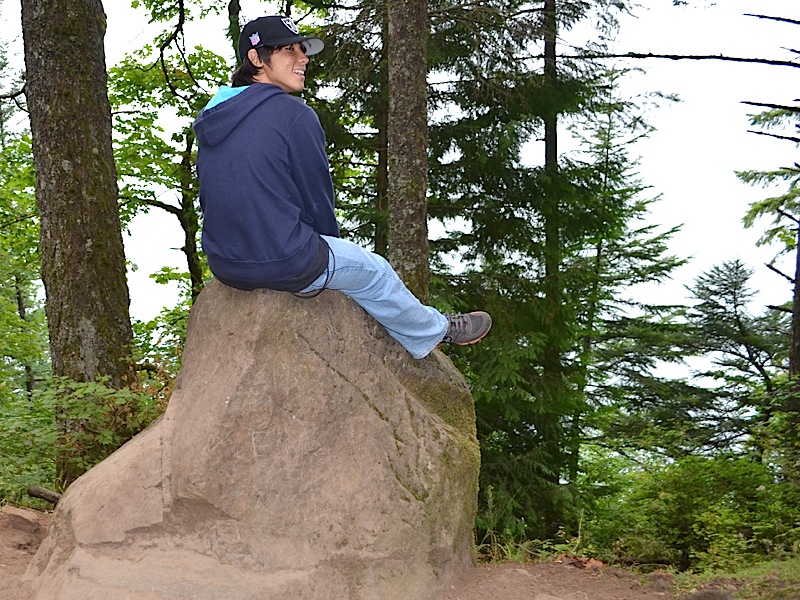 | ||||
 |
We are back down to the "one mile to go" point from the bottom of the trail. The walking is easy here, it's all downhill! | ||||
|
I liked this contemplative look on Kai's face, so I had to include this one!
|  | ||||
 |
Still smiling, even after all this walking. We are getting very close to the bottom now! | ||||
|
We are back to the bench! This is a nice viewpoint and it is as far as Dotti and I made it when we came up a short time ago. It is a pretty good walk, and great starting hike if you are getting back in shape. It is probably about one third of the way up, or in this case, two thirds of the way down! No wonder Kai is smiling. | 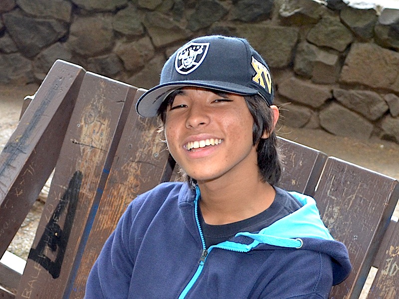 | ||||
 |
Many people have used that bench, or one of its predecessors, on this trail. If you are not in good shape at all, you will be very winded by the time you get this far along, because the grade of the trail is very steep. | ||||
|
Looking down from here, we are much closer to the cars and our starting point. | 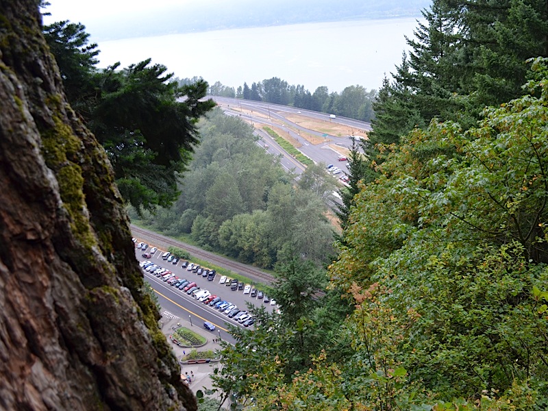 | ||||
 |
Changing the angle just a bit, you can clearly see our van on the right, only one car from the end. The sign where we began this trek from, is blocked from view by the leaves on the right. You will see two concrete inclosed islands of green and the one on the left, has a bench on it, that is facing due south, right towards the lodge and the falls. At the end of these pictures you will see a photo of Kai sitting on a bench; that is the bench. | ||||
|
Yes I know, it is blurry, but it is our van and we would be back in it very soon! |  | ||||
 |
This is the base of the upper falls. Every time I look at that, I remember that LeRoy and I walked behind those falls back in 1996. (Remember the signs posted today. If we did that today it would be an up to $500 fine, and/or 6 months in jail for doing what we did.) | ||||
|
And a couple of weeks after we did it, we saw why, when a boxcar sized rock fell out of the side the mountain and hit this pool and shattered. Where we had been standing was almost certainly hit with the equivalent of machine gun fire as fragments of rock were cast in every direction. Some of them even hit a wedding party up on Benson bridge and the bridegroom was injured, and that was a long way away from where the boxcar hit. We were right next to where it landed. I am older today and wiser I hope.
| |||||
| Kai is zeroing in on the base of the upper falls with his camera. Little did the two of us know, as he was snapping this picture, that I was about to take a fall. | 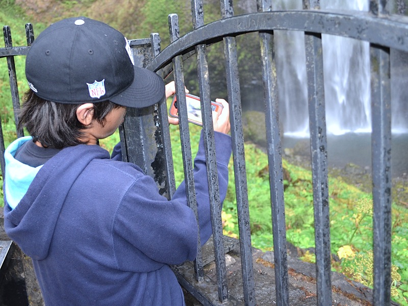 | ||||
|
This is where my boots would have come in handy. The falls create a powerful mist, and it covers everything close by. That includes this stretch of the asphalted trail. The angle of descent at this point is pretty sharp, getting down to the Benson Bridge. My tennis shoes lost all traction on the surface. Unfortunately, so did my walking stick. So, all at once my feet and my stick went flying up in the air and I landed flat on my back. As I mentioned at the top of this page, I had enough sense to keep my head and elbows from hitting that hard surface and my biggest injury was to my pride.
My back was aching for a few days afterwards, but it was minor and soon went away. What didn't go away so quickly was the memory of the fact that poor Kai, who was right behind me, watched his grandpa fall flat, and then one guy, who was sitting on a bench at that end of the bridge, jumped up and ran over to me, making me think I must look a lot older and more fragile than I actually feel. I was back on on feet quickly and we were on our way, but it couldn't have been fast enough for me at the time. I was quite embarrassed. If I had of worn my boots like I normally do, or I had at least taken that stupid rubber stopper off the end of my walking stick, I could have saved all of that. But that is what makes life interesting they tell me.
| |||||
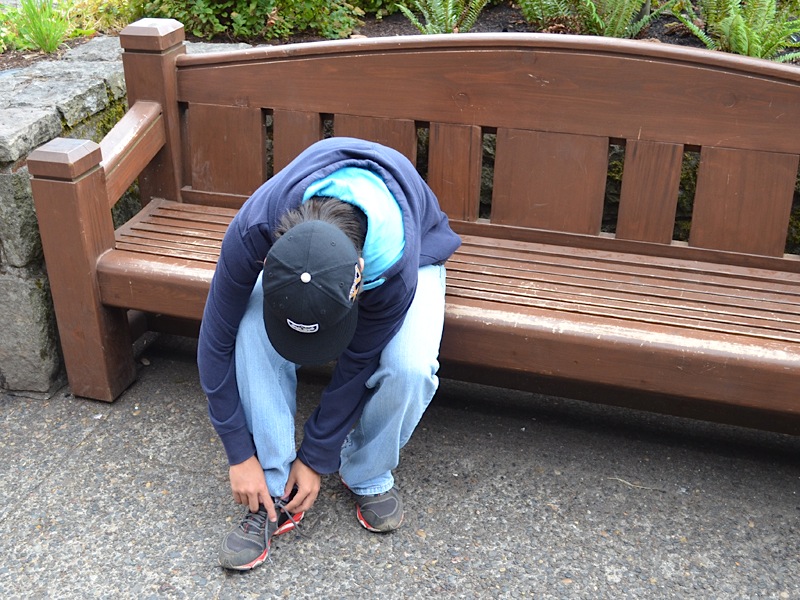 |
And here we are. The hike is over. Here is Kai on that bench I mentioned earlier and tying his shoes. I was plenty tired and ready for a relaxing drive back home. | ||||
|
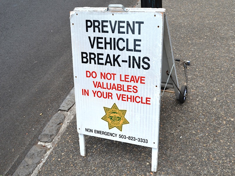
And as we were crossing over to get to the van, we had this reminder that we unfortunately have to share the planet with jerks. Where we were parked the odds were less of this happening, because people could easily see the car at all times, lots of people. Over in the freeway parking lot, cars are more out of view, and therefore far more likely to be a problem. But no matter where you park, there is always that risk.
|  | ||||
|
The hike was over, and I had great time. I hope Kai did as well. I enjoyed every moment of the time I had with my grandson, not only on this hike, but the entire visit. We played baseball and MarioKart, and by the end of the visit, Kai was beating me at that video game. He's good! That's my grandson!!!
Thank you Kai, and remember, your grandpa loves you!!! | |||||
| [ Home ] [ DWLZ ] [ Message Board ] [ Restaurants ] [ Order Cookbooks ] [ Dotti's Newsletter ] [ Support Dotti ] [ FAQs ] [ Email Dotti ] [ Email Al ] |