|
THE COON FAMILY HIKING CLUB
POWERED BY DWLZ.com |

|
| [ Home ] [ DWLZ ] [ Message Board ] [ Restaurants ] [ Order Cookbooks ] [ Dotti's Newsletter ] [ Support Dotti ] [ FAQs ] [ Email Dotti ] [ Email Al ] |
THINGS YOU
MIGHT ENJOY
MULTNOMAH FALLS
SEPTEMBER 6, 2003
The Coon Family Hiking Club
Official Hike #16
2.4 miles - 1 hours 15 minutes
|
What can I say about Multnomah Falls? In September of 1974, 29 years ago this month, Dotti and I climbed to the top of the falls on our very first date. There have been some changes since then, even geological ones! The trail has been worked on and there are many more signs and rules today, but the basic hike remains unchanged. It is a beautiful hike, starting right from the parking lot, and reaching all the way to the panoramic view from the top. You know you have been on a hike when you reach the top, but you know it was worth it when you step out onto the platform and look down.
It is a walk we have done many times and here are some links to pictures of some of the other times we have walked it: Tom's 3rd Conference Multnomah Falls Pictures Jim's and Tammy's visit in 2002 |
||
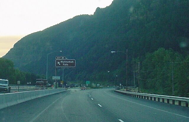
| From Interstate 84 (which was named Interstate 80N when Dotti and I first came to the falls) the exit is to the left, whether you are coming from the either the east or the west direction. The parking lot actually sits in between the two directional sections of the freeway. In order to get to the falls you have take a pedestrian underpass beneath the eastbound lanes of the freeway. | |
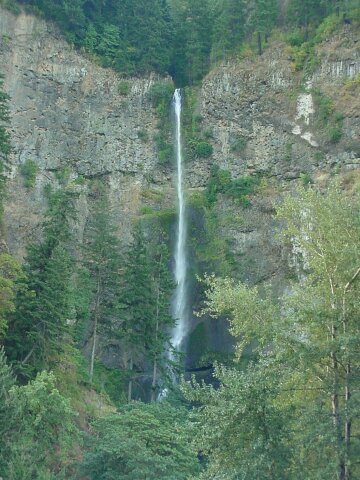
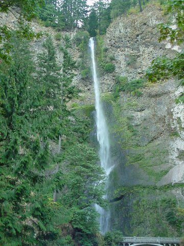
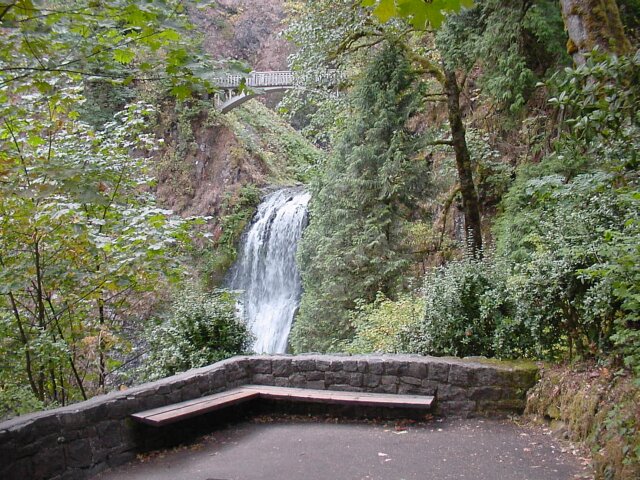
| Multnomah Falls. This was the view from beside our car when we pulled in. |
|
|
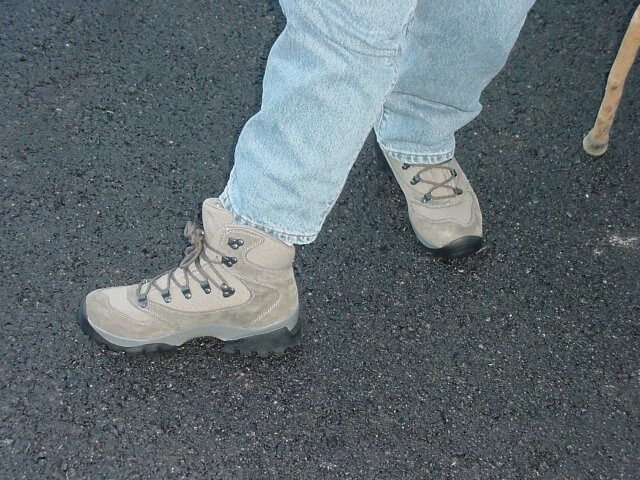
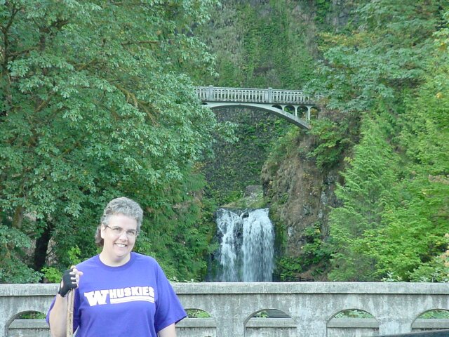
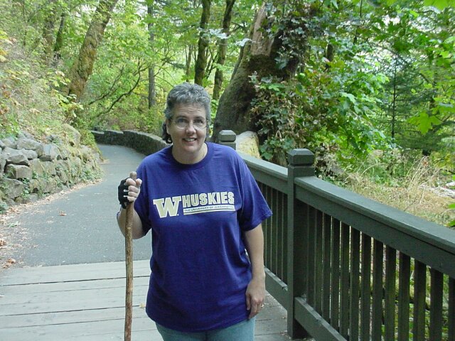
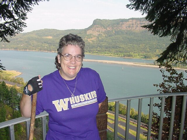
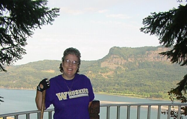
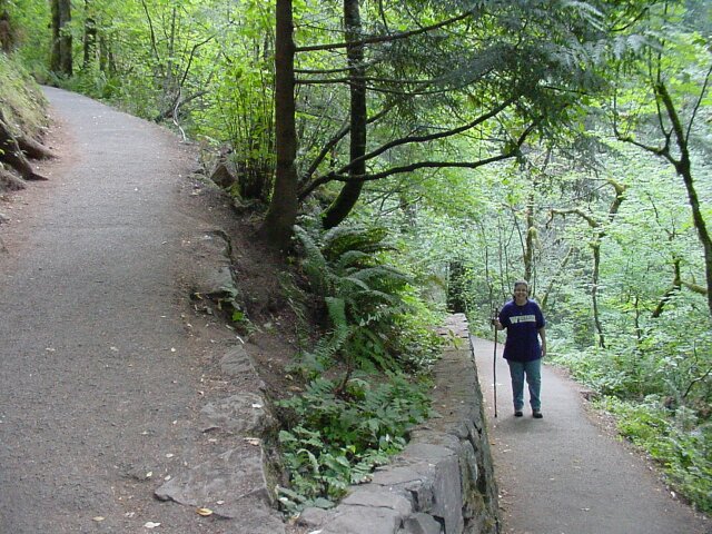
| Dotti was trying out her new hiking boots today. She said that they were very comfortable! | |
Wearing a tee-shirt from her alma matter, where she got her PHD in web design,  Dotti is showing off her new hiking glove. The walking stick has caused her some problems with injuring her hand in the past, so she was trying out this glove to see if it would help. It did the trick. Dotti is showing off her new hiking glove. The walking stick has caused her some problems with injuring her hand in the past, so she was trying out this glove to see if it would help. It did the trick.
|

|
|
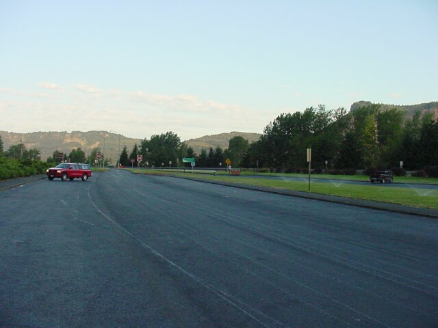
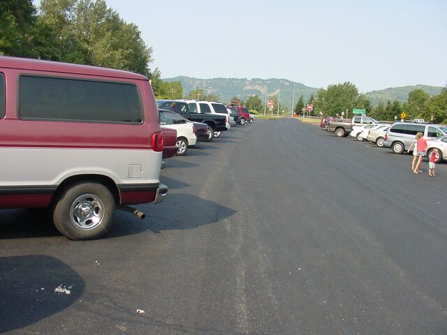
| Once again we have arrived to a nearly empty parking lot. (It was very similar to the time we parked here for the Wahkeena Falls hike) Later on when we got back, you will see that a few additional cars will have arrived. | |
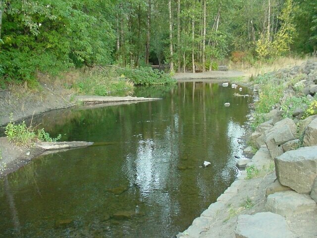
| This is Multnomah Falls Creek heading towards the Columbia River. Looking at it here, you could never guess about the wild ride this water has just taken over the 600-foot drop. As we were looking at the water, we could see ripples being created here and there. It looked like something was falling out of the trees above and hitting the water. Later on, after our hike, and while Dotti was doing some shopping in the gift shop, I sat down on the last rock on the right, on the end just before the rock wall stops. I watched the water closely, and I found that there was nothing falling but there were small nearly invisible fish that were jumping up and breaking the surface in order to catch very small insects that were flying right along the top of the water. |
|
|
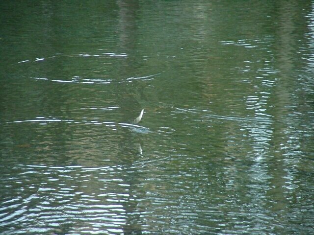
| Later, as I said, I realized that fish were hitting the surface, and some were even jumping 5 or 6 inches out of the water every so often, but when I snapped this picture I was just trying catch what I thought was falling from the trees. I didn't realize at the time that I caught one of the fish up in the air. It's blurry, but it's there. | |
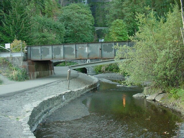
| Looking upstream from where the fish were striking, we can see four different bridges, for three types of transportation. The first bridge is a train bridge, and we saw a train going across it later on. The next bridge is a footbridge for us pedestrians to cross the Multnomah Creek on our way to the falls. The third bridge is for the cars traveling the Columbia Scenic Highway, and lastly the fourth bridge is another footbridge across the lower falls of the Multnomah Falls doublet. |
|
|
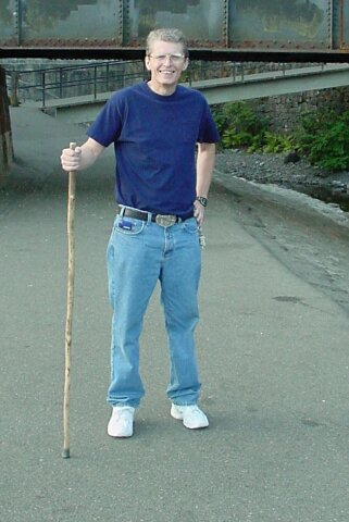
| Today, I went without a backpack. It was just a 2.4-mile hike this time and there was no need to carry much with us. | |
| Here I used the zoom to catch Dotti on the closest footbridge, with the Columbia Scenic Highway bridge right behind her, and the Multnomah Falls Bridge in the background. |
|
|
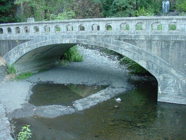
| The Columbia Scenic Highway bridge taken from the first footbridge. You can tell it is late in the summer because the water level is so low. | |
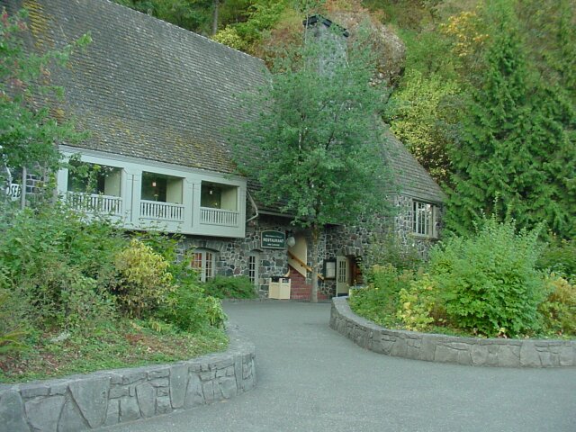
| The Multnomah Falls Lodge. The term lodge is more in the line of a day lodge rather than a place to sleep. There have never been any accommodations for room rental here, but there is a nice restaurant, on the second floor, that Dotti and I stopped at after our hike and we had a nice meal. In all the years we have been coming to the falls, this is the first time we have had a meal here. (We did have a cup of hot cocoa in 1995, but that was it.) They didn't have what I would call a WW friendly menu, but we worked around that and had a good meal anyway. |
|
|
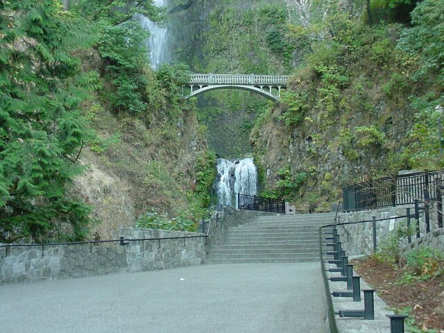
| Coming up the ramp from the lodge to the lower viewing platform. The lower falls are clearly visible and the footbridge across them. The upper falls are peeking through the tree cover above. | |
| The upper Multnomah Falls. |
|
|
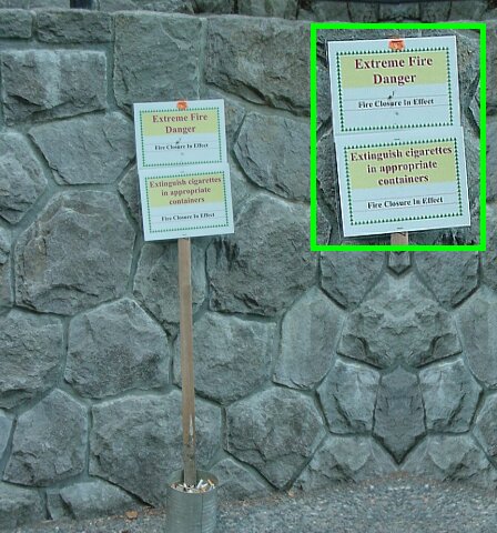
| This was a new addition. The week before there had been a serious fire just up the Columbia River from this location. In fact it probably was not completely out at the time this photo was taken. The trees were dry, and the fire danger was very high. So, they placed ash cans at various points along the way, and those were designated smoking areas. Everywhere else was closed to smoking. | |
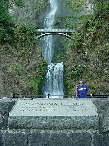
| Here is Dotti standing on the lower viewing platform, with the concrete marker in front, listing the heights of the falls as 543 FT for the upper falls, and 69 FT for the lower falls. Behind her you can see the lower falls, the Multnomah Falls Bridge, and the bottom of the upper falls. |
|
|
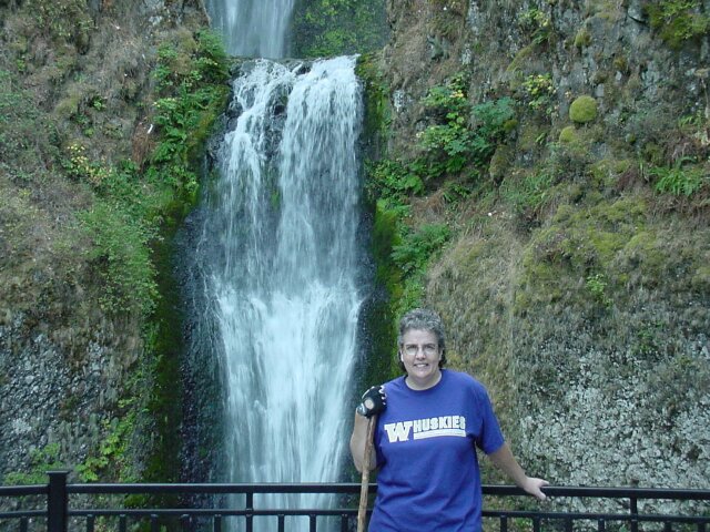
| A closer view of Dotti and the lower falls. | |
| Here's Al with the lower falls behind. |

|
|
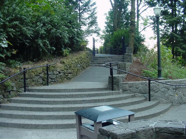
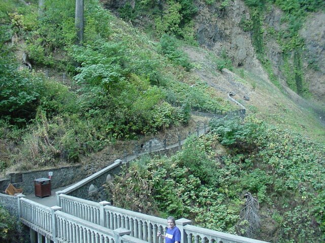
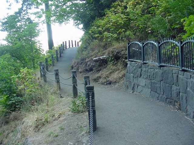
| The way leading to the top of the falls. If you look closely at the top of the second set of stairs, you will see a set of metal gates that can be closed when the Forest Service deems it unsafe to walk up the trail to the falls. A couple of years ago there were land/mud slides that took out part of the trail, so the whole thing was closed until they could make repairs. | |
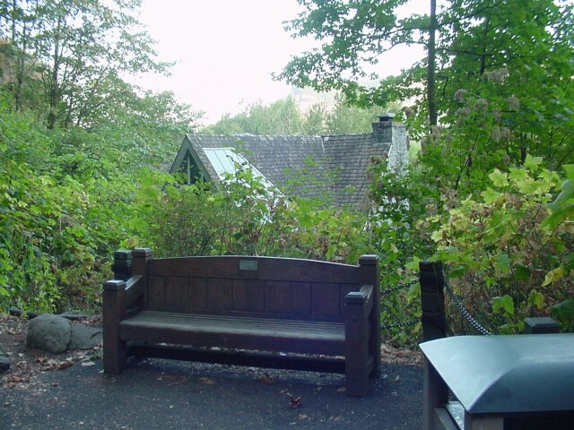
| Just past the metal gates sits this bench, and just behind it stands the Multnomah Falls Lodge, with its viewing window in the roof. In the dining room there are tables that are located under that window so the diners can look up at the falls during their meal. |
|
|
| We have already come about 0.2 miles and now there is one more mile to go to the top. To the top of Larch Mountain it is 6.8 miles. Not today thank you. Our first stop will be the Multnomah Falls Bridge. | |
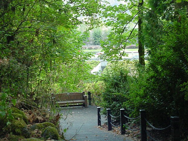
| Looking back down at the bench once more, we can see in the background the pedestrian underpass that we took to go beneath the eastbound lanes of I-84. You can tell that we are already up in the air because the train bridge, and the other two bridges we have passed, are all hidden behind the shrubbery below. |
|
|
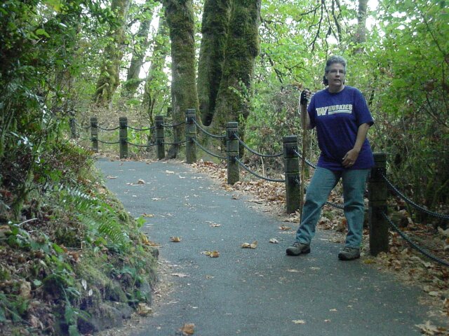
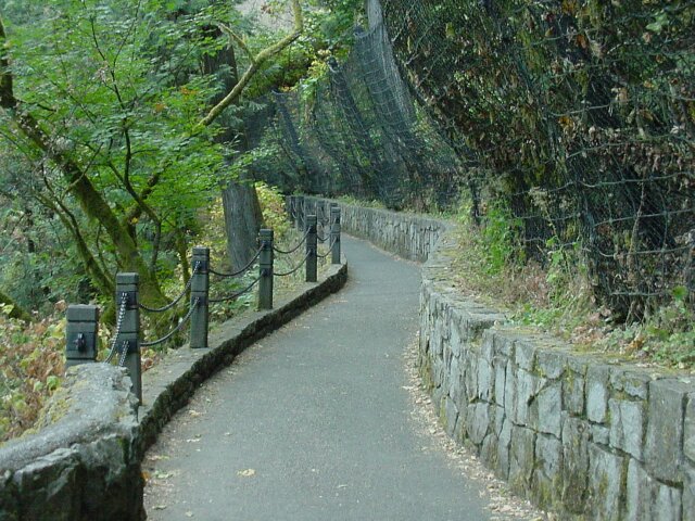
| Here's Dotti waiting for me as we are heading up the trail. This section of the trail is very heavily used, and they have dressed it up with the wooden poles and chains running between them. | |
| A switchback. We will be seeing a lot of those today. |
|
|
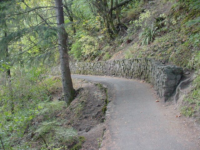
| This first section of the trail has a lot of visitors. There are small children and elderly people. So, they have the path walled in and fixed up very nicely. | |
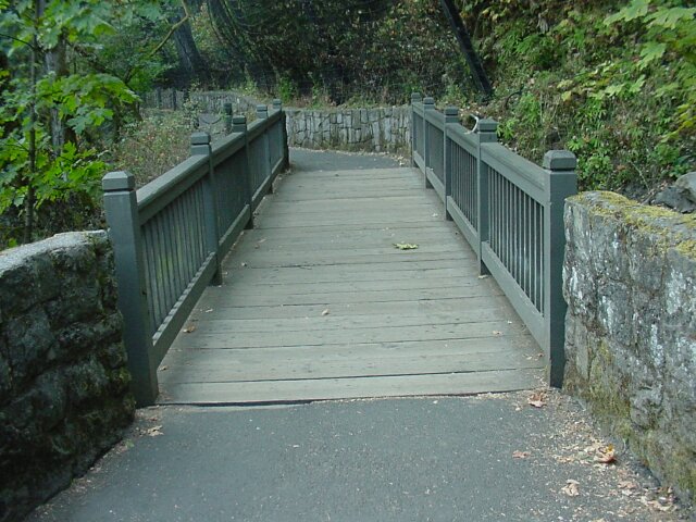
| A wooden footbridge that blends in well with the surroundings. |
|
|
| The netting on the right side of the path is to protect visitors from any possible falling debris, whether organic or inorganic. As we have seen on other hikes, as well as this one, the story of the Columbia River Gorge includes many landslides. | |
| Here's my lovely lady standing on the wooden footbridge. |
|
|
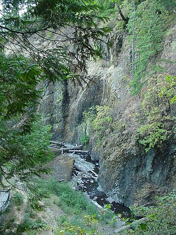
| Looking down onto the Multnomah Falls Creek. The canyon walls are all made up of volcanic basalt rock. | |
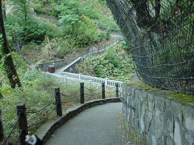
| Looking down on the Multnomah Falls Bridge. Here you can get a very clear view of the metal mess protecting the right side of the trail. |
|
|
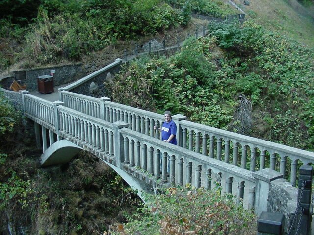
| There's my Dotti on the Multnomah Falls Bridge. | |
| Looking up above the bridge you can see the trail we will be taking heading off upwards to a switchback and then upwards some more. |
|
|
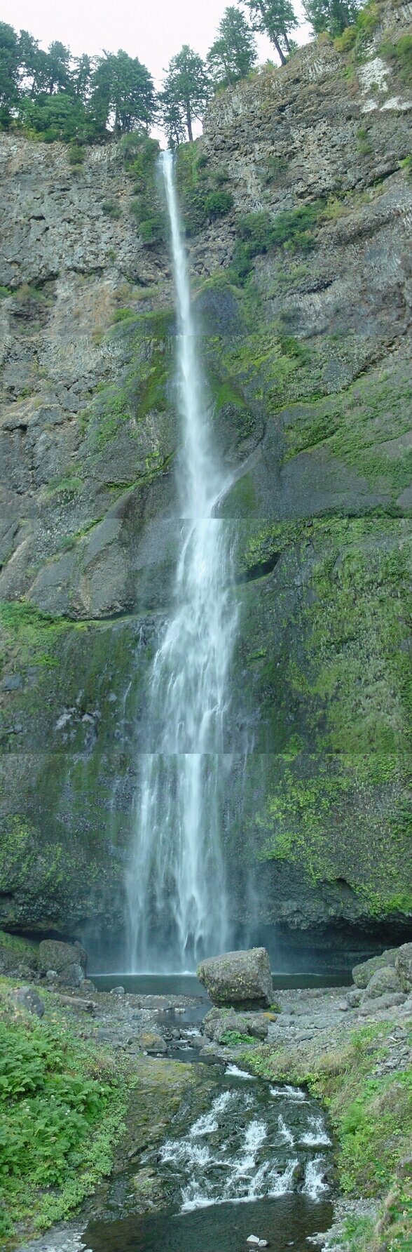
| This is a combination of 4 separate photos, and it shows the entire upper falls as viewed from the Multnomah Falls Bridge. Starting from the bottom if you scroll up to the second dividing line between joined pictures you will see that line cuts right through the middle of the spot where a rock broke free and fell in 1996. It was about the size of a freight car, and it hit in the fall pool below so hard that it shattered, sending pieces of itself in every directions as projectiles. One of those projectiles unfortunately struck the groom from a wedding party that was having pictures taken on the bridge. He was taken to a hospital but was released and able to carry on, much to the relief of the bride. About 2 weeks before that LeRoy and I had been walking behind the falls in the little cave that you can see at the base. (The large rock in the foreground is a piece of the rock that fell.) I wouldn't have given us much hope of surviving if we had been back there when the rock fell. At the top of the falls, the upper viewing platform is pretty well hidden. However, if you look closely at the upper left hand top of the falls, you can see a bit of it jutting out into view. | |
This is something that you very seldom see: looking down from the Multnomah Falls Bridge at the lower viewing platform and not seeing a single person standing there. In this picture you can see the platform, and the path leading upwards to the left. The bench we saw earlier is not visible, however the top of the lodge is visible with its viewing window in the roof. To the right we can see the Columbia Scenic Highway bridge, the train bridge and part of I-84. And off in the distance is the Columbia River. |
|
|
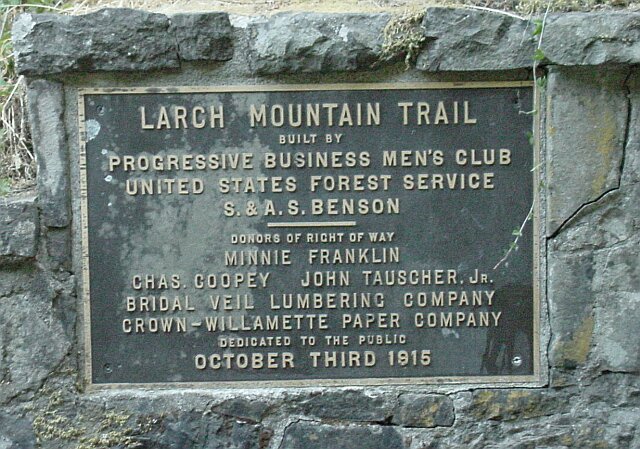
| At the end of the Multnomah Falls Bridge beside the trail there is this plaque mounted on the wall. This trail was constructed in 1915. It has been popular ever since. | |
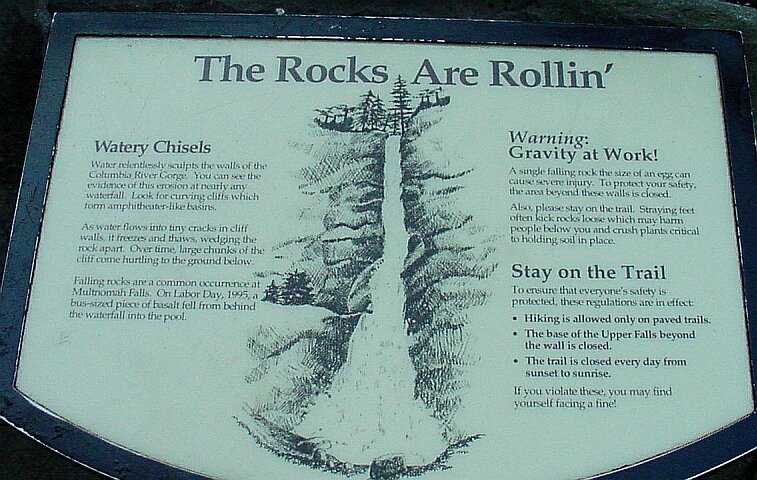
| This is an info sign that describes the processes that were involved in creating the amphitheater that surrounds the falls. You can also see the rules for this trail on the right side of the sign. The base of the Upper Falls was open, at least unofficially, right up until that big rock fell. Now they have closed it. |
|
|
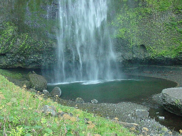
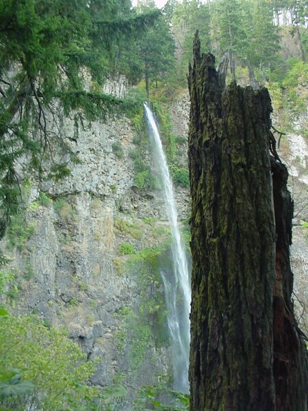
| This is a view of the base of the falls, and you can see the cave behind. I could stand up in at least parts of the cave, so it is at least 6'3" tall. | |
| This is the trail heading up after that first switchback after the bridge. You can see they still have it lined with the posts and chains. |
|
|
| As we approach the corner, we can see across the Columbia River to the Washington side of the Gorge. The layers of lava that make up the walls of the Gorge are clearly visible in this shot. | |
| Around the corner and up some more. |
|
|
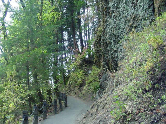
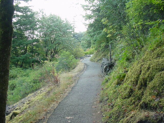
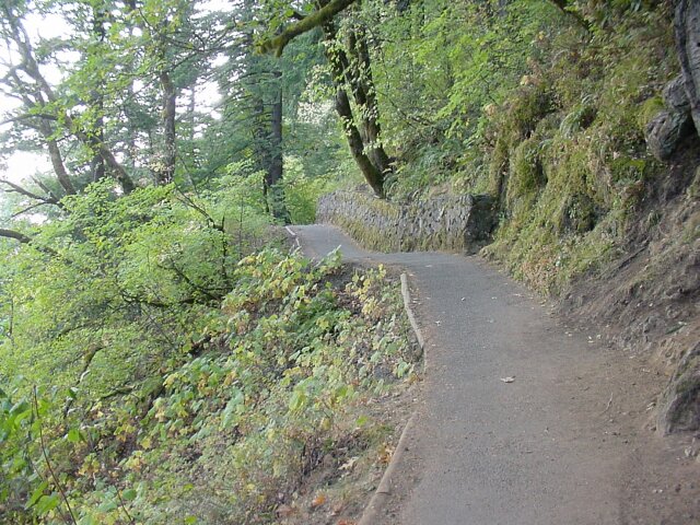
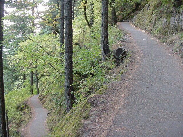
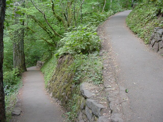
| I think they figured that all the visitors that were out for a short hike and a quick view of the falls would have turned around by this point, and so they stopped lining the path with rock walls or post and chain fencing. From here on the trail is open on one side. | |
| Looking between two trees towards a switch back and a junction with another trail. |
|
|
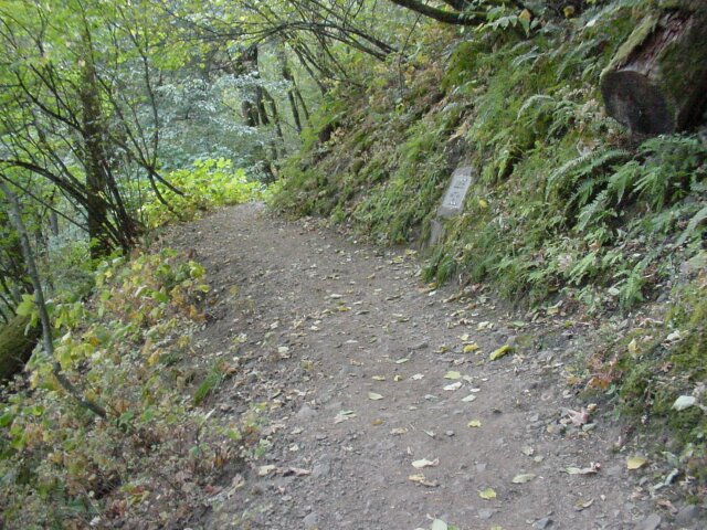
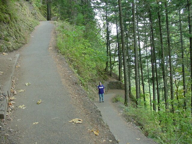
| This is Trail 400 that leads over to the Oneonta Falls trail. I spoke with a Forest Ranger on an earlier hike and was told that they do not recommend using this trail because it is not kept up very well. At this point it doesn't look too bad. It is dirt, while the Multnomah Falls trail is asphalted, but most trails in the gorge are dirt, and that is not a big deal. I assume that there must be some downed trees or washed out sections of the trail. One of these days I hope to go and find out for myself. Notice on the right that there is a plaque, which is in the next photo. | |
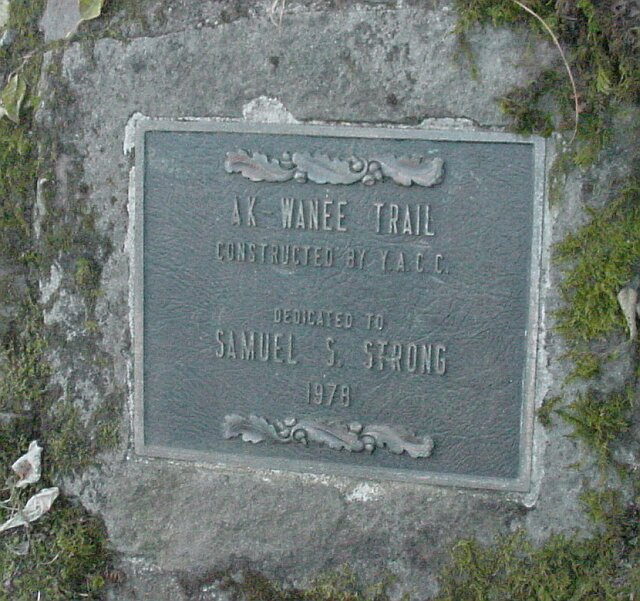
| This marks the Ak-Wanee Trail. However, I have a number of books and maps of this area and not one of them mentions the Ak-Wanee Trail. The trail is clearly marked on the maps as Trail #400, but they don't name it. I am not sure why. |
|
|
| Looking back from Trail #400 at Dotti standing on the switchback on our trail. | |
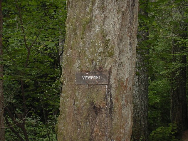
| Making our way up to the rest area, and view point. They have a bench set up here, which has been replaced since our first visit in 1974, probably more than once. As you can see, it looks fairly new even from this distance. Leaning up against its back is another sign marking a designated smoking area. |
|
|
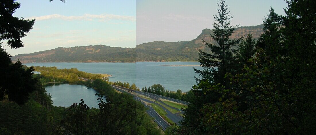
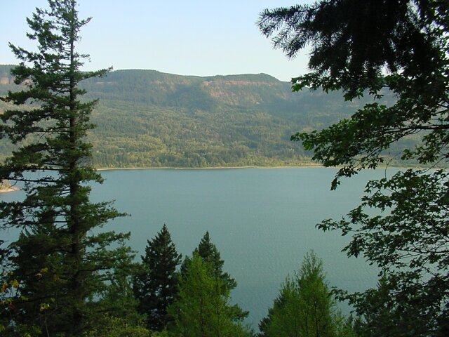
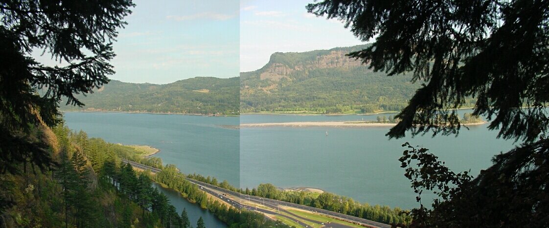
| Here is the view of the Columbia River and Gorge from the rest area. I put two pictures together to get the panoramic shot of what we were seeing. | |
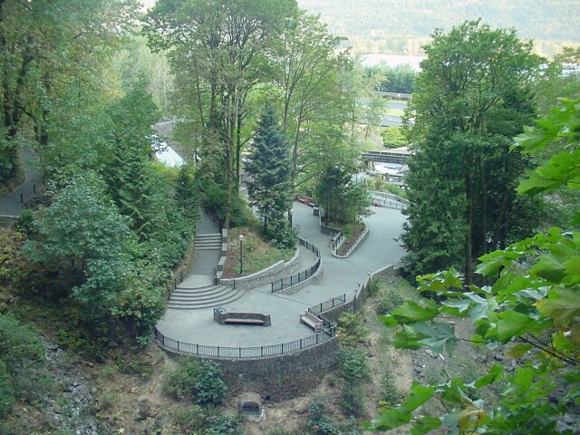
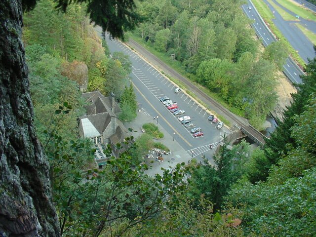
| Looking down at the Multnomah Falls Lodge from the rest area. The freeway parking lot on the right is still looking pretty empty but the Columbia Scenic Highway parking lot is starting to get some cars. Most of them belong to people who are setting up the artist's show that is visible in the lower middle of this picture. |
|
|
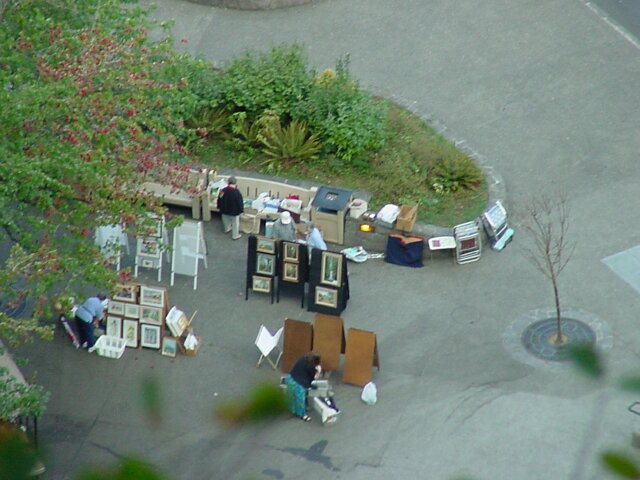
| Zooming in on the show you can see them hanging the paintings on the easels, with their folding chairs leaning up against the wall behind them. They are getting ready for a long day of trying to sell their wares to the falls visitors. So, naturally many of the paintings include the falls in them. | |
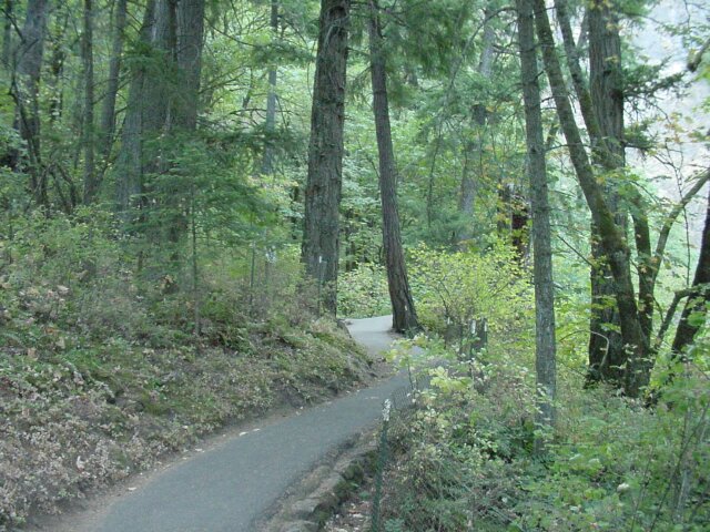
| Moving up the trail, you can see metal posts, painted green to blend in, with fencing attached. This is a fairly new addition to the trail. As more and more people frequent this path, the problems with thoughtlessly destructive people increase in direct proportion. In order to keep people from damaging the environment, or in some cases to keep the environment from damaging the people, we are seeing more and more sections of fenced area. |
|
|
| This view is from the switchback immediately above the rest area where the bench is. Every time we come to this trail with a camera, I have to snap a snot from this vantage point. I have seen professional photographers take pictures from here because it is a great spot to view the upper falls. We have already made a lot of progress upwards as you can tell by looking straight ahead at the point of the wall we are even with. | |
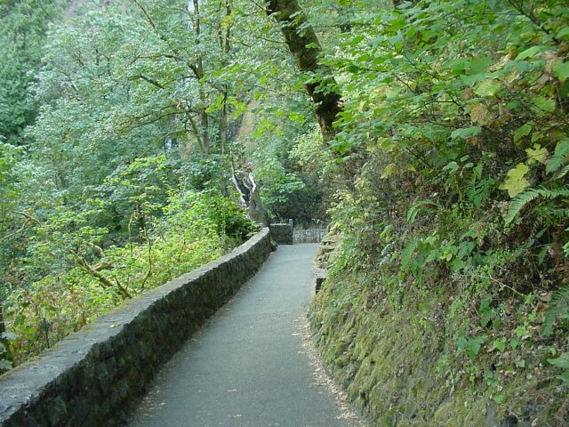
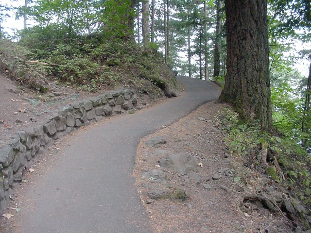
| Continuing on up the trail. On the right is a small section of rock wall that is of fairly recent construction. It is in place to hold back the bank from falling over the trail. It is a constant battle to keep these trails open, because landslides and falling trees continually attempt to block them. |
|
|
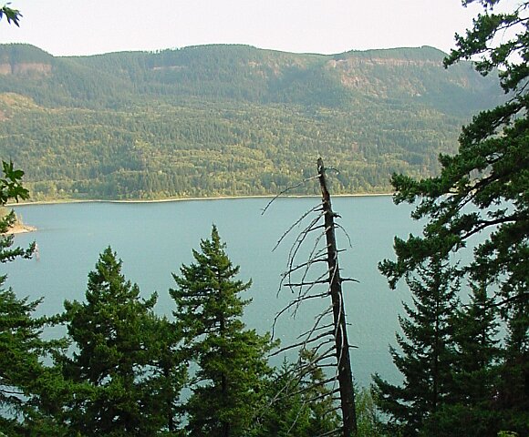
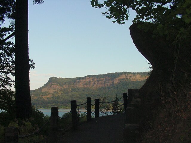
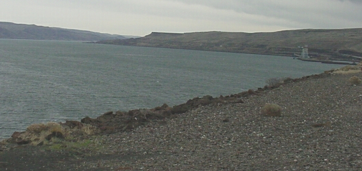
| Looking out over the Columbia River to the Washington side of the Gorge. If you look up near the top you can see the denuded rock, marking the high water line of the Bretz Floods created by the release of hundreds of cubic miles of water from the glacial Lake Missoula near the end of the last Ice Age. It is hard to conceive of water filling this entire gorge to that level. The top of what is now the Multnomah Falls would have been buried under many hundreds of feet of water. Most of the damage from that flood, is now covered up beautifully by the lush forest growth along this section of the Gorge, but on the eastern end of this channel the dry and unvegetated lands lie with their history clearly exposed. | |
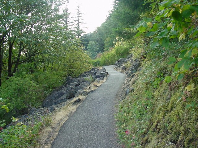
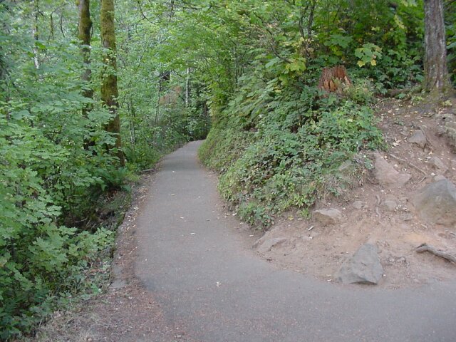
| Here the path cuts through an old landslide of volcanic rock. Unlike some of the trails that we have been hiking, this one has been smoothed out completely, with the rocks moved or buried, so we can look at that fallen rocks on either side without having to hunt for safe places to step as we walk by. |
|
|
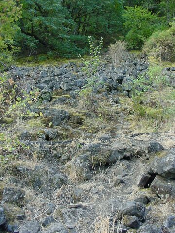
| Looking up the hill at the rock debris. A section of the hill above gave way at some time in the past and shattered into small pieces, which were strewn all along the path of the slide. It is characteristic of this type of stone that it breaks apart into pieces very readily. It is that feature that helps chucks of rock to fall out of the wall behind Multnomah Falls. | |
| This highlights the fact that these landslides are brutal to the vegetation. Where the slide came through all the trees were knocked down and vegetation is sparse. On the other side of the slide the forest continues on like nothing has happened. |
|
|
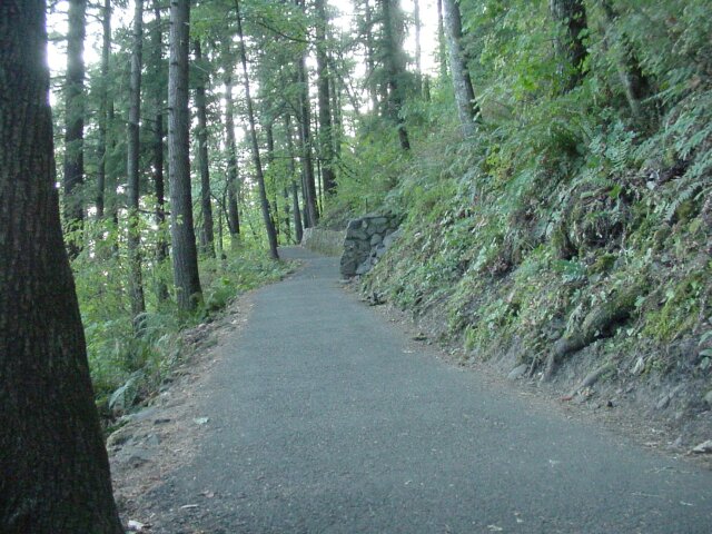
| I snapped this picture because at this location, when Dotti and I came up the first time after her knee surgery in 2001, there was an asphalt machine sitting on this very spot. There was a smell of oil and fresh asphalt at that time. Now the trail looks like it is getting worn and aging. | |
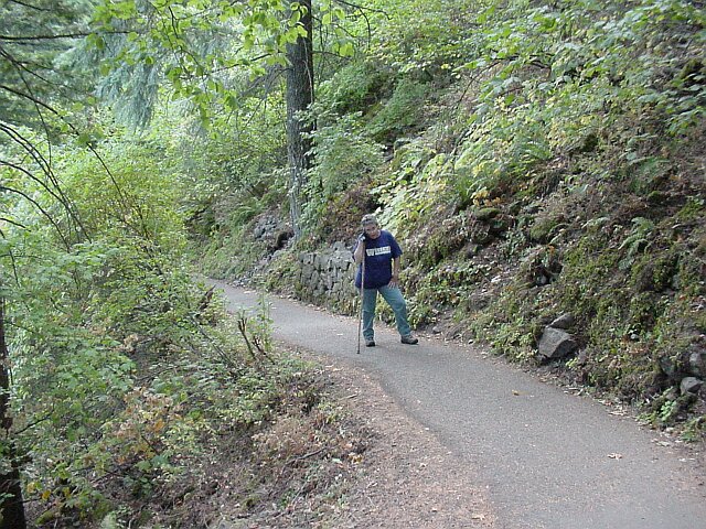
| Are we at the top yet? Dotti stopped for a second so I could snap this picture looking back down the trail. |
|
|
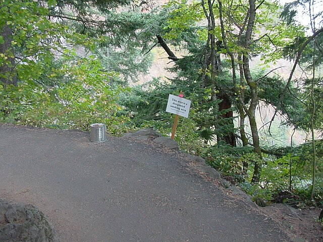
| Yet another designated smoking area. With both Dotti and I being ex-smokers, these still jump out at us a bit. Fortunately we no longer have a need to stop and frequent them, which we are very happy about. | |
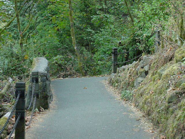
| Another section of trail where they have reinforced the bank with a rock wall to avoid slides taking out the trail. |
|
|
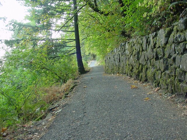
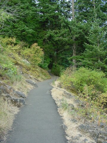
| And the trail stretches out into the distance. | |
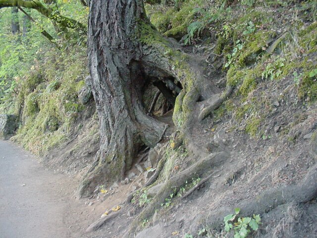
| It is amazing the lengths a tree will go to in order to get a good footing. This one possibly originally worked its way around a rock or fallen tree, that has since been removed, but for whatever reason, it has a two part approach to sinking its roots. It has taken the standard tree approach of putting stout roots straight down (very conservative), and then it has taken a path off to the right nearly shooting horizontally into the side of the hill (quite radical). Both Dotti and I felt it was worthy of a picture. |
|
|
| More supportive rock wall along the trail. | |
| Another clear view of the beautiful Columbia River and the northern wall of the Columbia Gorge. |
|
|
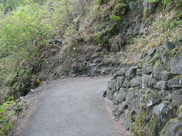
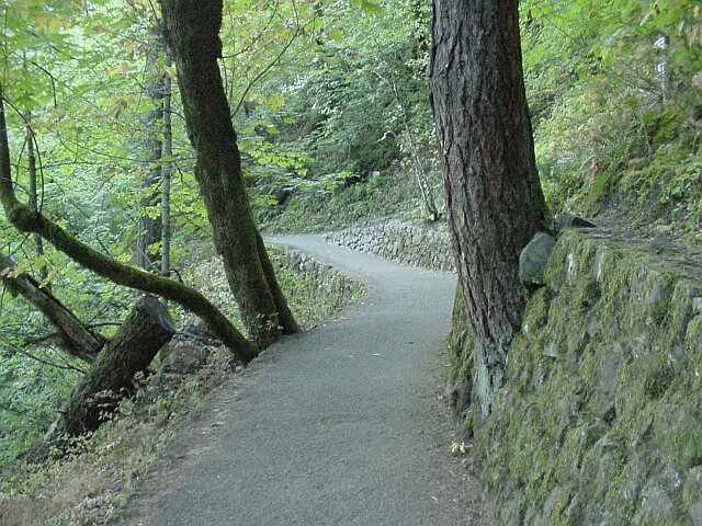
| This is a switchback, reinforced with a rock wall. Straight ahead is the start of what I assume is an unauthorized trail. It looks like it has been created by some people just heading out, to see what lies beyond. Due to the high volume of traffic on the Multnomah Falls Trail, they have started giving fines out for people who create such freelance trails. (Back in 1984, when we hiked this trail on our ten year anniversary of our first hike, I did a little trail cutting myself, going from a lower section of trail to an upper section of trail directly, and chopping off the longer switchback route. Even though I wasn't terribly heavy at the time, I was in pretty bad shape, and I thought I was going to die by the time I reached the upper trail. My heart was beating hard, and I was breathing even harder. I learned my lesson then. Now they have a sign posted right where I made my cut in 1984, telling us not do that any more, but I am not even tempted any longer.) | |
| Standing at the switchback and looking both up and down the trail. |
|
|
| At the next switch back, doing the same thing. You can even see the next switchback up the trail. | |
| Dotti stopped for me to take this picture as we are getting near the top. (We are aren't we?) |
|
|
|
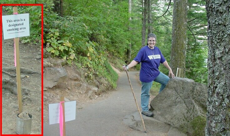
Yes! At the top, Dotti posing as a conqueress at the top of the hike. She looks happy to be here doesn't she? Actually we were both surprised at how quickly the top arrived this time. It definitely felt like the easiest hike we had ever taken up to the Falls. To the left was another sign, and in the insert on the left it shows what it says in the front. I'll bet the heavy smokers all stop and have a smoke at this point.
|
|
| The trail heads down in two directions from here. To the right (shown in the previous picture) the trail heads back down to the lodge. To the left the trail heads to the top of the falls, and also to the trail that leads all the way up to the top of Larch Mountain. |
|
|
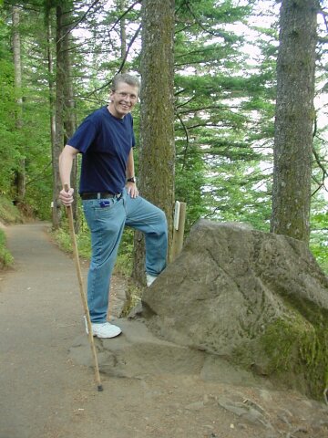
| My turn on "Conqueror's Rock." | |
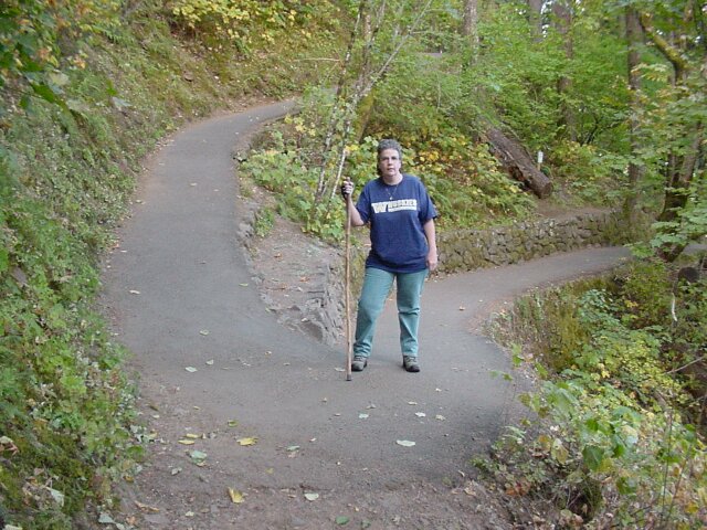
| After doing a few switchbacks in the downward direction we came out on the junction of the trail leading to Larch Mountain and the trail leading to the top of the falls. (You can see where we walked this section of trail on the Wahkeena Falls hike, and where we connected up with the Wahkeena trail from the top of Larch Mountain on Hike #11.) |
|
|
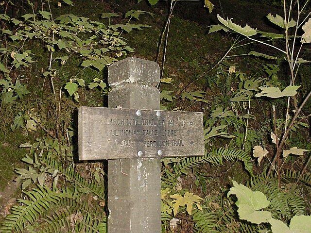
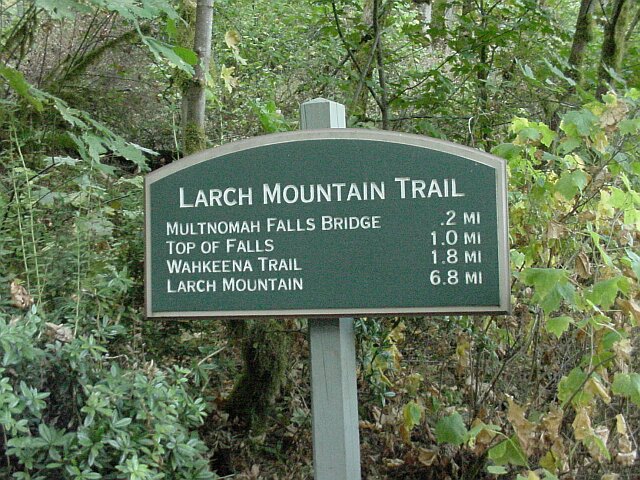
| The signpost pointing the way to the Larch Mountain Trail to the right, and the Lodge, a mile away, to the left. It also points to Perdition Trail, but that one was closed the last time we checked. | |
| Here is the sign pointing the way to the top of the falls viewpoint today. ( Click here to see what the sign looked like in 2001 when our friends Jim and Tammy took this hike. The nice new sign has long since been ripped down, but the old one still remains.) |
|
|
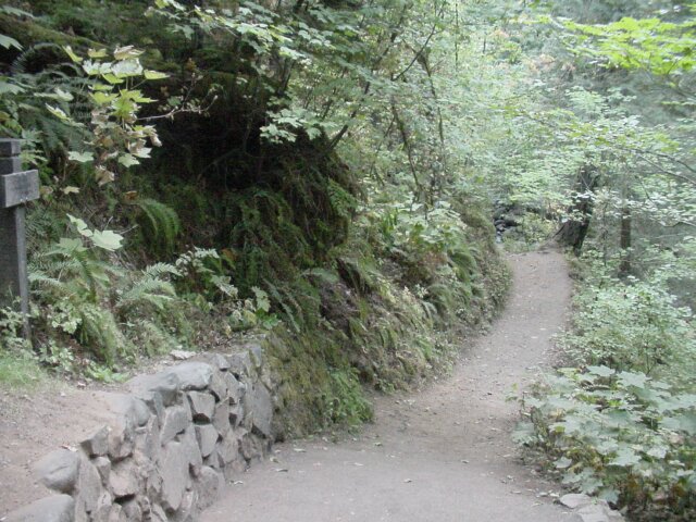
| Looking once again both up and down the trail at the same time. The top of the falls are calling to us. | |
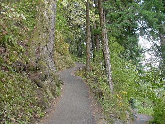
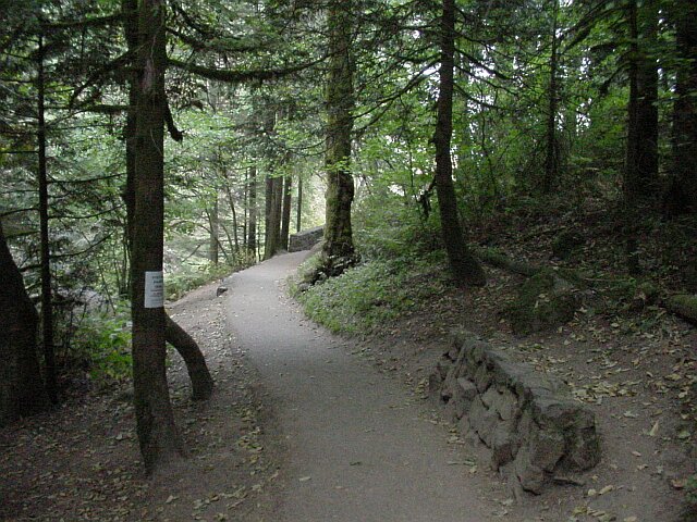
| This is pretty stretch of trail where the shadows are deep and the sound of Multnomah Falls Creek cheerfully babbling is soothing. It is hard to believe that a 600 foot drop lies just around that bend ahead. |
|
|
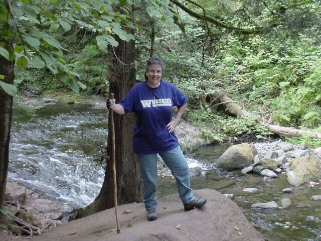
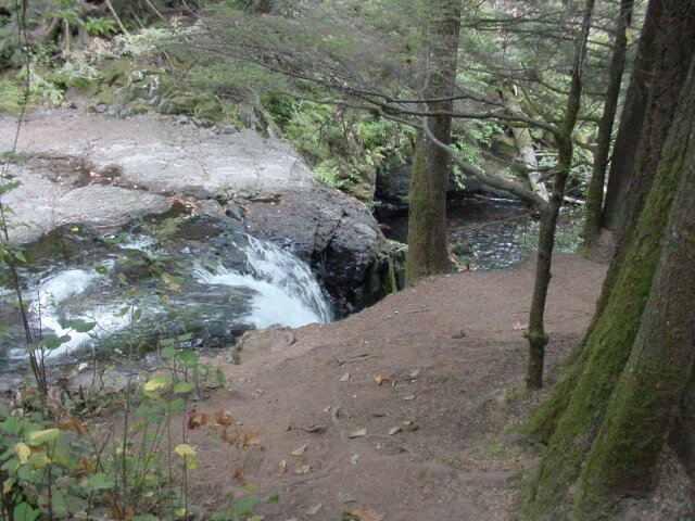
| We had to take a little detour down by the creek. It is such a pleasant location. | |
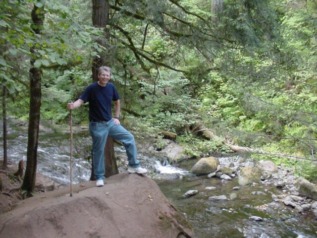
| My lovely lady, with the creek behind her. |
|
|
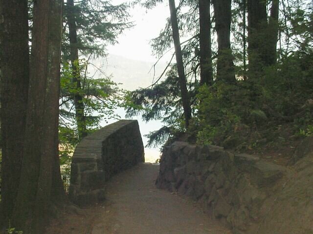
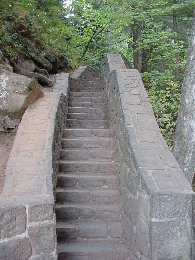
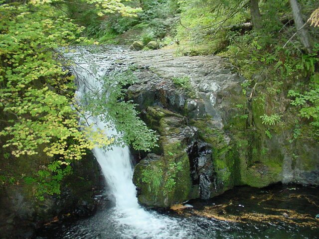
| At last the stone stairway to the top of the falls! | |
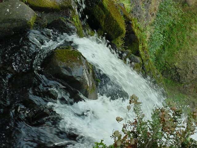
| This little falls is a very pretty one and this was taken of its top, just before I went down the stone stairs to the upper viewing platform. |
|
|
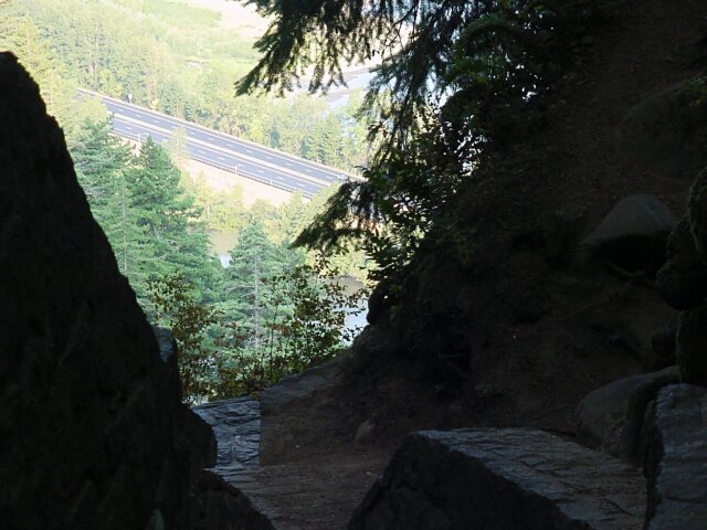
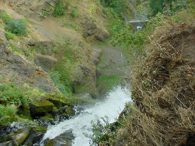
| Looking down the stairs and on down another 600+ feet to the freeway below. | |
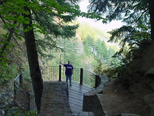
| Dotti is waiting for me on the platform. |
|
|
| Looking back up the stone stairs. Up until this point, we have had the trail to ourselves. That was really nice! While we were here on the platform taking pictures another couple came stepped onto the platform and turned around and left in a matter of seconds. From then on, we had the place to ourselves most of the way down. (Even though we took a lot of pictures at the top and didn't leave for some time after the other couple did, we caught up with them on the way down just before we hit the Multnomah Falls Bridge.) | |
| Looking over the falls. You can see the footbridge crossing the lower falls near the top of the picture. |
|
|
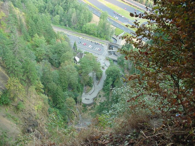
| The time is about 9:00 AM. There is not a soul on the lower viewing platform still. You can just see the Multnomah Falls footbridge at the bottom of this picture, and you can see the Multnomah lodge viewing window in the roof of the building, the art show, the Columbia Scenic Highway bridge, the footbridge, the train bridge, and even the entrance to the pedestrian underpass beneath the eastbound lanes of I-84. Our van now has two cars parked beside it and several other cars parked behind it. However, the parking lot is still looking mighty empty. | |
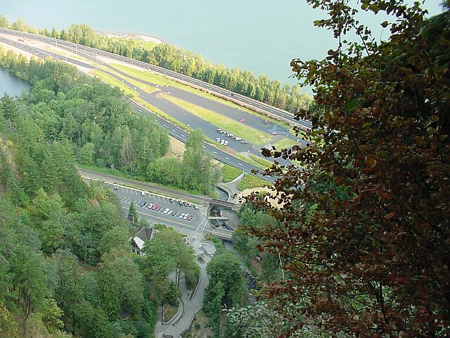
| Moving upwards a bit you can now see part of the Columbia River. |
|
|
| I put two shots together in this one to give you a panoramic look at what the view is like from the top of the falls. | |
| Looking back at the falls at the top of the falls. This is a beautiful falls in its own right! |
|
|
| Speaking of beautiful, here is my lovely Dotti with the Columbia River and Gorge for a backdrop. | |
| Here is another shot of my beautiful wife on the upper viewing platform. |
|
|

| Dotti took this one of me with my walking stick. | |
| On the brink of the big drop. |
|
|

| Another look at the small falls at the top. | |
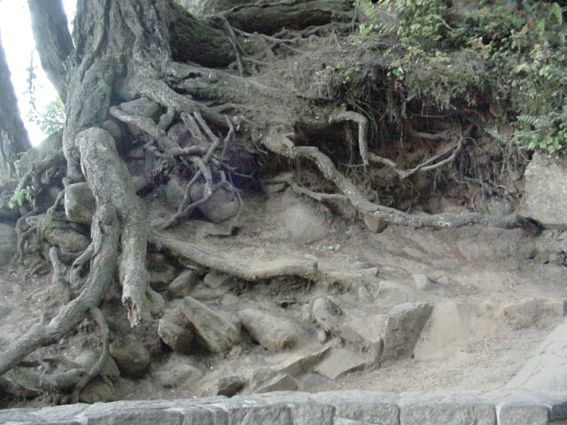
| I don't know how many times I have taken a picture of this root system, but I always find it fascinating to look at. |
|
|
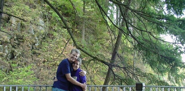
| I decided to try out my timer on the camera. I put the camera on the rock wall and ran over to get in the picture. (Any excuse to hug my lady is a good one.) | |
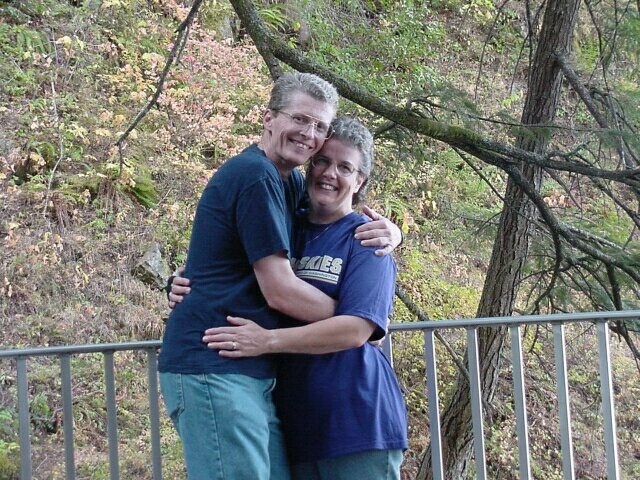
| The first one was such fun I decided to do it again. |
|
|
| In order to head back down, we had to head up first. Dotti is smiling big because the hard part is all over. | |
|
See how quick we moved? Here we are at the bottom again looking at the lower falls. I put the camera away for the trip down, and we made some really good time. It was just short of a jog, but it was easier on the knees than trying to go slow. (Click Here to see the picture I took in 2001 of our dear friends Jim and Tammy sitting on this bench.)
|
|
|
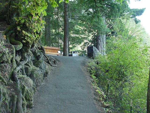
| We stopped at the lodge and had a nice meal. When we got back to the car, it was between 10:00 and 10:30 and the parking lot had begun to fill up. | |
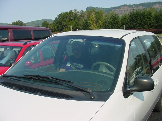
| Here's Dotti all safe and sound in the car, ready to head back home. |
|
|
|
We always love to walk the Multnomah Falls trail. It is our favorite. |
||
|
Here are some old pictures of us visting Multnomah Falls, or at a time when we did. |
||
|
Al & Dotti 1975 | taken a few months after our first hike up the falls. |
|
|
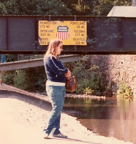
Dotti 1984 | taken at the falls in 1984 arround our 10th year anniversary of climbing the falls. |
|
|
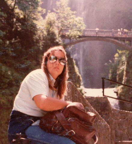
Dotti 1984 | taken just below the lower viewing platform. |
|
|
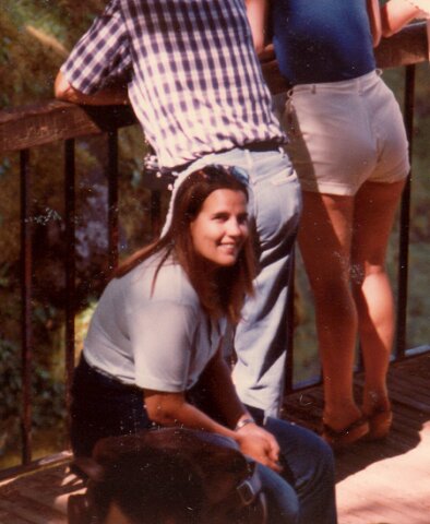
Dotti 1984 | taken on the upper viewing platform. |
|
|
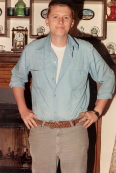
Al 1984 | taken a around the same time as we walked the falls. |
|
|
Dotti 1995 | taken from the lower viewing platform one year after our 20th anniversary of climbing the falls the first time. |
|
|
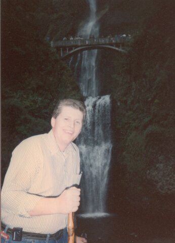
Al 1995 | taken from the same location at the same time. (Notice that our walking sticks were brand new then. Now they are showing their age.) |
|
|
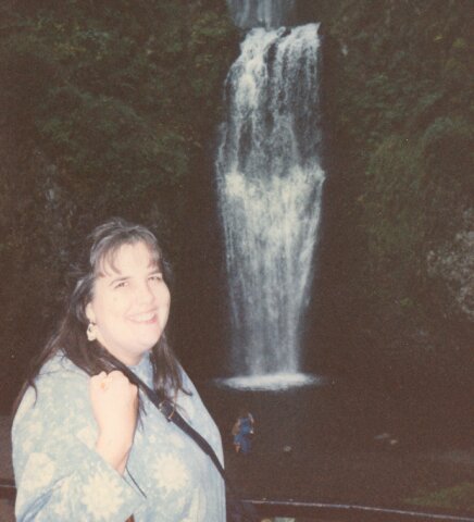
Dotti 1995 | taken at Horsetail Falls about the same time in 1995. |
|
|
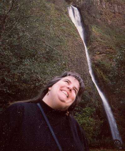
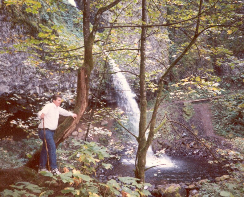
Al 1995 | also taken at Horsetail Falls. |
|
| [ Home ] [ DWLZ ] [ Message Board ] [ Restaurants ] [ Order Cookbooks ] [ Dotti's Newsletter ] [ Support Dotti ] [ FAQs ] [ Email Dotti ] [ Email Al ] |