|
THE COON FAMILY HIKING CLUB
POWERED BY DWLZ.com |

|
| [ Home ] [ DWLZ ] [ Message Board ] [ Restaurants ] [ Order Cookbooks ] [ Dotti's Newsletter ] [ Support Dotti ] [ FAQs ] [ Email Dotti ] [ Email Al ] |
THINGS YOU
MIGHT ENJOY
WAHKEENA FALLS LOOP
October 12, 2003
The Coon Family Hiking Club
Official Hike #18
5.5 miles - 2 hours 45 minutes
|
The Hikers
Tom Kreider: a prominent poster on the DWLZ message board, and a member of the WOW group, which formed at the last DWLZ conference. This weekend brought several of the members of this group to the Portland/Vancouver area, and this hike was scheduled as one of the events for that get together. Tom has lost over 90 pounds so far and is only a short distance from his final weight goal. Tom has also been busy working hard on his physical conditioning; even working up to jogging these days. He gave the rest of us all we could handle in the pace he set on the 1,600-foot climb, which is a testament to all the hard work he as been doing! Rip Napoli: Dotti's brother, and a great guy! He loves to hike and whenever he can break free from his busy work schedule he likes to join us on our hikes. (He is the one who took the "before" picture of Dotti and I back in 1997 on our CFHC table of contents page.) LeRoy Coon: Dotti's and my son. He is part of the WOW group, and has been on several of the previous CFHC hikes. I was very happy to have him along on this one as well! Al Coon: Yours truly, the narrator and official historian of our hike.
The Hike
This was the second hike in as many days for the four of us who did this hike: Tom, Rip, LeRoy, and myself. I have documented this trail previously on our Coon Family Hiking Club Hike #10, where you can see more pictures of the scenic stops along the trail, and read a description of the trail itself. For this hike, I was focusing on getting some shots of the people on the hike. This was the first of the CFHC hikes that Dotti was not present on. She was busy having fun with the ladies of the WOW group at a shopping mall, while us guys were out on the trail. We walked the trail in fairly quick time, stopping here and there to take pictures, but moving along pretty consistently. It was an overcast day, but rain was not a factor on the walk. We did get to discuss some books and other things along the way, when we weren't simply enjoying the great scenery. It was a nice cool day, just perfect for hiking! |
||
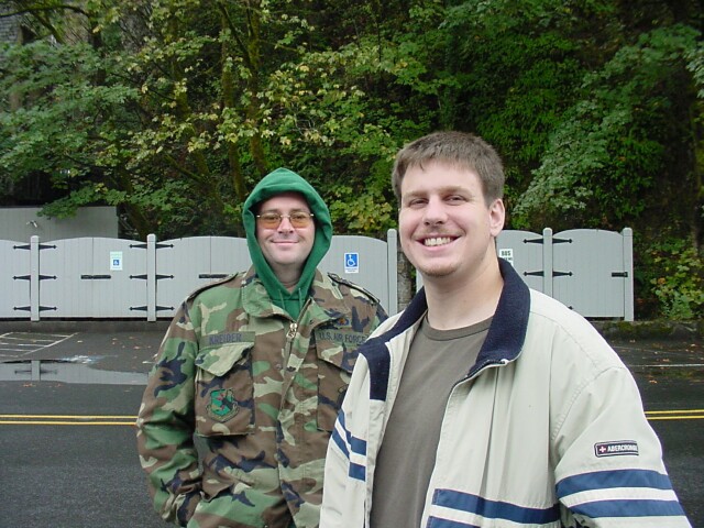
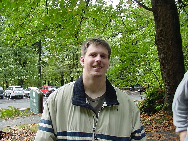
| Tom and LeRoy standing in the parking lot at Multnomah Falls, eagerly awaiting the start of the hike. You can just see the roof of the Multnomah Falls Lodge in the upper left-hand corner of the picture. On the drive out Tom noticed Crown Point resting on a basalt protrusion, high up on the wall of the Columbia Gorge. He expressed a desire to go there, and so I went off the Freeway one exit early, at the Bridal Veil Falls exit, and took the Columbia Highway to Multnomah Falls. We parked in the lot beside the lodge rather than the one out on the freeway. That positioned us to easily drive up to Crown Point after the hike. (Unfortunately, I neglected to tell Rip about the change in plans and he parked his car in the freeway parking lot as we had originally agreed upon. Since we had cell phones, we were able to connect up okay, and the after the hike, we waited for Rip to drive around and meet us so we could all go up to Crown Point together.) | |
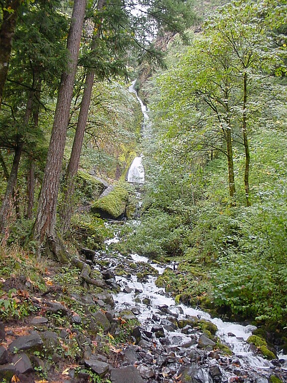
| At this point we had walked from Multnomah Falls over to Wahkeena Falls (for more pictures of the trail please see Coon Family Hiking Club Hike #10), which you are looking at here. Just under the wide spread of falls above, you can see the bridge that we will be crossing soon. |
|
|
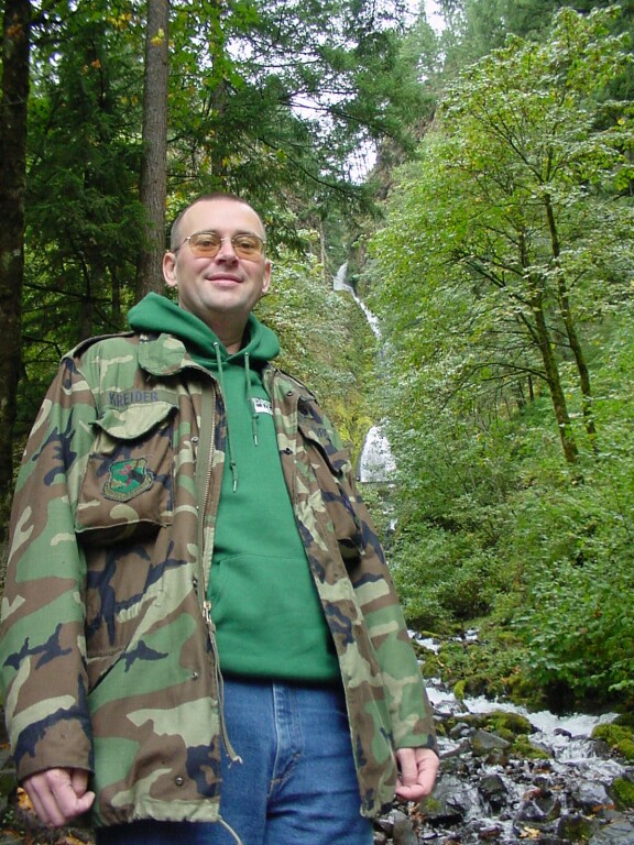
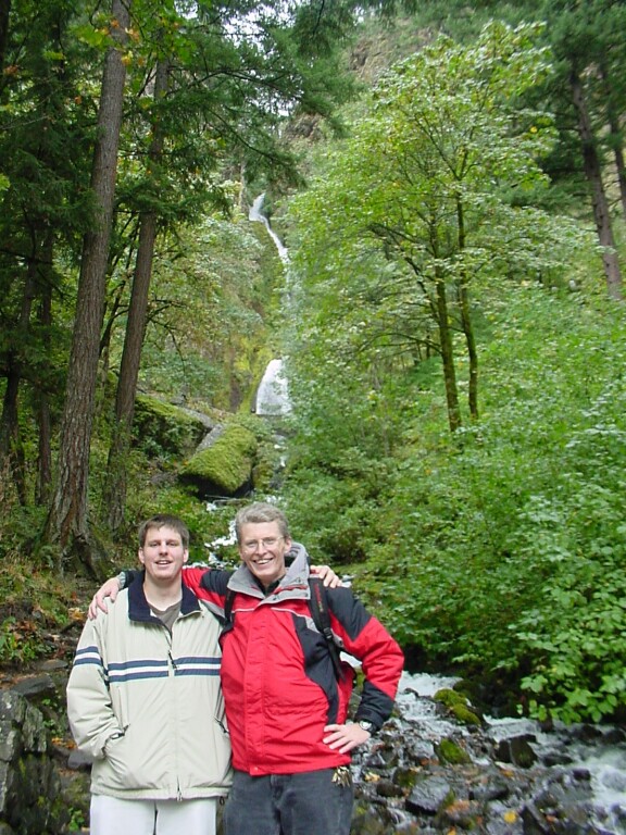
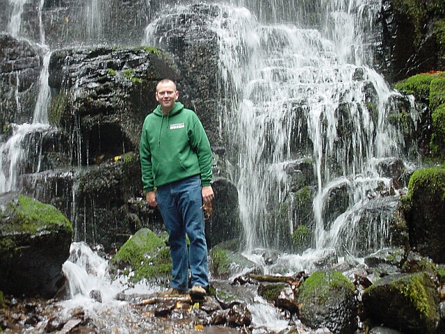
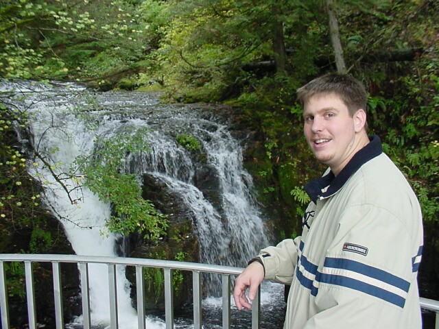
| Here's Tom with his Air Force coat on, ready for the climb, with Wahkeena Falls behind him. In this shot you can see all three of the of the distinct sections of the falls. The upper section is like a log chute water trough. The middle section is a traditional falls with a straight vertical drop. The bottom section is more of a "rocky rapids." | |
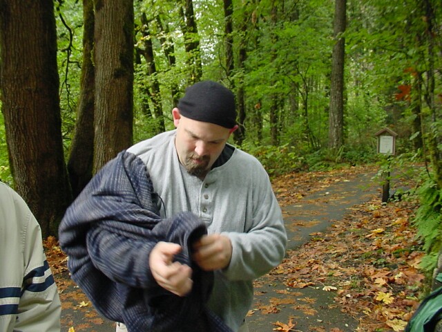
| Dotti's brother Rip is already too warm for his heavy outer shirt, and it is coming off. Looking back over his shoulder at the trail we just walked, you can see that the lighting was coming from a sun blocked by an overcast sky. It gave the woods a feeling of being more "indoors" than on a bright sunny day. Visibility was less, and the plants seemed thankful for the moisture in the air. |
|
|
| LeRoy appears to be ready to get going on the 1,600-foot climb. Behind him is the sign identifying Wahkeena Falls for those driving by. | |
|
Here are two pictures of a proud papa with his son. On the right, is a picture taken in 1977, when LeRoy was a newborn, and I was 26 years old. (Where did that hat come from?) On the left is a picture taken today, where LeRoy is 26 years old, and I am double that. LeRoy has grown up from that little child, into the man who can now stand shoulder to shoulder with me. How time flies! |

|
| Here is Rip posing before the falls. I put two pictures together to form this one, so the entire falls could be shown, while still capturing all of Rip. Note how Rip has planned ahead by using layered clothes. If it turned cold or started to rain in a big way, he was ready. If it warmed up, all he has to do is remove a layer or two to get comfortable. As with most local Oregonians, shorts are in order no matter what time of year it is. | |
| Tom is standing in the mist, on the bridge just below the middle section of Wahkeena Falls. There is just nothing like a Columbia Gorge hike to put a smile on your face. |
|
|
| After cutting through numerous switchbacks we have reached a viewpoint looking out over the Gorge, where I caught this picture of LeRoy and Tom. It appears that now Tom too has shed his coat as the hike is warming us up. | |
| Another shot of Tom at the viewpoint. |

|
|

| And here is Rip, his head staying nicely warm from his cap. I caught him deep in thought on the problem of whether a black hole would provide a doorway into another part of the universe, or merely act as a super trash compactor upon your ship as you came under its influence. His final answer unfortunately will have to wait for another time. | |
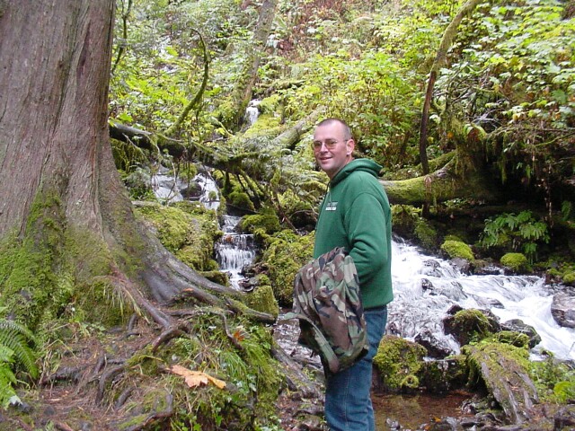
| The backpack hasn't started getting heavy yet, but by the time I hit the top of the ascent, I could tell I was lugging some extra weight. I hadn't gotten too warm for the coat yet, but it was getting close! |

|
|
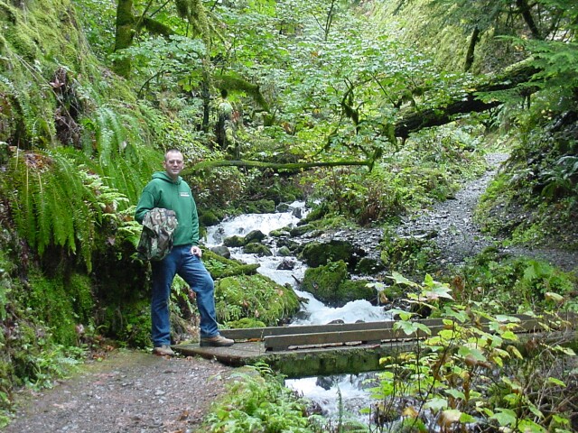
| Getting ready to cross Wahkeena Creek, Tom with coat in hand, is leading the way. The water, the mosses, the greenery, and the path all blend into a beautiful backdrop for a great hike! | |
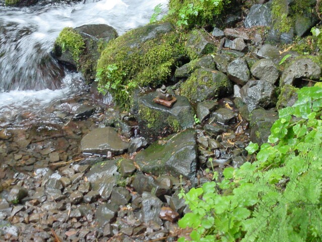
| If you look closely at the center of this picture, there is a stack of stones that someone put in place. It seems to be some sort of marker, placed beside the bridge. |
|
|
| As we are crossing the bridge, I caught this shot of the young men taking up the rear guard. | |
Tom, once again standing in the foreground, with a beautiful scene behind him. There is also another stack of stones to the left of Tom's coat and just above the root reaching out to the right from the tree. We decided that the markers were being placed for a wily backwoodsman who could follow such markers but for some reason couldn't find the well worn trail that we were following. 
|
|
|
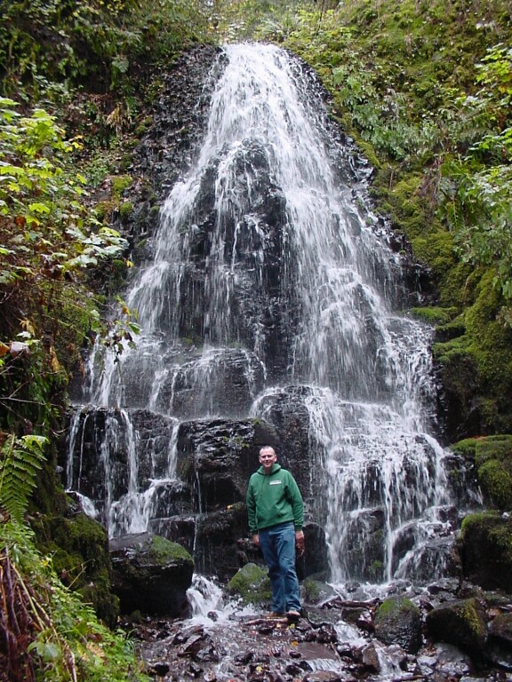
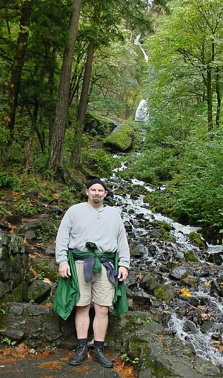
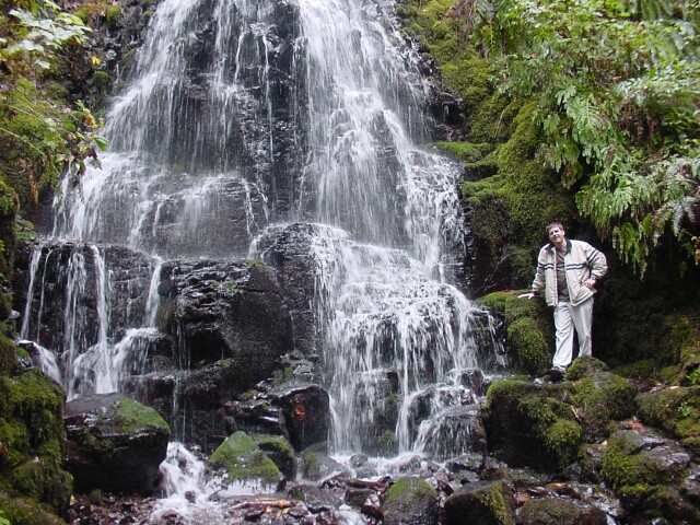
| Tom standing at the base of Fairy Falls. Is the Pacific Northwest great or what? | |
| Moving in for a closer shot. |
|
|
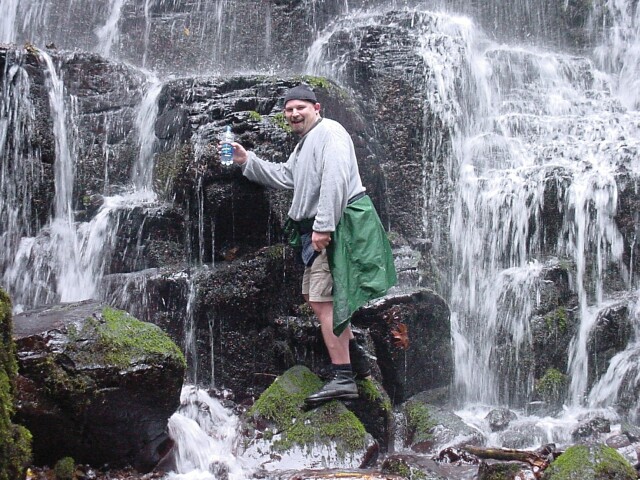
| Rip thought this shot would be a great one for a commercial for the brand of water he was carrying on the hike. | |
|
Moving closer you find that we still can't read the brand name on the water. but it still is a great picture! Unfortunately, in order to get this shot, Rip ended up completely soaking his right arm.
|
|
|

| I have shed my coat and shoved it into the backpack. We had been moving along pretty well so far and I was warmed up. | |
| LeRoy beside the falls. |
|
|
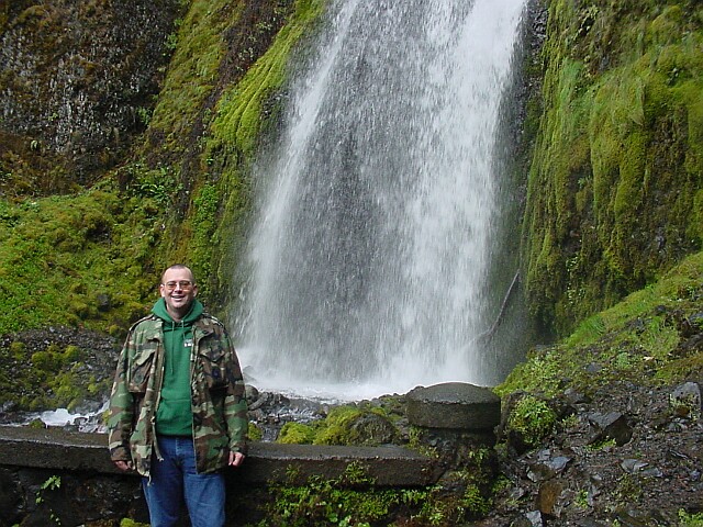
| Zooming in a bit. | |
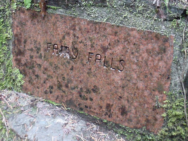
| On the right side of the falls we found this imbedded plaque. |
|
|
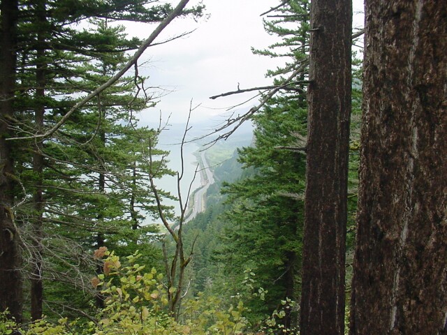
| We took the Vista Trail again, just like Dotti and I did back in July. This view is from whence the trail gets its name. You can see Interstate 84 heading off towards the east and into the fog. | |
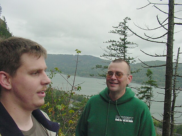
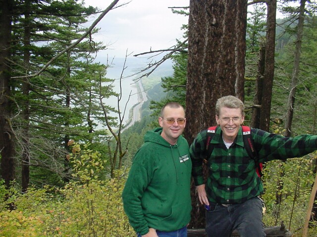
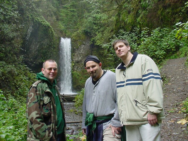
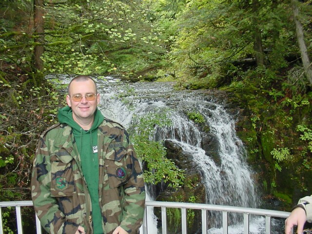
| Tom and Al with the vista behind us. The uniform of the day clearly included a green shirt. |
|
|
|
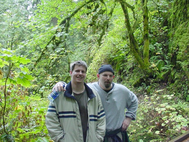
Rip just asked LeRoy if he could borrow $5 and this was LeRoy's reaction. Sorry Rip. Seriously, we had a lot of fun on this hike!
|
|
|
This is Rip's really big smile. You should see him when he is serious!
|

|
|
| We had now completed the Wahkeena Trail portion of our hike, and joined up with the Larch Mountain Trail. We are following Multnomah Falls Creek down towards the big falls. This is one of the many falls the creek passes over on its run towards the big drop. When Dotti and I took this hike in July, the sun was hanging low over this falls and I was not able to get a clear picture like this one. | |
| My 3 hiking companions with the falls in the background. I had to interrupt their discussion of the merits of Descartes' assertion on existence, and they were kind enough to spare a moment for the picture to be taken. |
|
|
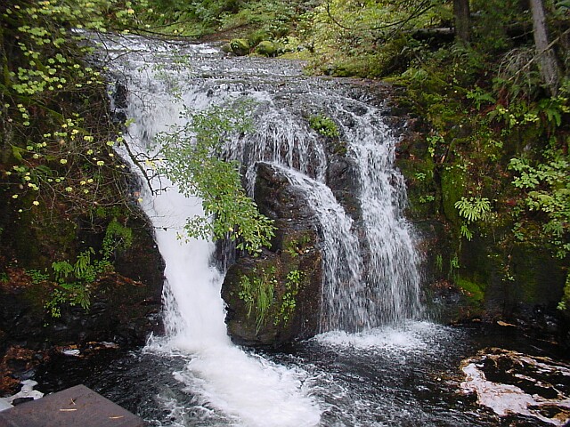
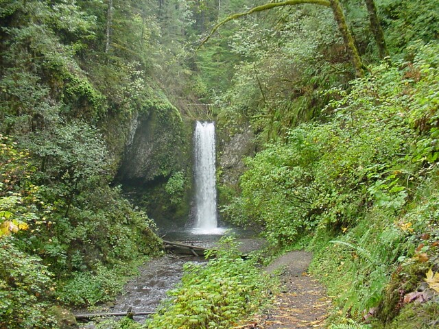
| Moving from one of Multnomah Falls Creek's waterfalls to another. This is the small falls right above the big drop. Though only a few feet high, it is a beautiful falls in its own right. | |
| Looking down from the top. Below, you can see the Multnomah Falls Bridge, as well as the lodge. |

|
|
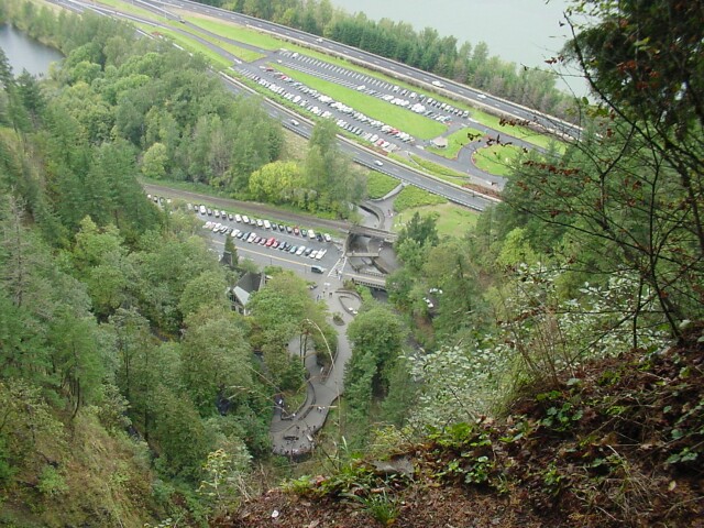
| Looking down at the two Multnomah Falls parking lots. This time the van is parked in the closer parking lot, while Rip's car is parked in the freeway lot. | |
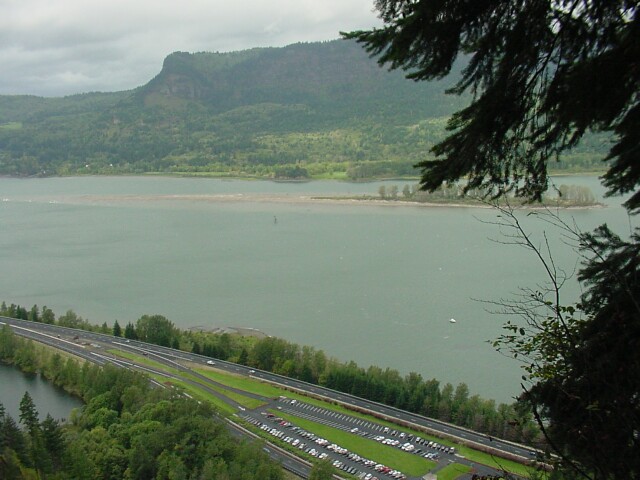
| Looking out across the Columbia River Gorge from the top of Multnomah Falls. |
|
|
| Here is Rip enjoying the view from the top of the falls. | |
| LeRoy also on the upper viewing platform. |
|
|
| Tom at the same location. | |
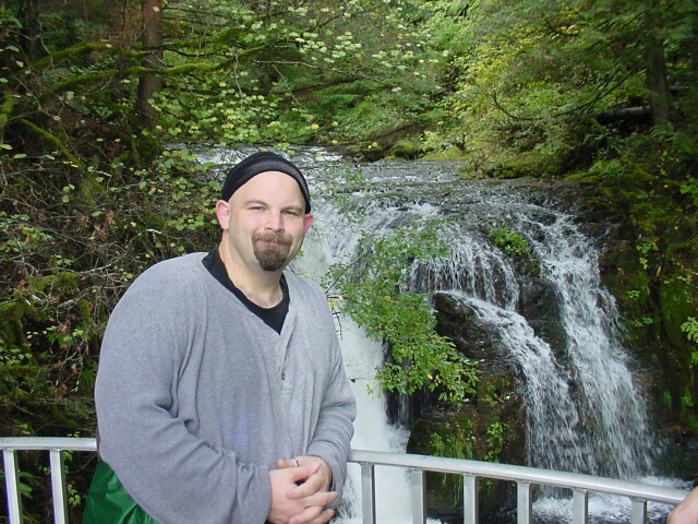
| And here I am as well. The little waterfall makes a nice background for pictures. |
|
|
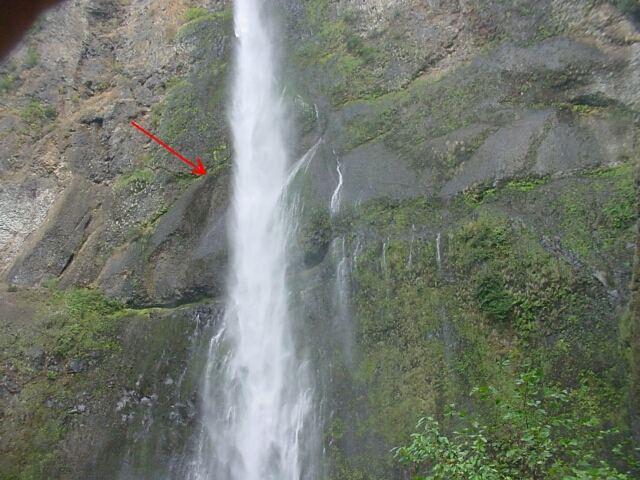
| After we got to the bottom of the falls again, I snapped this shot of the upper falls, right at the point (see arrow) where a large chunk of rock, about the size of a bus broke loose a couple of years ago and fell to the base of the falls. Before the rock fell, the water used to strike the rock at this point and jump off to the side in its fall. Now, with the obstacle gone, it falls straight down. The water was being blown around that day at times, and you can see in the picture little water streams flowing down the rock off to the right of the main falls. Those were all created by water being pushed out of its normal dropping route. Moments before I snapped this picture the falls were spread out over the rock to the right by the wind. | |
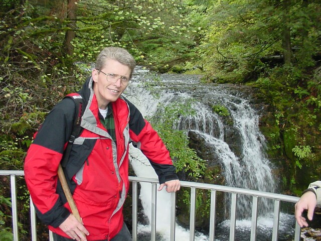
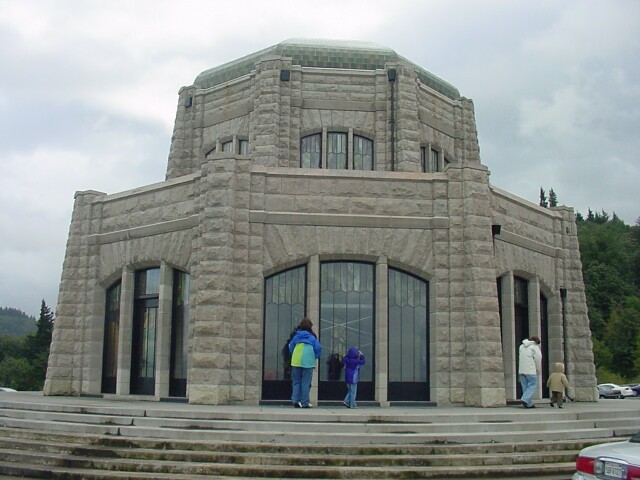
| On our way back to the hotel, we stopped at the Vista House at Crown Point, a natural viewing point for the Columbia Gorge. The building was built in 1916, and is in the process of being restored at the present. It is often windy at this spot, and the wind sometimes reaches 110 mph, because the Gorge is a natural wind conduit. The view from Crown Point is spectacular! |
|
|
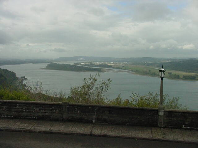
| The view from Crown Point looking west. On the right is Washington State, lying north of the Columbia River. To the left is the State of Oregon. | |
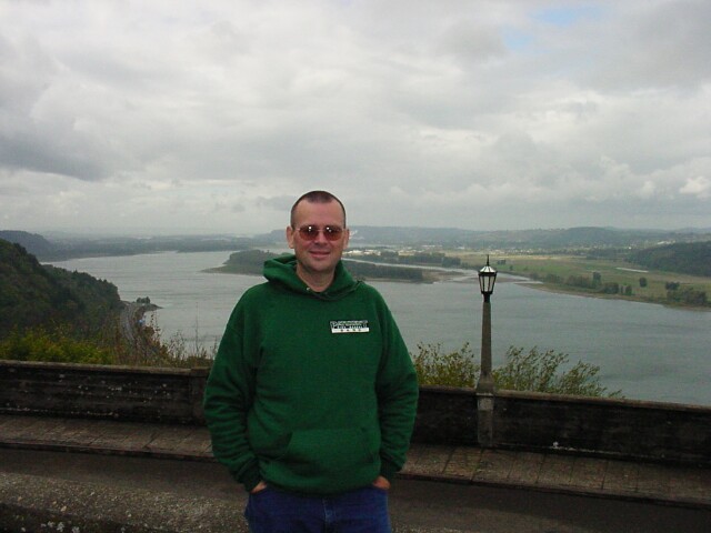
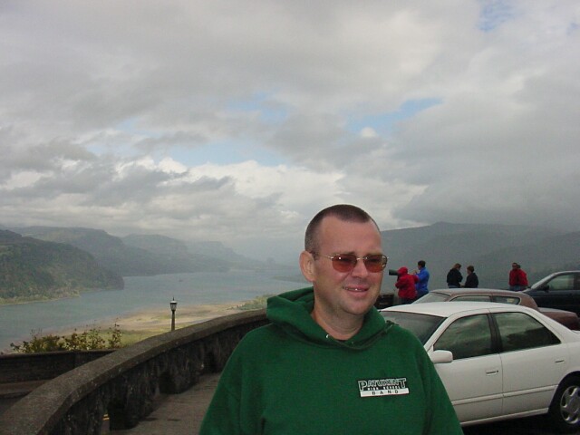
| Here's Tom with the mighty Columbia River in the background. |
|
|

| LeRoy from very nearly the same spot. Note the old style lamp posts in the background. | |
| Rip standing beside the van. Along with the lampposts, in the background here you can see the road that we would soon be taking that runs up the hill off towards the right. Driving on the Columbia River Highway, also created around 1916, is a visual treat all by itself. |

|
|
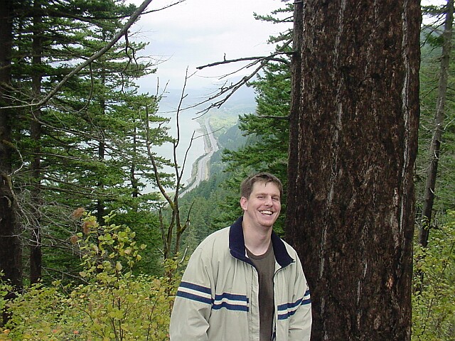
| Tom with the east view of the Gorge behind him. There was even a patch of blue in the sky, and a momentary spot of direct sunlight landing on the riverbank below. | |
| This a map of our hike that I put up for Hike #10. We started at the red S, and worked our way counterclockwise around the trail marked in red. The climbing ended around the point where trail #420C cuts off to the right towards Devil's Rest. From that point on it was all pretty much downhill. |

|
|
|
I really enjoyed this hike! The pace was fast, the company was great, the scenery was beautiful, and the weather was perfect for a hike. The only thing I really missed was my lovely Dotti. |
||
| [ Home ] [ DWLZ ] [ Message Board ] [ Restaurants ] [ Order Cookbooks ] [ Dotti's Newsletter ] [ Support Dotti ] [ FAQs ] [ Email Dotti ] [ Email Al ] |