|
THE COON FAMILY HIKING CLUB
POWERED BY DWLZ.com |

|
| [ Home ] [ DWLZ ] [ Message Board ] [ Restaurants ] [ Order Cookbooks ] [ Dotti's Newsletter ] [ Support Dotti ] [ FAQs ] [ Email Dotti ] [ Email Al ] |
THINGS YOU
MIGHT ENJOY
MOUNT ST. HELENS
July 26, 2003
The Coon Family Hiking Club
Official Hike #13
LENGTH OF HIKE 5.5 miles - 2 hours 50 minutes
|
This hike started out earlier than any of them so far. We got up at 04:00 to get ready to go, and we were on the road by 04:40. We drove up to Windy Ridge Viewpoint and after a couple of stops for pictures, we arrived at the parking lot, and started our hike at about 07:45.
On our drive up, once again we were struck with the dramatic change created by the volcanic eruption of Mount St. Helens in 1980. The forest was thick with tall, and beautiful pine trees, walling the road like a giant hedge. Even off in the distance, we could see that same thick forest rolling over the hills surrounding the base of the volcano. Then all at once, we rounded a corner and suddenly we were faced with bare ground, strewn with the dead hulks of flattened trees that once has populated this area as thickly as the area we had just left. I am always shocked by that that change when I see it. Our hike today was not one of beautiful trees, and cheerful streams. But instead it was one of devastation, and slow recovery; of majesty and of power. It is a very strange feeling standing where you know giant trees were as helpless as toothpicks to withstand the mighty blast from the mountain. To stand looking at the 8,364 foot peak of the mountain that once has stood 1,300 feet taller, and to picture the entire top and face of the mountain sliding down and into Spirit Lake below us, pushing all of the water out of its basin, and depositing 200 feet of debris where the lake had once been, was a humbling experience. Looking at that lake now, where the water rushed back over the debris, to sit 200 feet higher than before, and seeing all of the thousands of dead trees still floating on its surface, one couldn’t help but think of old Harry Truman, who was there either on or beside that lake when all of the destructive force of the volcano was unleashed. This is the setting where today’s hike took place, and though we didn’t see mighty trees standing all around us as we walked, we still saw overwhelming beauty. |
||||||
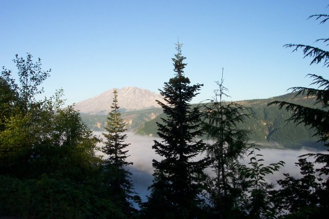
| Here is our first look of the day at Mount St. Helens. From this viewpoint, we are seeing the east face of the mountain. You can see that there is little snow on the mountain, and none of what is there is fresh. The trees here stand in testament of the fact that the eruption did not blow in this direction on May 18, 1980. The valley below is covered with a mist that we are now above. | |||||
| Looking down on the top of the clouds. The sky above was blue, and the day just couldn’t have been any better for taking pictures. |
|
|||||
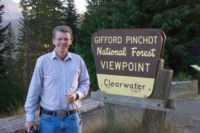
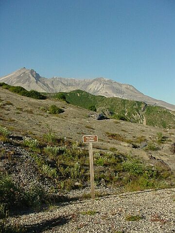
| Here I am by the sign for this viewpoint. I decided to wear a long sleeve shirt for the hike today, because there was not going to be any tree or cloud cover, and I did not want to get sunburned. It is still early and the sun is low on the horizon. Later on, when we started our hike, I put on my hat, and turned up my collar to protect me from the ever-brightening sun. | |||||
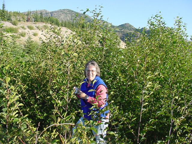
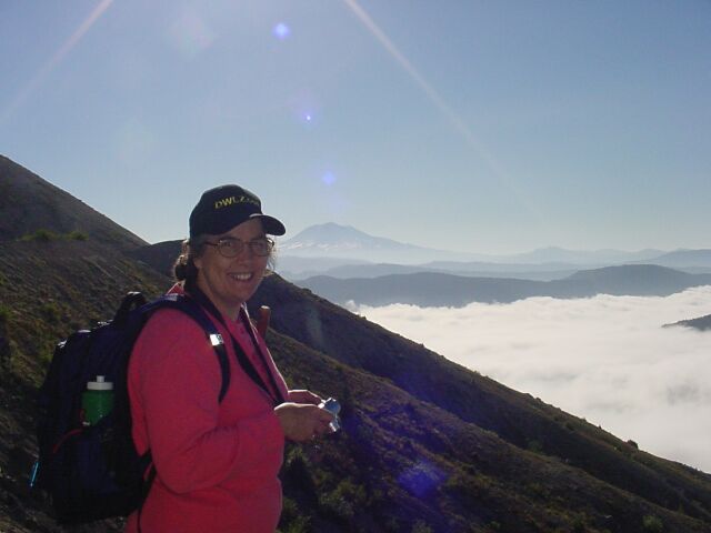
| I had hoped that Dotti would be able to get some sleep on the way up, but she was sweet and stayed up the whole way. (She even was alert enough on the drive to work on - and solve! - a tough logic puzzle she had been struggling with on her palmtop computer for some time.) I caught her here in between her picture taking efforts. She also chose to wear long sleeves, and even had a vest on, in case the elevation and early start ran us into cold temperatures. |

|
|||||
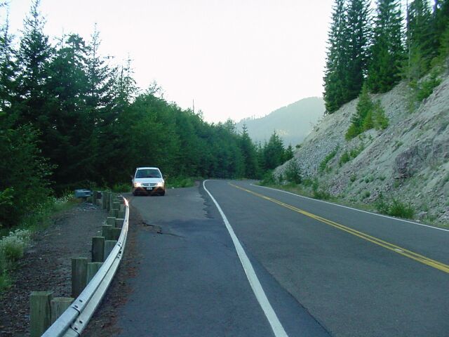
| This shot was one I took of the car looking up the highway in the direction we were actually driving. However, I had seen a photo opportunity that I didn’t want to miss. (It was a cloud cover scene that we ended up getting many of before the day was done.) I saw a turnout on the other side of the road and did a quick U-turn and parked. | |||||
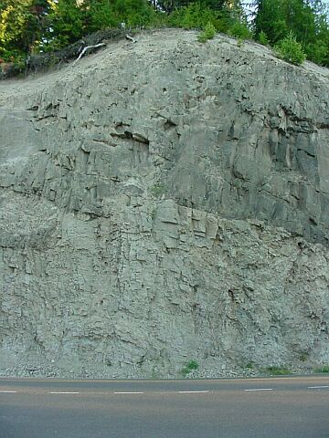
| The road cut here shows a couple of different layers of Mount St. Helens deposits. The lower one is of a lighter color, and the dividing line is quite distinct. Over and over again the volcanoes of the Cascade range have laid down deposits, as well as throwing ash so high into the sky that it has traveled around the world. |
|
|||||
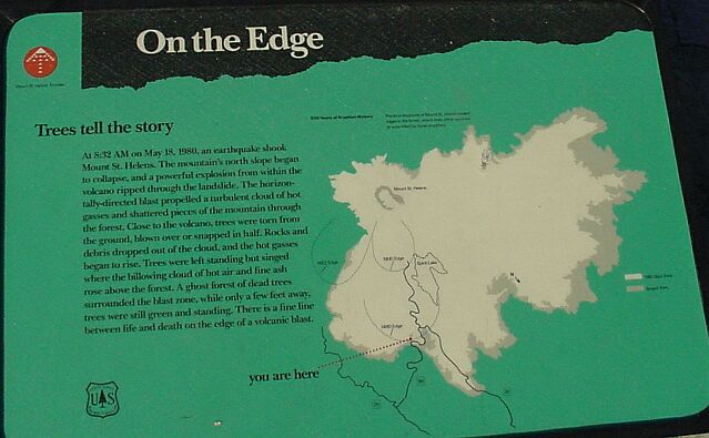
| After driving a number of miles farther, we had moved to the northeast of the mountain. On this map, which has north located at its lower right corner, it shows that we are on the dividing line between blasted and pristine forest. The black line beside the point labeled "you are here," shows the road we were going to drive, moving up the drawing to Windy Ridge at the end of the road. Shortly we would be paralleling the eastern shore of Spirit Lake. The text on the sign states what our eyes could see for themselves. It was uncanny the way untouched trees were continuing their existence right next to trees that had been killed by the heat, and/or knocked flat by the super-high velocity winds of the eruption. | |||||
| The sign from the last photo can be seen in the lower right corner of this one. Mount St. Helens stand in the center, unrepentant, and sure to do the dirty deed many times again in the future. Its victims are still standing, though dead, right in front of us. All of the terrain here visible was completely covered with heavy forest before the eruption. Today the green is supplied by shrubbery, and the trees are dead hulks. |

|
|||||

| Here I am squinting into the early morning sun. | |||||
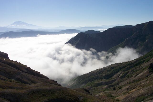
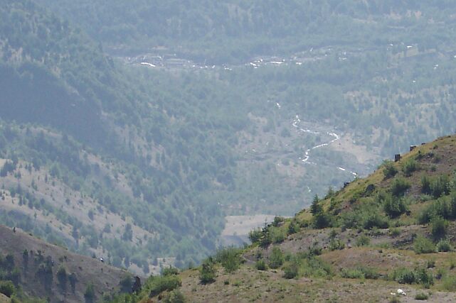
| Off in the distance you can see a layer of clouds, riding above the valley floor. The pattern of destruction below us was interesting in itself. Notice how a clear line is visible running up the hill in the distance, where everything beyond it is green and lush, old growth forest, but on this side of the line, there is bare ground that runs to one strip of forest that somehow survived. On this side of that strip, everything was destroyed. (The green trees visible in the foreground I believe were planted after the eruption.) |

|
|||||
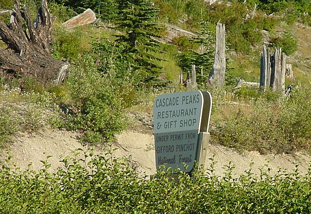
| After a 3 hour drive we were looking for a restroom, and were hoping that the ones at this gift shop would be open. Unfortunately not. However we did find two other restrooms open up the road a short distance. | |||||
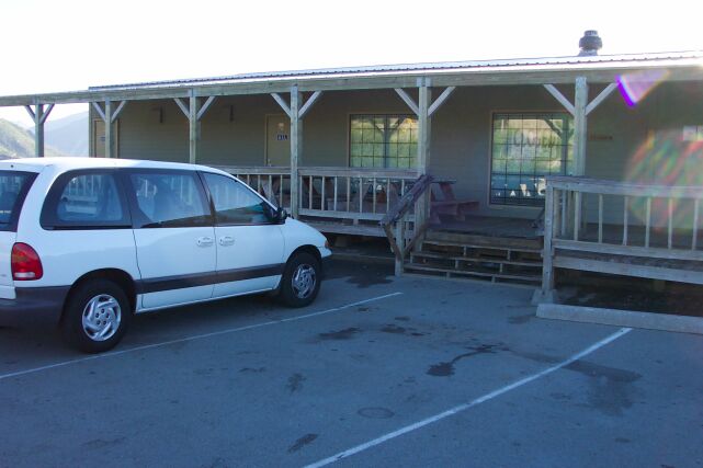
| Our van had the parking lot to itself, since everything was closed. (Note sign in window.) |
|
|||||

| Dotti took a couple of pictures of some flowers (see below) and then one of me. | |||||
| This is my lovely Dotti with her camera in search of more flowers. |
|
|||||
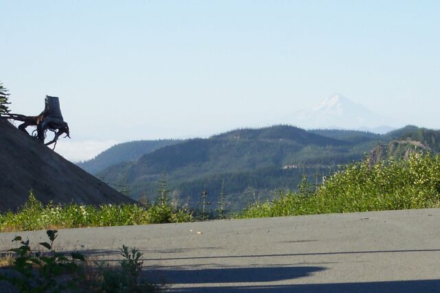
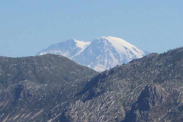
| Besides the stump on the left which I always have my eye out for whenever we come up here, I noticed that Mt. Hood was visible from this parking lot. It is dim in the picture, but easy to make out. | |||||
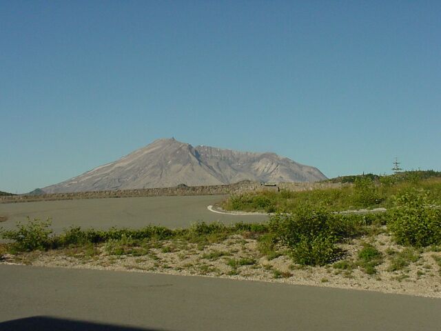
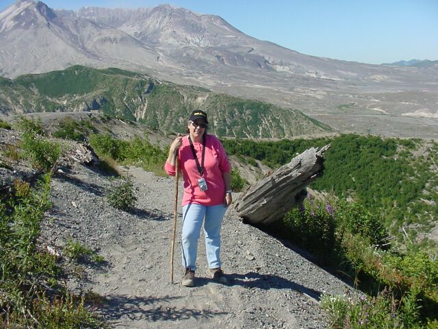
| Mount St. Helens on the other hand, is not dim at all. We felt like we were right on top of it. |
|
|||||

| Dotti took this picture of an information sign at the next viewpoint along the road. Later on we found that we could see this location from the trail we were hiking on, so we were pretty close here to our final driving destination. The sign goes through some info on what makes the Cascade Volcanoes work, and then at the bottom there is some info given on the three volcanic peaks that are visible from this point. Mt. Adams is not very close to any major population center, even though you can see the top of it from Portland on a clear day. Still, at 12,286 feet, it is taller than Mt. Hood or Mount St. Helens, and more massive than Mt. Rainier. It is a big mountain! Mt. Hood, at 11,245 is the tallest peak in Oregon, and dominates the landscape of Portland on any clear day. Mount St. Helens, even though it is only 8,364 feet today, is the star of the show these days because of the fireworks it set off 23 years ago, that the landscape is still trying to slowly recover from. | |||||
| Off to the east, Mt. Adams stands quietly. The rippled land of the Cascade Mountain Range appears like waves on choppy sea. On the right were the restroom facilities that we were happy to find. |

|
|||||
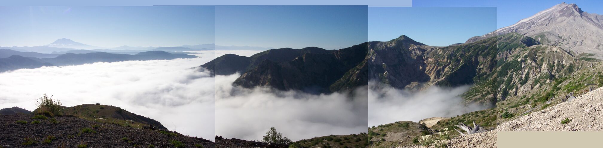
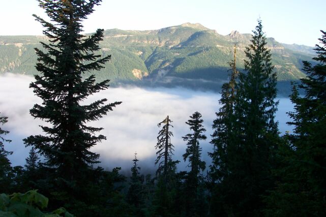
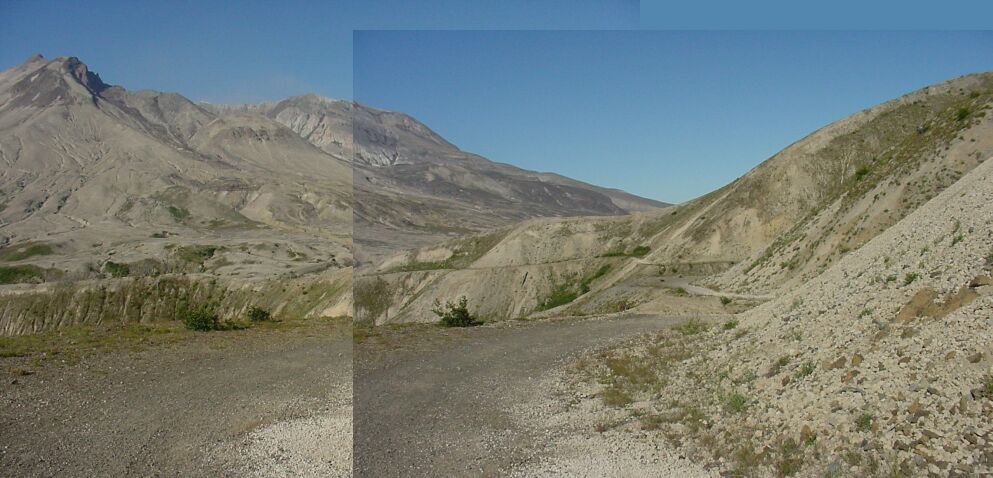
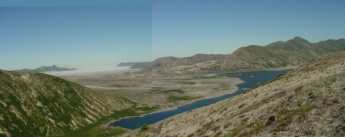
| Dotti took 4 pictures scanning from left to right, which show the cloud layer below us in the valley, and the mountain above us on the right. I pieced them together to form this panoramic view of the scene. Normally, when you are looking down on clouds like that, you are in an airplane. | |||||
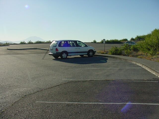
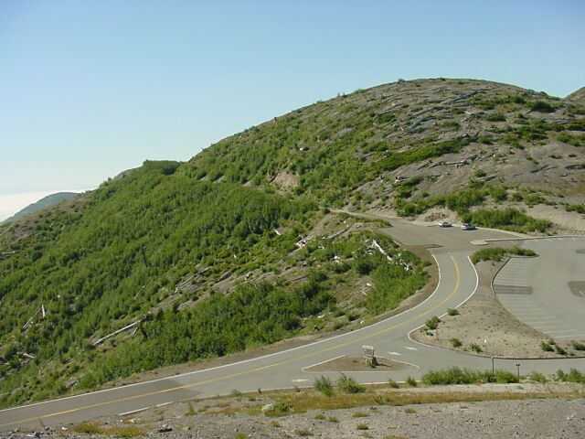
| Well, we finally made it to Windy Ridge. Our walking sticks are out of the van, and that means its almost time to get our hike started. |
|
|||||
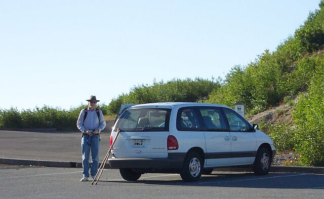
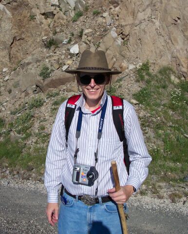
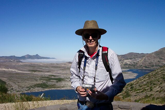
| Here I am with my hat on, and camera in hand, snapping a few pictures of the area around the parking lot. This hat is one that I picked up several years ago on the Oregon coast, during one of early visits there after moving back to the area in 1995. I thought it would be good for keeping the sun off me as we walked the unprotected trail. | |||||
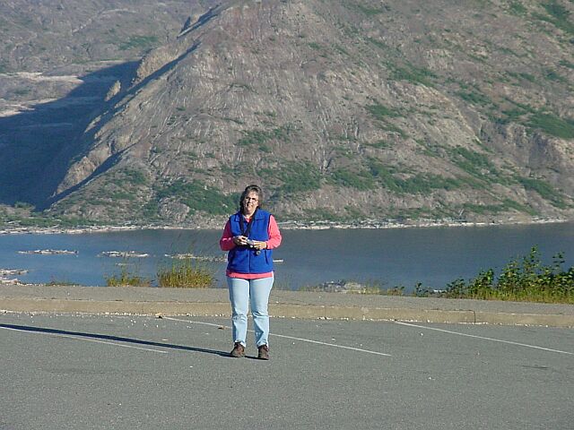
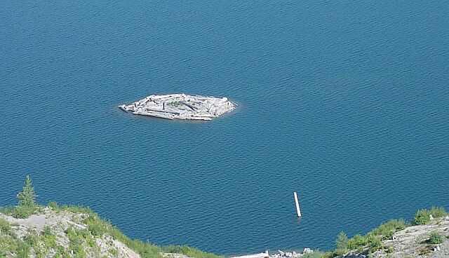
| Here’s Dotti, also with camera in hand, her vest on, and Spirit lake behind her. You can even see a few of the log islands floating on the lake, which move around with the wind. |
|
|||||

| Across the parking lot are the restroom facilities and the long flight of stairs that Tammy, Jim and I walked up in 2002, while my Dotti, who was recovering from her knee surgery, kindly waited in the car. There are over 400 steps there (more on that later) and you know you have been climbing after going up them. | |||||
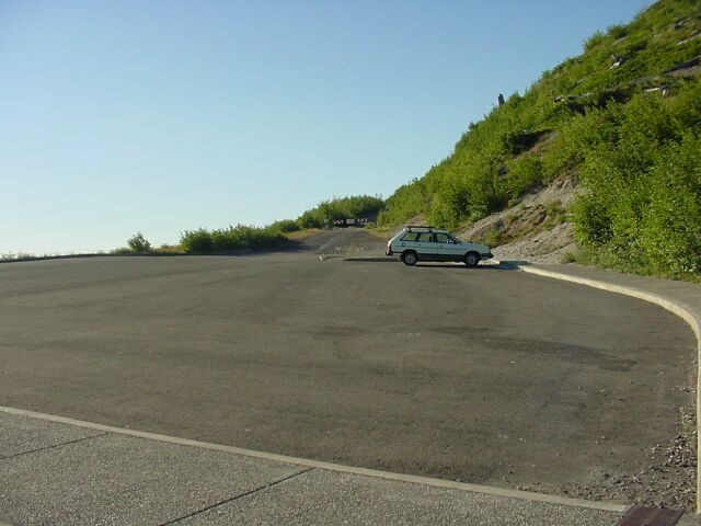
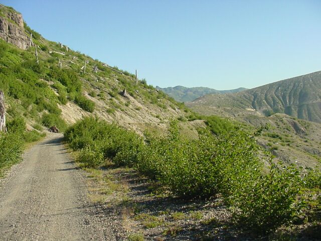
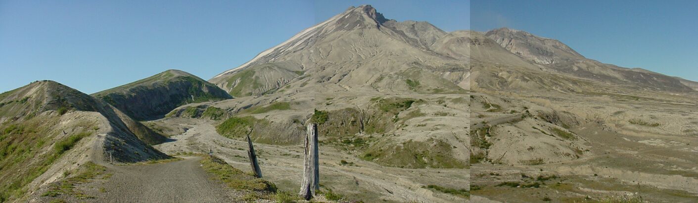
| We could have actually parked closer to our trail, which starts at the gate you can see, but since we were on a hike, we didn’t think it would matter much. Up the side of the hill you can see dead stumps sticking out of the bushes. Some of them were over a hundred years old, standing tall and proud until 1980. Now they are nothing but grim reminders. |
|
|||||
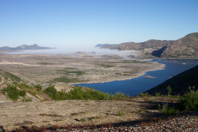
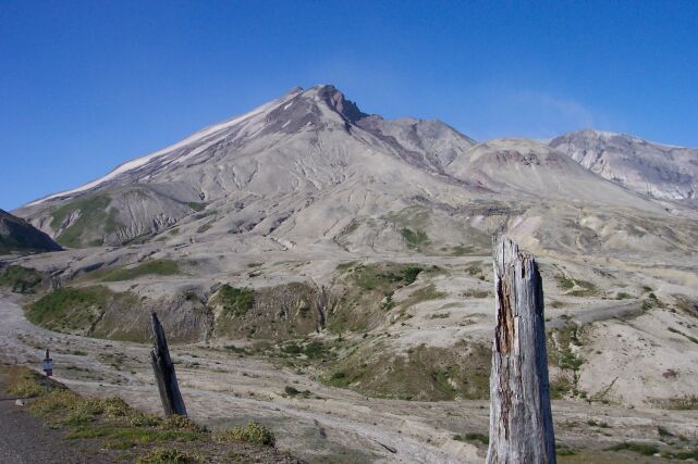
| Off to the west lies Spirit Lake. I have never seen it look so blue. The misty clouds stretch out before us, clinging to the ground like a hand searching for something it left lying by the lake. | |||||
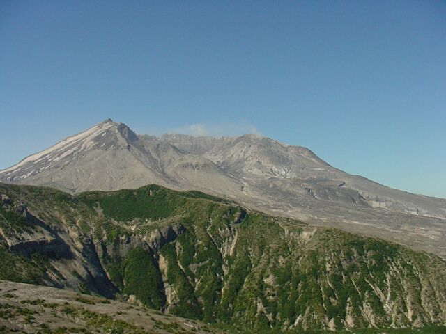
| Mount St. Helens peaking over the top of the intervening hill. If you follow the slope of the lines of its sides, you can see where the old peak used to sit, near the top of the picture. Then it would have been more than just peaking over the top of the hill, it would have been towering over it. |
|
|||||
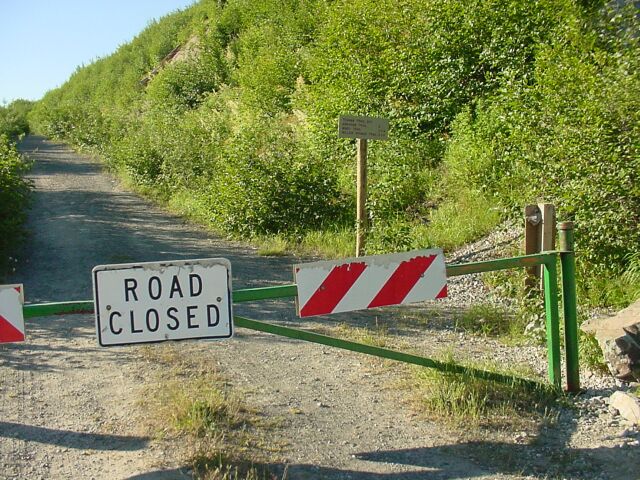
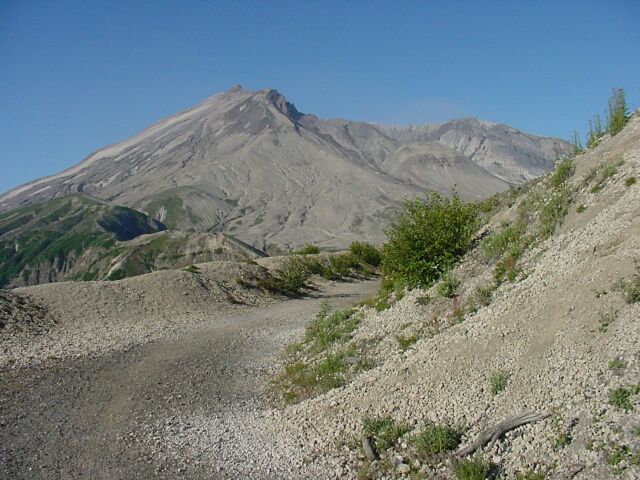
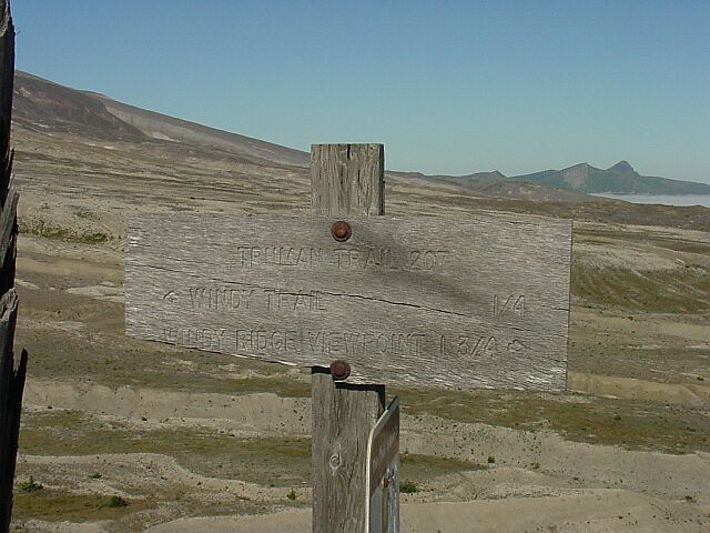
| This padlocked gate bars the way to vehicles. The sign says: Truman Trail 207; Abraham Trail 2 miles; Windy Trail 2.25 miles; Willow Springs Trail 3.5 miles. As it turned out, this section of our walk took us to the Windy Trail, and back again. | |||||
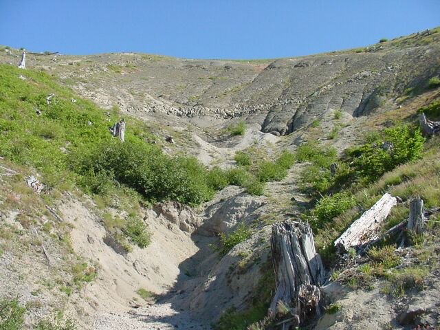
| While the area around this trail is green with vegetation, remember that this was once a heavily forested area, and there is not a single tree to be seen. |

|
|||||
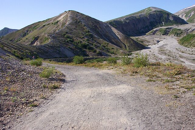
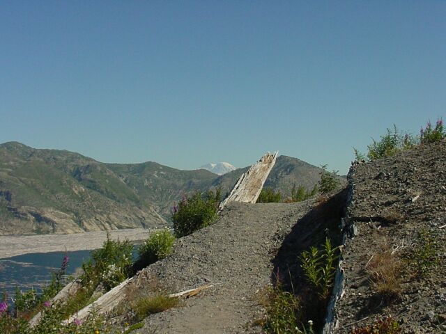
| This is looking back the way we came. Off in the distance, looking like a scar line across the naked face of the hill, is the road that we drove down to get here. The last viewpoint we stopped at is just visible as a dark spot about halfway down the picture about 20% in from the right side. On left, you can see two reminders of the fact we are walking on a volcano. The first is the condition of the dead tree remains, having been blasted out of the living world, and the second is the exposed basalt rock high in the upper left corner of the picture. | |||||
| Just around the corner we are coming face to face with the crater of the mountain. Like Count Dracula’s head, the dome is surrounded by its "cape," which extends high up over and around it. That dome is the lava plug, which capped the tunnel leading to the magma chamber below. It is the cork in the bottle, which, at least temporarily keeps the magma from exploding all over us. It has been continually growing since the eruption, and at some point in the future, its height will surpass that of the surrounding crater walls. It will then become the new peak of the mountain, and as it continues to grow, it will establish greater and greater heights for the mountain itself. Mount St. Helens will not be a finished piece of work for some time to come. |
|
|||||
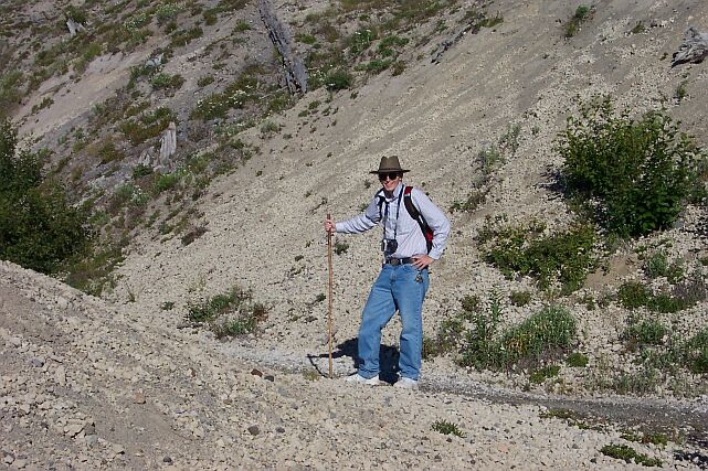
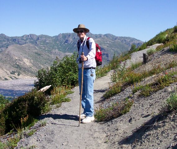
| Here I am on the trail. The hat is helping to keep the sun off my face, though not completely. I have also turned up my collar to keep the sun from burning the back of my neck. | |||||
| Dotti took a picture of me taking a picture. I was just rounding the final turn before there would be nothing between the crater and myself. |
|
|||||

| My beautiful Dotti in the foreground and the volcano’s mouth in the background. | |||||
| Dotti caught another shot of the clouds topping the valley, with Mt. Adams in the backgrounds. |
|
|||||
| Dotti snapped another picture of me on the trail. | |||||
| I put two photos together on this shot to give the feel of what the mountain and the terrain looked like here. The lush, beautiful, old growth forest that once stood here is difficult to imagine, when looking at this desert-like landscape. |
|
|||||
| A couple of reminders stand here, to remind us that trees were native inhabitants of this land at one time. | |||||
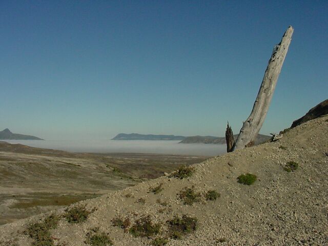
| Looking west out first across the badlands, and then the clouds. |
|
|||||
|
Here is another two photo shot that I put together. On the right is the crater, straight ahead the path continues, and off to the left, believe it or not is another path, called the Abraham Trail. The Abraham Trail leads over the hill before us, and down on the other side to an eerie plain of volcanic ash. The trail is narrow at this point, and when it hits the second ridge, there are stairs laid into the hill. It looks like it would be a challenging trail, but we didn’t go that way this time. Off to the right we see the crater and the growing lava dome. Immediately after the eruption, the lava dome was about 600 feet in height, but today it is over 1,150 feet. If it continues to grow at its previous rate, it will fill the crater in about a century, and return Mount St. Helens to its old height in 200 years. (See the US Geological Survey Web Site) That is assuming that it doesn’t blow its top in the meantime.
The dead looking landscape seems so out of place with the thousands of square miles of heavy forest that surround it, granted, at a distance. |
|||||
| Looking back up the trail at Dotti, who had stopped to take a picture. |

|
|||||
| This trail marker is located at the junction of the Truman Trail and the Abraham Trail. At this point we were only a quarter of a mile from the Windy Trail. We had come 1.75 miles from Windy Ridge. | |||||
| There I am out ahead on the trail, working my way down to the bottom. Straight ahead from where Dotti took this picture lies our turn around point. The Abraham trail is moving up the ridge on the left. This portion of that trail is all done in stair steps. |
|
|||||
| The end of the trail for us. Off in the distance, on the right you can just see a trail marker sign for the Windy Trail, which leads to the Loowit Falls. The Truman Trail heads off to the right from here and goes over to Coldwater Peak. | |||||
| On the way back, Dotti took this picture of me walking up a hill, with Mt. Adams in the background. |

|
|||||
| Looking down into a valley that had been all clouds when we came up the trail, now you can see the rivers and trees that were covered before. | |||||
| A two picture shot, this shows part of Spirit Lake on the right, and the clouds still hanging around to the west. |
|
|||||
| Here is Dotti with Mt. Adams in the background and the clouds seemingly close enough to touch. | |||||
| Looking up the hill beside the trail, I spotted a clear line of volcanic rock that was obviously part of some past eruption of Mount St. Helens, buried deep in the hill under ash and other deposits. Higher up there is a darker line that may have come from a later eruption. In the foreground, there is no doubt that this tree was demolished by the lasted eruption. |
|
|||||
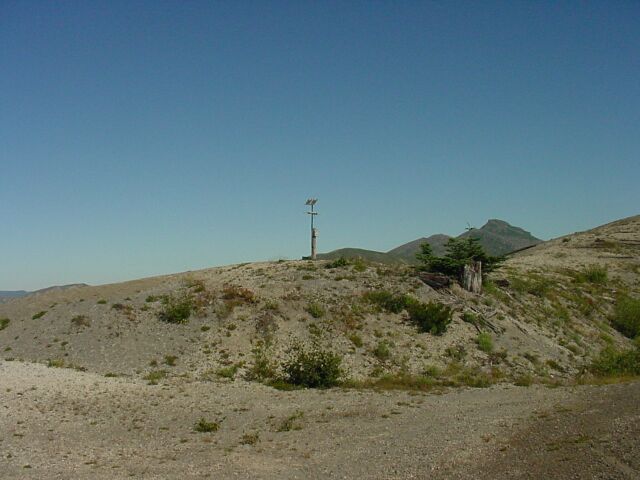
| I am pretty sure this is a seismology station, used to monitor the seismic activity of the volcano. There was a solar panel for power and a radio antenna. I didn’t see anything that would have gathered weather data, and I know they monitor the mountain at all times for earthquakes, just in case. To the right, with the trees, you see the old life, which has passed, and the new life, which is just starting out. | |||||
| Here I am with Spirit Lake, and a lot of dead looking ground, in the background. |
|
|||||
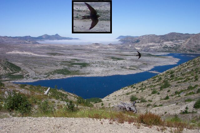
| Dotti snapped this picture of the lake, and it wasn’t until afterwards that she discovered that she had caught a bird in the picture too. (Dotti’s just too honest to lie and say that she planned the shot that way.) I put a close up of the bird at the top of the image. | |||||
| We moved the van over to the restrooms, and then we tackled the stairs. In the distance you can see the trail we had just walked. Mount St. Helens lies just over that hill. |
|
|||||

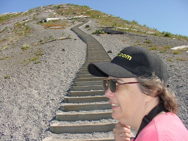
| Here I am standing at the foot of the stairs. My collar is up to keep the sun off my neck, and the wind is keeping things comfortably cool. On the walk up, Dotti used a count of 50 stairs for a resting point. She would walk up 50 steps, and rest. Walk up 50, and rest. I preferred the "walk at a steady pace all the way to the top" method. It took us both about the same amount of time to reach the top; we just used different methods. A side effect of the method that Dotti used was that she accumulated a count of the total number of stairs when she reached the top. (More on that later.) | |||||
| Dotti getting ready to start the climb. The stairs running up the hill, and especially as they get near the top, almost look like the body of a snake, switching this way and that, back and forth. |
|
|||||
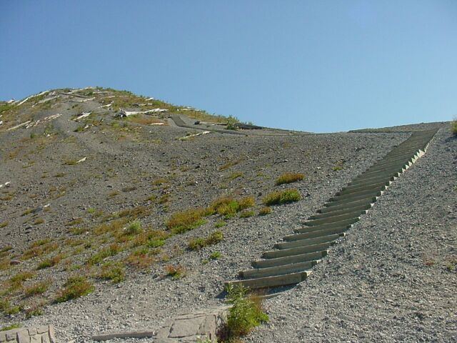
| We have begun. The stairs are actually wooden frames that are filled with dirt and gravel. We found it easier for the most part to just step on the frames, going from wooden board to wooden board, stepping over the dirt filler. You can tell from the scattered tree bodies that this would have been a very bad place to be on May 18, 1980. | |||||
| The top at last! If you look closely you can see the construction of the steps. Off in the distance, the cloud layer is still hanging tough. |
|
|||||
|
The Great Stair Count Debate Who has the right count??? Dotti at the top. You can see the steps here pretty well, with the wooden frames and the dirt filler. Dotti was clearly happy to have the climb finished. (As was I!) It was interesting that the last time I came up these stairs, it was with Tammy and Jim, our closest friends and when we got to the bottom on that day, Tammy had counted the stairs on the way down. I happened to make a video of her telling me what her count was. At the time we made the climb today, I honestly didn’t remember what Tammy had said was the number of steps. However, since Dotti had counted them too, I took a video of her telling me what her count was. IF you click on the links on the right, you can find out what they said. Since I have the highest regard for the opinions of both of these lovely ladies, and I am no fool, I am not taking sides in this debate. Instead, I think maybe we will all come back some day and do a recount. If for no other reason, the view from the top is worth it. |
|
||||
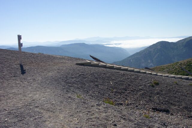
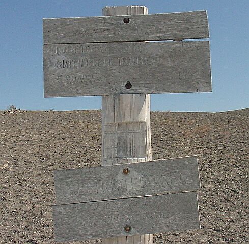
| As soon as you reach the top of the stairs there is this sign awaiting you. It tells you that the Smith Creek Trailhead and Road is 1.25 miles away. I noticed that all of the signs on the trails around this mountain are extremely weathered. There is nothing to keep the sun, rain, snow, or wind off of the signs, and they suffer greatly as a result. |
|
|||||

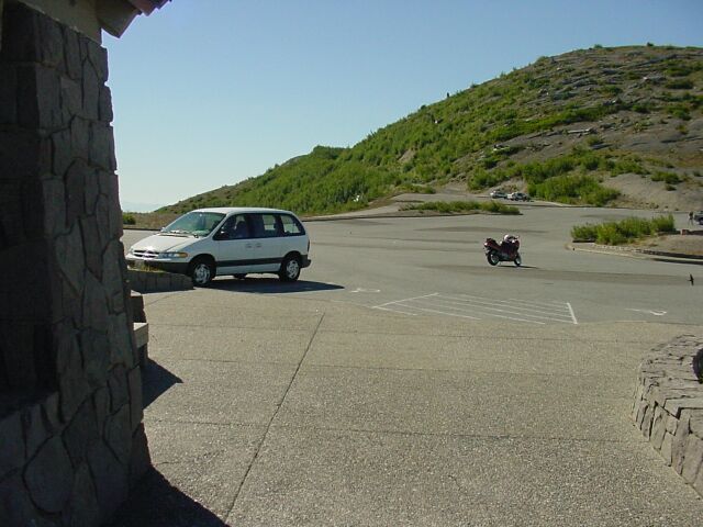
| Looking down the stairs is enough to make you dizzy. Our little van is being kept company by a band of bikers, and the crater is once again looking over the hill at us. | |||||
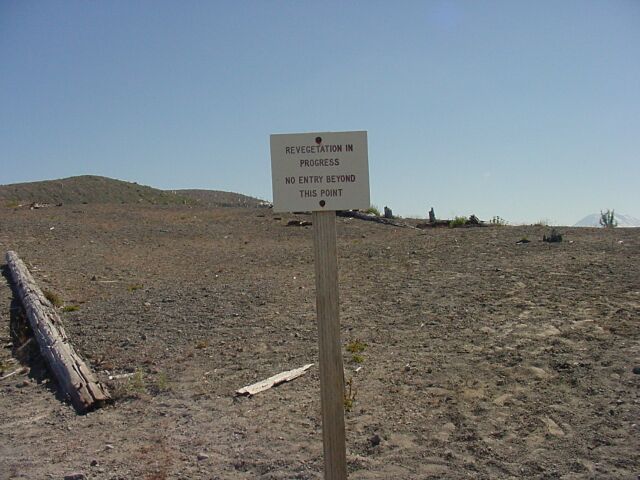
| Every time I pass this sign I have to chuckle. I understand what they are doing, and it is a test where they can study how long it takes for the ground to recover after an eruption. Nonetheless it is amusing to think of that ground, where next to nothing is growing is a place where "revegetation" is in progress. This goes one step past the "Keep off the grass" sign, and it says, "Keep off the ground where maybe someday there may be grass." |
|
|||||
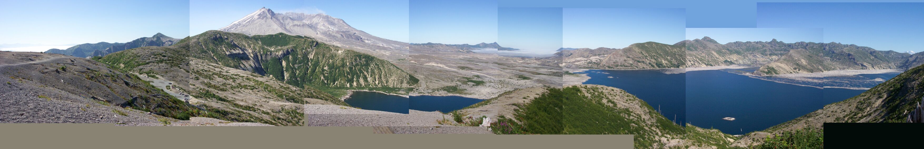
| Wow! Dotti stood at the viewing platform and she took a panoramic view of all the good stuff she could see from there, one shot at a time. I pieced them together into a single image that you can pan through. Starting on the right you can see Mt. Rainier sticking up over the top of the hill. Below that lies Spirit Lake, looking blue as can be, except for the cover of dead trees that still float on its surface after 23 years. When those trees finally get waterlogged, or rot and sink, and the surface is clear once again, Spirit Lake will be exceedingly beautiful, even without vegetation surrounding it. When the trees come back it will be once again a beautiful scenic paradise. Moving to the left you come to the no-man’s-land where what was the top of Mount St. Helens slid down onto, and across, on its way into Spirit Lake. Vegetation has been slow coming back to that area so far. Then you come to what is left of the volcano, the crater and the lava dome. Not to worry however. The mountain is on the mend, and one day will be as big and beautiful as it was before. Continuing on to the left, you come to the top of the stairs that we ascended, with the lonely trail marker sign standing its vigil. The trail from the sign to our viewing platform finishes off the panoramic shot. | |||||
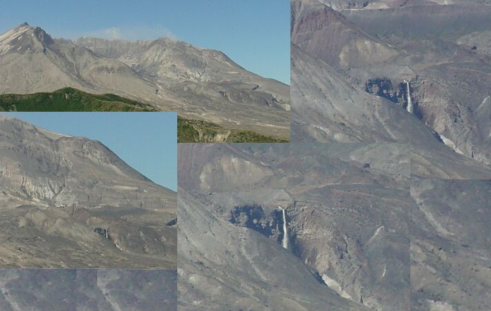
| These photos are of Loowit Falls. This falls is created by glacier melt, from a glacier that has formed behind the lava dome. In the upper left view you can see the crater, and the falls is just visible on the right side of the image as small white smear. Moving to the image just below that one, you can see the falls clearly as we zoom in a bit. The lava dome is just out of the picture on the left. Moving to the picture on the right, with my zoom set to maximum, you can see what the 200’ falls really look like. Even on this hike, we got to see a falls. |
|
|||||
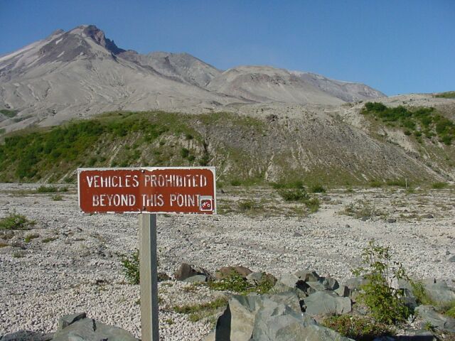
| Looking to the southwest there is the path that we had walked earlier, as it runs past the gate and around the bend on the left side of the hill. | |||||
| Looking over the top of the hill at the crater. |
|
|||||
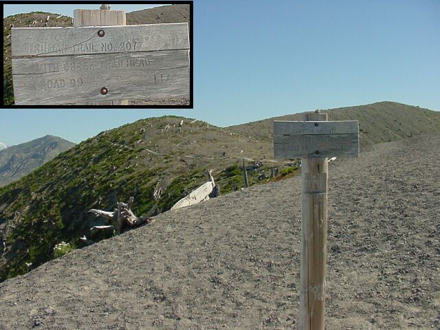
| This sign, at the back of the viewing platform is a bit easier to read than the last one. Here you can see it says "Smith Creek Trailhead & Road 99 1 1/4." The trail it is marking is dirt and barely distinguishable from the surrounding terrain, but that was where we were next headed. | |||||
| As we worked our way around the hill the trail became easier to see. Here I am enjoying the view of Spirit Lake. |
|
|||||
| Here is one of the log islands that have formed on the lake from the many trees that were knocked down and forced into Spirit Lake by the eruption and water movement created in the lake as a result. | |||||
| Looking ahead on the trail, just over the hill is the peak of Mt. Rainier, most commonly viewed from the Seattle area. This mountain is over 14,000 feet tall, and is the tallest of all of the Cascade mountains. |
|
|||||
| In an attempt to capture the top of Mt. Rainier with the zoom, which she did nicely, Dotti also caught a picture of what happened to the forest that surrounded Harry Truman’s Spirit Lake. The trees were just flattened. I read that there were 3.7 billion board feet of timber blown down by the blast, enough for 250,000 homes. That is a lot of trees. | |||||
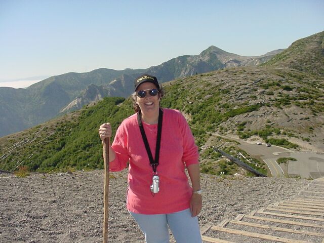
| Here’s my lovely Dotti, while behind her we can see the ridge that holds the viewing platform we were on earlier, the ridge that forms the hill we were parked next to when we first arrived at Windy ridge, and finally the volcanic crater. If you look closely, you can even see Loowit Falls! |
|
|||||
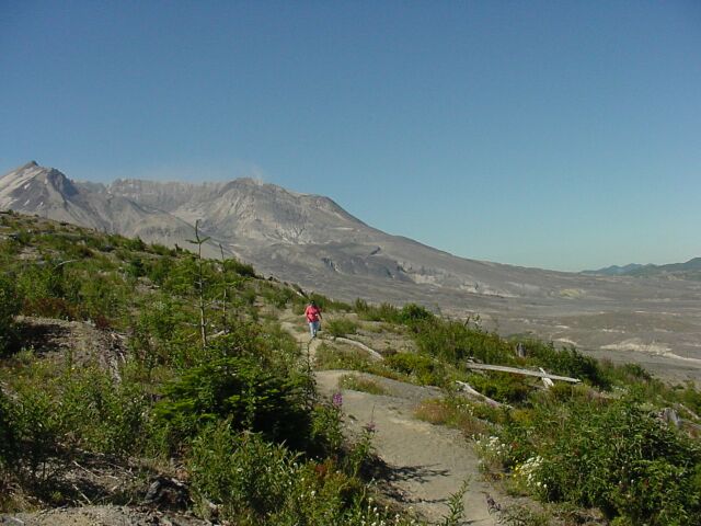
| If we followed this trail any farther it would only take us back down to the road that we drove up earlier. So, we felt we had gathered in all of the scenic shots it had to offer, and we chose to turn around at this point. The little pines to the left of the trail where Dotti is walking, give testament to the fact that the land will recover, and the forest will return. It may be knocked down again one day, but it will not stay knocked down, no matter how many times Mount St. Helens erupts. | |||||
| Here our official CFHC botanical photographer, Dotti, has collected another interesting and beautiful assortment of flowers from along our hiking paths. Even in the devastation of the blast zone, flowers are coming back strong! |

|
|||||
| I had high hopes of this being a great hike this week, and as it turned out, it was even better than I had hoped. We got to see one volcano, recently active, up close and personal. We got to see three others from a distance. Even though the trees were missing around Mount St. Helens, there was still plenty of beauty to witness. And we still got to see a great deal of beautiful forest land on the 224 mile round trip drive to our hike. It may be a while before we make it back up to Mount St. Helens, but I am glad we got to visit it for this hike. | ||||||
|
|
||||||


| [ Home ] [ DWLZ ] [ Message Board ] [ Restaurants ] [ Order Cookbooks ] [ Dotti's Newsletter ] [ Support Dotti ] [ FAQs ] [ Email Dotti ] [ Email Al ] |