SILVER FALLS
September 25, 2004
The Coon Family Hiking Club
Official 2004 Hike #6
LENGTH OF HIKE 7.2 miles - 4 hours 46 minutes
PREVIOUS SILVER FALLS HIKES
Silver Falls CFHC 2003 Hike #6
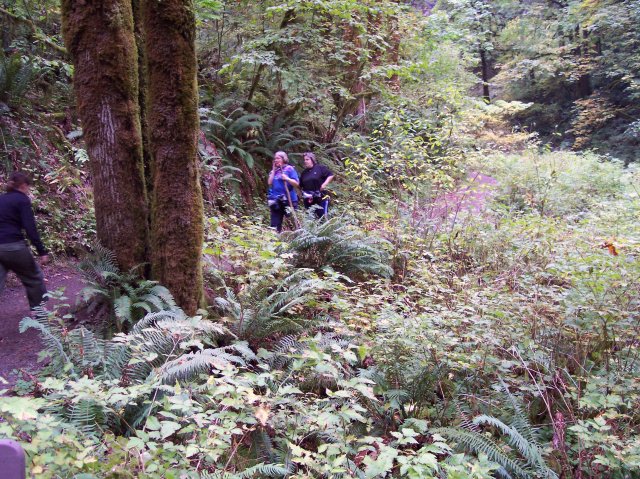
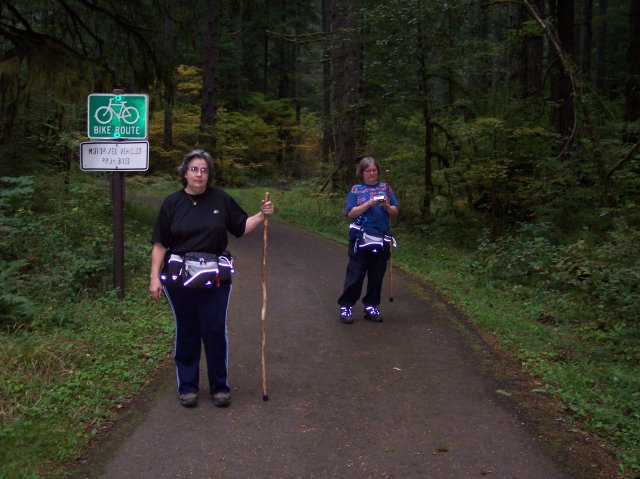
The point of letterboxing is to locate a hidden container out there in the big wide world, given instructions that are found on the Internet, on a letterboxing web page. If you follow the instructions correctly, you will find a little waterproof box that contains a small "logbook" where you can sign your name, date it, and even leave a little message for others to read. There is usually a rubber stamp in the sought after container that indicates the cache location name that you can use to stamp on some paper that you thoughtfully brought along just for that purpose. Each of us brought a rubber stamp that represented something about us, and we brought along a stamp ink pad, along with some instructions for finding a couple of letterboxes. We were set for a new hiking adventure; at least new to us. J We arrived in the parking lot and were ready to go a bit after noon. It was around 60° when we set off on our hike. The sky was overcast but it didn't appear to be threatening rain. All and all it was great weather for hiking! Just a trivia note: We had three cameras going during this hike, and pictures from all three of them made it onto this page. Joan had her datestamp turned on, so on her pictures, unless they were cropped (like photo number 1), will show the date and you will know who took them. For the pictures that Dotti and I took, they are all mixed up in the presentation and unless one of us is in the picture it could have been taken by either of us. |
||

|
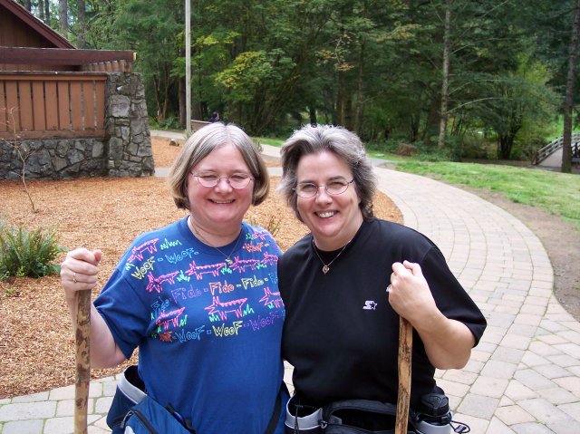
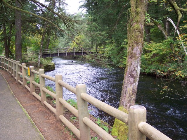
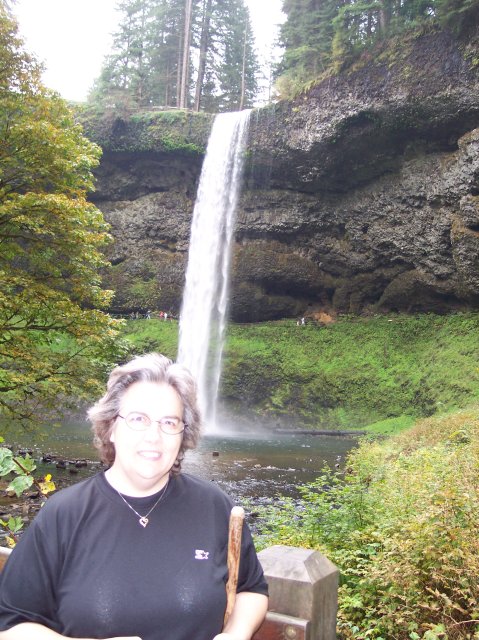
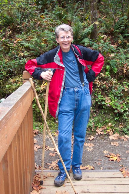
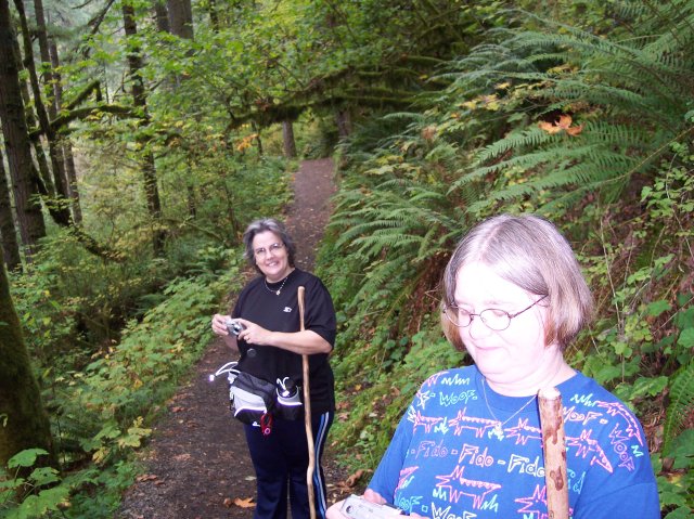
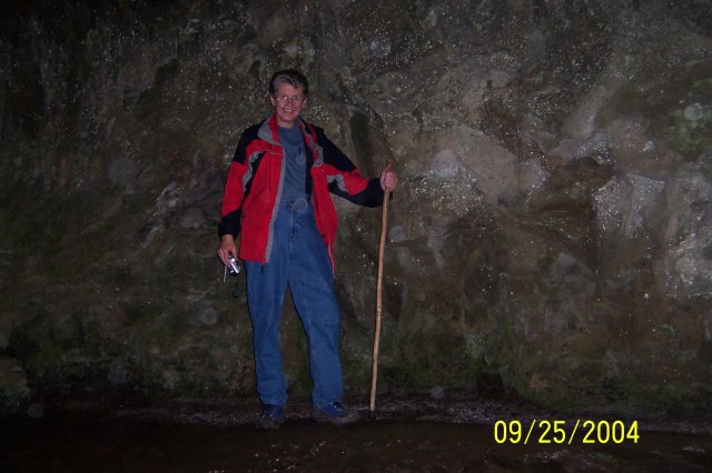
Joan snapped this picture of Dotti and I with our walking sticks, and the South Falls Lodge is in the background. |
|
|
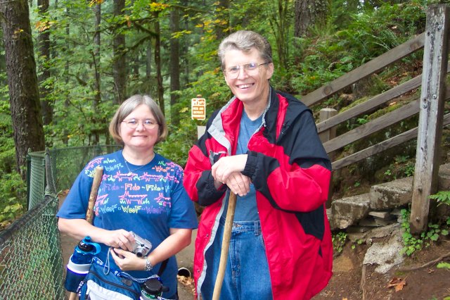
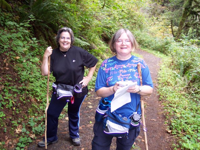
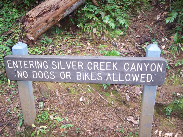
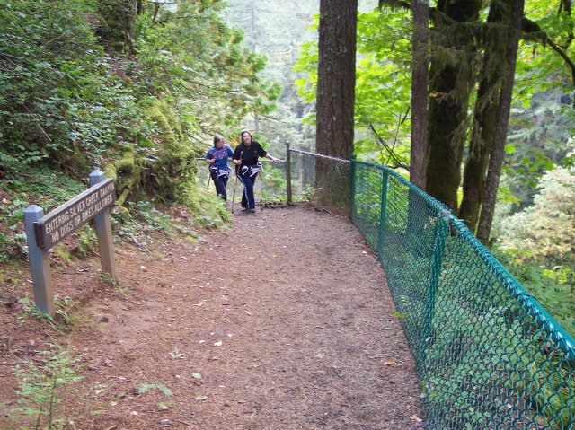
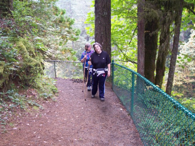
Here are Joan and Dotti ready to hike! Most of the hiking trail that we would be on for the day prohibits people from bringing their dogs on it, with or without a leash. Looking at her tee-shirt, it appears that Joan has found a way to bring Fido in spite of that. Woof! J You can see that Dotti has her water bottle all ready to go. |
|
|
|
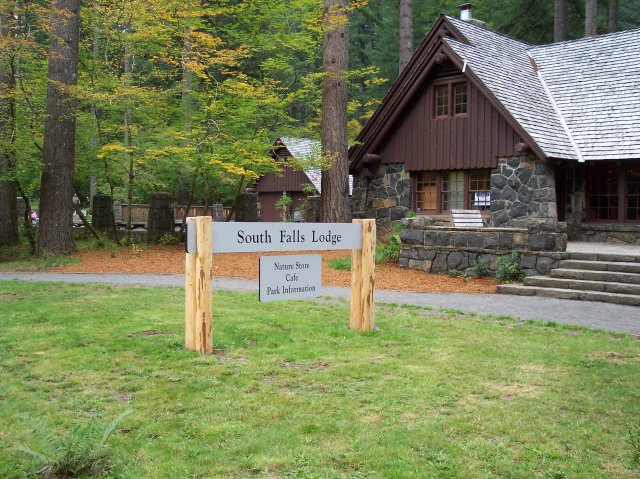
The South Falls Lodge. They have found an interesting name for their gift shop: Nature Store. However the eating establishment and purveyors of trail data have taken a more traditional approach to nomenclature. The buildings, trails, and signs all seem to fit pretty well with the beautiful surrounds that they are cast in. If you saw this sign, even without the pine trees in the background, you would feel that it belonged in a place very much like this. The same is true of the lodge, etc. |
|
|
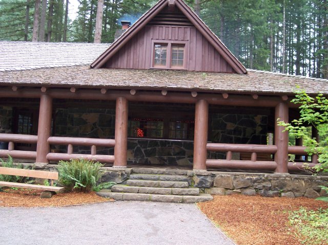
Notice the smoke coming out of the chimney. The year before we had a lot of rain when we did this hike and it was fighting to climb out of the 40s for temperature. The fire in the fireplace in that lodge was very welcome that day! |
|
|
|
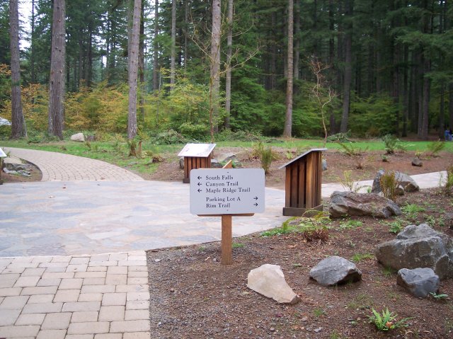
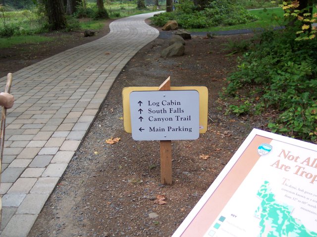
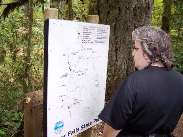
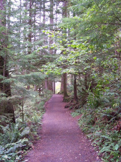
You can probably tell that this is all new construction. They have really worked hard on dressing up the hiking areas of the Silver Falls State Park. The sign points out that the South Falls are to be found to the left, along with two trails that we would be walking on. To the right is an alternate parking area and the trail upon which we would be returning on. But that would be nearly 5 hours after the time this picture was taken. |
|
|
One of our hiking books complains about the mundane names that were chosen for the various falls along the Train of 10 Falls. However, those names were downright creative when compared with the name that was chose for the, well for lack of a better term, "Log Cabin." J |
|
|

|
I like this picture. The sign is interesting, not for what it says, but just the way it fits in with the background. The side path curves off into the dark trees and wooden structures, and leaves one to wonder what sort of interesting things might be found if only we followed that trail. |
|
|
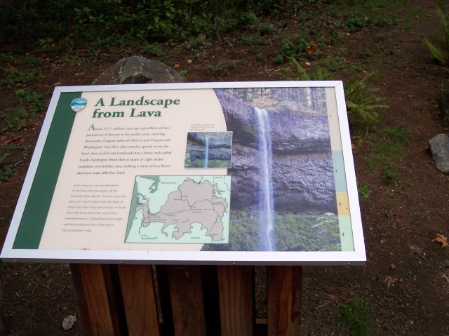
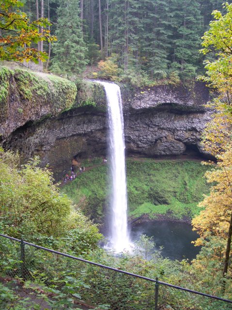
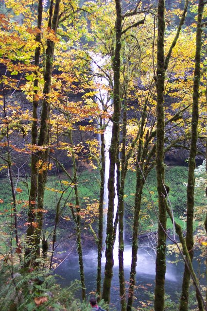
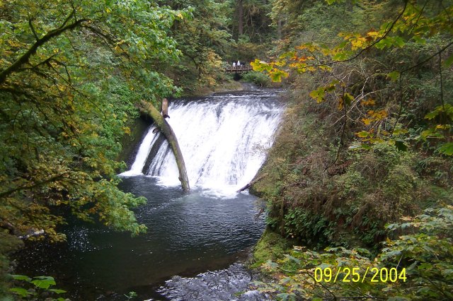
I snapped this picture of a sign along the way, because it has some interesting geological information about our area. (If you would like to read the text on this sign click here.) It goes far beyond Silver Falls, although the photo on the sign shows the South Falls, with less water flowing over it than the amount we saw flowing on this hike, dropping over thick layers of frozen lava. The map shows the extent of one the largest eruptions of lava in history. The map shows nearly all of the State of Washington and the northern part of Oregon, as well as a slice of the western part of Idaho. Most of this huge area of land is covered by the darker colored patch that indicates the area that was covered with deep lava flows, which started in Idaho and flowed all the way into the Pacific Ocean. It is nearly impossible to conceive of the extent of this massive event. The lava behind South Falls, shown on the photo on the sign, came from that massive flow long ago. The photo also shows some of the other factors working to shape the land. The water flowing over the lip of the lava wall is visibly wearing the lava down at the drop off point. It is also wearing it down behind the falls, as the mist from the falls works its way into the cracks in the basalt and during the winter it freezes, and splits the rock, causing pieces to break away. This process has created the huge cavern-like expanse behind the falls. Plant life sinks its roots into the cracks in the stone, forcing them to expand and thereby weakening the rock. The humans have cut a path that crosses the photo as well. The land is changing slowly, but it is being changed. What will happen in the future? We'll just have to wait and see. |
|
|
|
Joan and Dotti are getting their walking sticks crossed up, but they aren't crossing swords. J This is the path that leads to the top of the South Falls. |
|
|
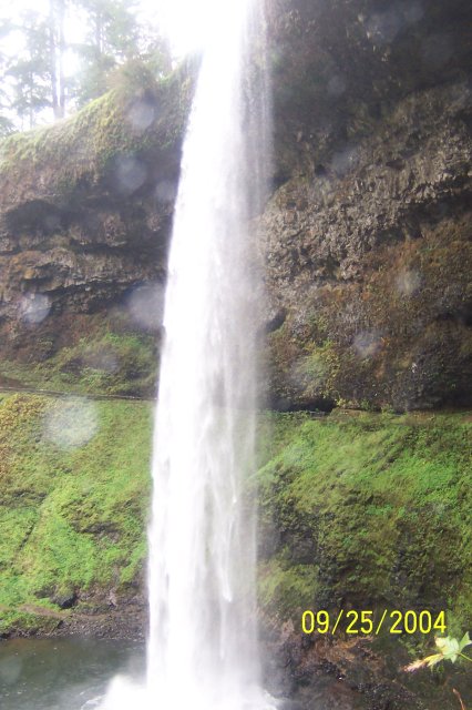
I was looking for someone to cross my walking stick with, but it stands alone. Water is turning white as it is taking the leap down South Falls just behind me. |

|
|
|
Now this is how I like to cross walking sticks. J There is just something romantic about standing at the top of a beautiful waterfall with my beautiful wife! |
|
|
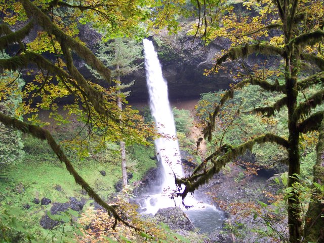
Joan standing at 1,310 feet above sea level and on the brink of quite a drop. The forest and the South Fork Silver Creek both rush right up to the edge in the background, but the forest has better brakes. |

|
|
|
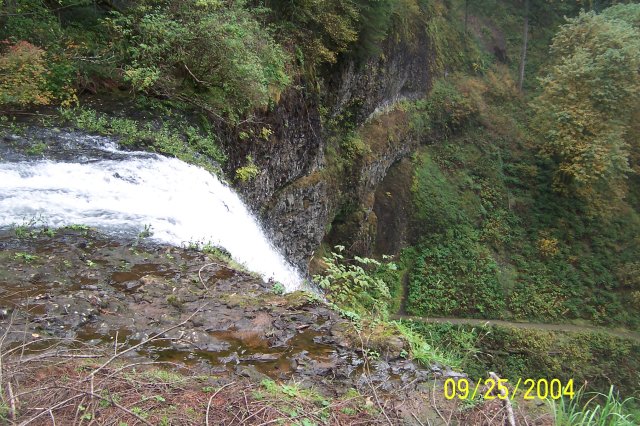
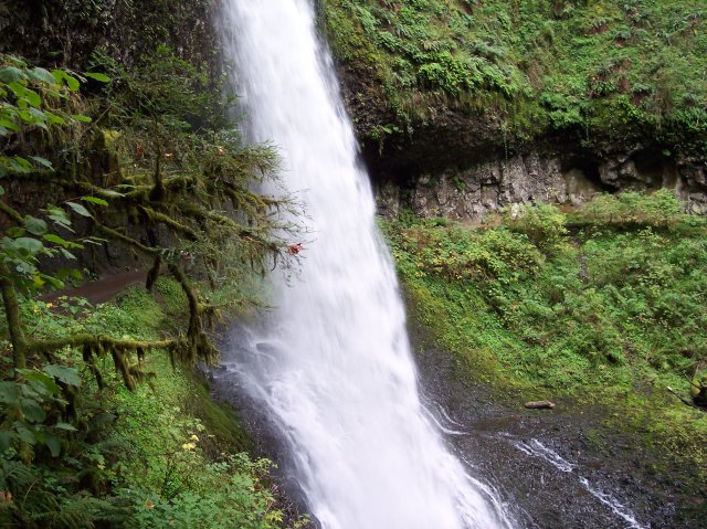
The line of water drops is shown here backed up behind the turnstile for the upcoming thrill ride over the 177-foot South Falls. |
|
|
Can you hear the water drops yelling, "Wee!"? There they go over the top. |

|
|
|
The ground goes from a few feet away to almost 200 feet away as you move from left to right in this picture. The trail below, that we would be walking on very soon, looks like it is coming right out of the falls. |
|
|
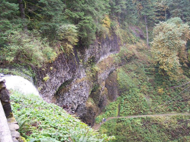
The people on the path below look very small from this distance. The basalt wall looks like a layer cake until its surface disappears beneath the green growth on the hillside. |
|
|
|
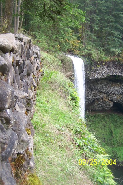
Local rock has been used to create a manmade wall in the foreground, while the natural wall of the same material runs out beyond the South Falls. |
|
|
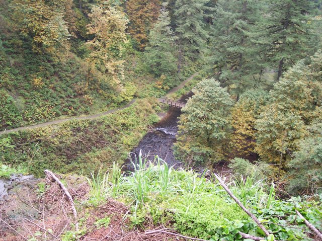
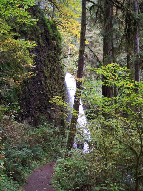
The bridge across the South Fork Silver Creek marks the point where the Canyon Trail was closed. Our plans at this point were to take the same route we had taken earlier in the year, which included walking the trail that runs down under the falls, and over to the left side of this bridge, and then to cross the bridge and return up to the level of the top of the falls. From there we would take the Maple Ridge Trail that runs more or less parallel with the Canyon Trail, but up on the ridge of the canyon, rather than along the creek. |
|
|
|
Here is my lovely Dotti with the South Falls in the background. We are heading downward now, but the people under the falls still look really small from here. |
|
|
Joan and I have descended the stairs. We took a quick trip along the path that you can just see over Joan's right shoulder to see Frenchie Falls (more on that later.), and now we are ready to head down to the base of the South Falls. |
|
|
|
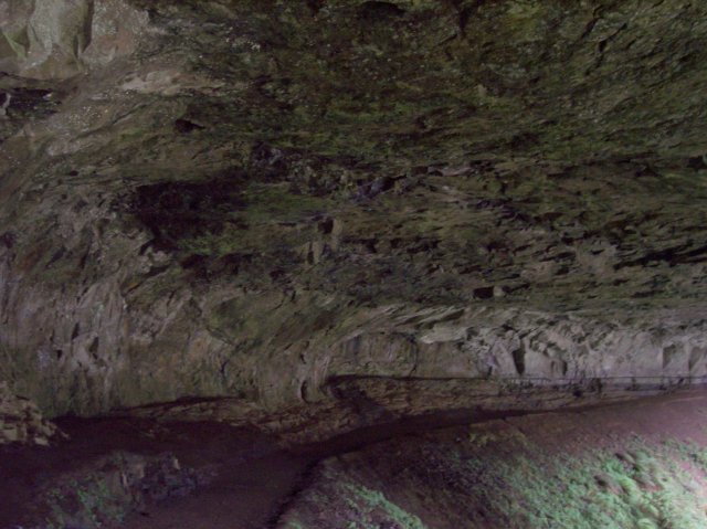
The way the rock has been eaten away by the water over the years is really amazing! The concave impression looks similar to a clamshell structure (like the Hollywood Bowl) designed to project the music of an orchestra out to the audience. I am not sure how many tons of rock have been eaten away in this fashion but it must have been a lot of them. |
|
|
The leaves covering the falls in the background are showing the time of year has reached my favorite: autumn! The fall equinox was just three days ago, but the trees seem to know that it has passed by. |
|
|
|
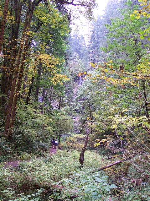
A view of the entire falls path. Many people just drive to the South Falls, and perhaps walk to the bottom, and then they return to their cars and go home, considering the trip worth it. |
|
|
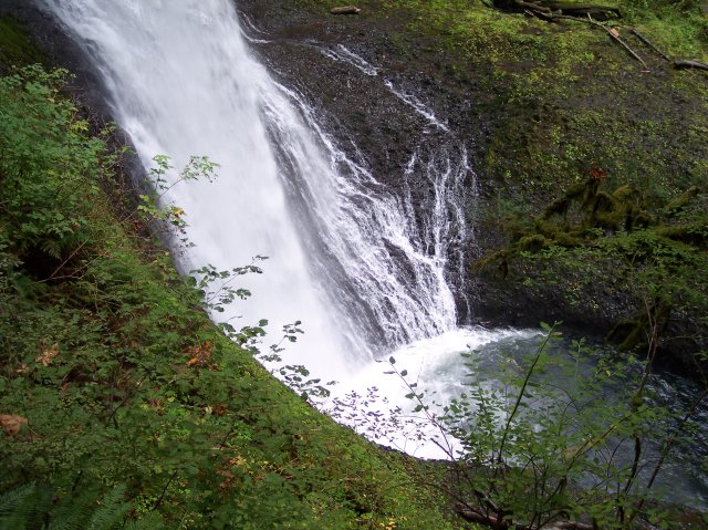
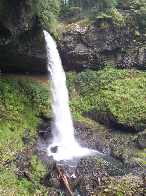
The water stream pouring over the top looks almost solid enough to climb. The white water visibly spreads out quite a ways beneath the surface of the fall pool. |
|
|

|
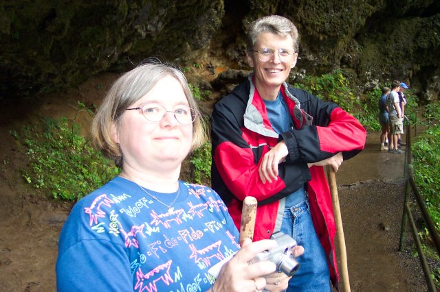
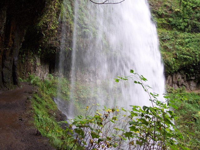
Joan and I are here standing directly beneath the South Falls and looking up at the back of the water stream coming over the edge. Up close, the rock wall behind us looks even more like the manmade rock wall that we saw at the top of the falls. |
|
|
Still under the falls, a place that people love to linger and gaze, Dotti took another picture of Joan and I. |
|
|

|
In the distance you can see that we are now at the same level as the bridge that we saw earlier from above. You can see that the water is falling hard, but we are not getting much, if any, of the mist, mostly because we are quite a distance back underneath the falls. |
|
|
From this angle, the water coming over the top appears to be much less substantial. Separate streams and "clumps" of water appear with the sky behind to highlight the flow. It no longer appears to be one solid piece. |
|
|
|
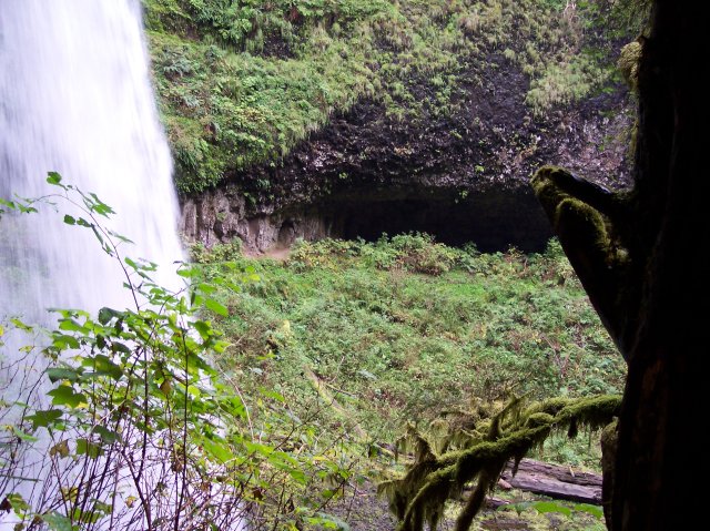
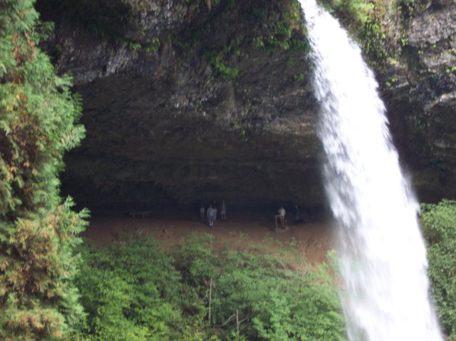
Here the water almost looks like a stream of white smoke climbing into the sky. The view of the distant bridge is completely blocked by the water. The people on the trail look pretty tiny, giving some scale to the photo. |
|
|
Looking downward, we capture a view of the water falling into the pool from behind the South Falls. |
|
|
|
Dotti was in the lead and turned around to take this shot of Joan and I. Notice how the guy in the background has his head trapped in one of the many species of man-eating rocks in the area. J |
|
|
I think that we have established the wind direction now. We are to the west of the falls, and Joan has water mist on her lens for the first time, so the wind is coming from the east. |
|
|
|
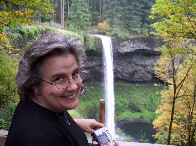
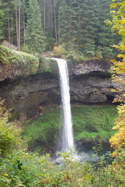
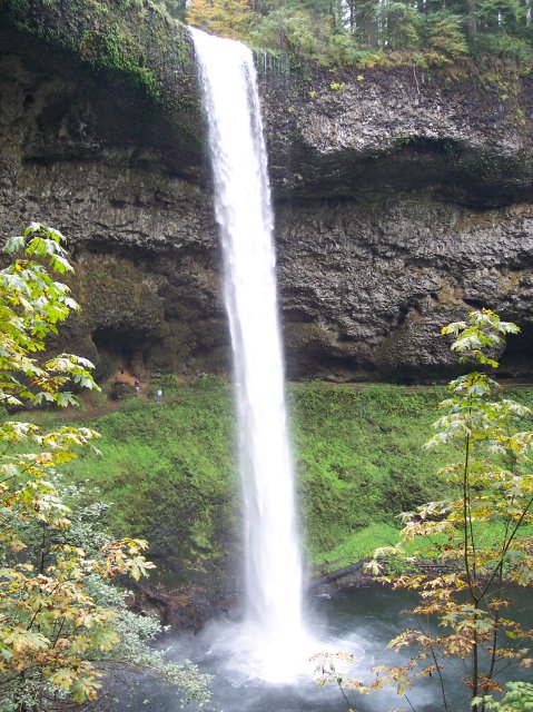
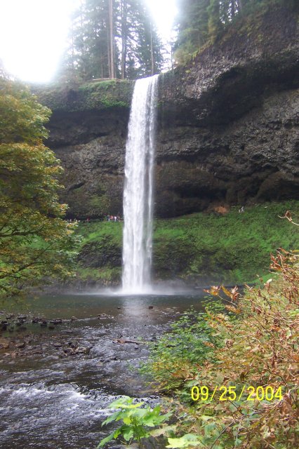
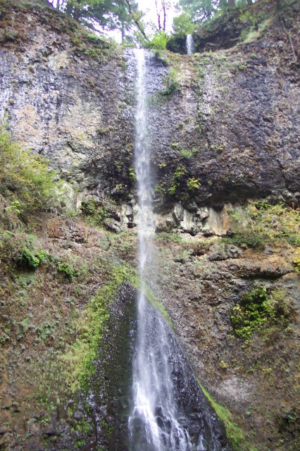
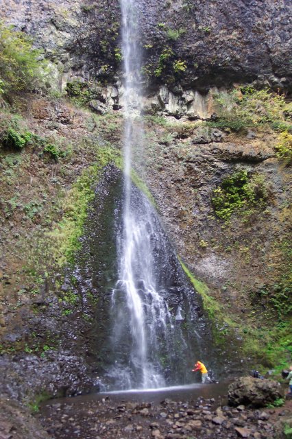
Moving a little farther away, Joan has taken a very nice shot of the entire South Falls. Now the people under the falls look very small. It lets you know that the water really is falling 177 feet (about the height of 30 men). |
|
|
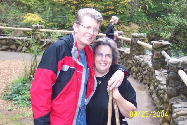
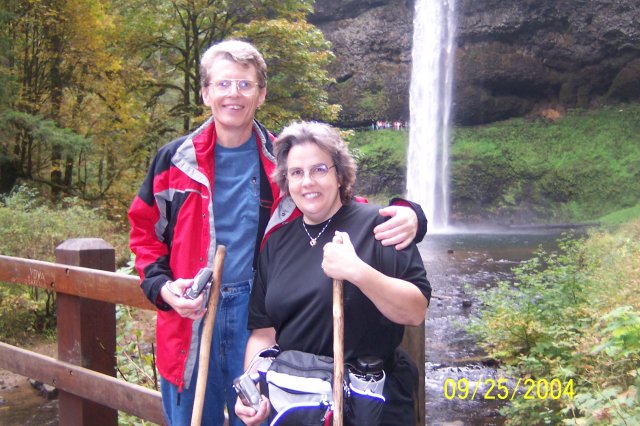
On what is very close to the 30th anniversary of our first meeting, my lovely lady and I are standing on the bridge that looked so small from the top of the falls. |
|
|
|
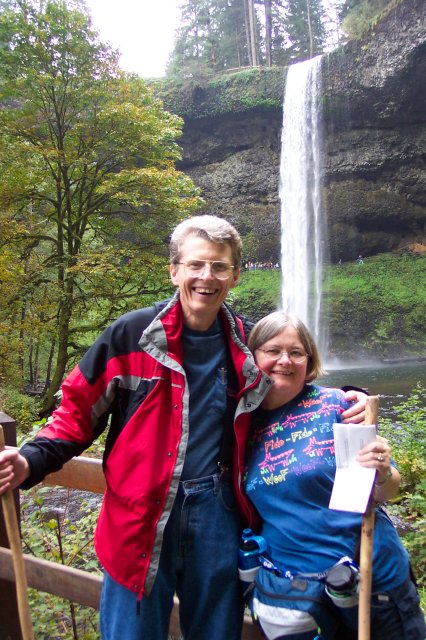
Here Joan and I are also on the bridge, with Dotti behind the camera. You can see the top of the falls in this shot, and the people standing up there are difficult to see at all because they appear so tiny. The people at the bottom of the falls appear a bit larger but are still fairly small. It is shocking to think about the fact that Multnomah Falls is over 3 times as tall as this one! |
|
|
My lovely Dotti on the bridge, and looks as if a little yellow leaf is trying to pose on her right shoulder. |
|
|
|
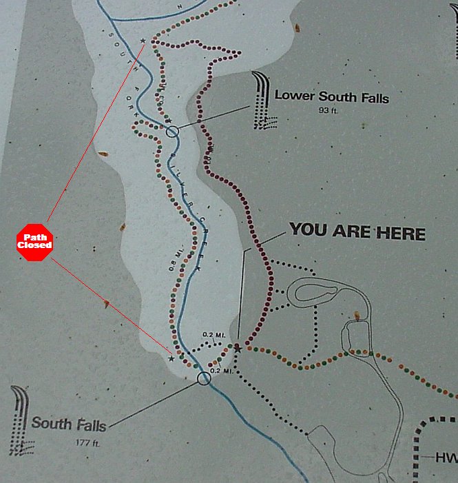
This is a map that shows this part of the trail. The "YOU ARE HERE" star marks the point at the top of the falls from where the trail heads down to the bottom of the falls. Where we actually were, standing on the bridge, was at the star at the left of the picture--the lower of the two stars that are pointed to by the "Path Closed" stop sign. From that location, moving upwards on the map, until you reach the second star pointed to by the "Path Closed" stop sign, the path marked by the little circles was closed. That is the Canyon Trail and apparently had some problems with either a washout or a mudslide that took a section of the trail out and had yet to be repaired. We have walked that trail on previous hikes, and the only significant waterfall that we were going to miss today was the Lower South Falls, located at the point on the map where the path crosses the South Fork Silver Creek, so indicated because the path goes beneath the falls. (If you visit either of the first two links at the top of the page you will find several pictures of the beautiful Lower South Falls.) To get around the closed path, we would be crossing the bridge and taking the little side trail back to the path that we had descended to get down here. Once we retraced our steps back to the top of the falls, we would take a left turn and follow the Mapple Ridge Trail, indicated by the line of purple circles on the map. Once we reached the upper star pointed to by the "Path Closed" stop sign we would be back on the Canyon Trail and could complete all of the rest of the loop (not show on this map). |
|
|
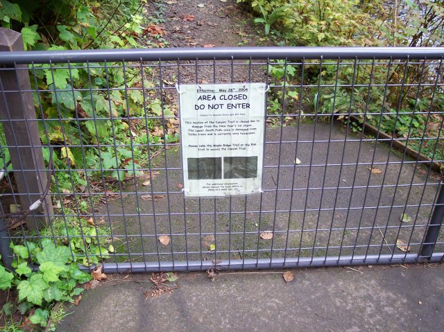
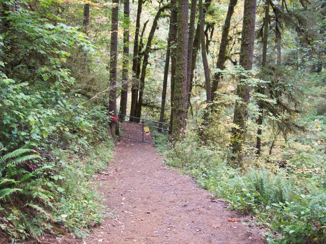
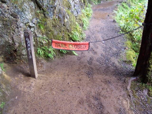
This gate marked the spot where the Canyon Trail was closed. Unfortunately, we could proceed no farther in that direction. |
|
|
|
In case you couldn't read the smaller writing on the notice on the gate, they chained this sign up with larger letters. |
|
|
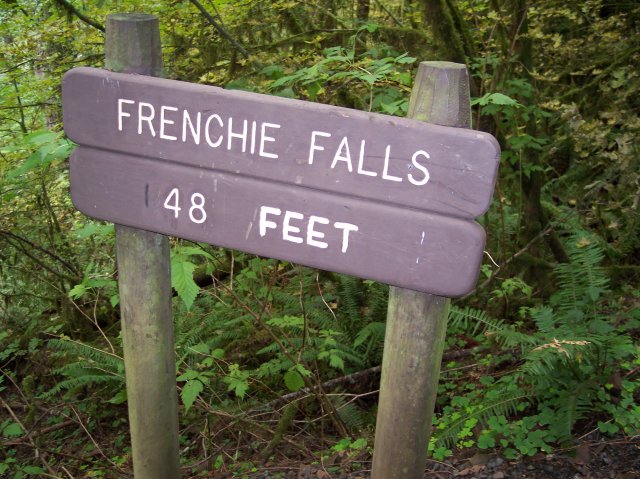
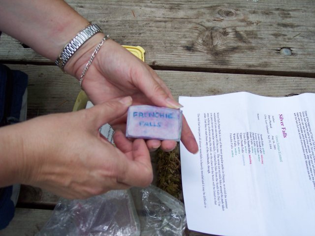
We were looking for a letterbox. The first one on the list was for Frenchie Falls, and so we headed over there, as previously mentioned. The waterfall itself is rather unspectacular. Not only is it only 48 feet tall, but it has very little water flowing over it. But even knowing that beforehand, we were trying to figure out the instructions for the letterbox, and so we came to look. |
|
|

|
There you have it ladies and gentlemen. Frenchie Falls in all its glory. Also, after reaching the view at the base of the falls, we figured out that the instructions were referring to the top of the falls instead. Back to the old drawing board... |
|
|
Was that, "turn right at the second pine tree," or "turn left..."? J |
|
|
|
This the massive flow of water that goes over Frenchie Falls, and that explains a lot. However, while the Maple Ridge Trail continued on across the bridge at the right of this picture, our goal was across the bridge on the left, and we could smell victory just ahead. |
|
|
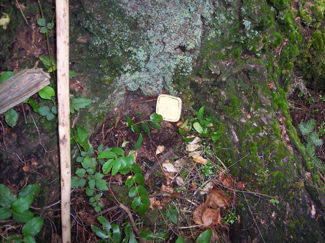
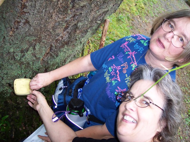
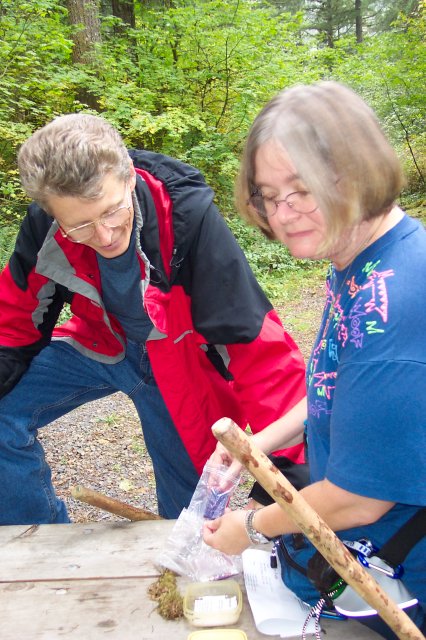
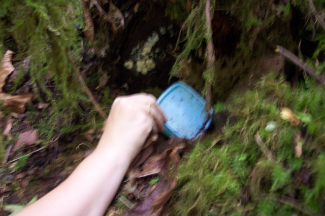
Voilà! Our little letterbox. We were not sure what to expect. How big would it be? What would it look like? How would it be hidden? |
|
|
|
The camera was at a bit of an odd angle on this one, but it captured Joan and Dotti removing the cached letterbox. It was pretty cool finding our first one. |
|
|
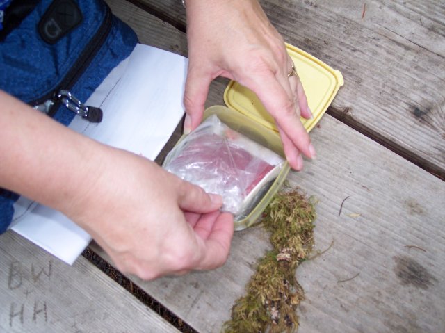
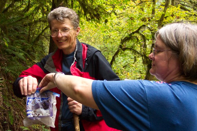
Upon opening the container, it appeared that the contents were safely stored in a plastic bag to keep out the moisture, of which there are normally copious amounts in this area. |
|
|
|
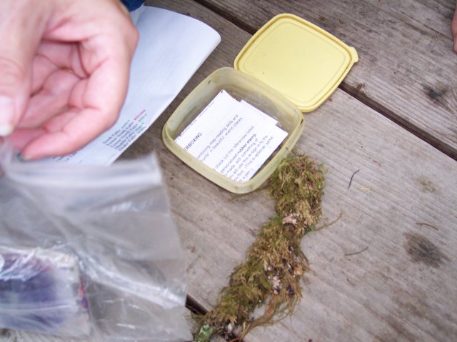
There were some written instructions at the bottom of the container, while the stamp and logbook were inside the bag. |
|
|
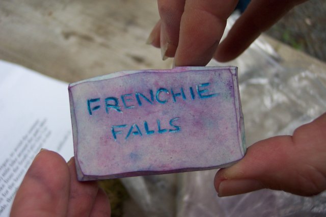
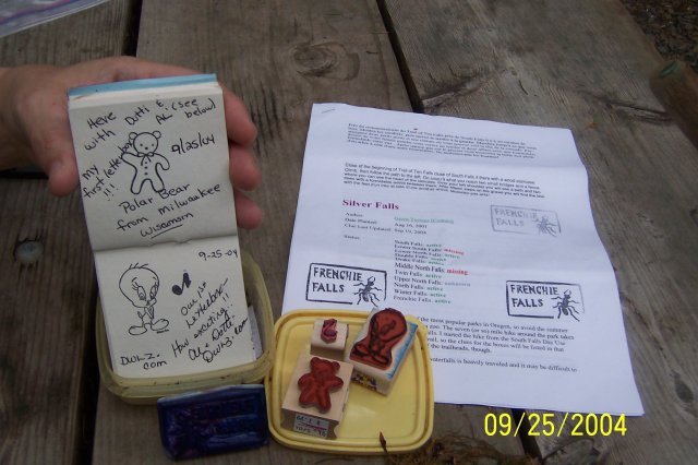
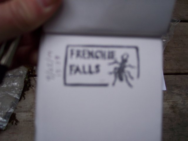
Here is the stamp that we found in the letterbox, and it said, "Frenchie Falls." |
|
|
|
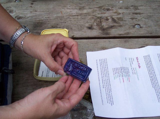
We see Joan holding up the back of the stamp, and lying on the table you can see the instructions that we had previously printed out from the Internet on how to find this letterbox. |
|
|
A better shot of the back of the stamp. |
|
|
|
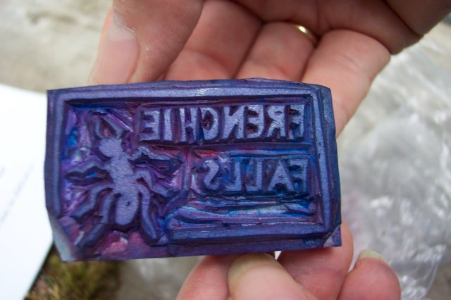
A close up of the business side of the stamp. |
|
|
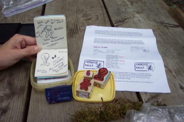
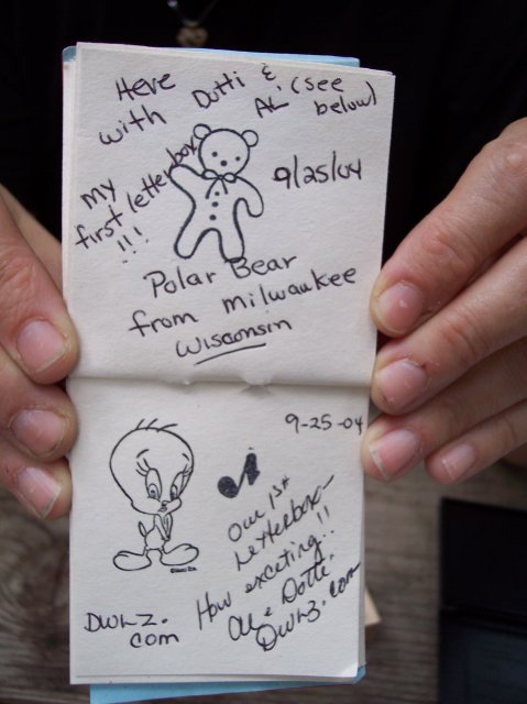
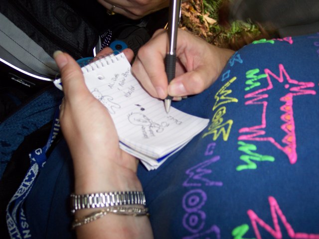
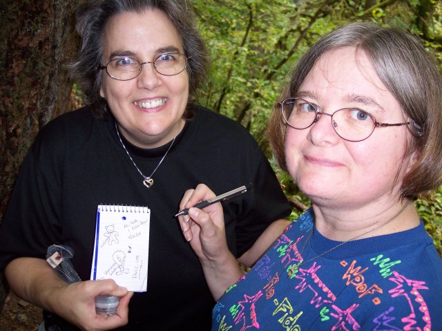
On the left is the logbook where we put our stamps and put our comments. Joan had a teddy bear stamp that she used. Dotti naturally had a Tweety stamp, and I used an eighth note stamp. On the paper to the right you can see where we stamped it a few times with the Frenchie Falls stamp. |
|
|
|
In this one you can clearly see the stamps and read what we wrote. |
|
|
This is not clear but it shows where I stamped my "Journal Lite" notebook with the stamp, and dated it on the left. |
|
|
|
Okay, so we got carried away with this first time. You are almost there with this shot of the logbook. |
|
|
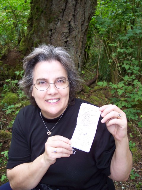
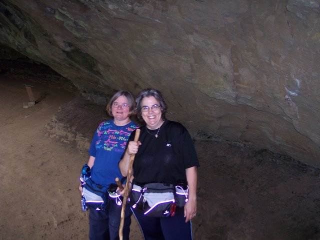
Dotti holding the logbook. |
|
|
|
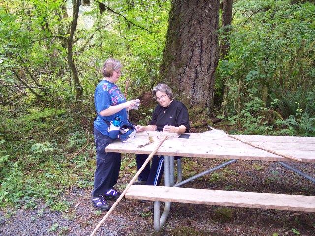
Joan is starting to put things back as I am looking on. |
|
|
It was nice that there was a table so handy for our first letterbox, so we could sit down and enjoy it. |
|
|
|
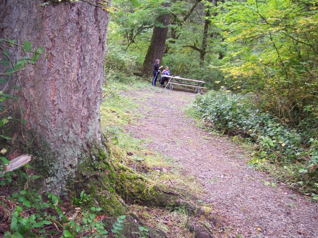
This shows about how far the table was from where we found the letterbox. |
|
|
Since we are on the letterbox theme, here is the location of the second one we found on the hike. This was near the Double Falls. |
|
|
|
This box was blue, but it was about the same size. |
|
|
Once again the contents were protected in a plastic bag. |
|
|
|
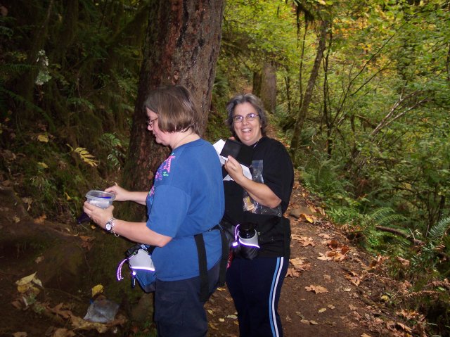
Dotti and Joan juggling the letterbox, its contents, and our stamps and stamp pad. |
|
|
Once again our stamps found their way into a logbook. |
|
|
|
I think that the ladies are having fun! J |
|
|
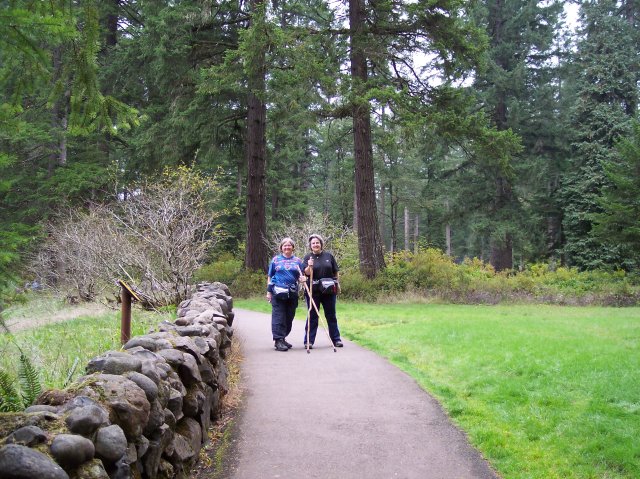
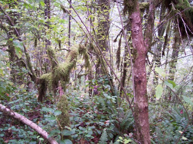
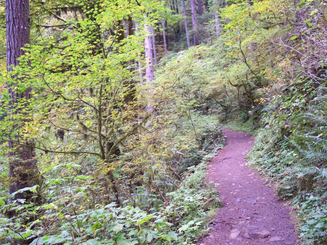
Our letterboxing behind us we returned to the trail. There is quite a wide array of plants growing here. The climate is wet and the ground is fertile. One other thing—if you look very closely in the center of the photo you will see the head of a deer looking back at you. |
|
|
|
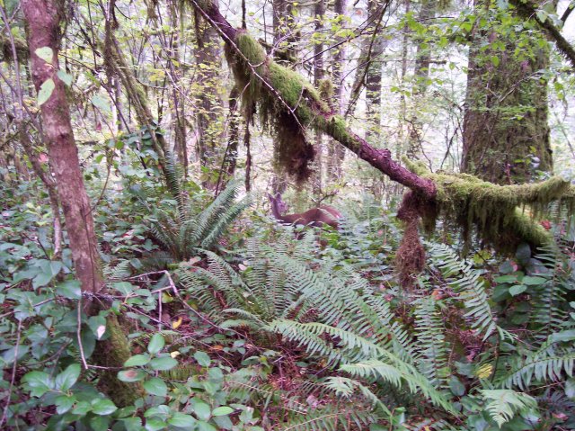
Here you can see the back of the deer, and he is looking away from the camera this time. |
|
|
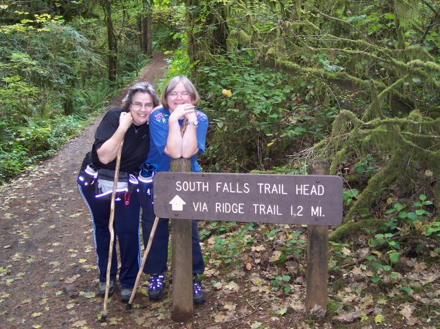
Here are my two lovely hiking companions. We have reached the place where the Maple Ridge Trail merges with the Canyon Trail. We just came down the path that lies behind Dotti and Joan, and have traveled 1.2 miles from the top of the South Falls. |
|
|
|
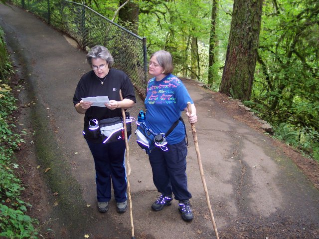
Dotti is checking our current location on the map. We are getting ready to once again walk down the Canyon Trail which we were forced to abandon back at the bridge beneath South Falls. |
|
|
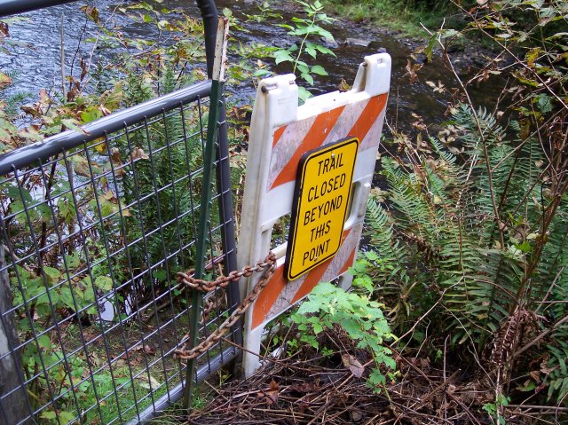
This is the other gate closing off the Canyon Trail. If we had passed through this gate and took that trail, it would take us back to the bridge under the South Falls. |
|
|
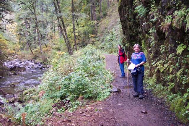
We have changed creeks now, as Joan and I are walking along the North Fork Silver Creek. While it is quite green here, you can see that the trees are not the thick pine forests of the Columbia River Gorge. We are on the border of the Willamette Valley, and as far south as is Salem, Oregon. |
|
|

|
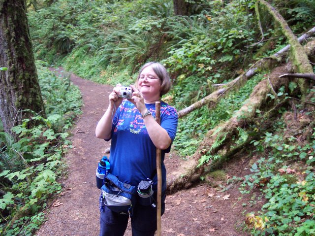
Dotti snapped this close up of yours truly on the trail. |
|
|
I returned the favor, and am very happy with the results. It is a joy seeing that beautiful smiling face each day! |

|
|

|
I took this picture right after the previous shot of Dotti, and I like this one too! Joan looks like she is having a good time, and I know that I was. |
|
|
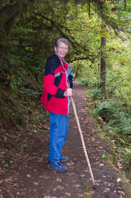
Dotti resting on her walking stick for a moment. |
|
|
|
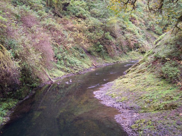
The North Fork Silver Creek winding its way along the canyon. The water is pretty clear, as you can see the bottom for most of the way across it. |
|
|
Yes, I was having a good time. I love this trail! |
|
|
|
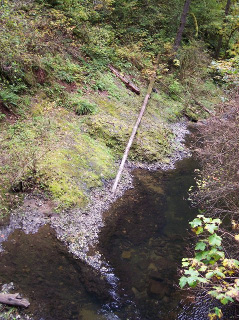
It looks like Paul Bunyan left his walking stick here and went off without it. The water at the bottom of the picture was still and clear with the creek bed easily visible through it. |
|
|
Here Joan is getting all set to snap a picture. The trail is heading for a stand of tall trees. |
 |
|
|
Another shot of Joan on the trail. |

|
|
|
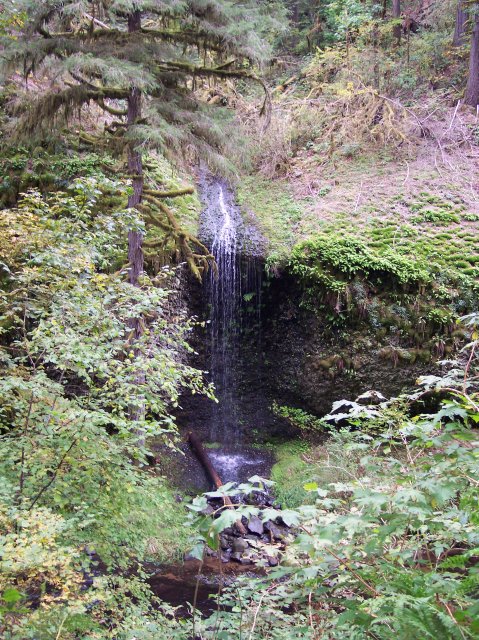
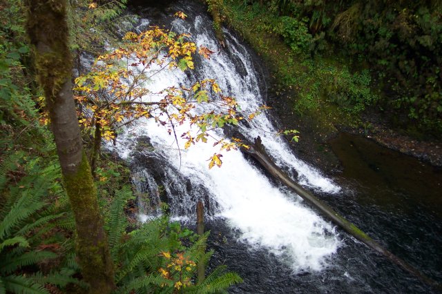
This little falls is not named to my knowledge, but it was a pretty little falls nonetheless. |
|
|
This looks like a couple of healthy happy hikers! |
|
|
|
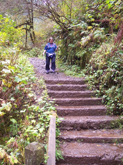
They tried to make sure that there were no really steep grades on the trail, and if we had a quick change in elevation, they put in stairs to make it easier. |
|
|
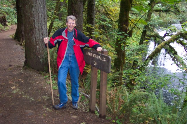
Who are those two hikers? The Lower North Falls is only 30 feet tall, but it puts quite a bit of water over the top of it. So, it looks pretty impressive anyway. |
|
|
|
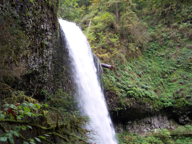
That tree has been laying across the falls for several years, and for the time being it has become part of the falls. The bridge that you see off in the distance is located right after the cutoff for the short path to Double Falls. |
|
|
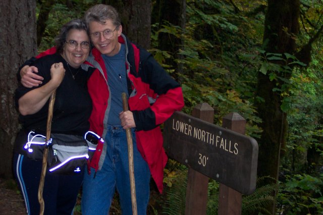
Another picture of me with the falls sign. |
|
|
|
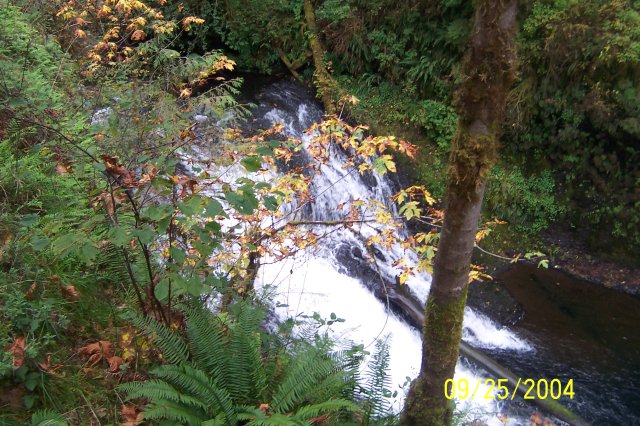
Looking down on the Lower North Falls. Again, you can see some of the leaves are beginning to change in color for the fall. |
|
|
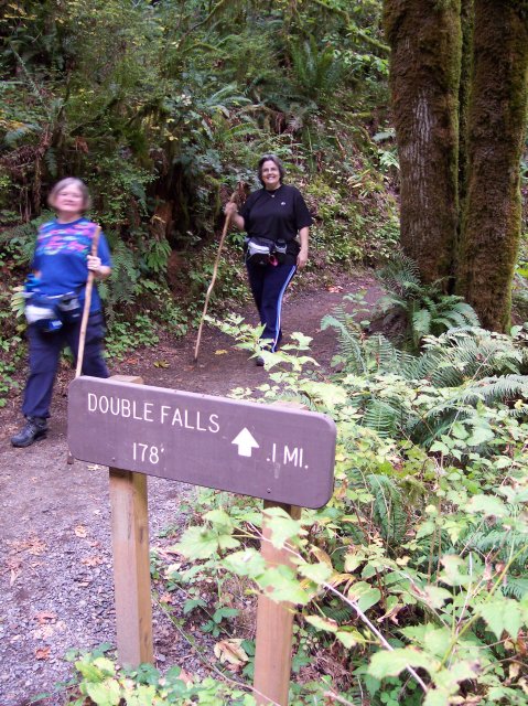
Joan and Dotti on the path to Double Falls. You can see that Double falls is actually 1 foot taller than South Falls, but it has such a small flow of water, it will never compare in popularity. |
|
|
|
Here they are again on the path to Double Falls. |
|
|
The path continues on around the bend in the distance. You can see the top of Double Falls, but it is partly covered by the leaves in the foreground. |
|
|
|
Looking up to the top of Double Falls. It is a pretty falls, but it doesn't have very much water coming over it. As the water gets close to the bottom, it hits the rocks and is spread out into a white sheet, surrounded by dark rock with a green border. |
|
|
At the very bottom of the falls, there is an orange scarecrow, mounted there to frighten off Bigfoot, should he wander by. Actually that was a fellow hiker who was playing in the water. The bottom part of Double falls looks just a bit like Fairy Falls on the Wahkeena Falls trail in the Columbia Gorge. |
|
|
|
I am standing at the mouth of the viewing platform at Drake Falls. We have come between 2 and 3 miles so far on our hike. The temperature was starting to creep up towards 70°, but our pace has been moderate, and I was still comfortable wearing my coat. |
|
|
Joan made us do this, so she could take a picture. J There is something about the top of falls, I don't know what it is... |
|
|
|
Joan on the viewing platform. The falls are behind her, and the couple, over against the rail, are looking down at Drake Falls. Unfortunately, there is not a very good view of this falls from the trail, even from the platform. |
|
|
This the best view available of Drake Falls. This falls is 27 feet tall, and it flows quite a bit of water over it. If we could look at it head on, it would be very pretty indeed. |
|
|
|
On the trail again. We all three had our cameras in our hands for this photo. I wanted to try and get under the Middle North Falls this trip, because it has a trail behind it and I wanted to see where it ended up. The ladies wanted to rest a bit and were willing to wait for me here. |
|
|
This is the 106-foot Middle North Falls. It is interesting in that it has a major flow on the left side, but there is a minor flow that extends all the way across the wide lip of the falls. It looks like a huge letter 'C,' formed by the water and rock. You can see the trail that runs behind the falls clearly in this picture. That is where I was headed. |
|
|
|
I am on the side path that leads to the Middle North Falls. There are some people ahead of me behind the tree. |
|
|
After passing the people I arrived at this disappointing sign. I wasn't going to get to walk under the falls and see where the trail led. |
|
|
|
The next best thing was to take a few pictures of the falls and the path behind it. |
|
|
The path continues around the other side at least for a ways. |
|
|
|
I am not sure if the trail ends right there, or if there is a cave, or something else worth seeing on that side. |
|
|
Once again we see a solid basalt wall with water pouring over the top of it. I never get tired of looking at it! |
|
|
|
Moving down the Middle North Falls, you can see the water hitting the rock surface below and spraying out across it. |
|
|
And finally the water slides into the semicircular fall pool below. On the surface of the pool it almost looks like a crescent moon formed by the white foam. |
|
|
|
Looking back along the little side trail from the falls, as I head back. |
|
|
The ladies waited patiently for me while I was gone, and you can see that Dotti was very excited to see me return. J |

|
|
|
Joan lining up another shot with her camera. |
|
|
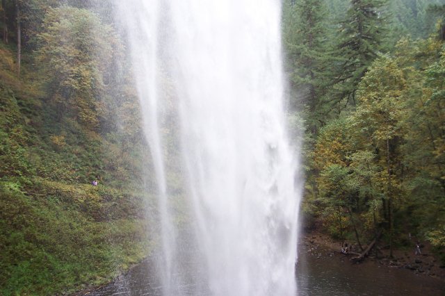
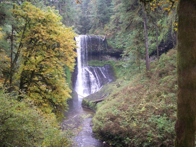
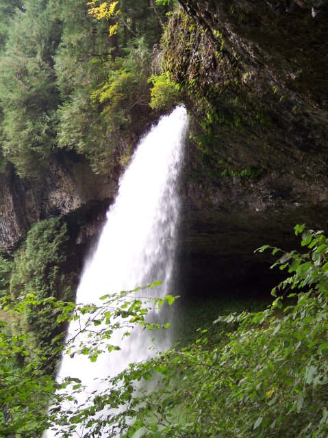
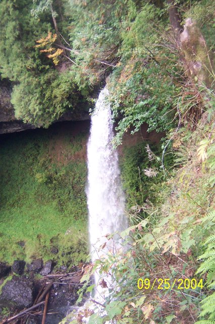
This is the other "big falls" on the Silver Falls trail. North Falls is 136 feet tall, and appeared in the movie "Hunted" near the very beginning. It is a truly beautiful sight! |
|
|
|
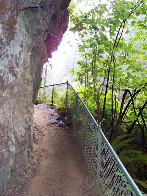
We are just north of the falls at this point working our way behind, and into the cavernous space created by the water working on the stone. Above the falls you can see the chain link fence that runs along the trail that we will be taking later, after ascending the 77 steps set into the stone. There is a parking lot not too far up that trail, so many people will park there and come down to look at the falls, or even start their hike of the entire loop from this end. |
|
|
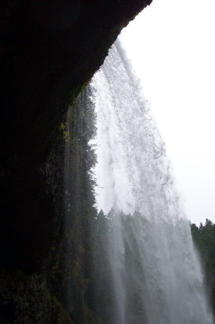
The water here looks powerful, like water being fired from a giant fire hose nozzle. You can see some people in the shadows under the immense rock roof. |
|
|
|
Entering the cavernous water-carved room from the north. |
|
|
I worked my way up some very slick stone to pose for this picture, and I was feeling pretty dumb when I started my way down, and not sure I was going to make it without losing my footing. I didn't fall, but it was luck more than skill that made that true. |
|
|
|
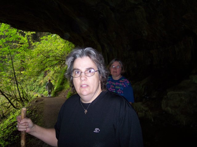
I caught Dotti when she wasn't expecting it with this shot. Notice how dark it was where we were at. Joan looks deep in shadow, and the back wall is invisible, totally lost in the darkness. The hiker in the background is moving from the bright green world into shadow. I used the flash, or Dotti and Joan would have been little more than silhouettes. |
|
|
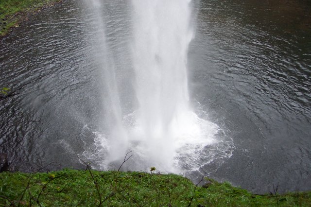
As water from North Falls crashes into the rocks below, and then calmly exits to the right, Dotti and Joan share a happy moment. The nearly dead tree on the left looks like a Dali creation, but it fits this eerie underground world. Looking up over the ladies' heads, it can be seen that our path is already headed upwards by the time it leaves this cavern. |
|
|
|
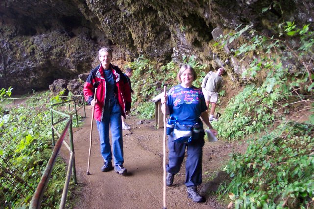
Here we are about to exit the North Falls "cavern," and Dotti is smiling as if she didn't know that we had 77 steps to climb to the top of the falls, just around the corner. |
|
|
|
Coming back out into the gray sunlight, we can see the south side of the North Falls. From this angle the rock ceiling to the cavern looks thin, and the water is persistently wearing down into it. Over time this structural system will certainly change significantly. However, during our short lifetimes, it may appear relatively unchanged throughout. |
|
|
Fast-forward to the top of the stairs. We are in about the same position as we were for the last photo, except we are about 100 feet higher. |
|
|
|
I wandered ahead of the group when we went up the stairs and I got in the picture of the falls, and then I retraced my steps. This is looking back from the top of the falls, towards the top of the stairs. The stones are very low on the path on this section and I have to be very careful not to break one of them with my hard head every time we come through. |
|
|
Rejoining the group. As they near the top, you can see that Dotti and Joan are really enjoying the vigorous climb, but to show that they have self-control, they are attempting to hide their unbounded joy. J |
|
|
|
Another one of the things that I like about this trail is that you don't have to fight off dogs that owners "forget" to put on leashes. |
|
|
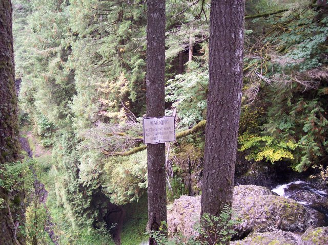
"Warning! Persons are warned not to approach too close to edge." With a 136 foot drop awaiting those persons who ignore the warning, it is amazing that the warning was required in the first place. But in a world where people have to be warned that coffee is hot, and that knives are sharp, I guess this is not that surprising after all. |
|
|
|
Almost done with the climbing! We have climbed up to 1,420 feet above sea level, from the low point of about 1,090 feet. This is not one of the hikes with a big elevation change, but the over 7-mile length, plus side trips and a lot of moving around while taking pictures still wears you down by the end of the hike. |
|
|
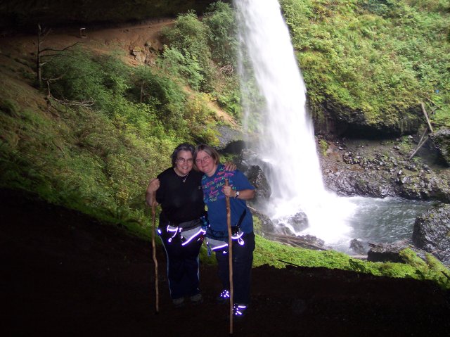
A smile finds Dotti's face once more and we are on our way, ready to hit the "Rim Trail" for our return to "base camp." |
|
|
|
The end of the Canyon Trail and the beginning of the Rim Trail. Straight ahead leads to the North Falls parking lot, and to the path to the Upper North Falls. Dotti and I visited the UNF on our first Silver Falls hike but we haven't taken that detour since. We are overdue for our return. |
|
|
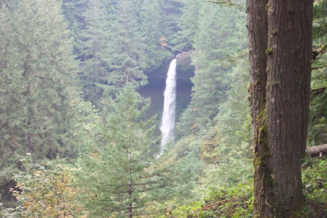
We have left North Falls far behind already, but it is still beautiful! |
|
|
|
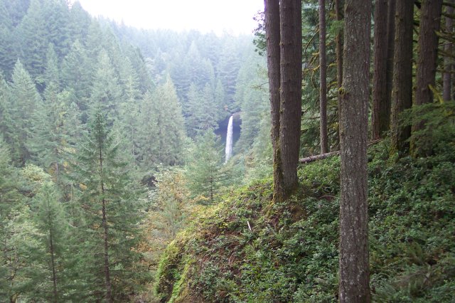
Using the zoom the falls appears closer. From this view you can see where the water has cut into the stone at the top of the falls, like a string would cut into cheese if it were pulled too tight across it. The process is very slow, but stone is no match for flowing water. It will always be worn away. |
|
|
This road crossing marks our return to the South Falls area, and I have finally warmed up enough to take off my coat. J |
|
|
|
Dotti and Joan getting ready to take some of the last steps of our hike. It was a fun walk and we saw a lot of beautiful scenery, as well as finding our very first letterboxes! |
|
|
|
||