|
GLACIER BAY
I was out taking pictures when at 10:45 Alaska Time (11:45 PDT) when we left Icy Strait, and entered Glacier Bay. 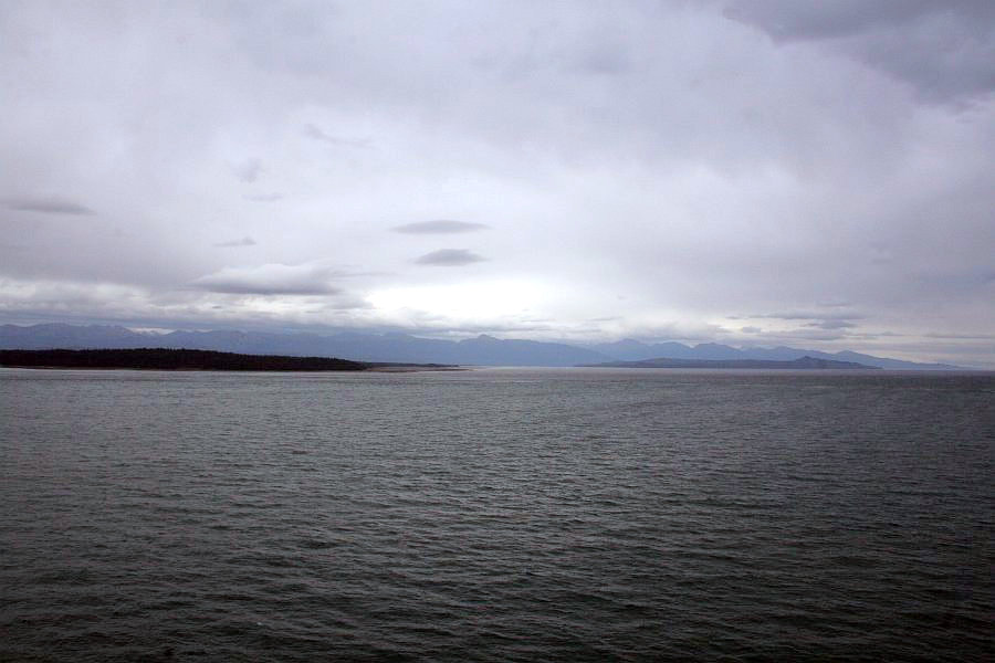 The sky was dark and gray, and the water reflected that around us. The bay was quiet, and the weather was not extreme. The temperature at the mouth of Glacier Bay was in the low 50s, and with the wind chill it felt like it was in the low 40s.
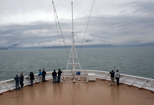
(I am not sure if was any colder than that inside the bay.) For we dwellers in the "lower 48" that was pretty cool for September. I had my coat on, throughout the afternoon, I spent as much time as I could with my gloves on, because my fingers would go numb with the cold when I took the gloves off. For most of the cruise, 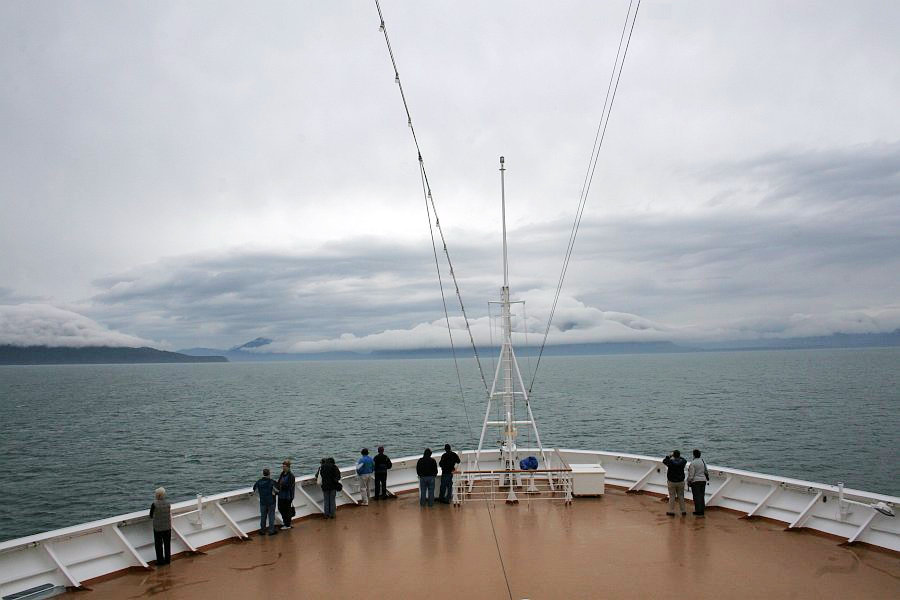 the bow on the Promenade Deck was closed, but for our day in Glacier Bay the captain opened it up for the sightseers. The bleak and gray horizon was broken by the mountains, who were wearing their cloud overcoats in the bay. The water, though dark, was calm, and it remained so for the entire time in Glacier Bay.
 Looking southward to Starboard across the forward most part of the Verandah Deck (Deck 5). Our staterooms were only a few yards back from here, and located on that starboard side. With the clouds hanging low, and brushing the tops of the mountains, it sometimes appeared that the hills were climbing upwards to the next floor.
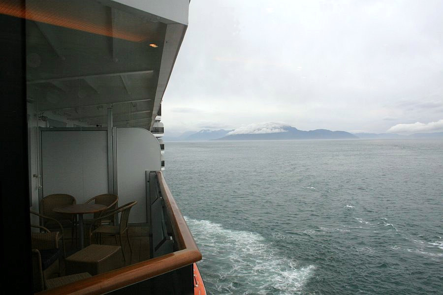 Still standing on the forward part of the Verandah Deck, I looked back along the port side of the ship for this shot. The verandah that you see is for cabin 5002.
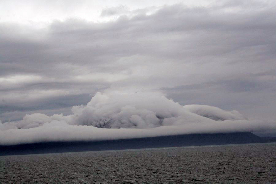 There was something very different about the atmosphere of Glacier Bay. This mountain looks like it has a huge cowboy hat on, pulled low over its brow. The temperature and weather we saw here felt strange, and it was left behind once we left the bay.
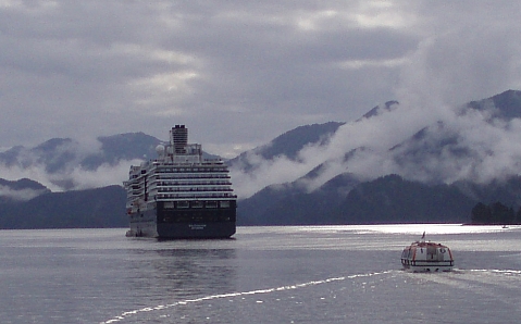
Here come the Glacier Bay Park Rangers! We picked them up at 11:00 a.m. 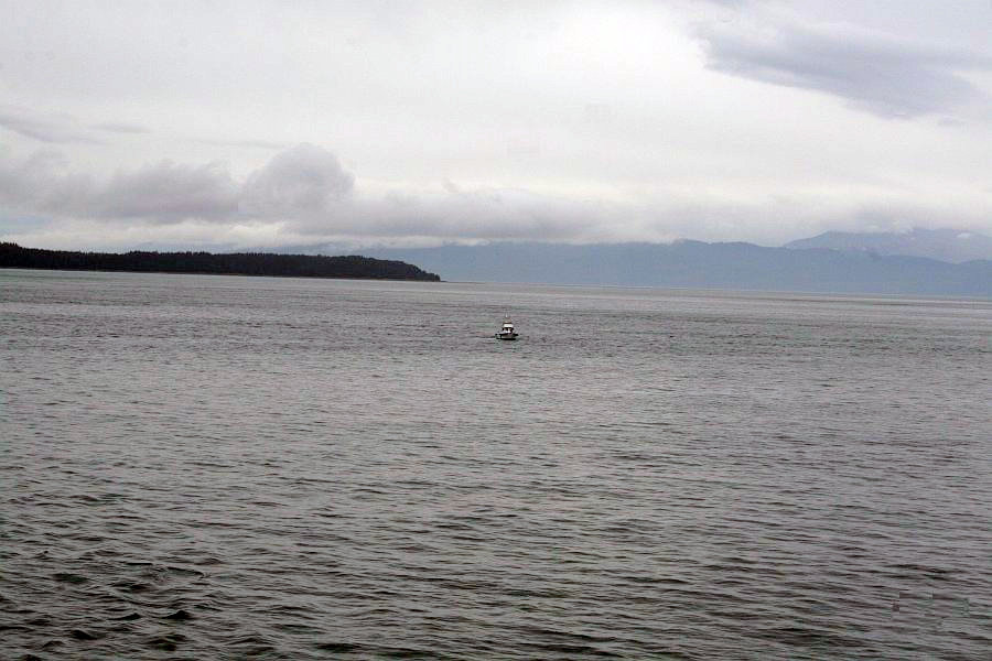 and they rode with us for our entire time in Glacier Bay until we dropped them off on our way out at 7:17 p.m. You can see some small ripples in the water, but there are no "long period waves," like the ones that had rocked the ship on Monday. I am sure the folks in the small boat appreciated this fact. During our time touring the glaciers and the bay, the rangers spoke over the PA system giving out information. Unfortunately, we could not hear them in our cabin, nor on our verandah. So, unfortunately, we missed out on their input. Fortunately, most of what they had to say has been available from other source which I do have available. and they rode with us for our entire time in Glacier Bay until we dropped them off on our way out at 7:17 p.m. You can see some small ripples in the water, but there are no "long period waves," like the ones that had rocked the ship on Monday. I am sure the folks in the small boat appreciated this fact. During our time touring the glaciers and the bay, the rangers spoke over the PA system giving out information. Unfortunately, we could not hear them in our cabin, nor on our verandah. So, unfortunately, we missed out on their input. Fortunately, most of what they had to say has been available from other source which I do have available.
This little island group stands watch over the mouth of the Muir Inlet,  while the 5,139-foot Mt. Wright rises in the background. In the mid 1800s this island, as well as the water we were cruising on, was completely buried in ice. The scientists have enjoyed having the opportunity of studying the process of recovery here. The land at the mouth of Glacier Bay was under ice, and scrapped bare near the end of the eighteenth century. By the mid nineteenth century the ice had melted the 40 miles from the mouth of the bay back to this island. So, the trees and plants, and wildlife that we see here have had 1.5 to 2 centuries to dig in and flourish. The land we were to see later would be younger, and some of it uncovered for less than 100 years. There the land would have much younger trees if any at all. while the 5,139-foot Mt. Wright rises in the background. In the mid 1800s this island, as well as the water we were cruising on, was completely buried in ice. The scientists have enjoyed having the opportunity of studying the process of recovery here. The land at the mouth of Glacier Bay was under ice, and scrapped bare near the end of the eighteenth century. By the mid nineteenth century the ice had melted the 40 miles from the mouth of the bay back to this island. So, the trees and plants, and wildlife that we see here have had 1.5 to 2 centuries to dig in and flourish. The land we were to see later would be younger, and some of it uncovered for less than 100 years. There the land would have much younger trees if any at all.
 In this area, the phrase "life is tough," is starkly expressed by the land. Vegetation must fight for survival, and even the rock is worn by the erosive power of the water. Streams cascaded down the walls of Glacier Bay at every turn, and the hope, and the reality, of new life where once there was only ice, is alive and well.
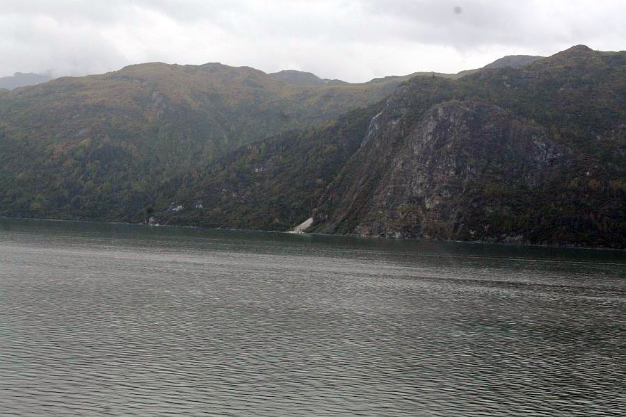 With a bleak background, the base of a waterfall emits a white stream into the bay with only us and the animals here to notice. If a tree falls in the forest and no one is there to hear it, it of course makes a sound; and a waterfall is beautiful, even if no one is there to witness it. However, it takes witness to enjoy an event, and I enjoyed this waterfall, even if I only had a moment to spend with it.
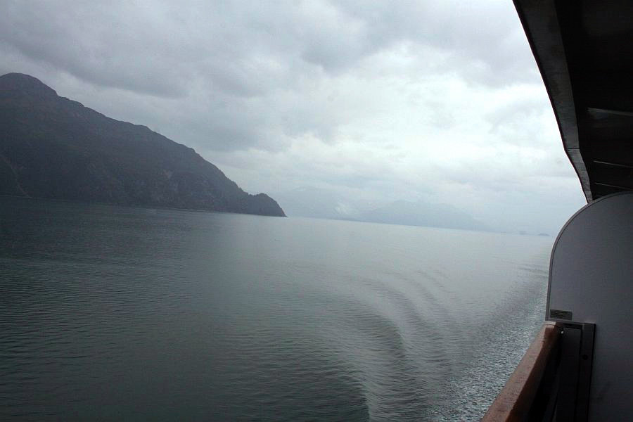 The entire world seemed gray. Looking up we saw the dark clouds forming a ceiling to the dreary room. The near mountains appeared to be nearly black, while the distant ones appeared to be fading entirely into mist. The water showed only the smallest of ripples, while our wake caused them to lift and sink behind us.
I completed my solo picture taking expedition around 12:15 pm. We were already well into Glacier Bay, and we would be getting to the glaciers before long. When I got back to the stateroom, I found that Dotti and Tammy were back from their Hydropool session, and were looking relaxed. They were also hungry. It suddenly hit me that I might run into a time crunch if I went to eat. My camera memory card was filling up, and I very much wanted to have lots of room on it for glacier pictures! So, I wanted to transfer my pictures over from off my camera to my laptop. I wasn't sure how soon the picture opportunities might be coming, and I thought I could do that while they went to get something eat, if Dotti would be willing to bring a sandwich back for me. She said that she would be happy to, and so it was all set. I moved the pictures over, and Dotti brought a turkey sandwich back for me, along with some cookies for dessert. I really enjoyed my lunch! As I was putting things back together so I could leave to take pictures with the group, Dotti and Tammy headed down to get their cups filled up with coffee, and I waited for them to come back up and get me. When we finally walked out on the deck, we found a lot of other passengers trying to do the same thing. It wasn't long before we decided that our stateroom verandah really did have a pretty good view, and maybe we would be better off there. We were very happy with that decision. There were only two downsides to it: 1) we could only see what was on the starboard side of the ship; and 2) we couldn't hear a thing that the rangers were saying. 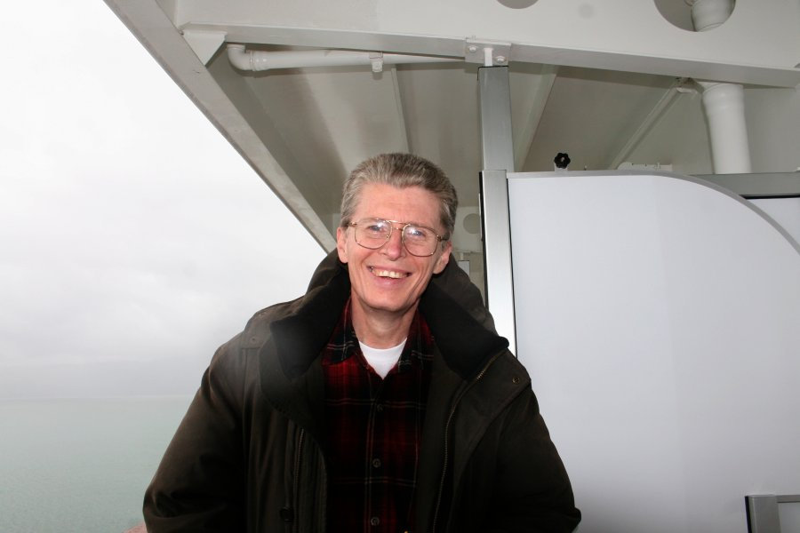 As it turned out, the ship's captain took care of item number one. He had the ship positioned so that both sides of the ship got a good look at everything. While the bow would have had obviously had the best continuous view, our view matched it at least half of the time at all the important locations. That was definitely satisfactory for us!
 Item 2 was a little harder to judge. I feel as though I have manage to replace most of what we missed from the rangers from other sources, but I would have liked to hear what they had to say.
The upside of using the veranda was immense. Dotti spent some time resting on the bed while I was out taking pictures, and I called her outside whenever something really exciting showed up. Since it was cold, at least to us who are used to being 22° of latitude below the Artic Circle, it was nice having our room to step in out of the wind, and to shake off the chill with warm air and warm drinks. The most crowded our two joined verandahs ever got was having 4 people there at once. Privacy, comfort, a great view, and great company; what more could anyone ask? If we had it to do over again, we would make the same choice! I was suddenly surprised by a something in the water. 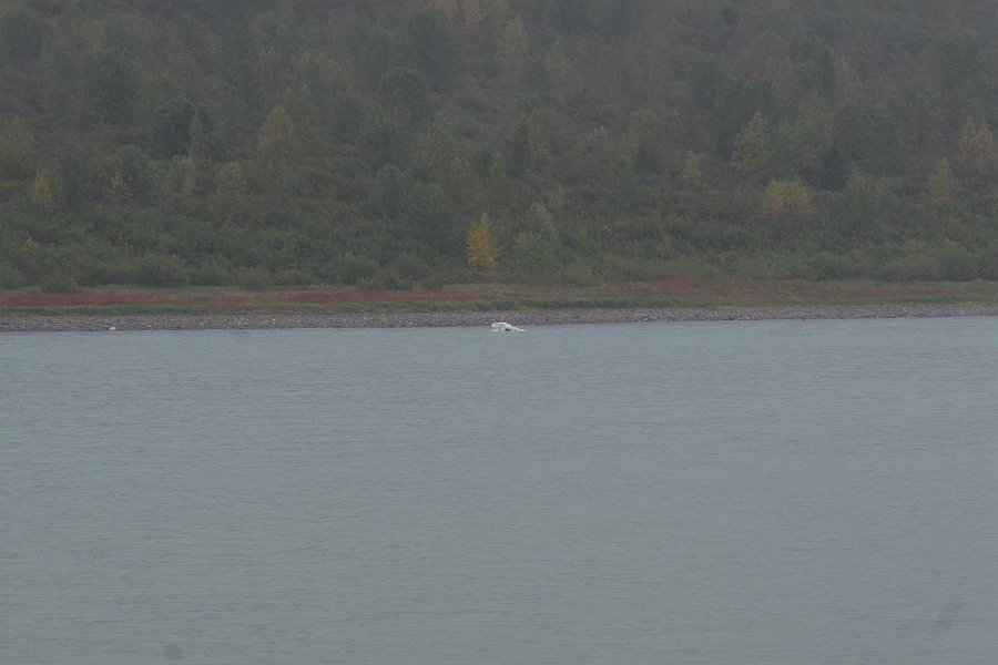 What was it? The head of a polar bear popping out of the water? Not this far south. Oh, it's an iceberg! My first iceberg, and it was floating by all by itself and I had no warning or indication that it was going to be there. I had no idea that later on I would be seeing literally thousands of them. So, it was a big moment for me. What was it? The head of a polar bear popping out of the water? Not this far south. Oh, it's an iceberg! My first iceberg, and it was floating by all by itself and I had no warning or indication that it was going to be there. I had no idea that later on I would be seeing literally thousands of them. So, it was a big moment for me.
We were entering Reid Inlet and that is Ibach Point behind us (see map on sidebar)  on the right. We were about to move into the world of glaciers, even though I had no idea how close we were when I snapped this picture. If I could have seen directly ahead of the ship right then, I would have seen Reid Glacier. But I still had to wait a few minutes before the ship turned enough to where I could see it. on the right. We were about to move into the world of glaciers, even though I had no idea how close we were when I snapped this picture. If I could have seen directly ahead of the ship right then, I would have seen Reid Glacier. But I still had to wait a few minutes before the ship turned enough to where I could see it.
And here it is: Reid Glacier! Well, at least part of it. I didn't realize it at the time, but I had already seen a Reid Glacier before. 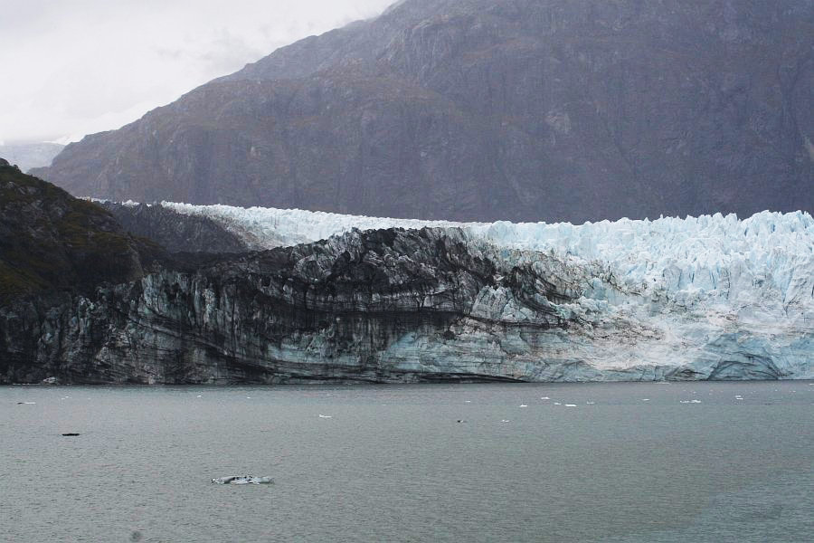 In fact I see it every time I see Mt. Hood on a clear day, because it there on the western side of the mountain. However, I have never been so close when I was looking at it as I was looking at Reid Glacier in Glacier Bay. Mt. Hood is 50 miles away, and over 11,000 feet tall. Reid Glacier is well up the side of the mountain. It is a pretty patch of white, but that is all it has ever been to me. (However, it is more to some people because there is a Reid Glacier Rescue Map available on the Internet to let hikers know how tough it may be to get rescued if they get stuck up there.)
Back to Alaska! This is the right, or western side of the ice face. Notice the ice bergs floating away from the glacier. With the glaciers on the east side of the Glacier Bay National Park, 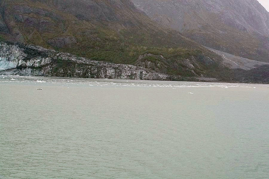 the termini of the glaciers have retreated up onto the land, just like a swimmer dragging himself out of the water and sliding away from the edge, in fear of a shark following him onto the shore. Each year the ice moves farther back away from the water. But the glaciers on the west side are doing just like Reid Glacier is, pushing forward into the water and, like a mother sending her children off to school, it calves icebergs and sends them on their way. Unlike a mother, Reid Glacier doesn't expect its charges to return. the termini of the glaciers have retreated up onto the land, just like a swimmer dragging himself out of the water and sliding away from the edge, in fear of a shark following him onto the shore. Each year the ice moves farther back away from the water. But the glaciers on the west side are doing just like Reid Glacier is, pushing forward into the water and, like a mother sending her children off to school, it calves icebergs and sends them on their way. Unlike a mother, Reid Glacier doesn't expect its charges to return.
However, in part they may! The icebergs, like this one, will melt, joining their fresh water with the sea water they are floating in. Then, some of that water will evaporate into the air, and later fall as snow onto the glacier and the Brady Icefield behind it which feed it. 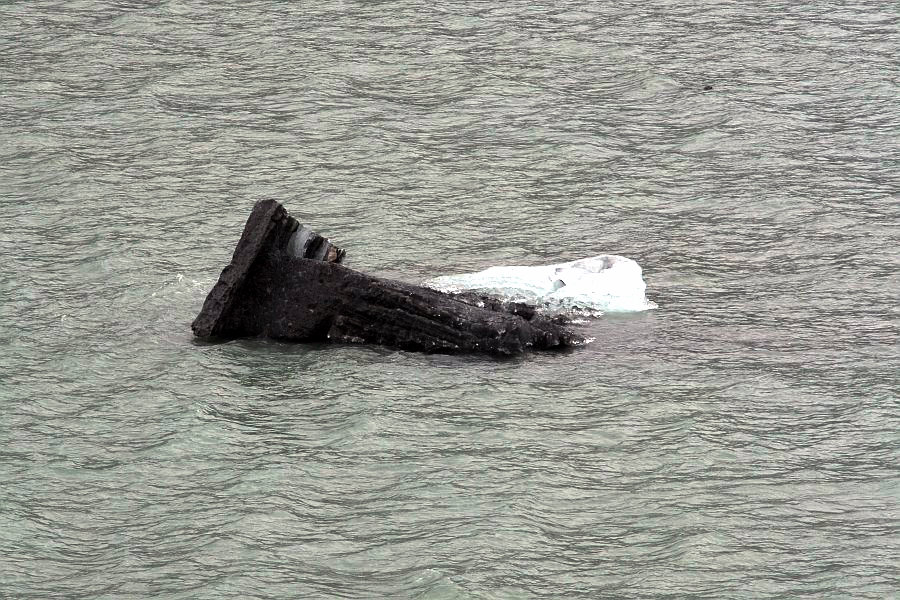 Some of the water molecules in Reid Glacier may have made several trips just like that. Some of the water molecules in Reid Glacier may have made several trips just like that.
See how dirty this one is? It is carrying dirt and rocks from the walls of the valley where it just passed through. Of course when glacier ice passes through, it normally moves "glacierally" taking its time. However, at 8 feet per day, Reid Glacier is moving along at a snappy pace for a glacier. This chunk of ice was just leaving the Brady Icefield in mid to early 2003. When you have to replace an entire 2 mile glacier every 3.6 years, you need to supply a lot of snow! When a glacier collects rocks, and sometimes even boulders, and then covers them in ice, those rocks can be floated away. When the ice melts the rocks will comes to rest, and they will be called "erratics," meaning that the stone isn't native to where it is resting. It is incredible how far a rock can travel sometimes! One boulder that was originally the size of a boxcar (over 160 tons of stone), before tourists carted away over 70 tons of it in pieces as "souvenirs," is known as the Belleview Erratic, and it is located 306 feet up from the floor of the Willamette Valley in Oregon. The argillite boulder was transported this very way, and it had originated over 400 miles away, in Canada just north of Montana! The chunk of ice that carried it had to be huge! Now this little guy we see here isn't going to carry anything that large, but he is moving some rock to a new location. Here in the center, the Reid Glacier looks like a confectionary delight, 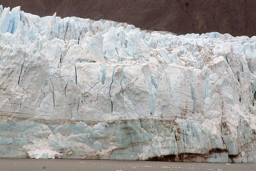 good enough to eat. Fractured on top to the point where it almost looks like hair, the glacier is all set to break into little pieces and float away as it hits the water. But it still is massive and sinks well below the waterline, and rests on bedrock below. good enough to eat. Fractured on top to the point where it almost looks like hair, the glacier is all set to break into little pieces and float away as it hits the water. But it still is massive and sinks well below the waterline, and rests on bedrock below.
As we start to pull away from Reid Glacier, we could see that, even with its rapid advance,  and with the fact that this glacier terminates at the end of fairly long and enclosed inlet, there isn't much ice in the water. Sure, there is more ice in the water here than we saw out in Glacier Bay proper, but as you will soon see, this water is nearly free of ice. Nothing we had seen so far had prepared us for what awaited us just to the west in the next inlet over. and with the fact that this glacier terminates at the end of fairly long and enclosed inlet, there isn't much ice in the water. Sure, there is more ice in the water here than we saw out in Glacier Bay proper, but as you will soon see, this water is nearly free of ice. Nothing we had seen so far had prepared us for what awaited us just to the west in the next inlet over.
As ms Westerdam begins to pick up speed, it whips the water 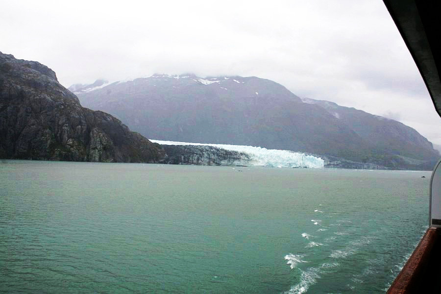 into white capped ripples that run away from us. We catch our last close view of Reid Glacier as we look back. What an amazing thing it is. Just like a 2 mile river in slow motion, it transports water, not at a rate of a few miles-per-hour, but of only 8 feet per day. But even so, it is replenished constantly at its source, and it empties out constantly at is mouth. into white capped ripples that run away from us. We catch our last close view of Reid Glacier as we look back. What an amazing thing it is. Just like a 2 mile river in slow motion, it transports water, not at a rate of a few miles-per-hour, but of only 8 feet per day. But even so, it is replenished constantly at its source, and it empties out constantly at is mouth.
When our "scenic cruising" had come to an end and ms Westerdam was making a 20-knot run through Glacier Bay for the exit, we had one last glimpse of the marvelous Reid Glacier from outside the mouth of Reid Inlet. 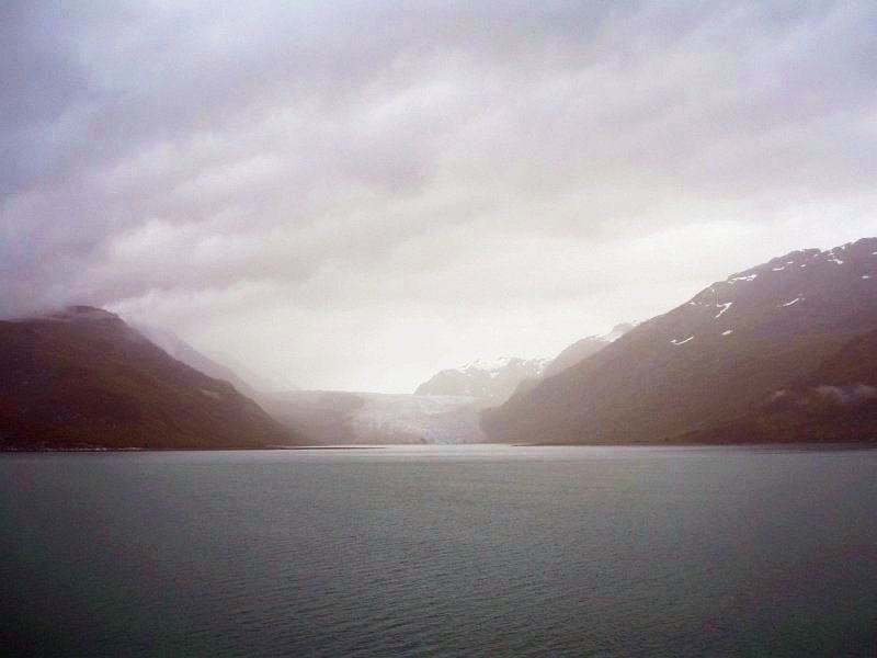 Just look at the way the ice runs over the rolling glacier valley floor, just like a river would. Imagine how, in 1776, as the Declaration of Independence was being signed, ice filled this valley, pouring out into an ice flow that was hundreds, or even thousands of feet thick, not just where our ship was cruising, but for all of the 50 miles out to Ice Strait. Look at the walls of the valley and how the ice has shaped them.
A glacier, like a thick plastic sheet, can move through valleys, filling depressions, scraping sharp projections right off, or climbing over gentle rises. Just like a river, it can expand to fill a wide valley, or contract and rise to work through a narrow spot. And once large areas of what we call temperate-climated lands had thousands of feet of ice like this blanketing them. The boulders that the ice carried can be found in New York, and glacier-polished rock can be found in the Midwest. The Great Lakes, and the Finger Lakes were gouged out by glaciers. Three quarters of the world's fresh water is still tied up in glacier ice, and if it all was released, it would raise the ocean level by 300 feet, flooding nearly every coastal city on earth. While global warming threatens to possibly do that, the threat of another ice advance is hanging over our future with a near certainty. The average warm spell between ice ages is between 8 and 12 thousand years. It has been 10 thousand since the last one. We are due. We are just getting started with our tour of Glacier Bay, and you can continue on to the next page, where we will be seeing the stupendous John Hopkins Glacier, as well as a number of other fascinating glaciers. |