POOL OF WINDS
04/01/2006
The Coon Family Hiking Club
Official Hike #2
LENGTH OF HIKE 2.5 miles - 1 hours 44 minutes
Total Elevation Increase: 600 feet
Started at 10:10 AM
Reached Hardy Falls at: 11:00 AM
Reached Pool of Winds at: 11:09 AM
Started back 11:19 AM
Finished at 11:58 AM
Starting Temperature: 49°
Ending Temperature: 53°
Previous Coon Family Hiking Club Hikes to the Pool of Winds:
Hamilton Mountain - 2004 CFHC Hike #4
|
||
|
The trail that leads to the top of Hamilton Mountain is an interesting one, with lots to see along the way. When Dotti and I first hiked this trail in June, 2004, we were very surprised to find some of the scenic beauty that we saw. The Pool of Winds itself is a very exceptional sight, and many other beautiful things greeted us at various points along the way.
We then returned a couple of weeks later to hike up to the Pool of Winds with our dear friends, Jim and Tammy. They really liked that hike as well, so we decided to show this trail to Tom and Barb when they came out from Maryland for a visit. And we are so glad that we did, because it turned out to be a great hike! |
||
|
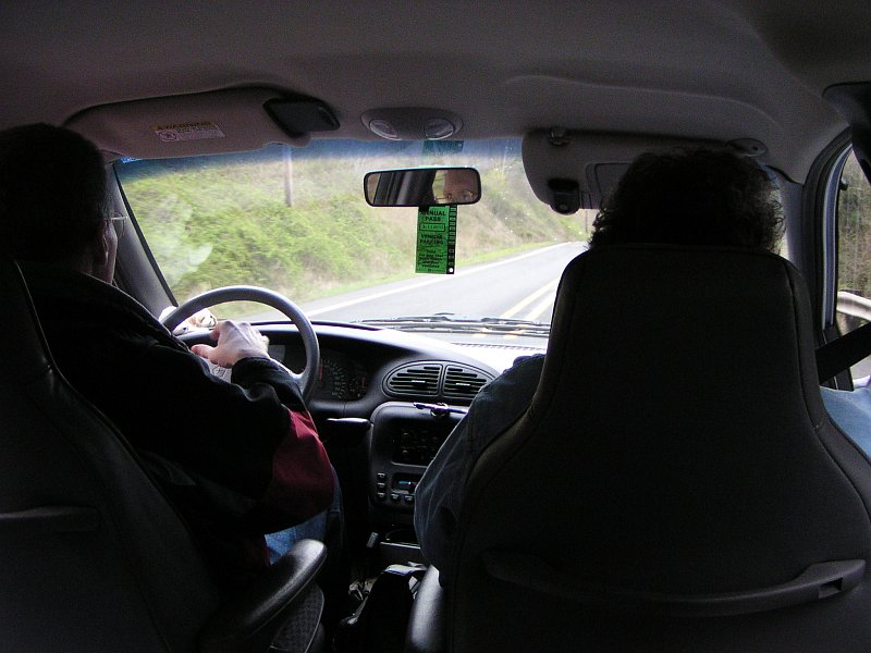
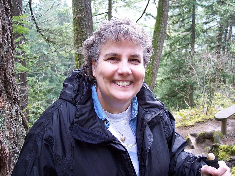
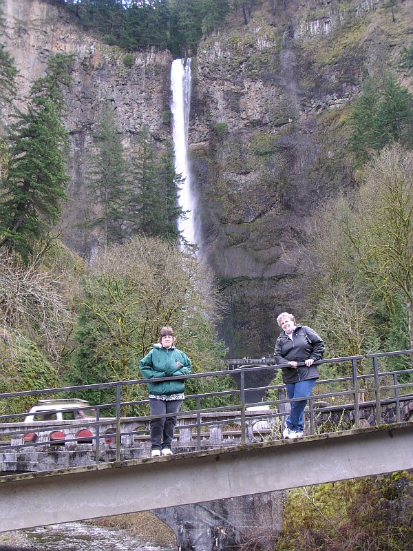
Tom took this shot, a couple of minutes before 10 AM, as we were driving on Washington SR 14, and getting very close to our destination. The temperature was a cool 49° outside, and you can see that Dotti and I have our coats on. We have our Northwest Park Annual Pass hanging from our mirror, which is required for parking at many of the State Parks in Oregon and Washington. |
|
|
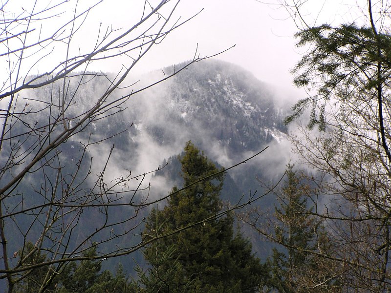
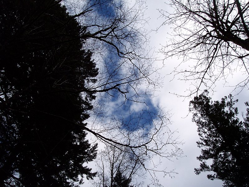
On the higher elevations there was some snow hanging on still, and the clouds hung on the mountain like a winter shawl; somehow I don't think this shawl gave much warmth. |
|
|
|
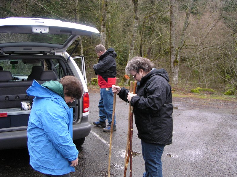
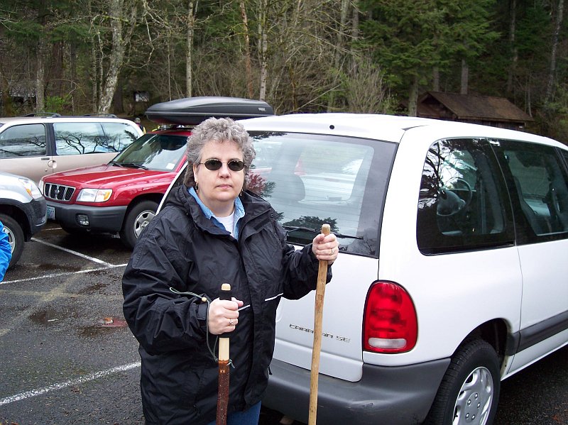
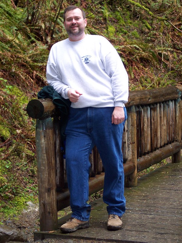
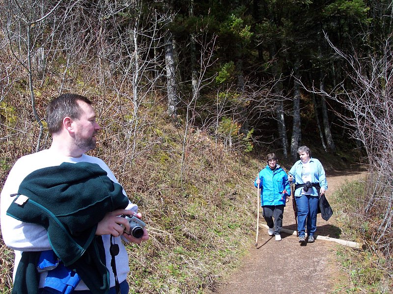
Tom caught us all getting ready in the parking lot. Barb was zipping up her coat and I had just donned my hiking boots. While it looks like I was apparently stuffing my pockets with perhaps a squirrel that I just picked up, Dotti is holding a collection of hiking sticks that we keep in the back of our van, for just such an occasion as this. Of course there was no squirrel, and I was actually digging out my gloves, because I was feeling a bit chilled by the damp cold. |
|
|
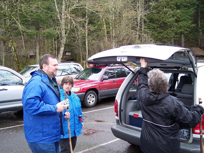
My turn. Tom is holding his camera in one hand his walking stick in the other: two hiking necessities! Barb is ready to go and waiting patiently, while Dotti is juggling the rear door on the van, and two of the walking sticks. It looks like the hike is about to commence! |
|
|
|
Dotti is ready to rock! Two sticks, sunglasses and a look of determination on her face. This trail doesn't have a chance against her! |
|
|
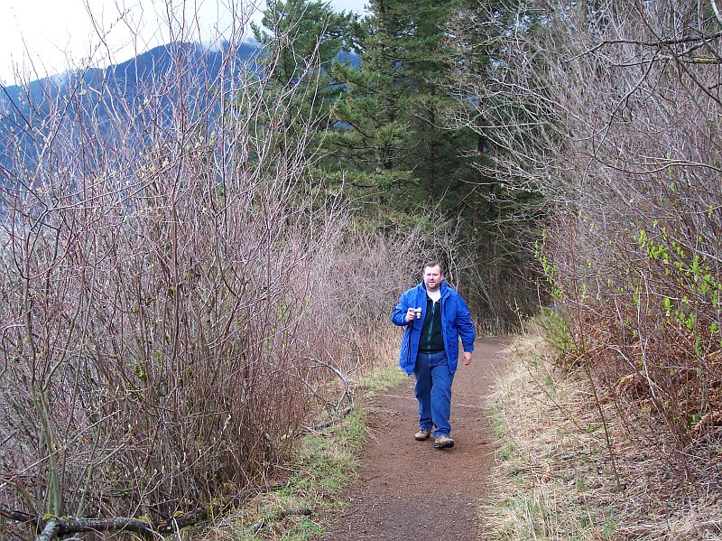
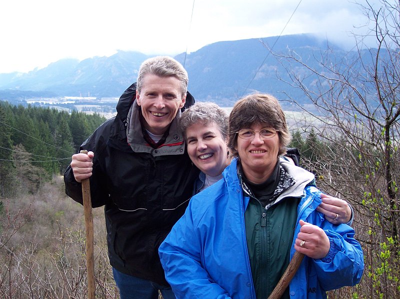
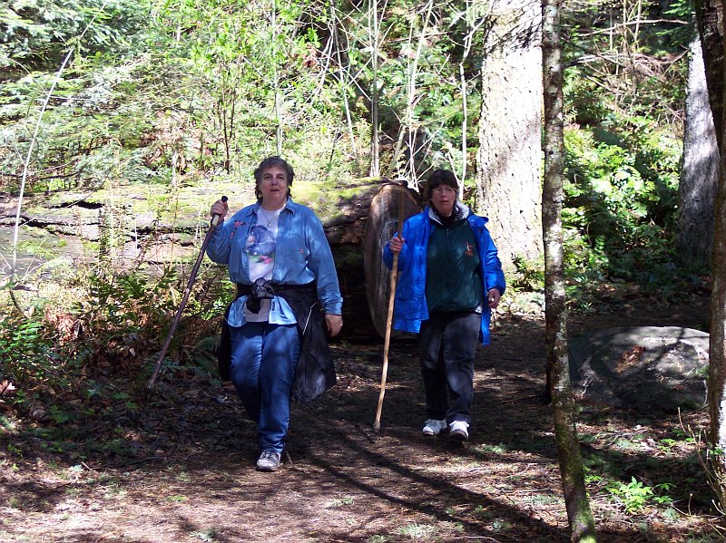
As you can see by her lovely smile, Barb is happy that we are finally getting started on our hike. The parking lot where we were standing was at 400 feet above sea level, and several hundred feet above the Columbia River as well. We would reach 1000 feet above sea level at our highest point on the hike at Rodney Falls, and the Pool of Winds. |

|
|
|
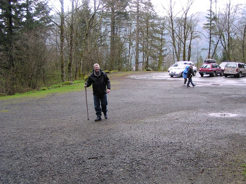
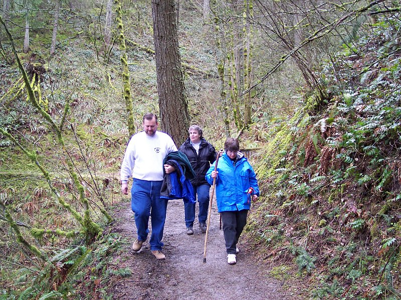
Tom got a bit of start on the rest of us, and took this picture looking back towards the parking lot from near the restroom building. I'm in the foreground with stick in hand, while Dotti and Barb are a bit behind, and the van that we came in is all the way to the rear of the parking lot. It obviously has rained recently, and we have our rain coats on just in case any more of the unruly behavior is about to occur. |
|
|
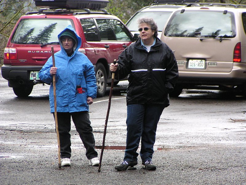
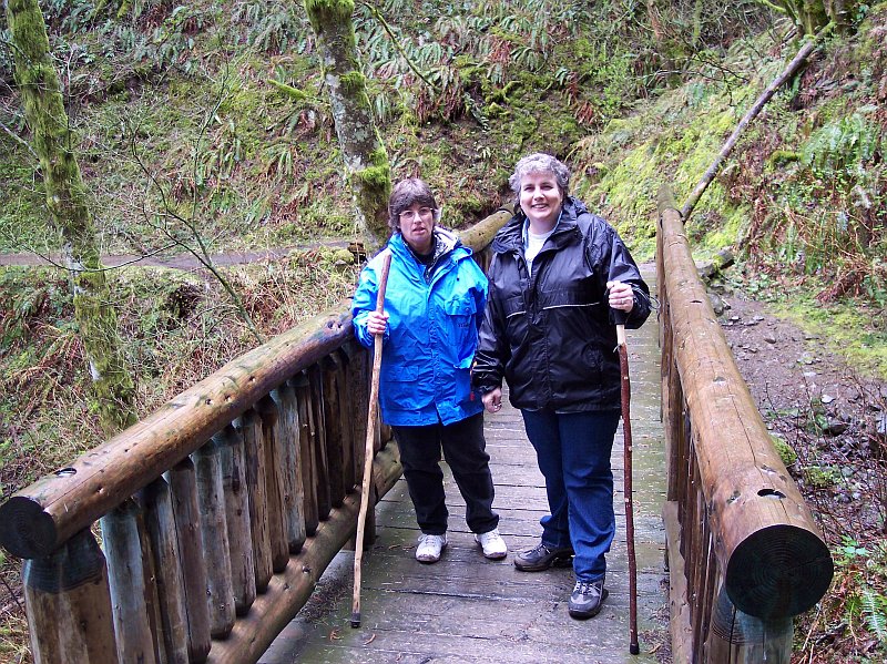
The two ladies ready to start hiking. Raincoats, walking sticks and smiles. Well, 2 out of three isn't too bad. |
|
|
|
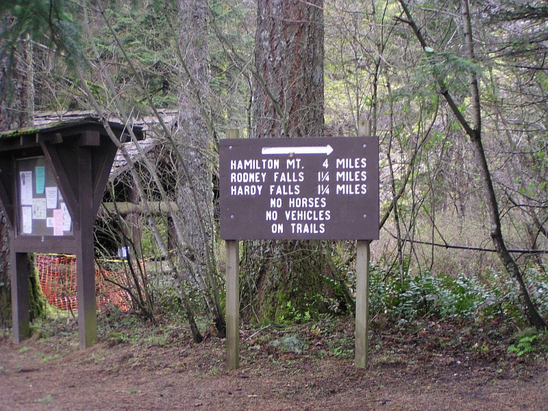
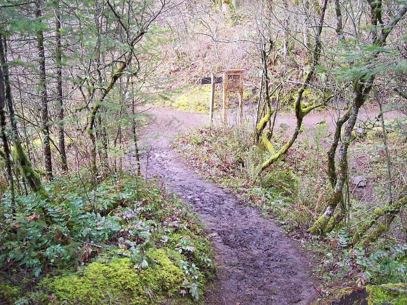
Here is where the official trail begins. The top of Hamilton Mountain is 4 miles away, but we aren't going that far this time. We are going to go to Rodney Falls and hardy falls though, but not in that order. While they are both listed as being 1.25 miles away, we actually come to Hardy Falls first, and then Rodney Falls. I am not sure why they listed them in this order. We are looking forward to a 2.5-mile round trip today. |
|
|
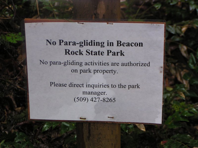
We were so disappointed to find this sign here. We so had our hearts set on para-gliding off the top of the falls. There are some areas that would no doubt be tempting in this park for people so inclined. There are some nice cliffs higher up the trail than we would be going, and the top of Beacon Rock just might lure someone into trying such a stunt. But if anyone does do that, they are going to tangle with the authorities if caught, but only if they survive; if they don't, no worries...none at all. |
|
|
|
The real trail lies before us, and we are finally making our way along it. The chainsaw has been at work, keeping the trail clear for us hikers. |
|
|
You could guess what time of year it is just from this photograph. The naked tress, and limited amount of greenery surrounding them shows that spring has not yet sprung. |
|
|
|
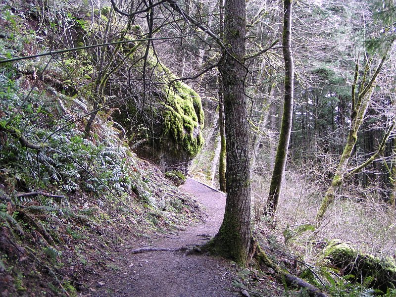
One of the advantages of the lack of leaves is that we can see more of the terrain surrounding the trail. Here the trail cuts to the left behind a moss covered outcropping of basalt. There are some stubborn patches of green to be seen, but there is a lot of brown as well. |
|
|
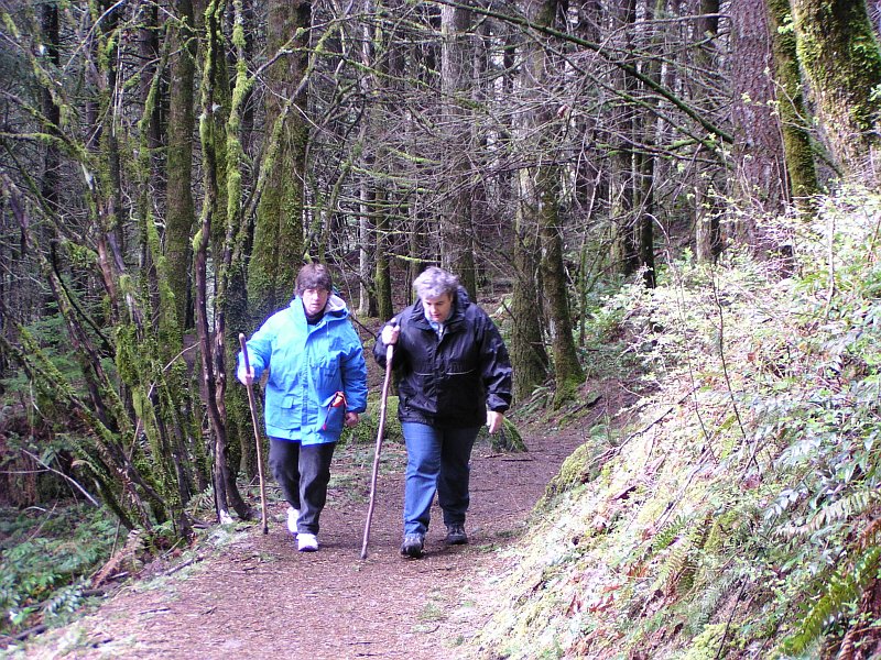
Here are Dotti and Barb working their way up the trail. Notice that the rain has not left the trail in too bad of shape, and just a bit behind Barb you can see the trail appears to have a stretch that looks completely dry. The tree cover is light this time of year, but it still provides some cover. |
|
|
|
It's time for a short rest, as the elevation increase has been coming along at a brisk pace. The sun looks like it is about to break through, because the background is really over lit in this shot. |
|
|
Dotti and Barb had a long conversation on the way up the trail. There is nothing like a great hike in the beautiful outdoors with good friends! |
|
|

|
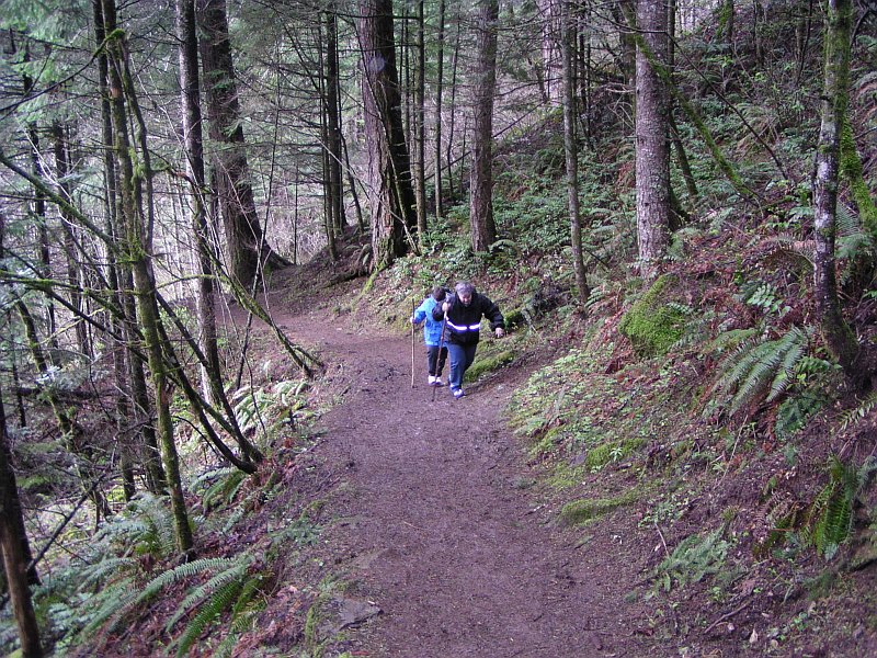
It looks like that sun breaking out thing did a full reversal, because Dotti has her rain hood up, and she doesn't do that unless it is getting wet. Tom's flash went off on this one; you can tell because Dotti's reflective band on her coat is radiating. If you look in the upper right hand corner of this shot you may be able to see just the top of a leprechaun's hat. He ducked just as we were taking this shot, or at least that is what it was. These green, moss covered rocks can play tricks with your eyes. |
|
|
The temperature hadn't gone up much and even the walking had not warmed me up yet. I didnt have my gloves on, but I had my knit cap on. And speaking of the cold, look at the broken branch on the ground at the right of this picture; even looking at the full-sized original picture it appears that there is snow or ice accumulated along the edge of this branch. Did it break off from a higher location a short time ago, and fall to earth carrying its frozen covering with it? Nothing else around it seems to have any ice on it, and it is intriguing thinking about where this might have come from. |
|
|
|
Breaking out into the open for a bit, Tom's blue coat comes to life in the brighter light, and his camera is ready to move into action when something of interest comes into view. The trees along here are all seasonal, and they are stripped bare of their green covering. The mountains in the far distance are in Oregon and they have wisps of clouds hanging on them. |
|
|
If this were spring, from this location you wouldn't be able to see Dotti at all, and even most of Barb would be blocked by the leaves on these trees and bushes. Fortunately, the leaves are not in the way and we can see the lovely ladies on the trial. The contrast between where we were walking, beneath the tree cover, and the open area we are entering, is shown by the light surroundings in the foreground and the very dark area that the ladies are leaving. |
|
|
|
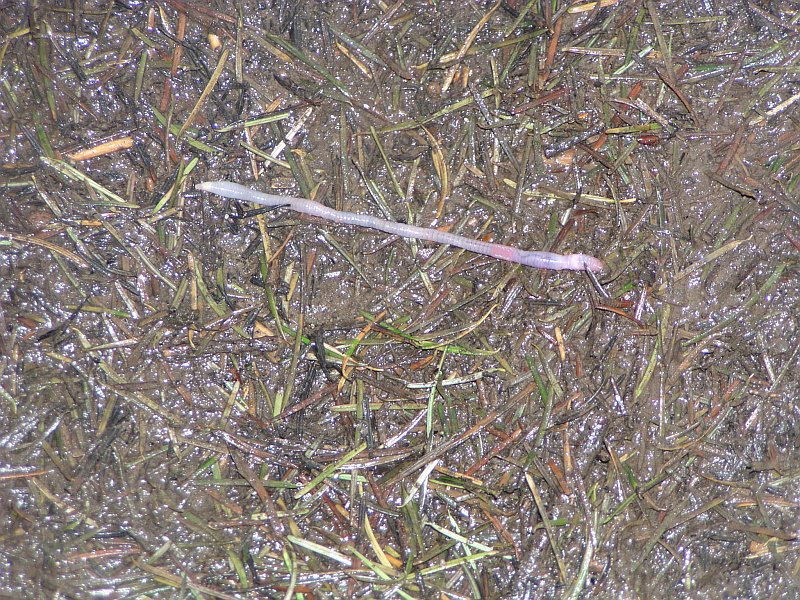
You have a choice of things to look at here. There is are the pine needles of course, in various states of decomposition, the light reflecting wet surface of the ground, the muddy trail, and of course what appears to be a fine example of a Lumbricus terrestris, or earthworm. Since the earthworm breaths right through its skin (it doesn't have lungs or even gills), it can't breath when the ground it is in gets saturated with water, filling up all of the surrounding air pockets with water. That is why you see them come crawling out of the ground and up onto exposed surfaces when it rains, or you run your sprinkler for a while. This guy had come up for a breath of fresh air. |
|
|
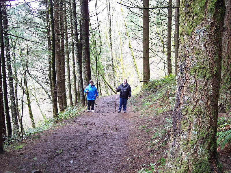
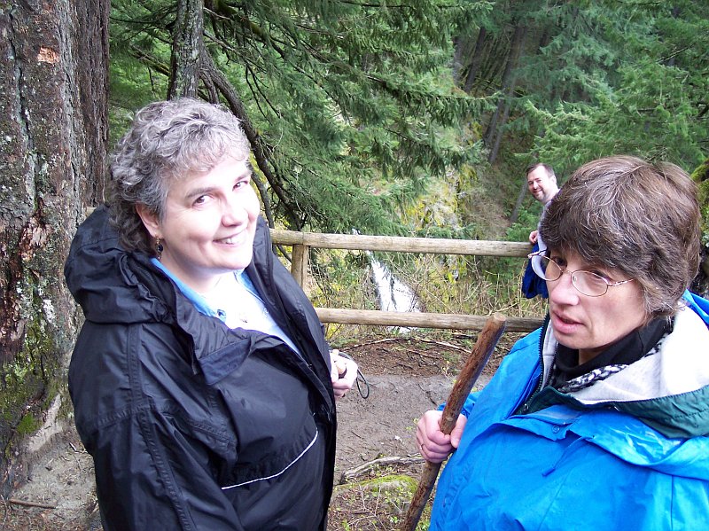
The surrounding scenery has changed, but the conversation continues. Are they discussing particle physics? Perhaps a fine point about Nietzsche's Thus Spake Zarathustra? I guess we will never know for sure. |
|
|
|
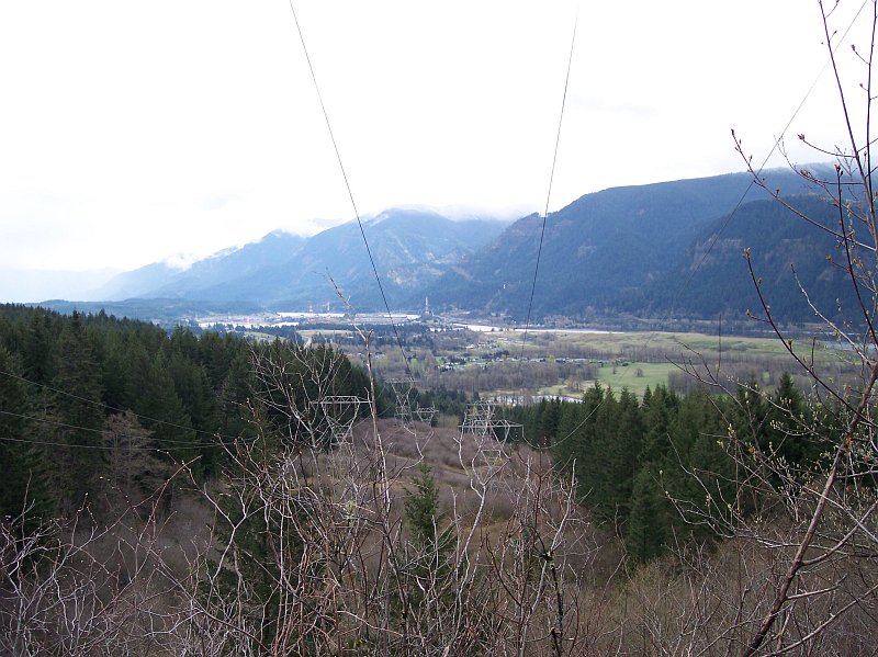
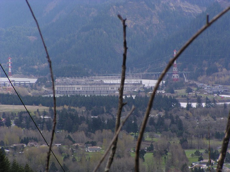
Where do we begin to describe a picture with so many fascinating things in it? Do we speak of the dual row of high voltage towers running their precious cargo of electrons along the copper conduits? Do the patches of snow on distance mountain tops catch our eye, or are we caught in the grip of the Columbia River's beauty? Does the Bonneville Dam take the center stage of our attention as it does in the picture? Or do we see the massive landslide that pushed the Columbia River a mile southward out of its old course, creating the old legend of the "Bridge of the Gods? We gaze here at some of the most geologically traumatized land on earth. It has been covered by thousands of feet of lava that flowed for hundreds of miles to get here. It has been pushed up thousands of feet by the earth's tectonic machinations, cut deep by one of the world's great rivers, and then had this very channel filled nearly to the top by a flood carrying hundreds of cubic miles of water, which ripped out the walls of this great Columbia River Gorge and left old streams and rivers cutoff high in the air: forcing them to fall great distances to reach the river. If that were not enough, periodically this area is pushed into by lava, or covered by ash from local volcanoes, like Mt. Saint Helens, Mt. Adams, and Mt. Hood. And yet after all of that, it remains a naturally beautiful paradise. |
|
|
Standing solid against the flow of the great Columbia River, the Bonneville Dam houses its generators, creates its power, and sends it out on the metal cables stretched from tower to tower in order to light our homes. Behind this concrete wall you can see the elevated Interstate 84 running along the wall of the Gorge, the cars and trucks on it looking smaller than a child's toys; while in front you see the dead appearing branches that stood beside our trail, and which will shortly be springing to life with green leaves in abundance. |
|
|
|
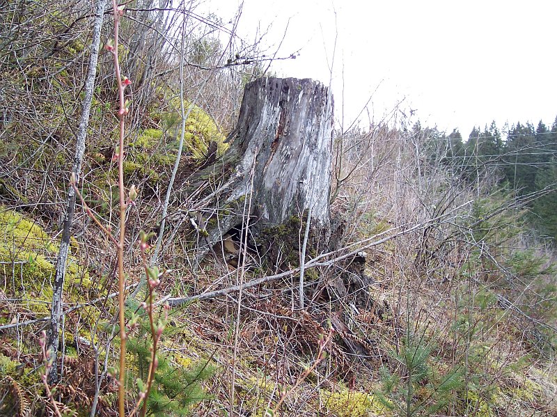
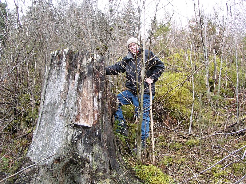
Like the foundation of an old building, this stump stands in reminder of the giant tree whose top would have had a line of sight view for a great many miles along the mighty Columbia River's course through its Gorge. How many people passed by its feet, as it haughtily stood above them, unknowing of their puny presence below? And now, like a ghost town, this gray reminder refuses to let us forget that we missed something, but what once was, is no longer. |
|
|
Tom snapped this picture after I climbed up to have a look at the stump from a different angle |
|
|

|
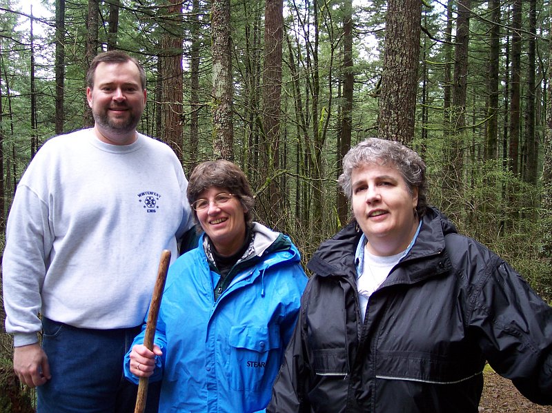
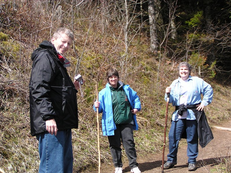
Dotti took this picture of Barb, Tom, and me, as we stood beneath the power lines running up the hill. |
|
|
Tom traded locations with Dotti for this shot. |
|
|
|
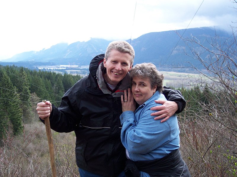
This is my favorite picture for the day! My lovely Dotti is nestled safely in arm, with our Pacific Northwest spread out behind us. It just doesn't get any better than this! |
|
|
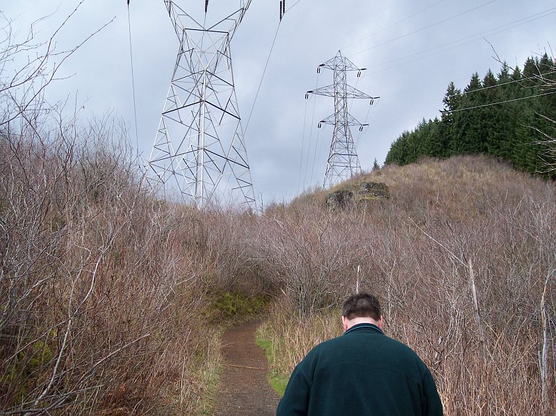
It's time to end the photo session and move up the trail. The giant metal towers look as if their arms should get tired, being held out to their sides all of the time. |
|
|
|
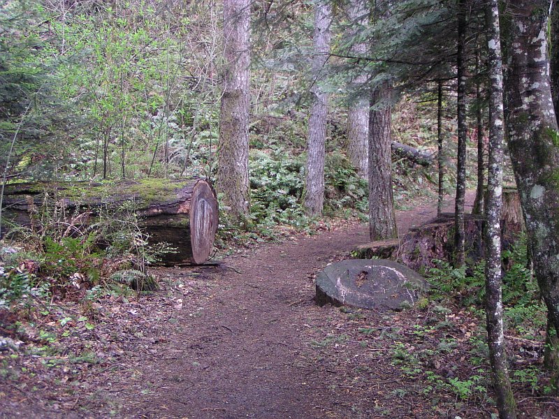
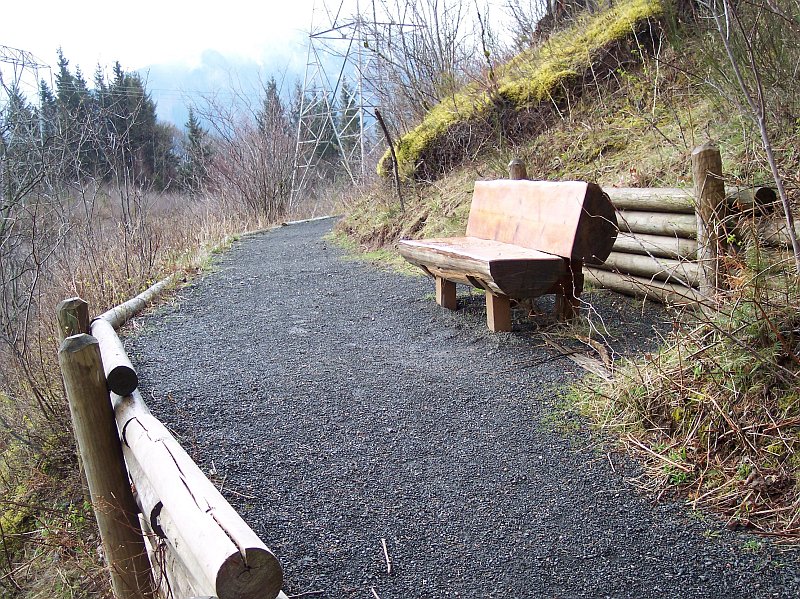
This is not our trail. It is a path that leads over to a campground to the west of us. The log bench is a really nice touch that we enjoy seeing every time that we come up here. It is a simple design, cutting a log in half and then mounting it, but it just seems so right for this area, and it fits in beautifully. |
|
|
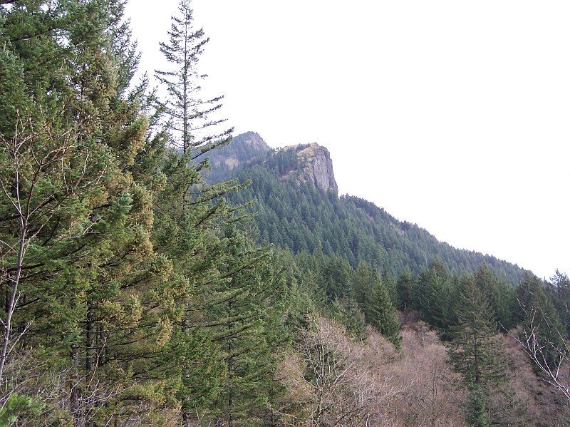
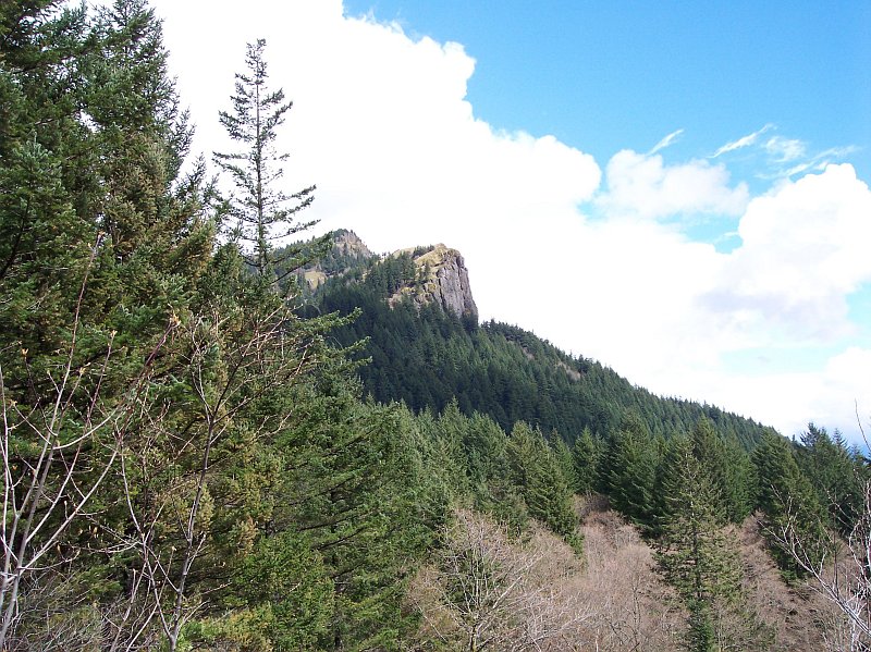
Looking up, we see one of the cliffs on the side of Hamilton Mountain. We were not going to go that far on this day, but it is a great view from up there and worth the effort to climb it. |
|
|
|
Turning around and taking one final look back down the power lines at the Gorge., behind Barb and Dotti. From here on we are going back into the trees. |
|
|
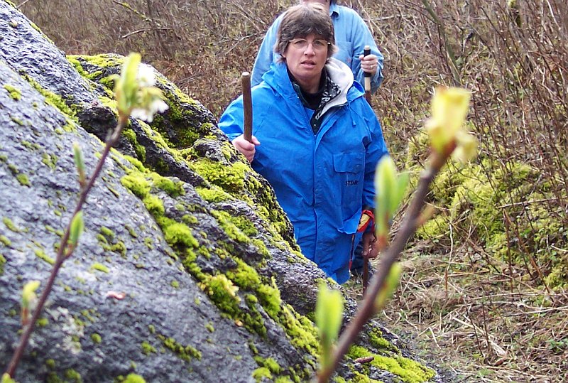
It was 10:34 when I took this picture. Barb and Dotti were making their way around this mossy rock on their way back into the forest. Notice, that in celebration of this being early April, and spring having officially commenced, there are some buds on the foreground branches. Winter's grip is about to be shaken loose! |
|
|
|
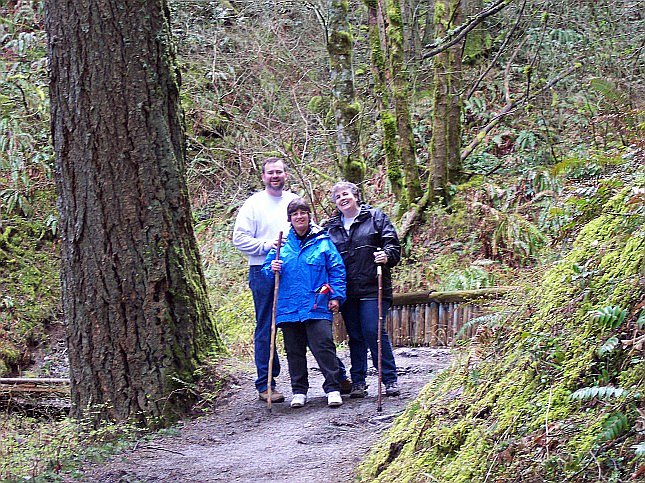
Here are my three hiking companions, having just crossed the bridge behind them. They seem to be having a good time, and I know that I was! |
|
|
The photo pose now broken up, the group is once again on the move. I think Dotti looks like she has a secret. What do you think? |
|
|
|
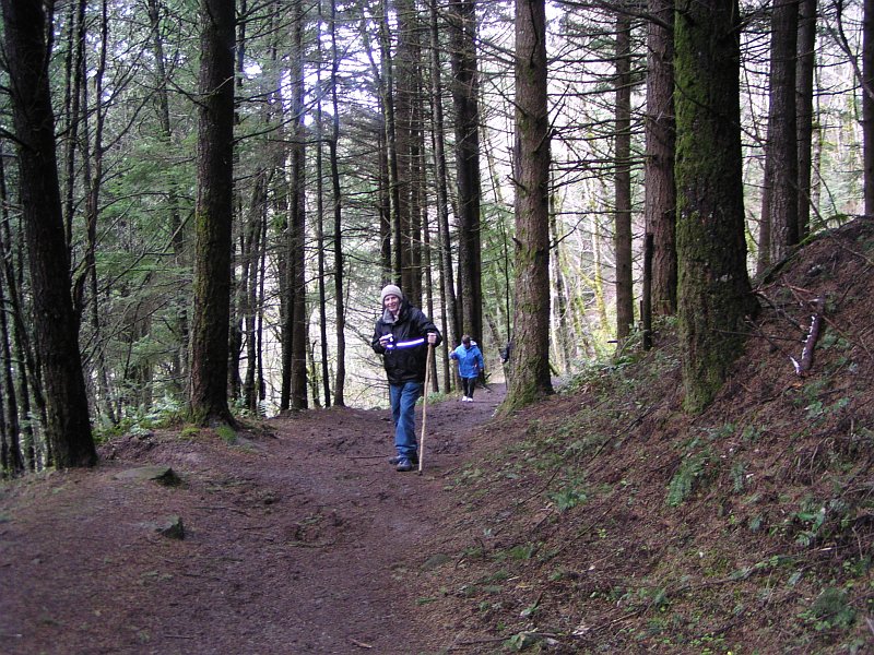
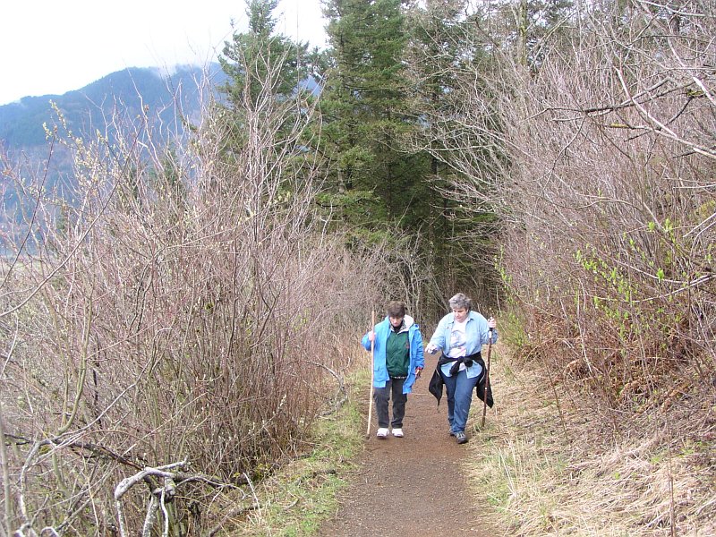
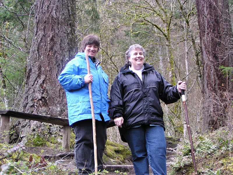
At 10:49 we took another quick stop for a picture. Since it is only 1.25 miles to our destination and we have been walking a while, we have to be getting close! |
|
|
Okay, I know that I am partial, but I think Dotti's smile is the most beautiful thing on earth, and even the beauty of the forest behind can't match it. Barb spotted something off to the side, and is giving it her full attention. |
|
|
|
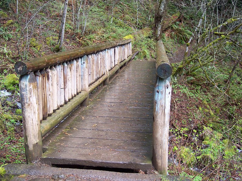
A little bridge, followed by a larger one. By making the bridges out of the wood of the forest, the structures fit in, as if they naturally belong here. |
|
|
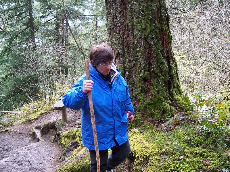
Tom's flash went off, as my coat's reflective strip is giving testimony to. The overcast day makes a little illuminatory assistance desirable for our pictures. The water soaked log beneath my hand was cool and smooth to the touch. Except for the lack of bark, it felt much like any of the hundreds of trees that we have seen fallen in the forest, when they have been exposed to a rainstorm. This bridge belongs right where it is. |

|
|
|
Tom and I exchanged places for this picture. The only thing better than taking a hike in the woods, is taking a hike in the woods with good friends! |
|
|
Okay, when you are in the woods hiking with friends, and with the love of your life; it really does not get any better than that! |
|
|
|
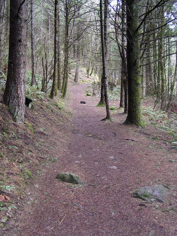
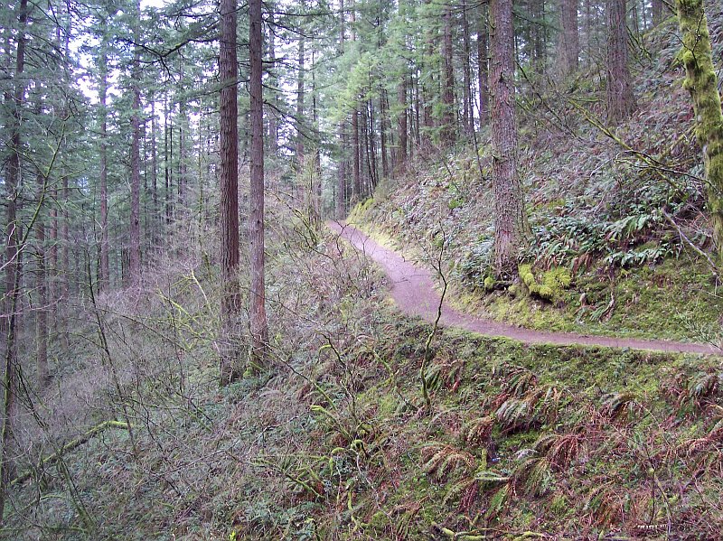
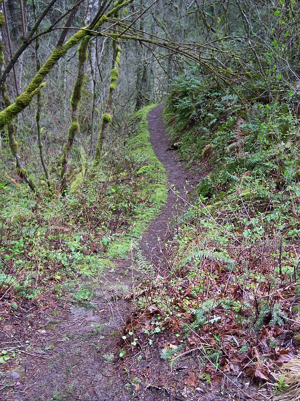
This trail looks almost as if were drawn into the picture, or pained there by a master artist. Other than the scent of man, that animals would pick up from that trail, there is little other impact on this part of the forest. It is like a magic carpet that brings here, and takes us home, without doing much to change the place we visited. |
|
|
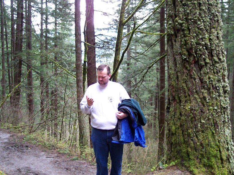
"I swear it," said Tom. "I had my camera right there in my hand, and all at once this little hairy-footed man ran out from behind a tree and grabbed it. He took two steps away, and dived into a hole over there. And he dropped this ring in my hand. That was the last I saw of him. "Oh, yes and the ring has some writing on it, that ends with 'One Ring to bind them.' What do you suppose that was all about?" |
|
|
|
It is always pleasant to remember that "...all who wander are not lost." This path leads somewhere. Let's wander off and see where? |
|
|
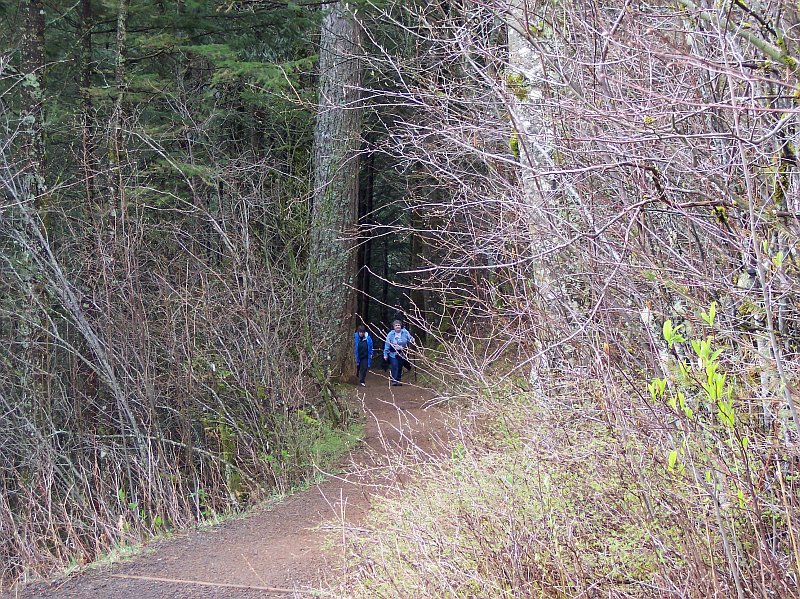
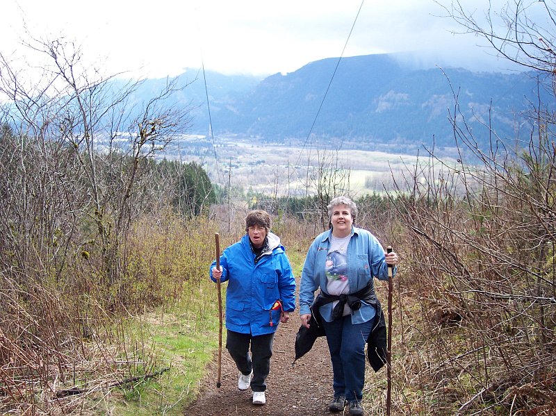
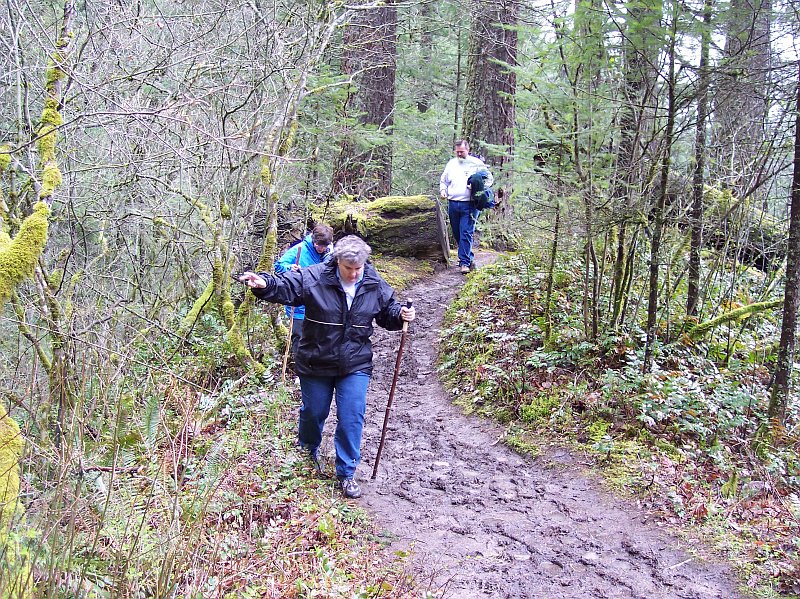
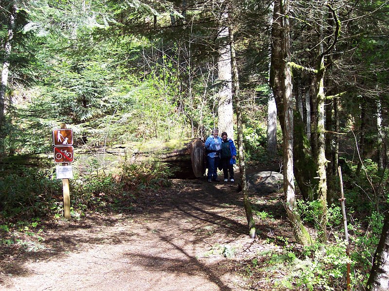
We may have taken the "path less traveled" back there at that intersection, but we definitely took the muddier one. The main trail runs from left to right in this picture, with the left being the way we had come, from the parking lot, and the right the way we were to continue after this little excursion was completed. The signs had said that this was the way to the Hardy Falls viewpoint, and muddy or not, here we come. |
|
|
|
A nasty spot in the trail. The mud was very soft and deep here, and we had to work our way around it. As you can see all of us were paying very close attention to our feet placement along here. |
|
|
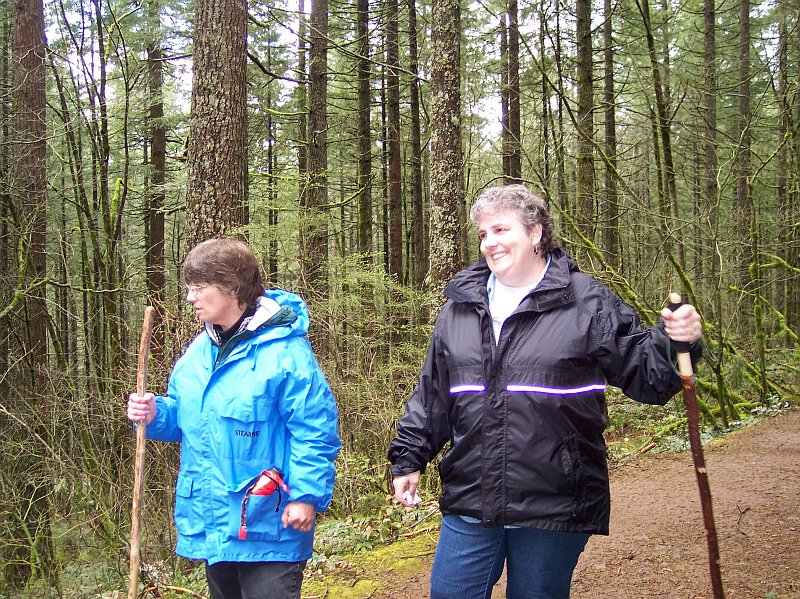
Here Barb was walking along a drier bit of ground on the way to the view point. In the background you can see one of the wood-reinforced steps we had to traverse, as well as braving the muddy trail. |
|
|
|
As you can see, Dotti is quite happy to be here, enjoying the beautiful view, and the fun hike with friends! |
|
|
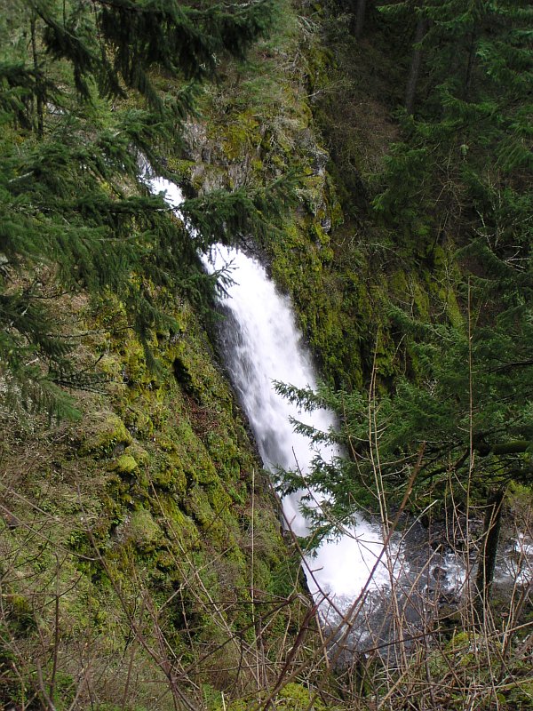
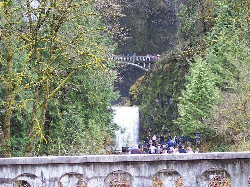
Hardy Falls, in all its glory, or at least as much of it as we could see. Unfortunately, there is no clear head-on view of this falls. Still it is pretty, even from this limited view, and at this time of year there is plenty of water flowing over it. |
|
|
|
I managed to get all three of my hiking companions in this shot. Tom is peaking around from behind his wife, with the ladies making the foreground a beautiful sight to behold. Off in the background, a bit of Hardy Falls is visible. |
|
|
Looking back up the at the ladies from the wooden rail protected viewpoint. The walking stick in Dotti's hand is fairly new one that we picked up for her recently. (It is extremely light for its supportive strength, and it even has a rubber grip at the top. She really likes it!) |
|
|
|
What's this? Blue sky trying to peek through the clouds? Those naked branches that you see reaching across this shot will very soon be loaded with leaves, and the blue of the sky will gradually become the norm for us, as we move into the summer months. By the end of summer, I am ready for the clouds again, and a return of the cool temperatures. |
|
|
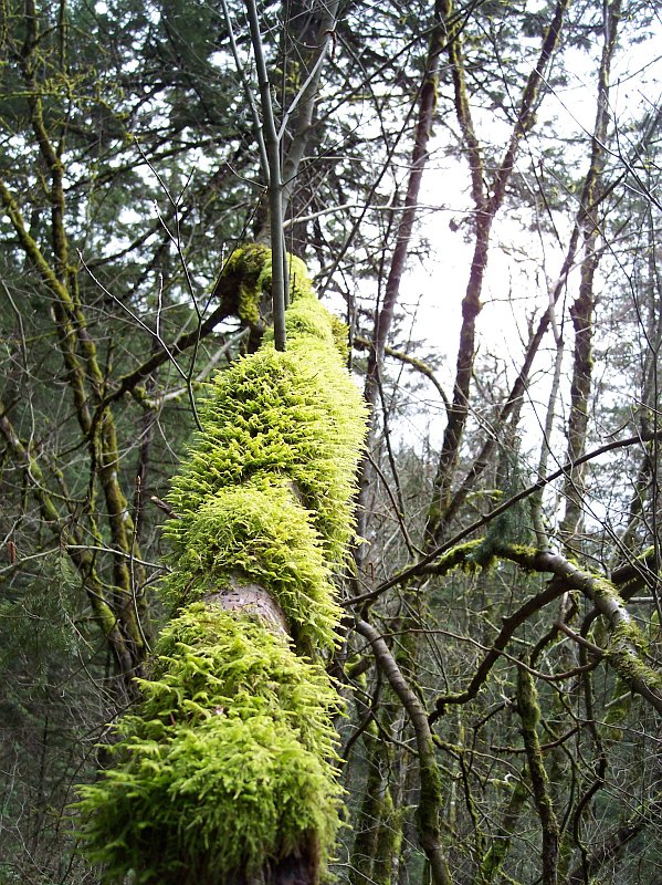
This tree looks like its primary function in life is to be a support for its moss covering. Its branches are showing no green of their own, but the moss has plenty to make up for it. |
|
|

|
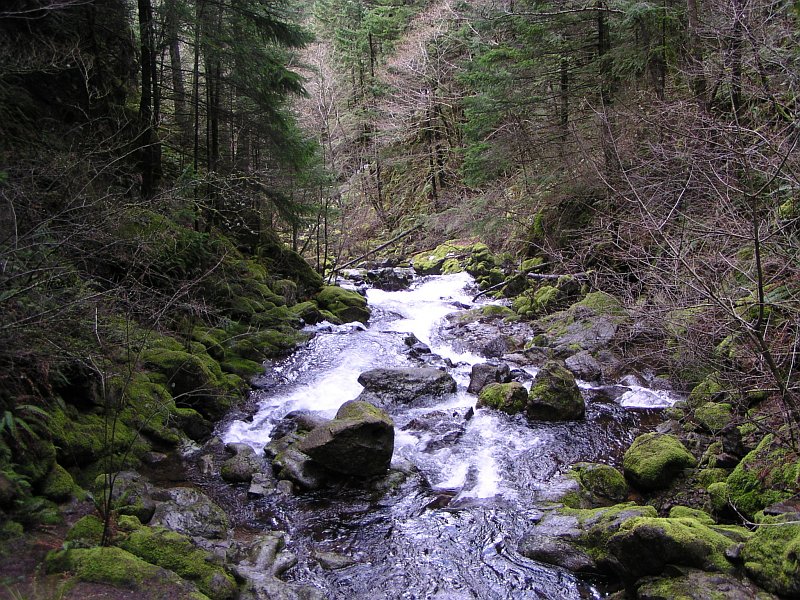
This little stream ran beside this path to the Hardy Falls viewpoint, and the water in it was destined to join up with the water in Hardy Creek not too far from this point. The rocks seem to be alive with all of that green moss covering them. |
|
|
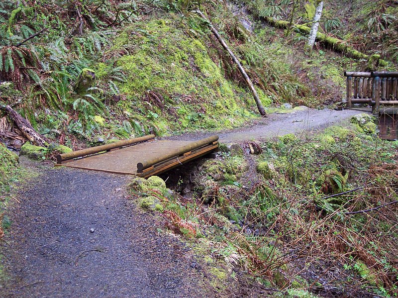
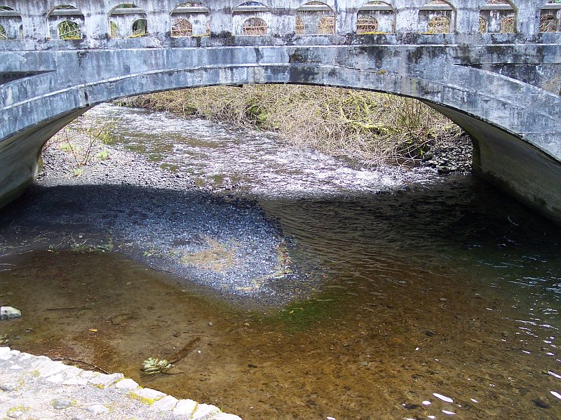
Our excursion to the Hardy Falls viewpoint is complete, and we have made it back from the really muddy trail, to the merely damp trail. This bridge crosses the gully that the little stream, which we saw in the previous picture, flows. It is similar in construction to other bridges that we saw this day. My guess is that someone in the Forest Service came up with the design and it was adopted for general use. In any case, the bridge was very solid and looked quite at home in its beautiful surroundings. |
|
|
|
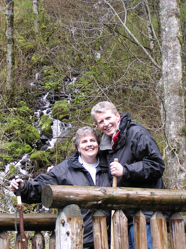
Here I am with my favorite hiking partner! Tom captured the stream in the background and the bridge in the foreground, to create a picture that I really like. |
|
|
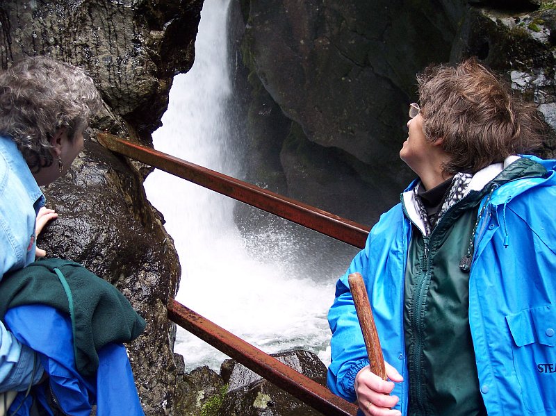
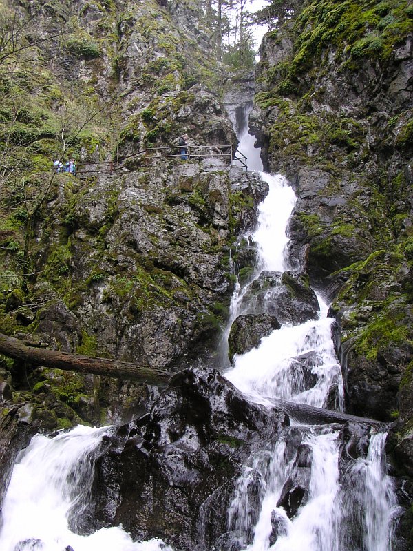
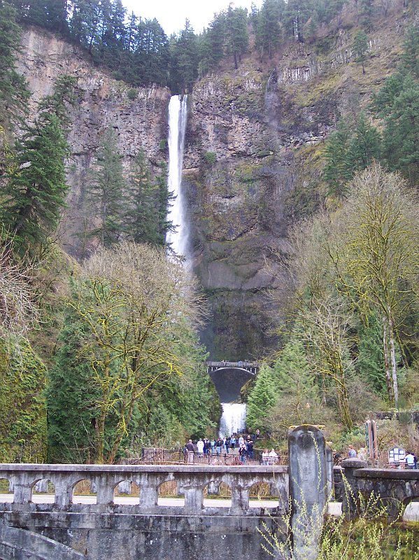
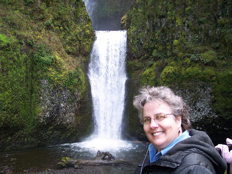
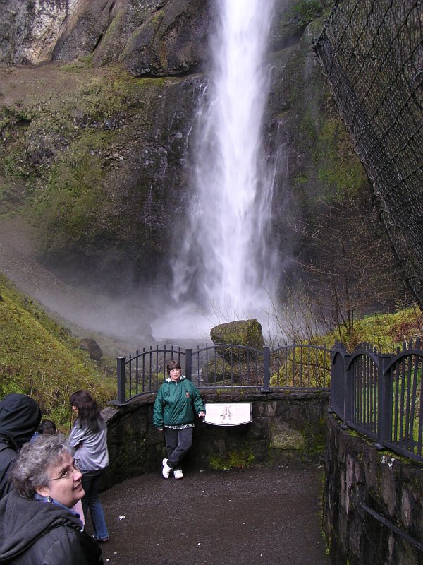
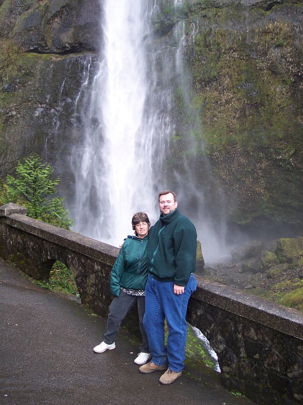
In this hike I wanted to get mostly people pictures, because we covered the trail itself in earlier hike (see the top of this page). So we took a small bit of a jump here, as Dotti and Barb are seen here looking into the mouth of the Pool of Winds, right above Rodney Falls. When you stand where Barb is at, the wind just pours into your face from the enclosure holding the dropping water of Hardy Creek. The water flows into the top of the cylindrical chamber, and falls to the bottom, with the rock surrounding that white churning mess like two hands cupped around it. On a hot summer day that damp wind hitting you in the face feels like heaven. On this day, the spray coated glasses and camera lens, and so we had to wipe them off repeatedly, and it made the 50° air temperature feel a lot colder. Just like the surrounding rock surfaces, the metal guardrail that you see here is never completely dry. |
|
|
|
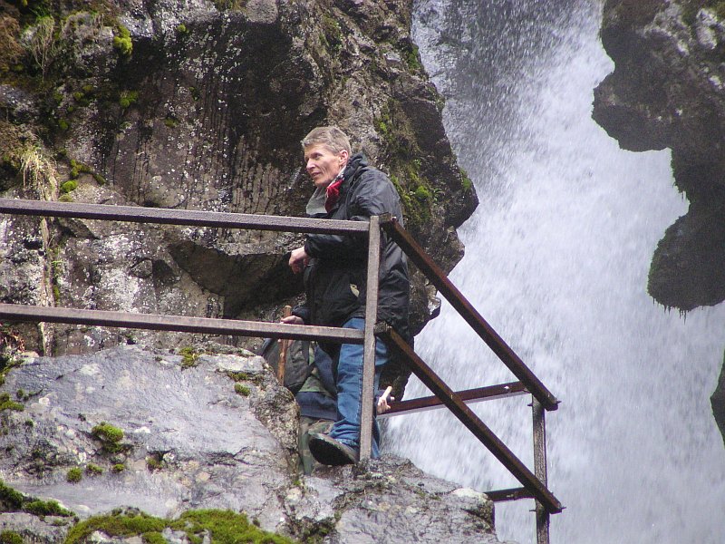
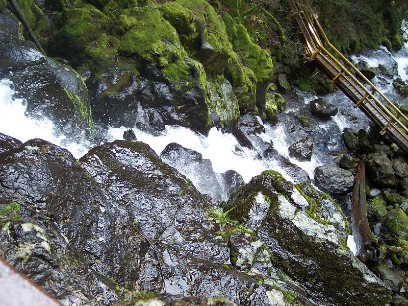
Tom took this shot of me standing at the mouth of the Pool of Winds waiting my turn to have a look into the wet jaws. The guy behind me, with the backpack, is enjoying the view of the white water churning inside its temporary captivity. Although it isn't visible in this picture, there is a fairly large log located behind the water that you do see. The first time Dotti and I came up here, the log was not visible either, because there was too much water flowing over it. But the second time we visited, the weather had been dry for a while and the water flow was much less, and we could see the log. It appears to have at least one cut end (the other end is beneath the water of the pool) and that lead me to believe that it has been placed there on purpose, and did not simply fall there on its own. Is it to force the water to fall into more pleasing pattern? I am skeptical that would be the reason. Surly this would be an awesome sight, no matter how the water fell. More likely it seems would be that they are attempting to protect the rock enclosure from being changed in some undesirable way by the water. Perhaps the back of the chamber is weakening or crumbling into pieces? |
|
|
Once again Tom snapped my picture from where he was standing below Rodney Falls. |
|
|
|
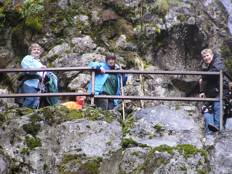
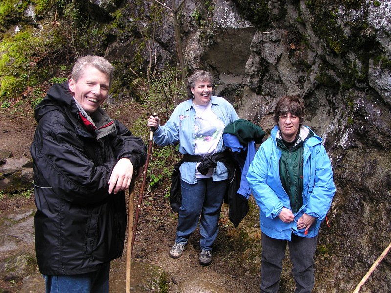
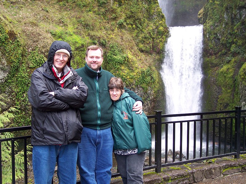
Here Tom added in the attractive part of our hiking party for this shot, along with this old guy. Behind our group there were others waiting. We saw a number of people here, more than along the rest of the trail, because it is a popular attraction, and when you get to it, you want to take a good long look at it. |
|
|
Dotti, Barb and I are in this shot, but this picture is really a great shot of Rodney Falls, and how the Pool of Winds fit into this natural wonder. Hardy Creek pours into the Pool of Winds from the right, falling 50 feet before hitting the pool whose surface is just about at the level where we are standing. Then the water breaks free and gushes out along a stream bed warn in the rock, and then slides down water slide-like channel until it hits a complicated rock labyrinth, splitting the flow in many ways, before it all comes together again below. A beautiful falls indeed! |
|
|
|
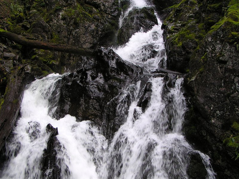
Here is the lower area of the falls. |
|
|
Looking down from the Pool of Winds viewing platform along the length of Rodney Falls. |
|
|
|
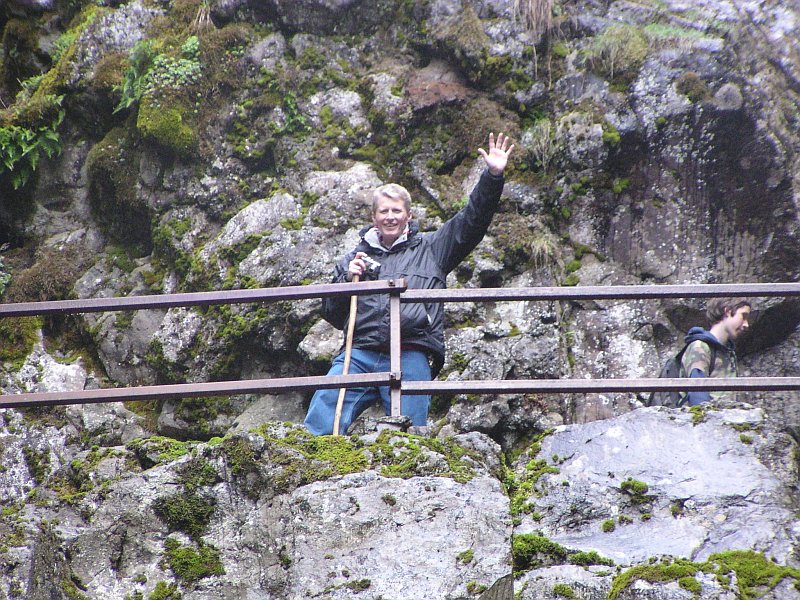
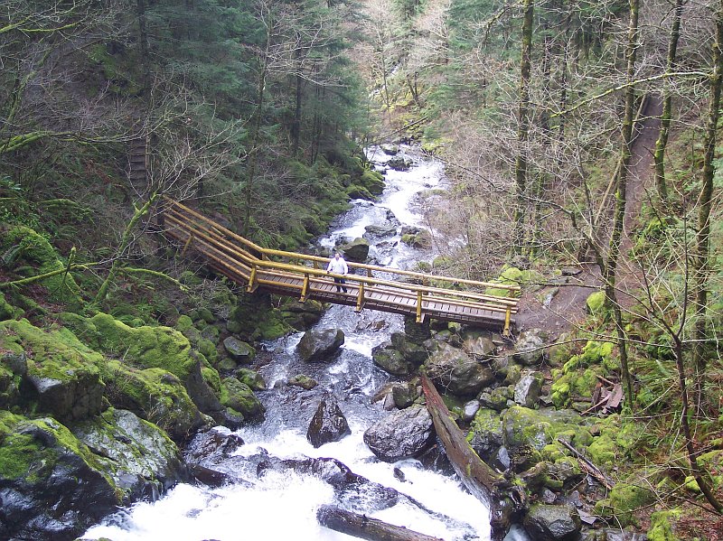
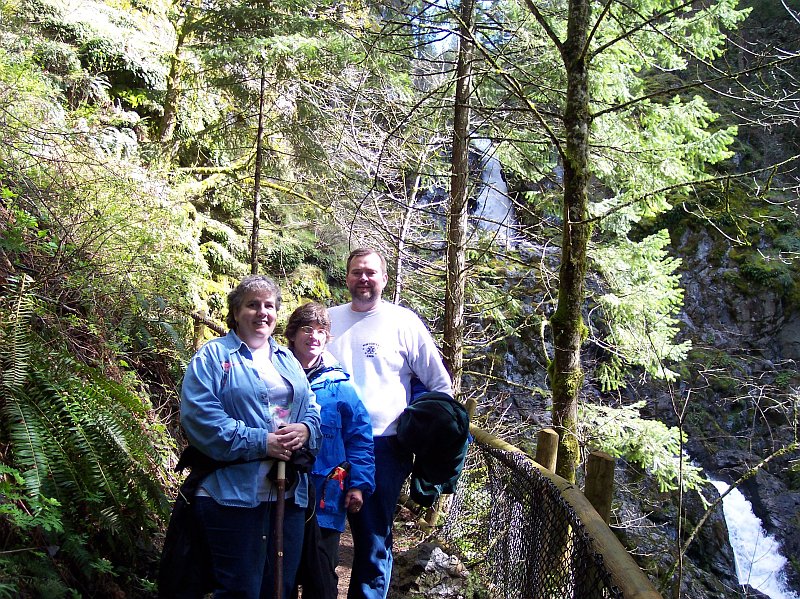
At last we get to see Tom, our trusty photographer for those shots of Dotti, Barb, and I, and Rodney Falls and the Pool of Winds. There was a tee in the path below and in one direction the path led to the Pool of Winds. In the other direction, it wound downward about 50 feet below the level of the path at the tee, and then led across this bridge, with a great view. Tom eagerly volunteered to be the one who would go to the bridge and take the pictures of the rest of us before retracing his steps to the tee, and then climbing the path to see the Pool of Winds up close for himself. Thank you Tom! If we were to follow the path across the bridge and continue on, we would reach the top of Hamilton Mountain. But that hike will have to wait for another day. (Those additional 2.5 miles of trail are very altitude intensive.) |
|
|
Tom also took this picture looking downstream from the bridge, as the water makes its way towards Hardy Falls. |
|
|
|
Tom has now joined the group again and took this close up shot. |
|
|
Now that Tom has had his chance to see the Pool of Winds, and enjoy the spray in his face, we are heading back down to the main path again, so that we can work our way back to our car. The group is smiling, because we all enjoyed the view tremendously, and of course the rest of the trip is nearly all downhill. Over Tom's shoulder you can see the Pool of Winds, for the last time for this trip, as we leave Rodney Falls, and head back. |
|
|
|
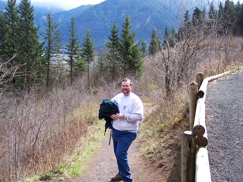
Here is Tom on the homeward trail. We are back in the open at the place we stopped to take pictures on the way up. (You can see the power lines dropping down from the upper right part of the picture, and the trail on the right is the one with the log bench at its side.) |
|
|
In about the same location, but looking back up the trail, where now the ladies are also in view. The sun is shining brightly now and we are feeling a little warmer now. Tom has his coat off, and Dotti has hers tied behind her; though Barb is still wearing hers. (I still had mine on too.) |
|
|
|
This a very similar shot to one I took on the way up, but this one has some sunshine even patches of blue in the sky. April can have some very changeable weather. |
|
|
The "happy wanderers" nearing the end of the trail. You can see that we layered our clothes for this hike. The collar of my coat is sticking out from under my raincoat, and the ladies have coats and shirts that allow for adjusting attire to match the weather conditions. We all stayed pretty comfortable on this hike. |
|
|
|
Here we are back where we started. Earlier this view was dark and gray, but the sun is out now. |
|
|
There is no holding them back now, the car awaits us! |
|
|
|
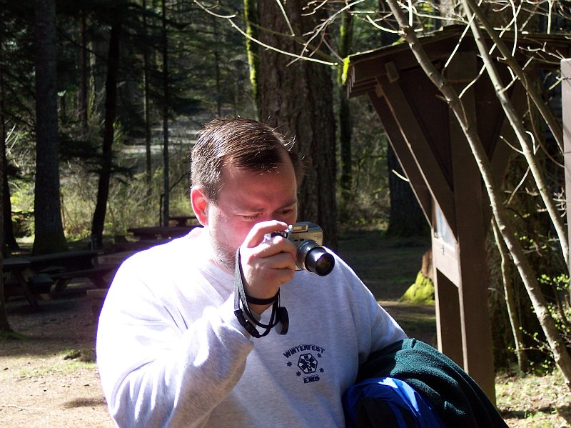
Catching the master at work with his camera. The picnic benches in the background show that we are near the parking lot now. |
|
|
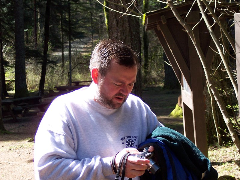
Tom checking his shot to see how it turned out. Another masterpiece! |
|
|
|
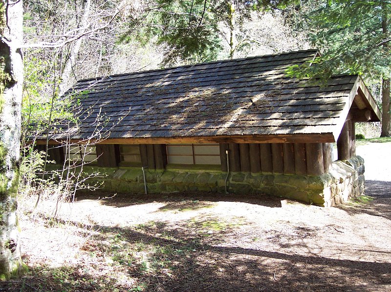
After a hike the restroom facilities are always a welcome sight, and they had some nice ones at this trailhead. |
|
A Few Earlier Visits to Multnomah Falls:
Jim's and Tammy's visit in 2002
|
||
|
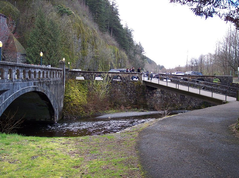
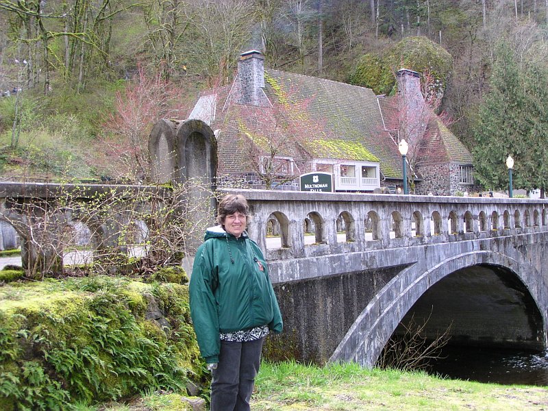
After our hike to Rodney Falls, and the Pool of Winds, we went across the Columbia River and over to our favorite falls, so Barb could see them. It was a busy day for this popular attraction and so we had to park east of Multnomah Creek, instead of the parking lot on the west side of it. But that was okay, because after a short walk we were at a nice location to take some pictures. On the left you can see part of the Multnomah Falls Lodge, and a concrete bridge that carries the Scenic Columbia Highway across the creek. Mid picture is Multnomah Creek, filled with water that has just recently passed over the beautiful Multnomah Falls. The bridge on the right carries foot traffic from the parking lot that is accessible from the freeway. |
|
|
|
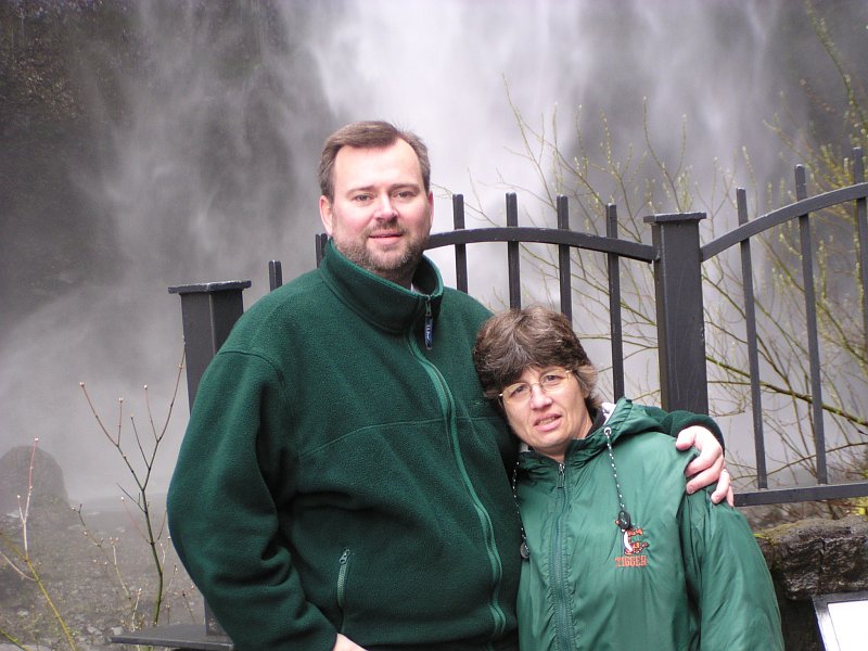
Tom took this picture of Barb, with the bridge and lodge in the background. The lodge has a restaurant in it, but there are no lodgings to be had. However, it has a very nice gift shop. |
|
|
I took this picture of Tom taking the last picture. |
|
|
|
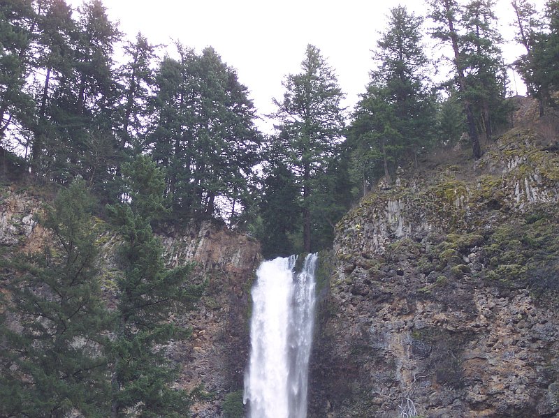
Looking at Multnomah Creek here, you never would know that it had just fallen over 600 feet a few minutes ago. |
|
|
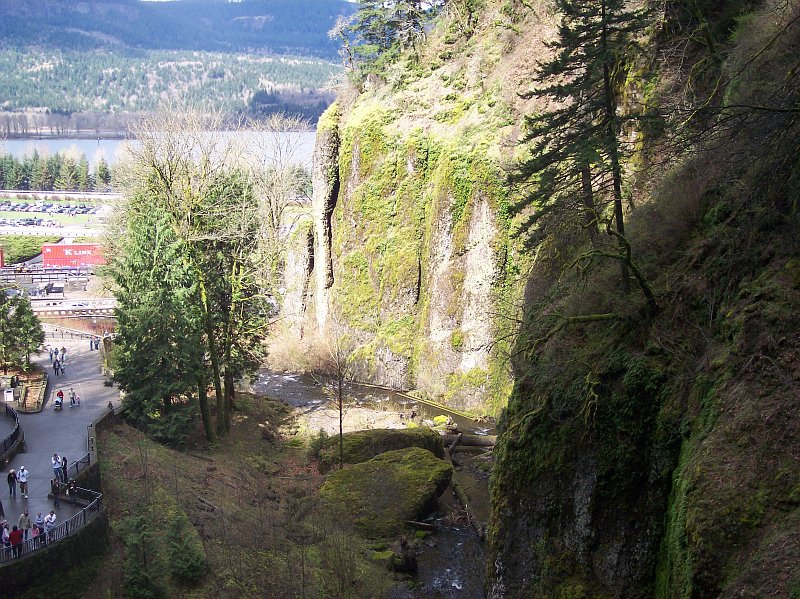
The massive basalt walls leap up to dominate our entire southern view. Multnomah Creek is pouring over the precipice, its crystal clear waters churned into a bright white, as though it had very tight knuckles. The forest crowds up to the edge of the cliff as if the trees were trying to catch a glimpse of what was going to happen to the water when it hit bottom. |
|
|

|
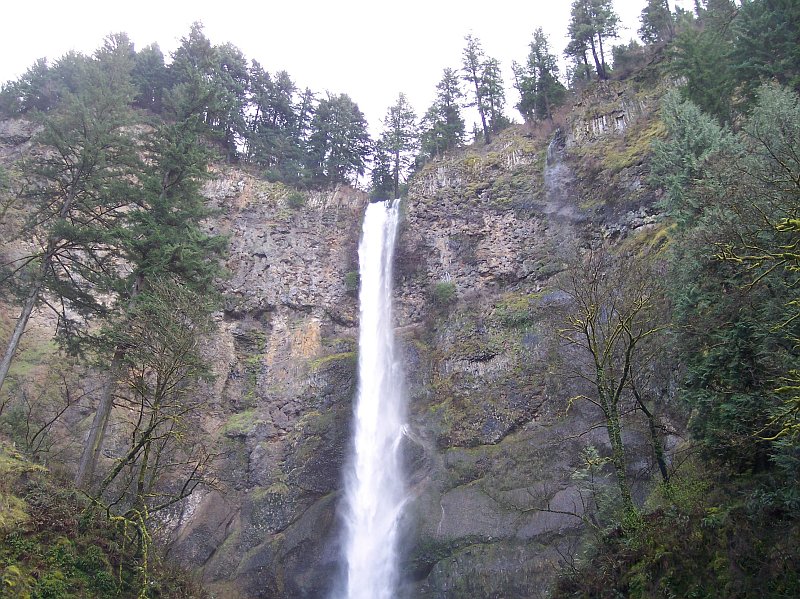
The hard, unyielding rock has been worn down by the unrelenting flow of the water. Bit by bit the rock is being taken away. Looking closely at the rock, we can see lava that has pillowed up into misshapen balls in the lower wall, but near the top the volcanic layer has cooled and formed into columns. Both of these types of basalt are found extensively throughout the Columbia Gorge. In spite of the trees and the moss covered rock; it is the falling water that captures our eye and makes us say, "Wow!" |
|
|
Working our way towards the falls, here are Barb and Dotti crossing the footbridge we saw earlier. They standing directly over Multnomah Creek as Tom is taking their picture. |

|
|
|
And here is Tom's artistic handiwork. Beautiful! |
|
|
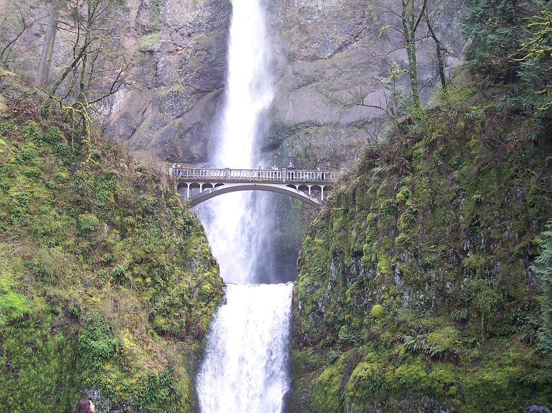
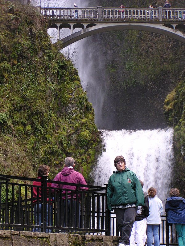
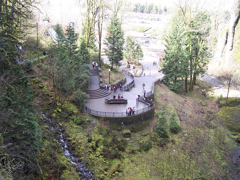
Peeking over the top of the concrete bridge we can see the 69-foot lower Multnomah Falls, just over the heads of the many visitors who are enjoying the falls. Higher up, the bridge across the lower falls has a number of people standing on it taking pictures. It is a fairly short walk up to that bridge, and very worth it! |
|
|
|
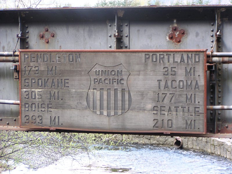
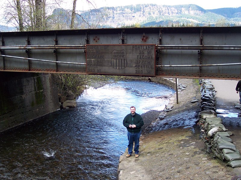
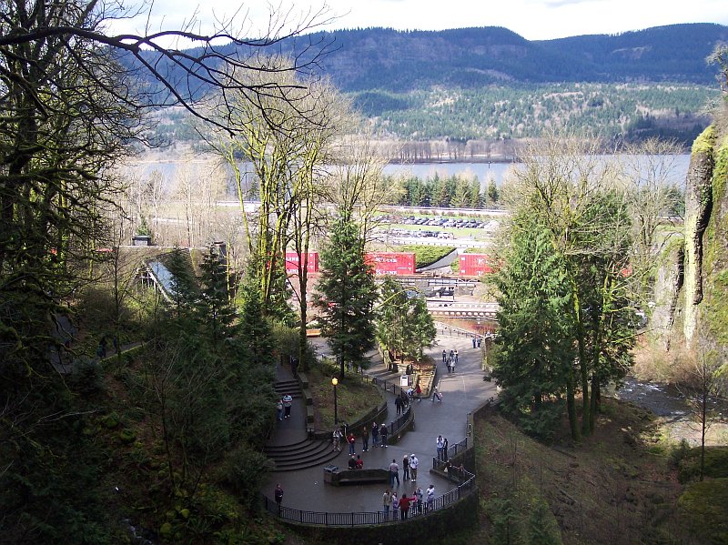
Right behind where Tom was standing is a steel bridge that carries the train track that runs to and from Portland to the west. On that bridge is this sign, letting us know how far the listed locations are. For Portland it lists: 35 miles. The freeway exit number is 31 for Multnomah Falls. The freeway (called I-84 today, but it was I-80N when Dotti and I first came here in 1974) begins at the Willamette River in Portland. The mileage on this sign is probably referring to the train depot in Portland, which might add a bit of distance to the trip. For the most part, the freeway runs right along the tracks. In fact on its final stretch of miles it is set right against the rails. (Old, pre-freeway maps of Portland show the rail running right where it is today, marking out where the freeway would one day be built.) |
|
|
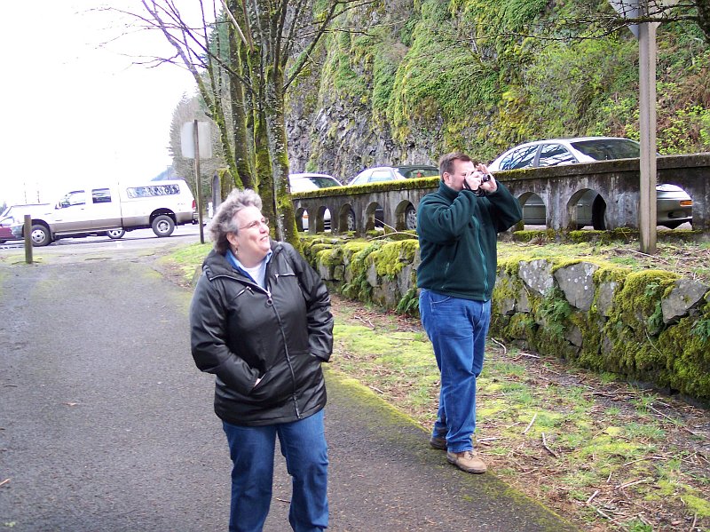
Here's Tom standing in the location he found for taking the picture of the ladies that we saw before, and the sign is right above his head. Notice the sandbags on the right of the picture, lining the walkway under the bridge. When the rain has been heavy, Multnomah Creek will rise, and it will flood the walkway if they don't put up the sandbags. Dotti has come to visit the falls when the water was up that high. |
|
|
|
Looking closely at the top of the falls. The water is pouring over on the right side of the depression cut in the rock in addition to the main flow to the left. In the summertime, when things are much drier, the flow to the right disappears and only a smaller flow to the left will be present. |
|
|
Pulling back so that more of the falls is visible. The layers of basalt are easier to see from here, and the trees at the rim look like haughty judges peering down at a condemned man. In the foreground the rock extends out for a ways and stops on both sides, allowing us to view the falls behind. The trees hanging on to the tilted terrain in seeming defiance of gravity. |
|
|
|
Multnomah Creek, flowing over this rock wall, has cut a deep channel that now is bridged by concrete. Day after day, year after year, century after century, the water continues its work and the rock must give way in time to the unrelenting flow. As photos testify, the cars and people come and they go, but the falls remain, changing ever so slightly, even after several lifetimes of men. Model-T Fords brought people to see this falls. The falls are still here. The rock wall has lost a few piecesone of the big ones fell shortly after we moved back here in 1995but by and large, ignoring the tinkering that we have done (bridges, roads, trails, and buildings), the falls look the same as they did when Lewis and Clark first laid eyes on them. |
|
|
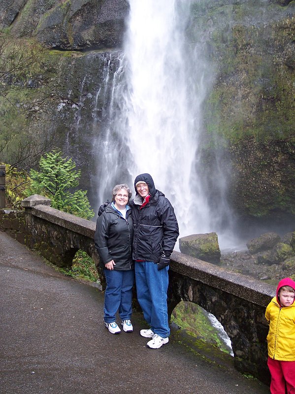
Seeing my beautiful Dotti with such a lovely background simply takes my breath away! The log behind looks like it is stretched out taking a nap next to the final fall pool of this great falls. The way the white water spreads out below the drop, and you can almost imagine the water drops shaking their little heads to clear things up a bit after dropping over 600 feet, and then swimming away from where they landed in the pool. The rock walls, covered in water seems like a pretty tough place to take up residence, but the moss seems to be loving it. Standing here, with Dotti smiling at me, I can honestly say, it just doesn't get any better than this. |
|
|
|
Dotti took the camera for this one, and got the rest of us in, with the lower Multnomah Falls behind us. You can tell that we are having a good time. Our day with nature has been very enjoyable with our friends! Things have started to cool off again. The spray from the falls, and the clouds overhead have made the coats very attractive. |
|
|
Barb in front of the falls. Looking right behind her, you can see that it is hard to find a place where you can take a picture at this natural attraction without having a crowd of people in it. Of the things I like about this shot that Tom took is the way it captures the feel of the high bridge, and the hint of the much higher falls above it. Wisps of mist extend outwards from the falls, gradually fading to invisible over the gray rock behind. |
|
|
|
This scene makes me think of a warm fireplace on a winter's night. With Tom and Barb keeping warm, the water falling behind, has spread out like fog, and hints at cold temperatures and a dark night approaching. We have moved up to the bridge and are above the lower falls. The water we are seeing here is part of the upper Multnomah Falls, and it has dropped 542 feet, hitting the rock wall on the way down, and with wind resistance working on it and pulling it apart. |
|
|
Barb is posed near the sign that describes the falls while the upper falls puts on its show in the background, while Dotti looks on from the left. This is the point where the trail up to the bridge dumps the people out into a "holding area, where they wait their turn on the bridge, which is on the left. I remember the time when I tried to see how fast I could get to the top and back and how difficult it was to move through this area quickly. |
|
|
|
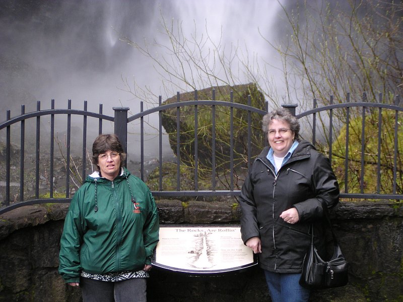
This time both of the ladies are standing by the sign; and we can see that the sign says, "The Rocks are Rollin'." Right behind the fence you can see a rock that was up on the wall at some time in the not too distant past. Rocks break off and fall, making the entire wall move backwards over time. This process has created a semicircular cathedral that surrounds the falls. |
|
|
Okay, I am not dressed in the "height of fashion" but I am warm, and I have my arm around the prettiest girl in the world. The rock surfaces in this area are always wet from the falls' spray, so the moss grows thick here. |
|
|
|
Another picture of Dotti and I, this time just beyond the bridge. Many rocks that have made a long drop from above lie on the ground behind us, with the mist from the falls, which took them down, covering them. |
|
|
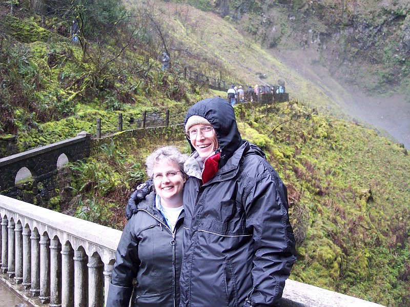
Tom and Barb standing in the same location. |
|
|
|
Looking down at the lower viewing platform where we were taking pictures only a few minutes before. |
|
|
A very similar view, also taken from the bridge, but this one is corrected to match the lighting out over the Columbia River. There is a train going over the train bridge that we looked at before, and even the mileage sign is visible, though not readable. Out behind that you can see the freeway's parking lot, and finally the Columbia River, marking the dividing line between Oregon and Washington. The mountains in the distance are in Washington State. |
|
|
|
We can follow the path of Multnomah Creek in this picture, as it heads for the bridge we walked across to get here from our car, and on to the Columbia River, which will take this water out to the Pacific Ocean. The sharp rock walls are covered with life that loves the wet surroundings created by the falls. |
|
|
Looking down at the lower Multnomah Falls, with its moss covered rocks on either side. It hardly seems like 69 feet that it is dropping from this angle. |

|
|
|
Dotti and I had a great time hiking with Tom and Barb, and hope it won't be too long before we can do it again! |
||
|
|
||