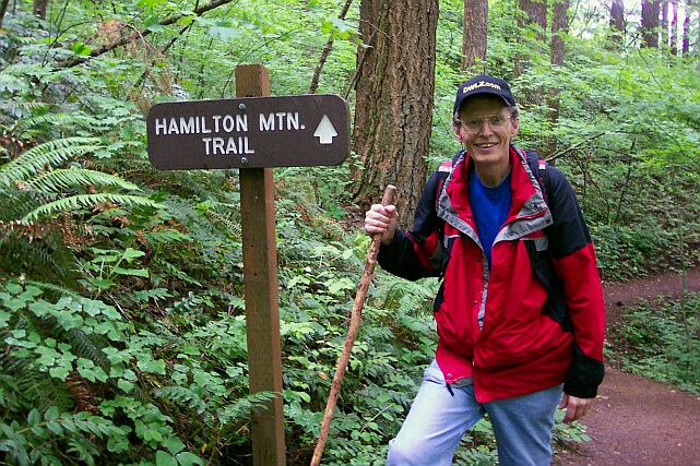
HAMILTON MOUNTAIN
June 13, 2004
The Coon Family Hiking Club
Official 2004 Hike #4
7.6 miles - 6 hours 30 minutes
|
|
Hamilton Mountain is a hike that I had been thinking about for over a year. It is located on the Washington side of the Columbia River, and situated right beside Beacon Rock, which we had climbed back in 1995 or so.
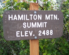
The parking lot is 400 feet above sea level, and the summit is at 2,488 feet. So, we had to climb over 2,000 feet to reach the top. Since we had not been doing a lot of heavy duty hiking this season, it was quite a task to take on, but Dotti felt ready to give it a try, and that was good enough for me. 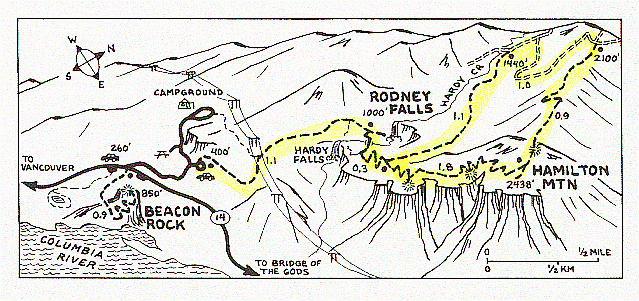
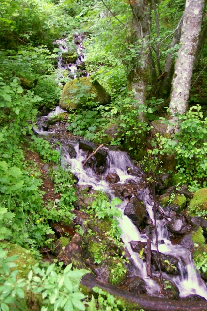
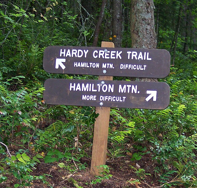
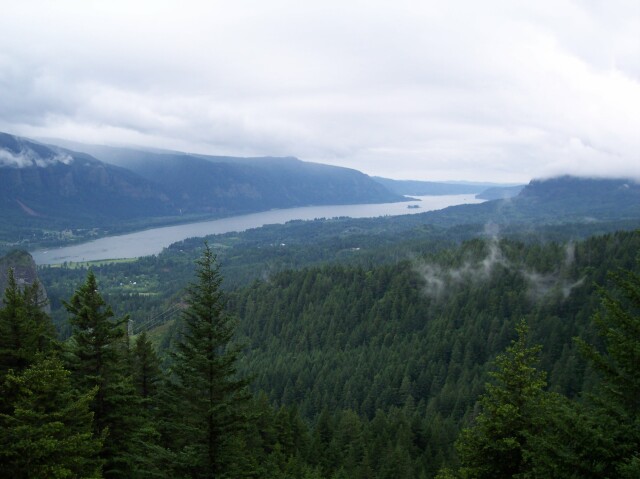
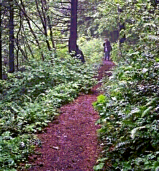
(Click for lager image) The trail runs for 1.1 miles, from the parking lot past the junction with a path that comes from the park campground, right under power lines coming from the Bonneville Dam, and up to two very pretty waterfalls, located at an elevation of 1,000 feet. From the falls it goes another 0.3 miles on the level to a Y in the path. There we had to choose whether to take the "difficult" path or the "more difficult" path. (To show the difference between them: the difficult path climbed the 1,488 feet to the summit in 3 miles, while the "more difficult" path climbed it in 1.8 miles.) Both paths led to the top, and in the end we did the loop that encompassed both paths. From the junction to the 2488-foot summit, via the "more difficult" path, we walked the 1.8 miles. We had gone 3.2 miles by the time we reached the summit, but they were definitely the hardest miles of our hike for the day. From there on it was nearly all downhill! (The downhill walking caused us some joint pain, but we completed it much faster, and it was far less tiring.) From the summit we headed down the path that had been labeled "difficult" on the sign at the Y. We went nine-tenths of a mile to a dirt road at 2,100 feet of elevation. The trail shared the road for a mile, losing altitude fairly quickly, until it split off on its own again at the 1,440-foot level. On we walked down another 1.1 miles until we reached the Y sign once more. From there we retraced our steps the 1.4 miles back to our car to complete the 7.6 mile hike. Before reaching the summit, I had worked up blisters on the heels of both of my feet, and another advantage of heading downhill for me was that my feet were pushed forward away from the backs of my boots, and as a result the blisters felt better. |
||
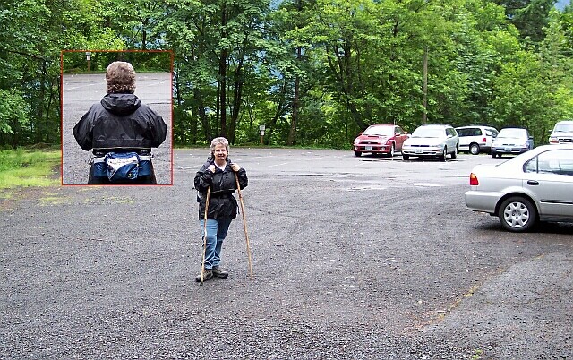
| Here is my lovely Dotti in the parking lot, holding both of our walking sticks. From the rear you can see her "fanny pack" where she had her camera and some other items for the hike. Off in the distance you can see our white van. When we got here we found that there was a $5 parking fee. Unfortunately, I didn't have a $5 bill, and so I had to drop $10 into the pay box. In spite of that, I have to say that I got my money's worth on this hike! | |
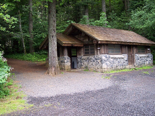
| We always like to see a nice restroom at the trailheads for our hikes. It gets you started on the path on the right foot, so to speak. And they are handy when you get back down off the trail, after drinking all that water along the way. The stone and log construction fits in well with the setting. |
|
|
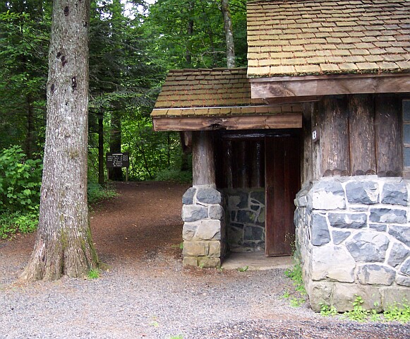
| Looking past the restroom, the sign marking the trailhead is visible. | |
|
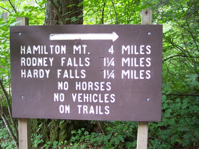
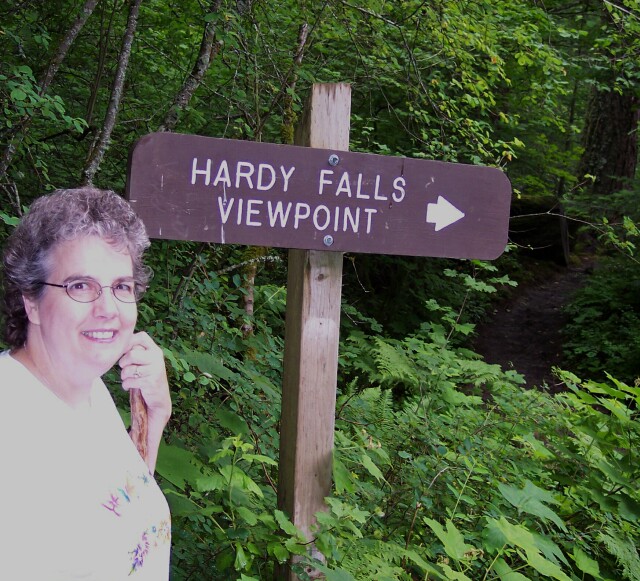
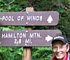
On that sign you can see that Hamilton Mountain is listed as being 4 miles away. They sort of rounded and left it up in the air as to which way you were going to go, later on when they gave you a choice. One path actually leads to the summit in 3.2 miles. The other leads you there in 4.4 miles. I think they were assuming that you were going to take the latter, and they rounded the distance downwards. Or perhaps they were aiming at some part of Hamilton Mountain other than the summit. Rodney and Hardy Falls are just a short walk up the trail. I would imagine that there are a great many people who come here just see the falls. We saw a large number of people heading up the trail as we came down from the falls area towards the parking lot. It was a bit late in the day to be trying to make the summit, so we assumed they were going to the falls and then returning.
We were disappointed that no horses were allowed on the trail, but we managed to get along without Trigger or Silver.  Later on we did come across an equestrian trail, so horses are welcome in the area, just not on this part of the trail. Later on we did come across an equestrian trail, so horses are welcome in the area, just not on this part of the trail.
|
|
|

|
Dotti looking at the sign, and showing her grief at having to leave the horses behind.
|
|
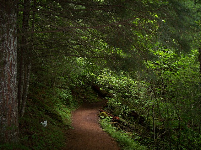
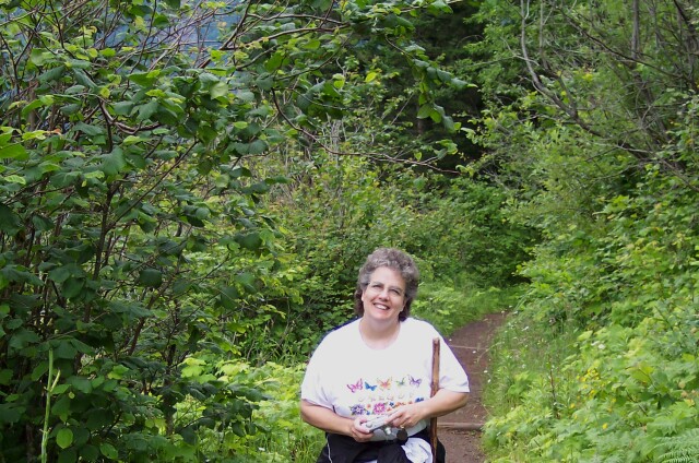
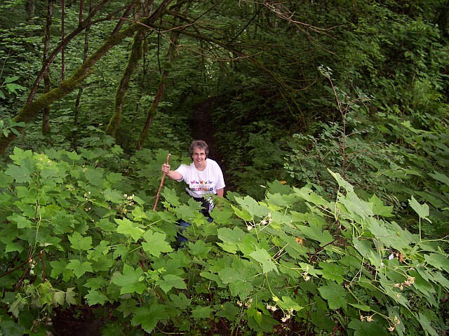
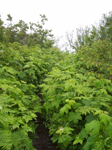
| This looks like a storybook entrance to a wonderland of adventure. We had a great day for walking. The temperature was in the 60s all day, and though it rained, it was never oppressive. Our pants stayed free of rain water for the most part, with just a bit of wetting along the bottoms just after we hit the summit and heading down the other side. There was a great deal of shrubbery pressing into the path area, and it was wet from the rain. When the rain was actually falling, we were safely tucked under the trees, and they took good care of us, keeping us dry. |
|
|
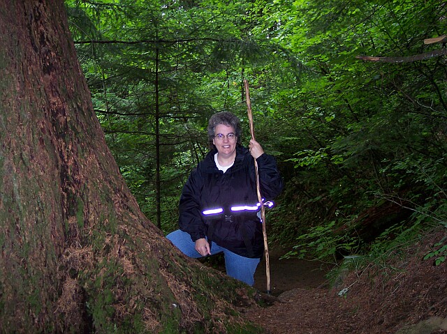
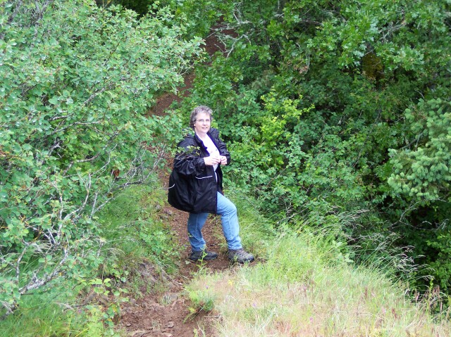
| Dotti looking past a tree alongside of the trail. Her coat has a reflective strip on it that always jumps out at the camera when the flash is on. | |
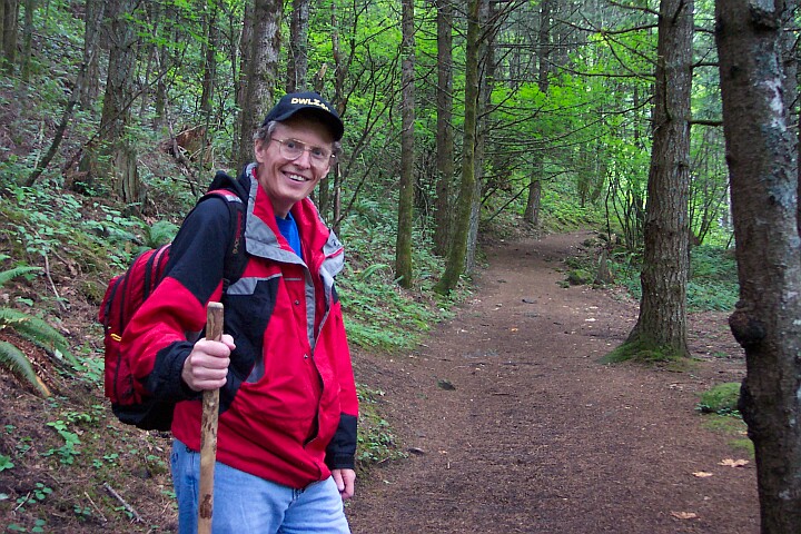
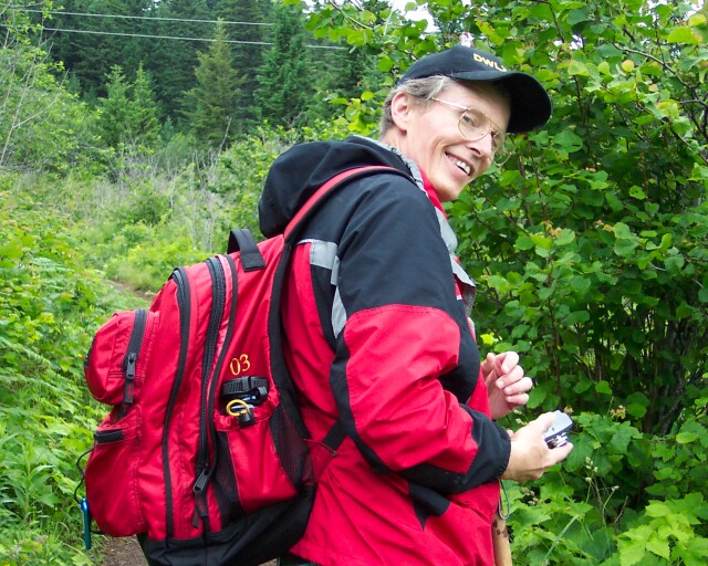
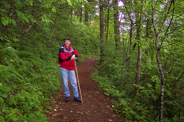
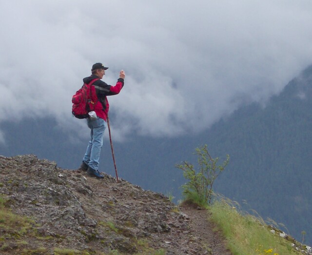
| Yours truly, sporting my backpack, DWLZ.com ball cap, and my walking stick. With the cool temperatures, I was able to wear the coat throughout the entire walk. |
|
|
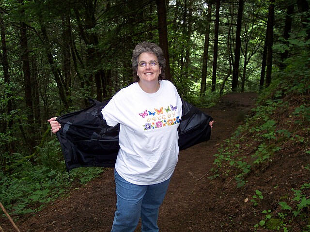
| Dotti was already warm and ready to dump her coat. | |
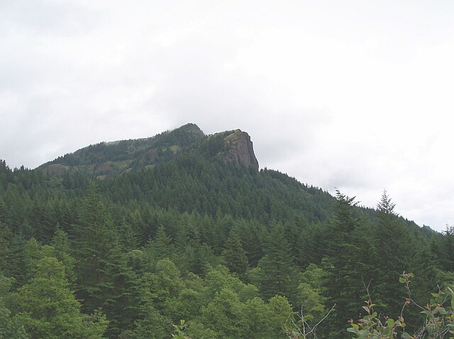
| This was taken at the point of the walk where the power lines crossed our path. Up ahead the peak of Hamilton Mountain calls to us. Later on, when we got to the area right at the base of rock face you can see there, we thought we were as high up as we were going to go. We were sadly mistaken! We actually were going to go up to the top of the second little peak, above that rock face, before we were through. |
|
|
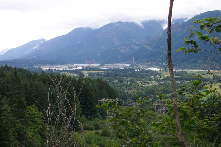
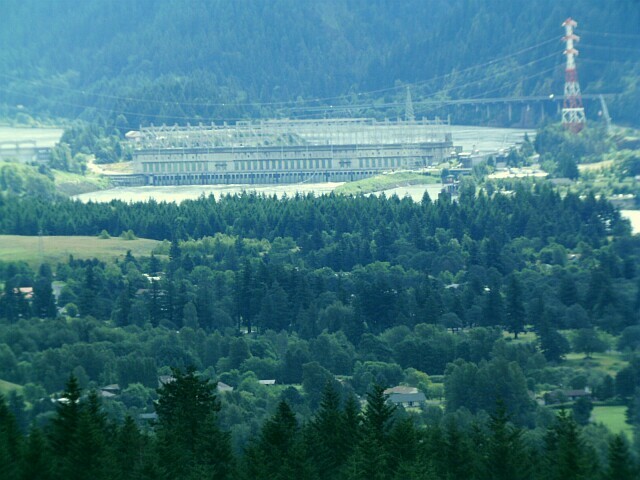
| Looking down from our vantage point we could see the Bonneville Dam, and its power lines running up the hill. Bonneville Dam was designed to be the number one power producing dam in the country. If its capacity were realized it would top the Grand Coulee Dam of Central Washington. However, in order to save the salmon that use the Columbia River, and for other environmental reasons, the dam will probably never be fully brought online. Even so, it is still quite impressive. | |
| Here we were testing our binocular camera out. The camera is focused on the right segment of the dam, bringing it up much closer than in the previous picture. |
|
|
| With the power lines above me, and the trail in front of me, Dotti caught me looking back, camera in hand. | |
| Dotti standing under the power lines as we are getting set to move up the trail towards the falls. |
|
|
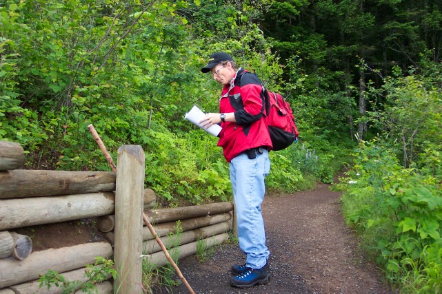
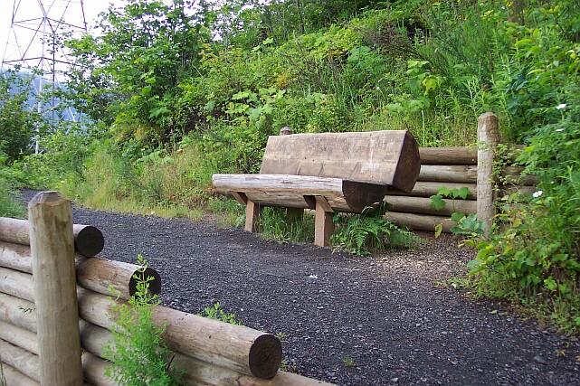
| There was another trail that came in to join our trail and I was checking the map. The trail was from the campground off to the west of us. | |
| Here at the junction of the two trails they built a bench out of a log. It was definitely worth a picture. |
|
|
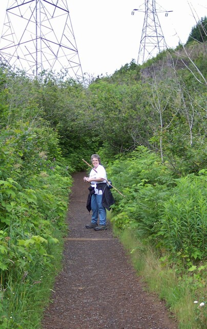
| Making our final move through the power line area. Dotti has her coat tied around her waist, her walking stick tucked under her arm and camera ready to go. | |
| Back in the forest, away from the power lines. |
|
|
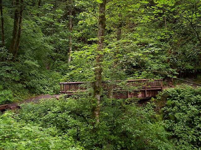
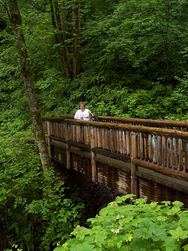
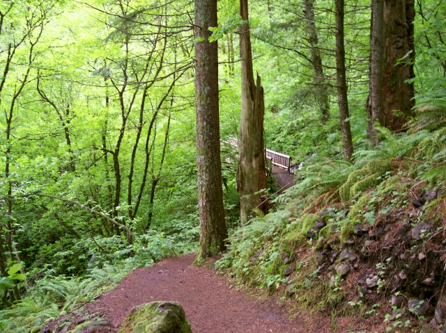
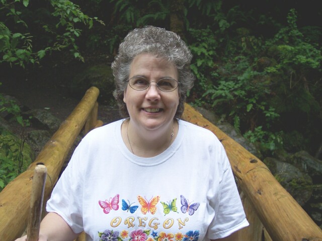
| We saw several really pretty bridges on this hike. This bridge was made from rough cut timber, and it really looked like it belonged in the forest. | |
| Dotti enjoying the view from the bridge. The coloration along the base of the bridge almost looks like it is resting in water, and we are looking at reflection. But the water is far below the bottom of this picture. |
|
|
| We are at the first falls. There was a little path to walk down in order to view the falls, and off we went to investigate. | |
| Can you tell it had been raining? This section of the path was really muddy! |

|
|
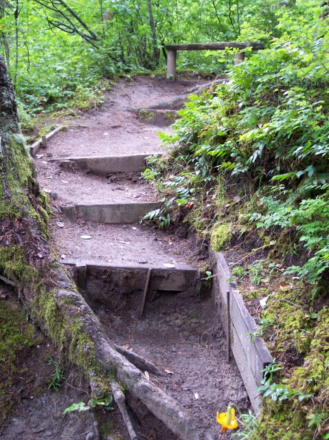
| I took a picture of this part of the trail because on the bottom step shown, Dotti took a wrong step and hurt her knee. I was worried that it was serious, but the pain passed quickly and she did the rest of the hike just fine. | |
| Dotti coming down some more steps to the viewing area. |

|
|
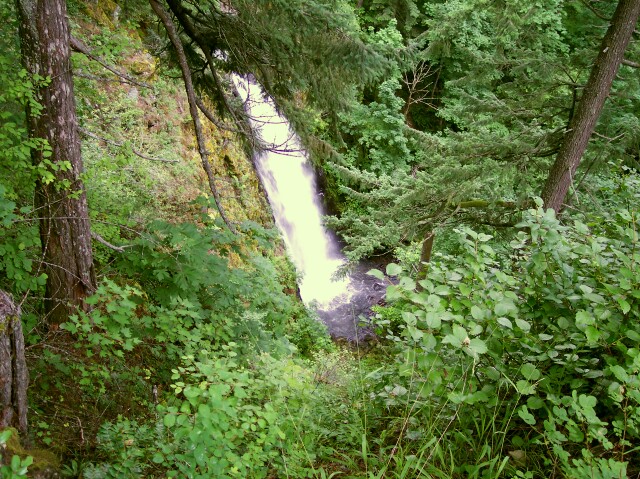
| At last, we got to view Hardy Falls. It is a pretty falls, but unfortunately, we could not get any closer than this, and this was the best shot we could get of the falls. | |
| This little creek was running alongside of our path as we headed back up to the main trail. |
|
|
| We found an alternate path back up to the main trail, and it cut out many of the stair steps that we would otherwise have had to take. It was "the road less followed" but we were glad we found it, and Robert Frost would have been pleased. | |
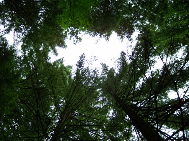
| As we walk through the forest, all too often we forget to look up. The trees were towering above us and provided a fairly functional umbrella whenever the rain cut in. |
|
|
| Looking backward down the trail we just came up, and at a bridge we crossed. The lush greenery even hangs on to the stones alongside the trail. | |
| Rodney Falls was the highlight of our hike. It's features included a 50-foot drop into an enclosed drop-pool (Pool of Winds), whose exit slot was filled with wind, mist and rushing white water, followed by a long cascade downward across angled rock surface, under a bridge, and on to the top of Hardy Falls. When you click on the picture at the right you will be taken to a separate page with our Rodney Falls pictures. |
|
|
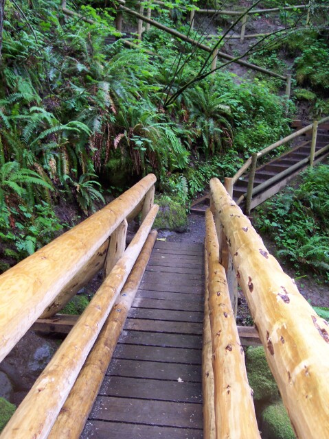
| The lovely Dotti, hiking in Washington with her Oregon shirt on, crossing the Hardy Creek bridge that lies between Rodney Falls and Hardy Falls. | |
| Taken from directly over Hardy Creek, looking up the trail in the direction of the Hamilton Mountain. As soon as we cross the bridge, we are faced with a series of switch-backed stairs to get to the top of the Hardy Creek canyon. |
|
|
| At the top of the stairs and on our way along the Hamilton Mountain Trail. | |
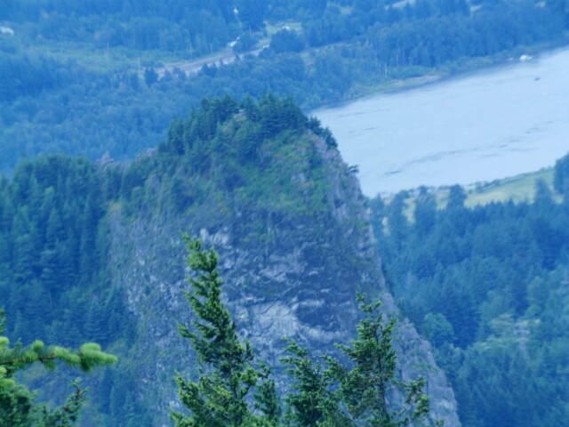
| From this viewpoint you can see that we are just about even with the top of the 850-foot Beacon Rock. To the right of the rock, nearly hidden in the mist is a high-tension power line tower, marking the lines that we crossed early on our way. The Columbia River Gorge looks eerie in this light. |

|
|
| Here we came to the big decision point. Did we want to take the newer (1976) path that was merely "difficult," or did we want to go the "whole 9 yards" and get the total Hamilton Mountain experience? | |
| Yep, you guessed it. We went for the "power hike." There were points along the way where I was not sure the right choice had been made, when my heart was racing and my wind was running low. However, when we reached the top, we knew we had made the right choice. |
|
|
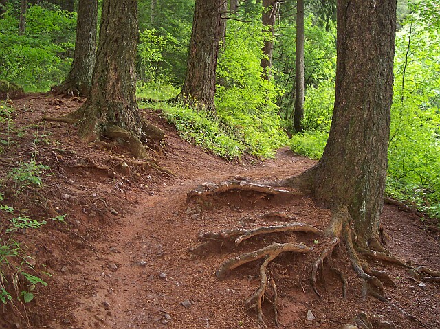
| One of the problems that trees have near a walking trail, is that their root system tends to get exposed. You can see here that this tree has a lot of its roots lying above the ground. | |
|
Dotti was nice enough to push the front tree aside for this picture so we could see the one behind. In spite of the cloud cover and mist, the light was good, and some of the green simply jumped out at us.
Dotti had once again put on her coat, because the rain had started to fall and the temperature dropped a bit. |
|
|
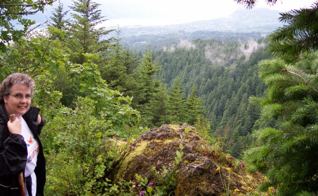
| Dotti caught me at the top of a hill that I had I climbed for a better view. My map packet was hanging out of my back pocket, and the Gorge was in my sites. | |
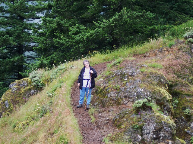
| Looking back at Dotti from my vantage point. She was smiling brightly, because we thought we were nearly at the top. The trail we were about to walk lies behind Dotti, and as you can see it is moving upward. It continued to move upward for a long time to come. |
|
|
|
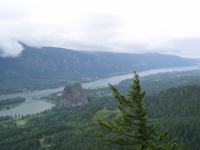
Meanwhile, you can see the view we were enjoying. We are well above Beacon Rock now, and the Columbia River is flowing off into west at the right of this picture. Once again the power lines we were standing under earlier are visible at the bottom of the picture.
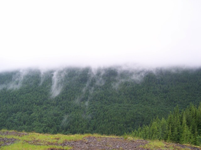
There was a constant high overcast that day, and there were lower clouds that came and went. At the upper left of this picture you can see one of them moving down the Gorge. |
|
| Moving my camera to the right, showed the Washington side of the Gorge, and the low clouds sitting on the mountaintops. |
|
|
| In this picture you can see the wisp of clouds resting on the ridge just below our position. The lovely Columbia River flowing down its Gorge is strikingly beautiful. | |
| Once again testing out our binocular camera, I zoomed in on the top of Beacon Rock, were you can just see some people standing between the trees. Dotti and I climbed that rock when we first moved back into the Vancouver area, and the thing I remember the most about it was that it was very windy; something that we were reminded of in a more direct way later on at the Hamilton Mountain summit. |
|
|
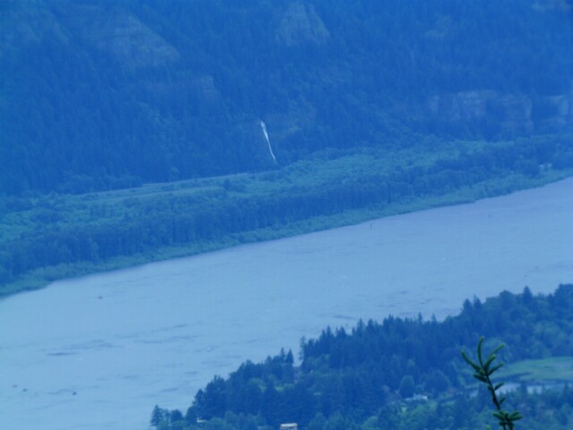
| To the right of Beacon Rock we saw Horsetail Falls clearly standing out on the Oregon side of the Gorge. At first we were wondering whether it was Multnomah Falls but it was not carved back into the basalt wall, and checking a map later, it was definitely Horsetail Falls. As bright white as it is, there must be a lot of water flowing down the falls! | |
|
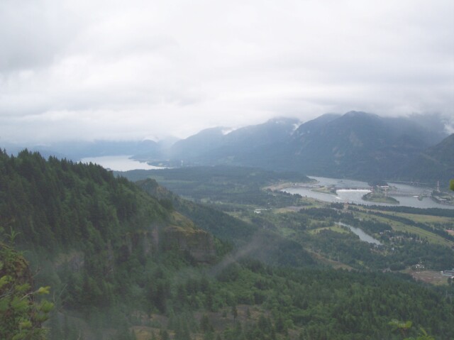
We were getting hungry and looking for a good place to eat our lunch. We passed by a viewpoint with an excellent view below it, but the ground was wet, and the wind was blowing, so we decided to look for some shelter. We ended up eating behind where I am standing in this picture a little ways, under some trees.
Off to the left the low hanging clouds are seen resting on the mountaintops behind me. |
|
|
| There is a large range of contrast in this picture. The rock foreground, several types of trees near Dotti, the distant hilltops falling away below us, with white clouds skimming along like white caps on a restless ocean, and the whole view fading into misty clouds in the distance. | |
| One last shot of Horsetail Falls in the background, with my lovely wife in the foreground. |

|
|

|
Here's Dotti with our lunch bag, standing in the sheltered area where we ate our lunch. I had carried the bag, with our lunch in it, up in my backpack, and we used it to carry all of our garbage back out. (The Forrest Service promotes the slogan "Leave No Trace" for hikers and campers, and we try to abide by that.)
This is our first hike where we actually took a real lunch with us. And I think it may become a regular tradition for future hikes. That extra energy really came in handy for the rest of the hike, and we felt better at the end of the walk as a result. |
|
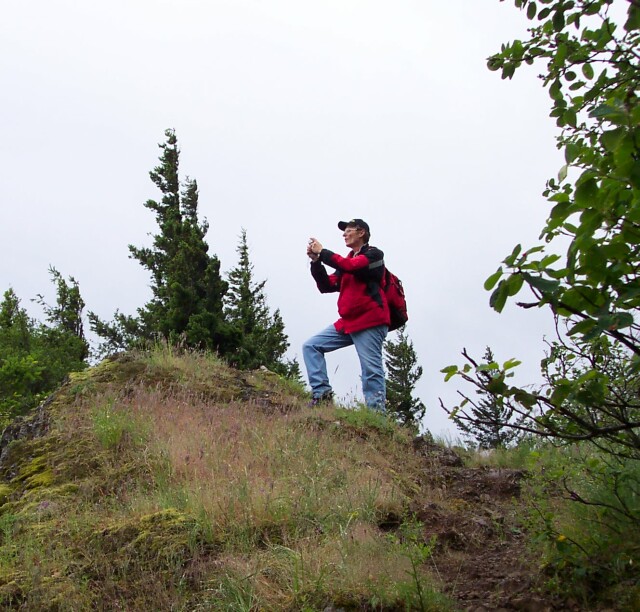
| Dotti caught me one more time at the top of a hill in search of a better view. |
|
|
|
Here you can see the stuff of legends lying at your feet. Off to the left, behind the hill blocking our view, there are cliffs that were created by a huge landslide that occurred 500 years ago. Landslides are common in the Columbia Gorge, and sometimes they are big ones. This particular landslide ran all the way across the Gorge and dammed the Columbia River behind a 200-foot wall of shattered rock, and created a lake that stretched back nearly 70 miles up the Gorge!
After a few months the water reached the point where it topped the dam, at its lowest point on the south side of the Gorge. The water quickly eroded a path and sent a huge flood 100 feet deep into what is now the Troutdale area just east of Portland. Once the water cleared away enough of the debris the only remaining results of the landslide were these: the river had been pushed 1 mile out of its old channel to the south; and the Cascades were formed. The Cascades were a set of very rough rapids, and they were what the Cascade Mountain range was named for. Today they are no longer visible, because they are buried beneath the water backed up behind the Bonneville Dam. However, the settlers coming along the Oregon Trail found them to be a formidable obstacle to their progress. The Indians have a legend about the "Bridge of the Gods" that was based upon this event, when people could just walk across the Columbia River, at least for a short time. Today there is an actual bridge called "The Bridge of the Gods." It lies upriver, just around the bend created by the landslide, and just before the normal channel is returned to by the Columbia River. It would be visible in this picture but it lies lower than the landslide debris that is between the camera and the bridge. |
|
|
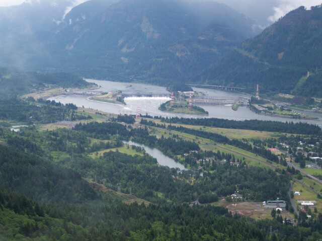
A close up of Bonneville Dam. You can see how they used the natural island masses to build off of, and build sections of concrete to block the separate river channels. The narrow channel created by the "Bridge of the Gods" landslide made this an ideal location for a dam.
Off to the right you can see Interstate 84 (named Interstate 80N in 1974 when we lived in Portland) as it runs eastward past the dam from right to left in the picture. Between the dam and us, Washington SR-14 runs along a parallel course on the north side of the river. |
|
|

| A close up, using the binocular camera. Visible is I-84 at the top of the picture, a ship on the river behind the dam, and the high voltage wires heading from the dam towards the place where our path earlier in the day ran underneath theirs. | |
| Looking back at Dotti from my vantage point. |
|
|

| And we thought we were nearly there. We still had to not only climb to the top of these rocks, but up to another peak even higher still. As they say, "ignorance is bliss" and it was nice thinking that we were about done with the hard stuff. | |
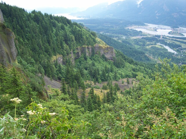
| Looking out across the floor of the Columbia River Gorge around Bonneville Dam. The walls of the Gorge have expose rock that was stripped bare by the Bretz floods thousands of years ago, at the end of the last ice age. The rock itself was laid down by the second largest lava flow on earth that ran all the way from Idaho to the Pacific Ocean! And aside from all of that, it is just plain beautiful to look at. |
|
|
| And speaking of beautiful to look at, here is Dotti walking up the trail to say hi in this animated gif. | |
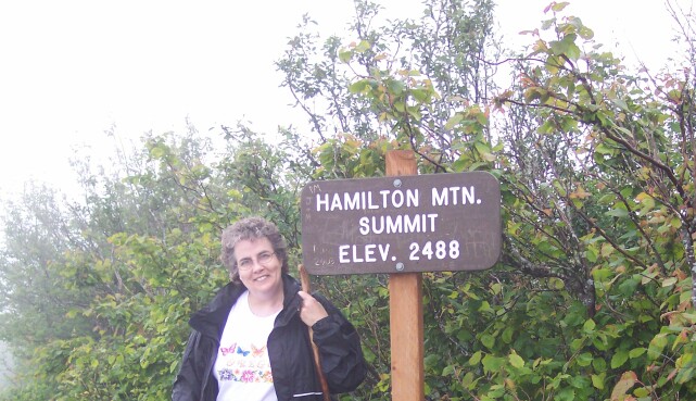
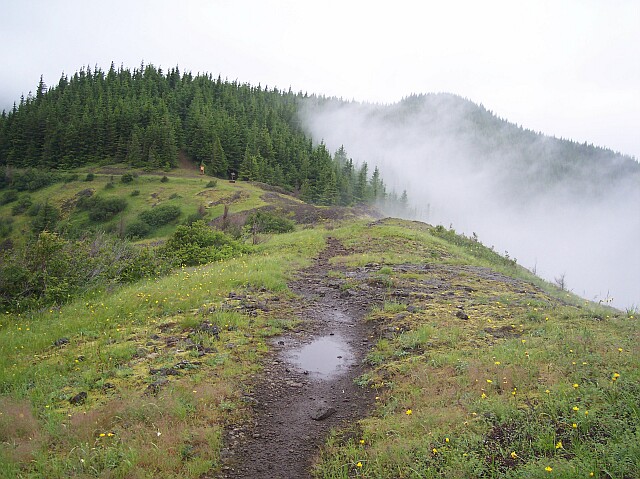
| Well here we finally are at the summit. You can see the misty clouds hanging about the trees in the background. |
|
|

|
I was happy to have something to lean on at this point. I was feeling really tired, and happy to be at the top. There was a sign off to the side that someone had scratched a comment on that said something like, "Be happy, it is only 4 miles back to your car!" Sarcasm is a beautiful thing.
Behind me there is a trail that we did not take. It leads downward in elevation about 50 feet, to a viewpoint. However, we were ready to continue on downward towards our car. On a clear day we would have certainly gone on to the viewpoint, but not this day, especially since we had seen pretty much the same view from several locations on the way up. Maybe next time. |
|
| From here the path changed. Previously, on our way up, we met a lady headed down from the summit, and she seemed astounded that our pants legs were completely dry. During the heavy rain, we had been protected by the trees, and there was no heavy growth up close to the path. As we started to move downward from the summit on the part of the loop that had been previously labeled "difficult" on the sign at the Y, we found that things had changed. Now, we had low growing plants that brushed up against us as we walked. We were able to use our walking sticks to keep much of it off of us, and the rain had passed some time before, so they were not as wet as they would have been during an actual rainfall. When all was said and done, my pants legs were wet only about as high as my boot tops. Since my boots are totally waterproof, that was not a problem at all for me. |
|
|
| Once we cleared out of the undergrowth, we came out on a ridge that headed down to a picnic table underneath a sign. Right now you can see that the area around the sign is empty, but by the time we got there a group of about 5 people showed up wearing tee shirts and tank tops. As soon as they got to the picnic table they immediately broke out their coats, because there was a stiff and cold breeze blowing by. The clouds were hugging the hill tops around us and the ground was wet. | |
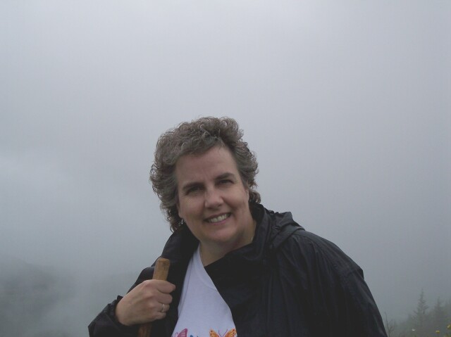
| Here is my lovely Dotti with the clouds forming an interesting background. From one moment to the next the surrounding terrain could be in clear view with plenty of light, or it could be completely covered in clouds. |
|
|

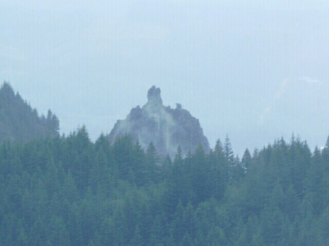
| This is a picture of the Gorge looking east. The clouds were too heavy to see much. There was an interesting rock formation near the center of the picture. I had to get a close up of it with the binocular camera. | |
| It seems that the rock was formed from a volcanic uplifting of some kind. There is a rounded dome with an extended protrusion out its top. |
|
|

| Looking back up to the top of Hamilton Mountain. The clouds were high above, brushing up against the eastern hillside and forming the background. | |
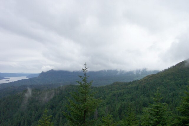
| Looking west it almost looks like a forest fire was sending smoke up into the sky, rather than clouds dropping out of the sky to engulf the mountaintop. |
|
|
|
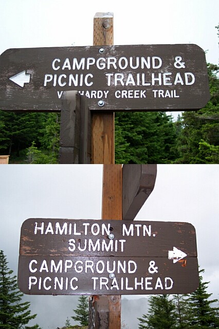
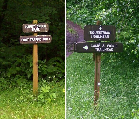
Dotti asked the people who were at the table if they would mind us taking some pictures over their heads of the signs there. They were friendly and happy to cooperate.
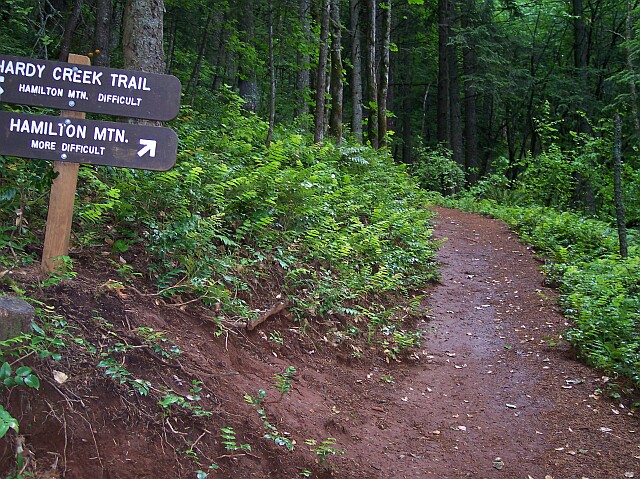
The top sign pointed to the "Hardy Creek Trail" that we were going to take back down to the car. The lower sign pointed to the route we had just walked, and on its list of destinations it included "Hamilton Mtn. Summit" in addition to the campground and picnic trailhead. |
|
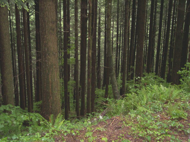
| Dotti took this shot of the trees along our path as we were walking down the gravel road portion of our hike. The trees were close together and fairly evenly spaced. |
|
|

| This is the part of the trail where we were walking on the gravel road. We had a large downhill incline for a lot of this part of the hike. Our knees and hips were not really happy with this, but our muscles, including our hearts were very pleased. | |
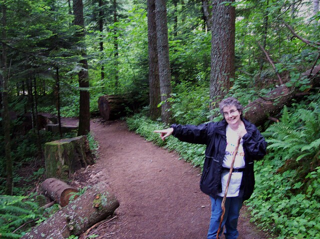
| Here we reached the point where the road and the foot path parted ways again. Off to the right the road continued on, and to the left our path awaited us. |
|
|
| The left sign in the previous photo is shown here on the left. It indicates that we were about to set off on the Hardy Creek Trail and that we once again had to proceed on foot. The sign on the right showed that those with horses had to proceed straight ahead on the road. | |
| We soon came across one of our old friends: the volcanic debris landslide. All four of these shots were taken while we were standing on the landslide field. The top image is looking up from where we stood, and the bottom was taken looking downward. The left shot was of our path from which we came, and to the right is the view looking down the path towards our destination. Although this was not as large as the one we had to cross on Larch Mountain, the path felt very narrow here. Fortunately the sun was not beating down, so the rocks did not radiate heat to make us uncomfortable. |

|
|
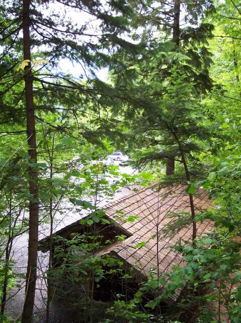
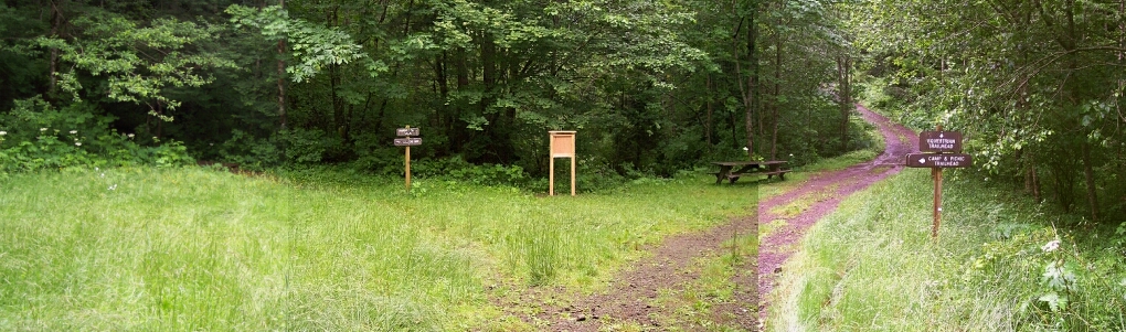
| Very soon after that we had joined up with the trail that we had originally ascended, and we followed it back to our car. Looking out from the trail in this view, our white van is visible through the trees, with the restroom sitting just below. We were happy at this point that both of them were there awaiting us. | |
| Dotti was very happy to see our car finally. The hike was drawing to a close. Our legs were tired and we were ready for some rest. |
|
|
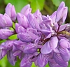
| Along the way Dotti took some pictures of the flowers, leaves, and even a bug we saw. Click on the image to the left to go to the flower page of our walk. | |
|
|
||

(Click for lager image)