TRIPLE FALLS HIKE
February 26, 2006
The Coon Family Hiking Club
Official 2006 Hike #1
LENGTH OF HIKE 4.5 miles - 3 hours 52 minutes
|
Our first hike of 2006! We have set our goal to get in more hikes this year, and to try and find some new ones to do. This is the earliest start we have had on our hiking season so far, and that helps in setting us up for the first goal. However, we have done the Triple Falls hike before in 1997, before Dotti's Weight Loss Zone, and then in 2003 as our second Coon Family Hiking Club hike. So, we didn't hit a new one yet, but I am sure we will be getting some in before the 2006 hiking season is over.
|
||
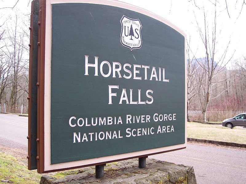
| When we got into our car, our destination was the Horsetail Falls parking lot, because from there it is a short walk to the trailhead of the path leading up to Triple Falls; and that was a real destination for our trip. These falls were created by the same forces that produced Multnomah Falls, and so many other falls along the Columbia Gorge. Instead of having numerous streams flowing gently into the Columbia River, as was once the case, there are streams dropping suddenly hundreds of feet in beautiful breath-taking white displays. The Brentz Floods(1) are said to be responsible for these conditions, as they sent hundreds of cubic miles of water through this area, filling this tremendous Gorge nearly to its top, and ripping out the sides of the Gorge walls, leaving the streams to fall such a long ways. While it must have been a very scary thing to behold, especially if you were unfortunate enough to be at the base of the Gorge when the rumbling sound of rushing water was growing to unbearable levels just before you saw the wall of water coming at you thousands of feet tall, today we reap the benefits of it, in being able to witness so many beautiful waterfalls. | |
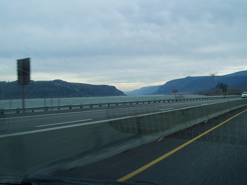
| Here we were driving along Interstate 84 (called Interstate 80N in 1974 when Dotti and I met here) and looking east into the mouth of the tremendous Columbia River Gorge. The sky was over cast but the predicted rain had not started yet. The surface of the Columbia River is marked with white caps, whipped up by the stiff breeze blowing out of the Gorge, carved out of the Cascade Mountains. We were happy with the temperatures for our hike, and we had our rain gear along so we wouldn't get wet when the rain did cut loose. |
|
|

| Here we had just pulled off I-84, and were turning onto the Columbia Gorge Scenic Highway. This turn off was marked for Bridal Veil Falls, but it also is the exit for the Angel's Rest trailhead. We were a little concerned when we saw that the Angel's rest parking lot was filled up. Had we come later than we should have? During the summer, we always try to get to our trailheads by 8 AM, to avoid the crowds. However, in February, on a day when it was supposed to rain, we thought that 9 AM would be plenty early enough. As we were driving along just after this picture was taken, we got a call from Dotti's brother Rip. He said that he was already at Horsetail Falls, and he was the only one in the parking lot. Good news! | |
|
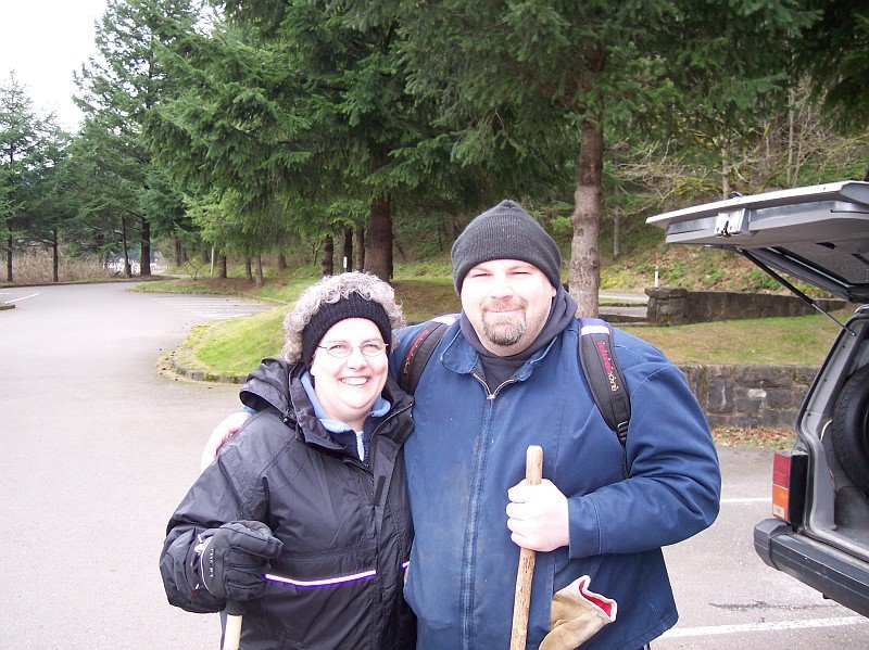
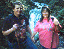
My lovely Dotti and her brother Rip. The temperature was just above 40°, but the wind was cutting right through our jackets. Rip, being a die-hard local Oregonian, was wearing shorts, but he did have a jacket and knit cap on. (He graciously offered to carry the backpack as well, where our lunch for the trail was stashed.)
Dotti had her ears protected with the knit ring, and was bundled up with a jacket and rain coat, and her hands were warm in her "skiing gloves." You can tell its the winter season by the foliage behind them. The evergreens change very little throughout the year, but you can see the brown bushes near the ground, and some bare branches on the trees on the right side of the picture. We all felt a bit chilled at this moment, but we knew it would pass soon, once we were on the trail moving. (What we didn't know for sure at this point was that just a bit into the hike, we would be moving far enough back into the forest to where the wind would die down to nothing, and then we really warmed up.) |
|
|
|
Rip explained that he nearly always closes his eyes when a picture is being taken. I probably was a holdover from his younger days when the white light in his eyes after the flash had blinded him was something he wanted to avoid. We put his statement to the test during the day, and he was right. J
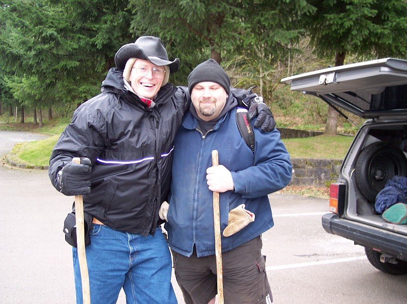
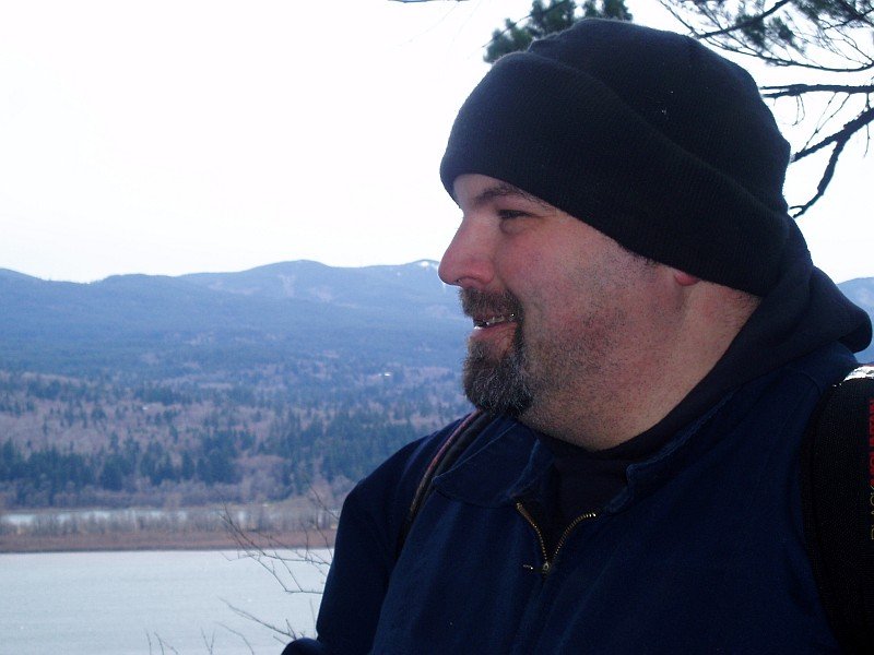
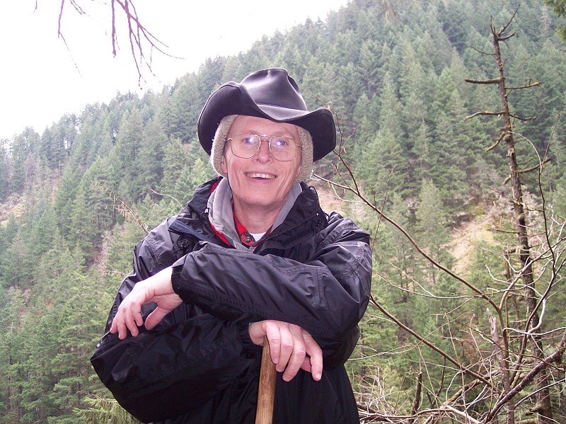
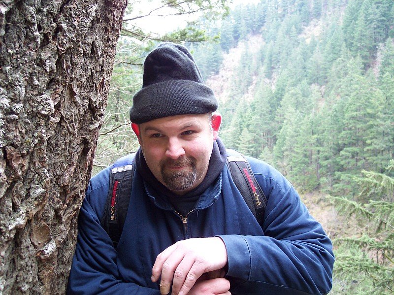
I was ready for the cold and the wet. I had my red Columbian jacket on beneath, and my raincoat on top. I also had on my knit cap for the cold, and my cowboy hat on to keep the rain off. My ski-gloves were very welcome at this point, because I had just put on my hiking boots, and tying up the laces and left my fingers feeling a bit numb. We were all eager to get moving, so we could warm up! |
|
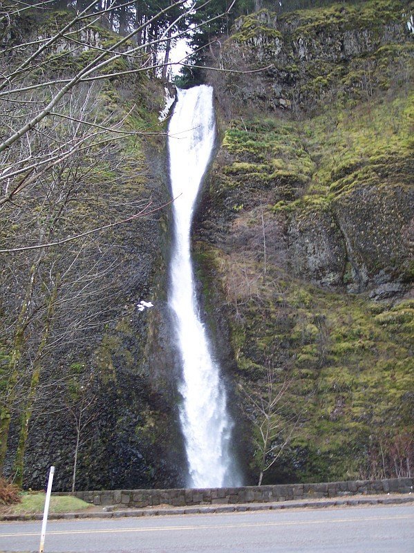
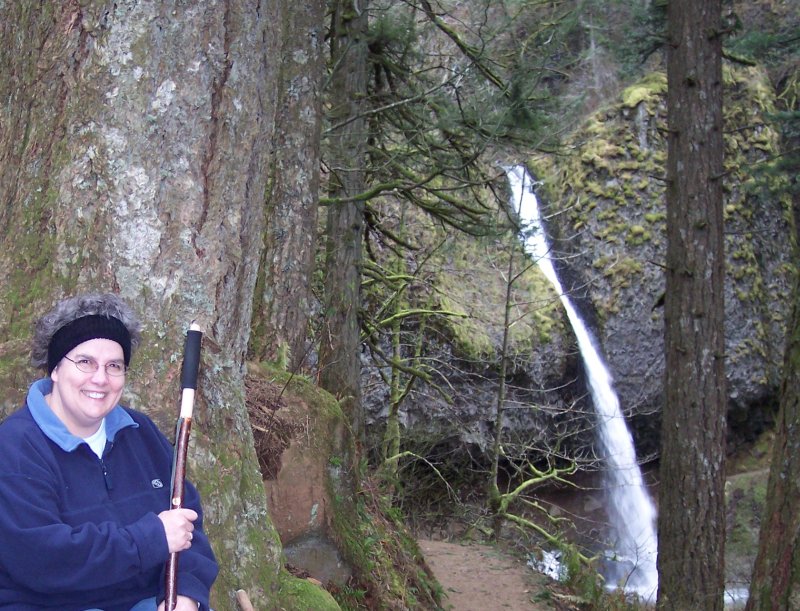
| These are the Horsetail Falls. The trees stand naked, shivering in the winter winds. The falls continue on their 176-foot plunge into the beautiful fall pool below. I love standing next to that pool on a hot summer day, and just soak up the cool mist streaming off the falls. It feels wonderful. I did make a quick trip down to the pool at the end of the hike, but I didn't stand around soaking up the cold. J Not today! The wind was quite cold enough on its own, even when we got back. |
|
|
|
You can almost see the goose bumps on those bare trees. The falls are just to the right of this picture, and the trailhead is near the center of the picture. It doesn't waste a lot of time moving upwards as you can see. Although our trip will take us about the same number of feet upwards as the Multnomah Falls Hike does, the rise is spread out over a longer run. So, we had some times when we were moving up sharply, most of the hike was more gradual.
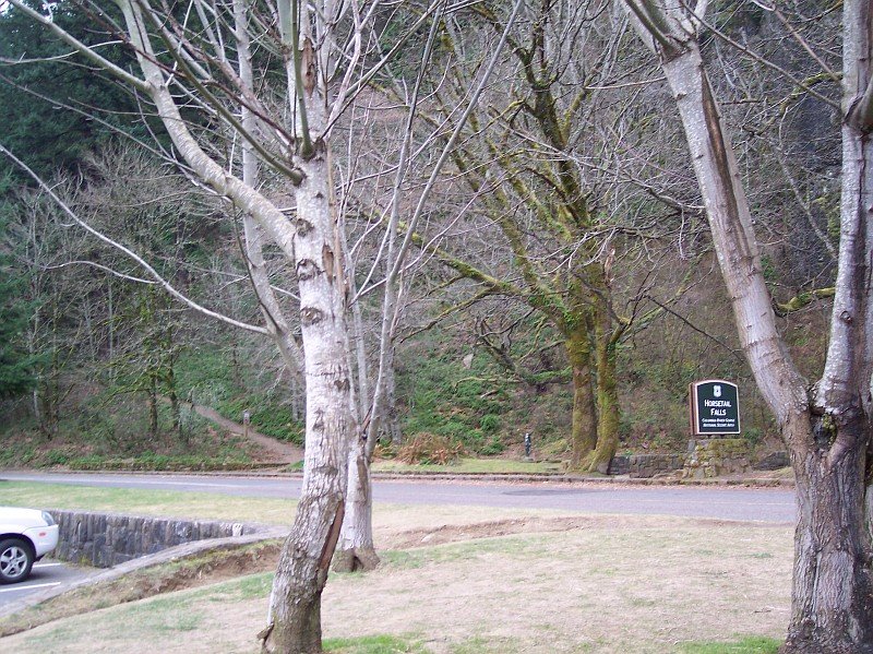
When we first pulled in, Rip's car was the only one in the parking lot besides ours. However, before we got started, another hiker had pulled in (the front of his car is just visible in this photo) and headed out on the trail ahead of us. Since we were planning on moving at a slow and reasonable pace, we were happy to see him start off ahead of us, so we wouldn't be in his way. |
|
|
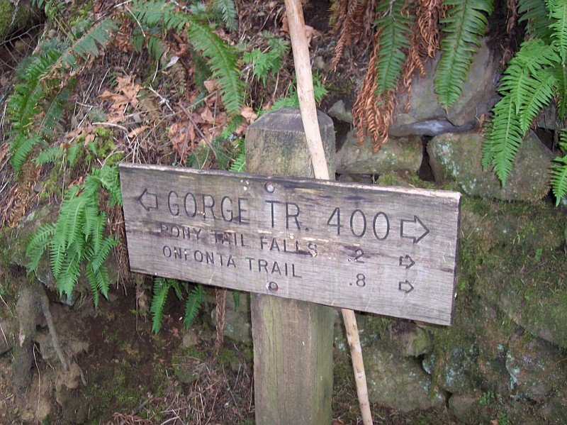
We finally are on our way. (I propped my walking stick behind the sign in order to free my hands for the camera.) Here is the first switch back, and it also intersects with the Gorge Trail #400. This trail runs for miles along the Gorge hitting waterfall after waterfall. Unfortunately, it is not as well kept up as many of the other trails, and I was told by a range at Multnomah Falls that it is one of the recommended routes to take. (The highway is usually within view of Trail #400, and in many spots it is easier to just walk along the highway than to follow this trail.)
This part of the trail is great though, and we would be turning right at this sign, and walking the 0.2 miles to Upper Horsetail Falls, better known as Pony Tail Falls. Even though this is winter, you can still see a lot of green here, including ferns and mosses. The brown leaves of autumn have not all gone away just yet, but they are heading in that direction. |
|
|
|
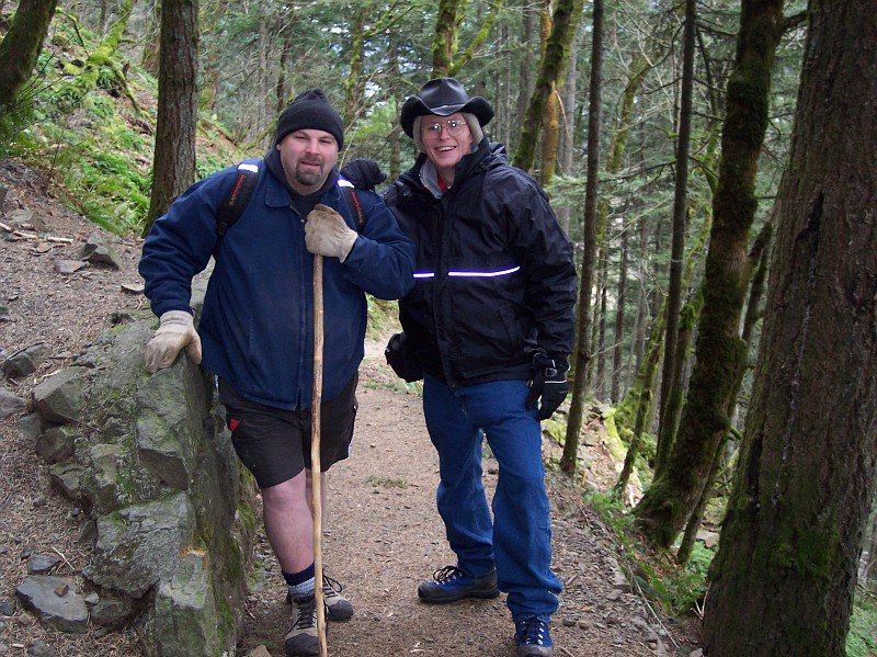
Dotti snapped this shot of Rip and I, while she was looking back down the trail. Rip has his gloves on now, and we stopped to take a quick breather before heading on. The greenery around us is very scenic, and even the bare winterized branches here are framed by the green trees behind them. There is no part of the year when this area isn't beautiful!
And speaking of beautiful... |
|
|
Here is my lovely Dotti resting on a stone wall that the path skirts on its approach to Ponytail Falls in the back ground. Dotti is sharing her beautiful smile with us, and the magical forest behind her is made even brighter by it.
We were already beginning to feel a decrease in the wind that we were feeling, and shortly it was to disappear nearly entirely for us, at least until we got back to this point on the trail. |
|
|

|
We have climbed up around 145 feet so far, and are watching the Pony Tail Falls dropping over 100 feet, splashing into the pool below them. Dotti and Rip are waving, while being tucked away safely behind the rushing water, in a cave that was created by the water's action upon the rock wall.
Each year the water seeps in-between the sections of basalt rock making up the wall. When the temperature drops below freezing, the water expands, breaking pieces of rock off, and exposing new rock to be wetted next time. Over and over again, century after century the process goes on, and in time, a cave like this one is created: as has been created behind each of the major waterfalls in the Columbia Gorge. |
|
|
Dotti is having fun, and I love to see that!
All three of us are in the cave behind Pony Tail Falls. In the upper right-hand corner of the picture (running right behind that small green moss-covered tree) you can see the trail that we had just come along to get here. The falls are pouring down right behind Dotti's head, and the water in the pool is exiting off to the right, to make its short trip to the top of the big show: Horse Tail Falls. |
|
|
|
Rip made sure that he wasn't going to have any bright spots running around in front of his eyes this time. J (The trick is to take the picture when he isn't expecting it.)
At this point in the hike we were happy that it hadn't started raining yet, but we were expecting it to start at any moment. The forecast was for probable rain in the morning, and nearly 100% chance of rain in the afternoon. So, we were fairly sure that we would get some rain during our hike. |
|
|
Shortly after leaving the falls, we came around the corner and were greeted with this view.
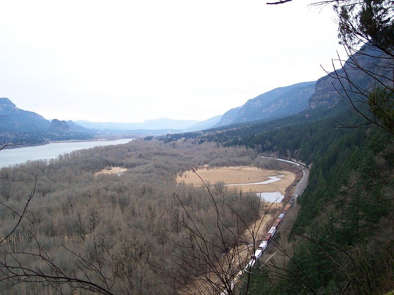
The Columbia Gorge Scenic Highway is inside of the route taken by the train tracks, and is therefore mostly hidden behind the green covered overhanging cliff side. Interstate 84 runs closer to the Columbia River, and it peeks at us through the trees in a couple of places as it runs eastward towards the top of the picture, and approaching Eagle Creek. (The electrical towers at Bonneville Dam--which are very close to the Eagle Creek Trail with its Punchbowl and Tunnel Falls--are just barely visible in this picture.) On the left you can see the volcanic Beacon Rock sticking up beside the river, and on to the left, Hamilton Mountain climbs towards the sky. The trees on the river bottom land are all brown, in honor of the winter season, but the Gorge walls are covered with the evergreens who know no winter. |
|
|
|
We had moved out, away from the path a bit, to get near the cliff edge to see the awesome view. Behind Rip is the Columbia River Gorge, nearly everything visible in the background is in our home State of Washington, even most of the portion of the river itself that is in view.
As long as the rain would hold off, we all were commenting on how great the conditions were for hiking. We all felt comfortable now, and it was neither too cold nor too hot. |
|
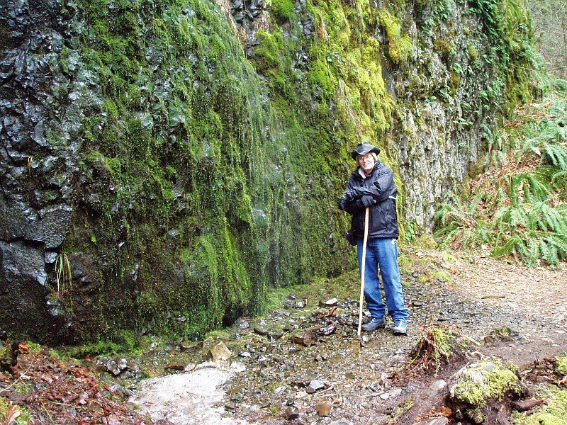
| I was testing my waterproof clothes a bit here. The green covered rock wall beside me was being continually misted by a very small waterfall, that appeared to be formed from individual, unconnected water drops. They formed a very light fog that is just visible between the wall and me. The rocks at my feet were damp, and my coat an hat were getting that way as well, but they were resistant to water, and so no harm was done. |
|
|
|
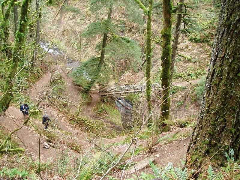
Dotti took this shot, looking down on Rip and me walking along the path towards the bridge over the Oneonta Creek.
The trail makes a fairly sharp drop in elevation here, and so it is cut into many switchbacks, to keep the grade to a reasonable level. |
|
|
I took this shot looking back up from the bridge to where Dotti stood waving, after taking the previous picture.
From this angle you can hardly tell that there are many switchbacked trail crossings between Dotti and us. |
|
|
|
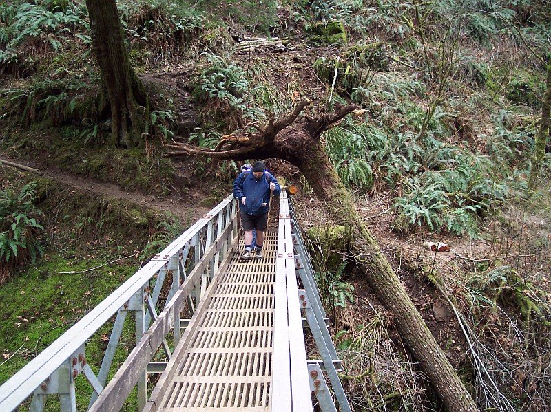
Dotti took another picture, after coming about half-way down towards the Oneonta Creek.
From here, you can see that there is a large tree that has toppled into the creek, and its roots are actually extending over the end of the bridge, with its trunk running all the way down into the water. We had to duck in order to get onto the bridge. |
|
|
I took this picture of Rip just as Dotti joined us after traversing the switchbacks. (If you look carefully, you can see her pants peeking through from behind Rip, and her hair is just visible over his right shoulder.)
The fallen tree has spread its roots over the end of the bridge as if it were creating an umbrella to keep the rain off hikers who were passing by. |
|
|
|
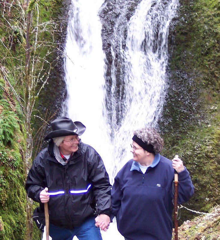
In 1997, before either one of us began our weight loss or smoking cessation journeys, Dotti and I had our picture taken when we were standing very close to the spot where we are in this photo. (We were up the trail a bit I think and the camera was up farther still, showing the top of the falls.) The falls behind us are where the Oneonta Creek drops 60 feet in a beautiful fashion.
There are also some falls that are called the Oneonta Falls, and they were close enough to throw a rock over them from where we were standing, but they unfortunately are invisible from this trail. We could see where the water was rushing to reach the top of that falls, but we could not see the drop. That will have to come on another hike. |
|
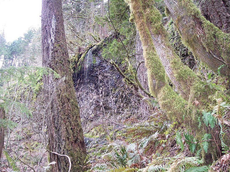
| Looking up and towards the south a bit, there was a little waterfall that was dropping onto the rocks below. This is probably a winter-only waterfall, drying up in the summer, and leaving water marks on the dry stones and ground--just to let you know that this is what it was doing all winter long. Of course in the summer, the bare branches you can see here will be loaded with lush green leaves, and the waterfall path may be totally invisible from the trail. |
|
|

| Looking downstream from the bridge; this is the path to the top of the 100-foot Oneonta Falls. The water probably doesn't travel more than a yard beyond where we can see before making its plunge. Alas, it is out of sight from here. | |
|
As you can see, this view of the 60-foot falls was taken from a place that was much closer to the location from which our 1997 picture was taken.
This hike has some very beautiful scenery on it..and Dotti has always been beautiful too: in 1997, and every day that I have known her ever since 1974. Looking back at our old pictures brings back a lot of happy memories, and Dotti is goregous in every one of them! |
|
|
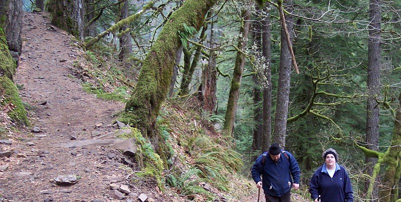
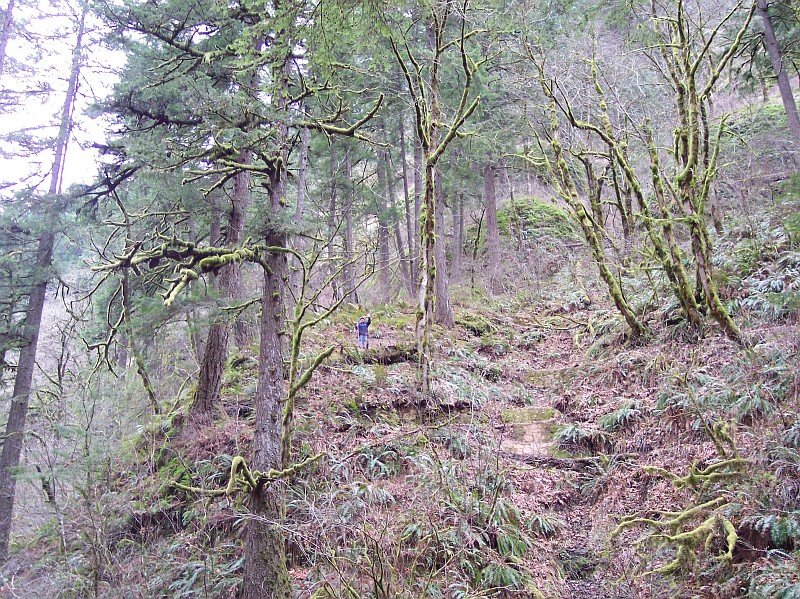
| We are still moving upwards, as we come to yet another switchback. Since this is the first hike of our season, we were hoping that it would not be too tough, but everyone is doing fine. Dotti looks fresh as a daisy and ready to go right to the top of the trail. Rip is keeping his eyes open for any ankle twisting rocks on the path. | |
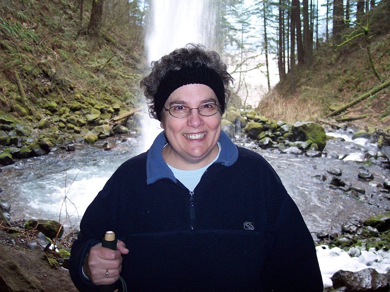
| We stopped for a minute to take a break, and I took this picture of my lovely Dot. There are a few more gray hairs than the first time we took this hike, but this is a face worthy of launching a 1000 ships. How could you not love this girl? What a jewel! |

|
|
| Dotti snapped this picture of some old guy she saw on the trail. I think that she was looking for some comic relief. J | |
|
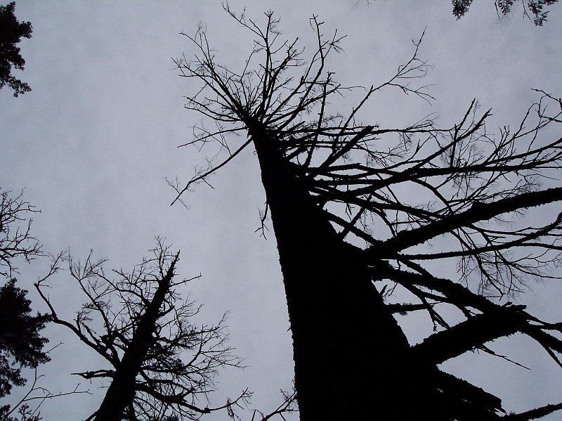
Looking up into the slate sky; we see this tree like a dark silhouette. Like a warrior who has been in too many battles, the tree appears unbalanced, with branches missing on this side. Some of the lower branches are broken off.
And still we awaited the promised rain. |
|
|
|
Ripwith his eyes open!
He looks like he has something mischievous up his sleeve. He is leaning his strong shoulder against the tree as if he were holding it up. |
|
|
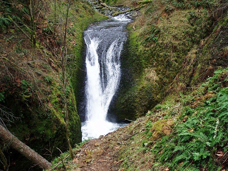
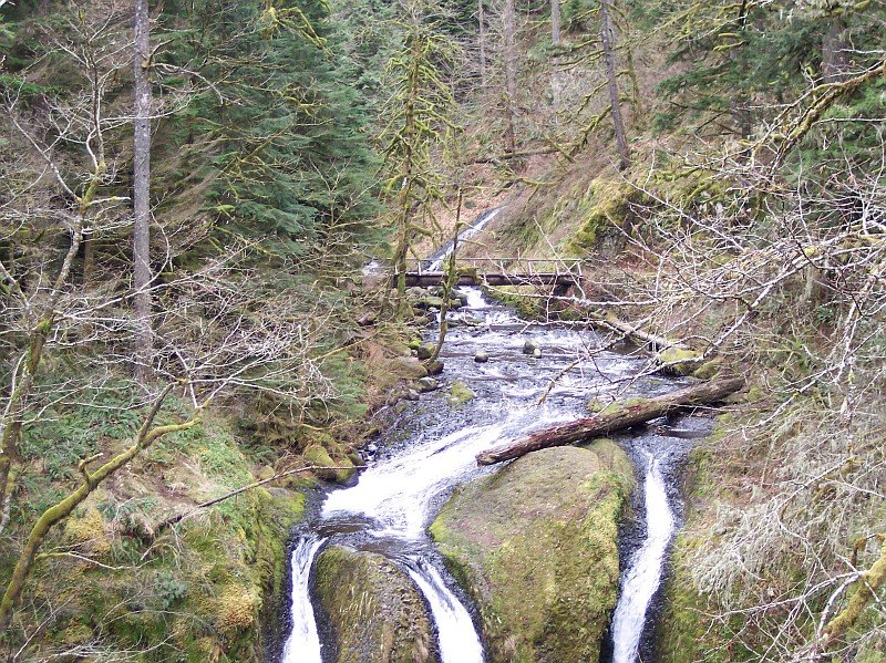
Here we are at our destination: Triple Falls. When we first came around the corner and caught a view of the falls, we were up higher, and looking down upon this rock ledge. The main path continued around the bend and headed on towards that bridge in the background. However, there was a little side trail that led down here.
Rip still has our lunch on his back, but that is about to change, because the dinner bell just sounded. |
|
|
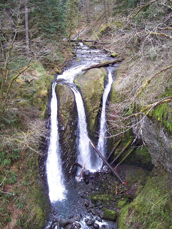
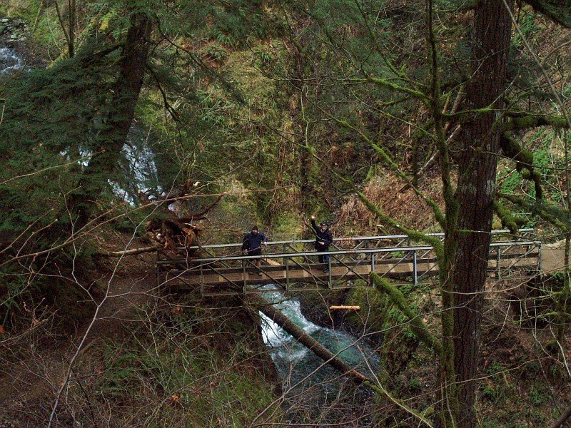
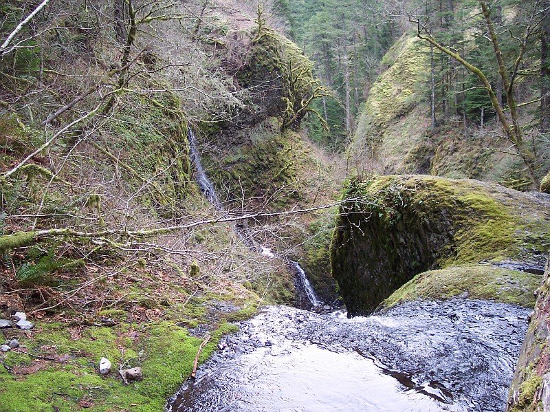
| This is the view from where Rip was standing in the previous photo. Looking at the base of the three headed falls, and then upwards to its top, and upstream in Oneonta Creek feeding the falls, the fallen tree is making its presence known everywhere. In the background you can see a bridge crossing the Oneonta Creek, and that will be our turn around point later on. | |
| We are 560 feet above sea level here, over 500 feet above where we started from. The falls are about 135 feet tall. On the left, the tree looks like it has on a green fur coat, as do the walls of the rock cathedral where Triple Falls make there splash. Water is life; and there is plenty of water to be found here. |
|
|
|
It is amazing how water will cut stone. The water of Oneonta Creek has passed over this stone bed for so long that it has cut three channels into the rock. Each of the channels passes about the same amount of water through it, forming three separate falls that are nearly equal in water volume.
The branches sticking out into this picture are obviously not evergreens, and they show the season very clearly. |
|
| Dotti caught Rip and me before we could duck. J We had just finished lunch and were ready to make our way over to the bridge before heading back down the trail to our cars. |

|
|

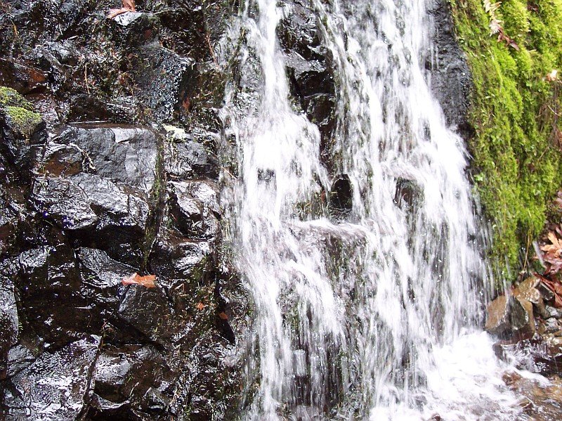
| Just a few yards from where we ate lunch, there was this little waterfall, whose water cut across the path. | |
| This is a close up picture taken of that same little falls, looking back after crossing its stream. Looking at the water rushing along, and the damp rocks, reminded us that it still hadn't started to rain, and the toughest part of the hike was already done. |
|
|
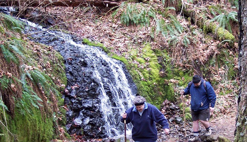
| Here are Dotti and Rip crossing the little stream by the waterfall. You had to watch your footing a bit, but it was not too bad. I was happy that I had waterproof boots at that time though. | |
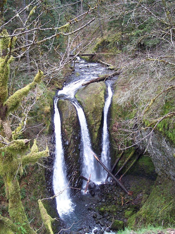
| Looking down at the top of Triple Falls. You can see how irregular the surface features of the stone are, and that makes it all the more surprising that they produce three equal flows of water. |
|
|
|
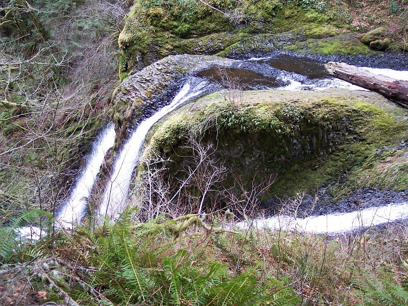
This is a view looking downstream, from above Triple Falls.
At the top center of this picture you can see where we ate our lunch and were posing for pictures. Downward and to the left of that, you can see the water from that little falls and stream that we had just crossed, falling down the bank, and into Oneonta Creek. In the foreground is the leftmost (viewed from this side) channel of Triple Falls. |
|
|
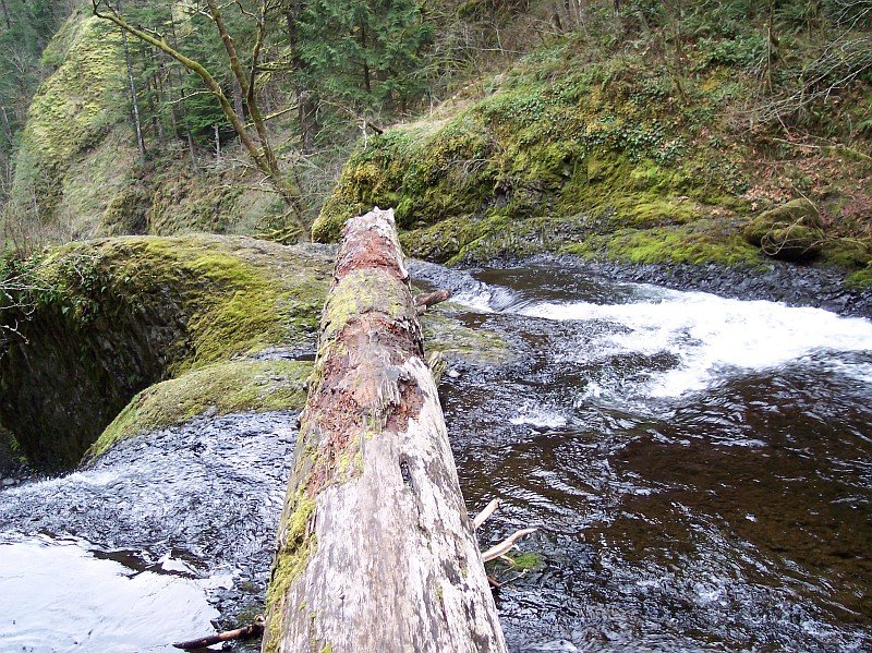
This is the fallen tree that we could see from our lunch site viewing area, lying across the top of the falls. I had worked my way down the bank, and then out onto the log in order get that last picture, and this one. About this time, Dotti requested that I cease and desist on further progress in this direction, and she hoped that I would return to my senses, and the rest of the group. J |
|
|
| I turned around and took a picture looking upstream at "the rest of the group," and decided that I would follow Dotti's great advice. | |
| But first I had to give them a wave. J The path is behind me and upwards about 30 feet. The little stream that we had crossed is still visible on the right side of this picture. The log looks like it might be the top of a dam from this angle, but the water was flowing right under it with no problem. |
|
|

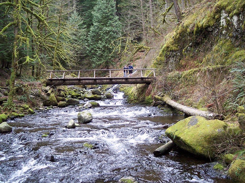
| Eyes open, and everything! Rip, with the bridge in the background. | |
| Looking upstream from the bridge. Water, treesstanding and fallenmoss, a little stream on the right, and whole lot of beauty! |

|
|

| A similar view to the previous one, without the telephoto. | |
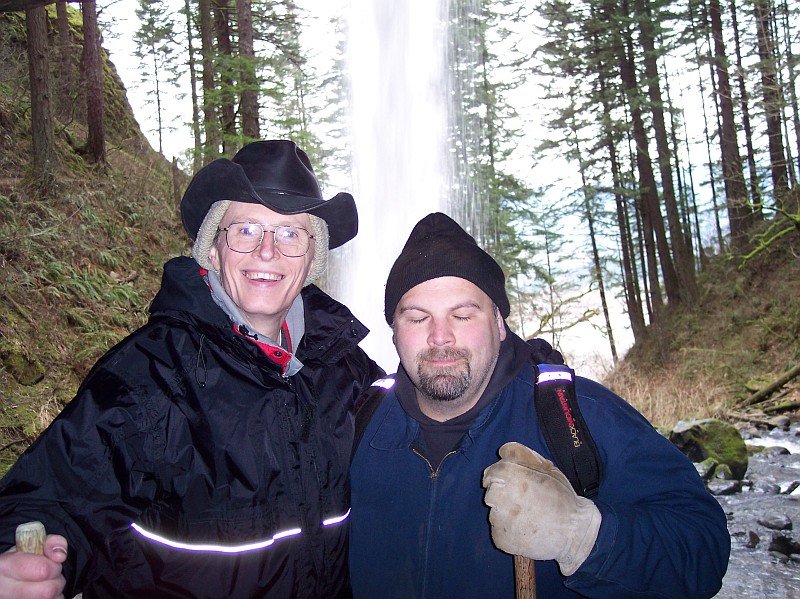
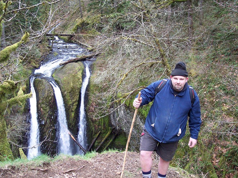
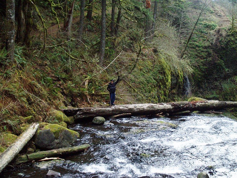
| Who are those guys? Rip and Al on the trail. Even though it was looking a bit dark at time, we still had not seen a drop of rain. We were quite surprised, but we still had a ways to go. |

|
|

| 47. Looking upstream from just off the bridge. This bridge was wooden, unlike the earlier one (with the umbrella roots). It really seemed like it was part of the forest, mostly constructed out of forest materials. | |
| I thought this might be an interesting picture when I saw how the bridge was put together. The supports formed a sort of tunnel. |

|
|

| Here is one more view upstream from the bridge. | |
| Looking from the bridge, right over the top of Triple Falls. Our lunch area perch is left of center above the falls top. |

|
|

| A friend of mine from work was originally supposed to come with us on this hike. He unfortunately wasn't able to make it. When I saw this dog I thought of him, because he owns two dogs, and they would have come on the hike with us probably if he had come with us. There were 3 or 4 dogs running around at the bridge area, and this was just one of them. | |
| 52. Fast-forward button. This is Rip and Dotti sitting down for a well earned rest at the trailhead. Our hike is done! While they were resting, I went over the Horsetail fall pool, and took a few pictures. |

|
|

| I thought this might make a good closing image. It was a fun hike, and we are all looking forward to our next one! | |
|
____________________________________________
Bretz Floods Wikipedia Northwest Passage: The Great Columbia River (New York: Simon & Schuster, 1995). Journey entry for the week we went to Dry Falls - Dry Falls are located in the Grand Coulee, which was created, or at least greatly expanded by the Bretz Flood(s), and the water which flowed over those falls also flowed through the Columbia River Gorge on its way to the Pacific Ocean. |
||