Mt. Hood: Silcox Hut
August 2, 2003
The Coon Family Hiking Club
Official Hike #14
4.0 miles - 2 hours 57 minutes
|
We got on the road a bit after 06:30 and pulled into the parking lot at Timberline Lodge, at the 6,000-foot level on the south face of Mt. Hood, around 07:40. Shortly after that we were on our way.
I was hoping for some cooler temperatures at the higher elevation, but the overnight low at Timberline Lodge was around 60°, the same as at our house. The high for the day was predicted to be around 76°, which was pretty close to what we were expecting in Vancouver. The wind was a factor at first, and it made it feel cooler as we started out, and so we both put on our coats for a short while, but that didn't last long. The biggest factor in our hike was the elevation. We started out at 6,000 feet, and then while hiking for one mile, we went up and additional 1,100 feet to over the 7,000-foot level. To compare that part of the hike with the Multnomah Falls path, we went up more than 300 additional feet on Mt. Hood, in about the same distance of hiking. So, it was a steep hike. However, we were huffing and puffing a great deal very early on in the hike; more than the steepness alone could account for. While the temperature did not seem to follow the rules of elevation on this day, the pressure rules were followed to a tee.
(Dotti performed a little science experiment on the way up to Timberline, inadvertently. She had a bottle of tap water in the car that she had sealed before we left home. When we got up close to the Lodge, she opened the bottle and some water spit out the top and up into the air, because of the pressure difference of what was inside the bottle [14.7 psi] and what was outside [11.8 psi].) The thin air made it difficult to breathe and the hiking was much tougher as a result. We had to take several rest breaks on our hike to the Silcox Hut at 7,000 feet. It was tougher than Larch Mountain had been in the sense that even just putting one foot before the other and trudging slowly was not enough for us to be able to continue on. We still had to stop and let our hearts slow down, and our lungs catch up. Most of our hike this week, like last week, was walking across bare ash, and other volcanic deposits. We spent about half of our hiking distance, and more of our hiking time, looking up at the crater and lava dome of this temporarily dormant volcano. (Though it was perfectly quiet while we were there, it does vent steam periodically, and there are seismic disturbances quite often under the mountain, to remind us that magma is still moving around down there, and that it is not yet dead.) Just below the crater were a great number of people, looking like ants on the hill, skiing on the snow that still clings to the upper slopes of Mt. Hood. The last eruption, which was not as explosive as what Mound St. Helens has been up to, poured lava and ash down its south side, creating a very nice slope for skiing. After we reached the top, we followed the less used trail, which was a bit harder to track but it provided some interesting scenery on our trip down. We finally descended below the timberline and finished our hike walking through the forest for about three-quarters of a mile back to the Timberline Lodge. |
||||||||||||||||||
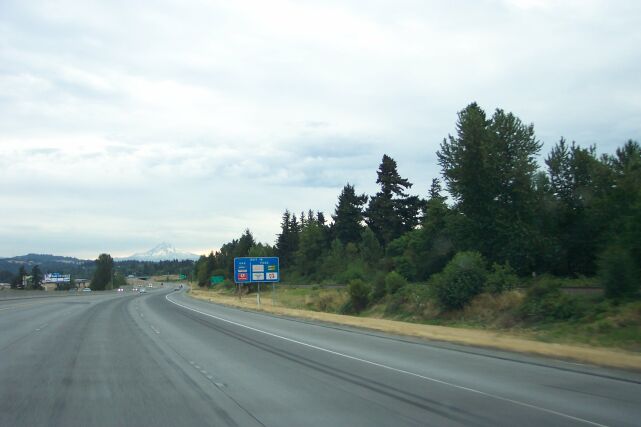
| Dotti snapped this picture of the 11,235 foot Mt. Hood while we were still inside the city limits of Portland on I-84 eastbound. | |||||||||||||||||
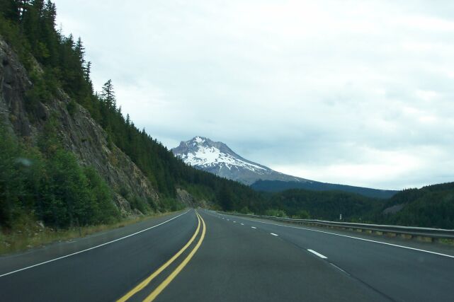
| This was taken from Oregon State Route 26, and you can see that Mt. Hood is getting much closer now. We are still looking at the west face of the mountain, the face that is visible from Portland on a clear day. This face also has its own lava plug, of which the mountain has several, but it is older and more worn from glaciers, therefore less visible than Crater Rock above the Timberline Lodge. |
|
|||||||||||||||||
|
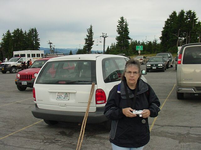
It is about 07:40 here, and Dotti just found out that Starbucks does not have a shop here at Timberline. It is going to be a long day. 
|
|||||||||||||||||
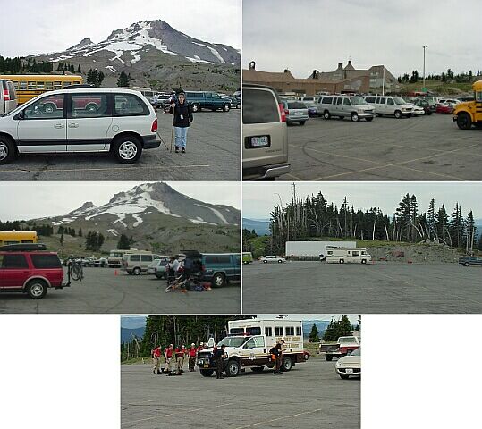
| Here are a few shots of the van, and the parking lot. In the first one, Dotti is waiting patiently, with the mountain peak behind her. Moving clockwise you can see the Timberline Lodge, in the background with the day lodge in between. Notice the empty parking places. Continuing clockwise, you can see the south end of the parking lot is completely empty. In the bottom shot, you can see the search and rescue people getting all decked out around their vehicle. Continuing clockwise, you once again can see Mt. Hood's peak. |
|
|||||||||||||||||
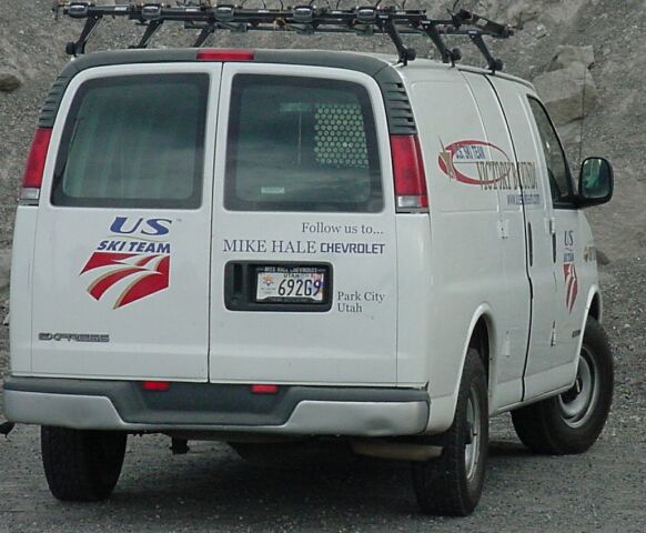
| When we were walking towards the Lodge, we spotted two vans with the US Ski Team logo on them. They had Park City, Utah on the rear panel, and thinking of Barb and Rick in Salt Lake, I had to grab a picture of one of them. | |||||||||||||||||
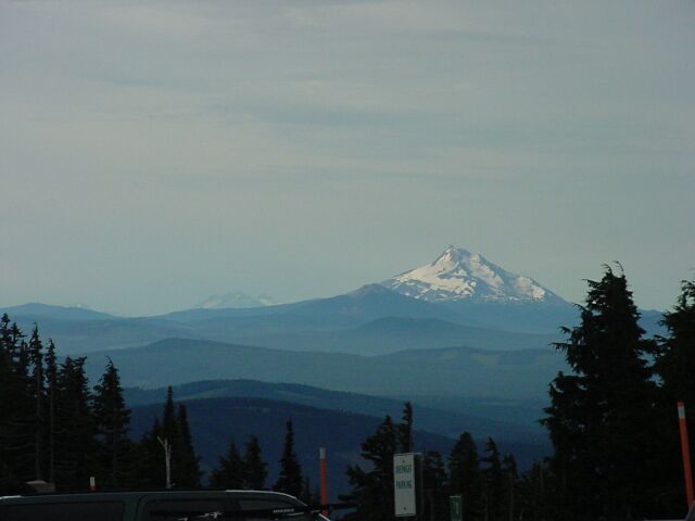
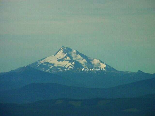
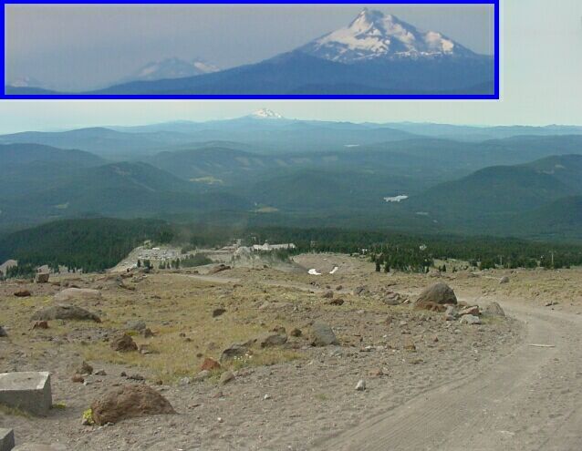
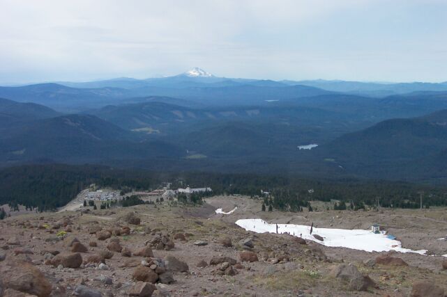
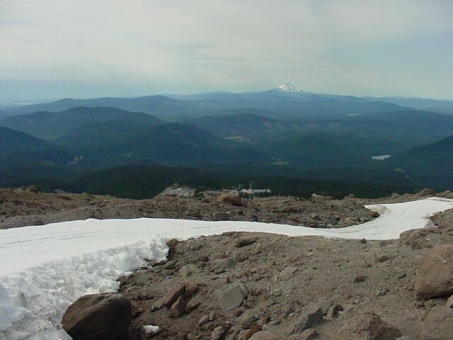
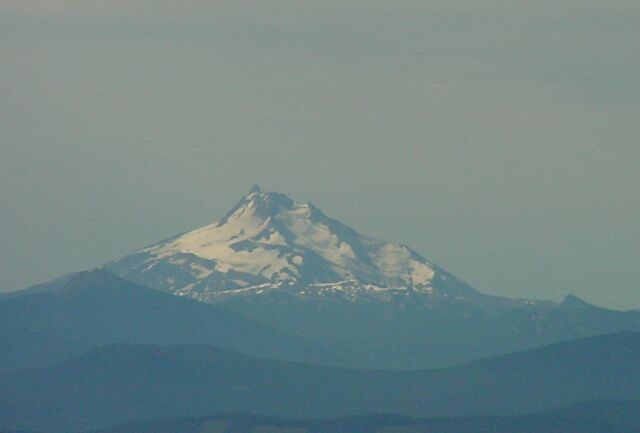
| We took several hundred pictures during our hike, and a significant percentage of those ended up being views similar to this one. In the foreground, about 45 miles away, we have Mt. Jefferson, standing over 10,497 feet. Behind him about 85 miles away, we have the Three Sisters; North (10,085 ft.), Middle (10,047 ft.) and South (10,358 ft.), clumped all together within 5 miles of each other. Off to the left is Broken Top (9,152 ft.). (Mt. Washington and Three Finger Jack are hidden behind Mt. Jefferson.) |
|
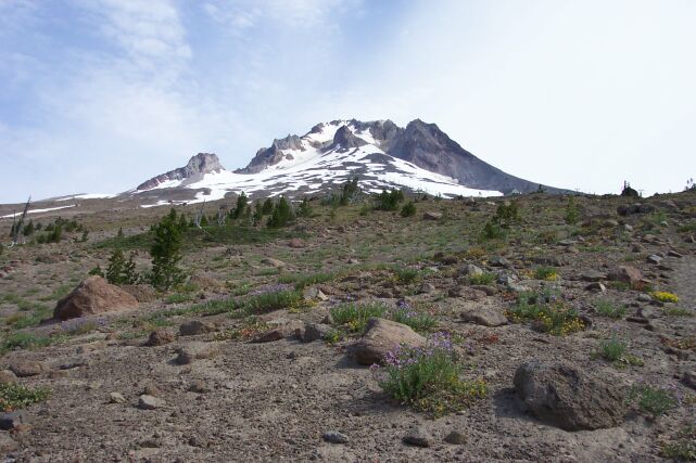
|||||||||||||||||
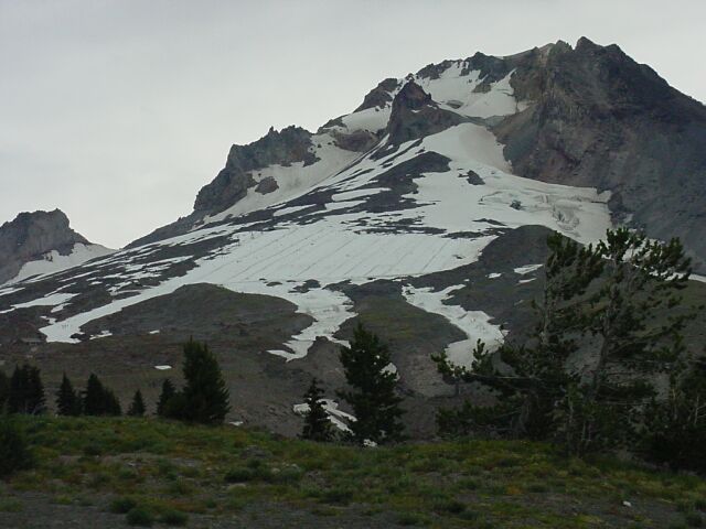
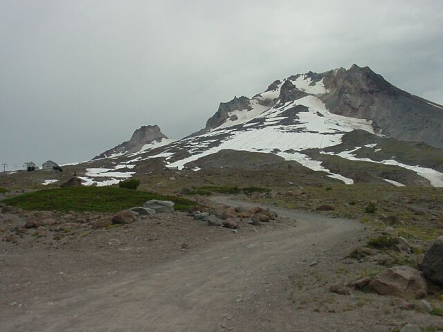
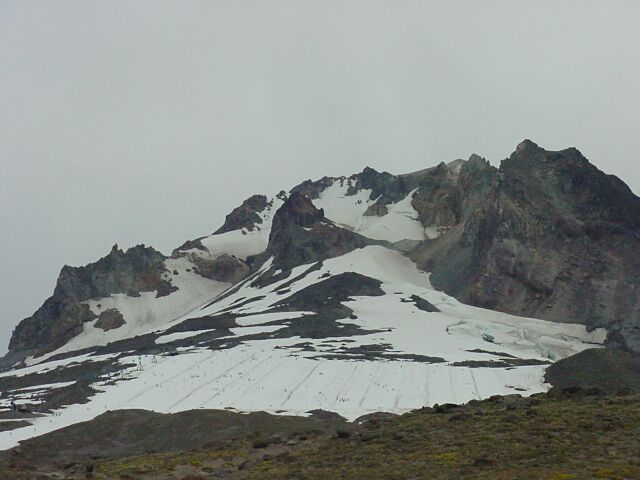
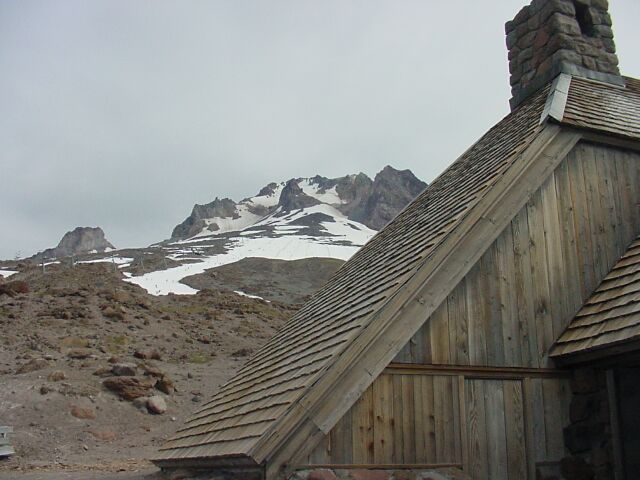
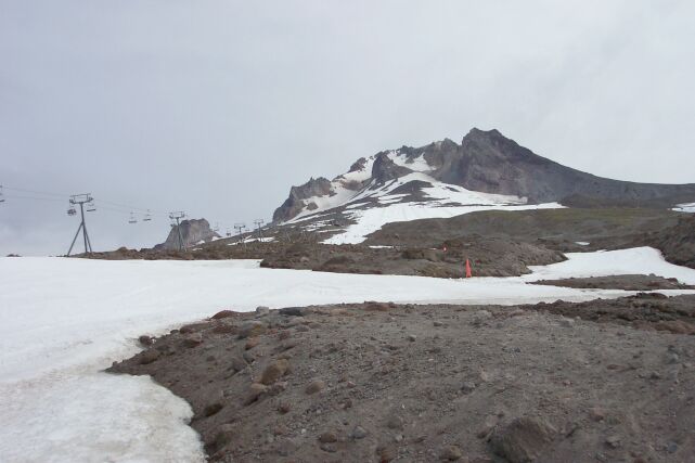
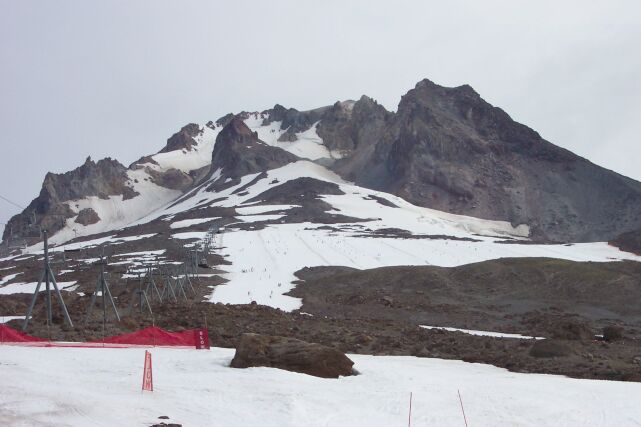
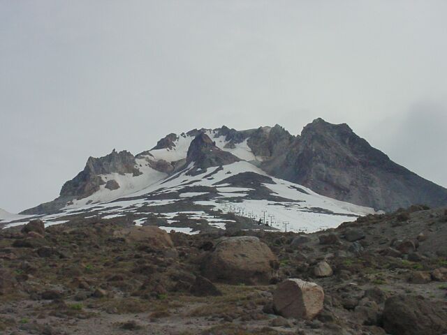
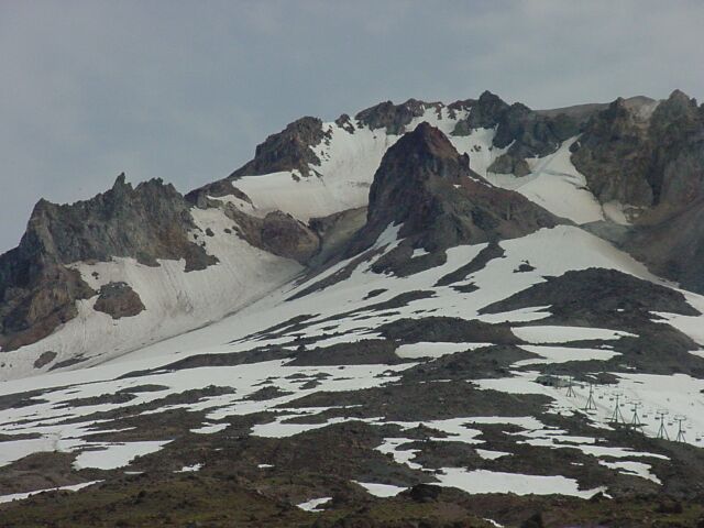
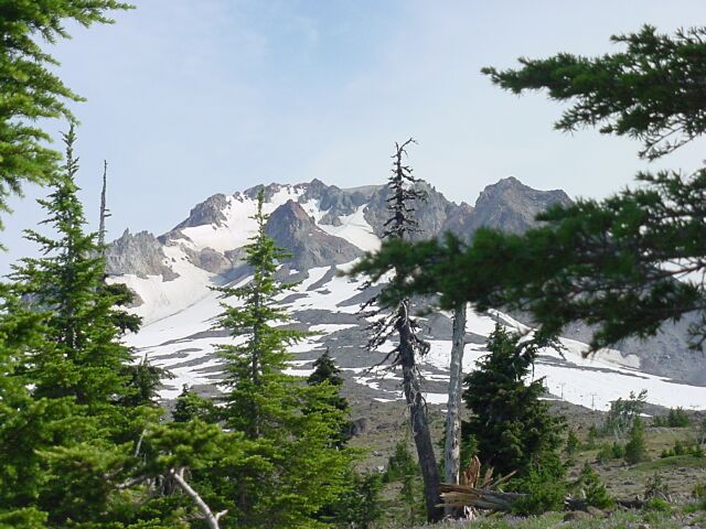
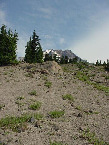
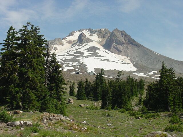
| Looking up at the peak of Mt. Hood. Notice the cathedral surrounding the lava dome, which is plugging the most recent vent of this volcano. The eruptive debris was spread down the southern slopes and created a long and wide smooth surface that naturally drew the skiers to it. There were quite a few of them on the slopes this day, but they are so far away that they are hard to see at this point. | |||||||||||||||||
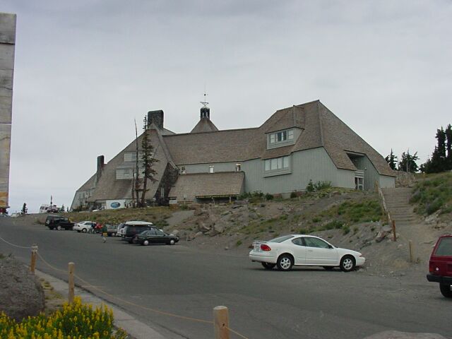
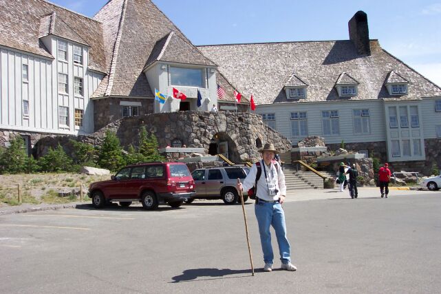
| This is the Timberline Lodge, built in the 1930s, and featured as the "Overlook Hotel" for the exterior shots in the popular film "The Shining" with Jack Nicholson in the 1970s. We fortunately would not have to deal with the snow or other problems that the characters in that movie had to face. |
|
|||||||||||||||||
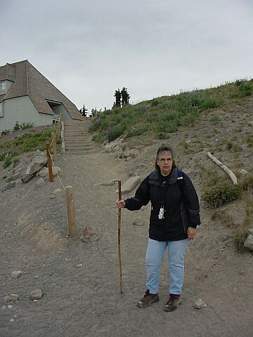
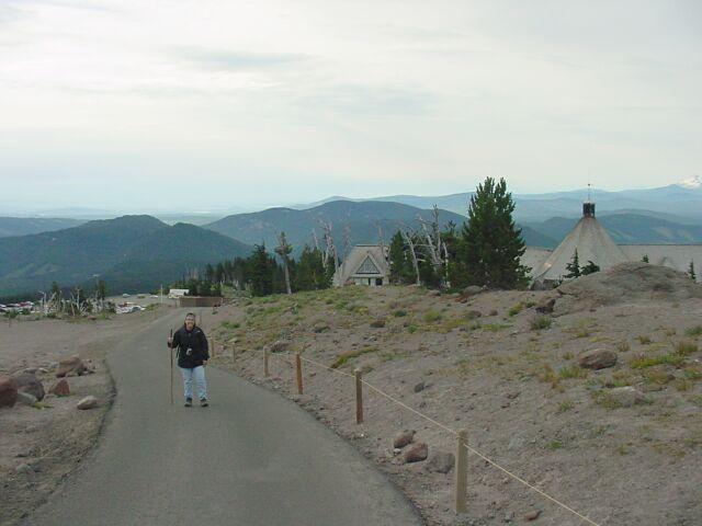
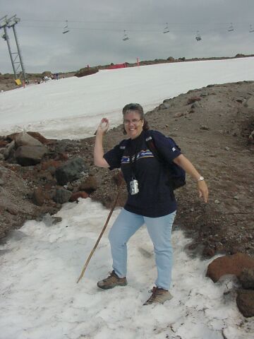
| Dotti, with her walking stick in hand, her camera around her neck and her coat keeping the chill off. Our path starts here as we go up past the lodge. | |||||||||||||||||
| The Timberline Lodge was build at Mt. Hood's timberline. Our hike took us well above the timberline, but you can see here there are some trees, both living and dead that are still slightly above us. |
|
|||||||||||||||||
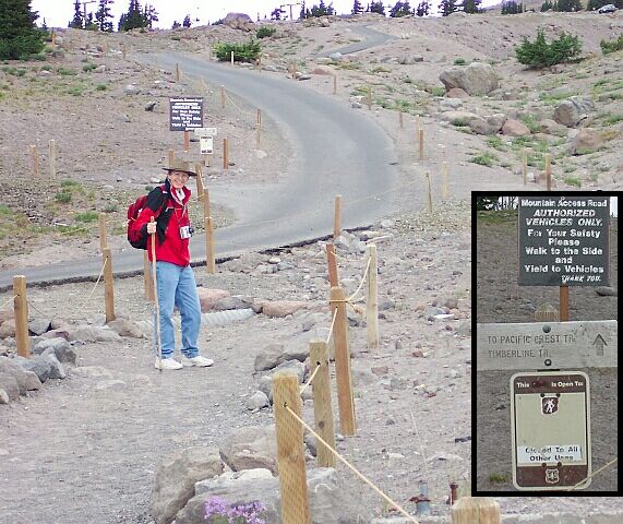
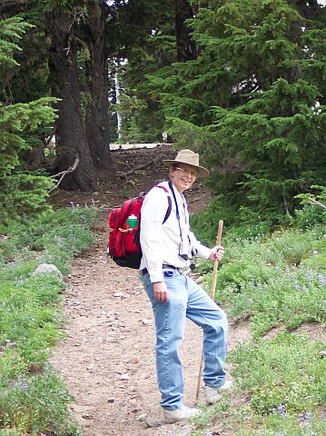
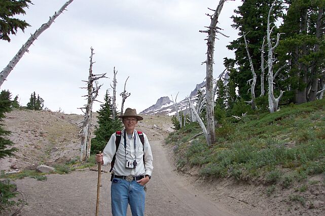
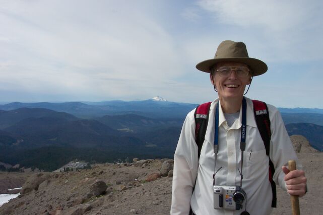
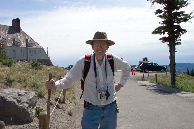
| Since I knew there would be minimal tree cover on this hike, I once again wore my hat to keep the sun off. My camera is ready and my coat is only going to be on for a few more minutes before exercise will make it unnecessary. The signs located behind me in this picture are also shown in the inset to the right. The Pacific Crest Trail that is mentioned is a famous one that runs from Mexico into Canada. | |||||||||||||||||
| Looking back along the trail, past the Timberline Lodge, over the day lodge and at Mt. Jefferson in the distance. |
|
|||||||||||||||||
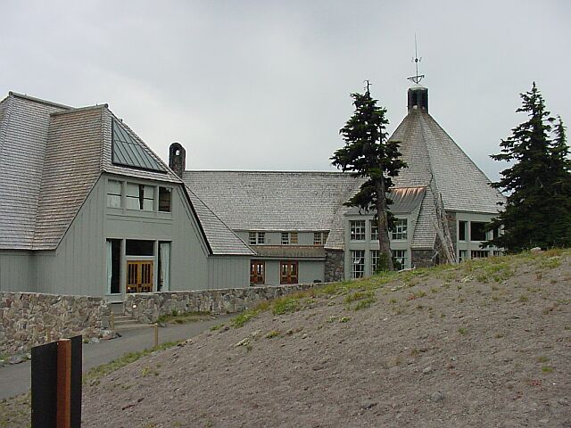
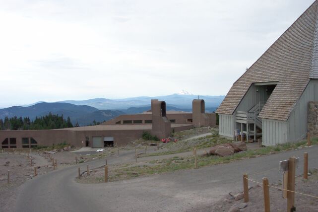
| The backside of Timberline Lodge. | |||||||||||||||||
|
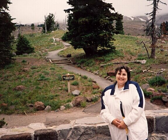
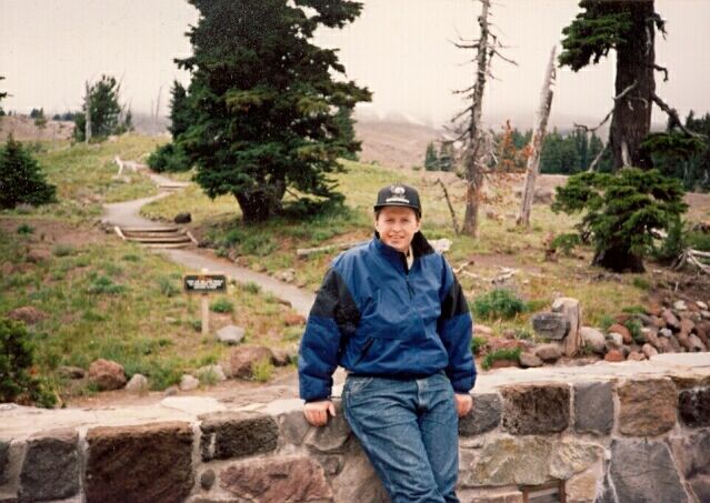
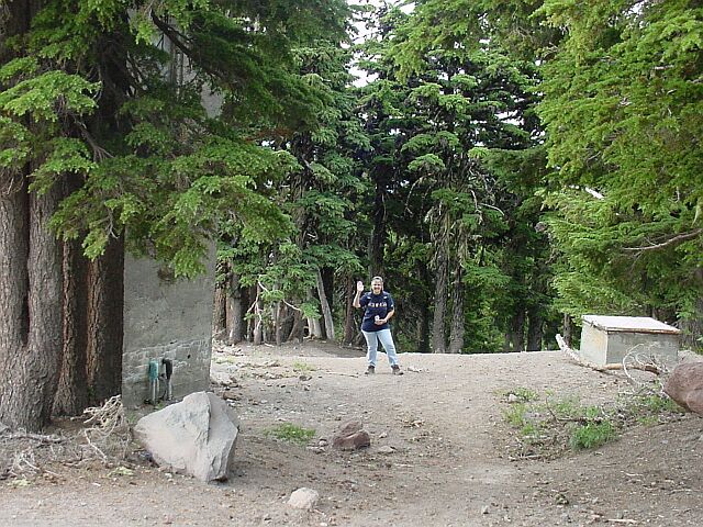
As a little flashback, here are three pictures taken back in August 1995, eight years ago. In the picture on the left, I am shown standing in front of the doors that you can see on the far right in the previous photo. In the center picture you can see Dotti leaning on the rock wall, with her back to where the picture above was taken from. On the right you will see me once again, this time sitting on the rock wall. When these pictures were taken, I weighed about 240 pounds, and Dotti weighed 245, and was at the highest she ever was. But she always had that beautiful smile! Dotti, who in spite of quitting smoking over a year ago, has still continuously maintained a bigger loss than I have, for nearly 4 years longer than I, today weighs less than I do by a fair amount, and I am 55 pounds down from where I was in these pictures. Sometimes it is good to remember where you came from! 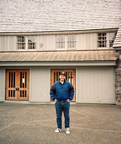
| ||||||||||||||||||
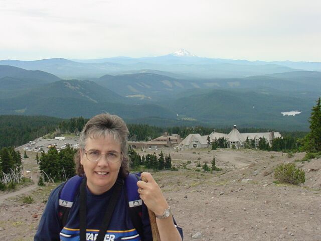
| With Mt. Jefferson off to the extreme right, and the lodge just peaking over the top of the hill on the right, here is Dotti smiling. Our car is parked in the parking lot well behind her. |
|
|||||||||||||||||
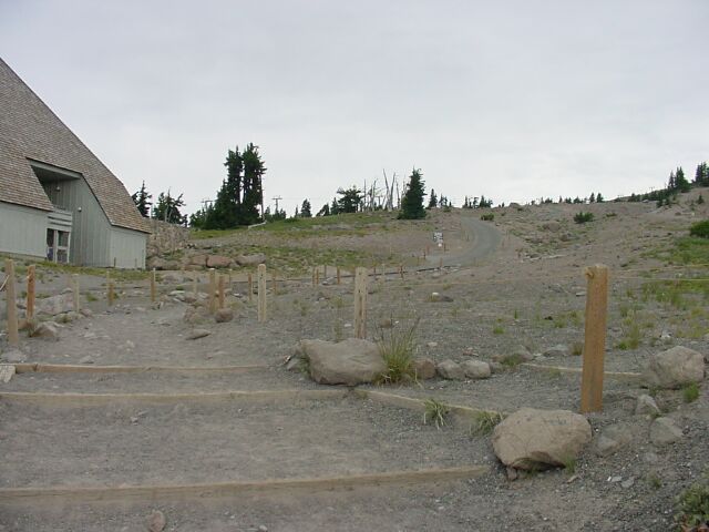
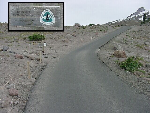
| Up this service road the vehicles go to transport the workers for the ski lifts and the Silcox Hut. Just ahead where the road jogs to the right, the Pacific Crest Trail crosses the road. We are going to take that trail to the right in a moment. | |||||||||||||||||
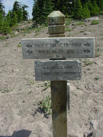
| Here is the trail marker for the Pacific Crest Trail. |
|
|||||||||||||||||
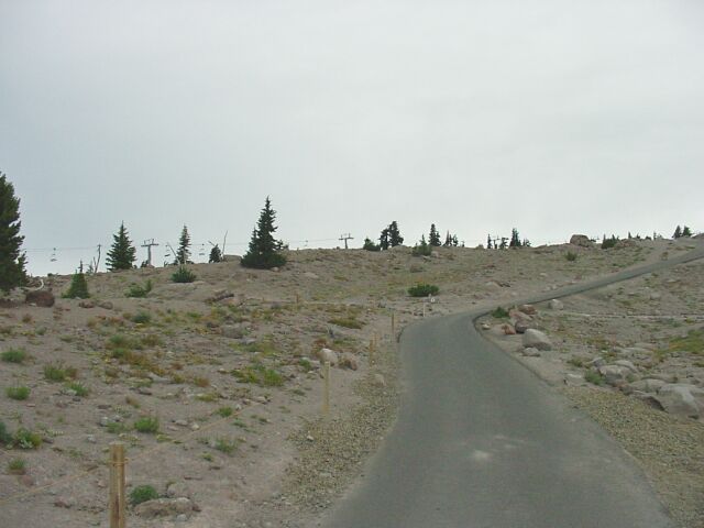
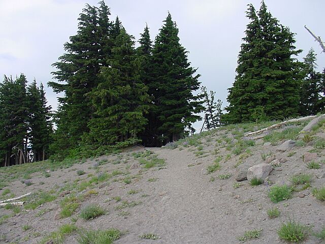
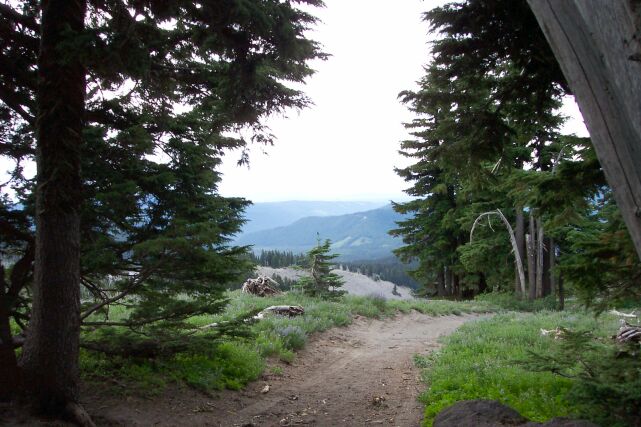
| This is the trail heading to the right. The ground is nearly free of trees at this elevation. | |||||||||||||||||
| Dotti and I had already worked up enough heat from walking to no longer need our coats. We took them off and then headed off on the Pacific Crest Trail. |
|
|||||||||||||||||
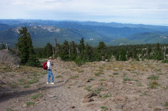
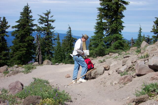
| Here I am, with my coat put away in my backpack and just getting set to step onto the trail. | |||||||||||||||||
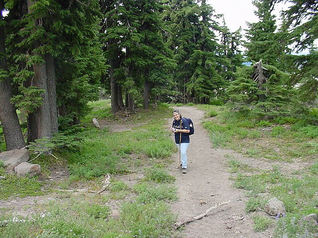
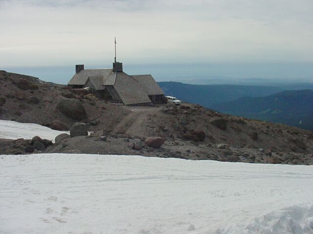
| I am walking ahead on the trail, and you can see that this trail does not stand out from the surrounding terrain. Off in the background you can see a concrete building that we will be coming back to later. |
|
|||||||||||||||||
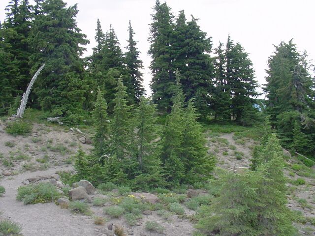
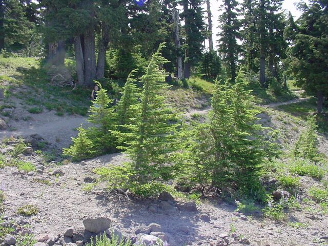
| We are working our way back and forth through the timberline at this time. The trail cuts through this stand of trees here, but it will only be a brief, but enjoyable respite from the ash-covered lands. | |||||||||||||||||
| I had to take a picture of this trail marker for the Pacific Crest Trail. |
|
|||||||||||||||||
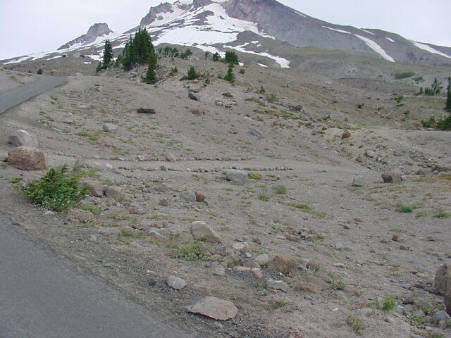
| Ahead is a junction point. To the left is the trail up the mountain to the Silcox Hut. We will be taking that later, but first we will go off to the right to a viewpoint of the White River Canyon. | |||||||||||||||||
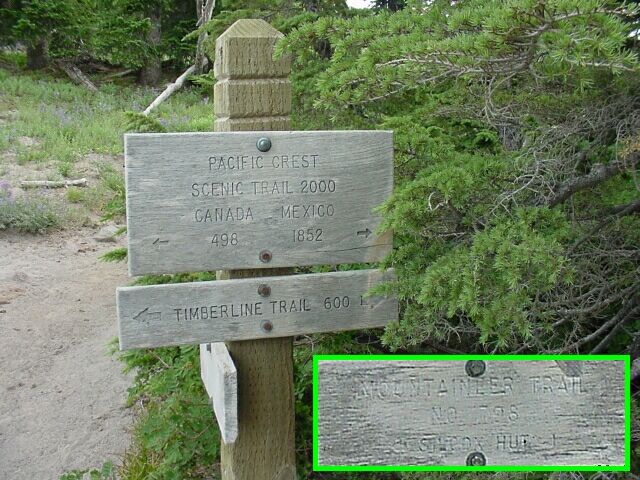
| At the junction point. I have inset the sign that faces to the left. You can see that it is heavily weathered, due to its orientation I presume. It says, Mountaineer Trail No. 796 and it is the one we will be following in a bell curve shaped path up to 7,000 feet over and back down again. For now, we will remain on the Pacific Crest Trail. I think it is interesting to see the mileages given for the start of both ends of the PCT. To the south, at the boarder of Mexico, the trail begins 1852 miles from this point. To the north it ends at the boarder of Canada, 498 miles from this point. There are those who have hiked this 2,350 mile trail in its entirety. That is not a task for the feint of heart. |
|
|||||||||||||||||
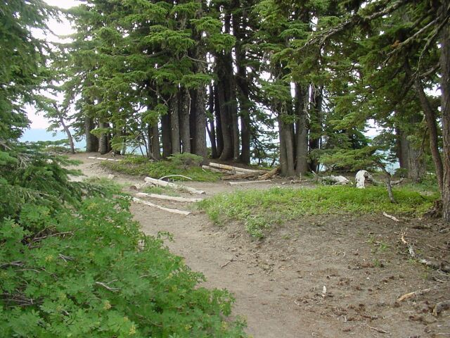
| Working our way through the small stand of trees. | |||||||||||||||||
| Looking back up the trail to that same stand of trees from the other side. |
|
|||||||||||||||||
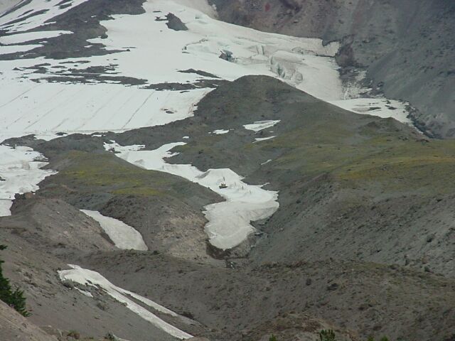
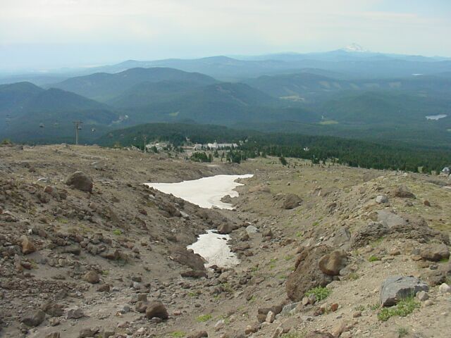
| Using the zoom, and looking up the mountain, you can see a snowplow in the snow-filled gully in the center of the picture. Behind it you can see the terminus of one of Mt. Hood's glaciers. | |||||||||||||||||
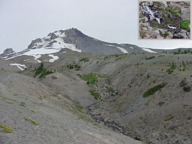
| As the snow above is hit with sunshine, it naturally begins to melt. The water runs down the mountain in streams like this one. Inset is a close up of the little waterfall that is actually located in the center of the picture. We feel that no CFHC hike is complete without a stream and waterfall. |
|
|||||||||||||||||
| Looking down the gully as the stream makes its way to one of the tributaries of the Columbia River. The little trees look like they should have Christmas decorations on them. | |||||||||||||||||
| Having seen the stream we have turned around and headed back to the junction. |
|
|||||||||||||||||
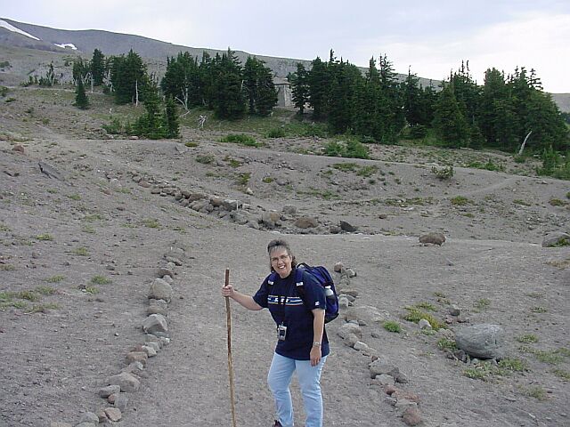
| I caught Dotti here pausing to snap a picture of some flowers. She took quite a few pictures of flowers along the way. You can see them all near the end of this page. | |||||||||||||||||
| We have moved up the Mountaineer Trail from the junction. This picture was taken looking south. |
|
|||||||||||||||||
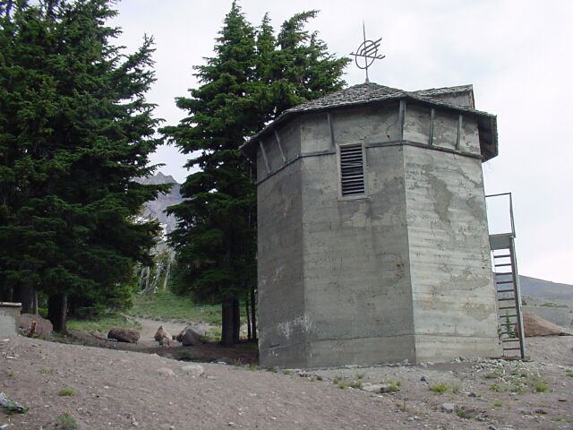
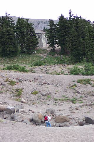
| This is the concrete structure that was just visible in an early photograph. It marks the point where a service road joins up with the Mountaineer Trail for the rest of the trip up to the Silcox Hut. | |||||||||||||||||
| Looking back at Dotti from the service road. She has laid her walking stick down so she can take a picture of some more flowers. |
|
|||||||||||||||||
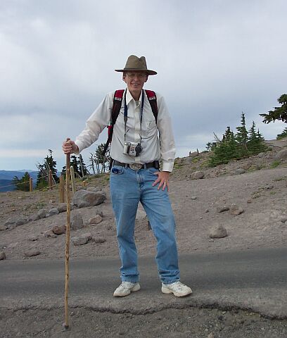
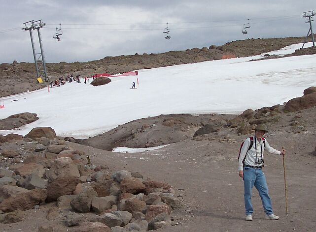
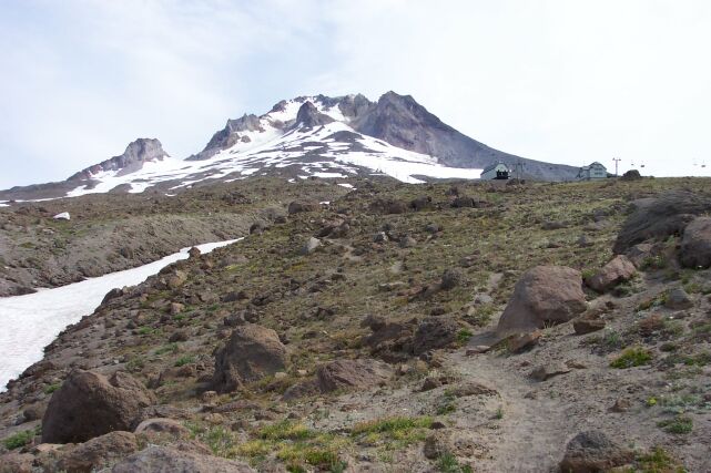
| Here I am standing on the service road/Mountaineer Trail joint path. The dead trees standing behind me mark the edge of the timberline. The average temperature from here on up is just too cold for the trees to sustain life. The water freezes for too many of the days per year and they cannot move enough of it to live. The strings of white dead trees look like ghosts stretching off in lines that run all the way around the mountain. | |||||||||||||||||
| We have come up a ways from where the last picture was taken. You can see the white trees behind Dotti on the left. To the right is the top of the Timberline Lodge, and off in the distance is the ever-present Mt. Jefferson. |
|
|||||||||||||||||
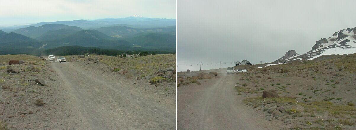
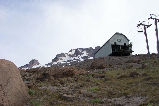
| It seemed that we were looking at an unchanging scene each time we glanced up; as if we were in a bad dream where you are walking or running as fast as you can and don't seem to make any progress. We were rapidly getting exhausted by our efforts, only to see our goal approaching at the slowest of paces. The terminus for the chairlift coming up the mountain from the lodge is on the far left, with the starting point for the chairlift heading up to the very top being just to the right of it. To the right of them both is the roof of the Silcox Hut just visible to the left of center of the picture. Far above, the ski slopes are very active. | |||||||||||||||||
|
As I was struggling along, trying to figure where my next breath was going to come from, Dotti called out, "Car coming!" I turned around and sure enough two vans from the lodge were carrying workers up to the Silcox Hut to set it up for some function. (The hut can be rented for groups of 12 or more, for a nominal fee of course.) I snapped their picture as they were on the way up to us, and then again as they left us in the ash dust.
|
|
|||||||||||||||||
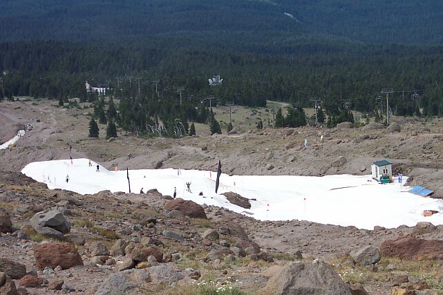
| The ants on the slope are getting a little bigger as we gain some altitude. | |||||||||||||||||
| We have come to a snow filled gully that has been set up for snowboarders. The roof of the Silcox Hut still looks to be too far away. |
|
|||||||||||||||||
| Turning around we caught a zoom image of Mt. Jefferson. | |||||||||||||||||
|
Looking down, the Timberline Lodge and parking lot are starting to look far away finally, and the people around that area are looking really small. At this point my heart was pounding in my chest, and I was gasping for breath. These little picture stops were vital to let our bodies try and catch up with the change in altitude while trying to go up a difficult grade. Dotti took a picture of the distant volcanoes with her zoom and so I inset that into the top of this picture.
I have to say that during this exhausting climb, Dotti did better than I did at keeping her breath. She has been doing a lot of exercise at the gym on the cross trainer, and it paid off here! Her cardiovascular system is in good shape! |
|
|||||||||||||||||
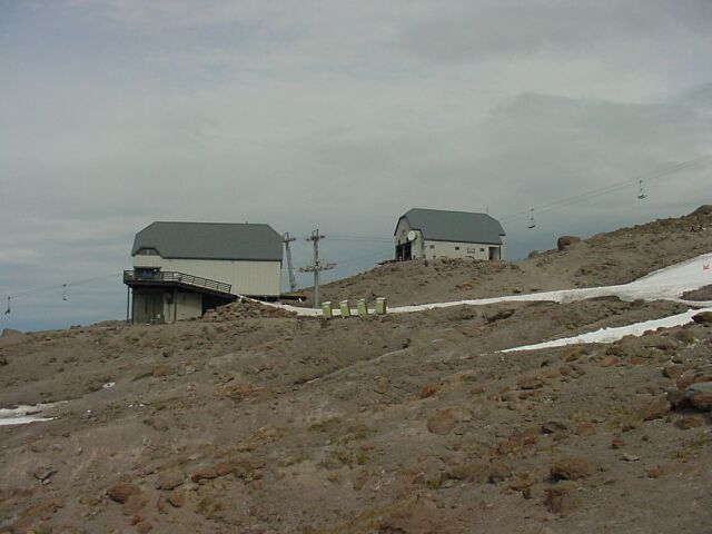
|
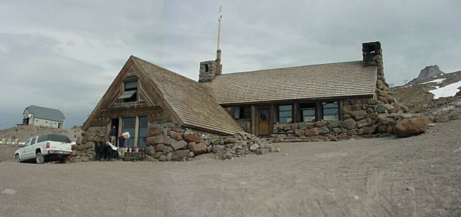
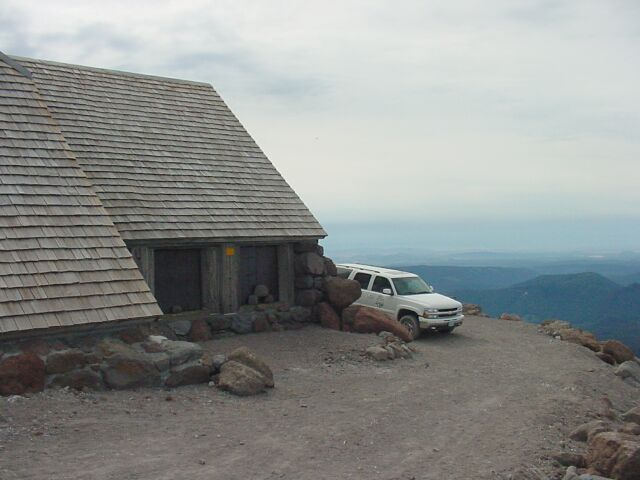
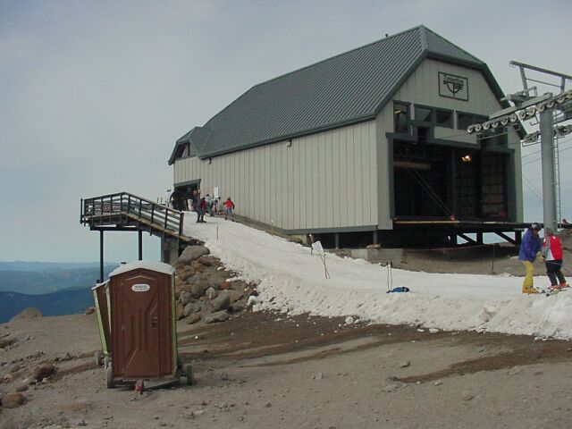
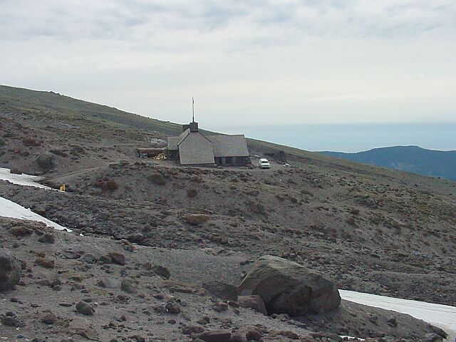
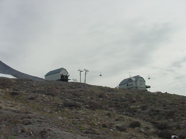
We (gasp gasp) have (gasp gasp) arrived! (gasp gasp) Yes!!! (gasp gasp) I put two pictures together to make this one picture of the entire Silcox Hut. We are now at 7,000 feet and wishing we had some oxygen bottles in our backpacks. But we made it! Off to the left you can see the chairlifts and we will be heading that way next. We saw some guys from the lodge moving boxes around, and we heard one of them complaining to the other about the guy who had just driven the other truck down the mountain for a second time. "He always volunteers to drive so he doesn't have to work." It seems that life is the same all over, even at 7,000 feet.
|
|||||||||||||||||
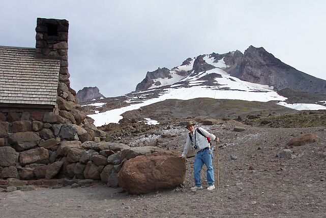
| Here Dotti caught me pushing this rock over a few feet to set up for a better shot. (Ha! Actually, I was just happy to lean on something for a bit.) |
|
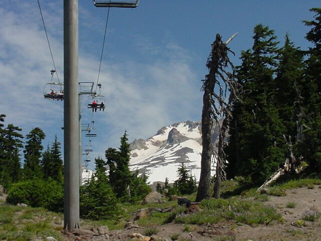
|||||||||||||||||
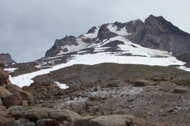
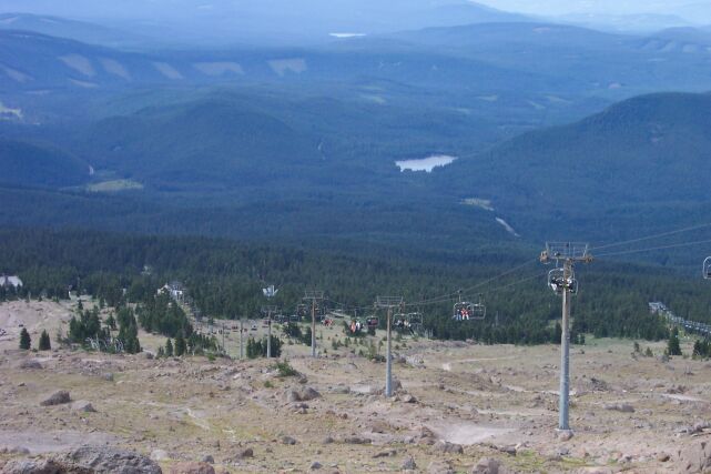
| Up the mountain from the Silcox Hut, the slopes are filled with skiers. The chairlift runs all the way up to the 8,600-foot level, another 1,600 feet beyond us. When the snow is covering all this ground in the winter, Timberline has a vertical ski drop of 3,600 feet. It was no accident that the US ski team van was in the parking lot below. During the summer this where they practice, on the Palmer Glacier straight ahead. | |||||||||||||||||
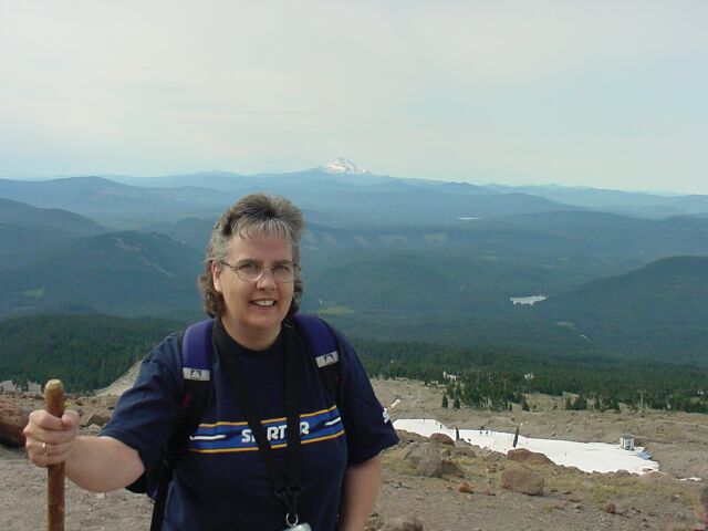
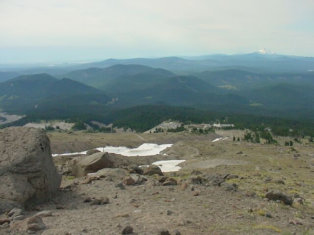
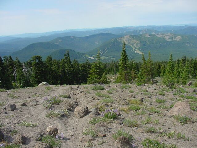
| The view from the top, or at least, from as high up as we were going. With Mt. Jefferson in the distance, and the lodge well below us, we could see the snowboarder slopes on the right. The guys doing the snowboarding appeared pretty small from here but you can still see that there are a number of them. If you look above them off in the distance you will see Trillium Lake, and even farther off in the distance lies Timothy Lake. |
|
|||||||||||||||||
| Using the zoom to catch the happy snowboarders. | |||||||||||||||||
| Getting ready to move on from the Silcox Hut. We have to cross two ski trails in order to get over to the chairlift, which we have to cross under to stay on our trail. |
|
|||||||||||||||||
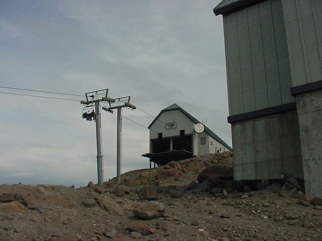
| We are even with the chairlift stations in elevation now, and you can see the snow lanes we will have to cross to get over there. The volcanic rock looks bare and lifeless. | |||||||||||||||||
| Looking over the roof of the Silcox Hut, while standing to the west of it. |
|
|||||||||||||||||
| Here's Dotti with all that scenery behind her. | |||||||||||||||||
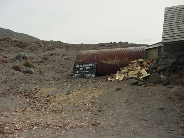
| Behind the Silcox Hut there is a corrugated tin storage shed, an old trail sign and a pile of fire wood ready to burn. With all the chips strewn across the ground it looks like they may have done some chopping on the wood right here. However, it is certain that they did not collect the wood from around the cabin this high above the timberline. |
|
|||||||||||||||||
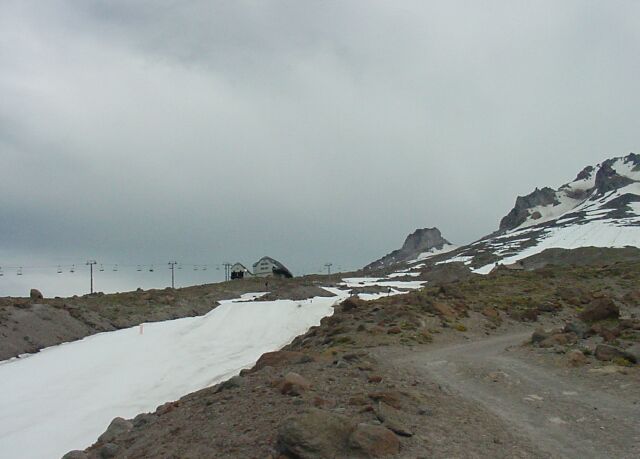
| Looking back at the west side of the Silcox Hut, and out over the vista beyond. The clouds have been keeping the temperature down all morning. | |||||||||||||||||
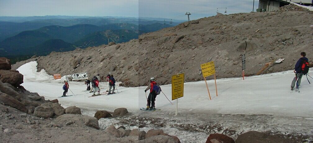
| This is one of the ski trails we have to cross to continue on our path. I put two pictures together in order to capture the scene. I took the right picture first and then the left. If you look closely in the group of boys to the left you will see the two boys that are skiing by in the right half of the picture. |
|
|||||||||||||||||
| We felt a bit like we were crossing a road, as we checked for skiers before crossing. | |||||||||||||||||
| Before crossing, Dotti had to throw a snowball at me. Just seeing snow in August is a nice change of pace. |
|
|||||||||||||||||
| Now we have cleared the two snow hazards and are safely on the other side, looking back at the Silcox Hut. | |||||||||||||||||
| What a view! From 7,000 feet it is beautiful. |
|
|||||||||||||||||
| Looking up the chairlift line an additional 1,600 feet. | |||||||||||||||||
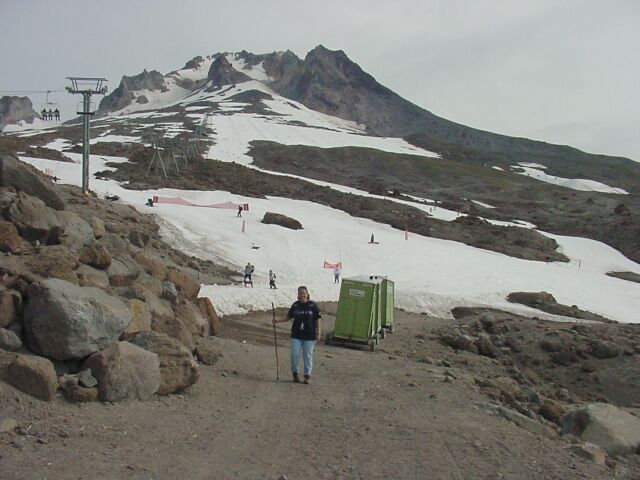
| Guys were skiing down the slope, and right up this ramp to get back on the chairlift again. The port-a-potties were lined up just in case. |
|
|||||||||||||||||
| Here I am standing at the base of the chairlift with Mt. Jefferson behind me. | |||||||||||||||||
| We just couldn't help looking back at the hut. We spent so much energy getting up there it was still hard to believe we made it. |
|
|||||||||||||||||
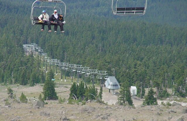
| Dotti walking by the chairlift ramp as we are getting ready to cross under the chairlift lines on our way down the mountain. | |||||||||||||||||
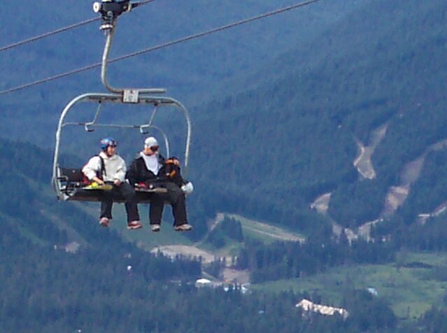
| On this shot Dotti took, it feels like we are almost sitting in the chairlift with the skiers. |
|
|||||||||||||||||
| The objects in the picture are pretty much the same, but the angle they present keeps changing. The cars in the parking lot are looking tiny indeed. | |||||||||||||||||
| Trillium Lake, though thousands of feet below it, appears to be sitting above the long run of the chairlift. |
|
|||||||||||||||||
| Here we are looking at two different chairlift systems. The skiers are on the upper lift and off to do some skiing. The lower lift is shut down, in waiting for the new snow to come in a couple of months. | |||||||||||||||||
| Another zoom shot of Mt. Jefferson. |
|
|||||||||||||||||
| Our trail running under the chairlift. | |||||||||||||||||
| Looking at the arrival line from down the mountain. The skiers arriving here came from right beside the Timberline Lodge. When we cross under this line the next time, our hike will be nearly over. |
|
|||||||||||||||||
| I snapped this shot looking down the line towards the lodge. It is amazing how many skiers and snowboarders are out enjoying the white stuff on an August morning. | |||||||||||||||||
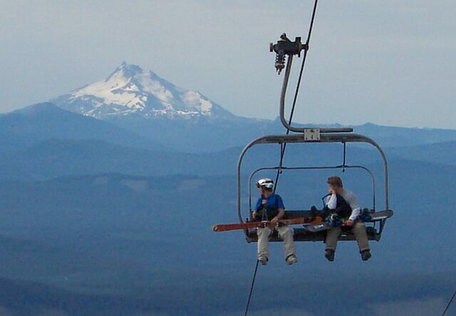
| Mt. Jefferson looks like it is nearly in the chairlift with these skiers. |
|
|||||||||||||||||
| This looks like it may be another skiing location for the winter months. | |||||||||||||||||
| We are finally on our way heading back down to the lodge. |
|
|||||||||||||||||
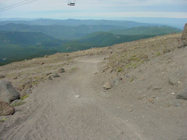
| The chairlift run looks like it is headed right into the mouth of the crater. | |||||||||||||||||
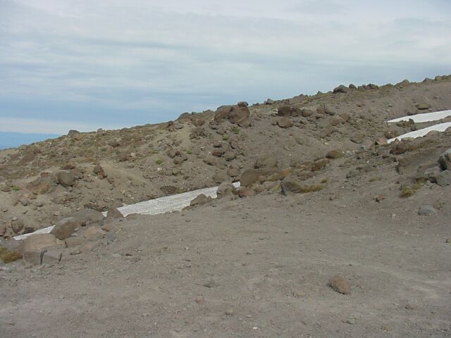
| We get to cross some additional snow to follow the trail, but this time there are no skiers to look out for. This snow looks dirty and untouched. The trail rises up the bank on the other side. It isn't much of a trail but it is headed in the right direction. |
|
|||||||||||||||||
| The chairlift stations are looking smaller as we make progress down the mountain. | |||||||||||||||||
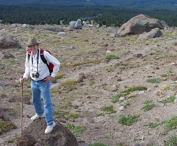
| I am standing on a volcanic boulder, and the trail is visible behind me. Off in the distance you can see a chairlift. |
|
|||||||||||||||||
| We are clearly west of the lodge at this point. | |||||||||||||||||
| Volcanic rocks liter the landscape, as grass attempts to hold onto the tough soil. |
|
|||||||||||||||||
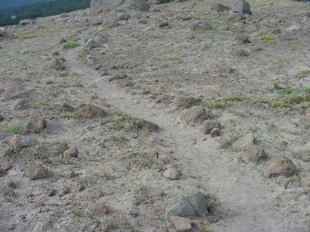
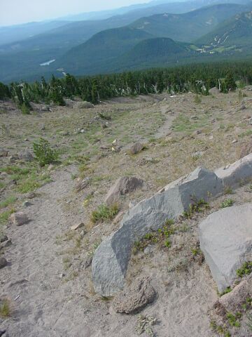
| Our trail is made up of volcanic dust, smooth and gray. The path is narrow, but at this point it is lined with rocks. | |||||||||||||||||
| From this angle you can get a pretty good view of the upper station of the chairlift at the 8,600-foot level. It is pretty easy from here to visualize the lava pouring out of the vent, and just flowing down over the landscape here. There was a volcanic event on Mt. Hood shortly before the Lewis and Clark party came through in 1805. The mudflows that were generated from that event sent debris all the way into the Columbia River, down what is now known as the Sandy River. The name is a shortened version of what Lewis and Clark named it: the Quicksand River. When their Corps of Discovery came through, the mouth of the river was filled with quicksand, which has since been washed away. The lava plug that stands tall in the middle of the crater is called Crater Rock. |
|
|||||||||||||||||
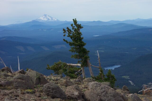
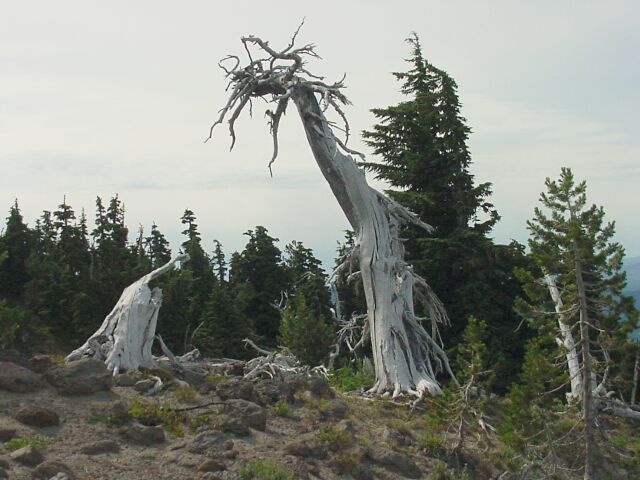
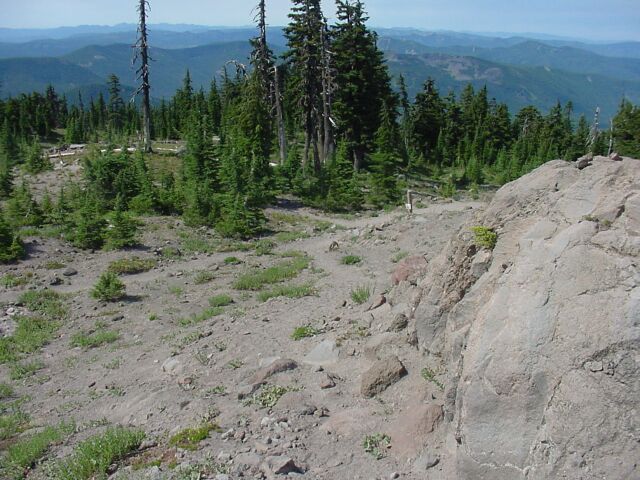
| Dotti took this breathtaking shot of the volcanic rock beneath our feet, the oddly shaped tree standing at the edge of a scene that stretches miles away beyond: Trillium Lake; Mt. Jefferson; and the rolling volcanic hills. | |||||||||||||||||
| I was wondering about that tree having a section that pointed out parallel with the ground. It just didn't look natural. When we got over to it I saw that it had indeed been snapped. Whether it was caused by snow, wind, or something else, I couldn't tell. |
|
|||||||||||||||||
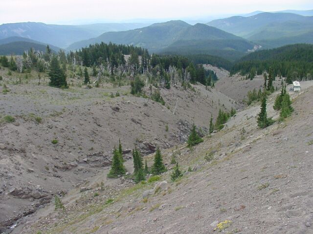
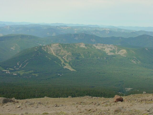
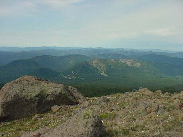
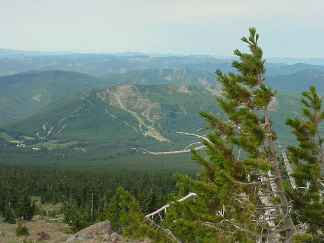
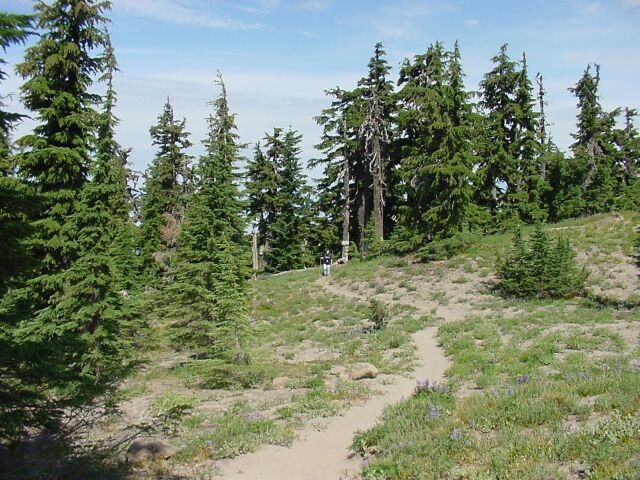
| Looking back up the trail you can see that it is a narrow, and less used path. The crater is growing smaller, and so are the chairlift stations, as we get farther down the mountainside. | |||||||||||||||||
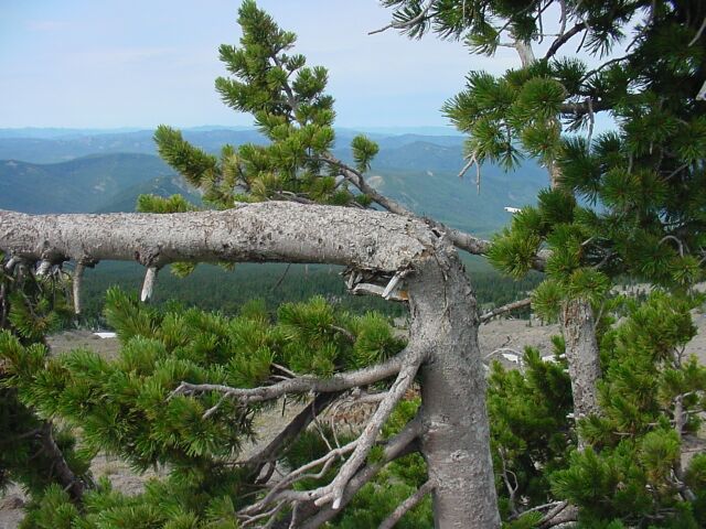
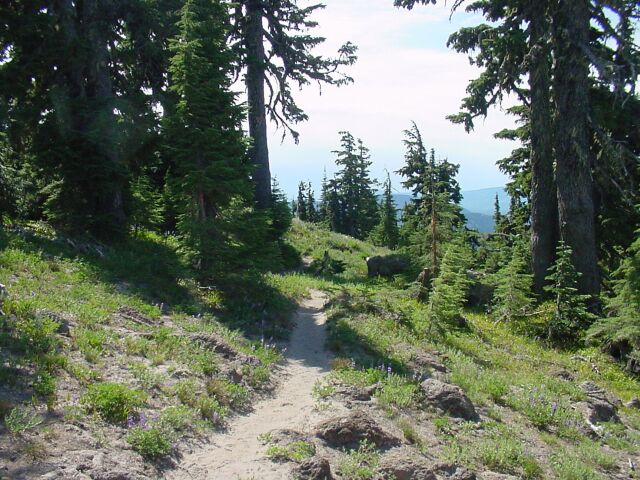
| Looking over the valley, we see forests that are thick and healthy, standing just below where we are. Close up and on the right, there are trees that have green pine needles, but with trunks that look less than healthy. Standing right next to them are ghost trees that have given up on their fight to live at the timberline. |
|
|||||||||||||||||
| Our path continues downward, with the timberline growing closer. | |||||||||||||||||
| We are coming up on some trees finally which means we have dropped quite a ways already. |
|
|||||||||||||||||
| The crater is looking much smaller now, and the chairlift stations are out of sight. | |||||||||||||||||
| A giant ghost tree looks like it is reaching out its long arm with a hand raised to the sky. The stump on the ground beside it looks like the skull of a giant steer, bleached white by desert sun. |
|
|||||||||||||||||
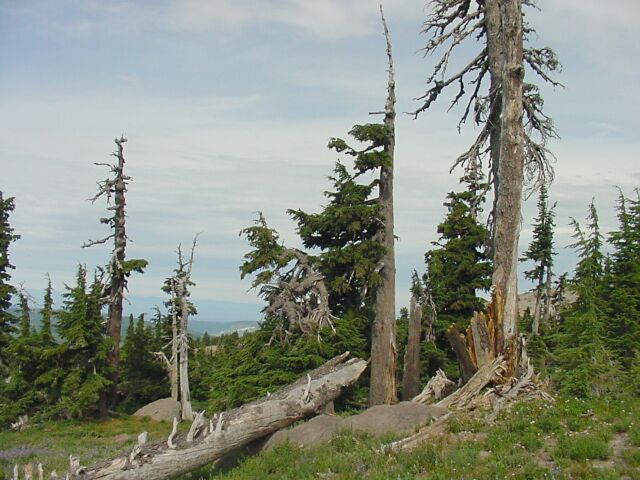
| A study in life at the timberline. The trees reach out their branches and are punished with high winds and bitter cold. They try over and over again to establish a viable branch system. They are left with gnarled failures and half completed works. But they battle on, until they become ghost trees. | |||||||||||||||||
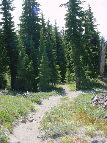
| With flowers on either side of it, the path leads down into the trees. |
|
|||||||||||||||||
| Using the zoom to look back through the trees up at the crater. | |||||||||||||||||
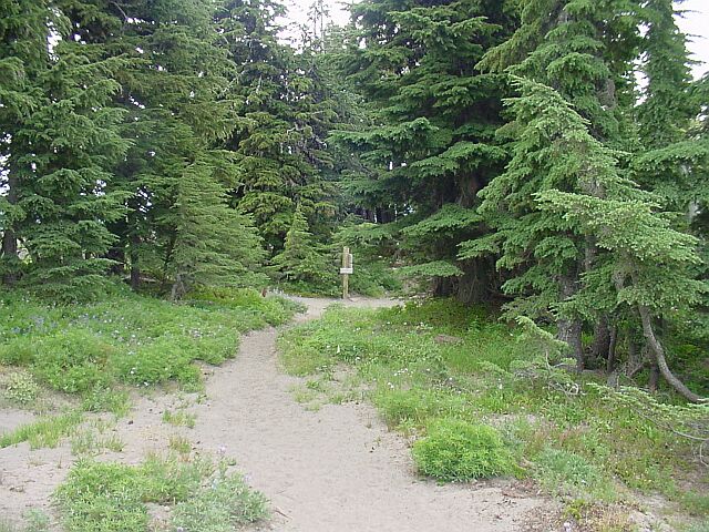
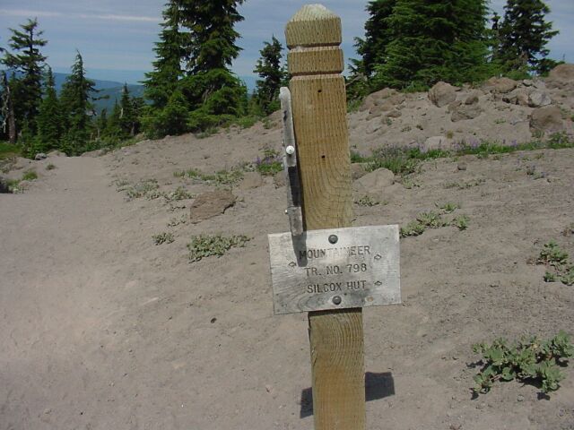
| The final stretch of this part of the trail, as we approach a junction point, with the trail marker sign right in front of us. |
|
|||||||||||||||||
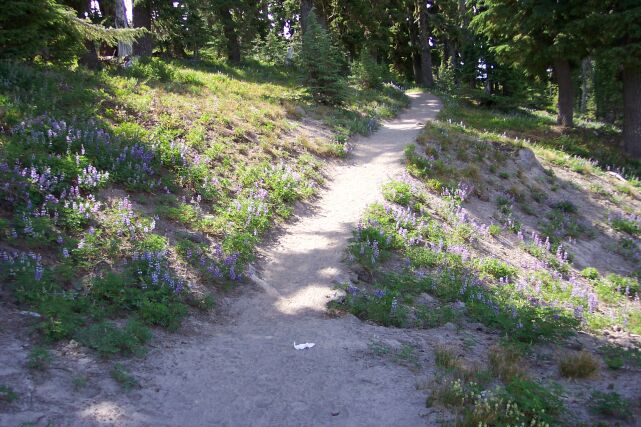
| The path running to the left had lots of pretty flowers lining it. Dotti got some pictures of those! | |||||||||||||||||
| The sign points to the right, the way back up the mountain to where we just came from, and to the left where the Mountaineer Trail continues on to the Timberline Lodge. |
|
|||||||||||||||||
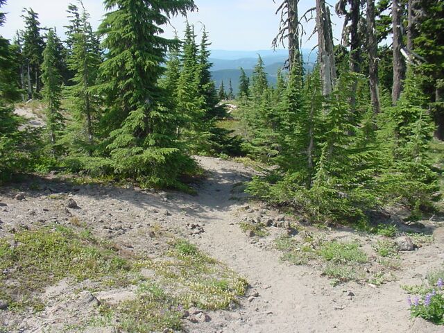
| This is the Mountaineer Trail heading back to the lodge. | |||||||||||||||||
| The other trail is the Pacific Crest Trail once again. Originally I had planned to take that trail out a couple of miles to view the Zigzag Canyon. But by the time we reached this point our legs were very tired and we had had enough high altitude climbing for one week. We could have followed the Pacific Crest Trail back to the right, (the path with the flowers above) and it would have taken us right to the same spot where we had joined it at the start of our hike, behind the lodge. But we decided to take the Mountaineer Trail down through the forest to the front of the lodge instead. |
|
|||||||||||||||||
| At this point, my memory stick reached the full point, and I had to change it. Dotti caught me digging in my pack for a replacement. | |||||||||||||||||
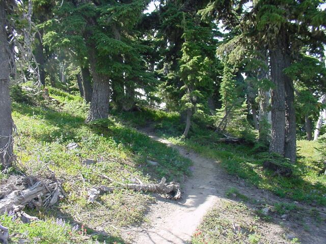
| The trail that we came down on from the top. Composed of dirt and rock, it was hard to see, but this side of it was a lot easier to walk than hiking up on the other side had been. |
|
|||||||||||||||||
| Dotti is hiding behind the tree and waiting for me. | |||||||||||||||||
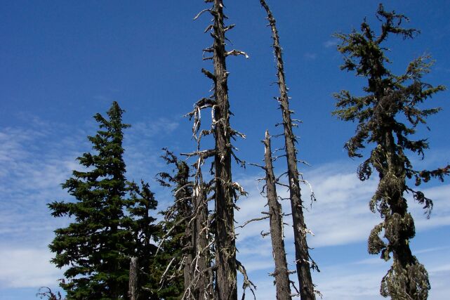
| Dotti took this shot, and the blue makes an outstanding background for these gnarled trees, tortured by the conditions at the timberline. The blue skies suddenly appeared as we reached the bottom of the hike, and it is good that it waited that long, because it warmed up as it became brighter. The climb was tough enough without it being hot. |
|
|||||||||||||||||
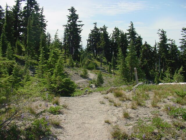
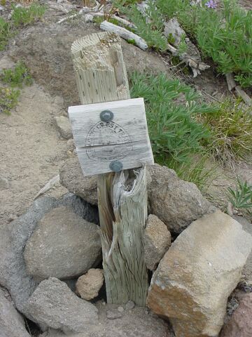
| Here the path is wider and surrounded by trees. To the right you can see a post standing all-alone. It is a marker. | |||||||||||||||||
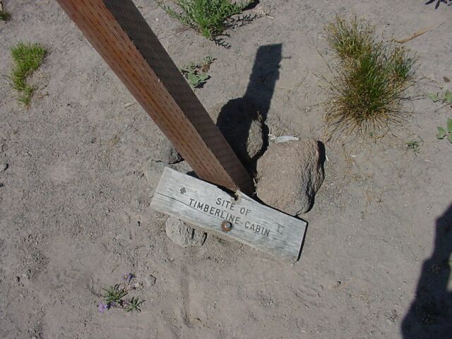
| And this is what it is marking: Timberline Cabin. The sign has been knocked off the pole somehow, but it is still easy to read. I am not sure who lived in this cabin, or if it was a private residence or a part of the lodge that has since been lost. |
|
|||||||||||||||||
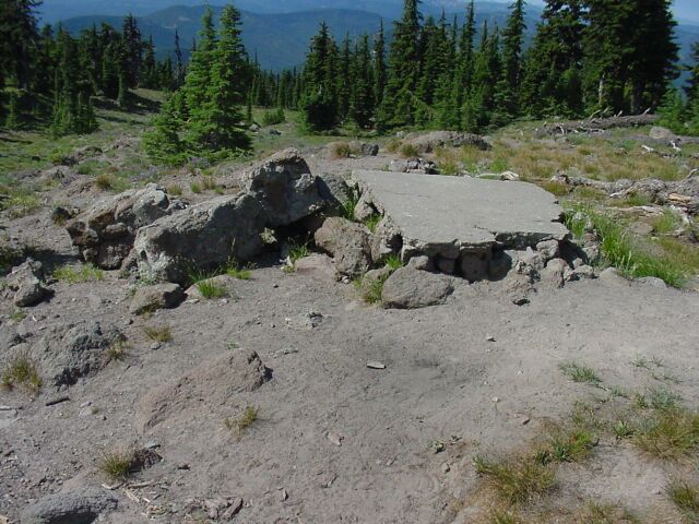
| This is all that remains of the Timberline Cabin. | |||||||||||||||||
| Heading back along the trail towards the lodge. There is still a gnarled quality to some of the trees but they are looking better than the ones just a short distance higher up the mountain. |
|
|||||||||||||||||
| There is Dotti coming across this open stretch on the trail. | |||||||||||||||||
| What a difference a bit of elevation change can make. Here are grass and trees to brighten the hike. You can still see the volcanic rocks embedded into the earth, but the vegetation does a pretty good job of covering them up. |
|
|||||||||||||||||
| Looking back up at the crater and the chairlift stations, using a bit of zoom. | |||||||||||||||||
| There are trees, grass and flowers here, along with some bright sunlight. Things are looking up. |
|
|||||||||||||||||
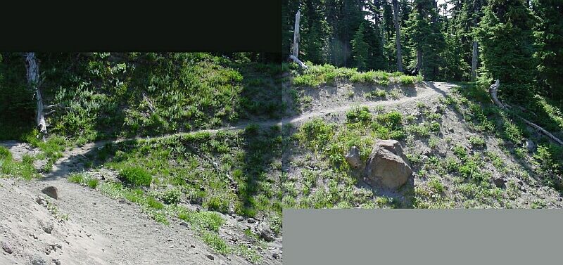
| I put two pictures together for this shot, to show the path of the trail at this point. | |||||||||||||||||
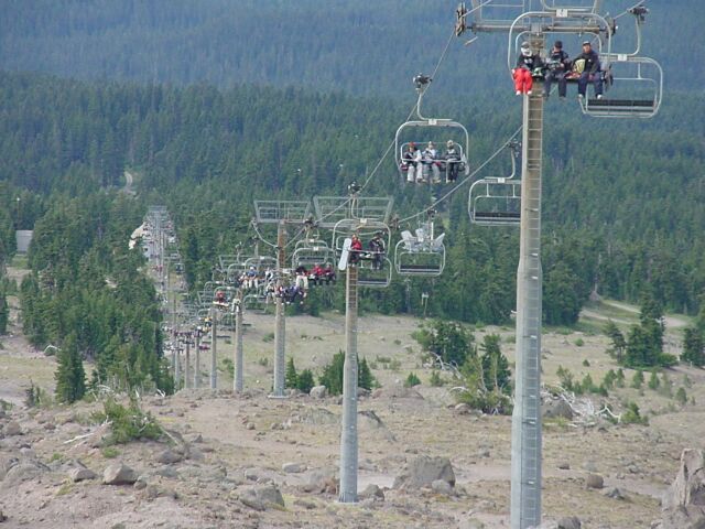
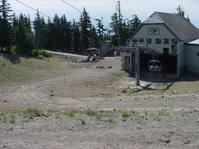
| At last we have broken out of the trees and have reached the other end of the chairlift that we saw at the top. These folks are heading up to where we just came down from. |
|
|||||||||||||||||
| Looking up the chairlift run from the bottom. | |||||||||||||||||
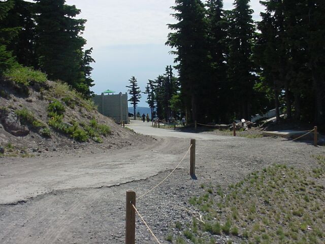
| This is the road to the parking lot in front of the lodge. The tall green wall straight ahead is surrounding the swimming pool for the lodge. |
|
|||||||||||||||||
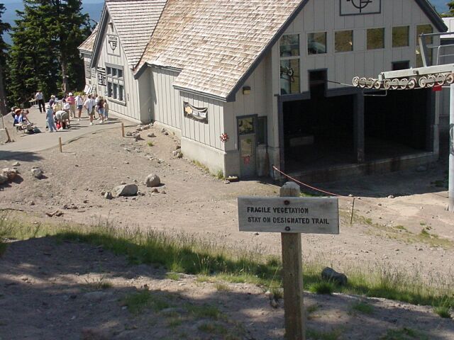
| To the right of the path is the chairlift station. The sign warns of the harsh conditions that plant life has to endure at the timberline. It is not so much the vegetation being fragile as it is the fact that it is living in very harsh conditions and therefore prone to dying with little coaxing needed. | |||||||||||||||||
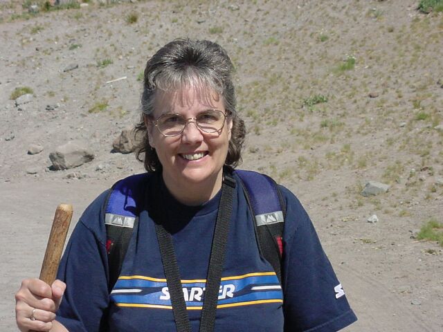
| Dotti smiling as we reach the end of this hike. |
|
|||||||||||||||||
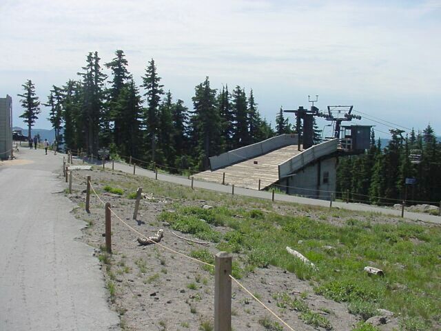
| This is the top of another chair lift for a lower ski run that operates in the winter. | |||||||||||||||||
| The Timberline Lodge stands behind me and we are finally back. |
|
|||||||||||||||||
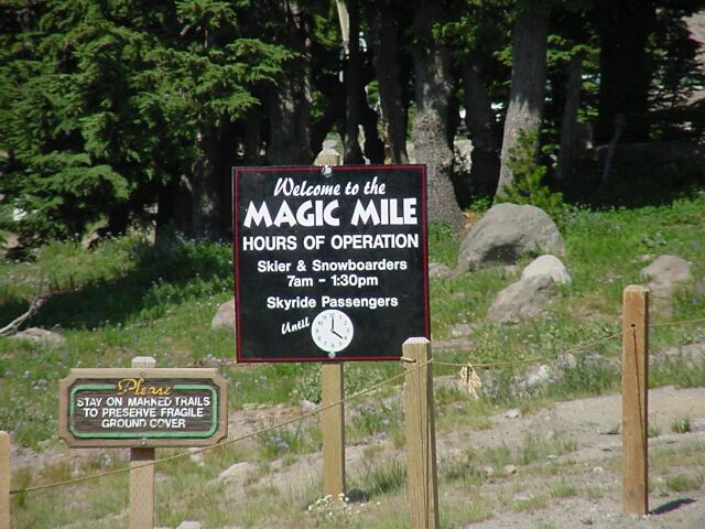
| The Magic Mile is the chairlift to the top. | |||||||||||||||||
| We are now in front of the lodge. |
|
|||||||||||||||||
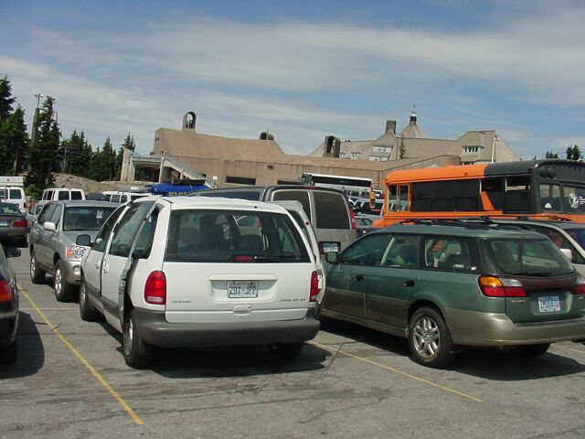
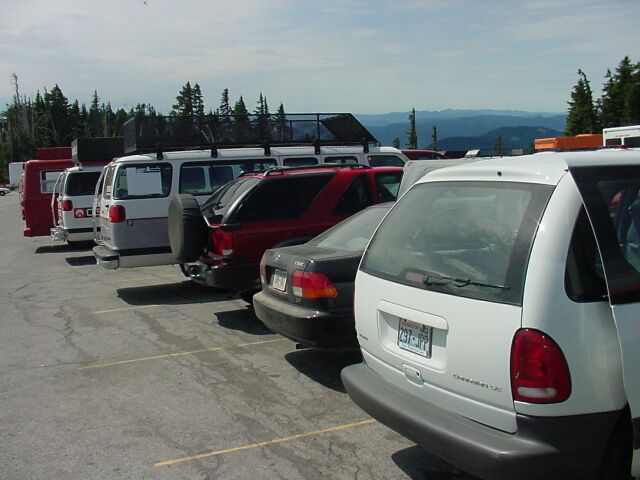
| Meanwhile back at the parking lot, the place has filled up since we arrived. | |||||||||||||||||
| Looking south, where there was nothing but an empty parking lot when we started our hike, there are no empty parking spaces left. |
|
|||||||||||||||||

| Here is a collage showing all the flowers that Dotti took pictures of during the hike. There is also one picture of a butterfly included that I took, and a picture of Dotti shooting a picture of some flowers as well. |
|||||||||||||||||
|
||||||||||||||||||
|
|
||||||||||||||||||